South Umpqua Headwaters Precontact Reference Conditions Study
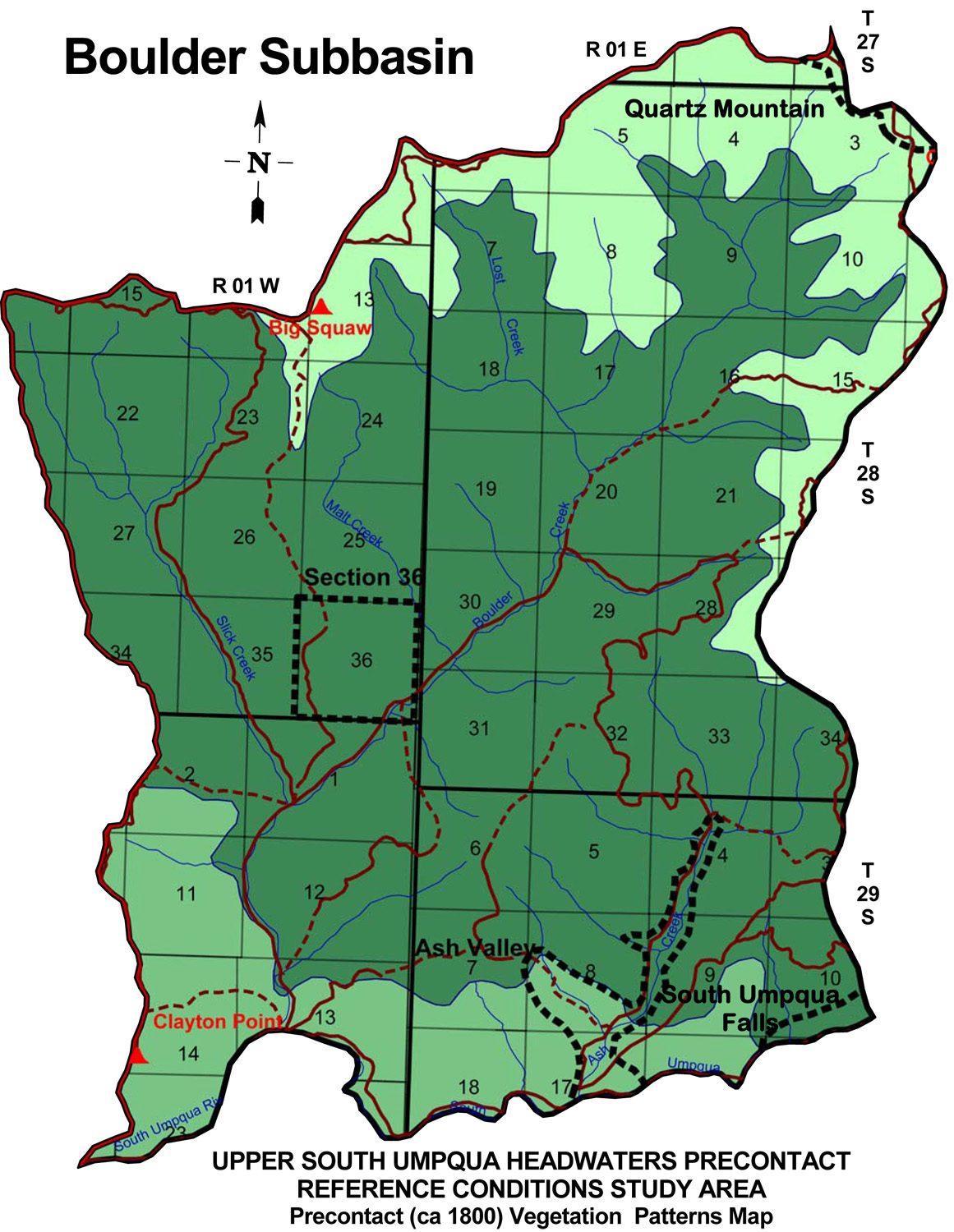
Boulder Creek Subbasin
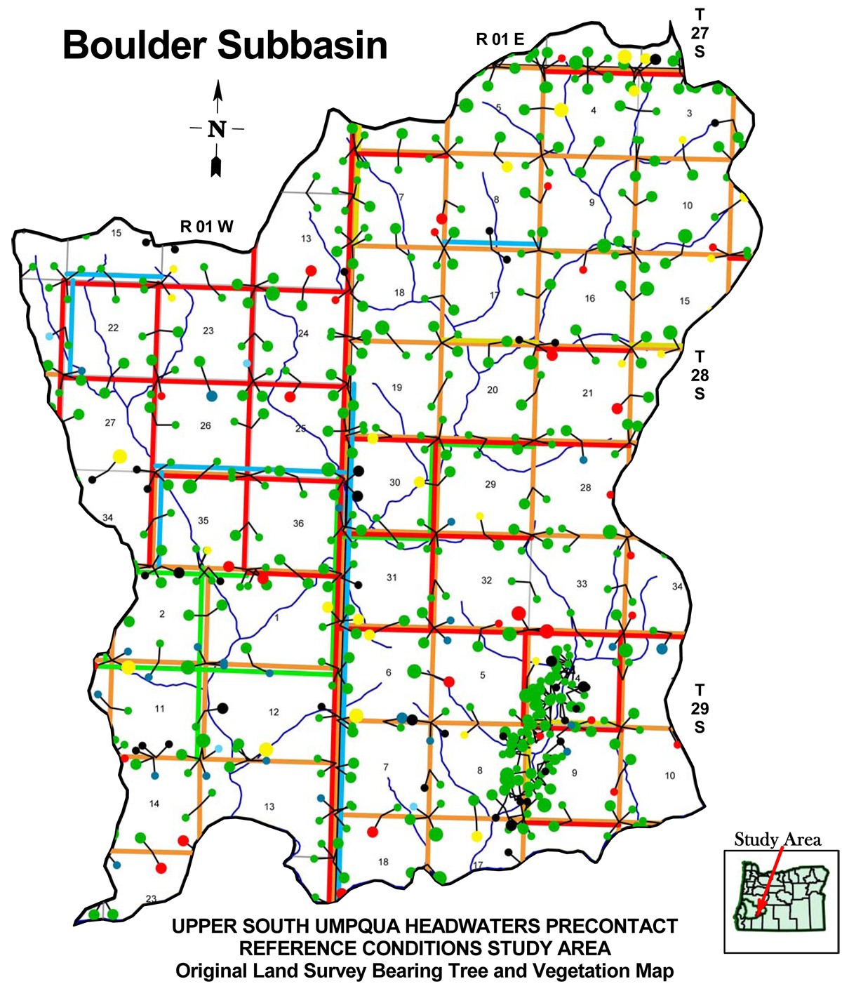
Boulder Creek subbasin map, with ca. 1800 Indian Trails and ca. 1800 Forest Vegetation Patterns.
| Study Area Vicinity Map | ca. 1800 Vegetation | 2010 Subbasin Index | GLO Bearing Trees |
The Boulder Creek subbasin is 31,522 acres in size and includes Ash Creek, Lost Creek, Malt Creek, and Slick Creek as principal tributaries. It is the northwesternmost subbasin in the South Umpqua Headwaters Reference Conditions Study, and contains portions of five Townships; three Fire Lookouts; two of the study's 25 designated "Area of Special Interest"" and portions of two others.
TOWNSHIPS, MAPS, PHOTOGRAPHS & ORIGINAL LAND SURVEYS
| Tsp. 27 S., Rng. 1 E. | Tsp. 28 S., Rng. 1 W. | Tsp. 28 S., Rng. 1 E. | Tsp. 29 S., Rng. 1 W. | Tsp. 29 S., Rng. 1 E. |
FIRE LOOKOUTS & OSBORNE PHOTOGRAPHS
| ICON | LOOKOUT | START | STOP | TSP | RNG | SEC | ELEV. |
|---|---|---|---|---|---|---|---|
| Big Squaw Mountain | 1932 | 1958 | 28 S. | 1 W. | 13 | 4,878 | |
| Clayton Point | 1933 | 1958 | 29 S. | 1 W. | 14 | 3,190 | |
| Quartz Mountain | 1915 | 1972 | 28 S. | 1 E. | 2 | 5,530 |
Icon |
Name |
TSP |
RNG |
SEC |
Acres |
 |
Ash Valley | 29 S. |
1 E. |
04, 08-09 |
597 |
 |
Quartz Mountain | 28 S. |
1 E. |
02-03 |
446 |
 |
Section 36 | 28 S. |
1 W. |
36 |
640 |
 |
South Umpqua Falls | 29 S. |
1 E. |
10-11 |
172 |
![]()
© 2010, 2020 Oregon Websites & Watersheds Project, Inc. & NW Maps Co.