Upper South Umpqua Headwaters Precontact Reference Study
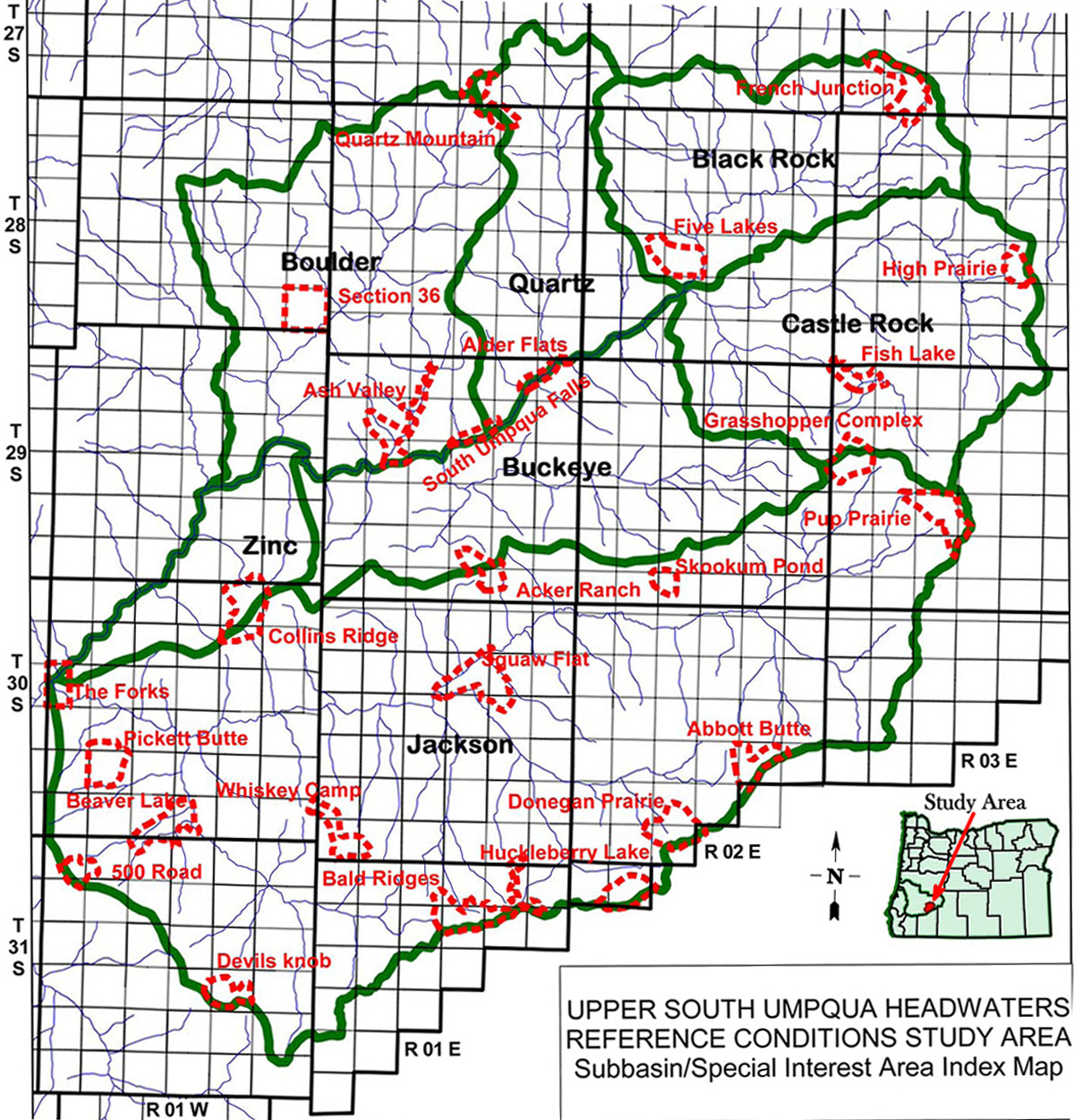
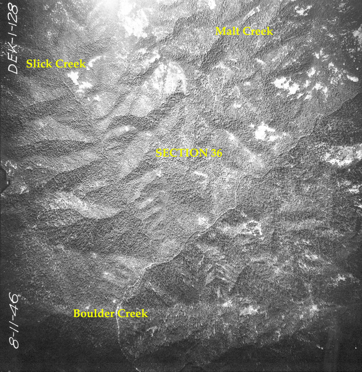
Section 36
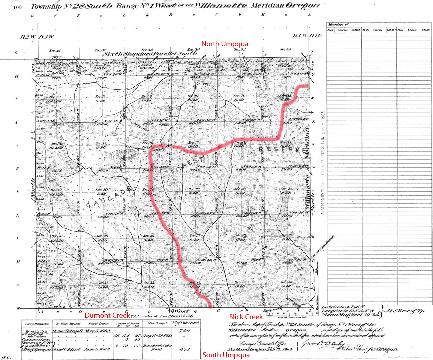
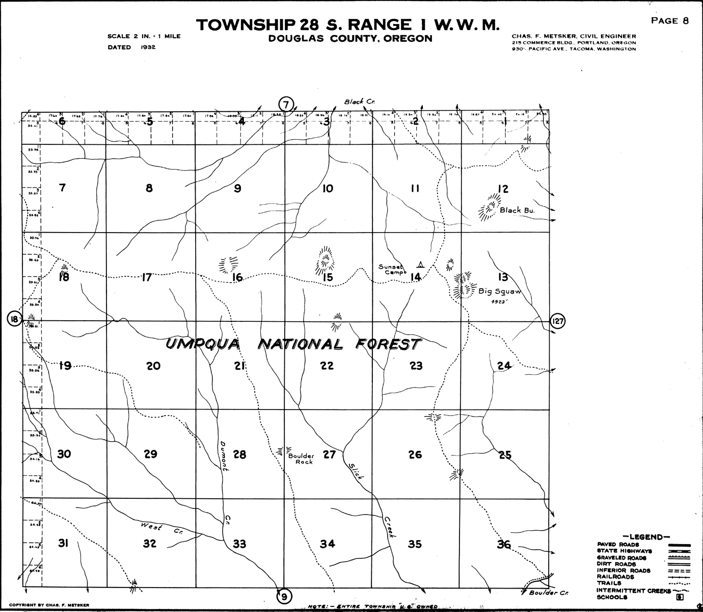
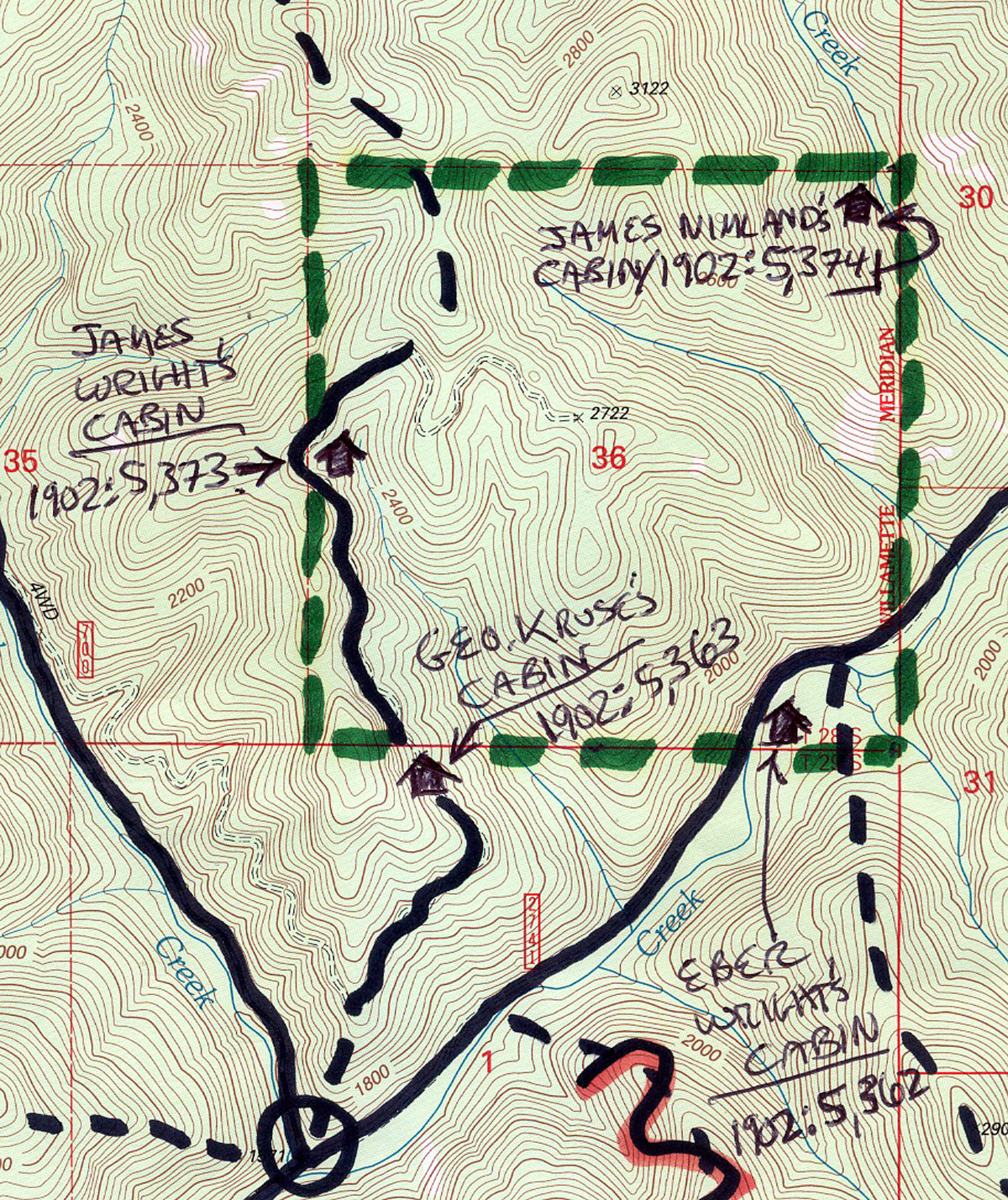
Section 36, South Umpqua River, Douglas County, Oregon (Angell 1902).
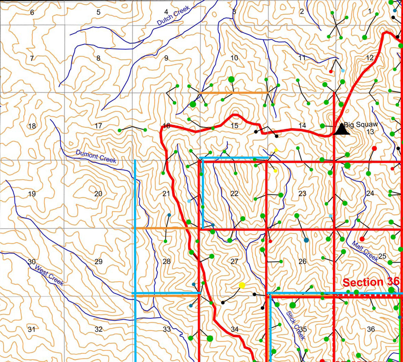
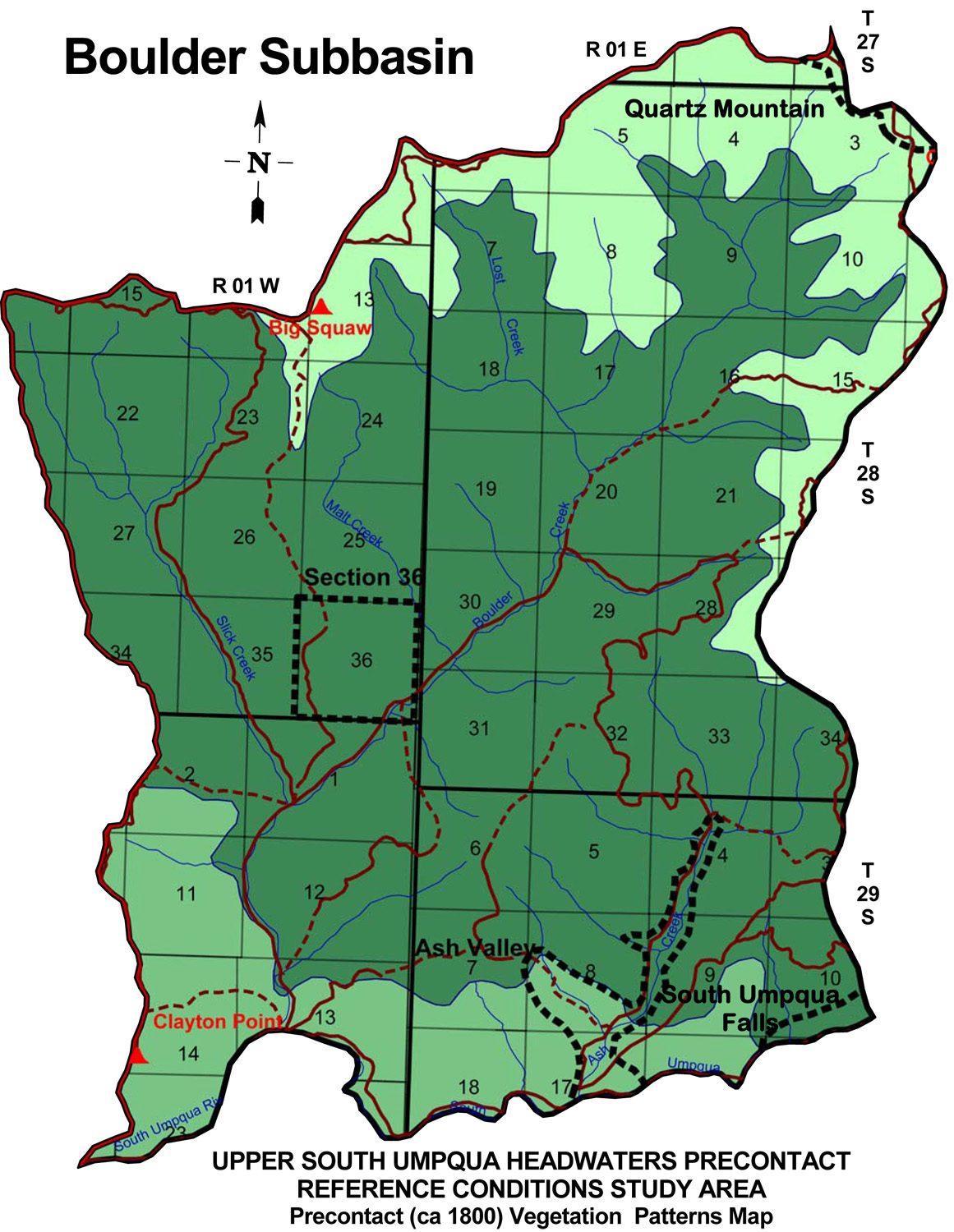
Section 36 Area of Special Interest is located on the steep forested hills between Slick Creek within the Boulder Creek subbasin of the South Umpqua River drainage in Tsp. 28 S., Rng. 1 W.
Section 36 was selected as an "Area of Special Interest" for The following list of 25 bounded areas was compiled because of their special interest to the 2010 "Upper South Umpqua Headwaters Precontact Reference Study" project. The determinations were made following discussions among project principals that focused on the studys research design, combined knowledge of the landscape, personal field observations, and detailed considerations of relevant historical documents, including:
Forestedd hills betwrrn on slopes of Big Squaw Mountain slick Crelo and Malt Creek tributaries of Bouler Creek. Ridgrline trail between the two creeks connecting Boulder Creek to Big Squawm Mountain and the ridgeline trail among the peaks separating South Umpqua and Little River basins.
Note: Because of the intended purpose of this study -- to assemble and document precontact land use and vegetation pattern reference conditions particular attention has been placed on selecting special interest areas that might best represent precontact (pre-1826) conditions, or contain information by which such conditions might be more readily inferred or determined: such as relict plant populations (including old-growth trees and other persistent vegetation patterns) or archaeological remains. For that reason, selection bias was given to known and suspected seasonal Indian villages, campgrounds, and other primary precontact destinations; such as likely hunting, fishing, gathering, trading, and food growing and processing sites. the Upper South Umpqua Headwaters Precontact Reference Study.
 |
 |
 |
 |
 |
| Subbasin Index Map | 1902 Bearing Trees | 1932 Metsker | August 11, 1946 | 2010 Annotated |