South Umpqua Headwaters Precontact Reference Conditions Study
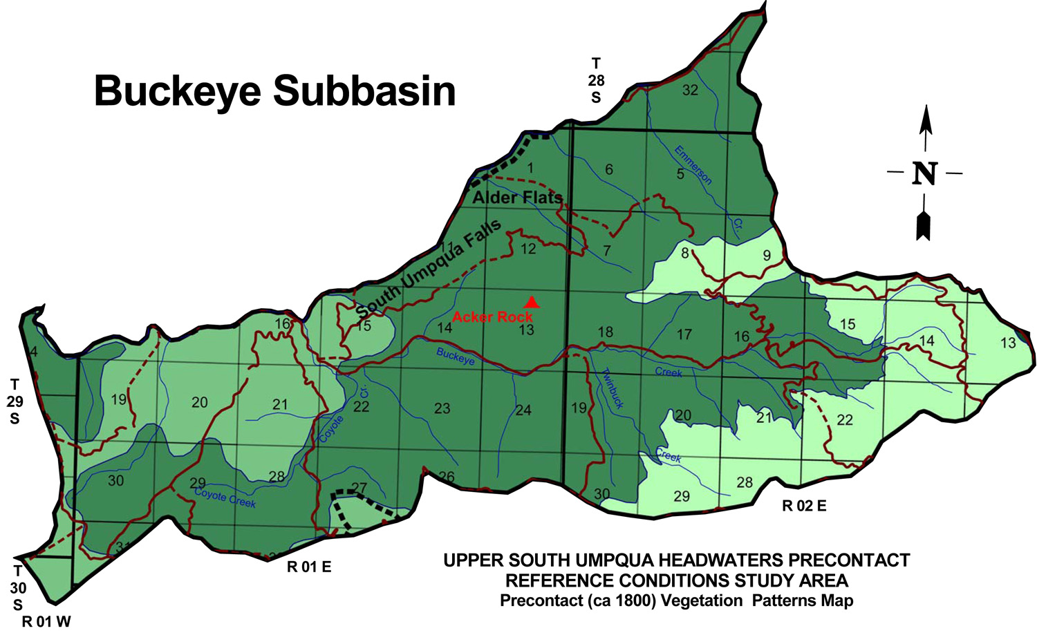
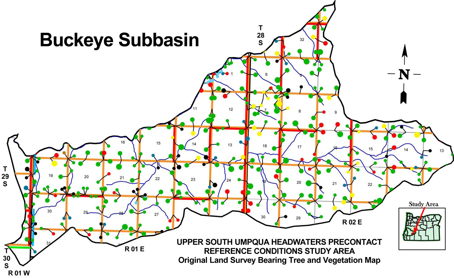
Buckeye Creek Subbasin
Buckeye Creek subbasin map, with ca. 1800 Indian Trails and ca. 1800 Forest Vegetation Patterns.
| Study Area Vicinity Map | ca. 1800 Vegetation | 2010 Subbasin Index | GLO Bearing Trees |
The Buckeye Creek subbasin is 25,573 acres in size and includes Emmerson Creek, Twinbuck Creek, and Coyote Creek as principal tributaries. It is the central subbasin in the South Umpqua Headwaters Reference Conditions Study, containing portions of five Townships; one Fire Lookout; and portions of two of the study's 25 designated "Area of Special Interest."
TOWNSHIPS, MAPS, PHOTOGRAPHS & ORIGINAL LAND SURVEYS
| Tsp. 28 S., Rng. 2 E. | Tsp. 29 S., Rng. 1 W. | Tsp. 29 S., Rng. 1 E. | Tsp. 29 S., Rng. 2 E. | Tsp. 30 S., Rng. 1 W. |
FIRE LOOKOUTS & OSBORNE PHOTOGRAPHS
| ICON | LOOKOUT | START | STOP | TSP | RNG | SEC | ELEV. |
|---|---|---|---|---|---|---|---|
| Acker Rock | 1913 | 29 S. | 1 E. | 13 | 4,112 |
Icon |
Name |
TSP |
RNG |
SEC |
Acres |
| Acker Ranch | 29 S. |
1 E. |
27, 35 |
359 | |
| Alder Flats | 29 S. |
1 E. |
01-02 |
190 | |
 |
South Umpqua Falls | 29 S. |
1 E. |
10-11 |
172 |
![]()
© 2010, 2020 Oregon Websites & Watersheds Project, Inc. & NW Maps Co.