South Umpqua Headwaters Precontact Reference Conditions Study
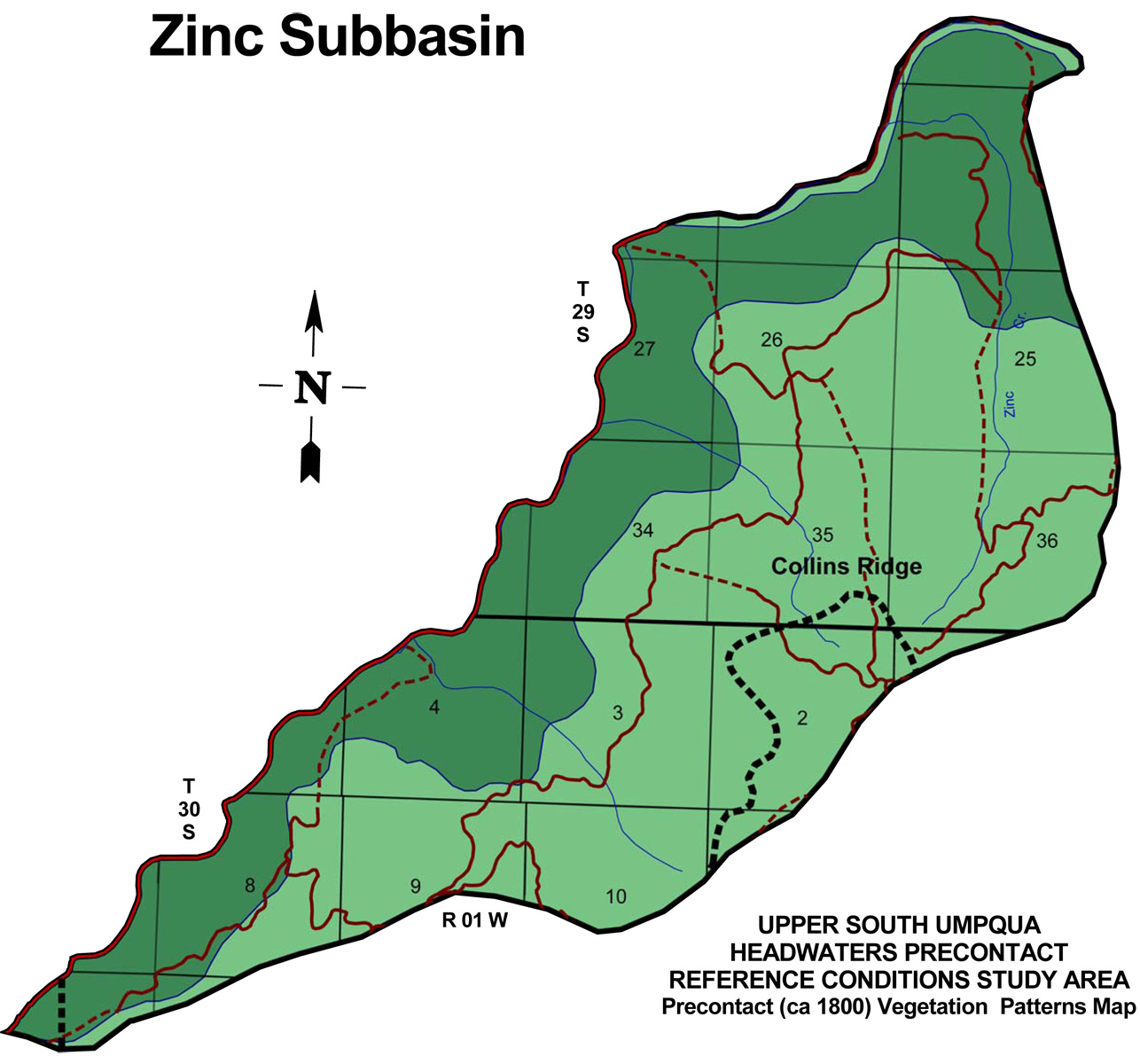
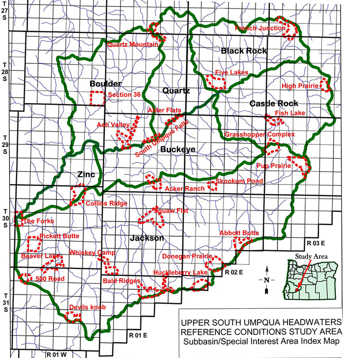
Zinc Creek Subbasin
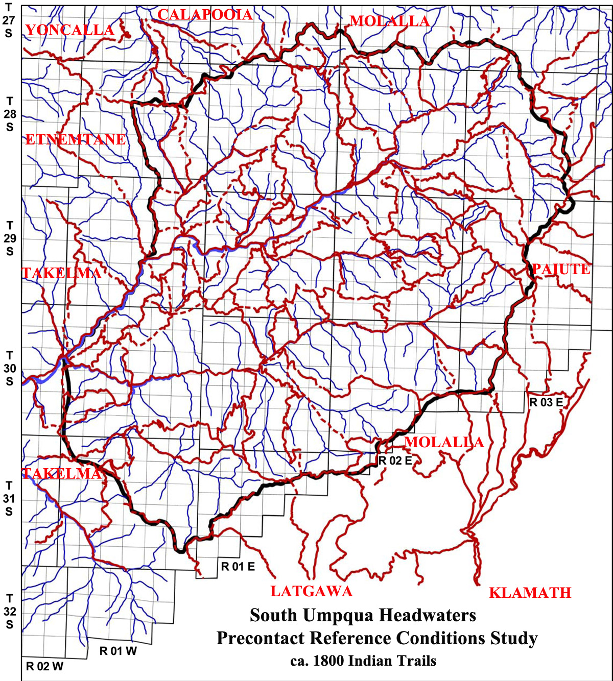
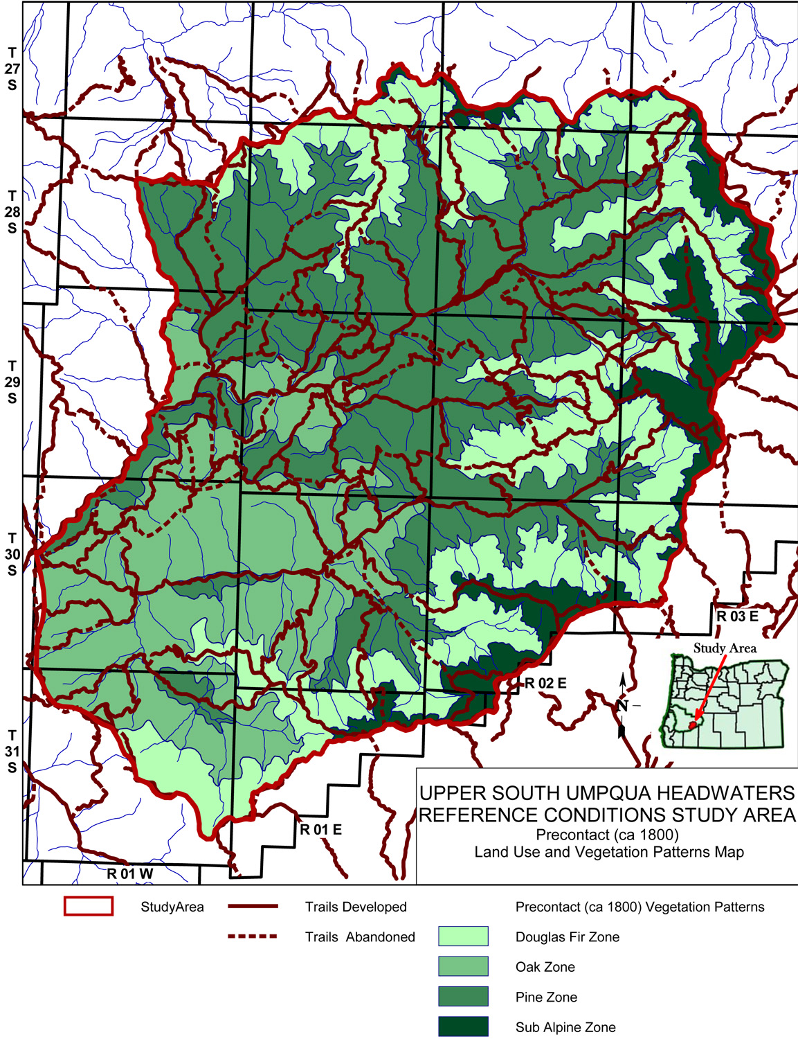
Zinc Creek subbasin map, with ca. 1800 Indian Trails and ca. 1800 Forest Vegetation Patterns.
| Study Area Vicinity Map | ca. 1800 Vegetation | 2010 Subbasin Index | GLO Bearing Trees |
The Zinc Creek subbasin is 8,893 acres in size and is the smallest and westernmost subbasin in the South Umpqua Headwaters Reference Conditions Study. It contains portions of two Townships; a single Fire Lookout on its perimeter; and portions of two "Areas of Special Interest."
TOWNSHIPS, MAPS, PHOTOGRAPHS & ORIGINAL LAND SURVEYS
| Tsp 29 S., Rng. 1 W. | Tsp. 30 S., Rng. 1 W. |
FIRE LOOKOUTS & OSBORNE PHOTOGRAPHS
| ICON | LOOKOUT | START | STOP | TSP | RNG | SEC | ELEV. |
|---|---|---|---|---|---|---|---|
| Collins Mountain | 1914 | 30 S. | 1 W. | 1 | 3,670 |
Icon |
Name |
TSP |
RNG |
SEC |
Acres |
 |
Collins Ridge | 30 S. |
1 W. |
02, 11 |
731 |
 |
The Forks | 30 S. |
1 W. |
18 |
347 |
![]()
© 2010, 2020 Oregon Websites & Watersheds Project, Inc. & NW Maps Co.