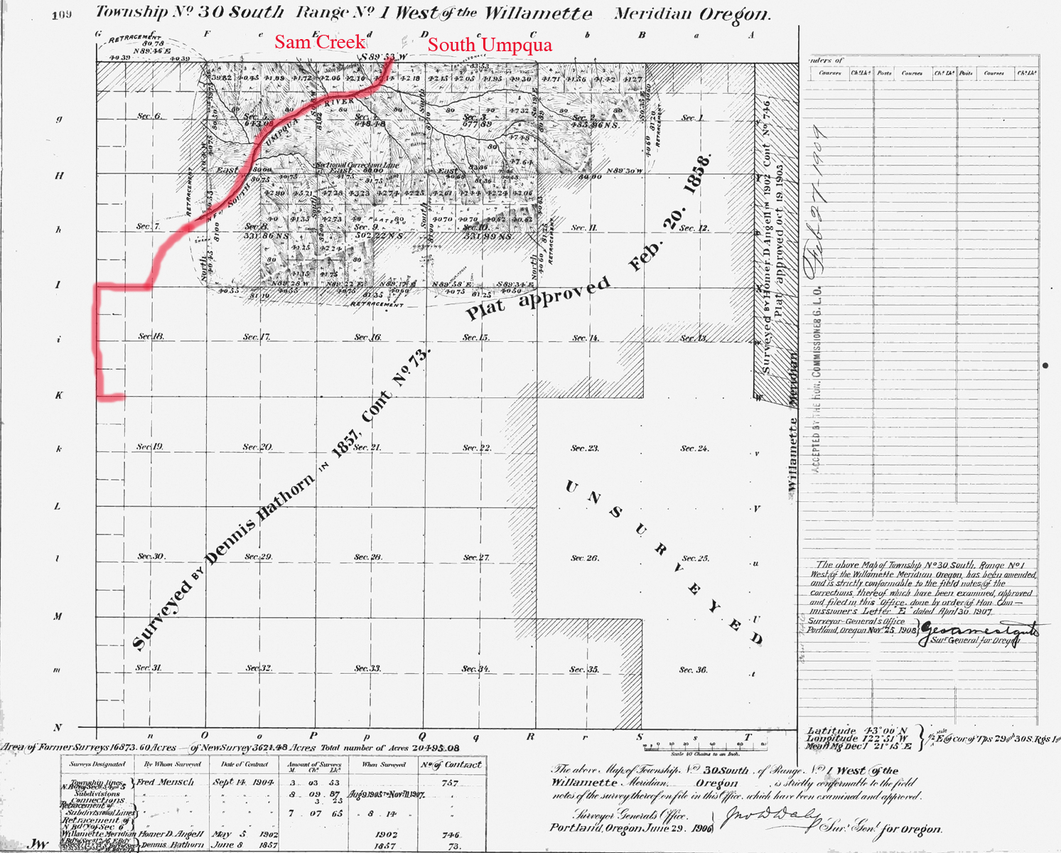
South Umpqua River
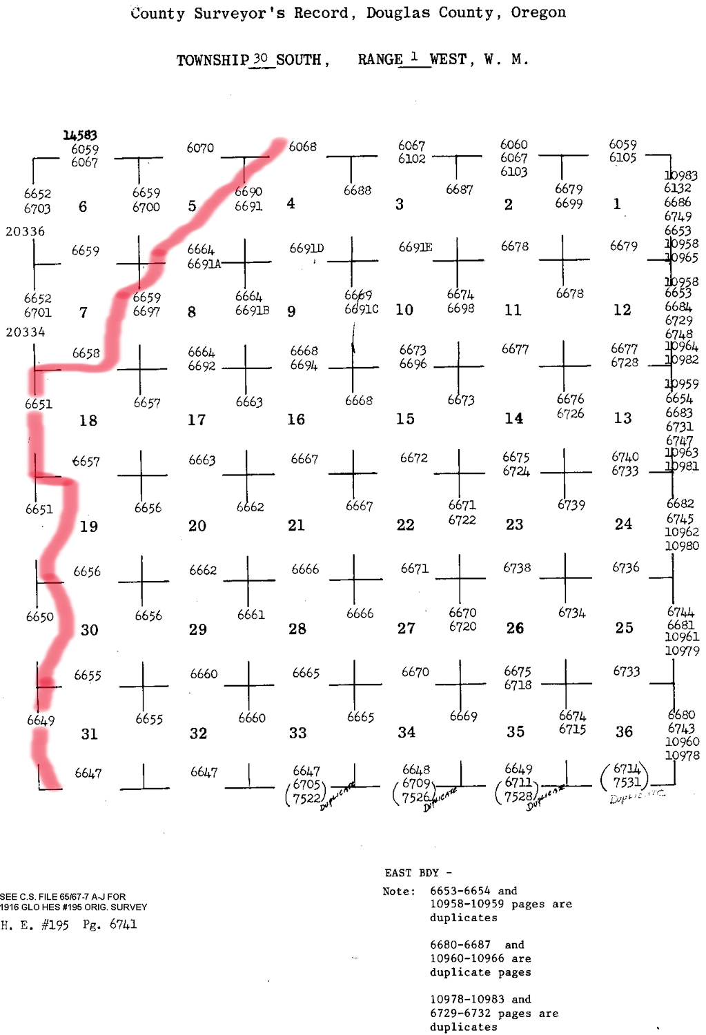
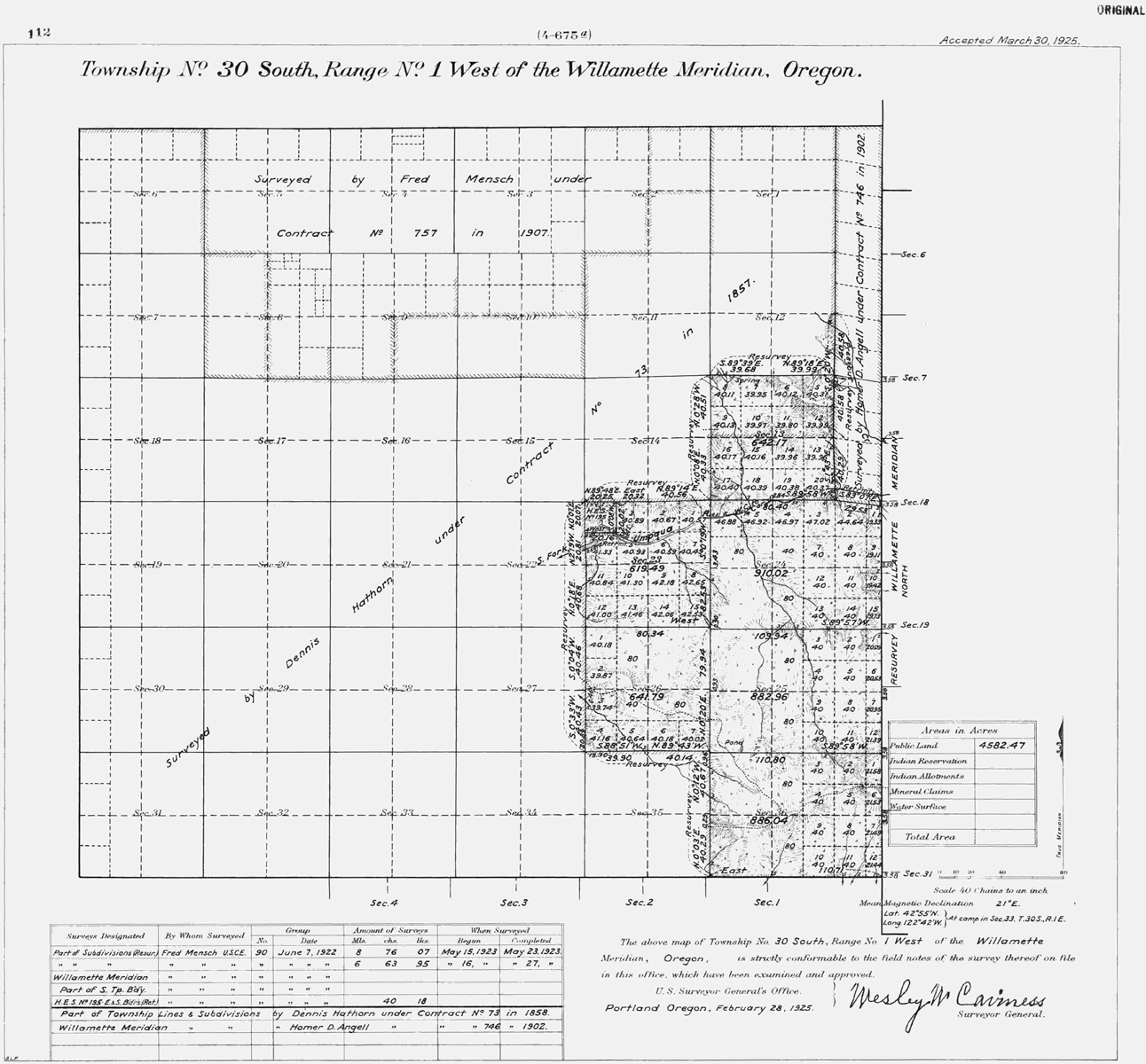
Tsp. 30 S., Rng. 1 W.
1925 General Land Office Survey Index
 |
 |
 |
 |
1858 GLO |
1906 GLO |
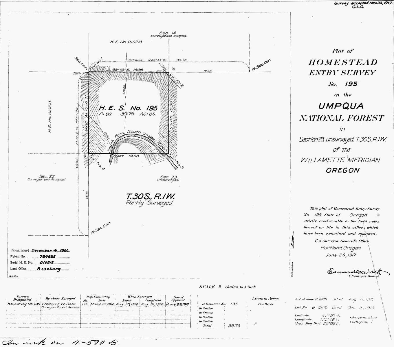
1917 HES 195 |
1925 GLO |
The redline in the index indicates the western boundary of the 2010 South Umpqua Headwaters Precontact Reference Conditions Study, including the Collins Mountain Lookout, Pickett Butte Lookout, and Coffin Butte Lookout;and the Collins Ridge, Pickett Butte, Beaver Lake and The Forks Areas of Special Interest. This survey was completed in 1857, 1858, 1902, 1907 and 1923 and mapped in 1858, 1906, and 1925 (Angell 1902; Mensch 1923b; Price, Carter, and Dawson 1937). A homestead was surveyed in Section 23 at the mouth of Bullock Creek in 1916 and mapped in 1917 (Rose 1916c).