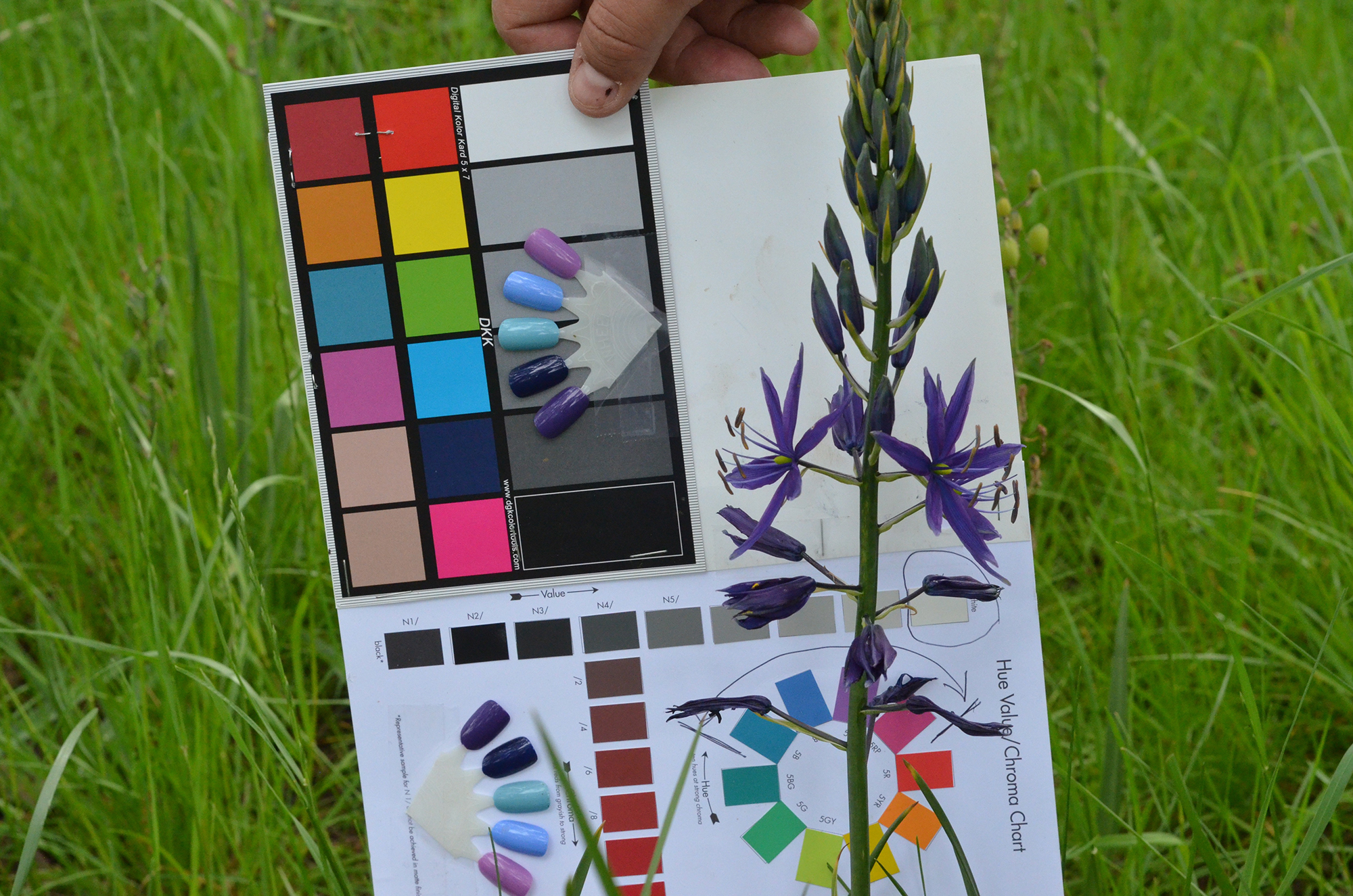
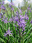
COLOR VARIATIONS IN NATIVE CAMAS FLOWERS ALONG THE OREGON I-5 CORRIDOR, April 23 - May 10, 2016
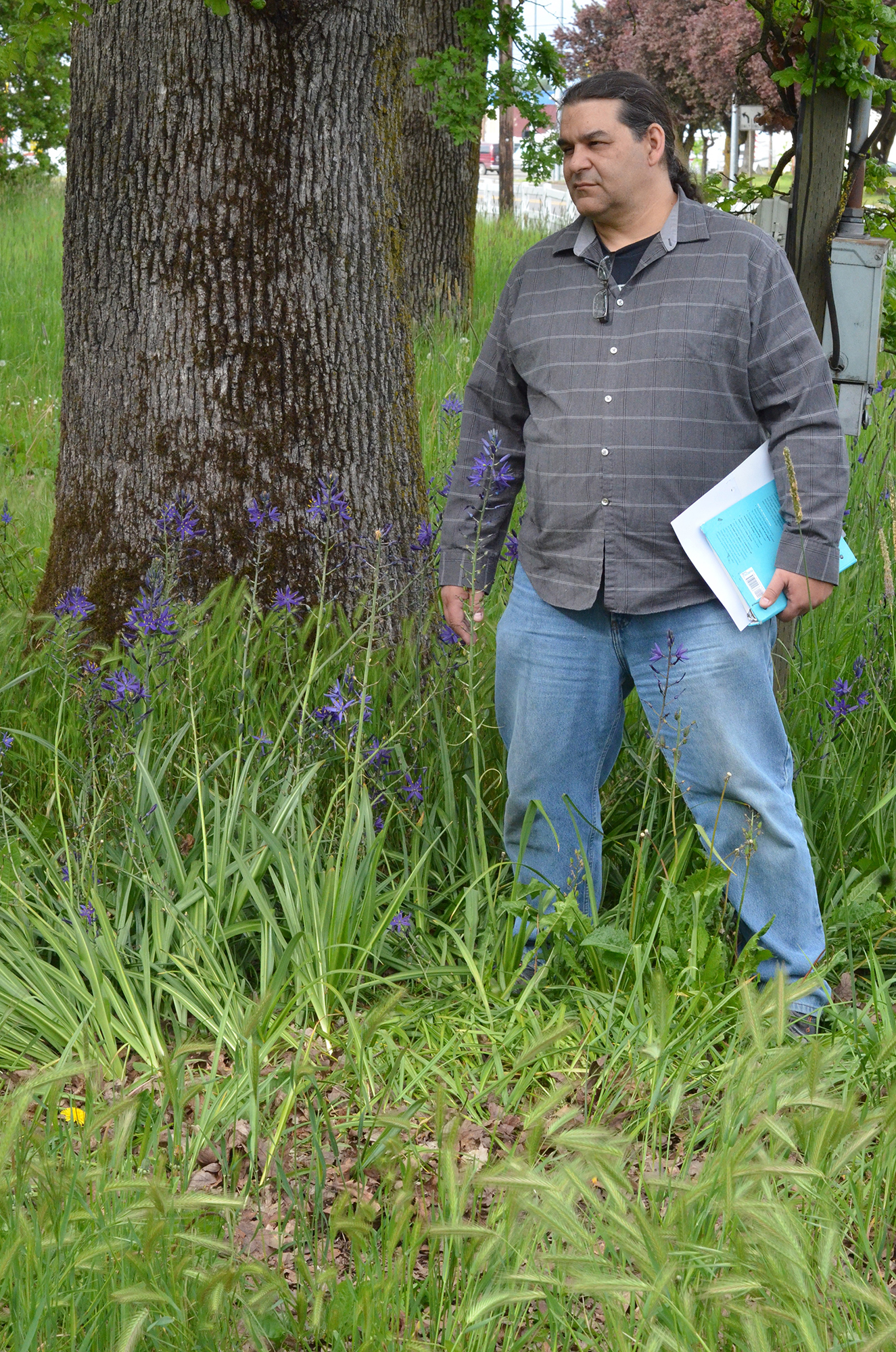
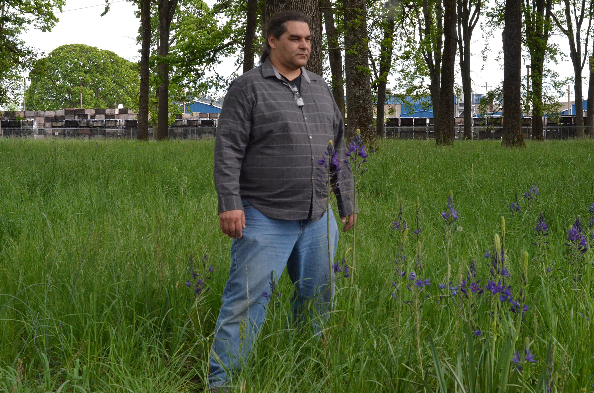
Dr. David Lewis in patch of deep purple camas flowers, Heritage Oak Grove, Oregon State Fairgrounds, Salem, Oregon, April 27, 2016. Photo by Bob Zybach*
Field Report By Bob Zybach, PhD.
Program Manager, www.ORWW.org.
June 10, 2016
This is a supplemental field report to the 2015 South-North transect report on camas color variations that was posted on May 14, 2015: www.orww.org/Native_Plants/Camas/Colors/20150511_Oregon_I-5
The hypothesis and field research methods of this project are found at: www.orww.org/Native_Plants/Camas/Colors/20160427_Salem_Fairgrounds
These two reports, and links to other ORWW websites and reports related to camas, can be found at: www.orww.org/Native_Plants/Camas
This research project asks the question: Were aesthetic qualities of camas blossom colors a factor in the establishment and/or maintenance of camas fields by precontact western Oregon Indian communities? This question is based on the observation that distinctive colors of camas blossoms appear to geographically correlate to early historical Indian communities, and particularly communities in the Willamette and Umpqua River valleys.
In the 2015 report on this transect we documented the significant -- and largely discrete -- differences in camas flower colors in various locations along the south-north I-5 highway corridor, from the Hugo Exit at Milepost (MP) 66 to the Corvallis Exit at MP 228 (162 miles). In 2016 we extended this transect from the California border at MP 0 to the Market Street Exit in Salem at MP 256 (256 miles). In 2015 and 2016 combined, more than 60 individual camas plants have been photographed from 34 different locations, with 30 of these plants selected and sampled for genetic testing.
Photograph Tables
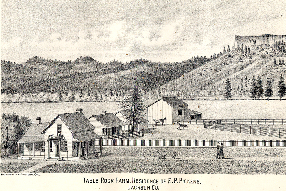
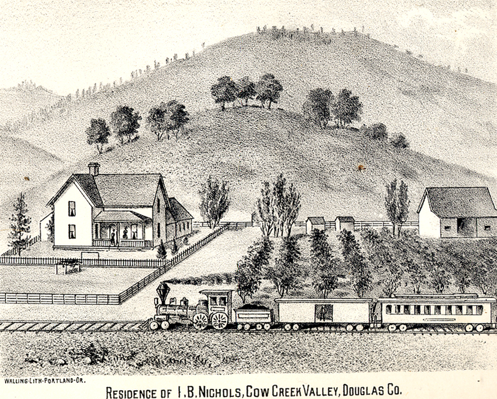
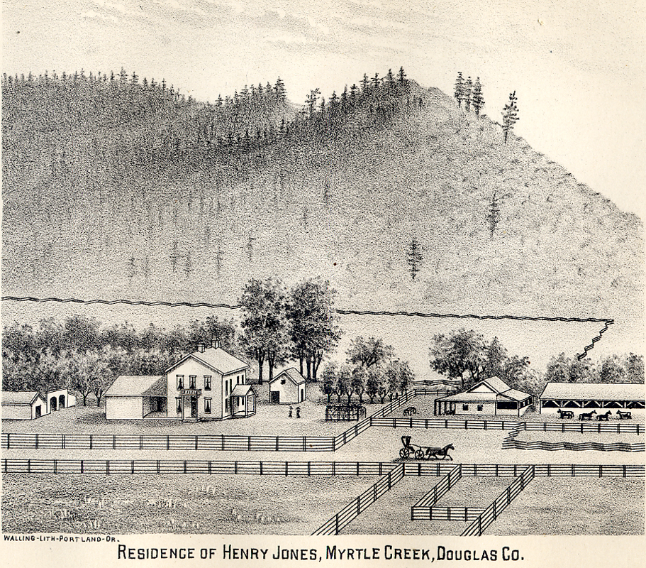
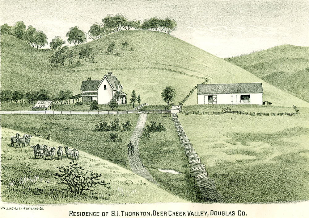
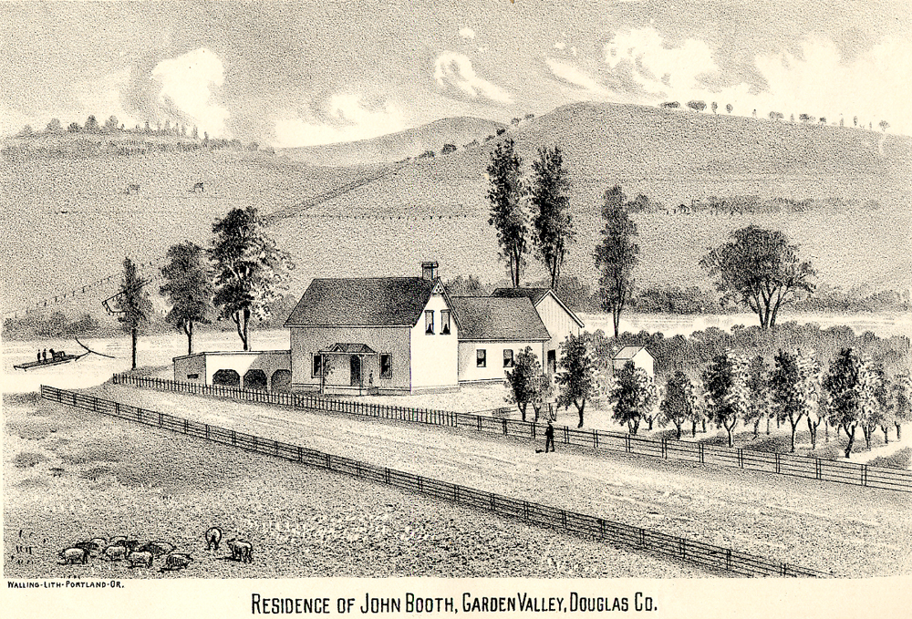
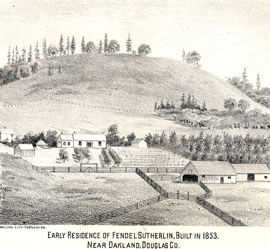
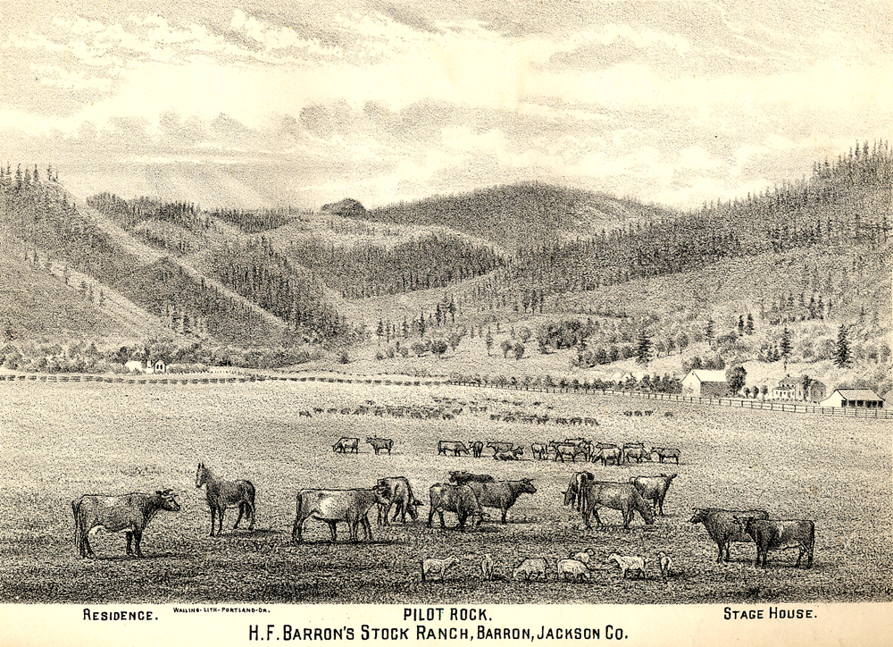
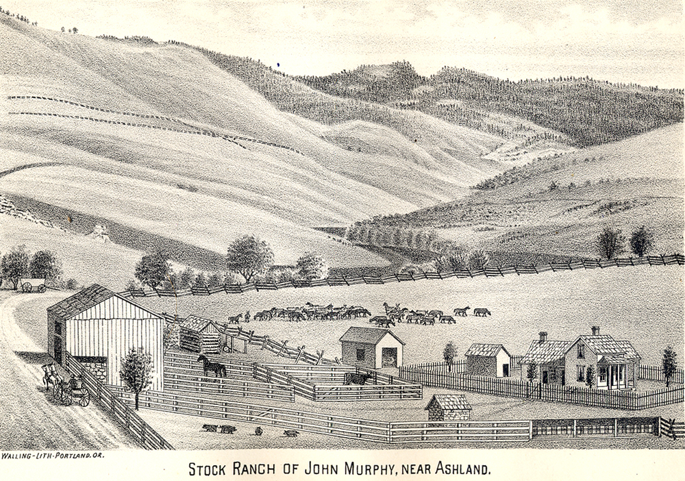
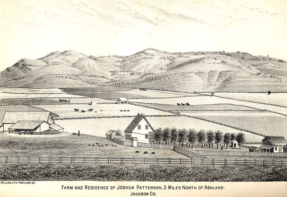
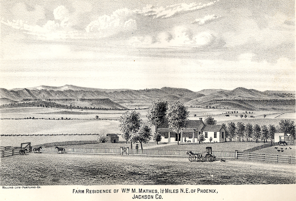
Table 1. South-North Transect from Pilot Rock to Table Rocks in 1884. This Table and the far left column on Table 2 are comprised of drawings that illustrate Albert Wallings' 1884 history of SW Oregon. They are arranged from south to north along the current route of I-5 in order to parallel the photographs of camas taken more than 130 years later. An examination of the drawings indicate why traces of camas and other native plants may have been erased from the landscape in the 165 years since white settlement and removal of local Indian families from the Table Rock Reservation to Grand Ronde 160 years ago. Note: these drawings very accurately depict landscape conditions -- including trees -- at the time they were made by James Tilton “Jimmy” Pickett. He was the son of famous Civil War General George E. Pickett and his Indian wife, "Morning Mist,” said to be the daughter of a Haida chieftain. Pickett was born December 31, 1857, probably in a house built in 1856, the same year his parents were married. The house is still standing in Bellingham, Washington and is considered to be the oldest house on its original foundations in the PNW. Morning Mist died a short while after her son’s birth, and James died childless in his early 30s after building a notable career as a detailed illustrator for newspapers, magazines and history books. Here are other Pickett drawings from that series: www.orww.org/History/SW_Oregon/References/Walling_1884/Illustrations
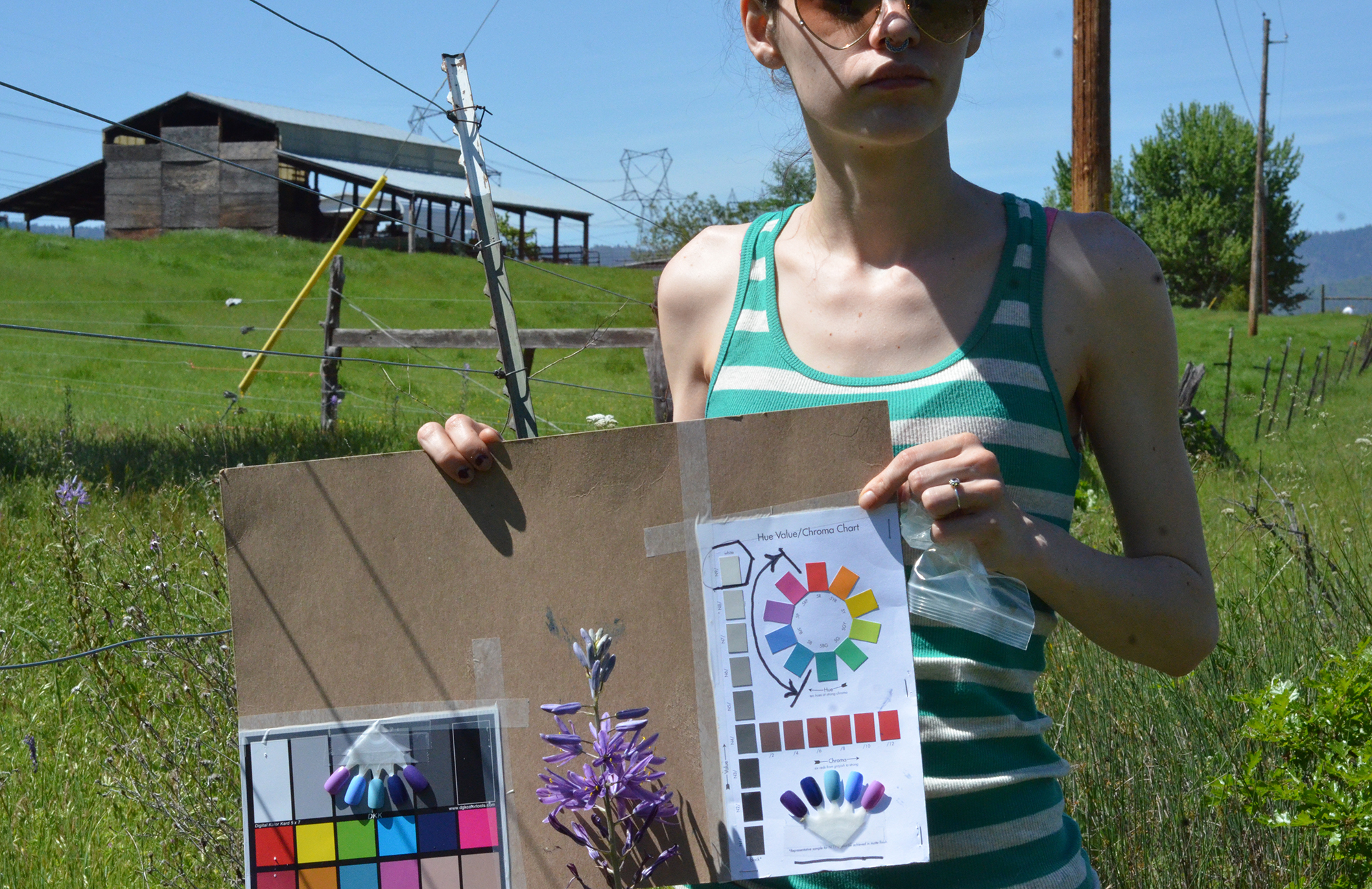
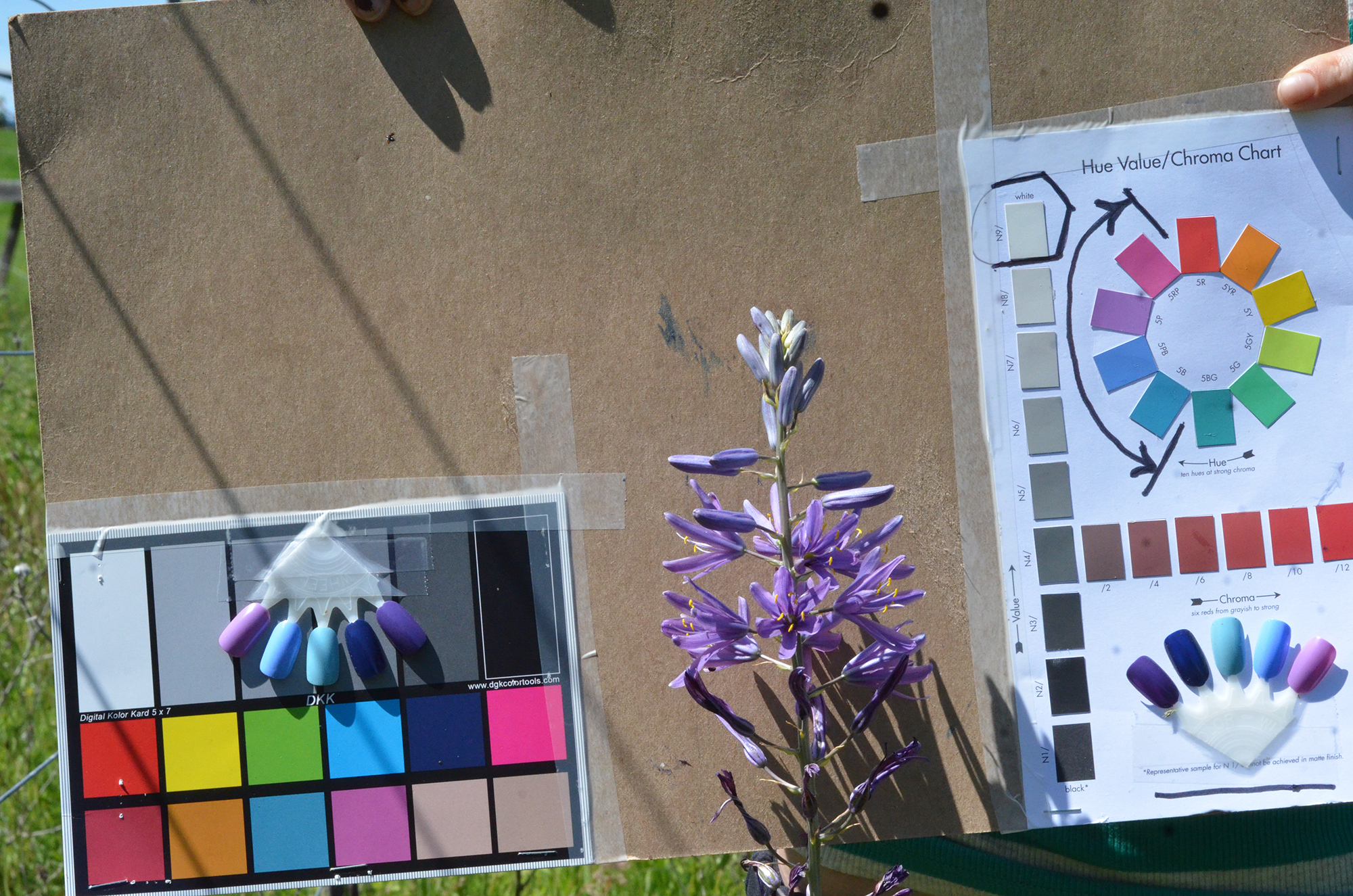
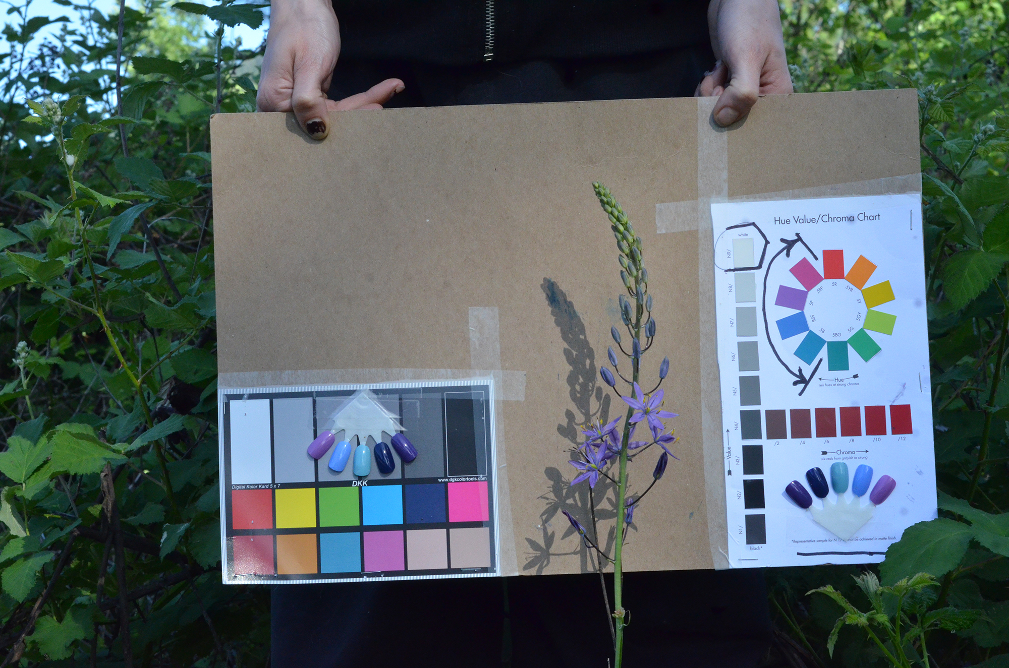
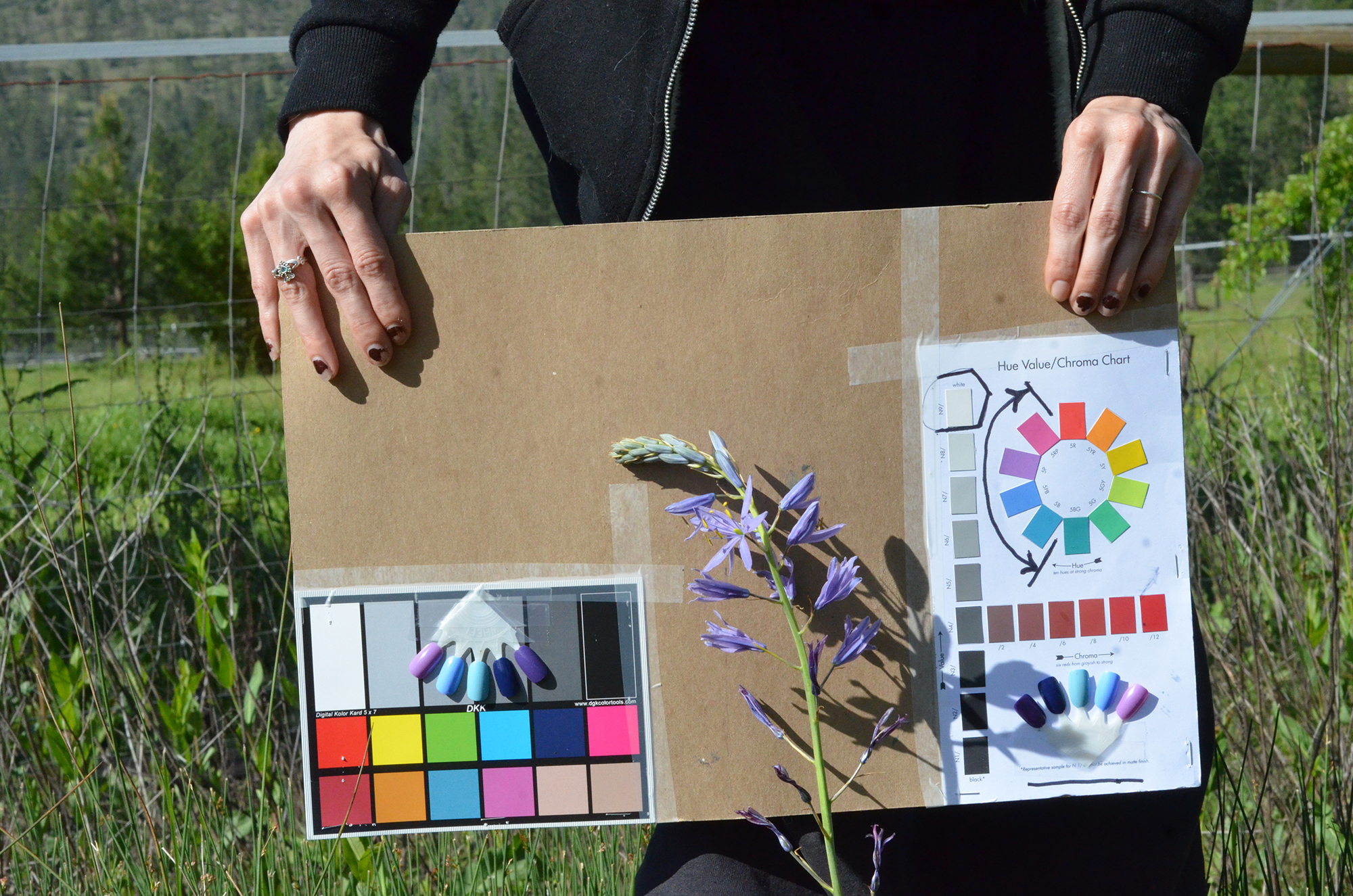
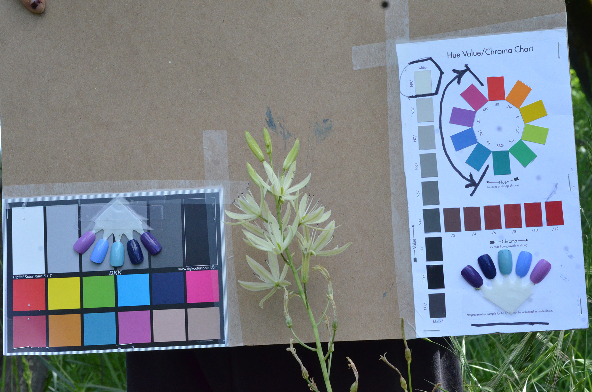
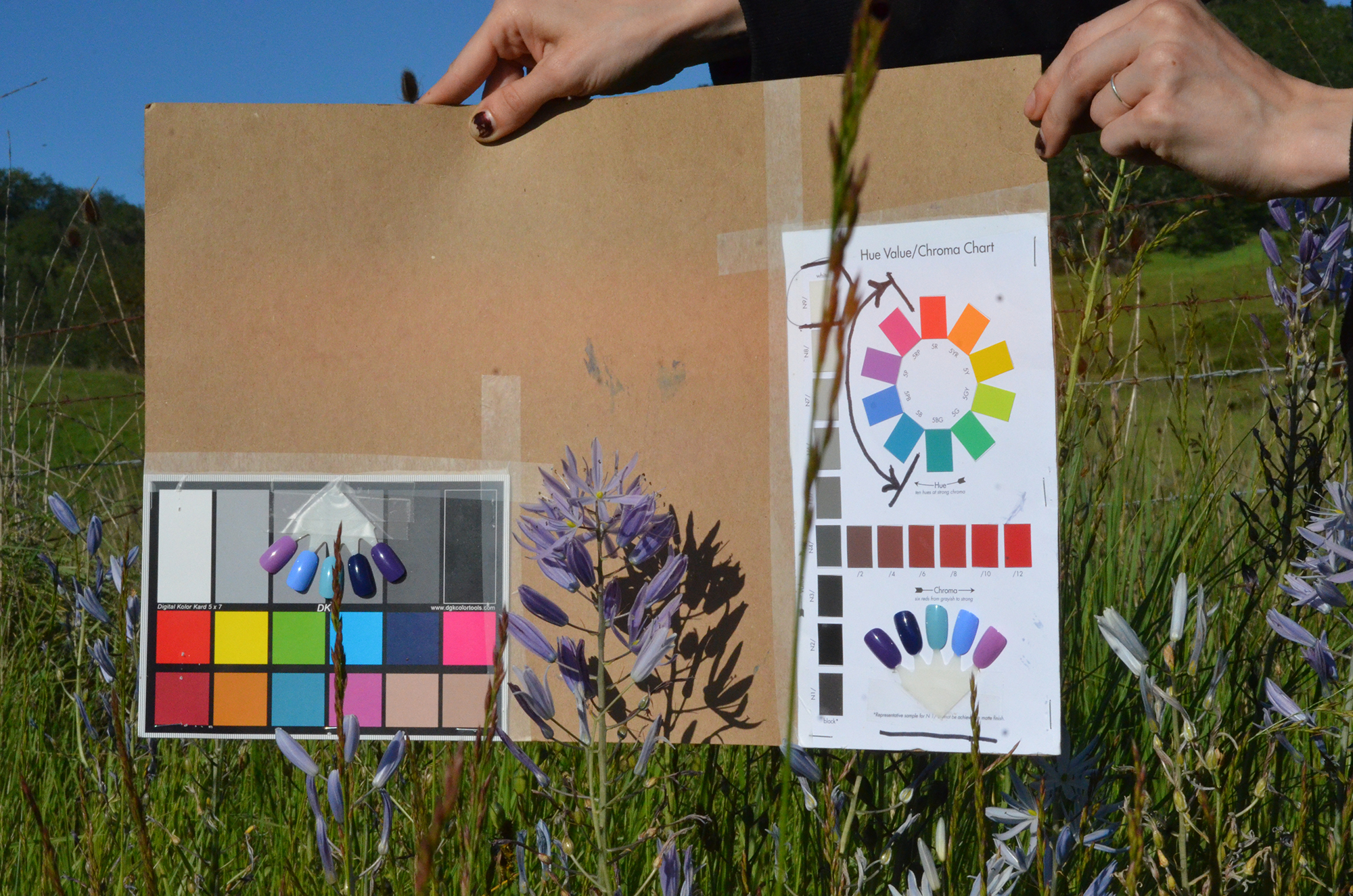
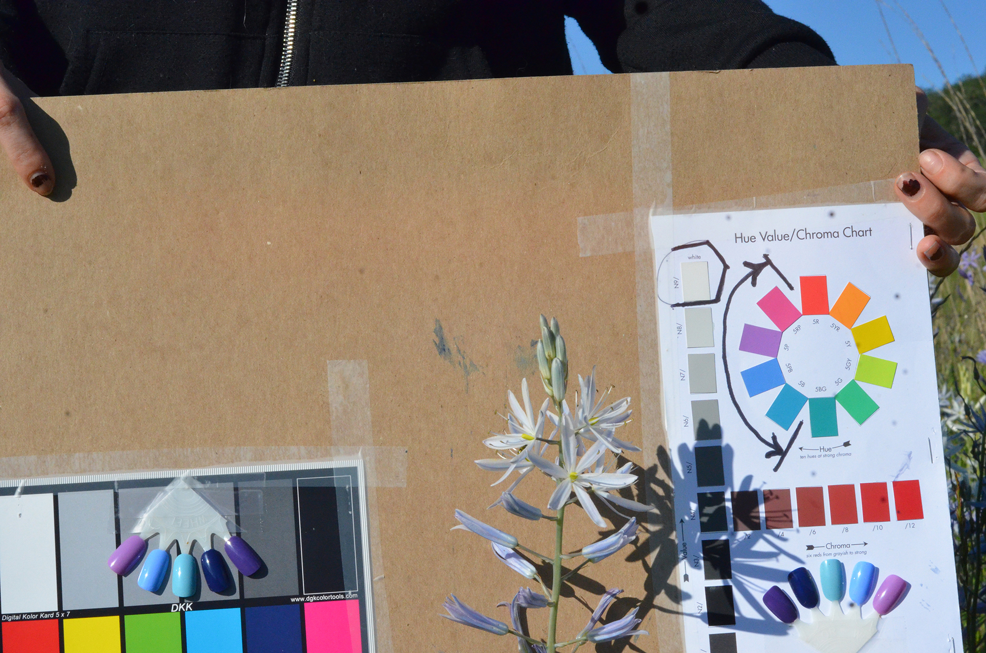
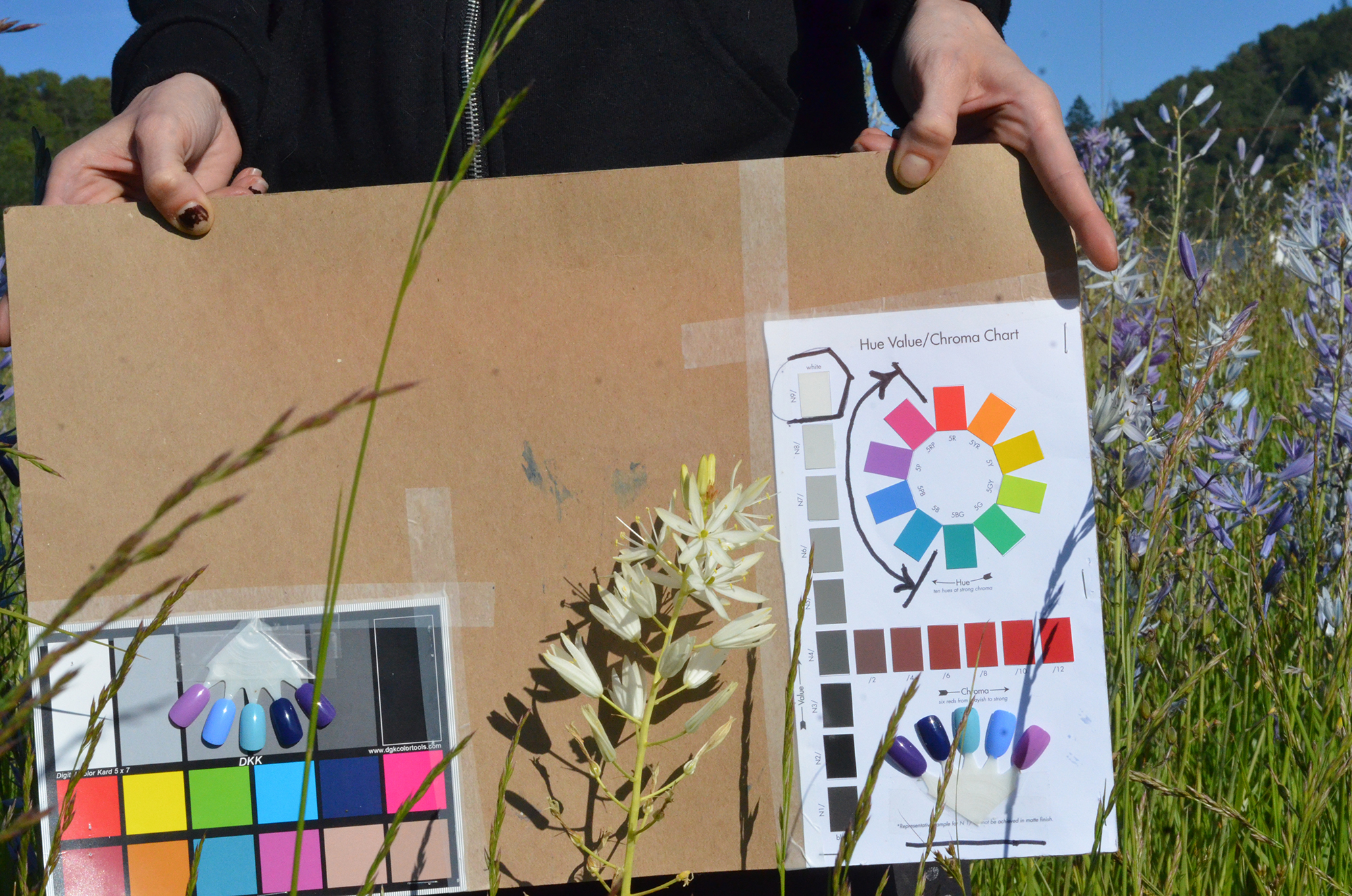
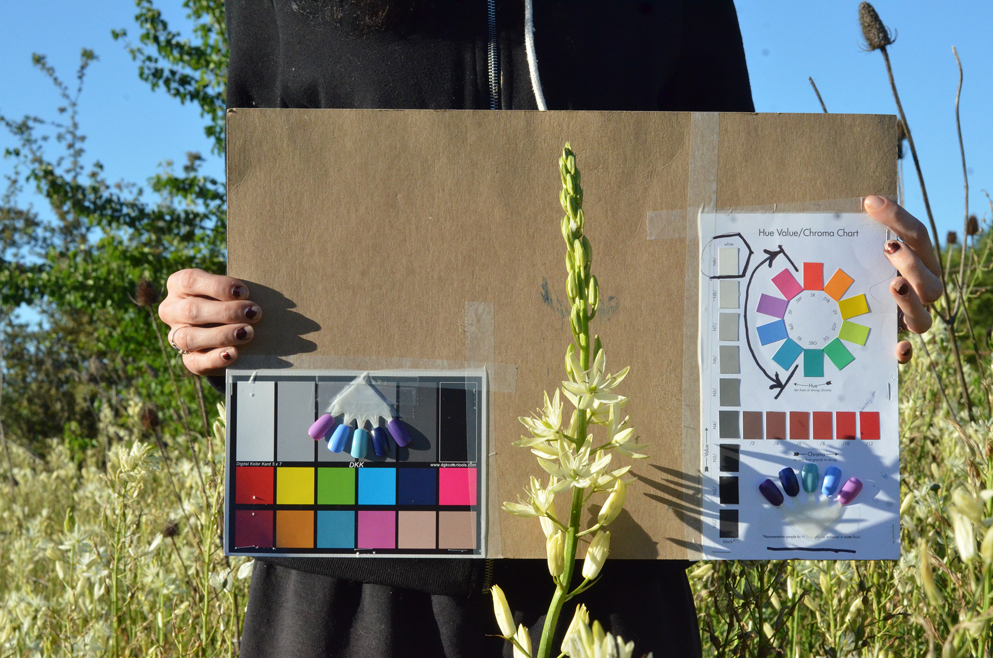
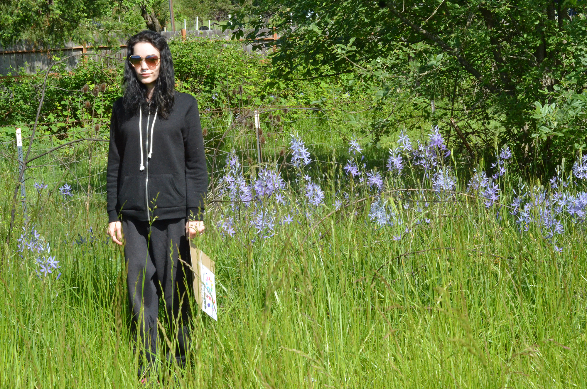
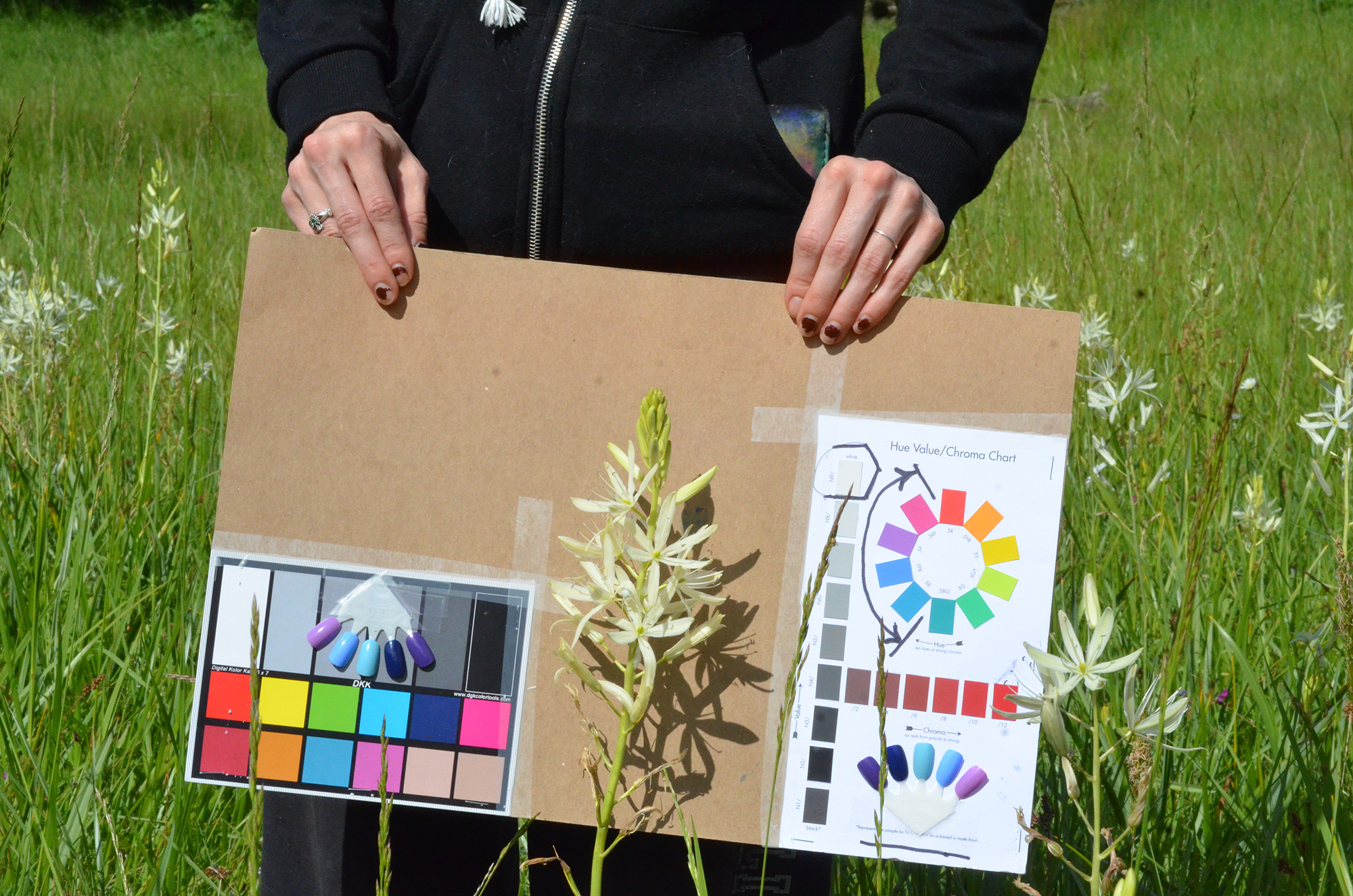
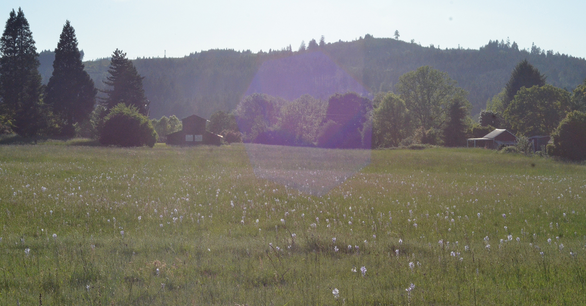
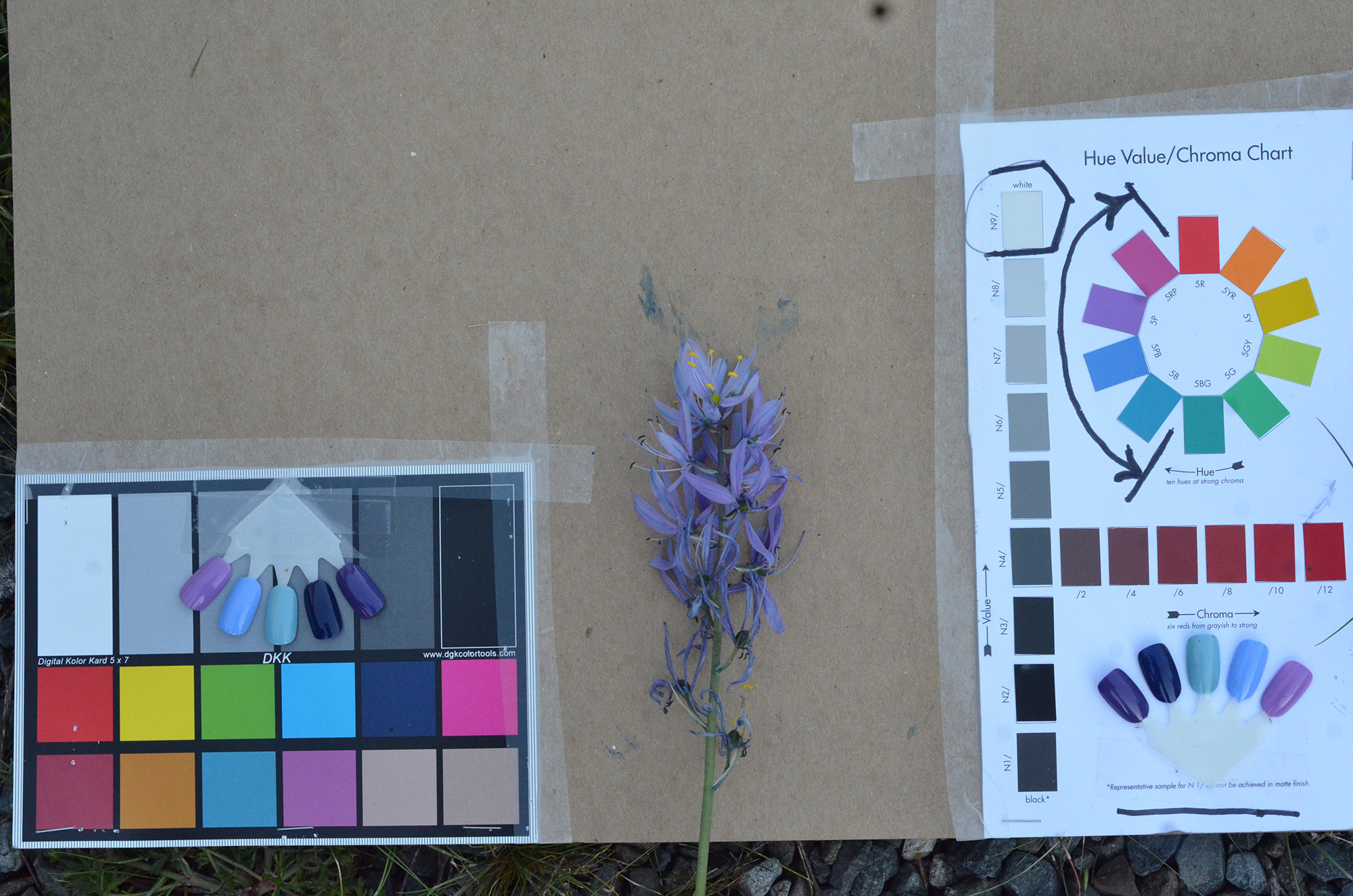
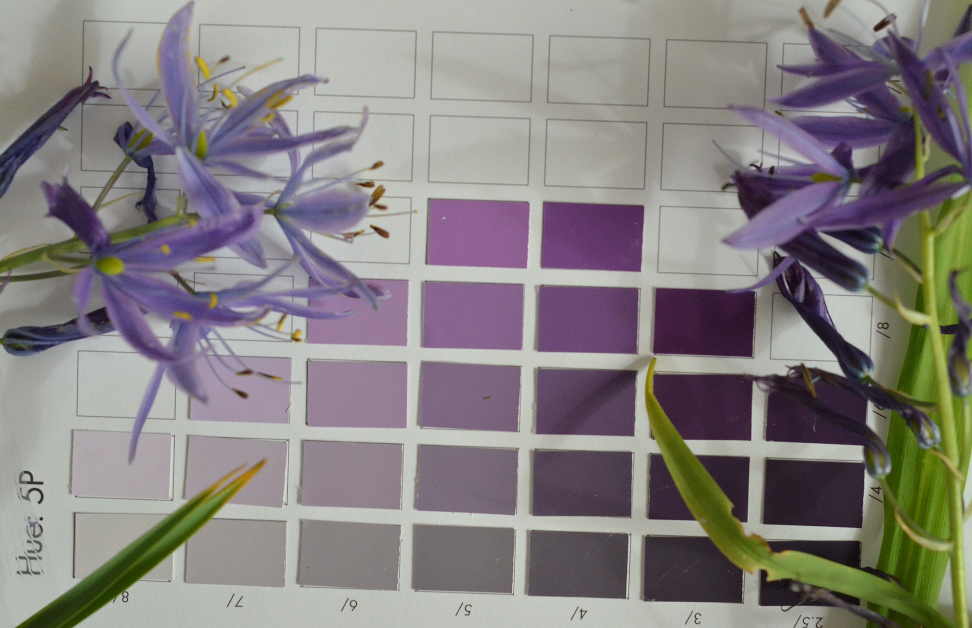
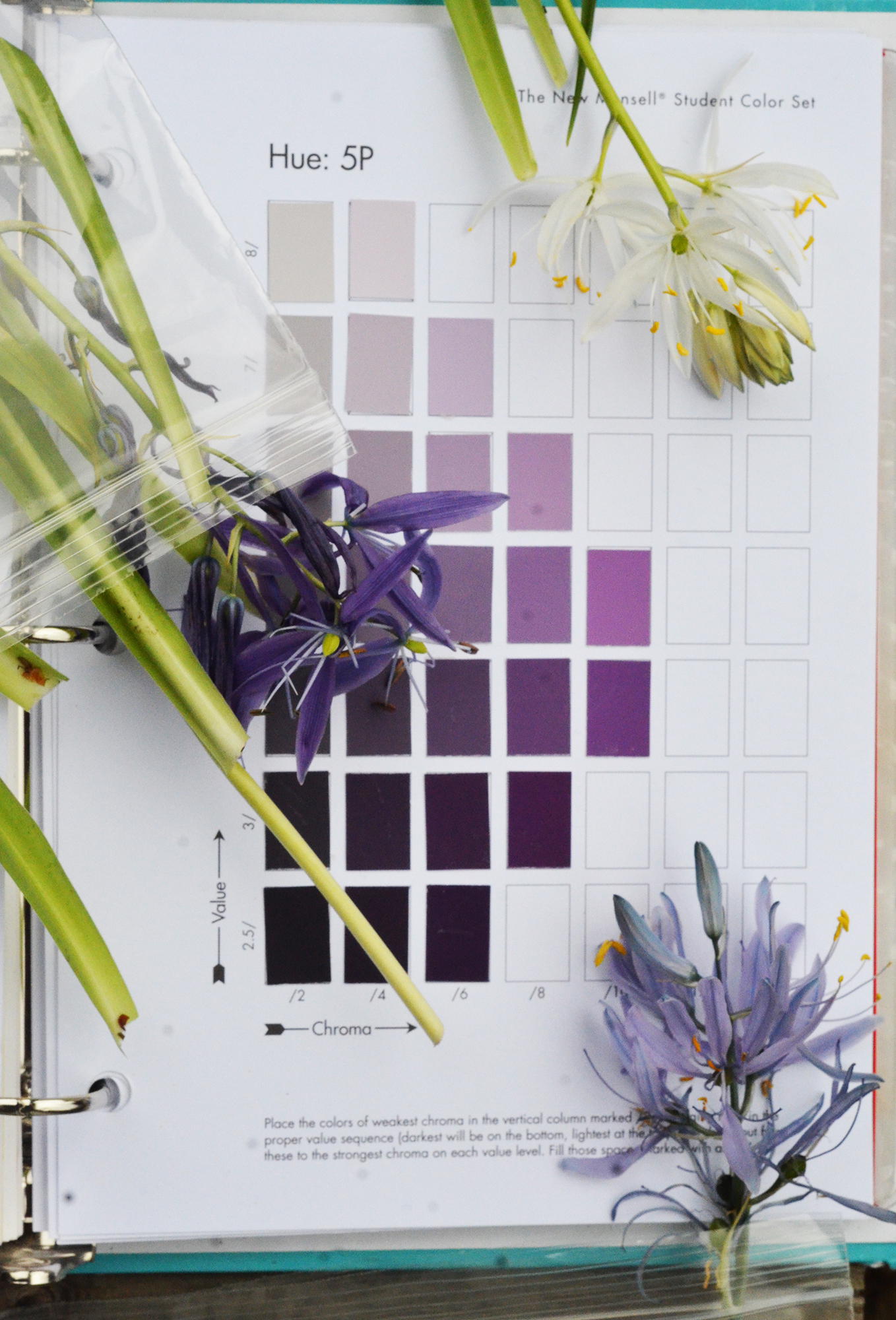
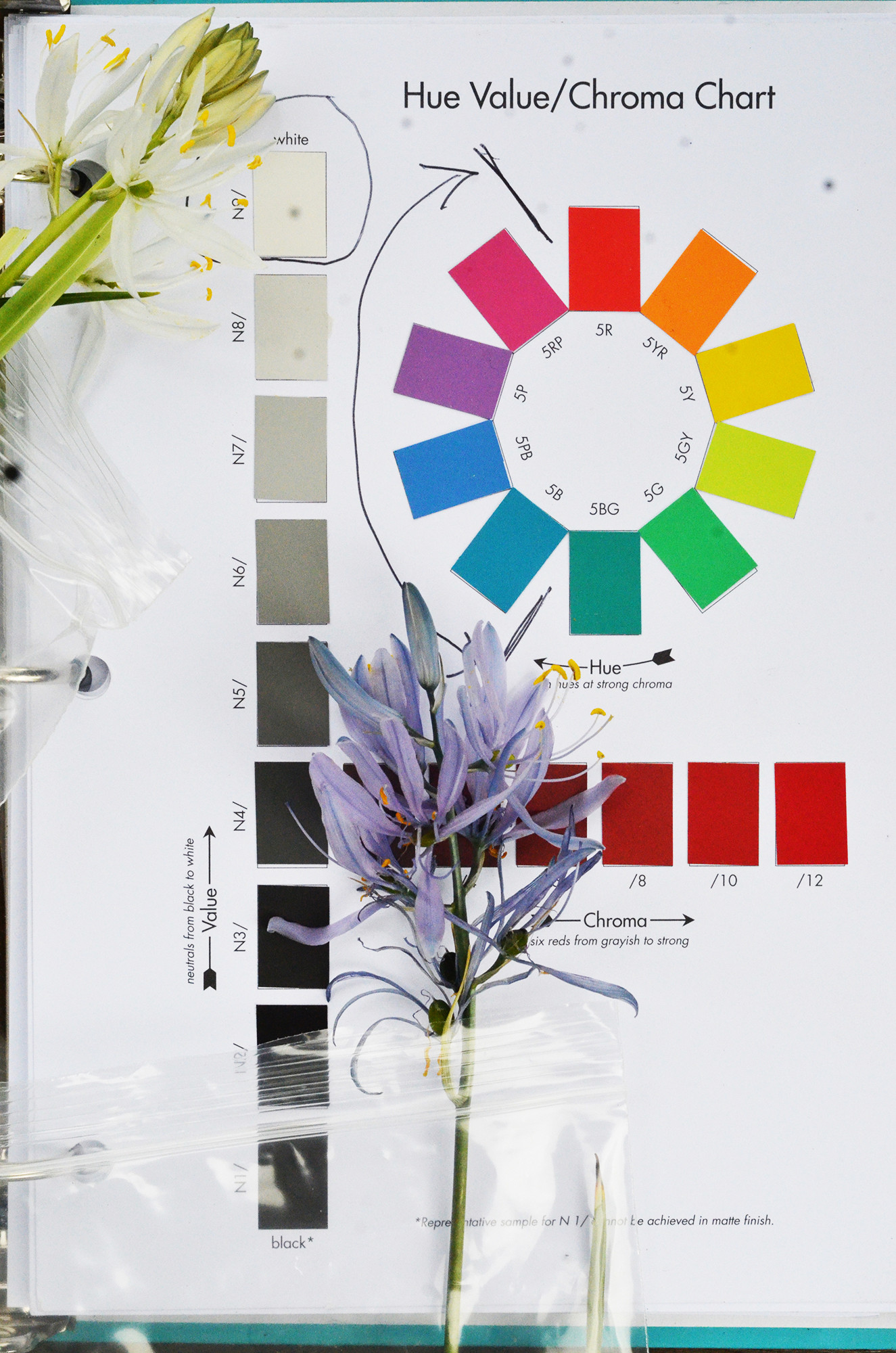
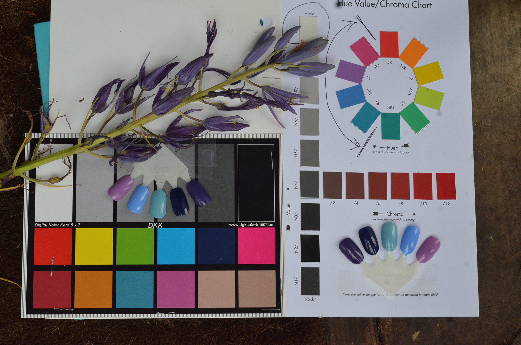
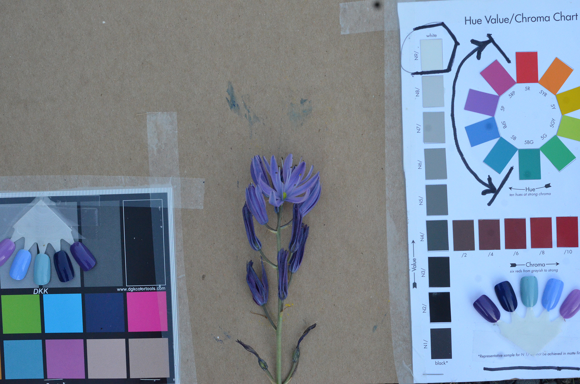
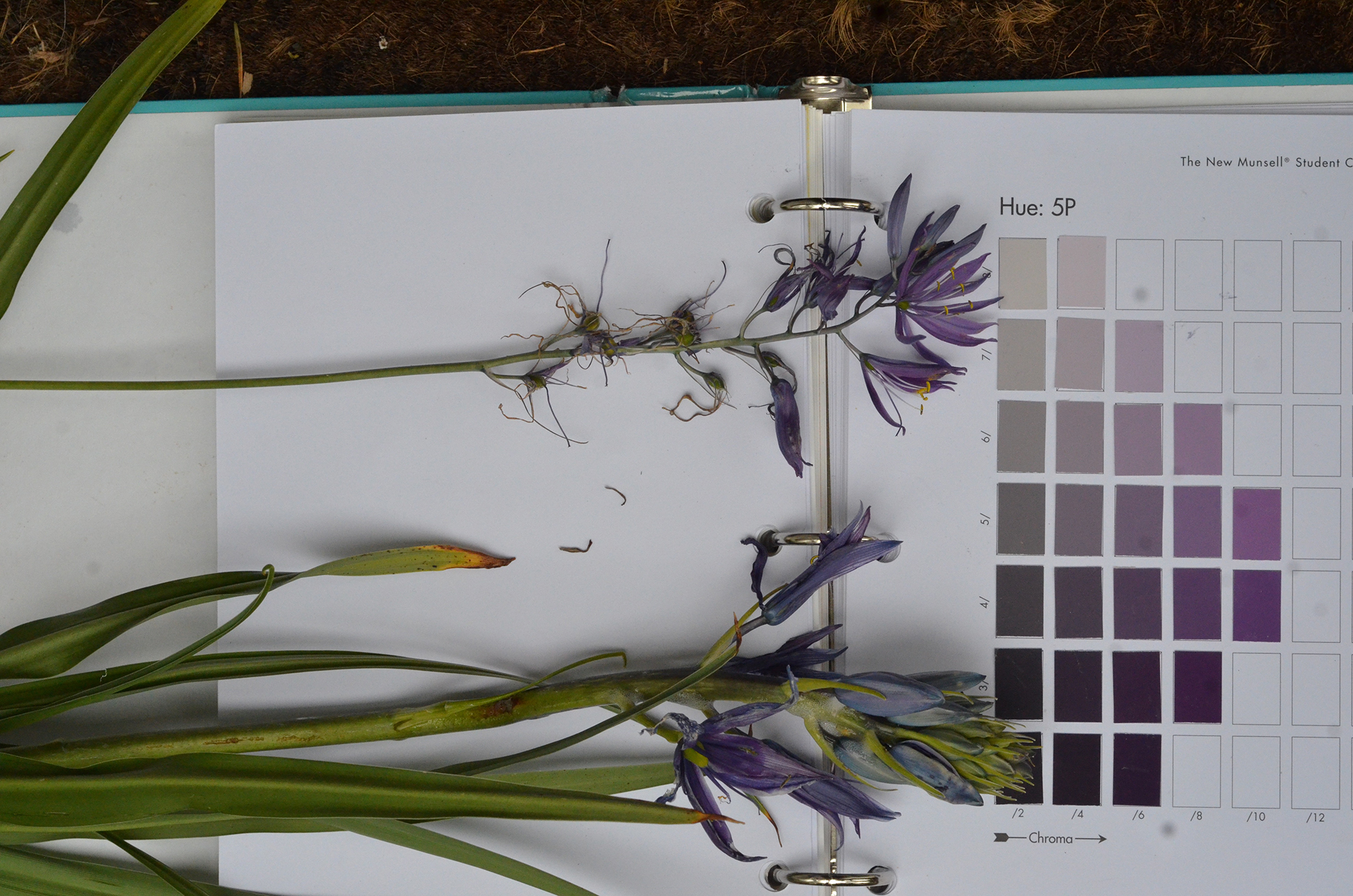
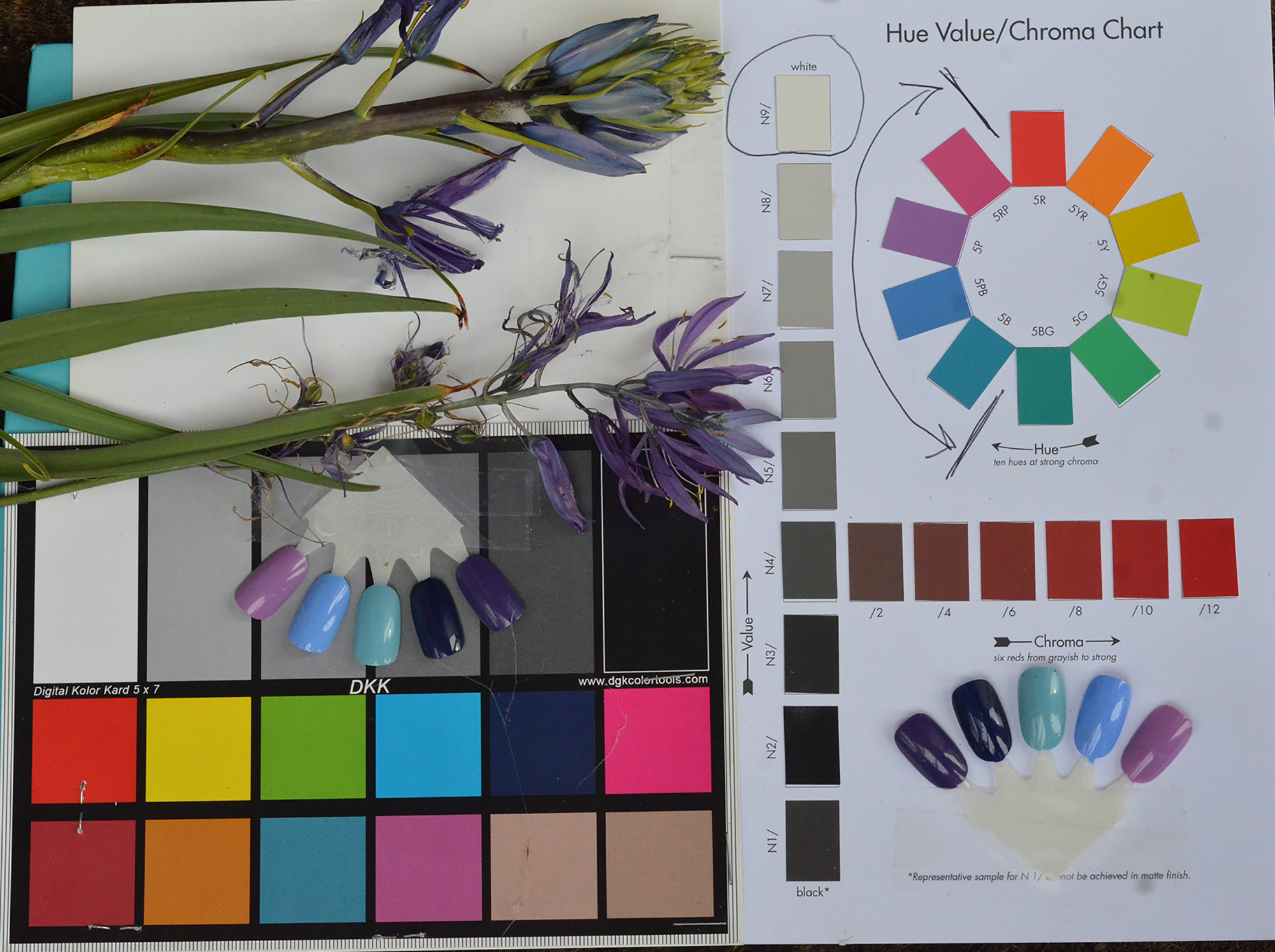
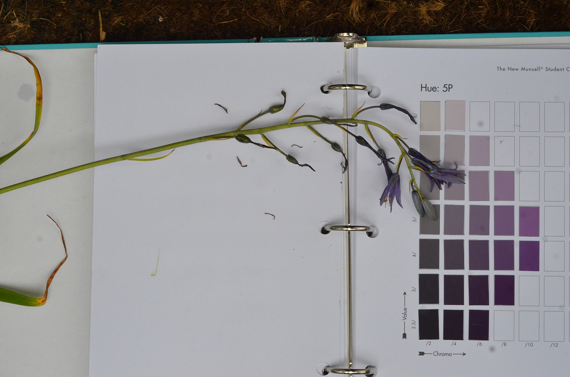
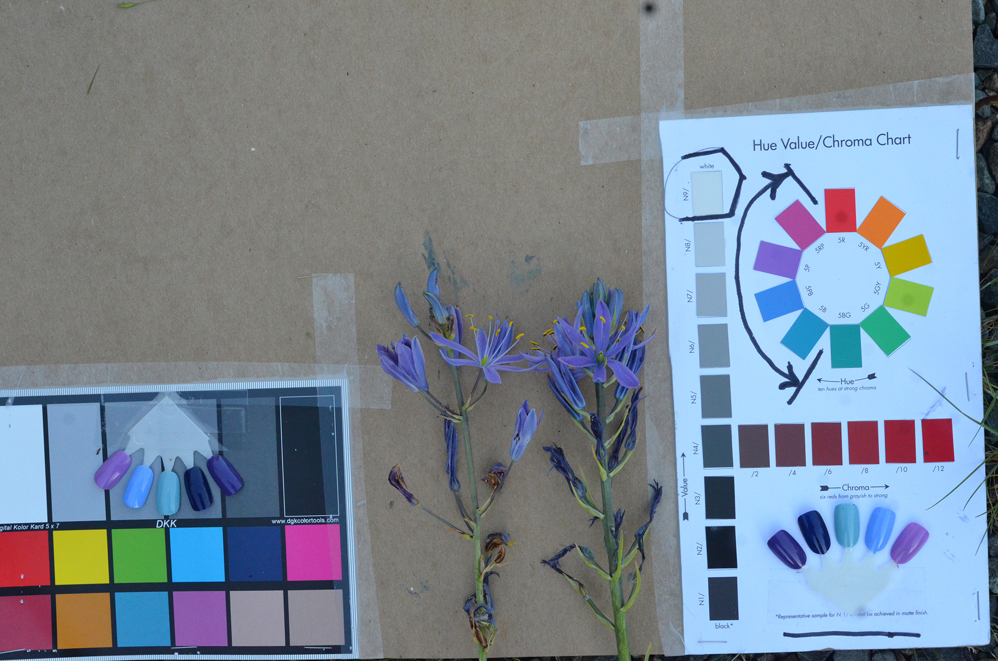
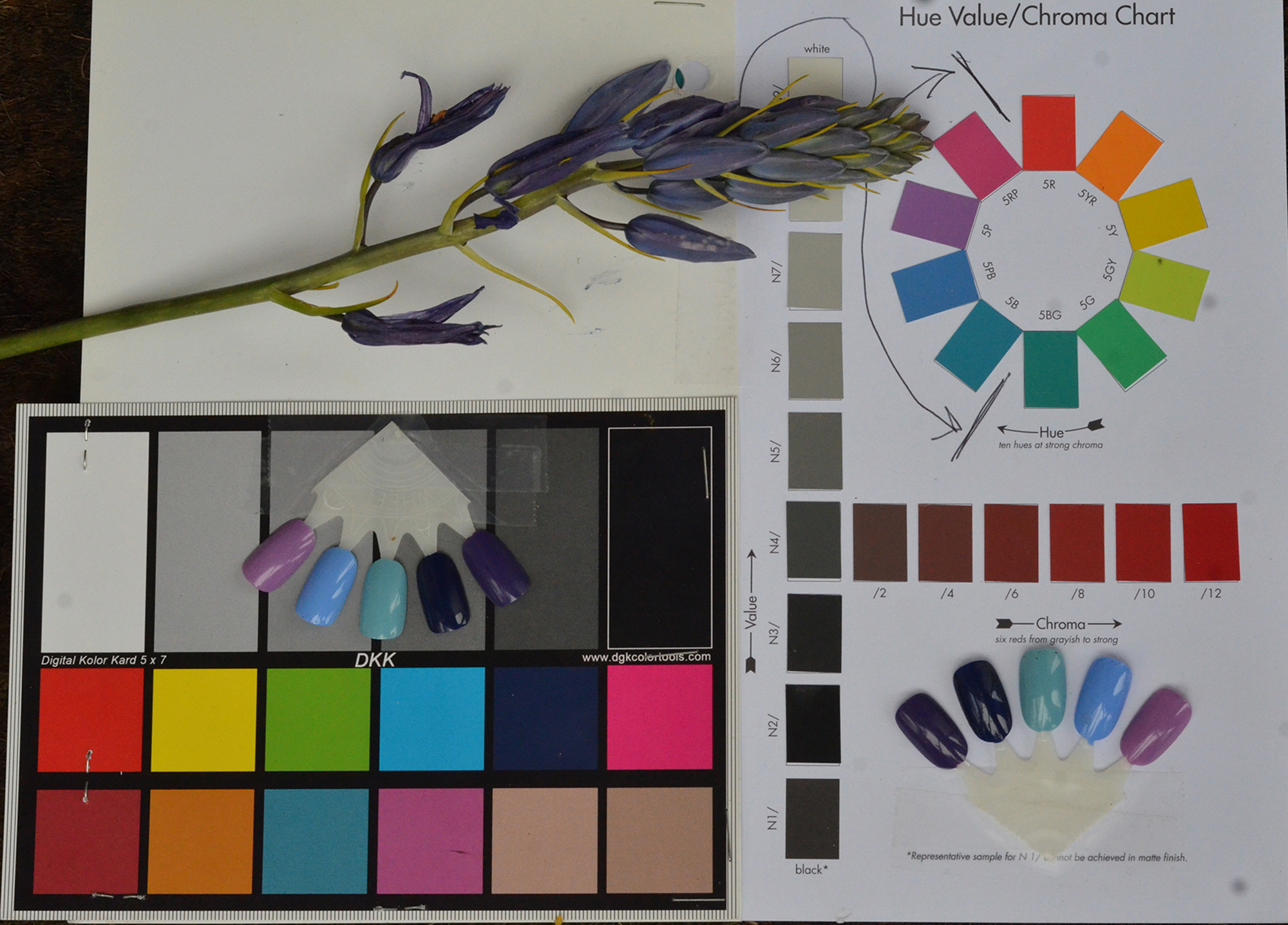
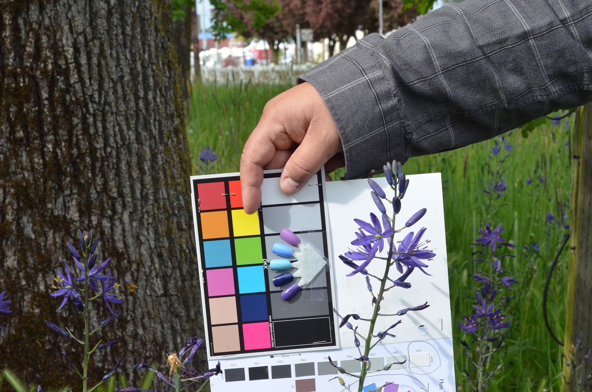
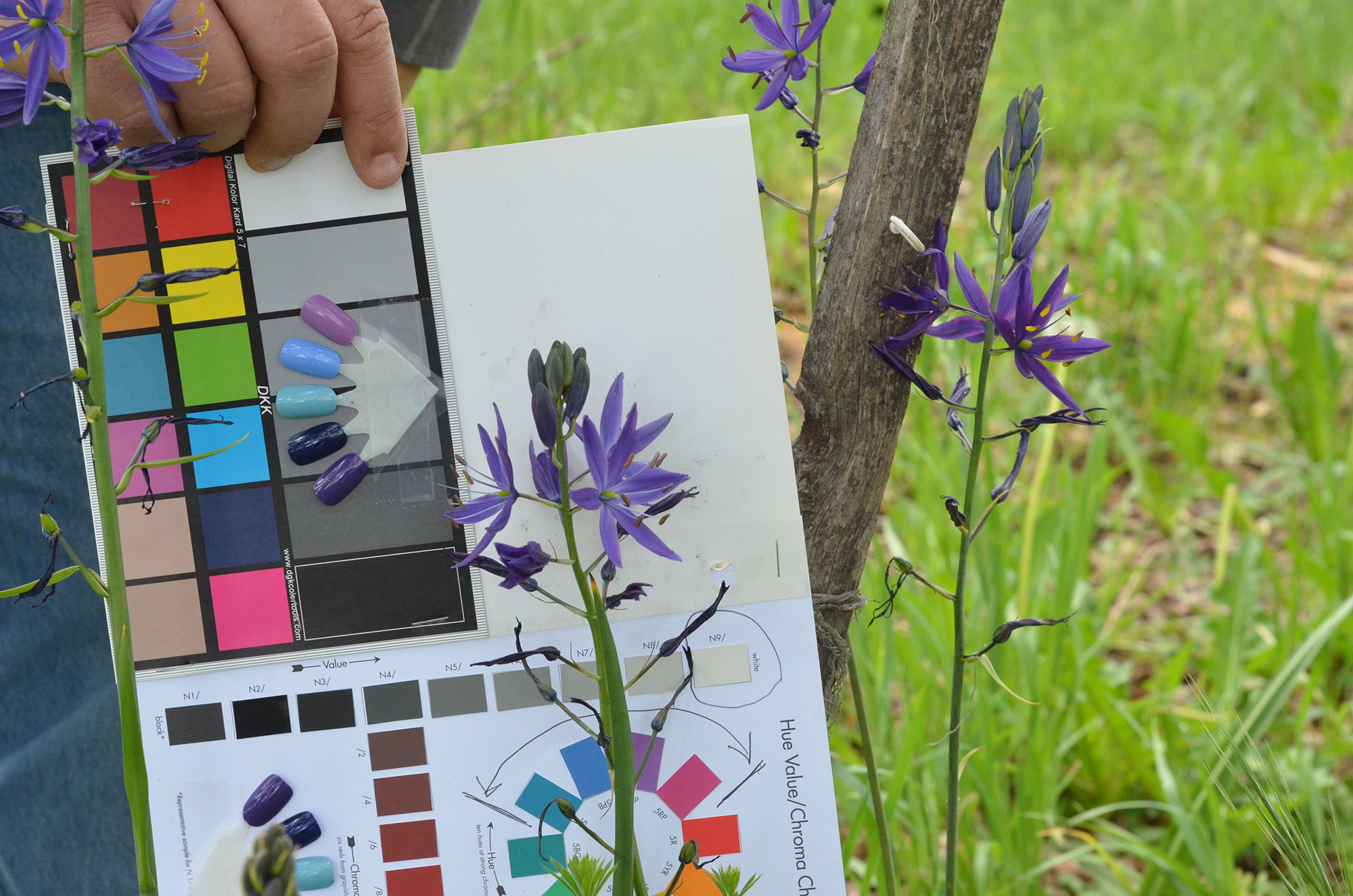
Table 2. South-North Transect of Camas Blossom Colors from Table Rocks to Salem in 2016. This table includes a continuation of the 1884 landscape drawings introduced in Table 1, as well as a series of camas flower photographs taken with color charts from Table Rocks to Salem, Oregon between April 23 and May 10, 2016. The significance of these documented color variations is discussed below in the text following the tables.
Table 1. South to North Landscape Drawings from Pilot Rock to Table Rocks in 1884.
 |
 |
 |
 |
|
| 1884_Barron | 1884_Ashland_South | 1884_Ashland_North | 1884_Phoenix |
Table 2. South to North Transect of Camas Colors from Table Rocks to Salem in 2016 Compared to Landscape Drawings from Table Rocks to Oakland in 1884.
Discussion and Findings
1) This year we extended our sampling southward to the California border on May 9. We had been expecting to find a significant number of plants along the Rogue River and along Bear Creek, as we found in the Umpqua and Willamette drainages, but were very surprised to find no camas along the I-5 corridor, which follows those streams, or in the connected parks, rest areas and adjacent highways. Dr. Susan Kephart, however, is doing research on several camas populations in southwest Oregon and along the Rogue River and thought we may have been too late for blossoming or the areas may have been mowed. Camas were still in full bloom at Table Rocks (Central Point Exit at MP 33) and Hugo (MP 66); the latter which we also visited on May 11, 2015. Additionally, by the time of our survey most of the roadsides, adjacent parks and rest areas had not been mowed yet. Shasta Tribal leaders and historians in a meeting in Scotts Valley, California on May 24, whose ancestral lands extended north to Table Rocks, said their ancestors were more focused on hunting, fishing and acorns than camas, which -- in contrast to the Kalapuyans of the Umpqua and Willamette valleys -- only constituted a secondary food source and was not so widely cultivated by the Shastas or their neighbors. Another apparent factor seemed to be local climate, which is significantly drier than the valleys to the north. In 2004 the ethnobotanist for Ashland City Parks, Donn Todt, was of the opinion that camas had been grown throughout these valleys prior to immigration, but large herds of hogs raised locally and driven seasonally between the Willamette Valley and California goldmines in the 1850s through the 1880s had largely extirpated local camas populations. In order to grow camas in a swale at North Mountain Park in the 1990s, in fact, the City of Ashland had to purchase bulbs from a nursery in Holland due to a lack of local sources.
2) Of the 34 total camas populations sampled during the 2015 and 2016 transects, the only one that also noticeably contained death camas was at Table Rocks, where it forms as much as 10% of the flowering plants in a camas field at the developed trailhead of Lower Table Rock. It has been said -- but not corroborated during this research -- that a nearly pure stand of this plant can be found in a vernal pool on the summit of Upper Table Rock. If this is accurate information, it may be the only such concentrated population of this plant in Oregon, which usually occurs singly or in scattered locations in other flowering meadows, fields and prairies. Death camas is known to have very similar growing requirements as camas and often appears in conjunction with this plant in many locations in the Pacific Northwest, so it is possible that it had been systematically weeded out during precontact time from many or most relict patches in this study. The pure stand of this plant on Upper Table Rock, if it actually exists, might also indicate a purposeful management of this deadly poisonous plant in a remote location for medicinal or other purposes.
3) Of the 34 total camas populations sampled during the 2015 and 2016 transects, only two contained a wide variety of blossom colors: Winston, at I-5 MP 119, and Salem-2 at the Oregon State Fairgrounds, three miles from the Market Street Exit at I-5 MP 256 -- nearly 140 miles from each other. The Winston mixed-color camas are at an intersection of ancient trade routes between the Oregon Coast and the South Umpqua Valley via Lookingglass Creek and the Coquille River, and the Salem mixed-color camas are also at the intersection of ancient trade routes: between the Cascade Mountains via the North Umpqua River and the Willamette Valley, and the Oregon Coast via the Salmon River. Other than these two anomalies, the other 32 populations are comprised almost entirely of a single base color: typically cream, dark purple, lavender, blue, or blue purple in western Oregon.
4) One of the most remarkable findings of this study is the preponderance of distinctly different colored camas blossoms that dominate and typify the Umpqua and Willamette valley populations: the most common color in the Umpqua Valley is a cream-colored large (or giant) camas, while the Willamette Valley populations are dominated by deep purple-colored large camas. Of particular interest is the fact that we were unable to locate a single cream-colored camas of all the tens of thousands of flowering plants we observed in the Willamette Valley, while conversely we were unable to locate a single deep purple-colored camas among the thousands of cream-colored flowers we observed in the Umpqua Valley. The line of demarcation between the two colors is very sharp along I-5: the northern-most cream-colored camas we observed was near I-5 MP 158 and the town of Anlauf at the headwaters of the Umpqua River, while the southern-most deep purple blossom observed was near I-5 MP 174 in Cottage Grove near the headwaters of the Willamette River -- a distance of only 16 highway miles and separated by the watershed of both basins. It is easy to imagine the appearance of both valleys in early spring 200 years ago when the Umpqua Valley floor was covered in a thick cream color and the Willamette Valley floor was simultaneously covered in a deep purple color. Certainly this had to be a remarkable appearance for each homeland of Kalapuyan people at that time, as well as being starkly apparent to the Calapooia people who occupied the Calapooya Mountains separating the two valleys! (Note: all spellings are correct). The basic questions are how this circumstance came to be in the first place, and secondly, how (and why) this demarcation had been maintained for the centuries preceding white settlement, and for the nearly two centuries since that time. It is the intent of this study to explore that very question.
*Unless otherwise noted, all photographs in this report are by the author.
copyright 2015 Oregon Websites & Watersheds Project, Inc.