
Map Index
Precontact History and Cultural Legacy
of Forest Research Sites in Southwestern Oregon
Click to enlarge. 1953 BLM aerial photograph of Shoestring study area, with vegetation-type patterns annotated as polygons for mappping purposes.
This index of annotated historical maps was developed under contract by Bob Zybach for Mike Newton, Oregon Sate University College of Forestry. These maps were used to help interpret and display changing landscape patterns in southwest Oregon during historical time, with a particular emphasis on the China Gulch, Humbug, and Shoestring study areas.
Early historical maps of southwest Oregon, 1826-1884. Early historical county maps of southwest Oregon at the
Cultural landscape patterns of southwest Oregon, 1826-1884. Detailed drawings of southwest Oregon locations, organized by local landmarks.
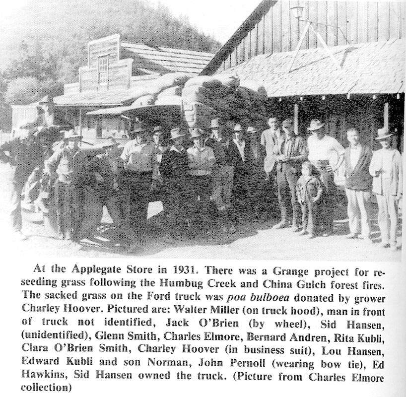
Historical maps of Applegate Valley subbasin, 1852-1978. Location of historical Applegate Valley roads, trails, and landmarks in the 1970s; 1931 forest fire history GIS map.
Historical maps of China Gulch study plots area. Metsker map, showing local landowners with road and trail locations followwing WW II.
Historical maps of Humbug study plots. Metsker map, showing local landowners with road and trail locations.
Historical maps and aerial photographs of Shoestring study plots. Selection of GLO maps, timber cruise, Metsker seuqence, aerial photos, and vegetation-types, showing logging history.
Original land survey notes of Shoestring study plots, 1854-1882. Reproductions of typed copies of original notes for 6-square miles.
Tabular summaries of Shoestring original land survey tree data. Bearing tree species and diameter classes for 6-square miles.
Tabular summary of Shoestring original timber cruise data. General description and analysis of 1916 property tax evaluation.
Early historical maps of SW Oregon, 1826-1884.
|
icon
|
Source | Type | Year | Description |
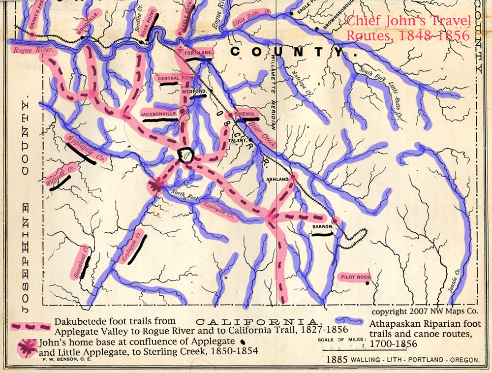 |
Zybach 2007 | Annotated base map | 1826-1856 |
Primary Athapaskan foot-trail and canoe routes in southwest Oregon in early historical time |
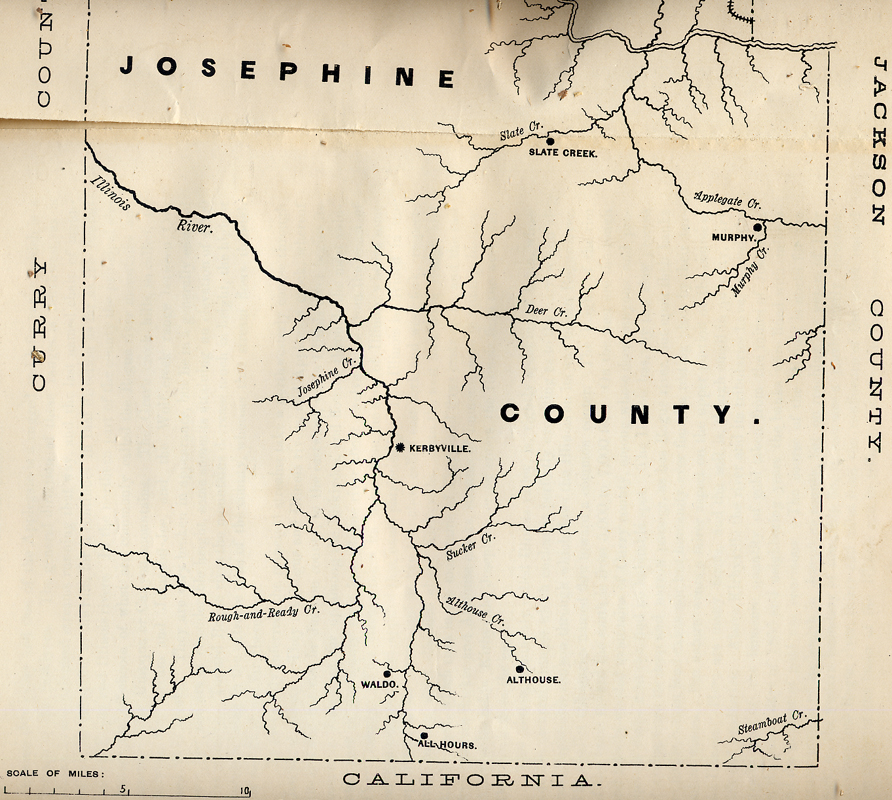 |
Walling 1884 | County boundaries and developments |
1852-1884 | Southern Josephine County during gold-mining period |
 |
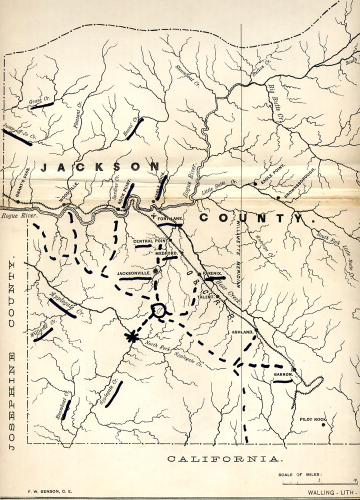
Walling 1884 | County boundaries and developments |
1852-1884 | Northern Josephine County during gold-mining period |
 |
annotated |
County boundaries and developments | 1852-1884 | Western Jackson County during gold-mining period |
 |
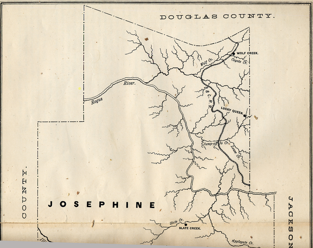
annotated |
County developments w/named landmarks |
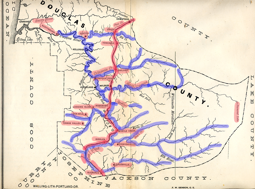
1826-1884 | Douglas County during early historical period w/major trade routes |
Historical maps of Applegate Valley subbasin, 1852-1978.
|
icon
|
Source | Type | Year | Description |
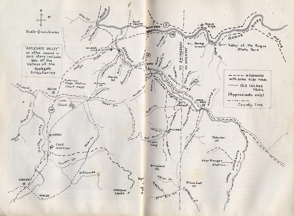 |
Johnson 1978 | Named landmarks & locations | 1852-1978 | Map and named locations and travel routes of Applegate Valley |
 |
annotated |
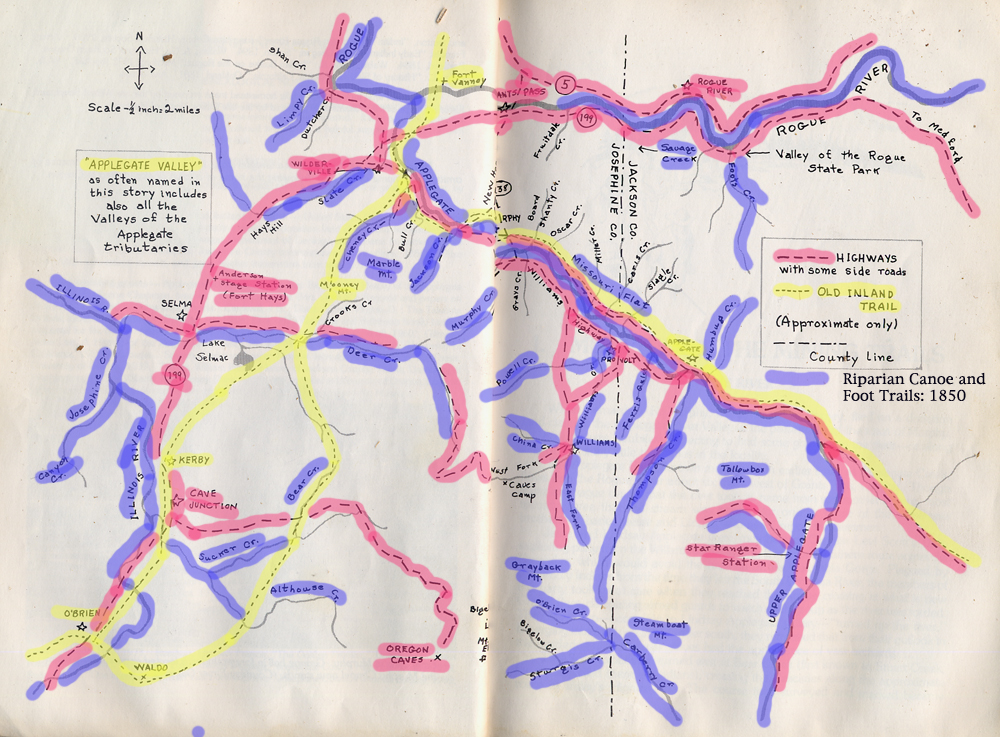
Annotated roads and trails | 1826-1978 | Historical travel routes and locations in Applegate Valley |
 |
Parsons & Assali BLM 2007 |
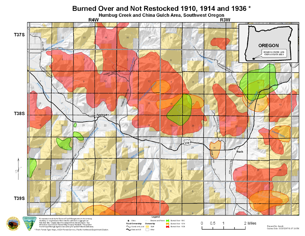
GIS Map of historical coverages Map Legend | 1900-1936 (2007) | Forest fire history of the 1931 China Gulch and Humbug wildfires |
Historical maps of China Gulch research plots area.
|
icon
|
Source | Type | Year | Description |
 |
Metsker 1955 | Cadastral, highlighted |
1955 | Landowners, landmarks, legal boundaries, and access routes of eastern Tsp. 38 S., Rng. 3 W., Applegate Valley, following WW II |
 |
Metsker 1955 | Cadastral, annotated | 1955 | Landowners, landmarks, legal boundaries, and access routes of western Tsp. 38 S., Rng. 3 W., Applegate Valley, following WW II; annotated to highlight ancient ridgeline trail system |
Historical maps of Humbug reasearch plots area.
| icon | Source | Type | Year | Description |
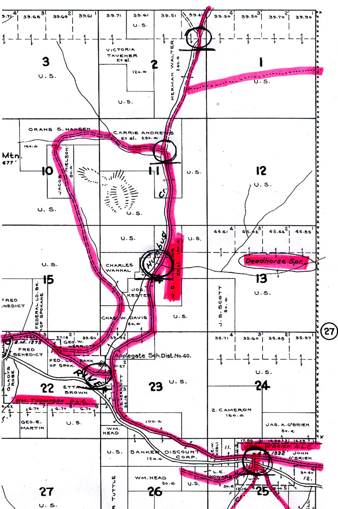 |
Metsker, no date | Cadastral, annotated | ca. 1950s | Landowners, landmarks, legal boundaries, and access routes of eastern Tsp. 38 S., Rng. 4 W., Applegate Valley, apparently following WW II; annotated to highlight ancient ridgeline trail system |
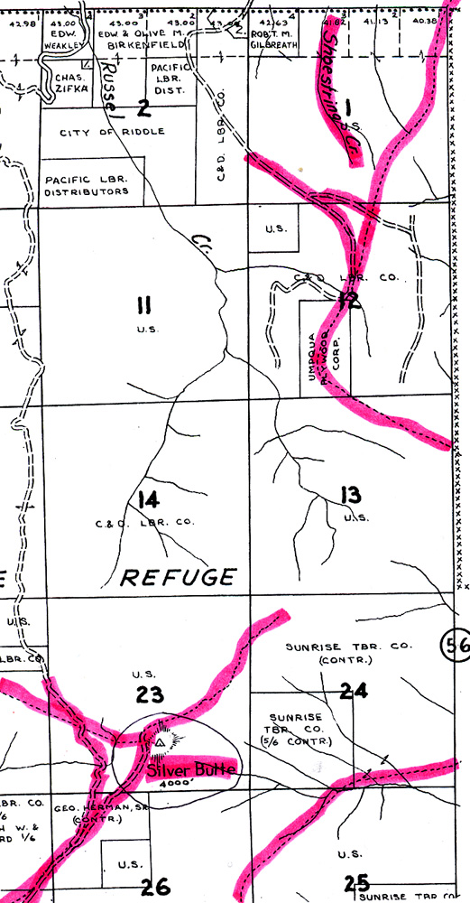
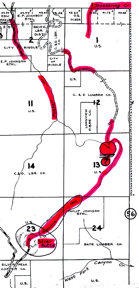
Historical maps and aerial photographs of Shoestring study plots
| icon | Source | Type | Year | Description |
 |
Douglas County Surveyor | Annotated topo; with surface features and legal subdivisions | 1854-1882 | General Land Office survey maps of Tsp. 31 S., Rng. 5 W., and 31 S., Rng. 6 W.; cropped, annotated, and indexed to original land survey notes |
 |
BLM | Timber Cruise, annotated | 1916 | Species, volumes, diameters, and heights of merchantable Douglas-fir timber of the SE 1/4 of the NE 1/4 of Tsp. 31 S., Rng. 6 W., Sec. 1 w/ tabular summary and analysis |
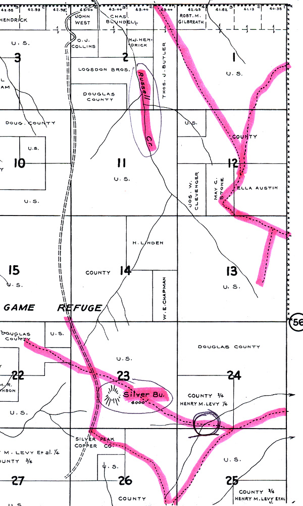 |
Metsker 1941 | Cadastral, annotated | 1941 | Landowners, landmarks, legal boundaries, and access routes of eastern Tsp. 31 S., Rng. 6 W., Cow Creek Valley, pre-WW II; annotated to highlight ancient ridgeline trail system |
 |
Metsker 1954 |
Cadastral, highlighted | 1954 | Landowners, landmarks, legal boundaries, and access routes of eastern Tsp. 31 S., Rng. 6 W., Cow Creek Valley, post-WW II; annotated to highlight ancient ridgeline trail system |
 |
Metsker 1967 |
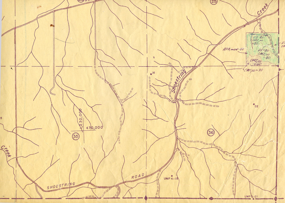
Cadastral, annotated | 1967 | Landowners, landmarks, legal boundaries, and access routes of eastern Tsp. 31 S., Rng. 6 W., Cow Creek Valley, pre-WW II; annotated to highlight ancient ridgeline trail system: "Shoestring Trail" |
 |
BLM 1953 |
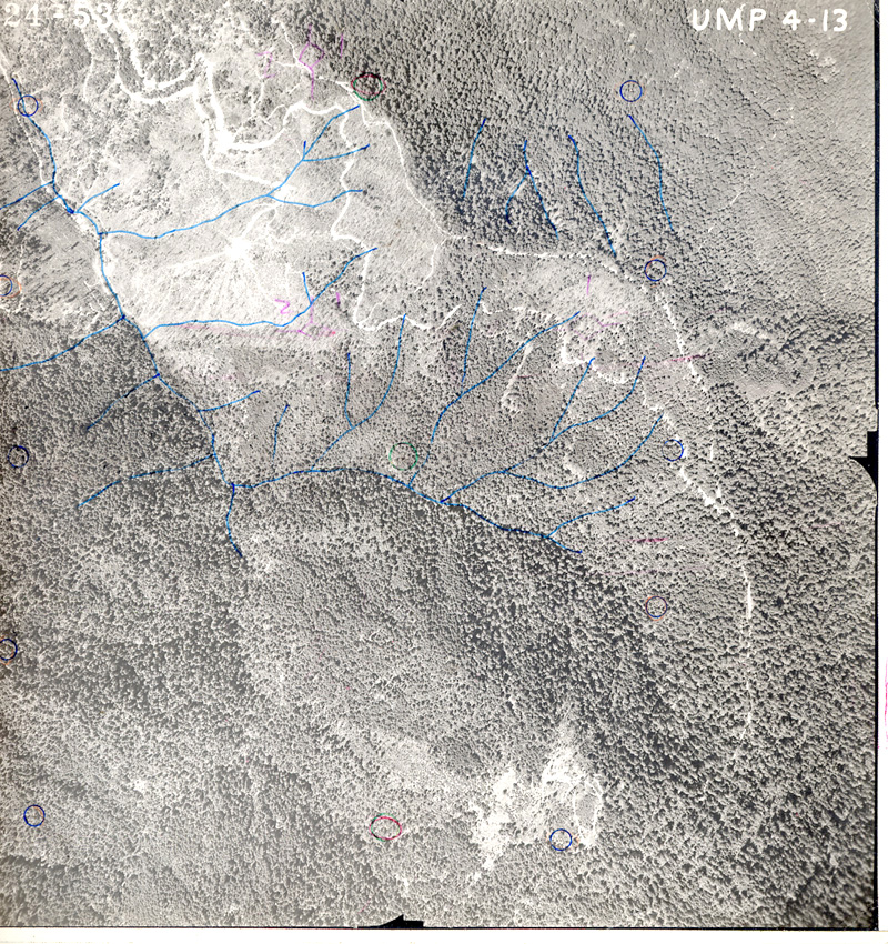
Aerial Photograph | 1953 | Southern 1/3 aerial sequence of Tsp. 31 S., Rng. 6 W., Sec. 1, Cow Creek Valley clearcut logging |
| |
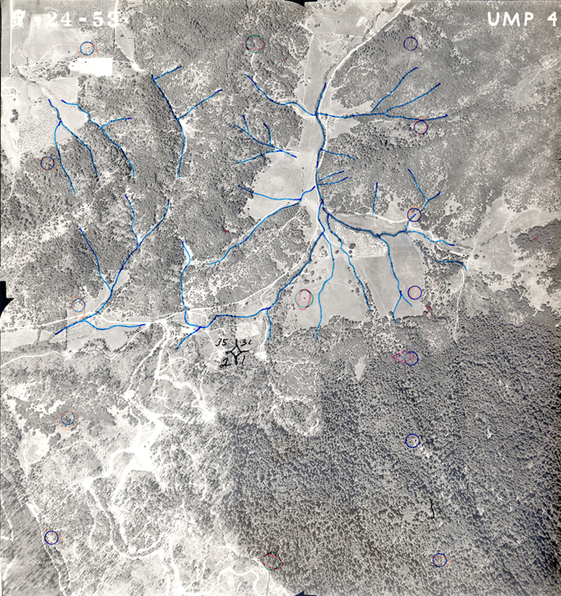
BLM 1953 | Aerial Photograph, annotated | 1953 | Annotated 2/3 aerial sequence of Tsp. 31 S., Rng. 6 W., Sec. 1, Cow Creek Valley clearcut logging |
 |
BLM 1953 | Aerial Photograph | 1953 | Northern 3/3 aerial sequence of Tsp. 31 S., Rng. 6 W., Sec. 1, Cow Creek Valley clearcut logging |
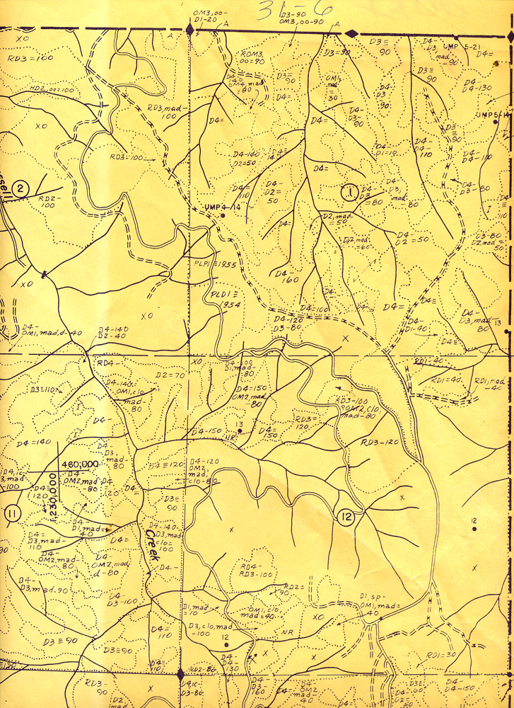 |
BLM 19xx | Vegetation Types | ca. 1955 | Tsp. 31 S., Rng. 6 W., Secs. 1 and 12, Cow Creek Valley clearcut logging and forest types |
 |
BLM 19xx | Vegetation Type, annotated | ca. 1955 | Tsp. 30 S., Rng. 6 W., Secs. 1 and 12, Cow Creek Valley clearcut logging and forest types |
![]()