Historical Accounts, 1826 - 1875
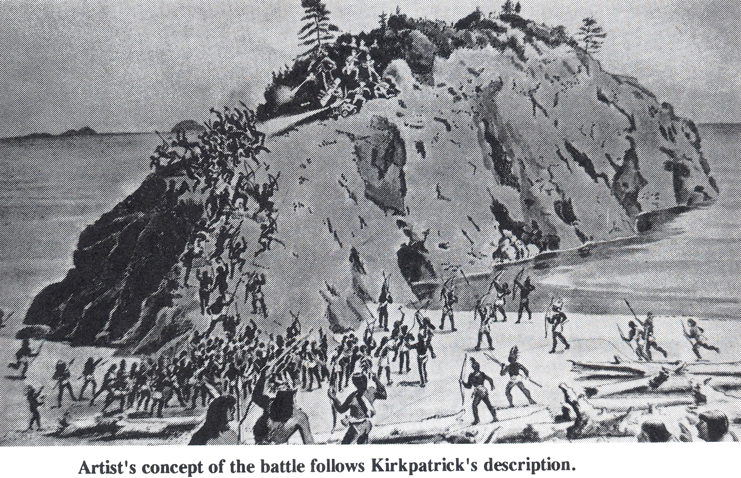
"Artist's concept" of John Kirkpatrick's eyewitness account of the "battle" that gave Battle Rock its name (Webber & Webber 1992: 29).
| Accounts of the June 1851 Battle Rock Massacre varied widely from the time that it took place. A ship passing by on its way to San Francisco claimed that all of the men left on Battle Rock by the previous ship landing had been killed by Indians: which version was immediately reported by the press. The fact soon became known that only Indians had been killed -- by a cannon and by rifles. Military reports also varied significantly in reporting the story, even after a few year's time (Zybach 2012: 63-68). |
The first journalists to travel through the Coquelle Trails study area were Alexander Roderick McLeod, arriving from the north in October 1826, and Harrison Rogers and Jedediah Smith, arriving from the south in June 1828. Both parties had entered an area in which there were no maps, written records, eyewitness accounts, or other information they could use to guide their way. None of the men in these parties could speak the local languages or had access to an interpreter, so there were no named landmarks that could be referenced or any other method to obtain specific travel information. Further, Smith was traveling with more than 20 men and 300 horses and mules through country that had never been traveled by horseback before.
Both parties entered the area for entirely different reasons -- other than the common interest in acquiring beaver skins -- but both kept daily records that commented on campsite locations, trail conditions, encounters with local Indians, weather, food, and wildlife.
People have used these records in the past to try and locate the trails used by these journalists – most notably Maloney (1940) regarding the specific campsite locations of the Smith Expedition, and Johansen (Davies 1961), Tveskov (2000), and Zybach and Wasson (2009) regarding the travel routes of McLeod – but this has been the first attempt to pinpoint those locations with the aide of modern technology, or for the specific purpose of better understanding the culture and ecology of the land and people connected by these routes and locations over time.
Following the construction of the trail maps, the authors spent several days and hours at the Coquille Tribal Administration offices in North Bend, attempting to match the written records of McLeod, Rogers, and Smith with the GIS-generated networks, annotated USGS field maps, and GLO maps and notes associated with this project; to see if historical patterns of human movements and encounters could be accurately located. Each day’s record from the McLeod and Smith trips in 1826 through 1828 – and many additional records from the early 1850s – was carefully considered and discussed to achieve a general agreement regarding the likeliest locations and routes noted in those records. These agreements became the rationale for the Excel files and GIS layers from which the project field map series was made.
In general, a strong correlation could be made between what the men were describing and where they were at the time the description was being made. Sometimes exact locations could be pinpointed (such as mouths of streams or obvious landmarks), but other times descriptions were hazy, misleading, or difficult to interpret. Estimations of mileage varied by journalist and over time; McLeod’s estimates seemingly became much more accurate the longer he stayed in the study area, and Smith and Rogers often disagreed as to how far they had traveled during the day since they first left the Sacramento Valley and began traveling north.
What follows are brief descriptions of several events that occurred in the earliest days of European-American exploration and settlement in Oregon’s south coast region, in addition to the travels of McLeod and Smith: events that set the stage for the future economic and commercial development of the region’s natural resources by and for the interests of the United States government and its citizens. How and where those early explorations and developments occurred was largely dictated by the transportation networks that already existed: the overland trails and canoe routes of the Indians of the Coos and Coquille River country, and their Athapaskan-speaking neighbors to the south and to the east.
| 1. Alexander Roderick McLeod Expeditions: October 24, 1826 - February 4, 1827 |
PDF_XX_KB |
|
| 2. Jedediah Smith Expedition: June 30 - July 10, 1828 |
PDF_XX_KB |
|
| 3. T’Vault, Casey, Kautz & Evans Expeditions Eastward: June 1851 – July 1856 |
PDF_XX_KB |
|
| 4. The Randolph Trail & Seven Devils: May 1853 - August 1856 |
PDF_XX_KB |
|
| 5. The Coose Bay Commercial Company: May 1853 - 1875 |
PDF_XX_KB |
|
| 6. The Coos Bay Military Wagon Road: 1869 - 1875 |
PDF_XX_KB |
![]()