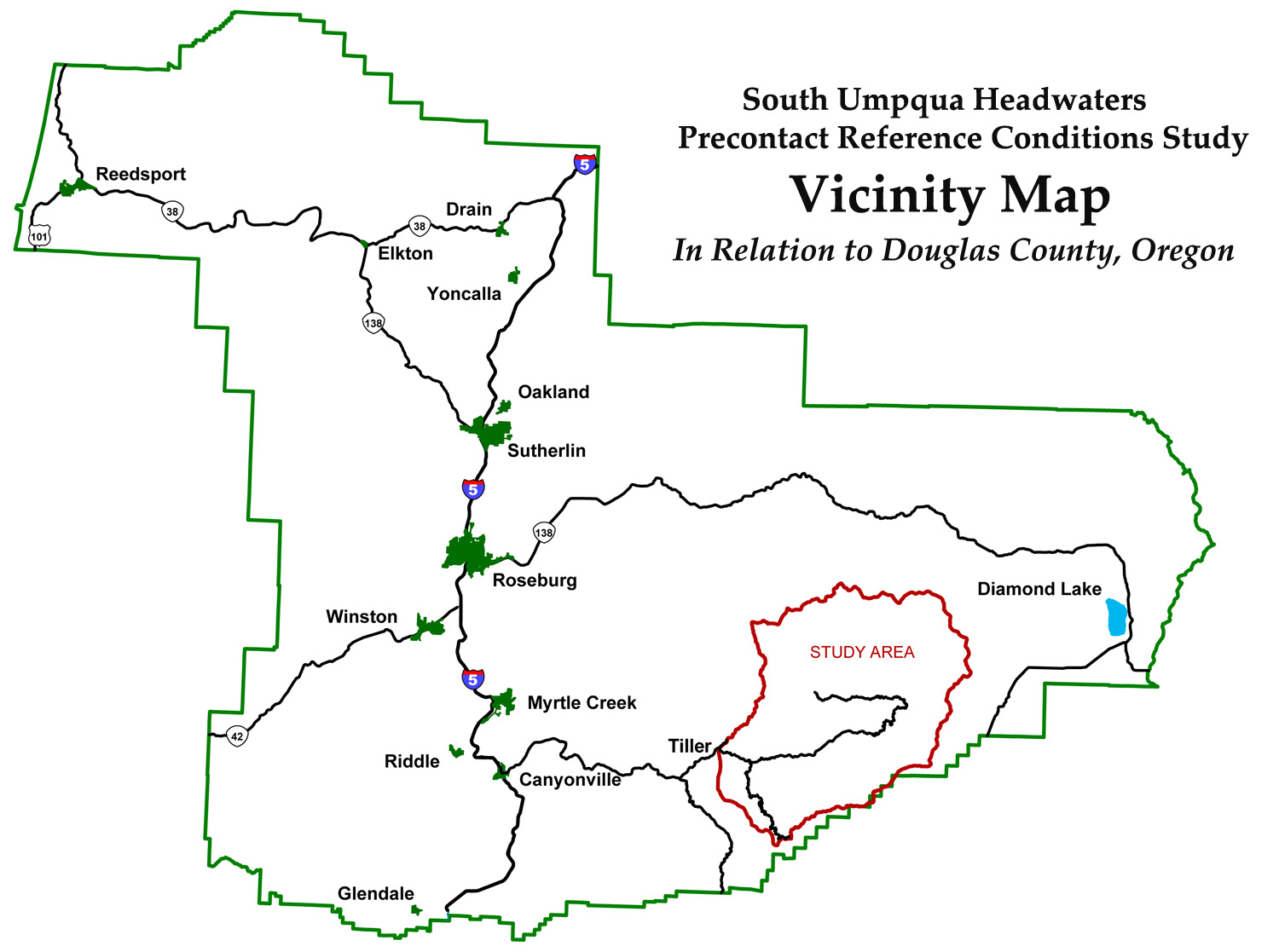
South Umpqua Headwaters Precontact Reference Conditions Study
Project Maps Index
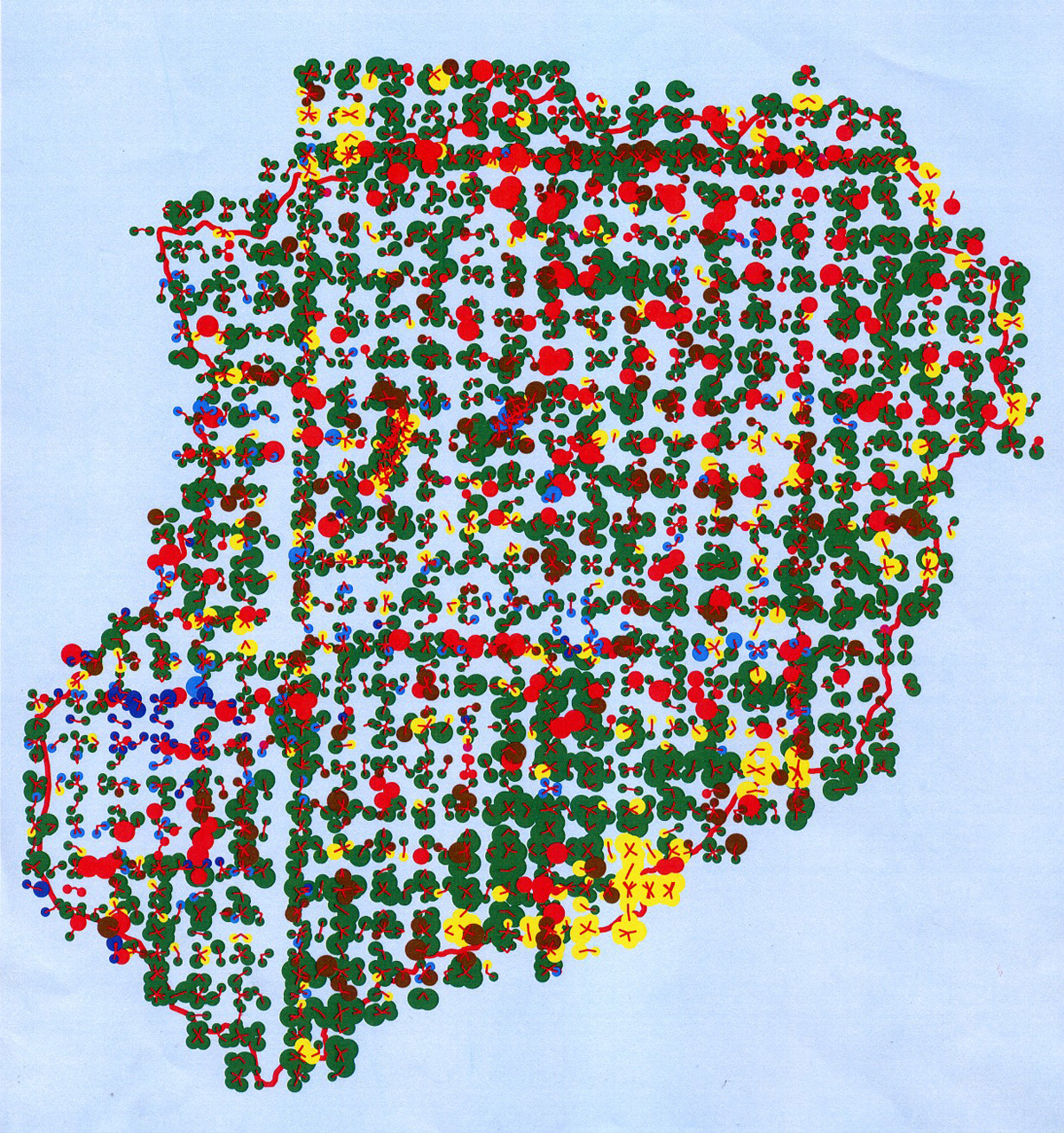
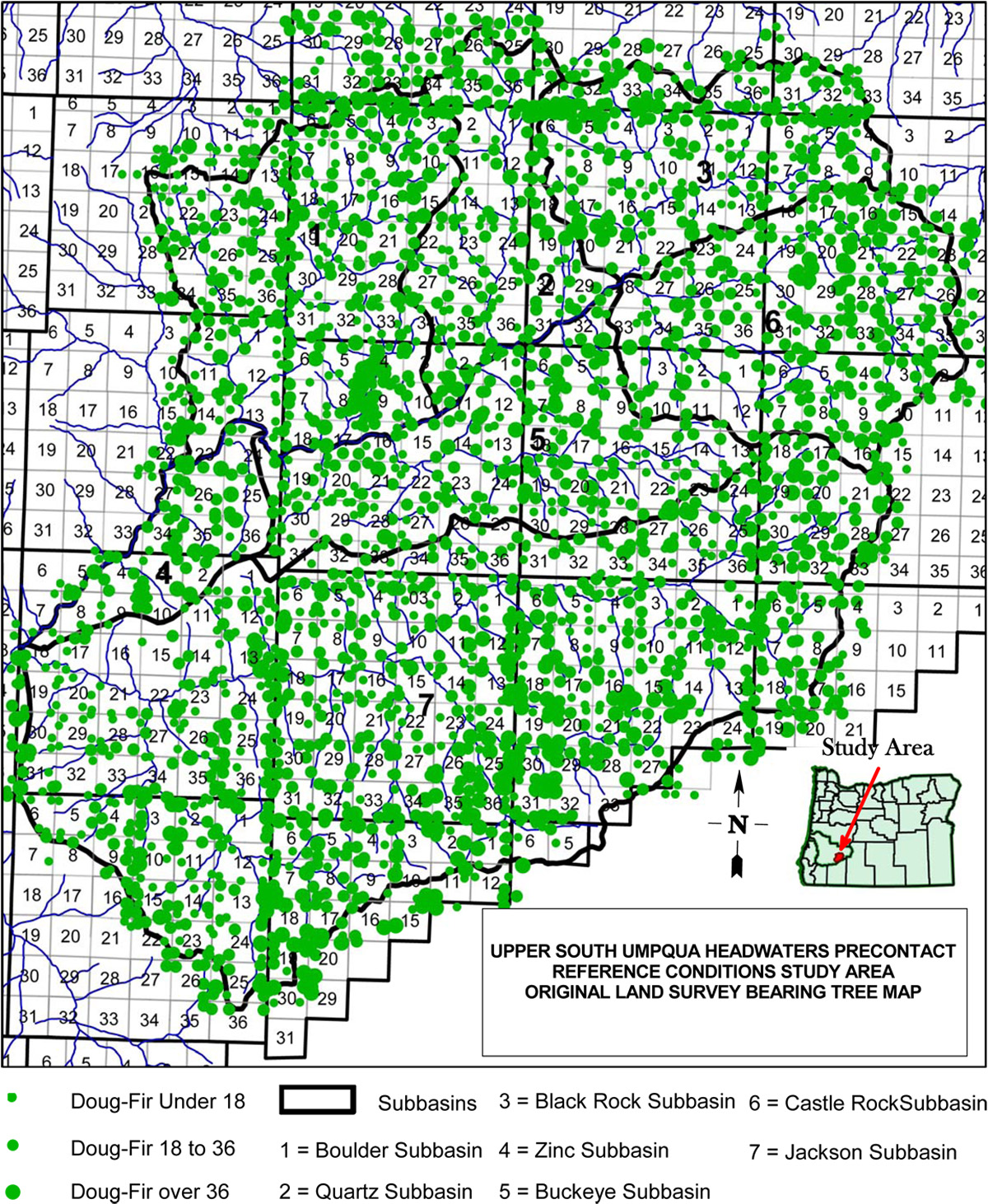
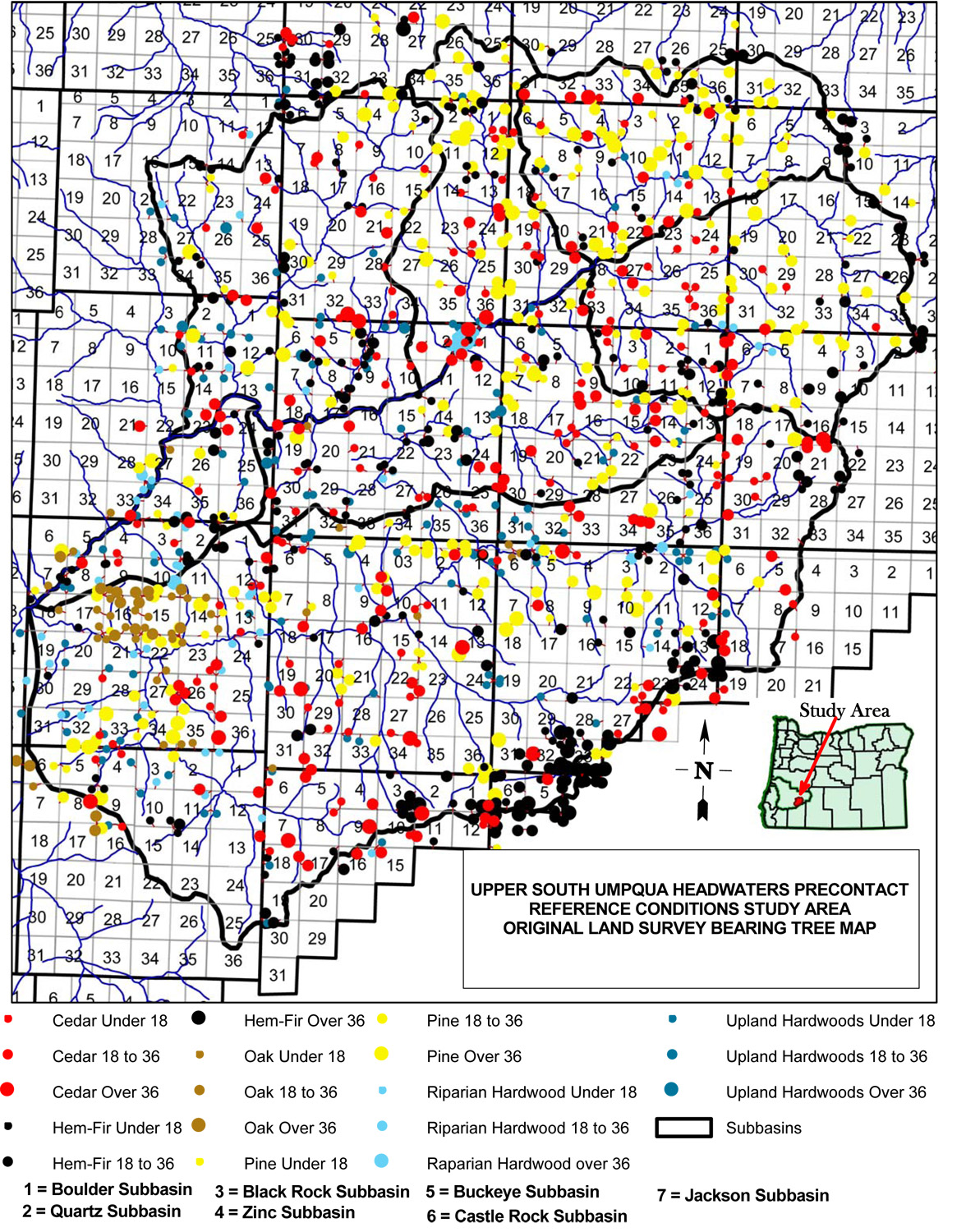
First GIS map draft of 3900+ GLO "bearing trees" in the study area (courtesy "GIS Team," Douglas County Surveyor's Office).
The majority of maps for this project were produced by the "GIS Team" at the Douglas County Surveyor's Office in Roseburg, Oregon during the 2010 calendar year. The GIS Team did a wonderful job of catching errors and repairing field miscues during the course of this project and deserve full credit for the high quality maps and tables they have produced from archival and field research data. Special thanks are given to Terrie Franssen, Jean Crawford, and Kathy Thompson for the great work quality and attention to detail represented by this work. Remaining errors and ommissions, of course, belong with the report's author and project's principal investigator.
Historical Maps are digitized representations of archival maps of the study area produced between 1900 and 1970, and obtained via archival research methods.
Study Area Maps are GIS-generated maps of the entire study area, including current research findings.
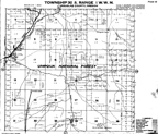
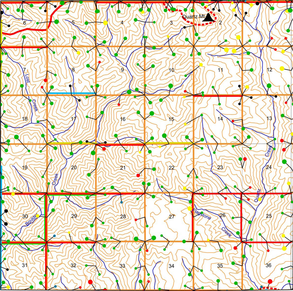
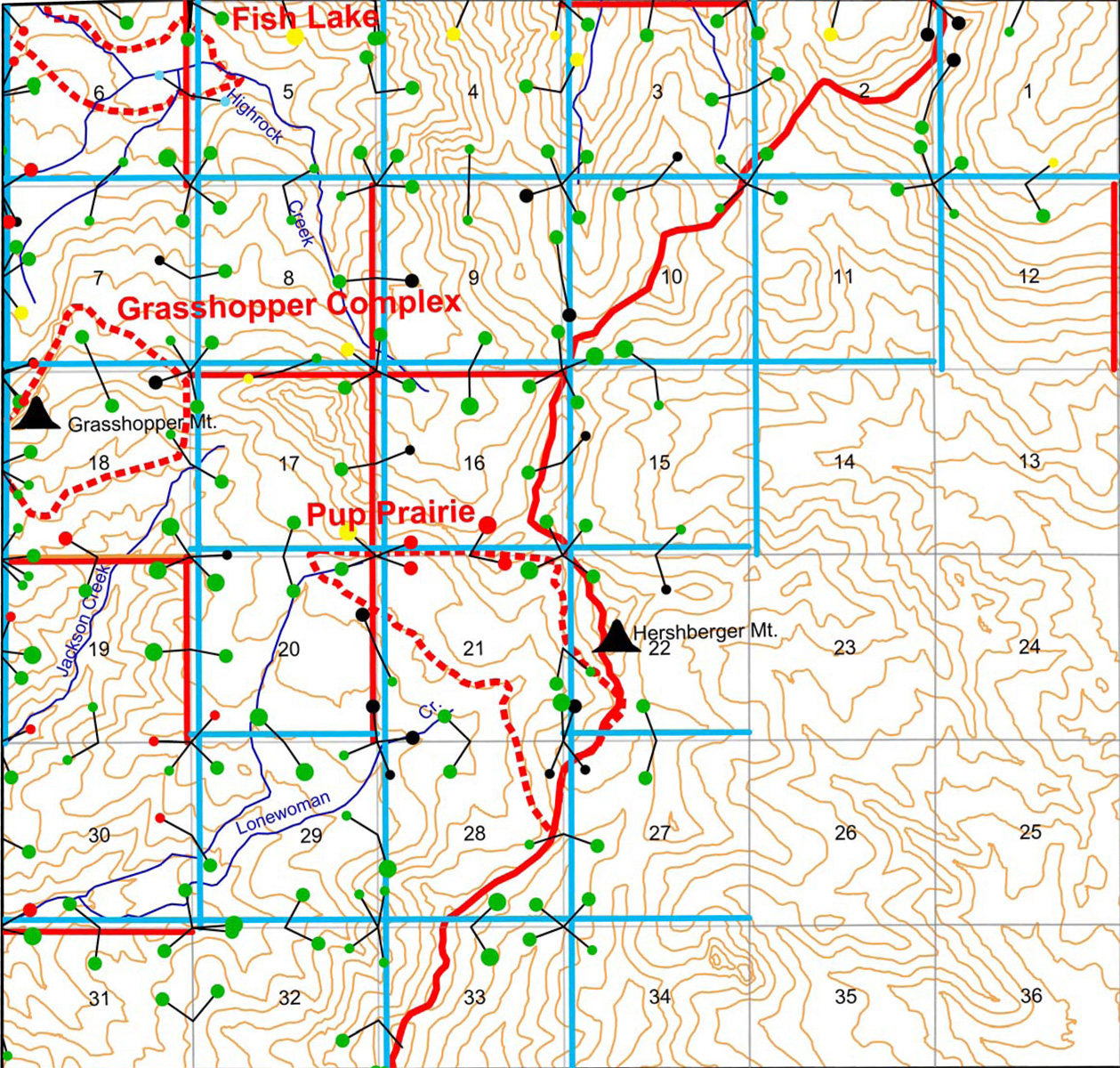
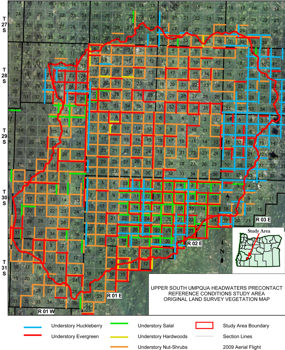
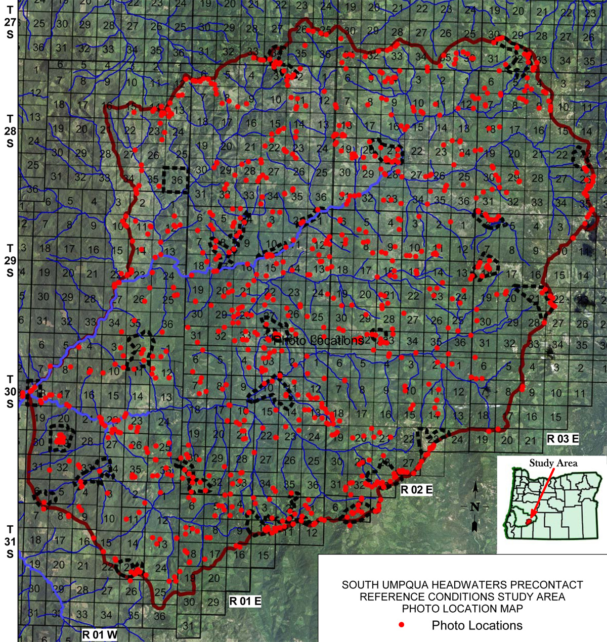
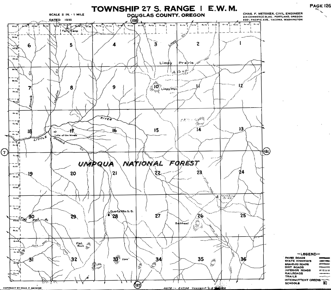
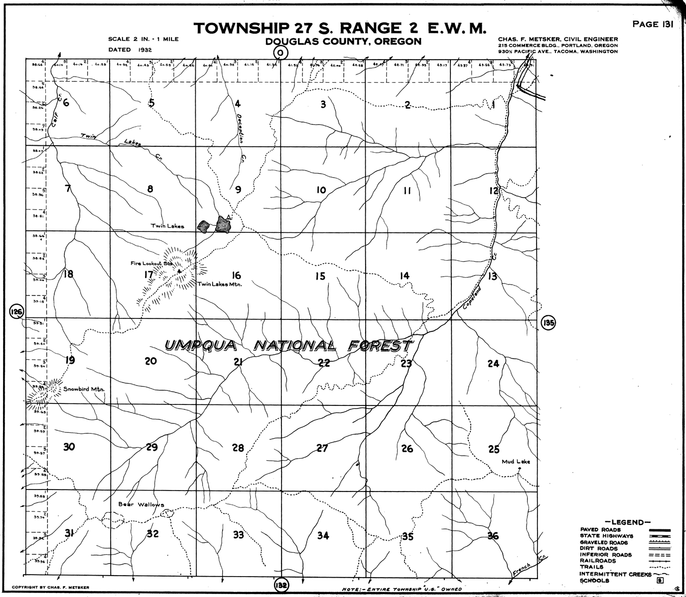
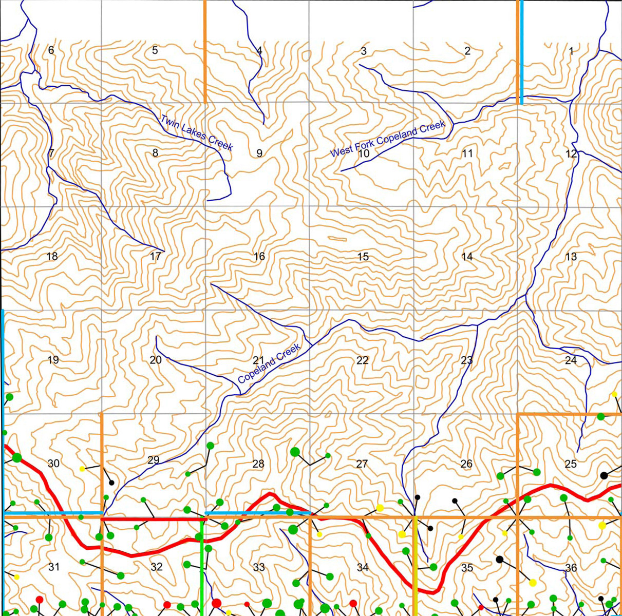
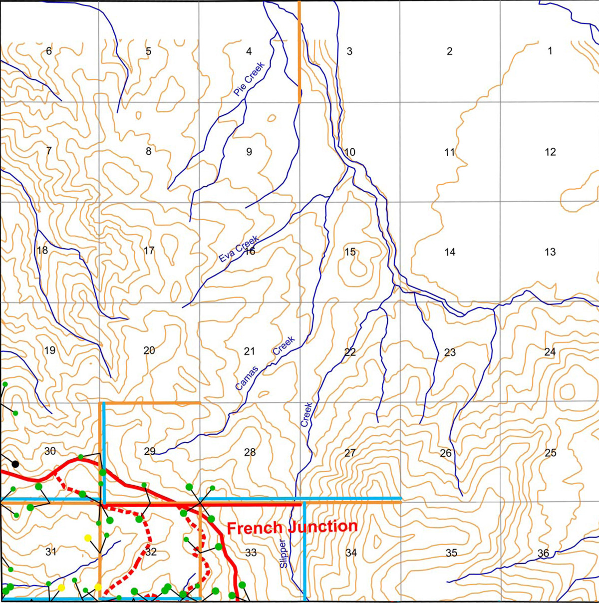
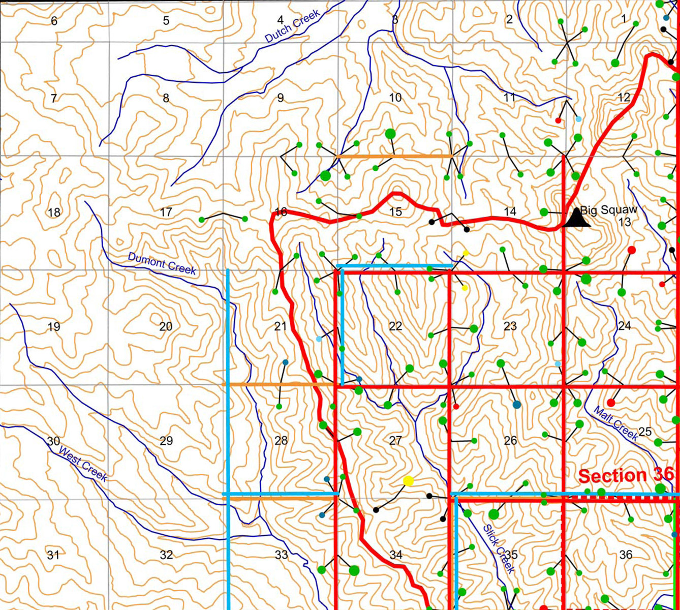
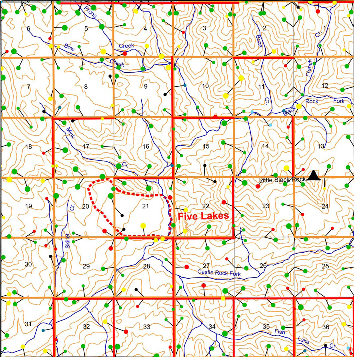
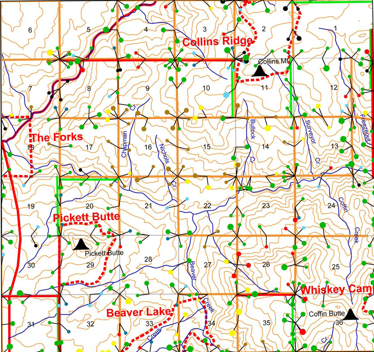
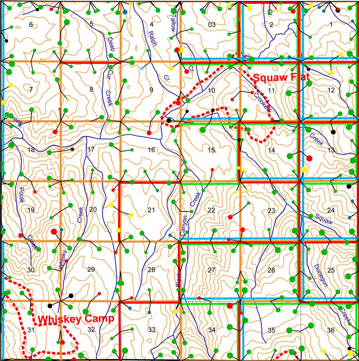
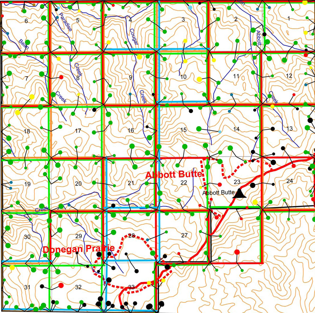
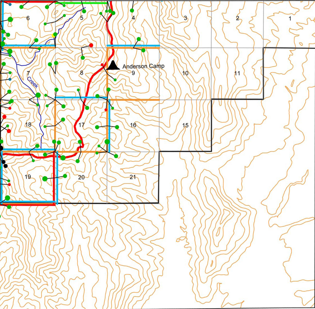
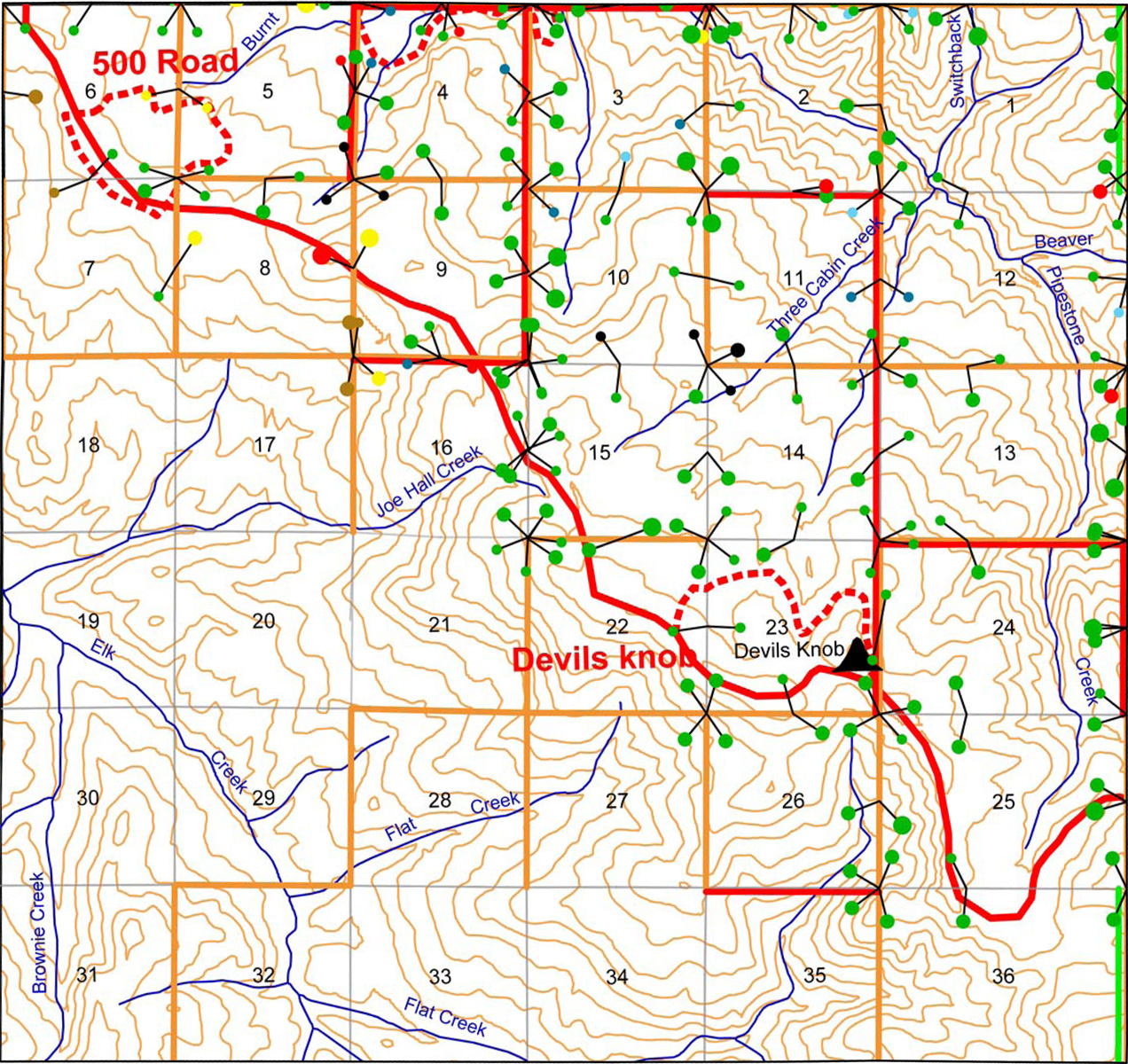
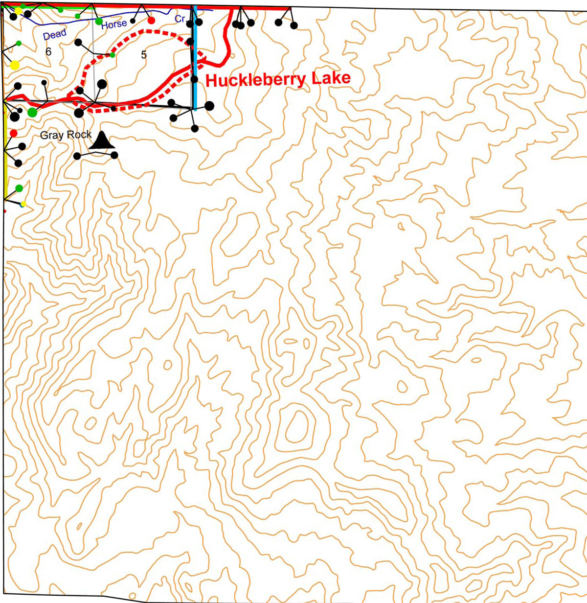
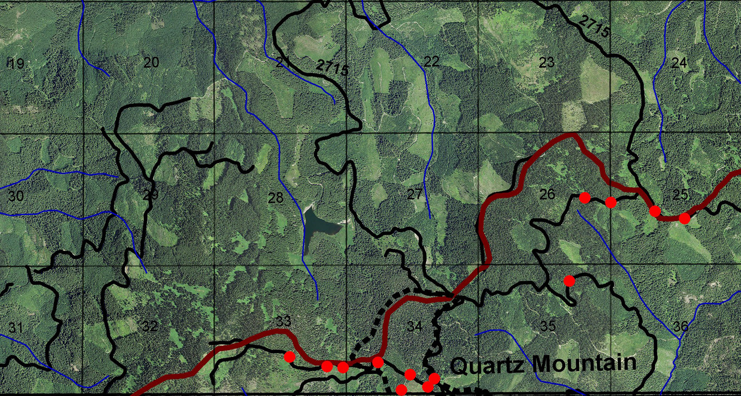
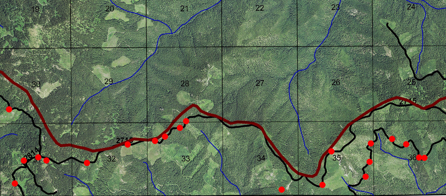
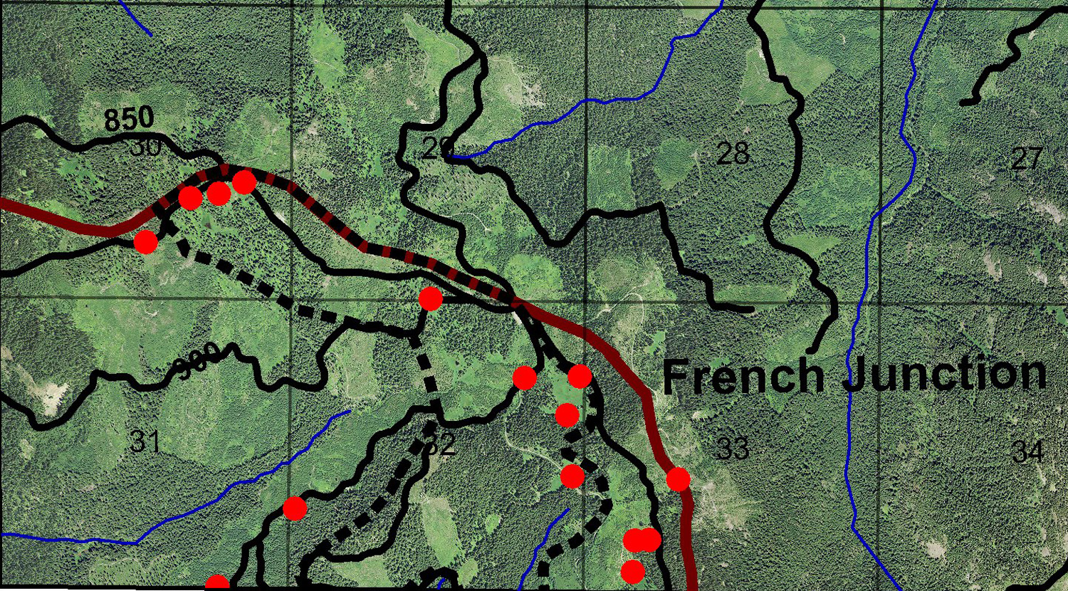
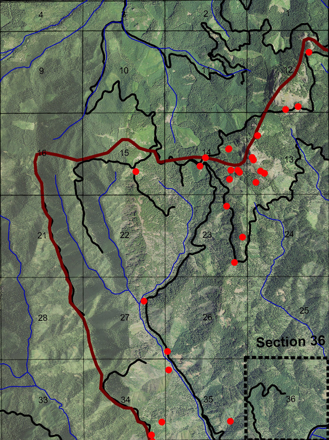
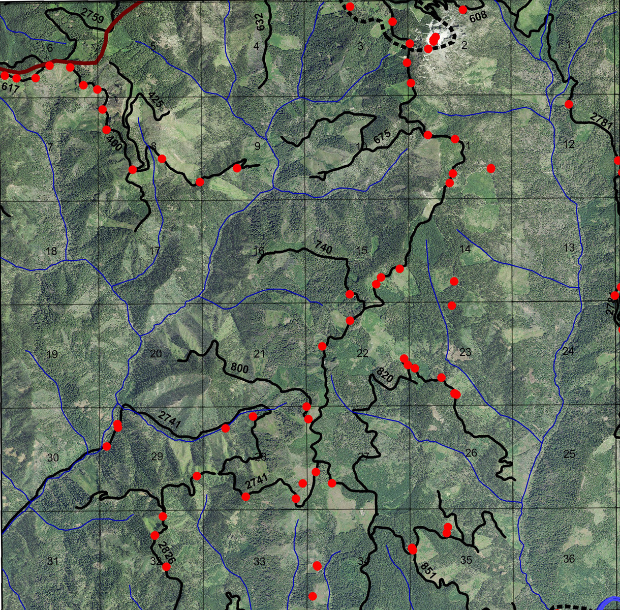
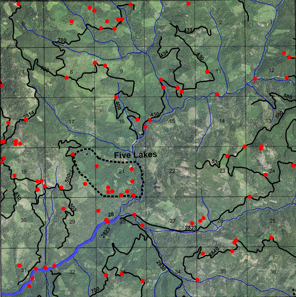
Township Maps are six-mile square portions of the study area, based on the original GLO (USDI General Land Office) "Public Land" surveys of 1858 to 1938. These maps are shown as the original GLO Maps; as cadastral Metsker Maps produced in 1932; as GIS-generated Bearing Tree Maps based on the original GLO surveys (listed individually by species, diameter, and color-code in a comprehensive tabular Excel file); as Photograph Index Maps showing locations of project field documentary photos taken during 2010; and as project research-based ca. 1800 Vegetation Maps. Index maps of the original GLO surveys, with links to typewritten copies of the original field notes and measurements can be found here: http://www.ORRW.org/Rivers/Umpqua/South/Land_Surveys/Index.html
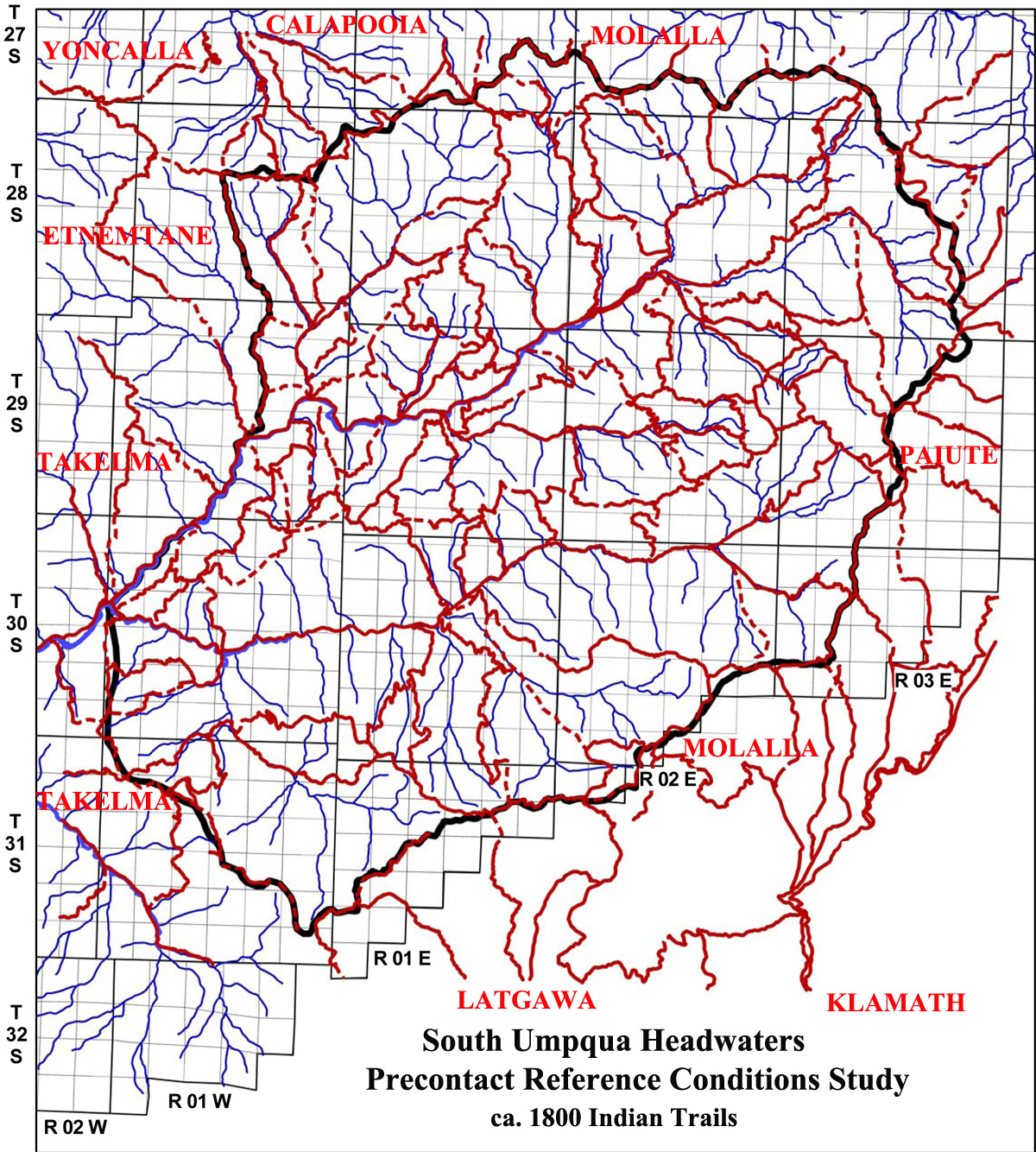
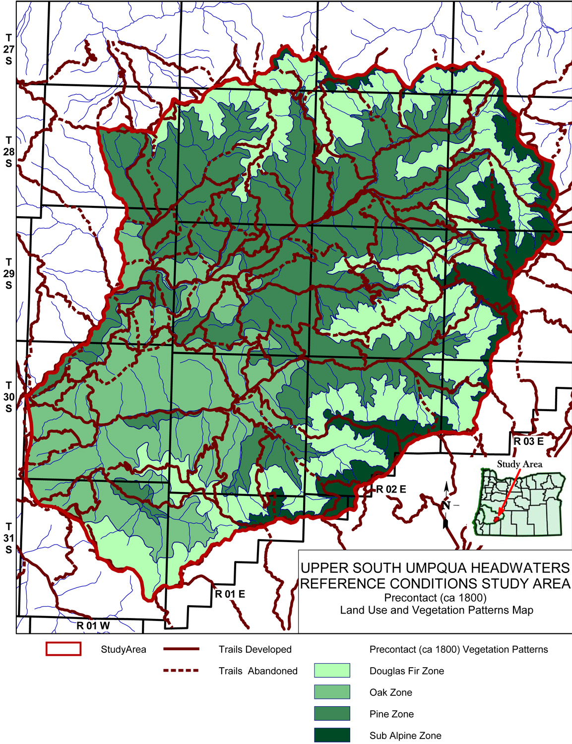
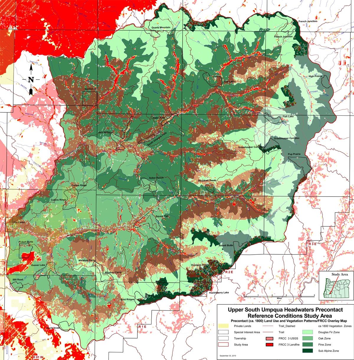
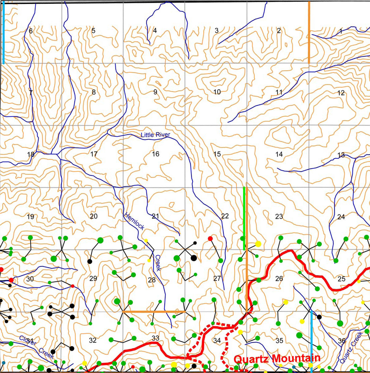
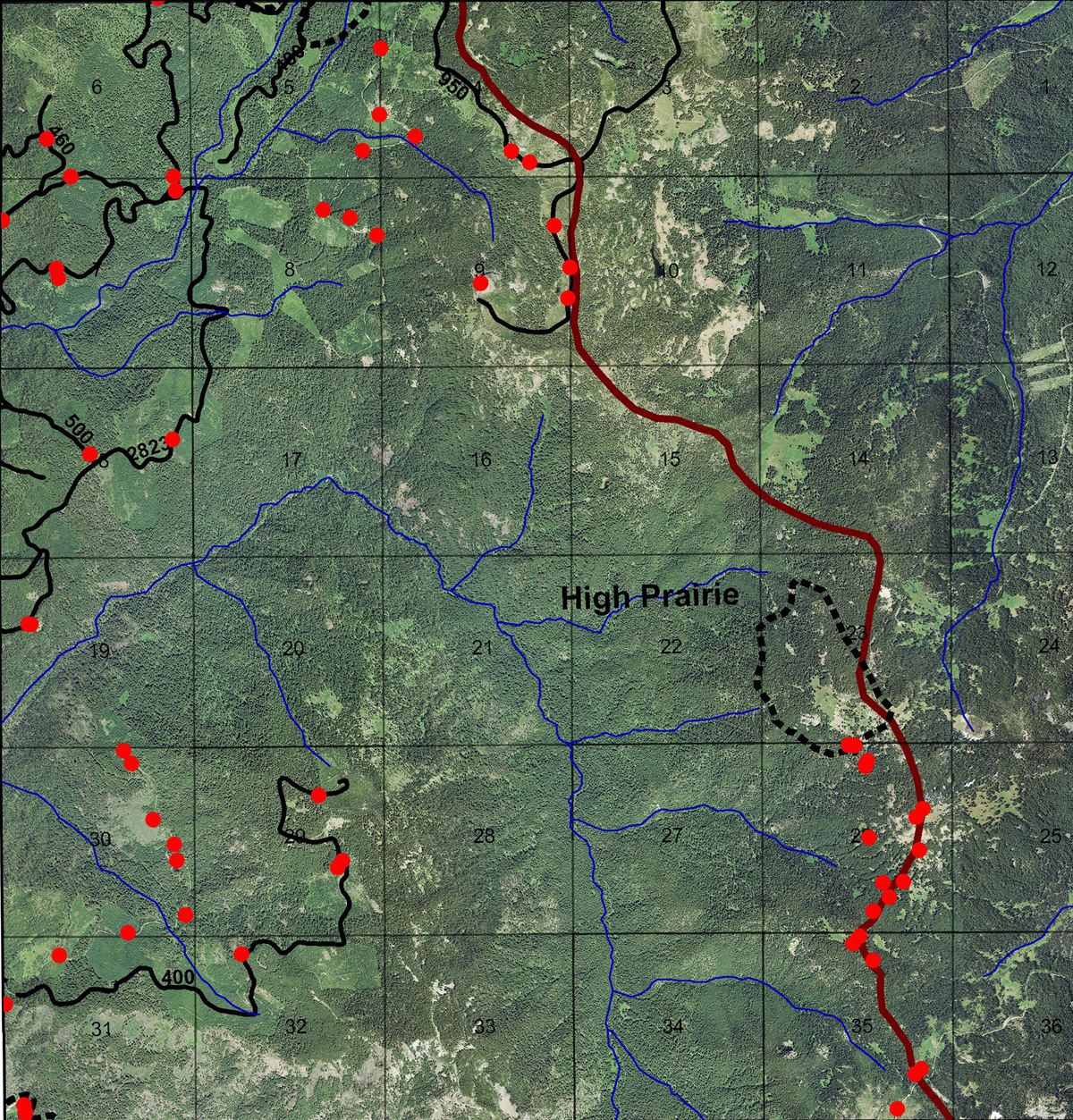
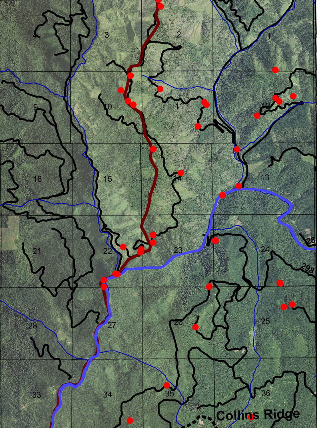
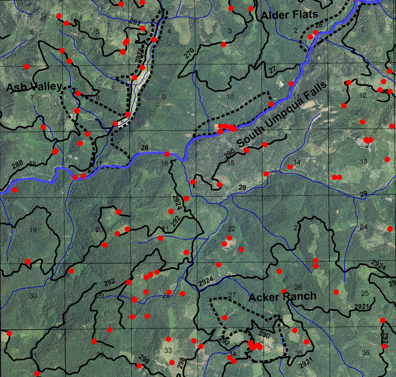
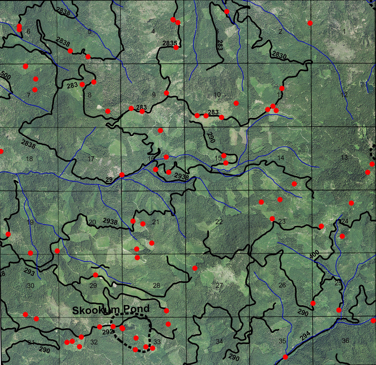
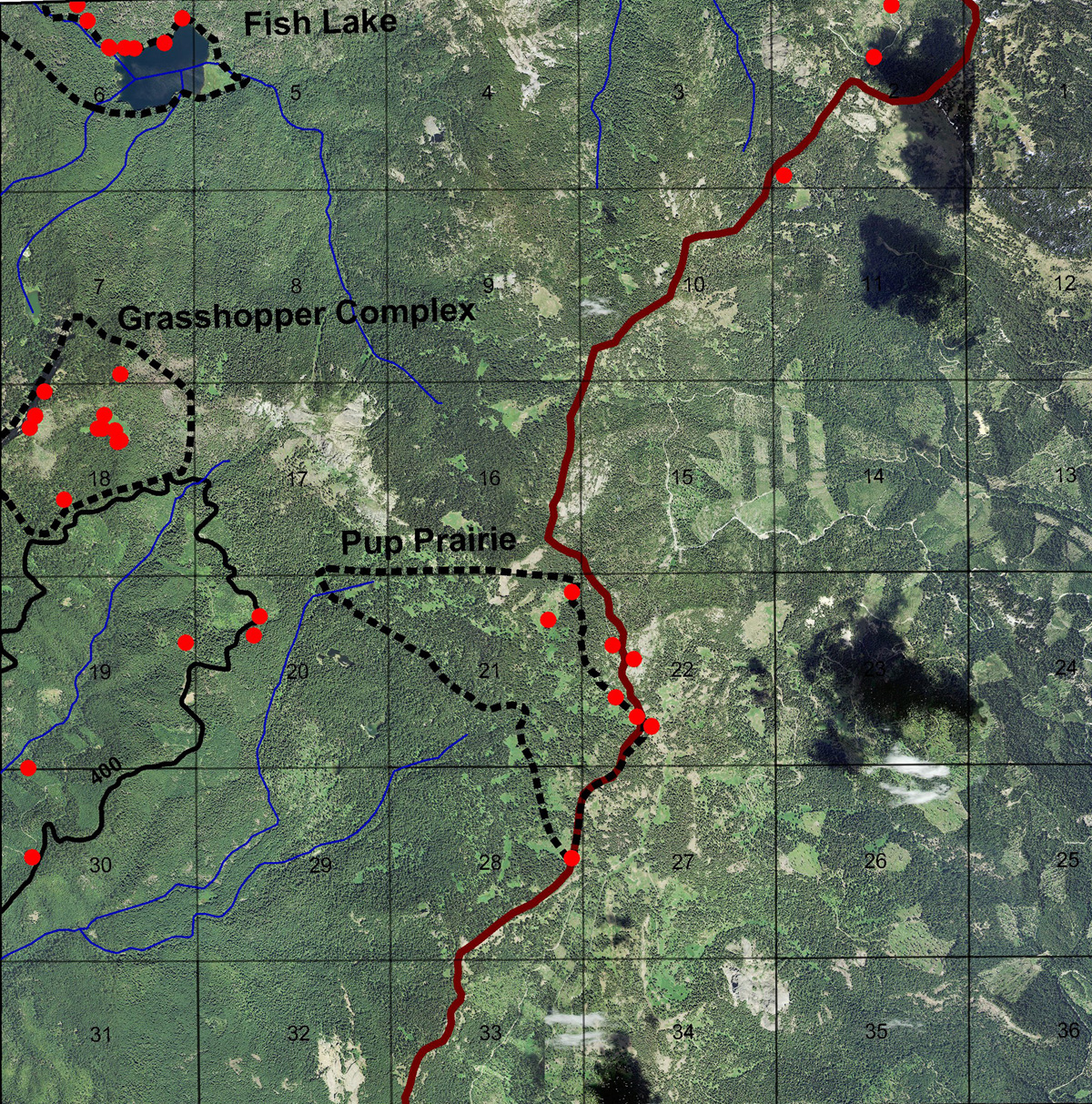
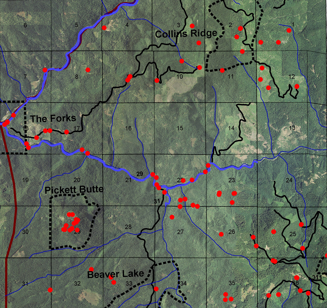
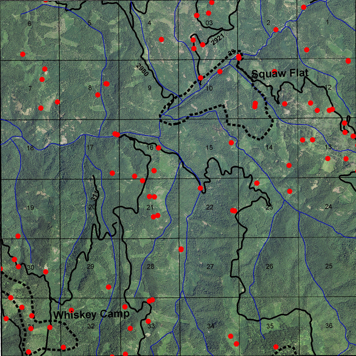
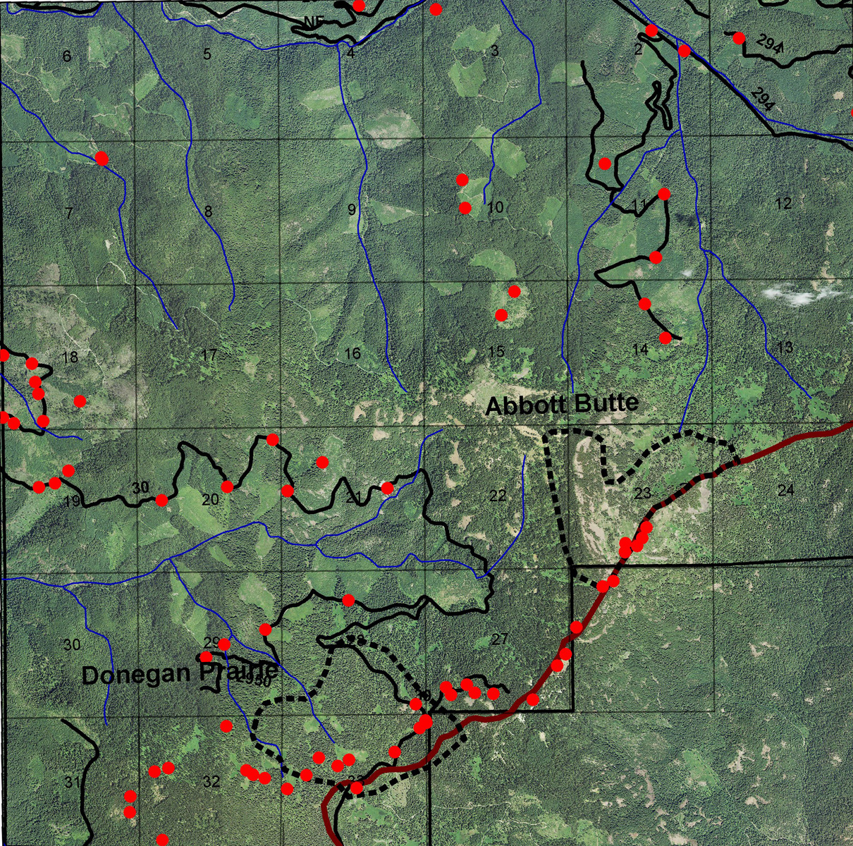
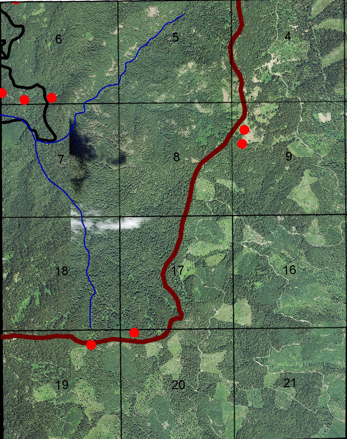
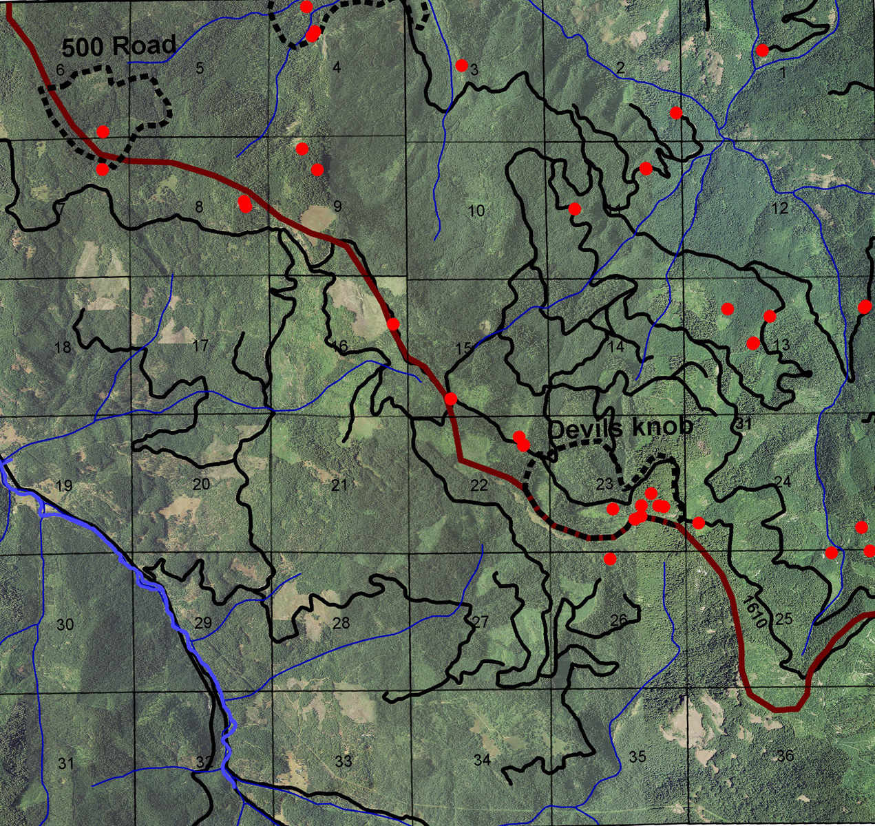
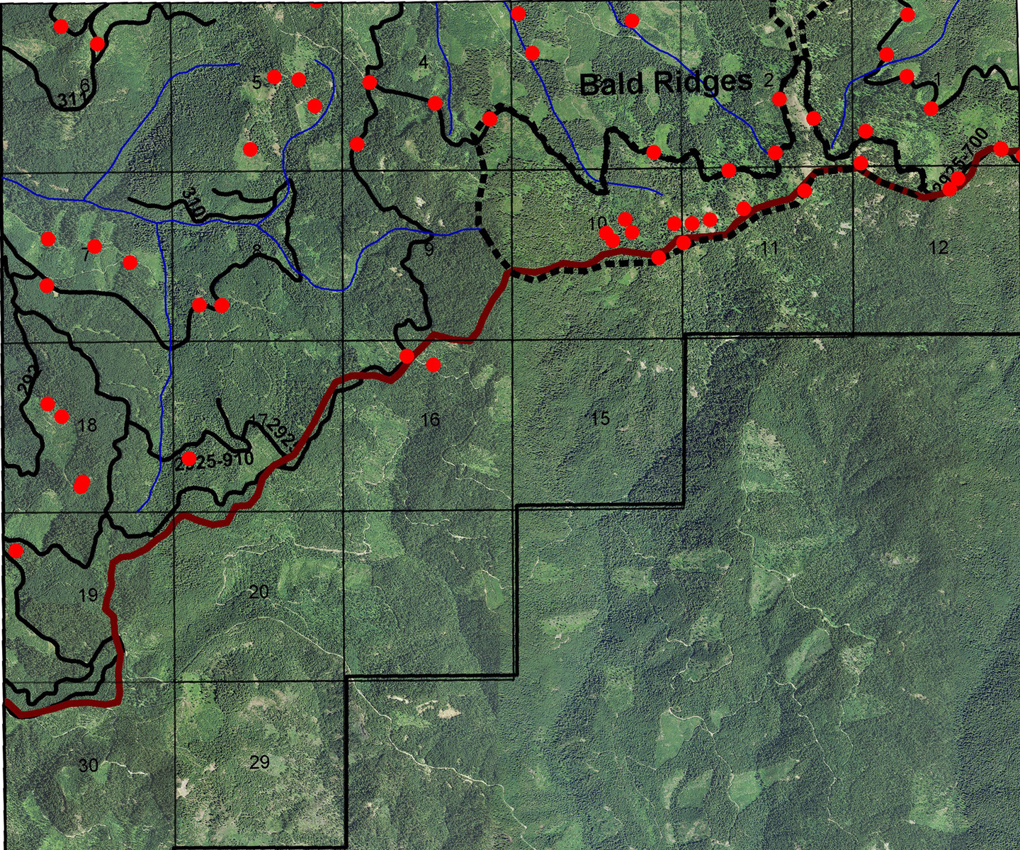
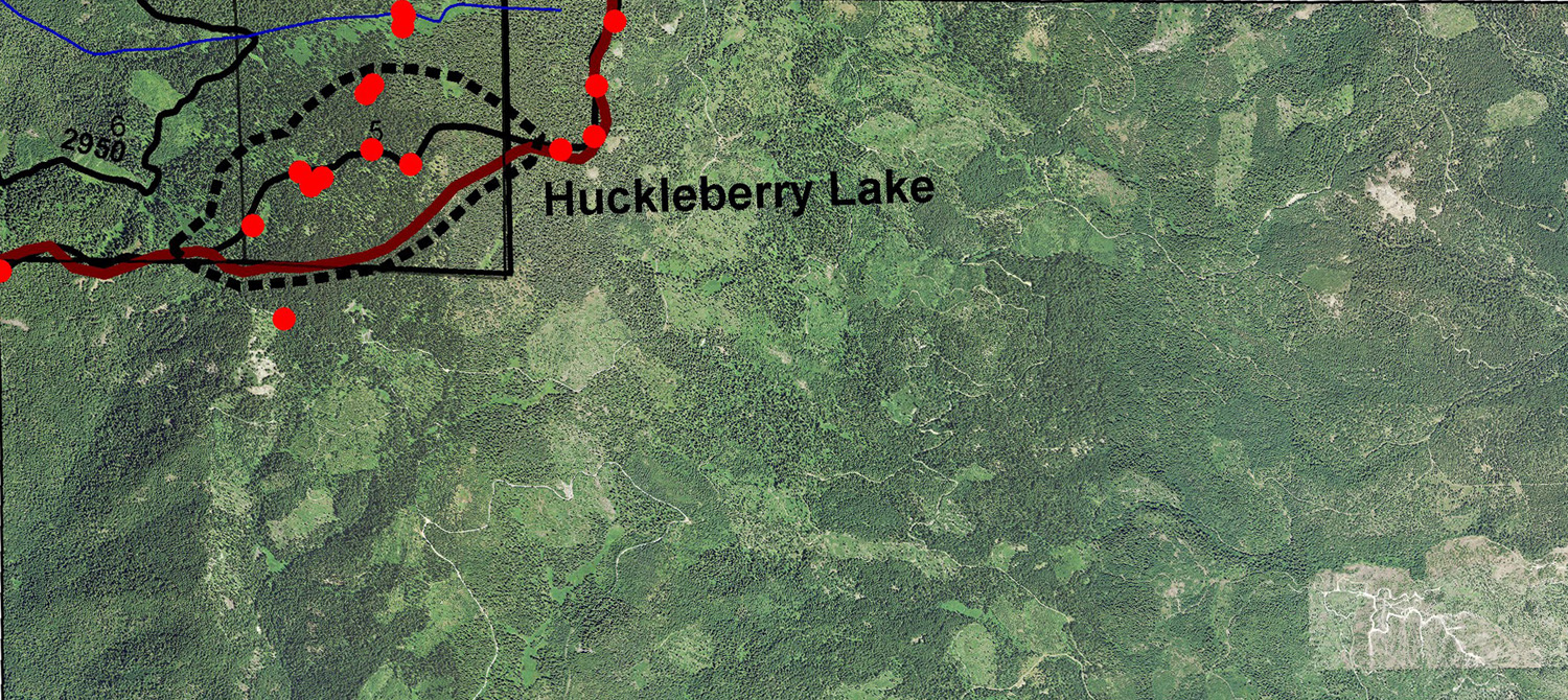
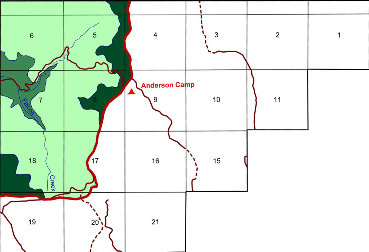
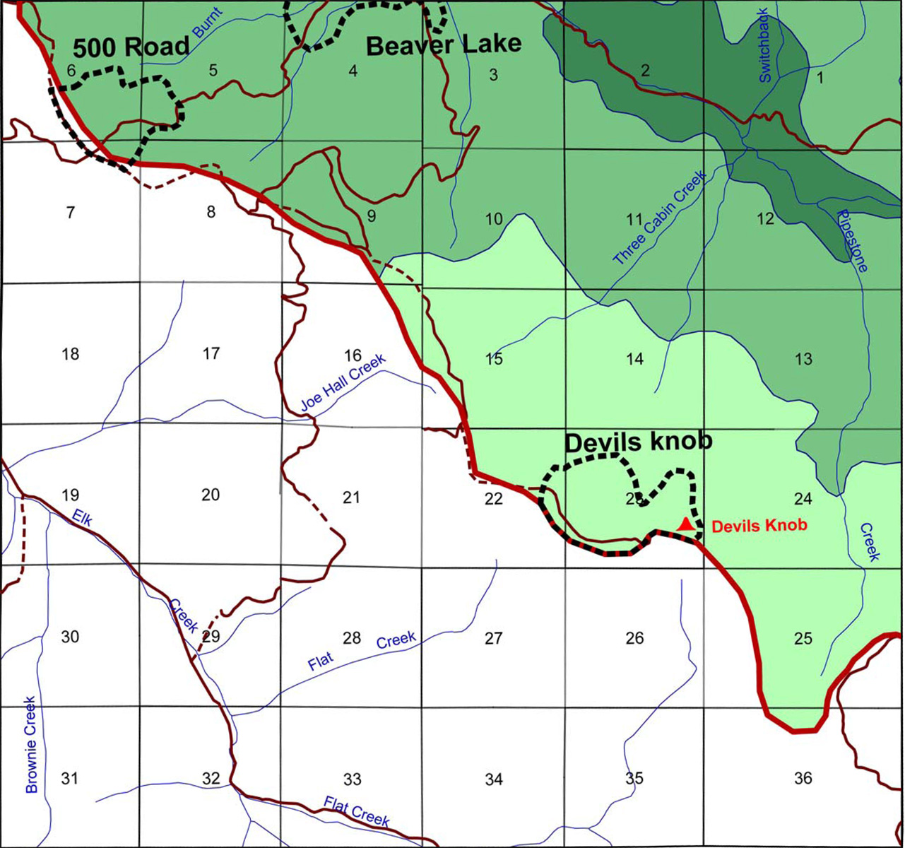
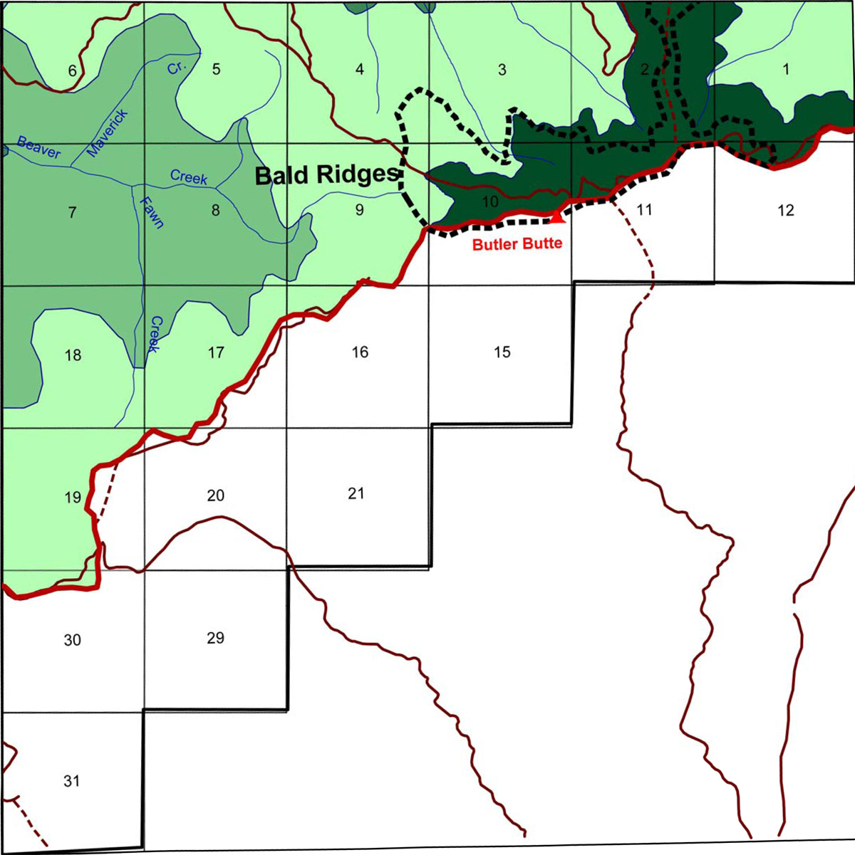
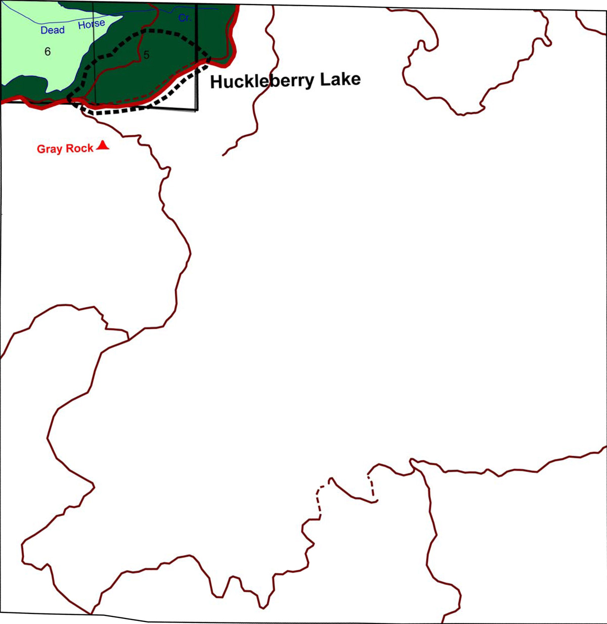
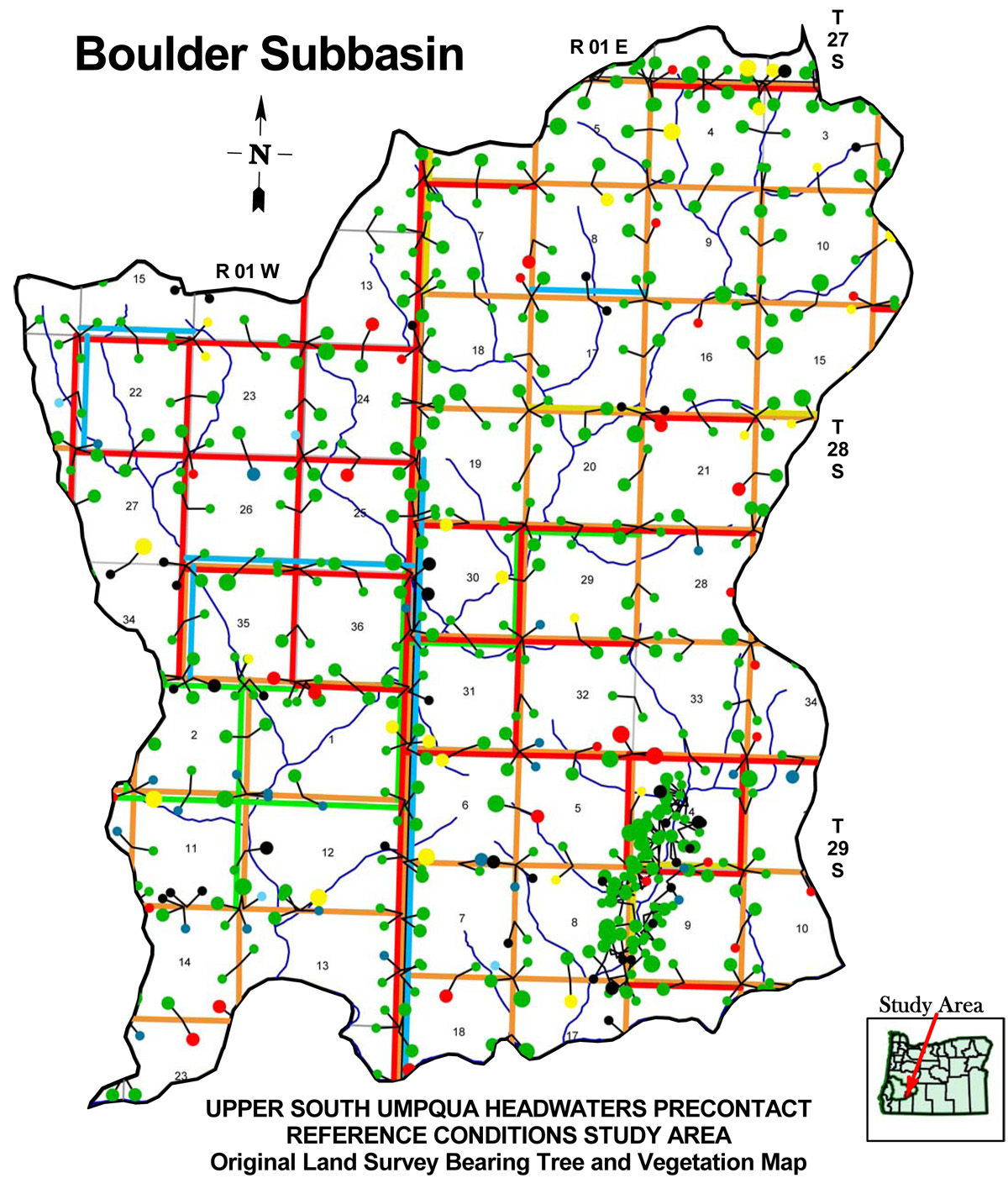
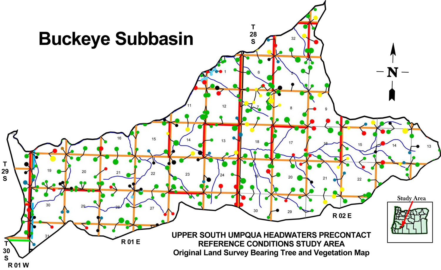
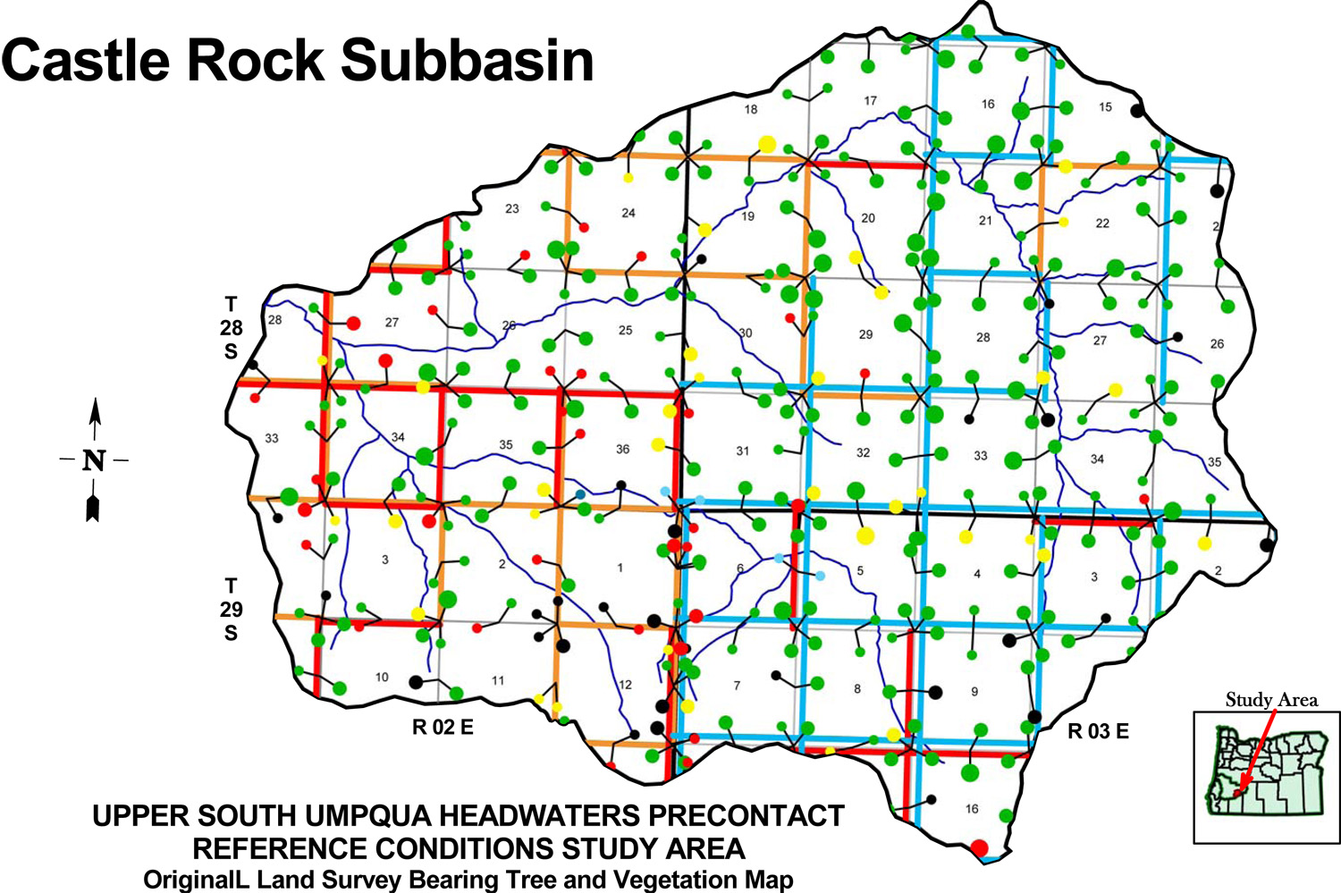
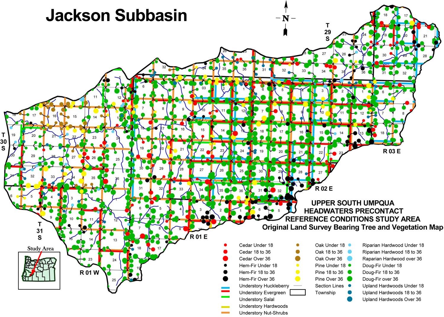
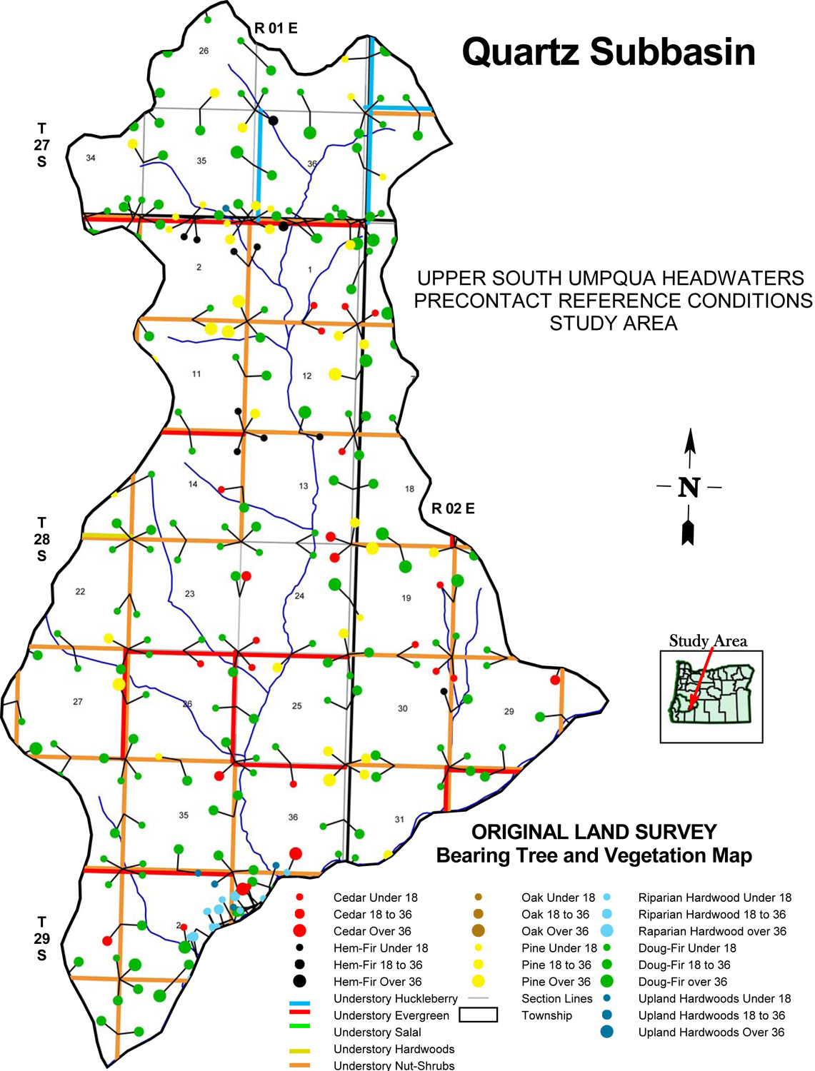
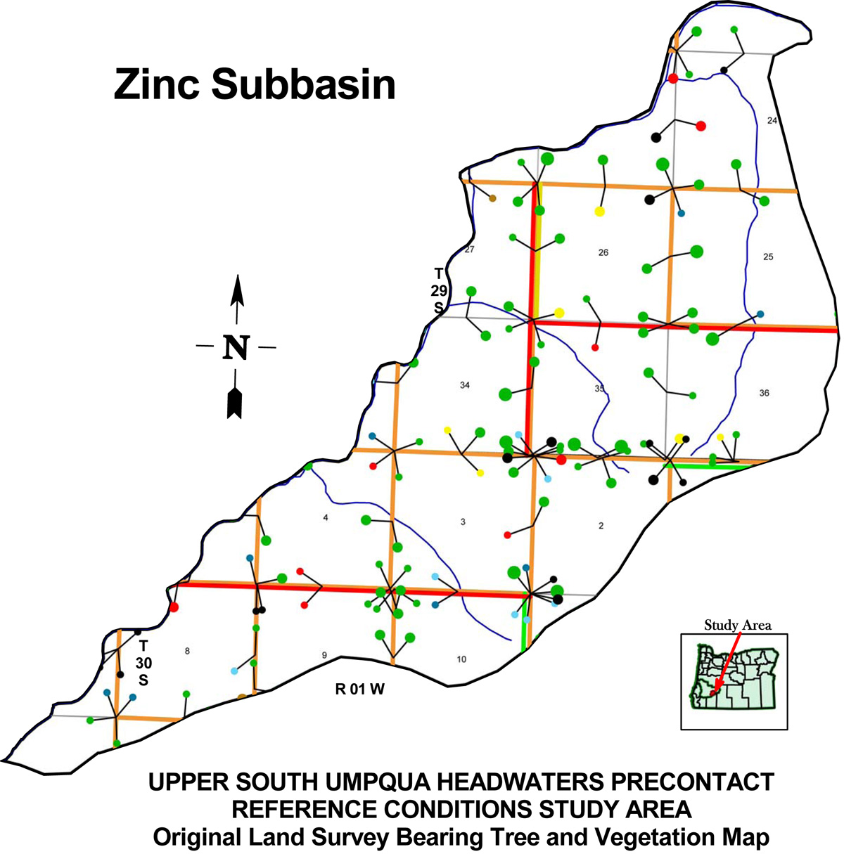
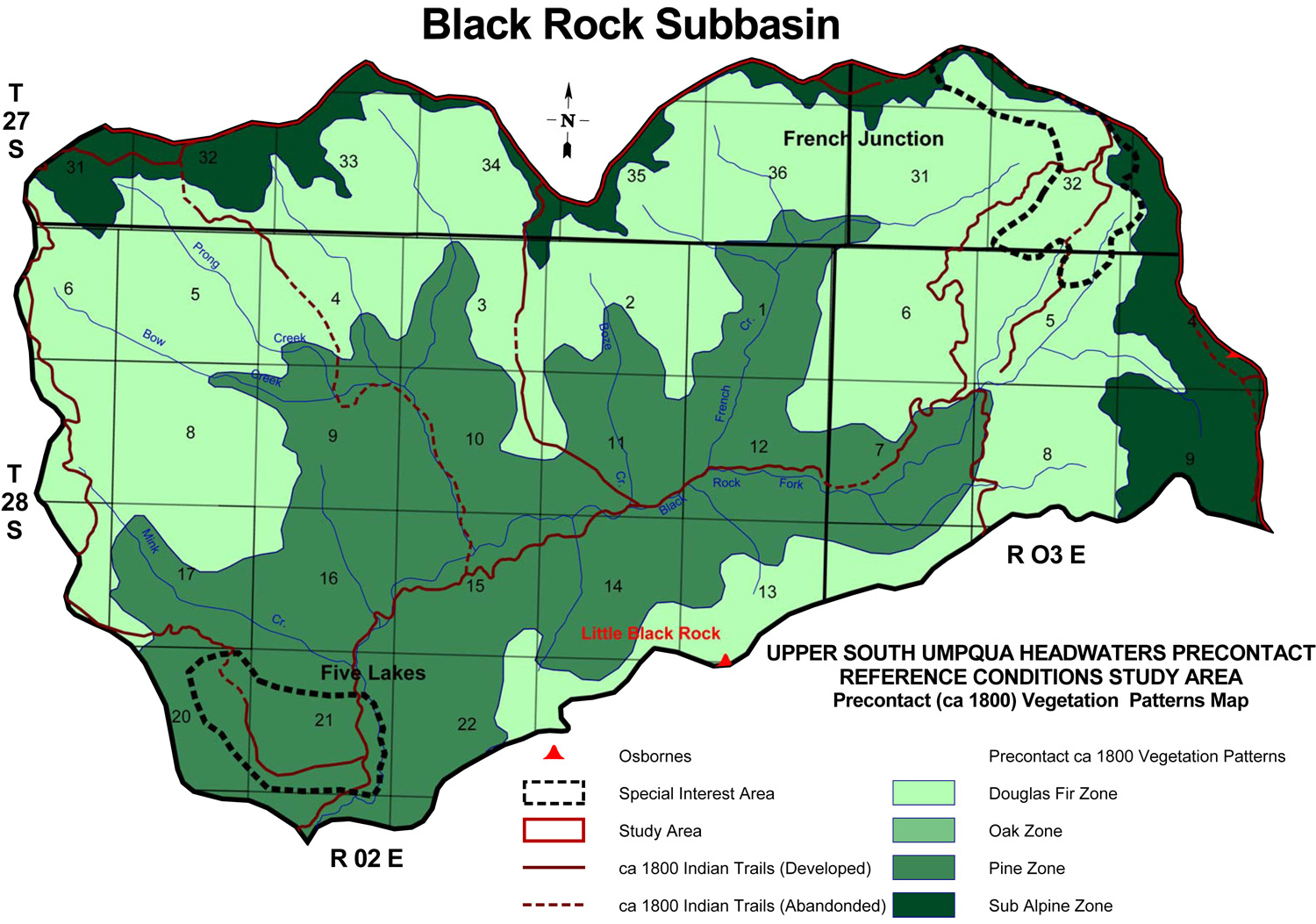
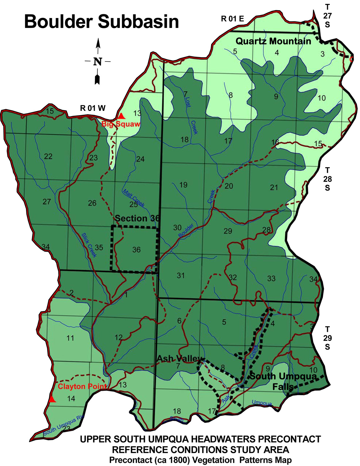
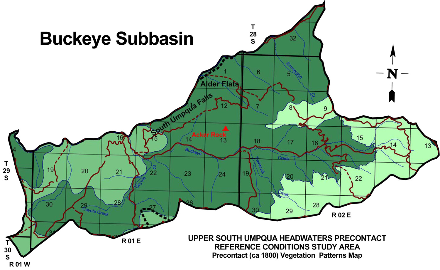
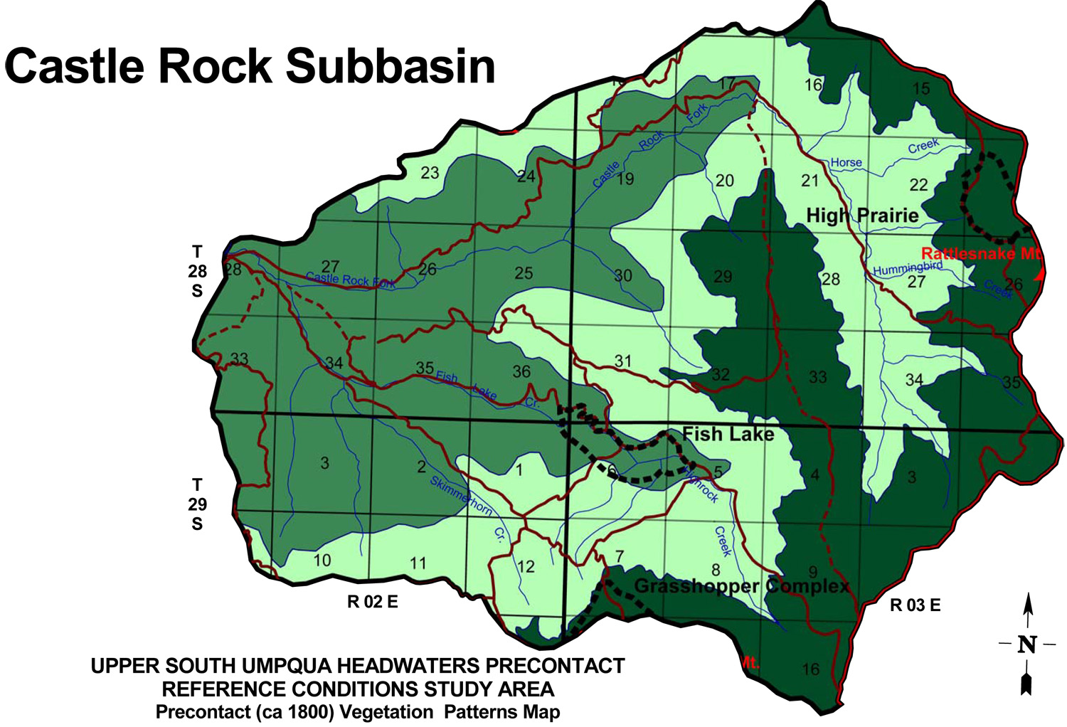
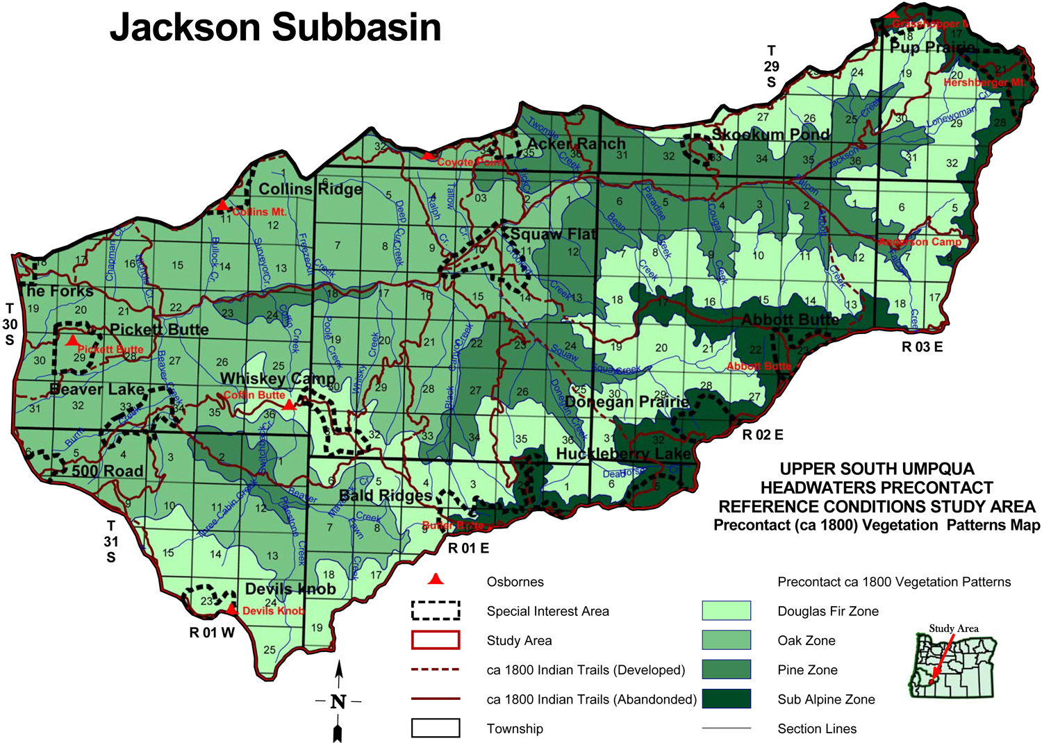
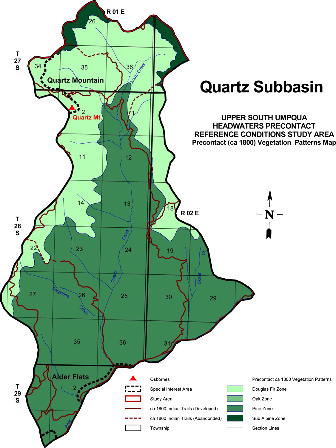
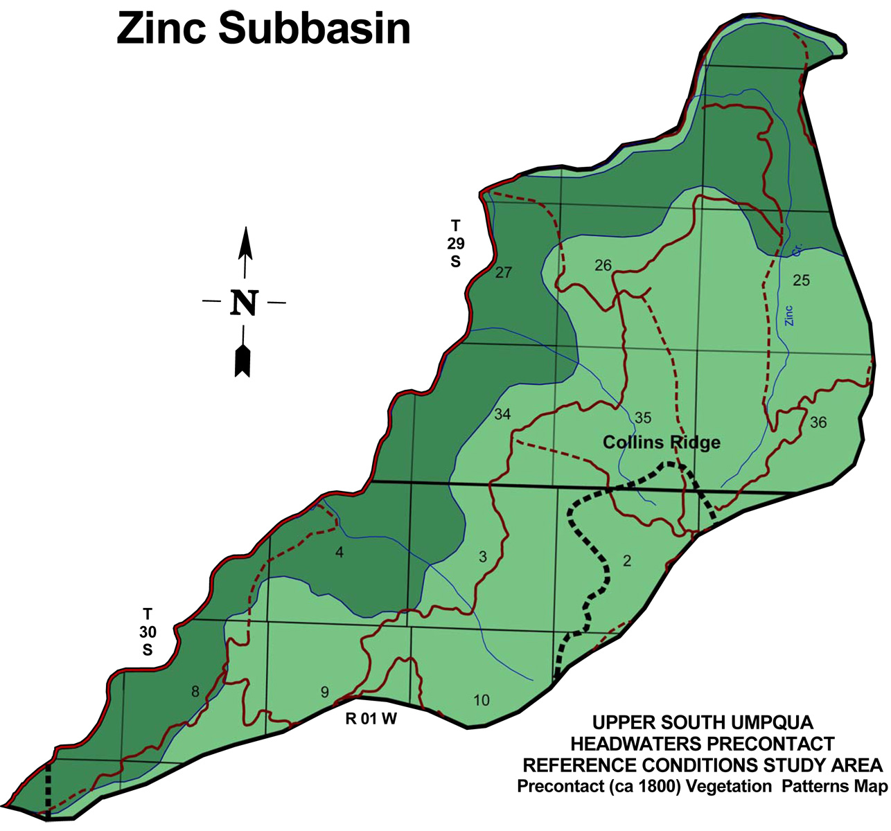
Subbasin Maps represent the final mapping products of this project: Bearing Tree Maps display locations, species and size classes of original GLO bearing trees and of understory vegetation species with important cultural food and fiber values; the ca. 1800 Vegetation Maps show primary vegetation types and principal travel routes in the study area where they likely existed more than 200 years ago.
Abbreviations: BT = Bearing Tree; ca. = circa; E. = East; GIS = Geographic Information System; GLO = General Land Office; NF = National Forest; ODF = Oregon Department of Forestry; Rng. = Range; S. = South; Tsp. = Township; USDA = United States Department of Agriculture; USDI = United States Department of the Interior; W. = West.
 |
 |
 |
 |
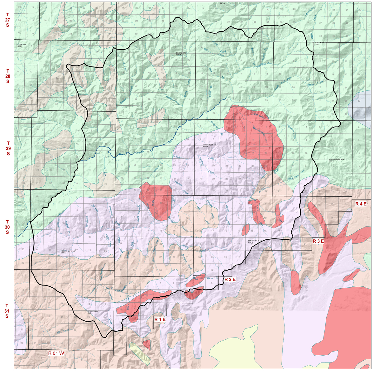
1900 USDI Timber Volumes |
1900 USDI Legend |
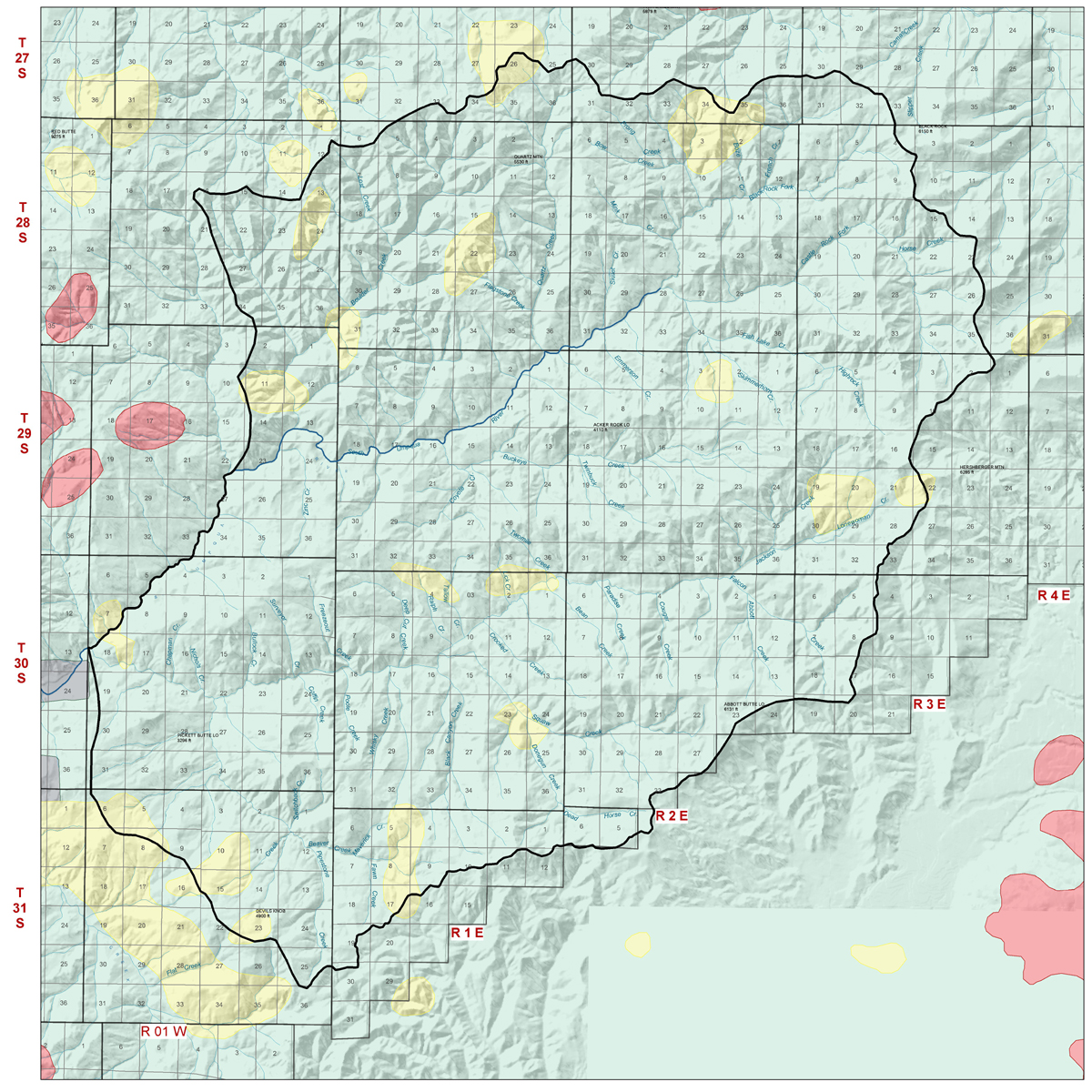
1914 ODF Fire Map |
1914 ODF Legend |
 |
 |
 |
 |
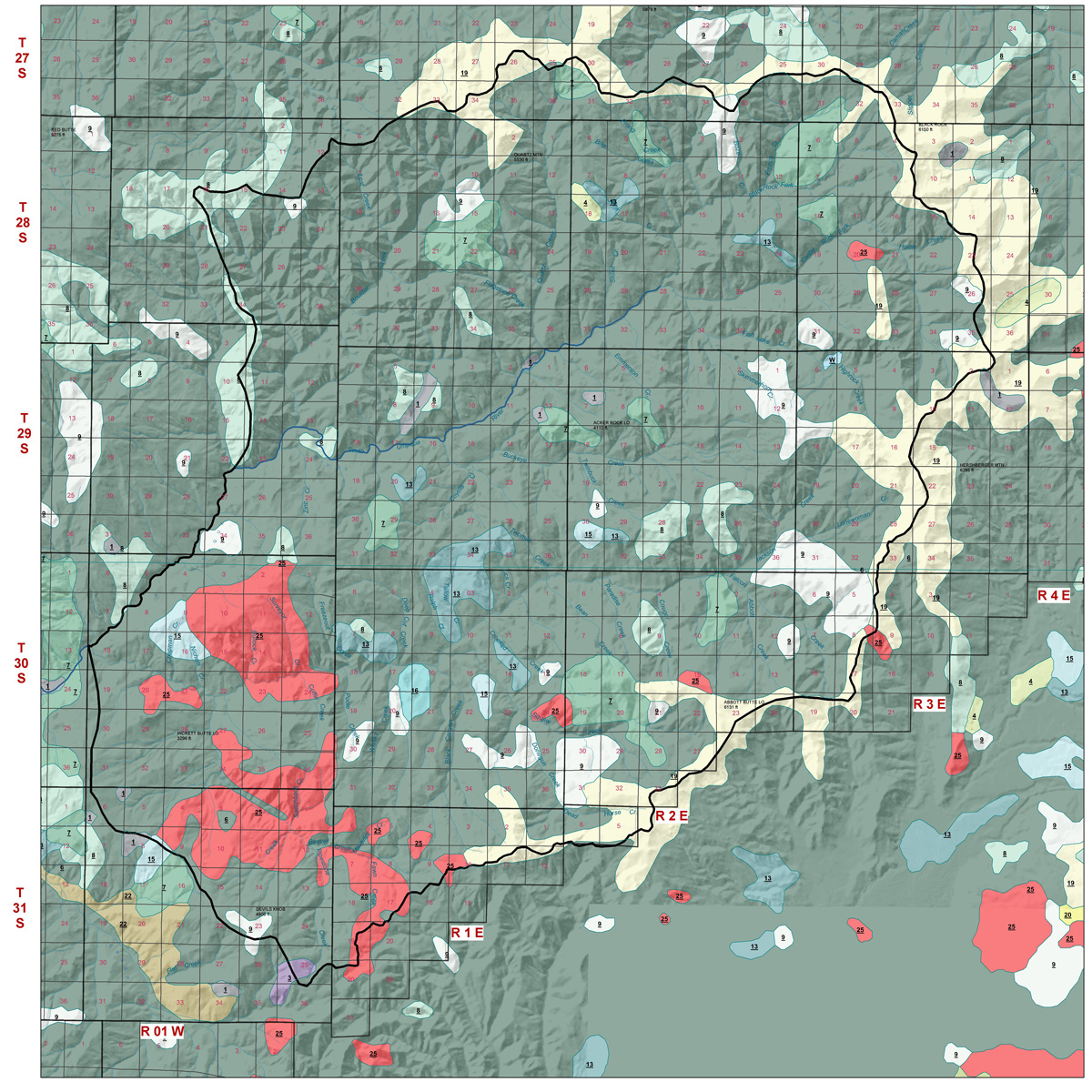
1936 USDA Vegetation Types |
1936 USDA Legend |
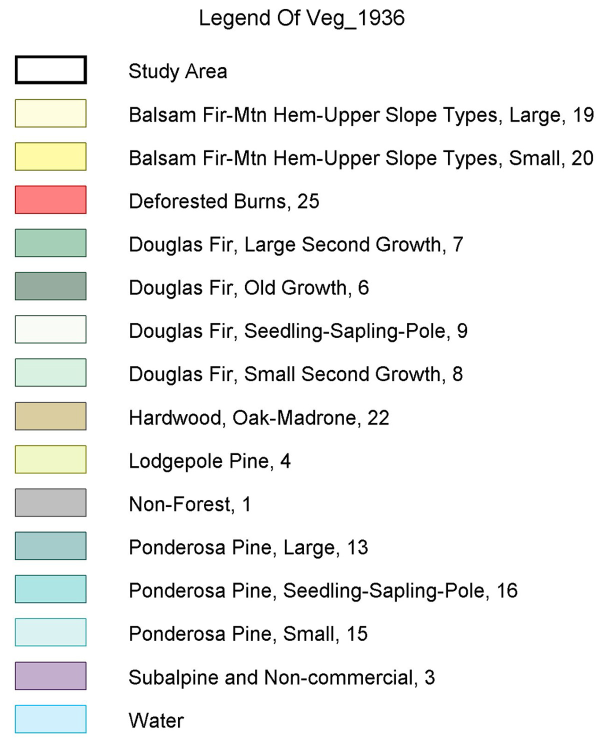
1936 Umpqua NF Recreation Map |
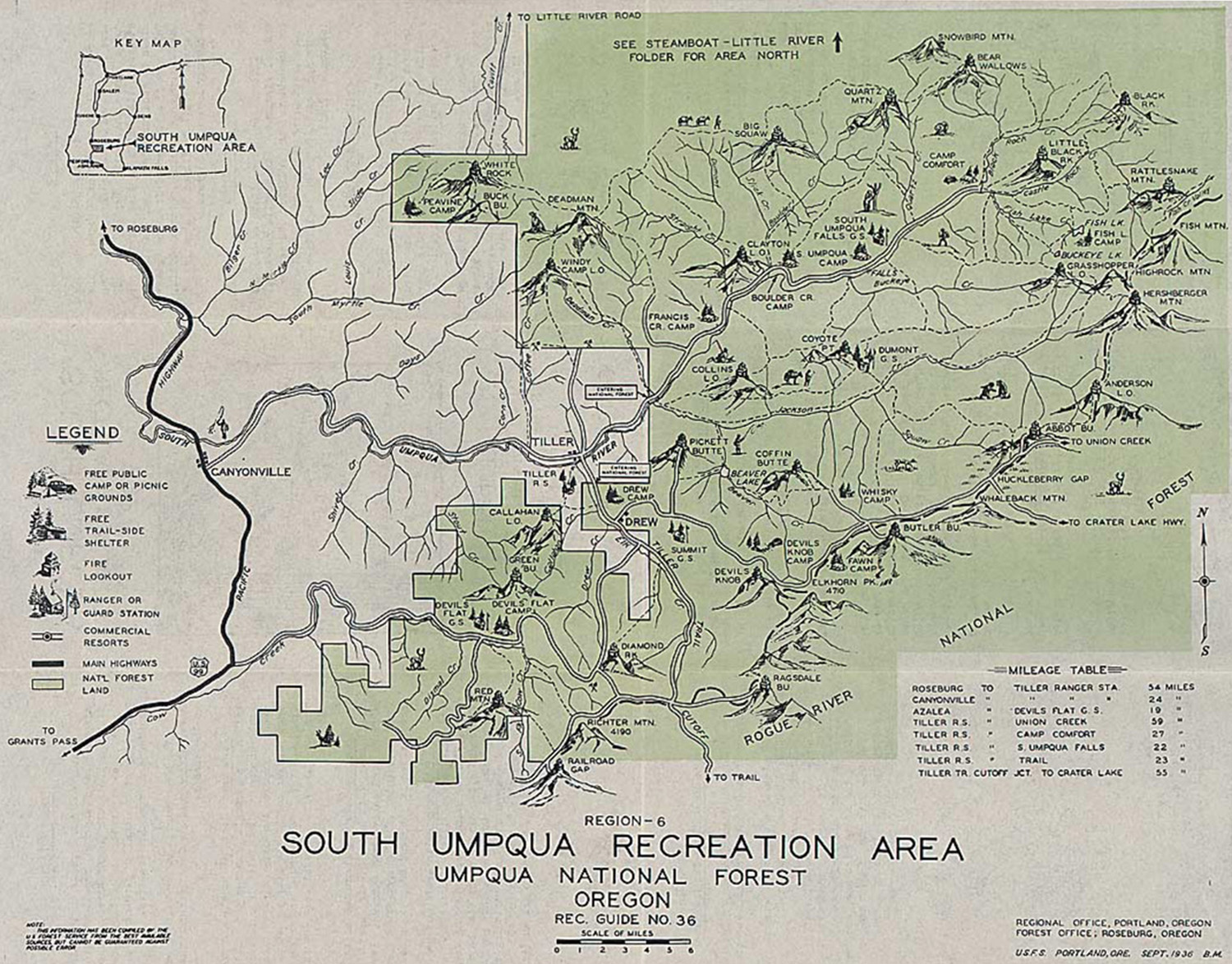
1970 South Umpqua Geology |
 |
 |
 |
 |
 |
Locational
|
Legal Subdivisions
|
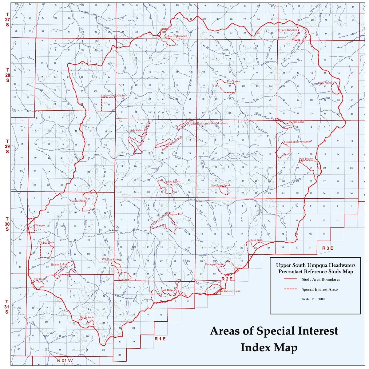
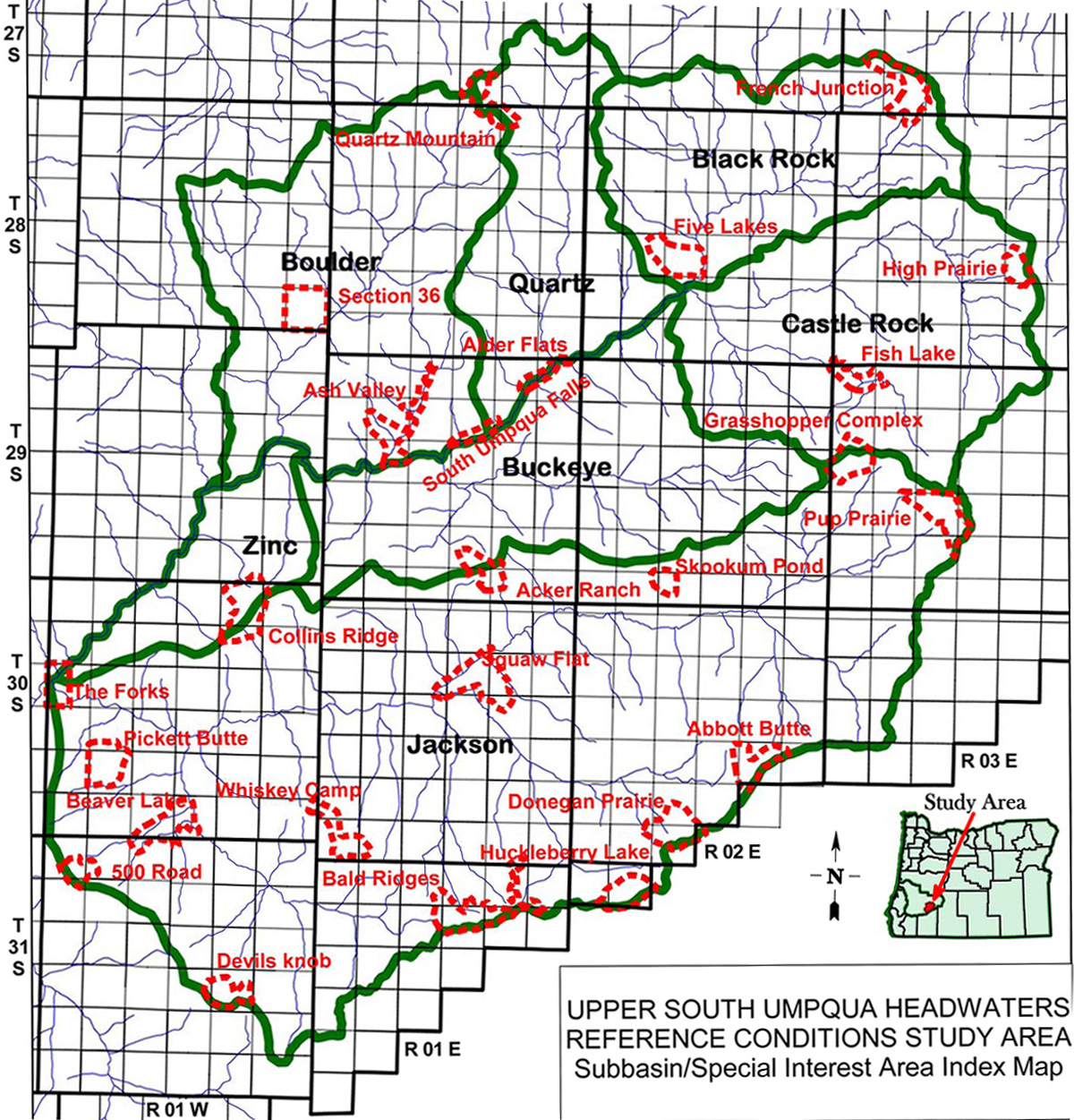
Subbasin Index
|
GLO Bearing Trees (Douglas-fir)
|
GLO Bearing Trees (Mixed Species)
|
 |
 |
 |
 |
 |
GLO Understory Vegetation
|
2010 Field Photograph Index
|
ca. 1800 Indian Trails
|
ca. 1800 Vegetation
|
2010 FRCC 3 Overlay
|
Tsp. 27 S., Rng. 1 E., 1929 |
Tsp. 27 S., Rng. 2 E., 1931 |
Tsp. 27 S., Rng. 3 E., 1931 |
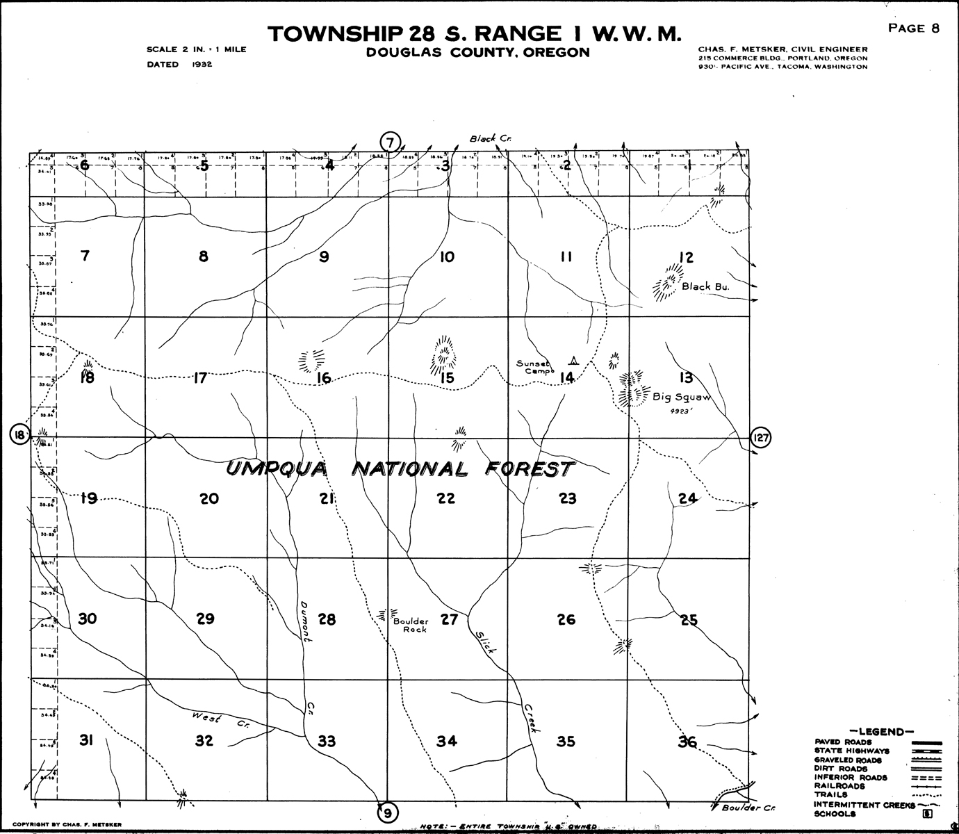
Tsp. 28 S., Rng. 1 W., 1904 |
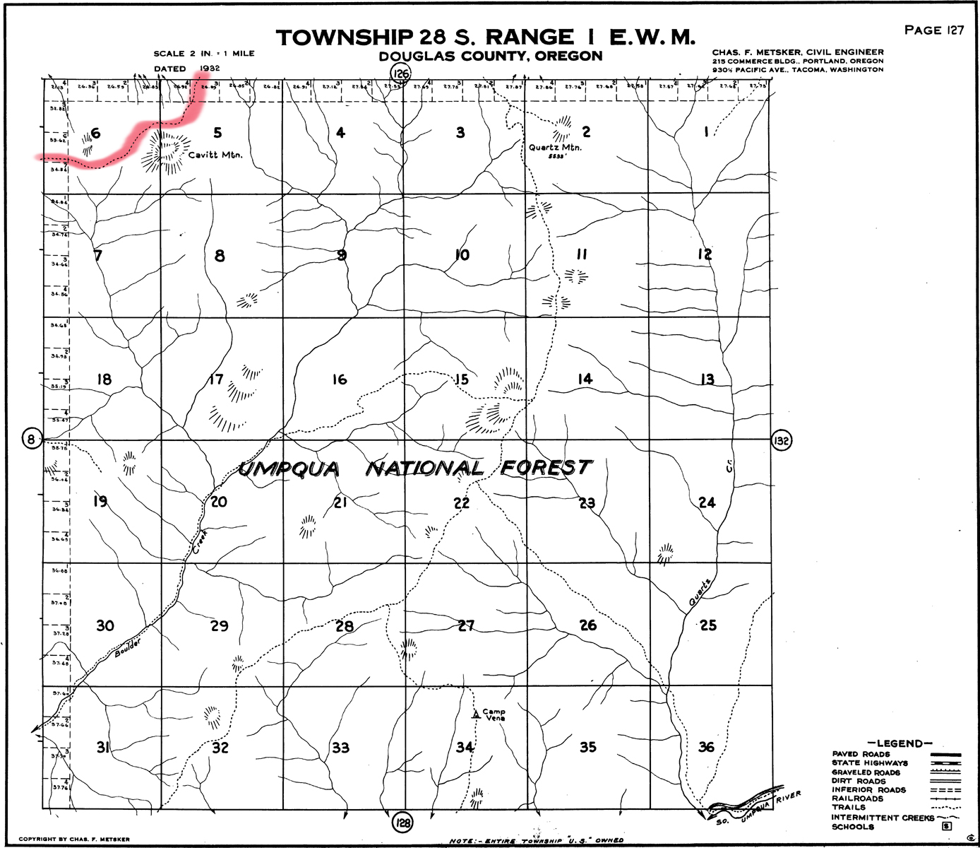
Tsp. 28 S., Rng. 1 E., 1928 |
|
Tsp. 28 S., Rng. 2 E., 1928 |
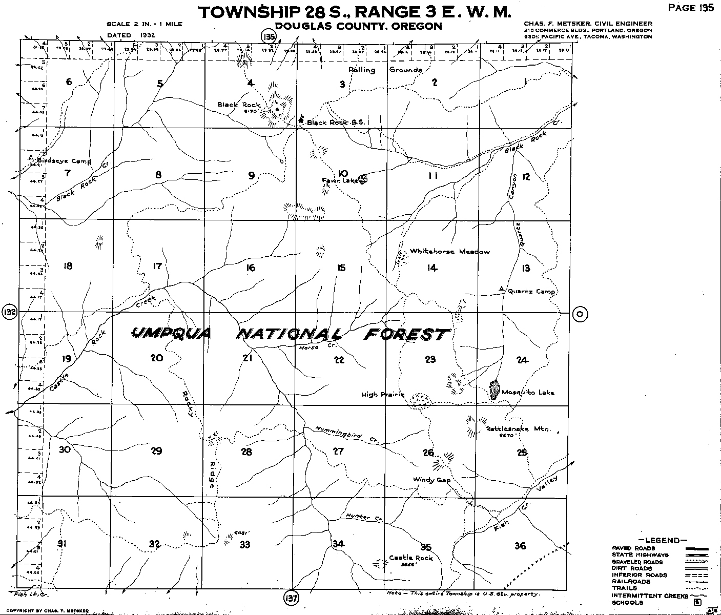
Tsp. 28 S., Rng. 3 E., 1930 |
Tsp. 29 S., Rng. 1 W., 1906 |
Tsp. 29 S., Rng. 1 W., 1912 |
Tsp. 29 S., Rng. 1 W., 1923 |
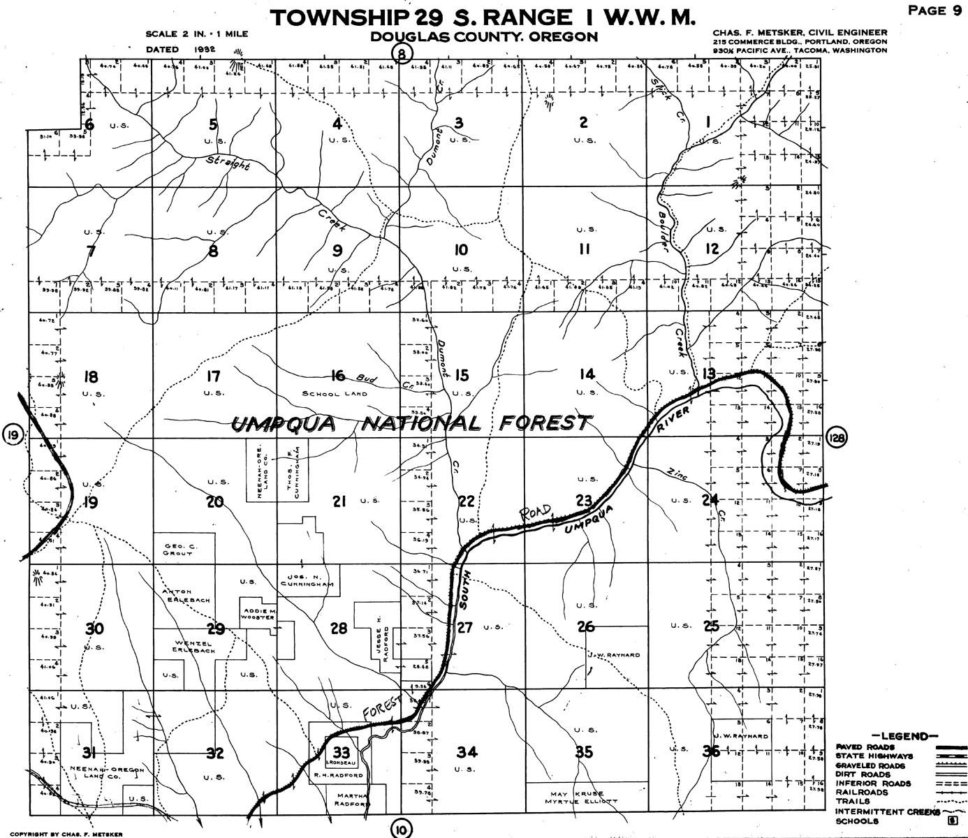
Tsp. 29 S., Rng. 1 E., 1911 |
Tsp. 29 S., Rng. 1 E., 1922 |
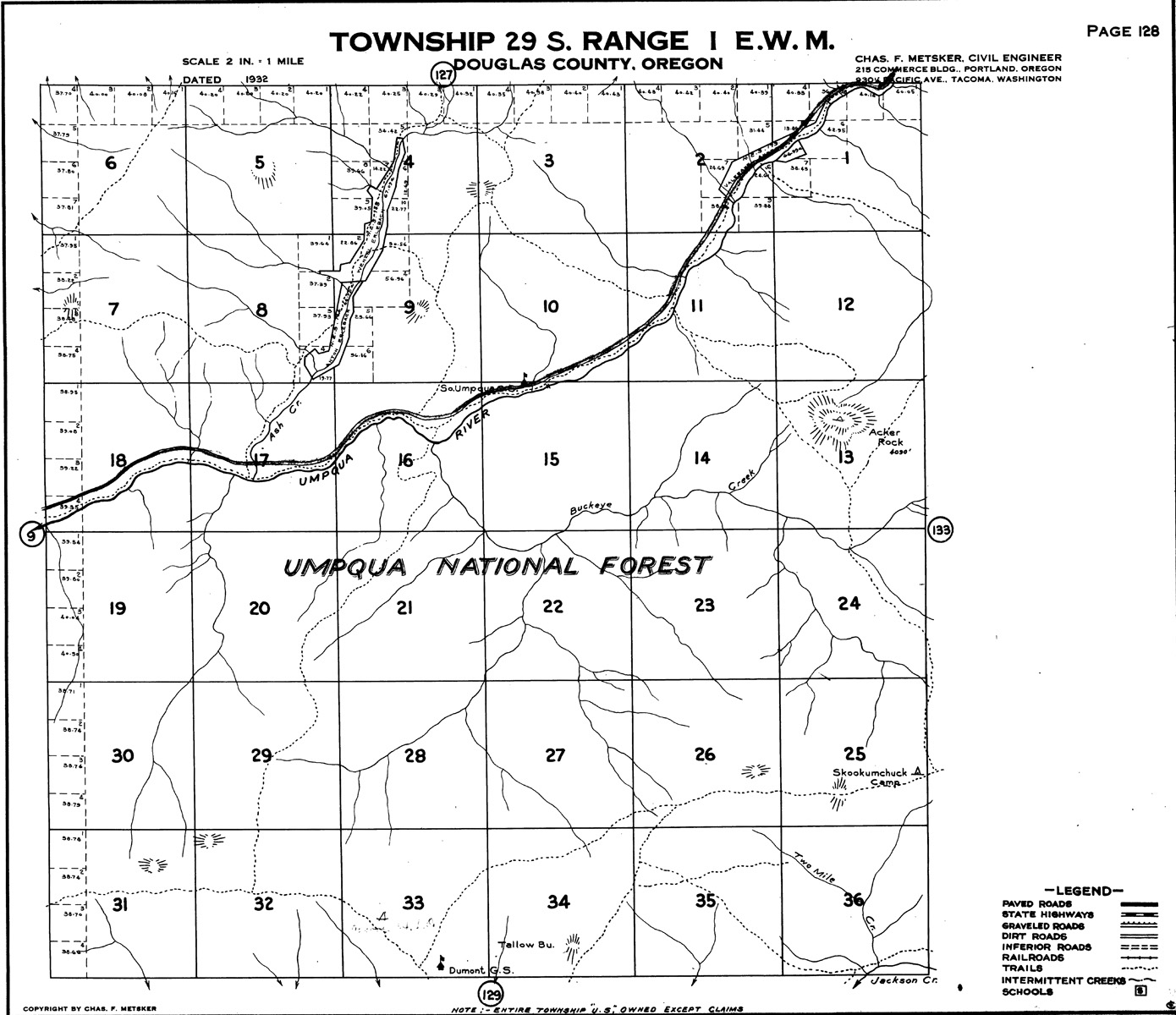
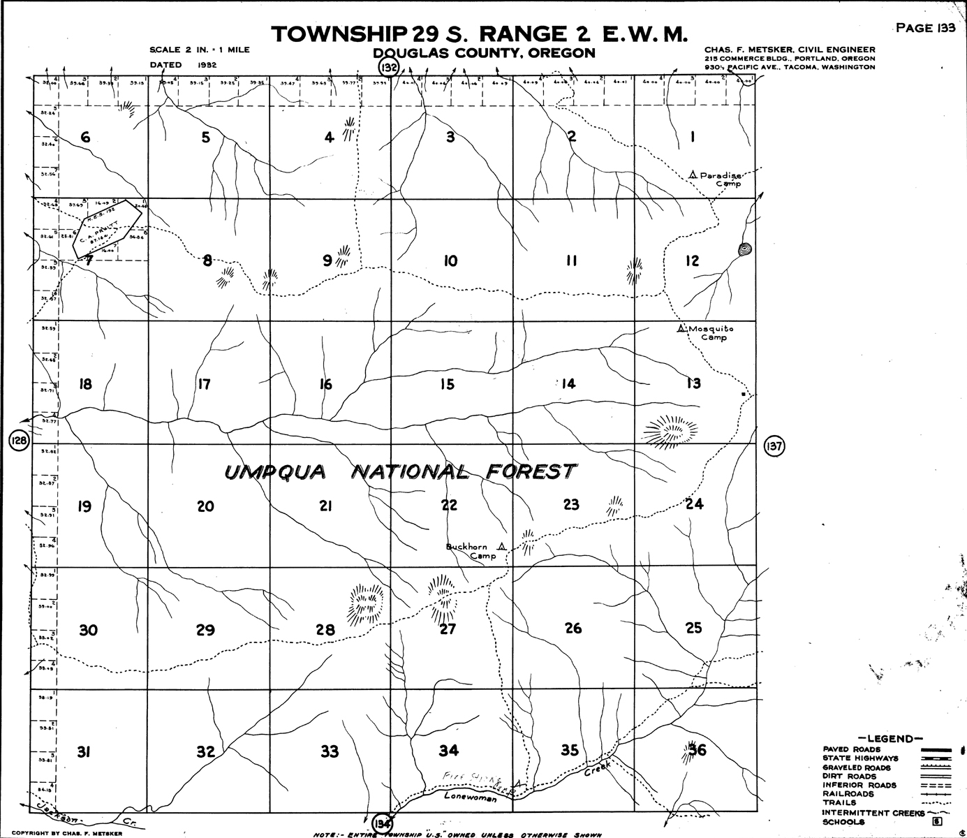
Tsp. 29 S., Rng. 2 E., 1927 |
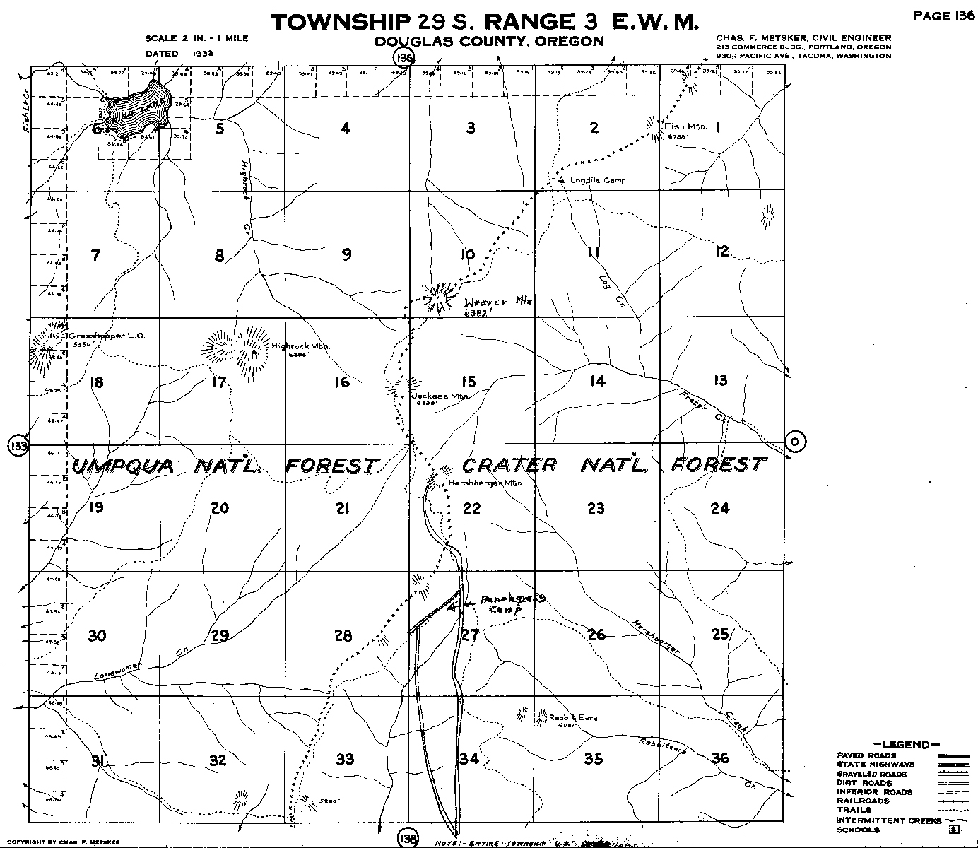
Tsp. 29 S., Rng. 3 E., 1928 |
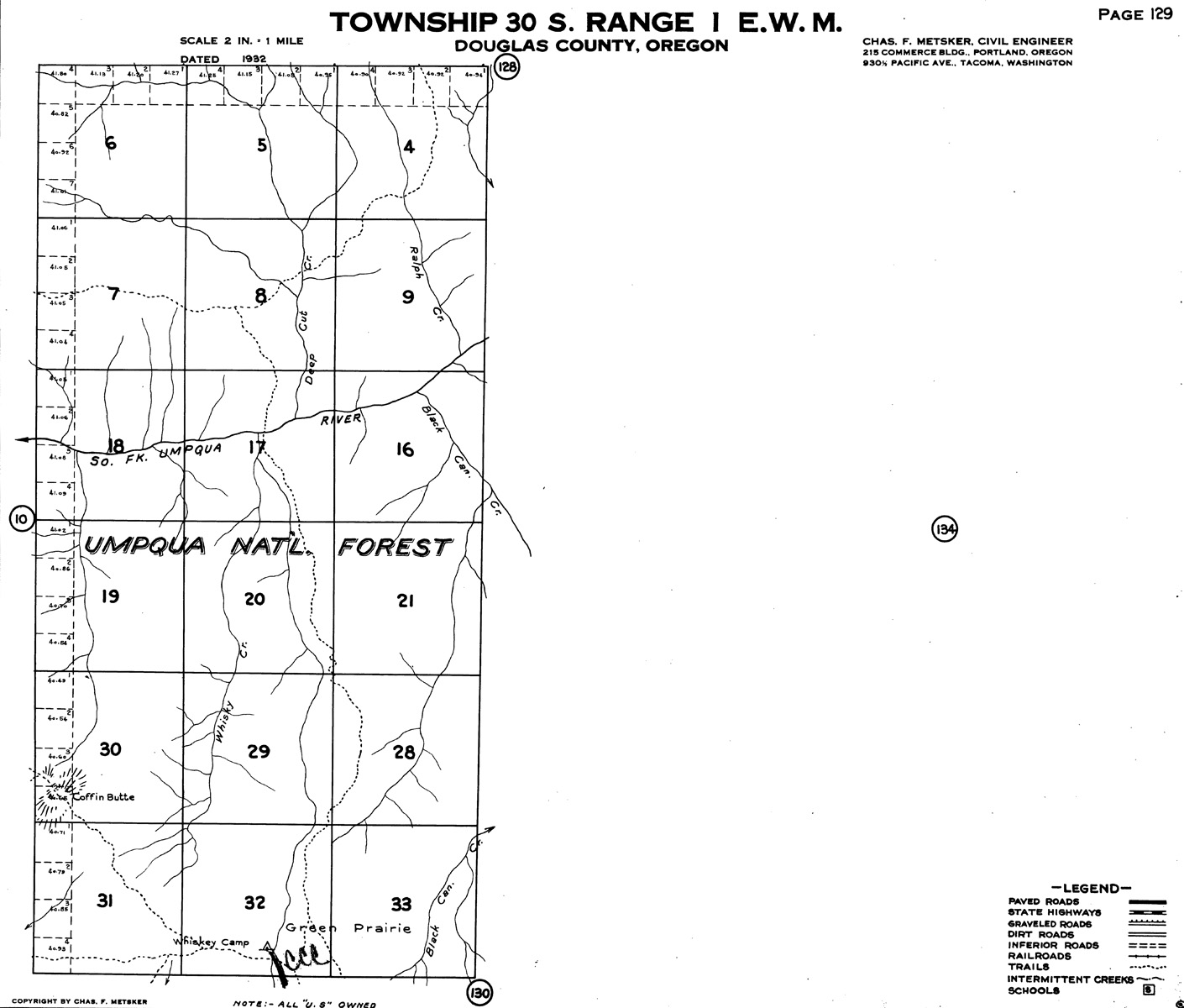
Tsp. 30 S., Rng 1 W., 1858 |
Tsp. 30 S., Rng 1 W., 1906 |
Tsp. 30 S., Rng 1 W., 1925 |
Tsp. 30 S., Rng. 1 E., 1925 |
Tsp. 30 S., Rng. 1 E., 1938 |
Tsp. 30 S., Rng. 2 E., 1938 |
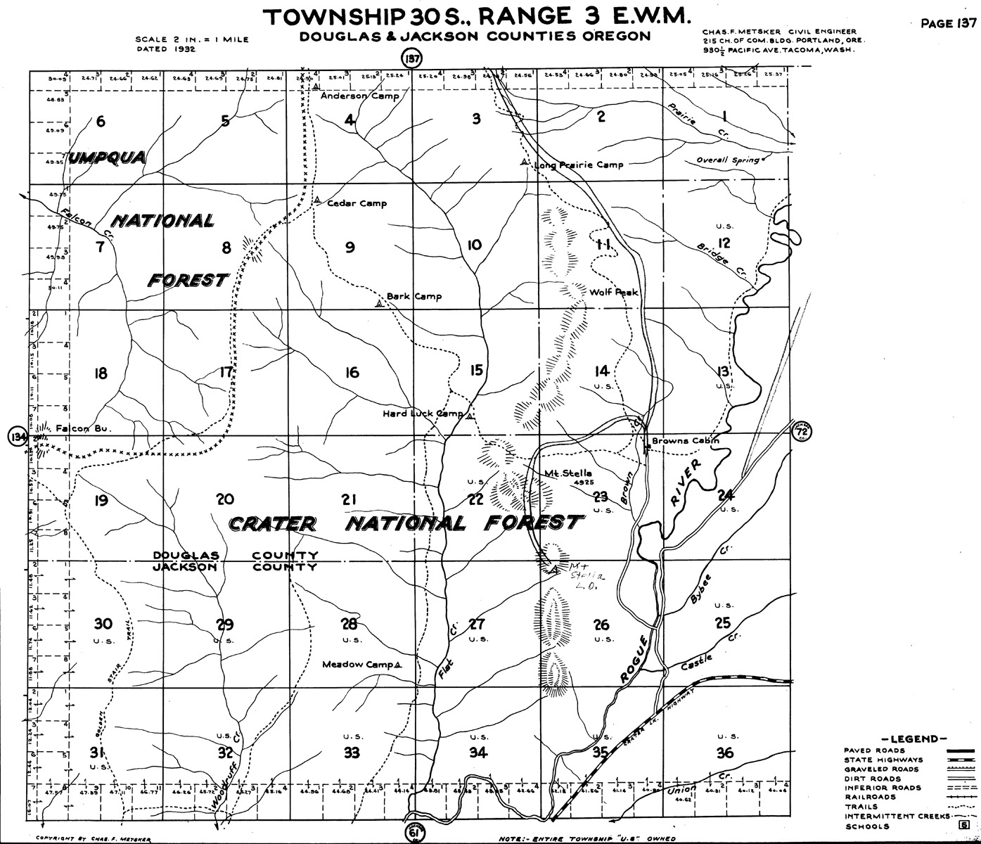
Tsp. 30 S., Rng. 3 E., 1929 |
Tsp. 31 S., Rng. 1 W., 1858 |
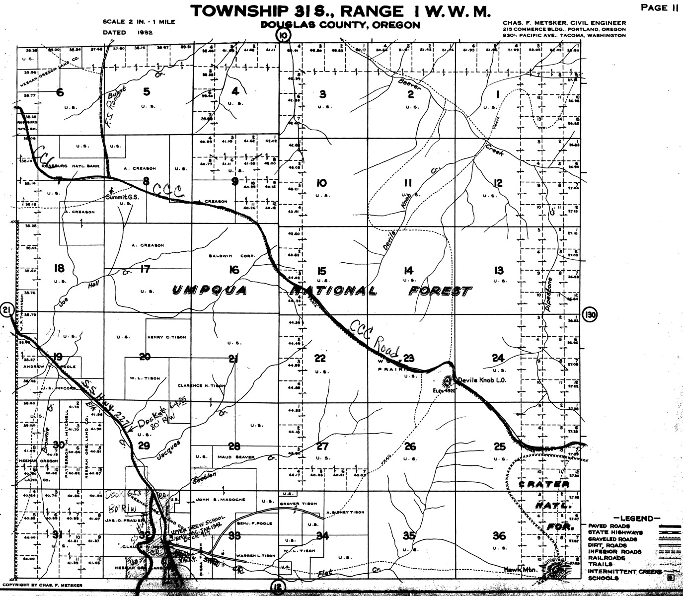
Tsp. 31 S., Rng. 1 W., 1925 |
Tsp. 31 S., Rng. 1 E., 1925 |
Tsp. 31 S., Rng. 1 E., 1937 |
Tsp. 31 S., Rng. 2 E., 1892 |
|||
 |
 |
 |
 |
 |
|
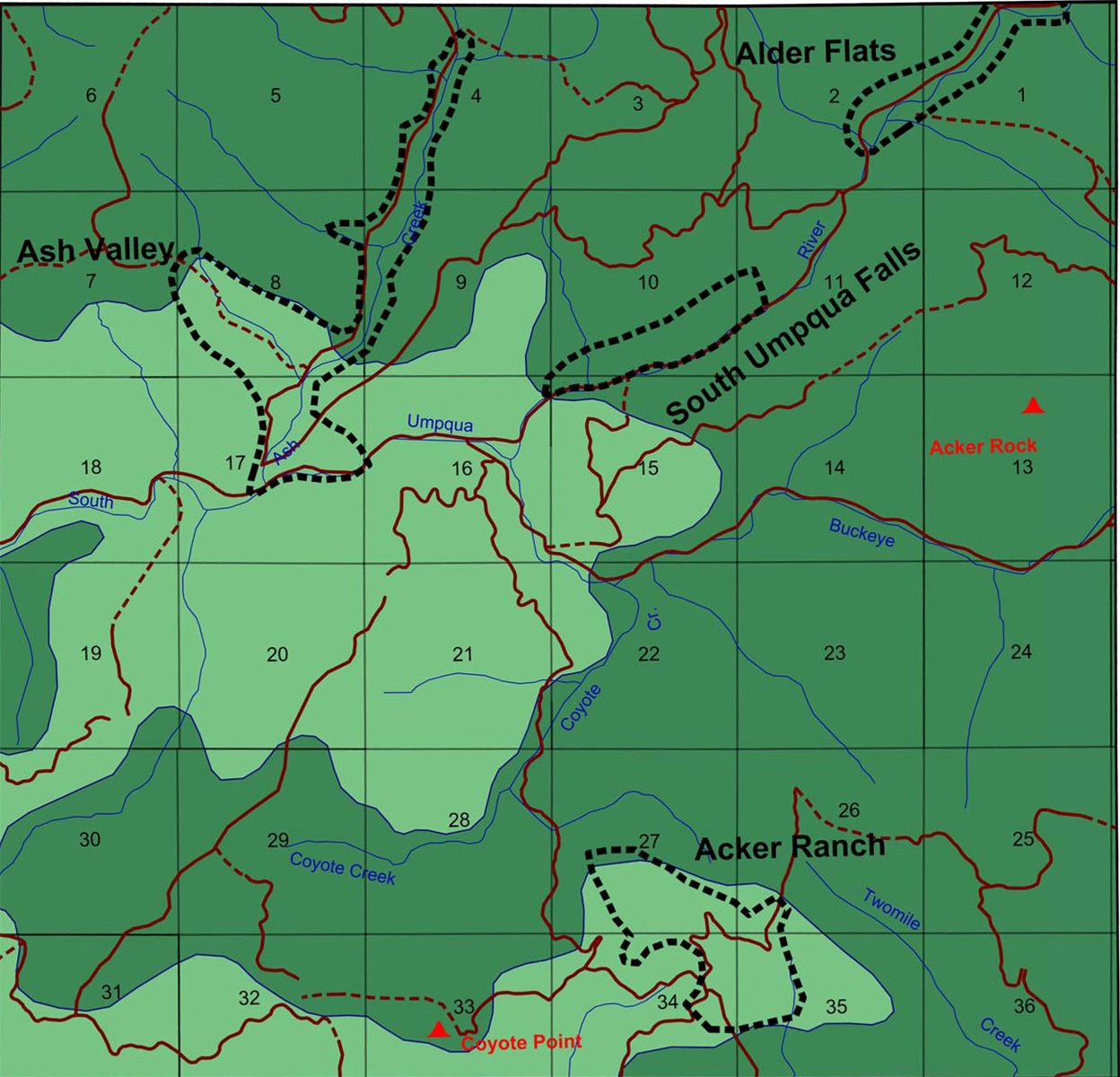
Tsp. 27 S., Rng. 1 E. |
Tsp. 27 S., Rng. 2 E. |
Tsp. 27 S., Rng. 3 E. |
Tsp. 28 S., Rng. 1 W. |
Tsp. 28 S., Rng. 1 E. |
|
 |
 |
 |
 |
 |
 |
Tsp. 28 S., Rng. 2 E. |
Tsp. 28 S., Rng. 3 E.
|
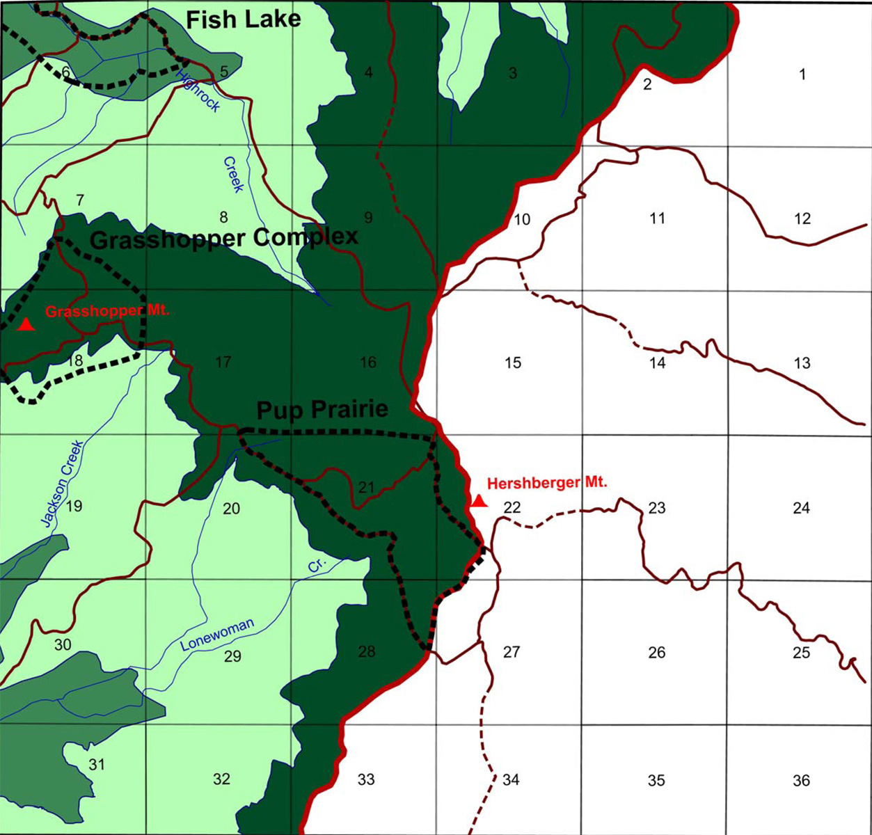
Tsp. 29 S., Rng. 1 W. |
Tsp. 29 S., Rng. 1 E. |
Tsp. 29 S., Rng. 2 E. |
Tsp. 29 S., Rng. 3 E. |
|
 |
 |
 |
||
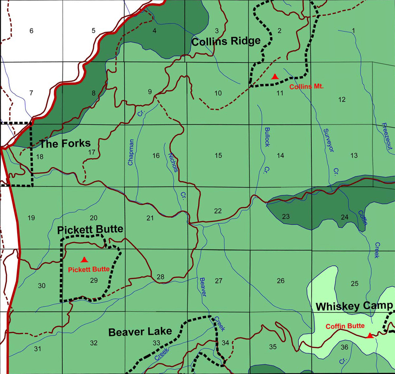
Tsp. 30 S., Rng 1 W. |
Tsp. 30 S., Rng. 1 E. |
Tsp. 30 S., Rng. 3 E.
|
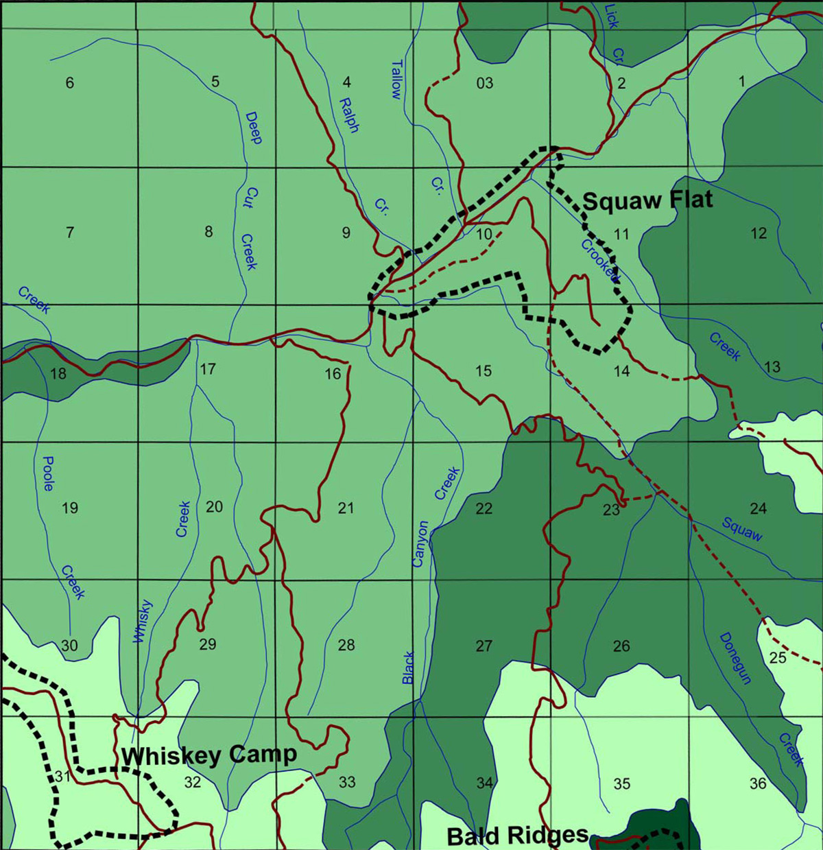
Tsp. 31 S., Rng. 1 W.
|
||
 |
 |
 |
 |
||
Maps Legend |
Tsp. 27 S., Rng. 1 E., 1929
|
Tsp. 27 S., Rng. 2 E., 1931
|
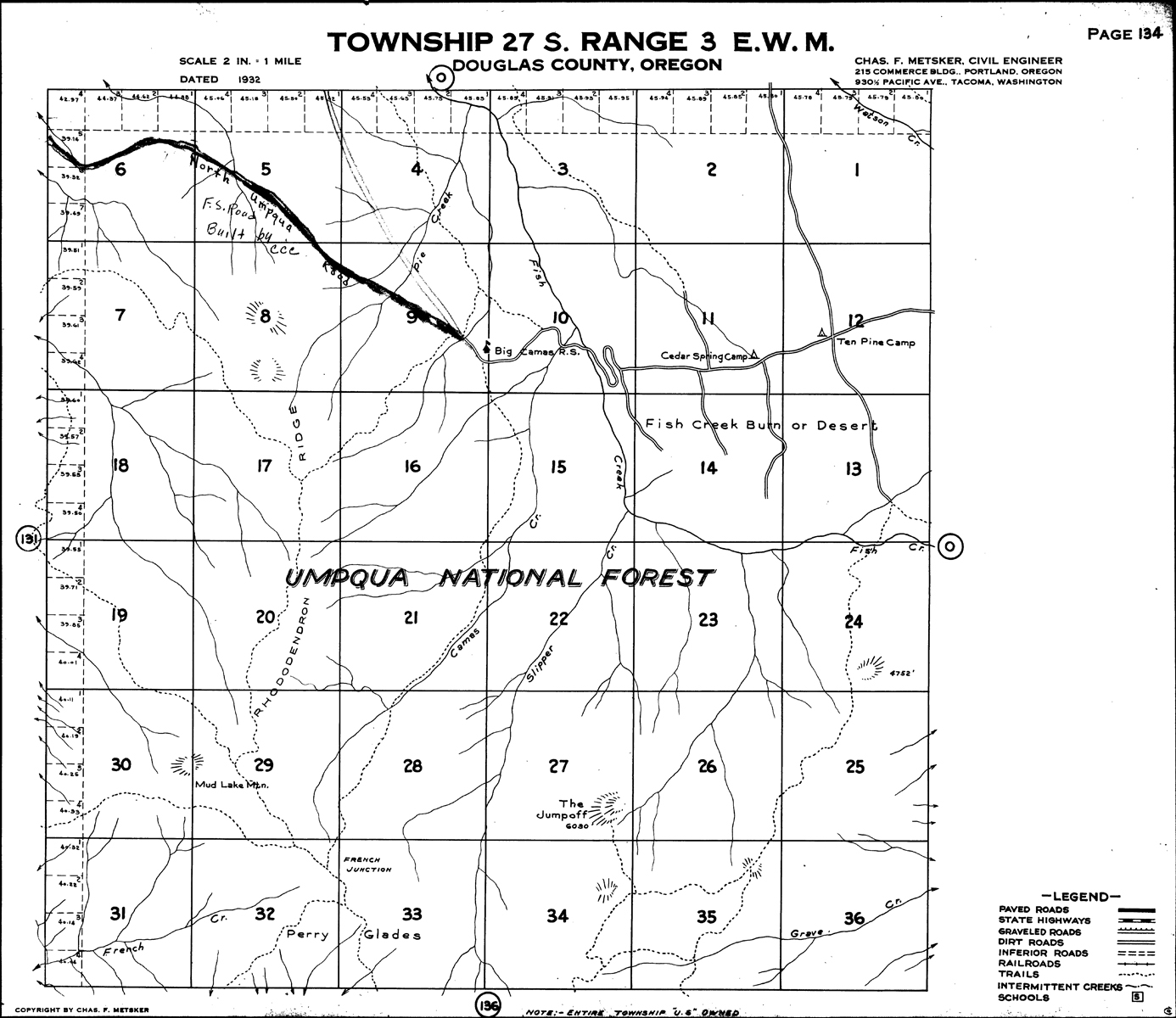
Tsp. 27 S., Rng. 3 E., 1931
|
Tsp. 28 S., Rng. 1 W., 1904
|
|
|
 |
 |
 |
 |
 |
Tsp. 28 S., Rng. 1 E., 1928 |
Tsp. 28 S., Rng. 2 E., 1928
|
Tsp. 28 S., Rng. 3 E., 1930
|
Tsp. 29 S., Rng. 1 W., 1906, 1912, 1923
|
Tsp. 29 S., Rng. 1 E., 1911
|
Tsp. 29 S., Rng. 2 E., 1927
|
|
 |
 |
 |
 |
 |
Tsp. 29 S., Rng. 3 E., 1928 |
Tsp. 30 S., Rng. 1 W., 1858, 1906, 1925
|
Tsp. 30 S., Rng. 1 E., 1925,
1938
|
Tsp. 30 S., Rng. 2 E., 1938
|
Tsp. 30 S., Rng. 3 E., 1929
|
Tsp. 31 S., Rng. 1 W., 1858, 1925
|
|
 |
||||
Tsp. 31 S., Rng. 1 E., 1925, 1937 |
Tsp. 31 S., Rng. 2 E., 1892
|
||||
 |
 |
 |
 |
||
Maps Legend
|
Tsp. 27 S., Rng. 1 E.
|
Tsp. 27 S., Rng. 2 E.
|
Tsp. 27 S., Rng. 3 E.
|
Tsp. 28 S., Rng. 1 W.
|
|
 |
 |
 |
 |
 |
 |
Tsp. 28 S., Rng. 1 E.
|
Tsp. 28 S., Rng. 2 E.
|
Tsp. 28 S., Rng. 3 E.
|
Tsp. 29 S., Rng. 1 W.
|
Tsp. 29 S., Rng. 1 E.
|
Tsp. 29 S., Rng. 2 E.
|
 |
 |
 |
 |
 |
 |
Tsp. 29 S., Rng. 3 E.
|
Tsp. 30 S., Rng.
1 W.
|
Tsp. 30 S., Rng. 1 E.
|
Tsp. 30 S., Rng. 2 E.
|
Tsp. 30 S., Rng. 3 E.
|
Tsp. 31 S., Rng. 1 W.
|
 |
 |
||||
Tsp. 31 S., Rng. 1 E. |
Tsp. 31 S., Rng. 2 E. |
||||
|
 |
 |
 |
 |
|
Maps Legend |
Tsp. 27 S., Rng. 1 E.
|
Tsp. 27 S., Rng. 2 E.
|
Tsp. 27 S., Rng. 3 E.
|
Tsp. 28 S., Rng. 1 W.
|
|
 |
 |
 |
 |
 |
 |
Tsp. 28 S., Rng. 1 E. |
Tsp. 28 S., Rng. 2 E.
|
Tsp. 28 S., Rng. 3 E.
|
Tsp. 29 S., Rng. 1 W.
|
Tsp. 29 S., Rng. 1 E.
|
Tsp. 29 S., Rng. 2 E.
|
 |
 |
 |
 |
 |
|
Tsp. 29 S., Rng. 3 E. |
Tsp. 30 S., Rng. 1 W. |
Tsp. 30 S., Rng. 1 E. |
Tsp. 30 S., Rng. 2 E. |
Tsp. 30 S., Rng. 3 E. |
Tsp. 31 S., Rng. 1 W. |
 |
 |
||||
Tsp. 31 S., Rng. 1 E.
|
Tsp. 31 S., Rng. 2 E.
|
 |
 |
 |
|||
Maps Legend
|
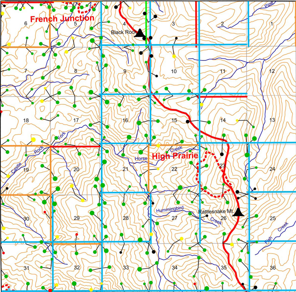
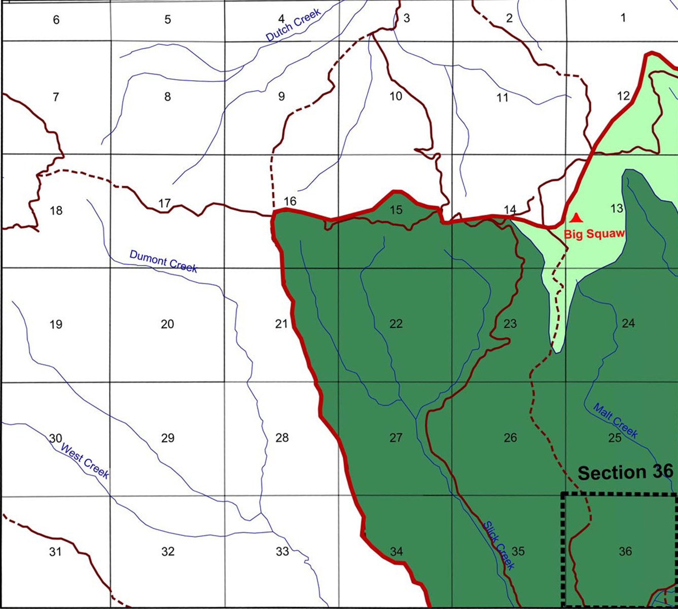
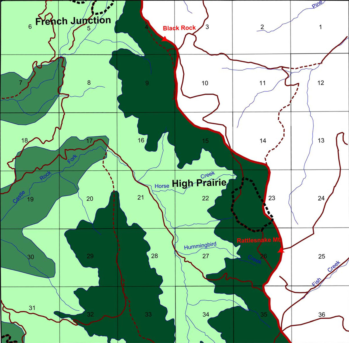
Black Rock Fork
|
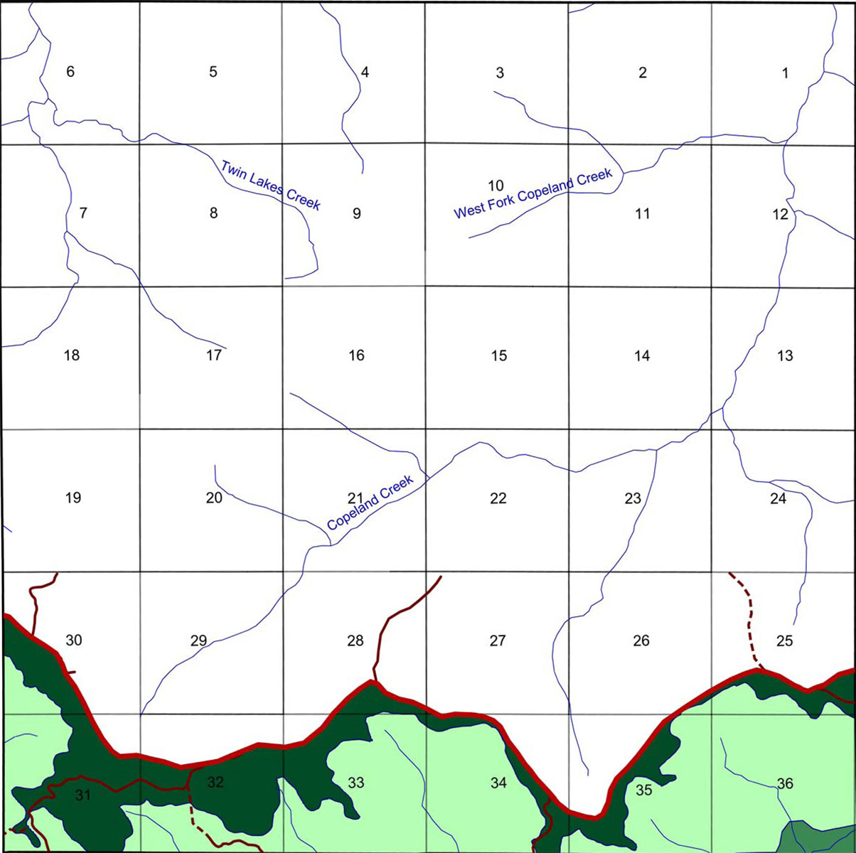
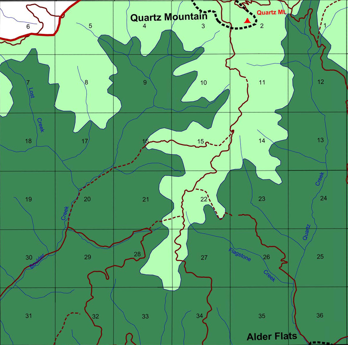
Boulder Creek
|
Buckeye Creek
|
Castle Rock Fork
|
|
 |
 |
 |
|||
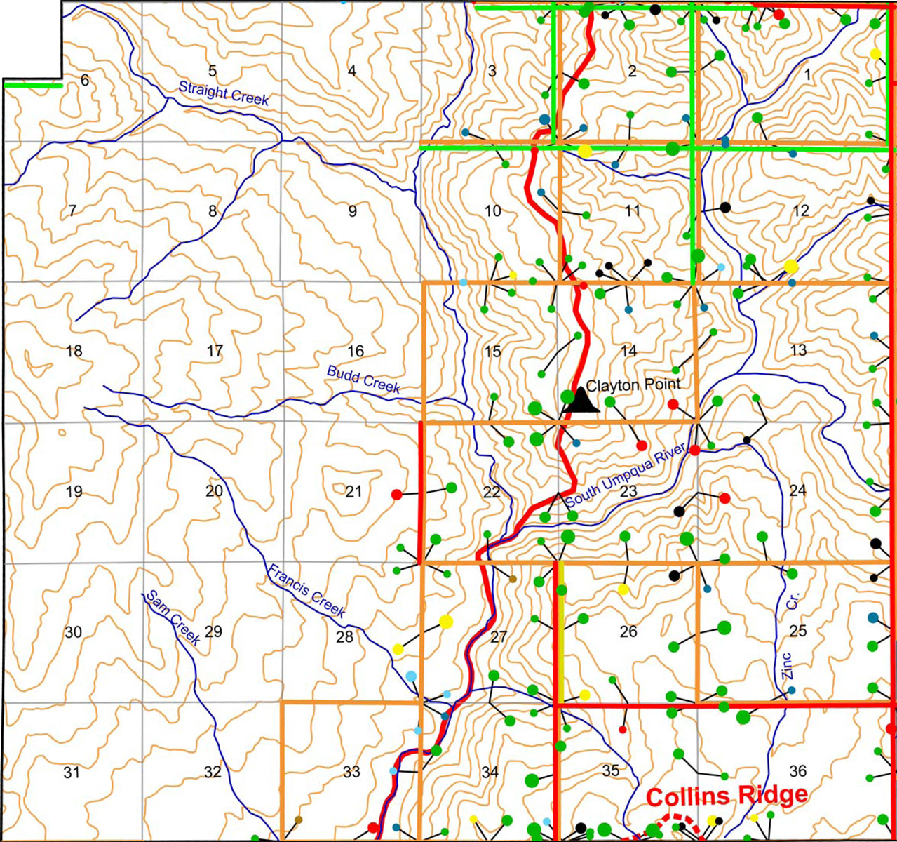
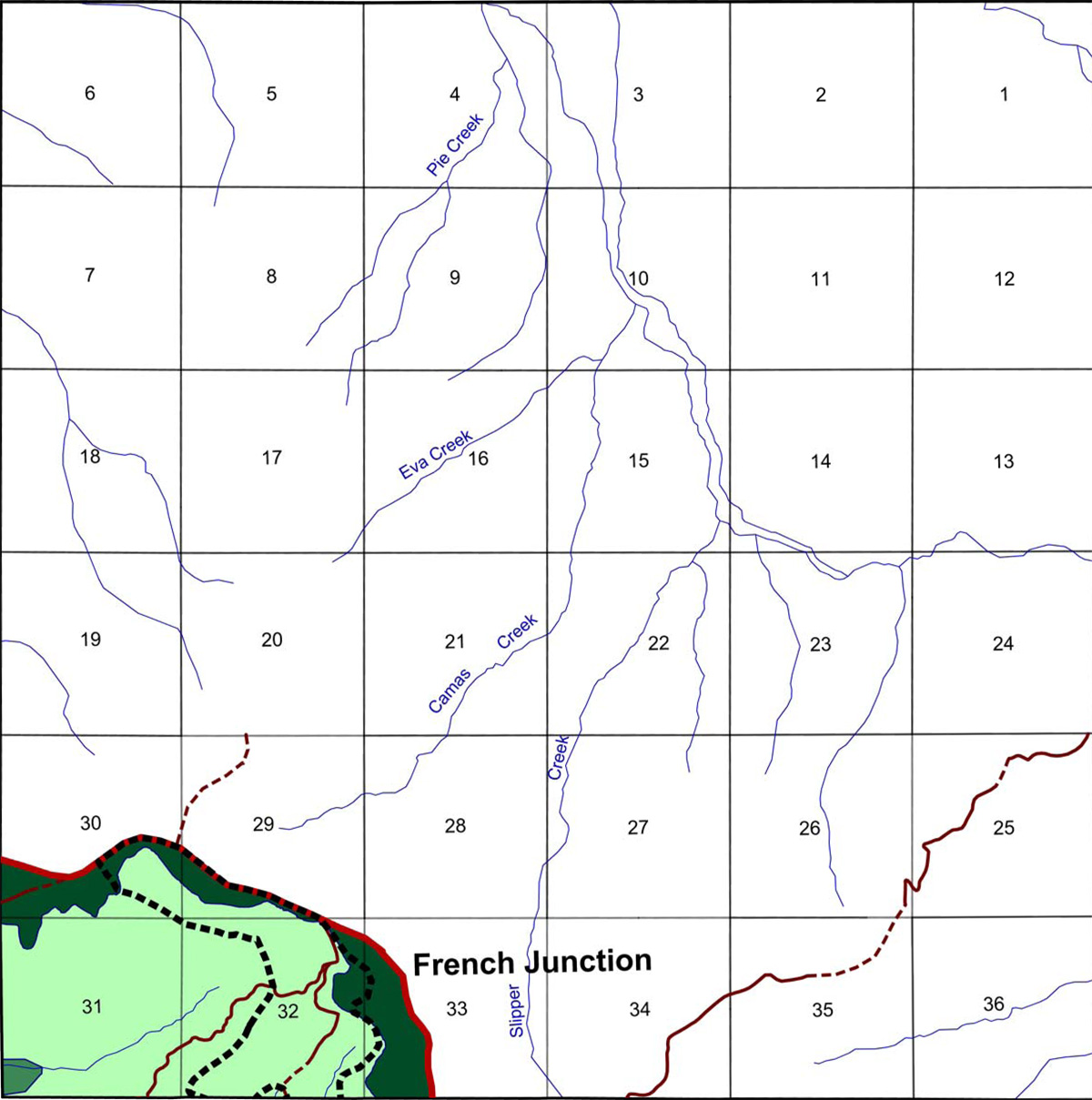
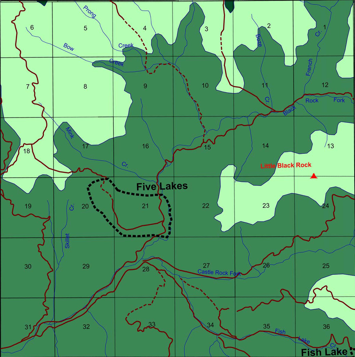
Jackson Creek
|
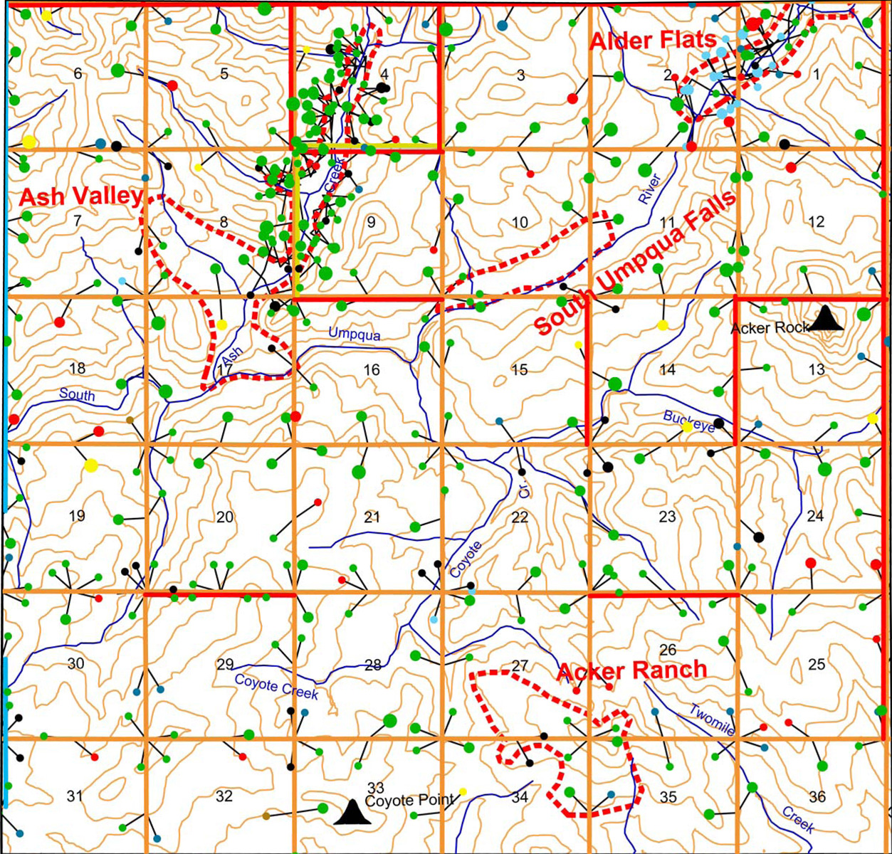
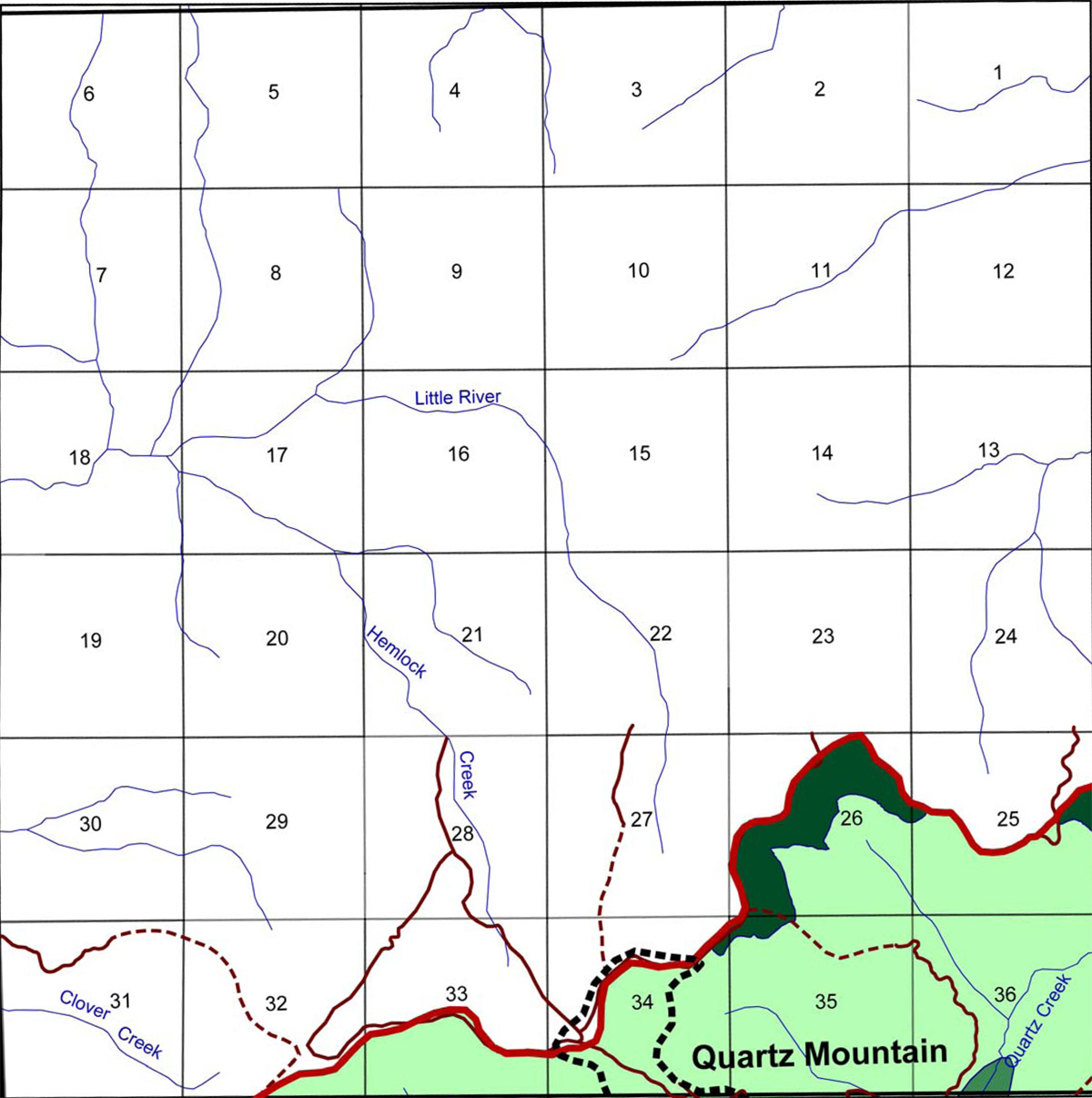
Quartz Creek
|
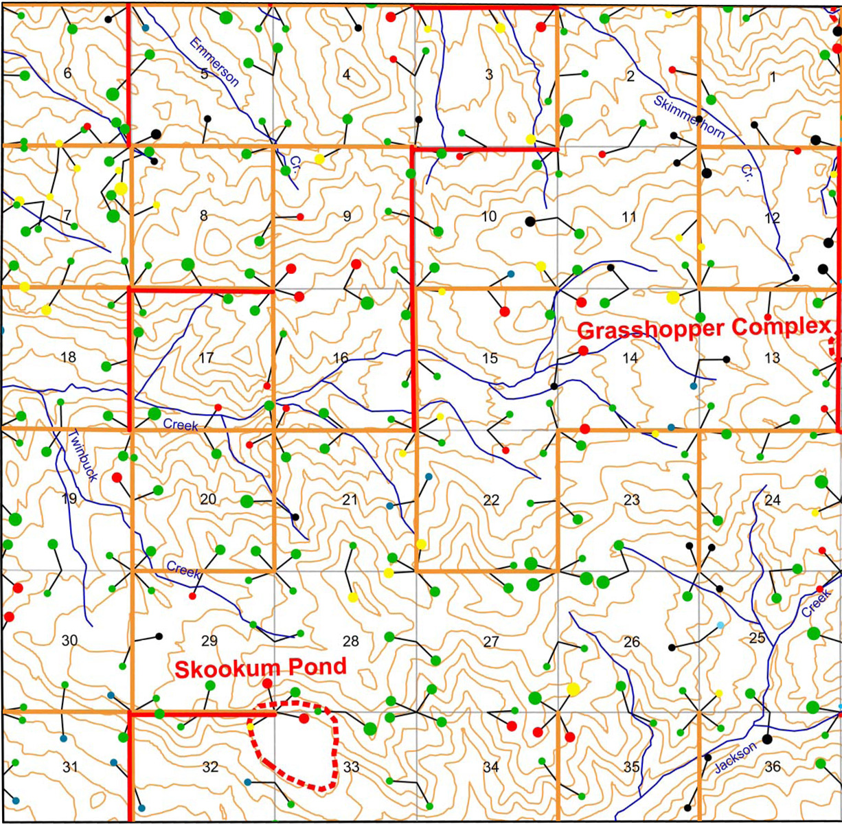
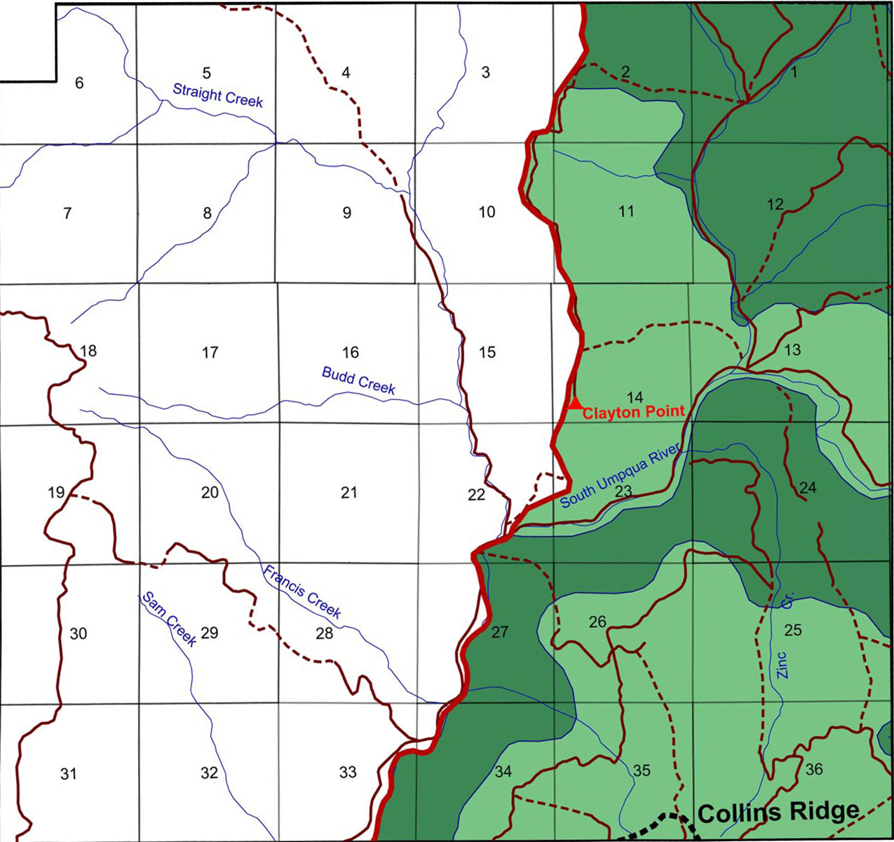
Zinc Creek
|
|||
 |
 |
 |
 |
||
Maps Legend
|
Black Rock Fork
|
Boulder Creek
|
Buckeye Creek
|
Castle Rock Fork
|
|
 |
 |
 |
|||
Jackson Creek
|
Quartz Creek
|
Zinc Creek
|