Douglas County, Oregon General Land Office Survey Notes
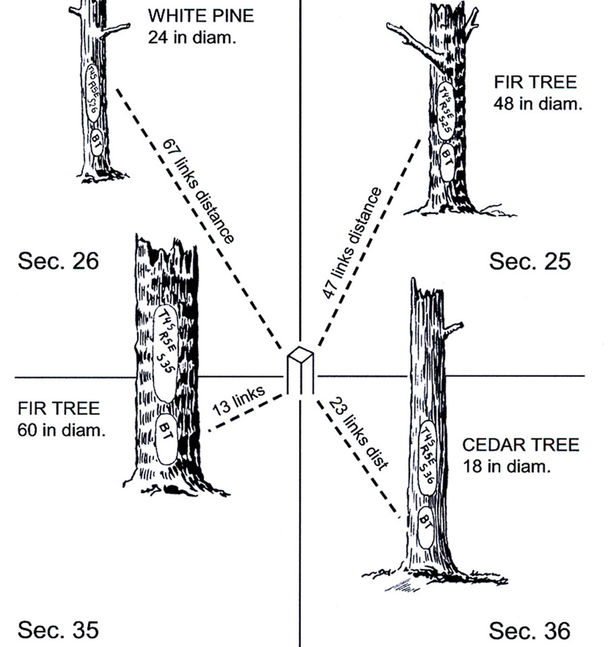
Typical GLO Section Corner Bearing Tree Diagram (Powell 2008: 2).
Original Public Land Survey ("P.L.S.") field notes are being compiled for the South Umpqua River basin and made available for research and education purposes, in conjunction with the 2010 South Umpqua Headwaters Precontact Reference Conditions Study. These notes were made available, and this project made possible, with the cooperation and assistance provided by the Douglas County Surveyors Office.
The South Umpqua Headwaters Precontact Reference Conditions Study area is contained within 18 partial and complete legal townships. The original land survey data for these townships formed an important part of the information used in the study: including more than 18 township plat maps; 18 township index maps; more than 1300 pages of transcribed survey notes that describing 3900+ bearing trees (tabulated in a comprehensive Excel file, including dates, species, diameters, and mapping codes); and exacting locations of ten important understory tree and shrub species, selected for their biological and cultural signficance (see: http://www.ORWW.org/Rivers/Umpqua/South/Upper_Headwaters_Project/Maps/index.html). GLO plats and notes were created between 1857 and 1938 and subsequently transcribed into map indexes and typewritten pages, then transformed into digital files. Survey notes and plats are referenced by surveyor names, dates, and contract numbers.
![]()