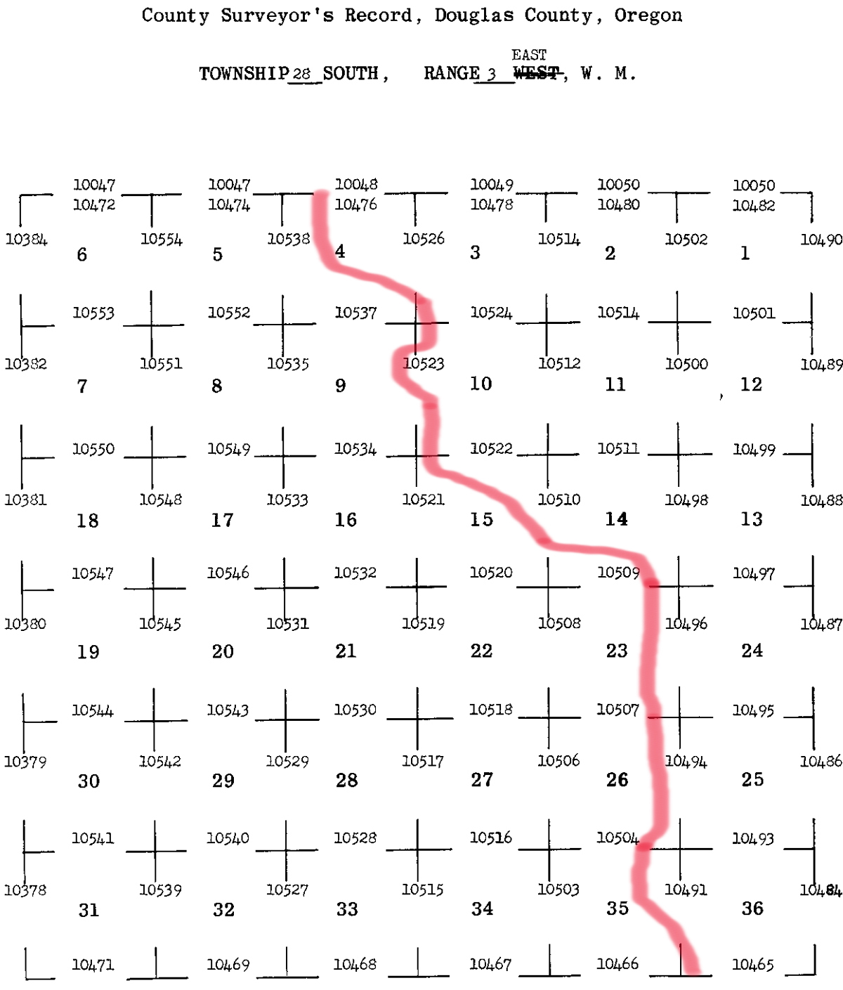
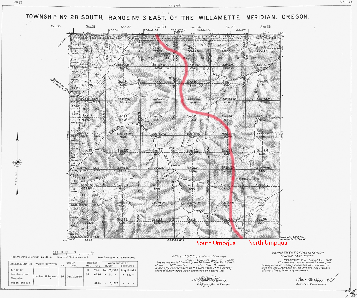
South Umpqua River
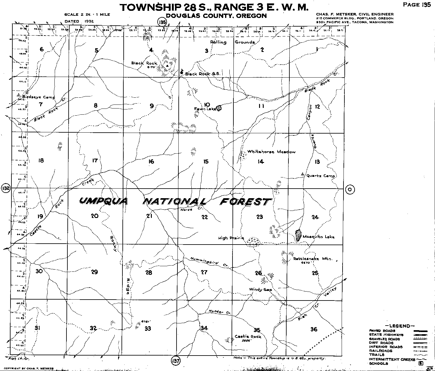
Tsp. 28 S., Rng. 3 E.
1930 General Land Office Survey Index
 |
 |
1930 GLO |
1932 Metsker |
The red line of this index follows the Cascade Crest and indicates the eastern boundary of the 2010 South Umpqua Headwaters Precontact Reference Conditions Study, including the Black Rock and Rattlesnake Mountain Fire Lookouts and the High Prairie Area of Special Interest. This survey was completed in 1929 and mapped in 1930 (Raymond 1929).