 |
 |
 |
1935 GLO |
1955 Annotated USGS Port Orford |
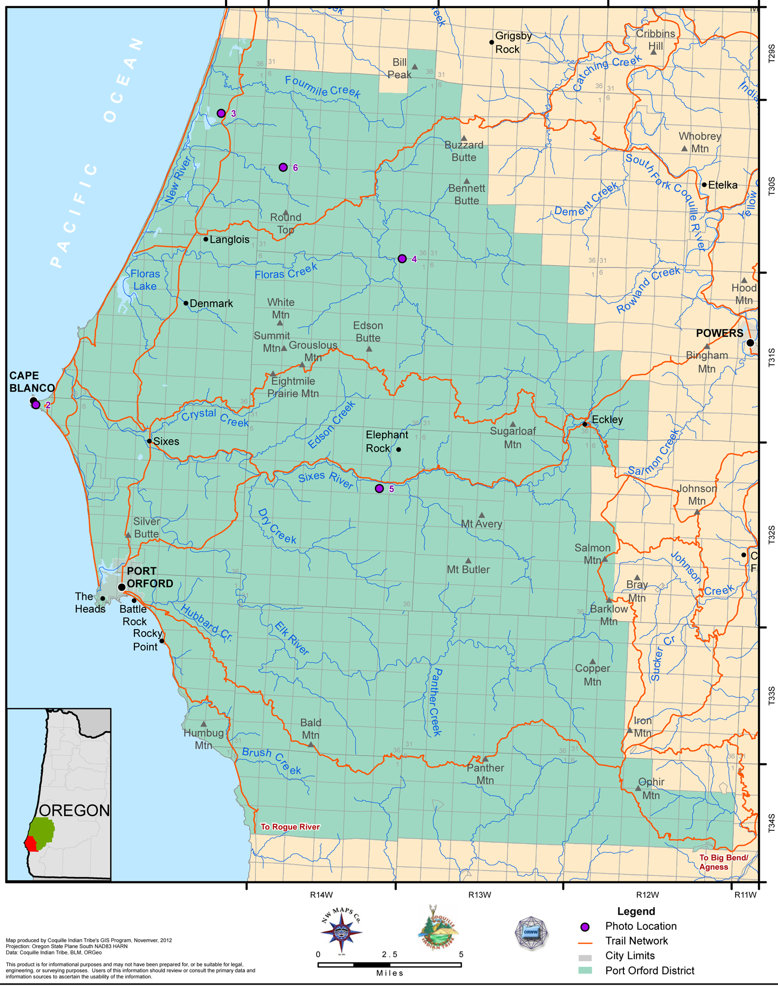
2012 Port Orford District |
Tsp. 34 S., Rng. 13 W.
General Land Office Survey Index
NOTE: THE INDEX MAP FOR THIS TOWNSHIP IS CURRENTLY UNAVAILABLE.
|
|
|
1935 GLO |
1955 Annotated USGS Port Orford |
2012 Port Orford District |
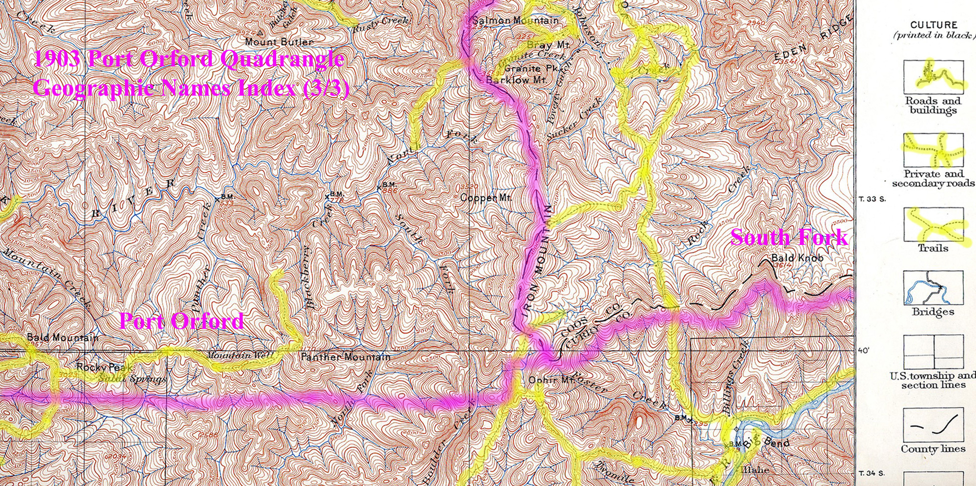
This township is entirely within the boundaries of the 2011-2012 Coquelle Trails Project. It includes Panther Mountain, Blackberry Creek and Elk River in the Port Orford Historical District. This survey was completed in 1933, and mapped in 1935 (Rigby 1928).
![]()