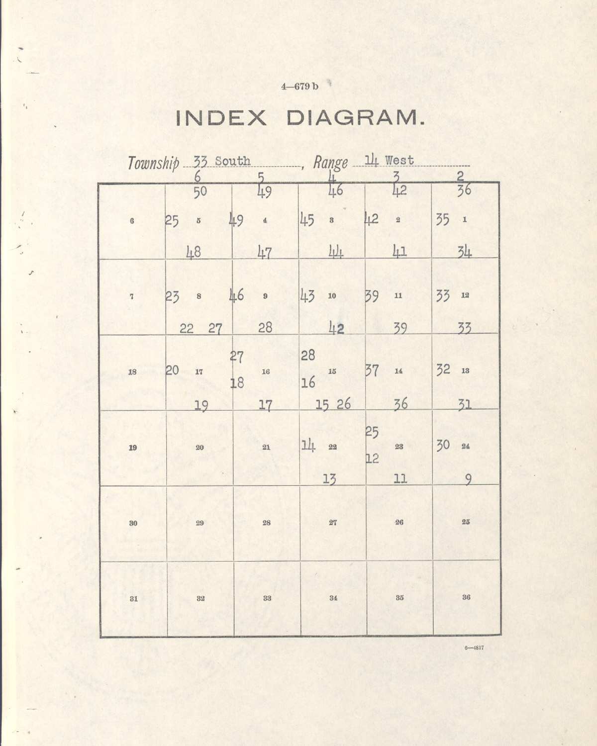
Tsp. 33 S., Rng. 14 W.
General Land Office Survey Index
NOTE: THIS INDEX MAP DOES NOT CONFORM TO THE PAGE NUMBERS IN THE TABLE.
 |
 |
 |
 |
1900 GLO |
1935 GLO |
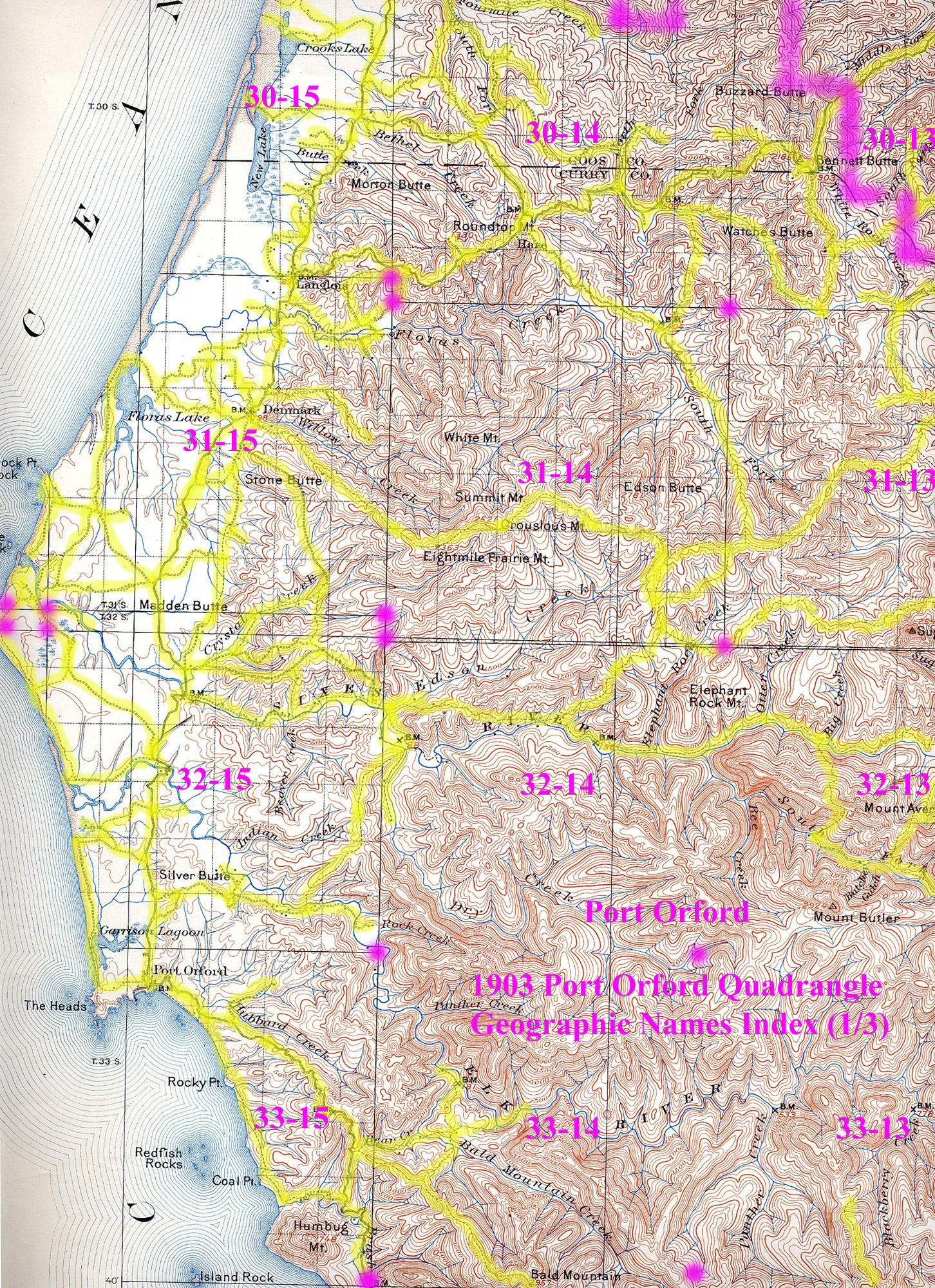
1903 Annotated USGS Port Orford |
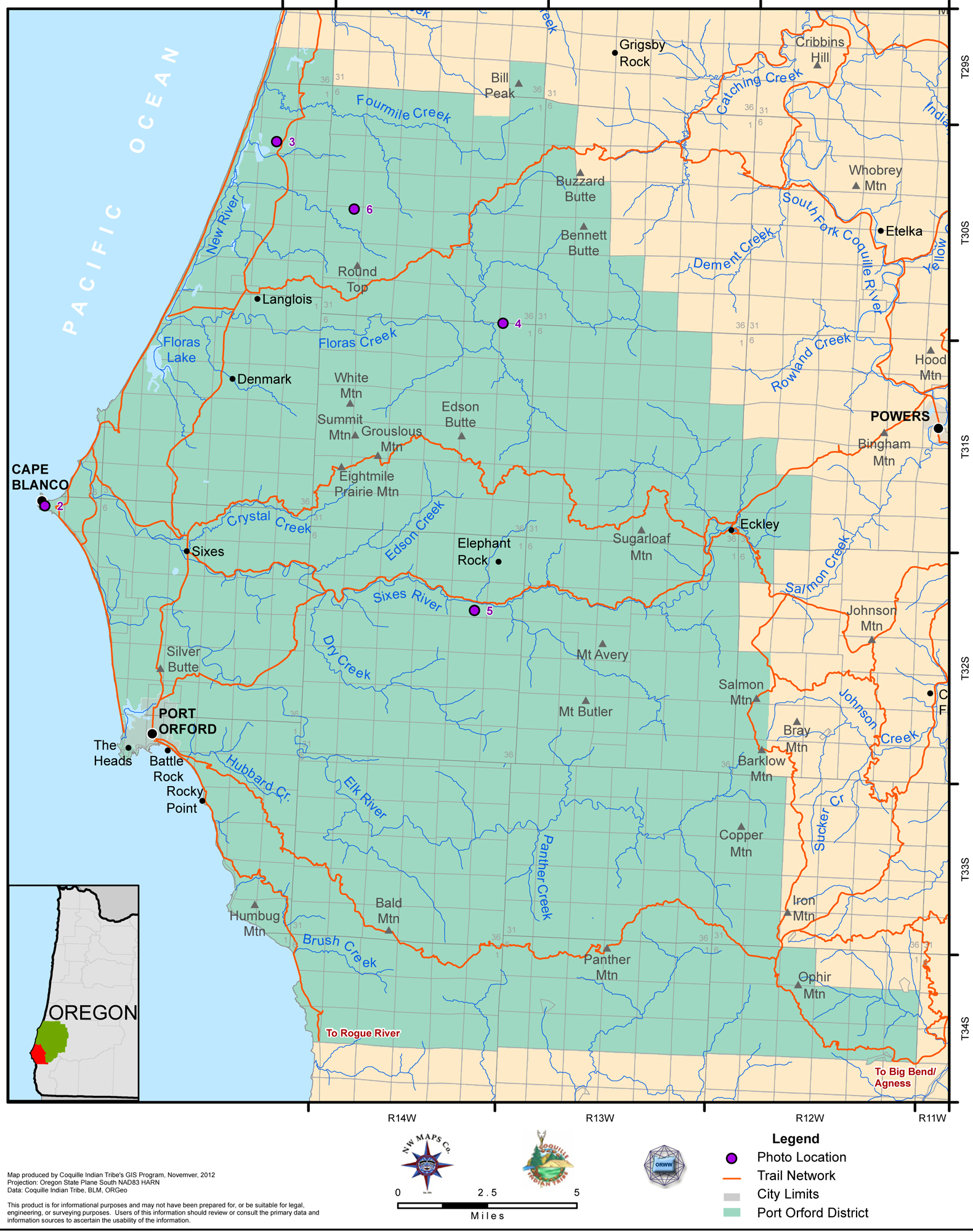
2012 Port Orford District |
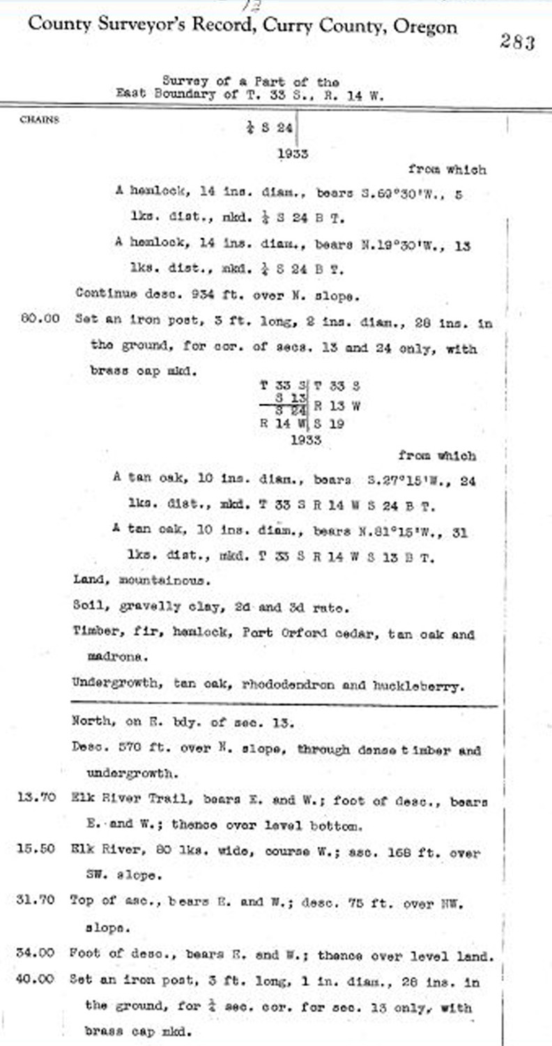
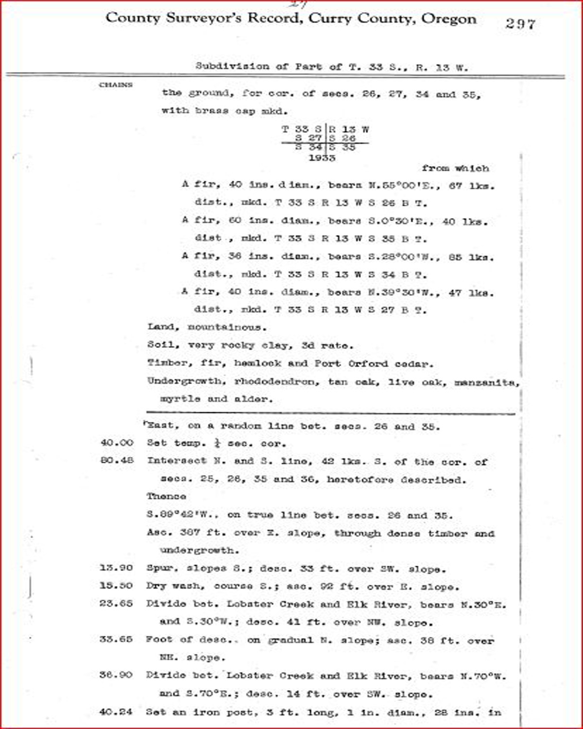
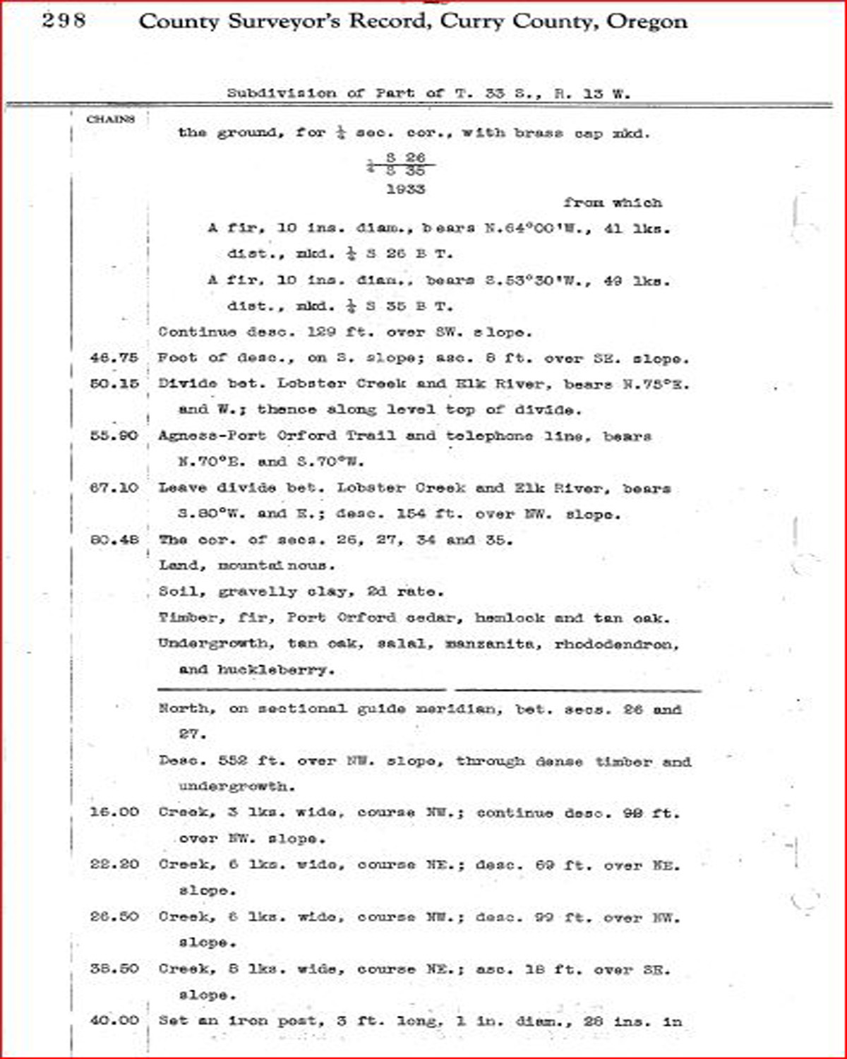
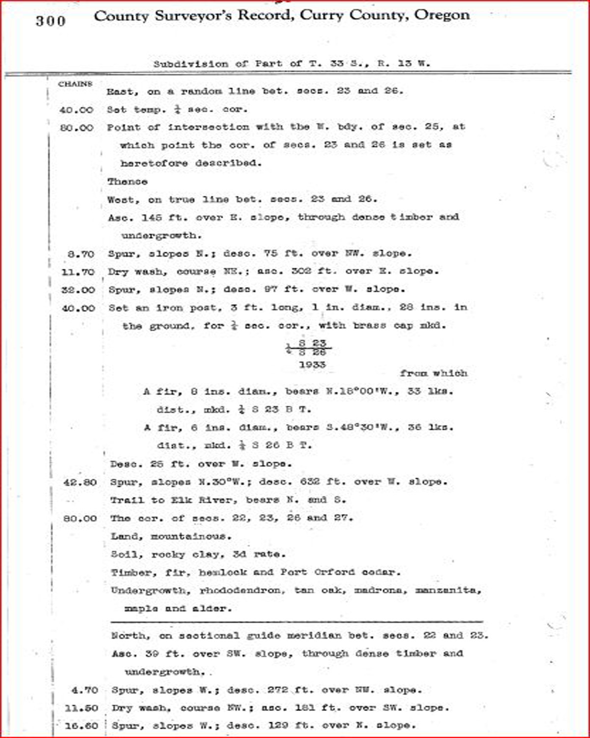
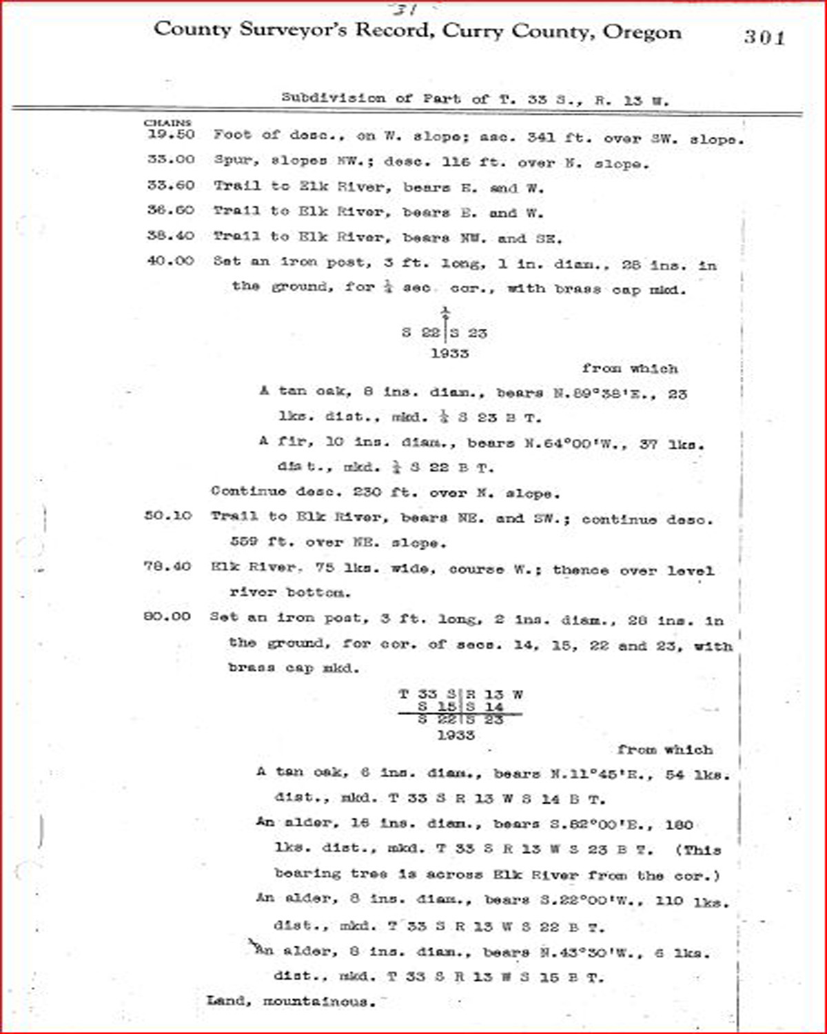
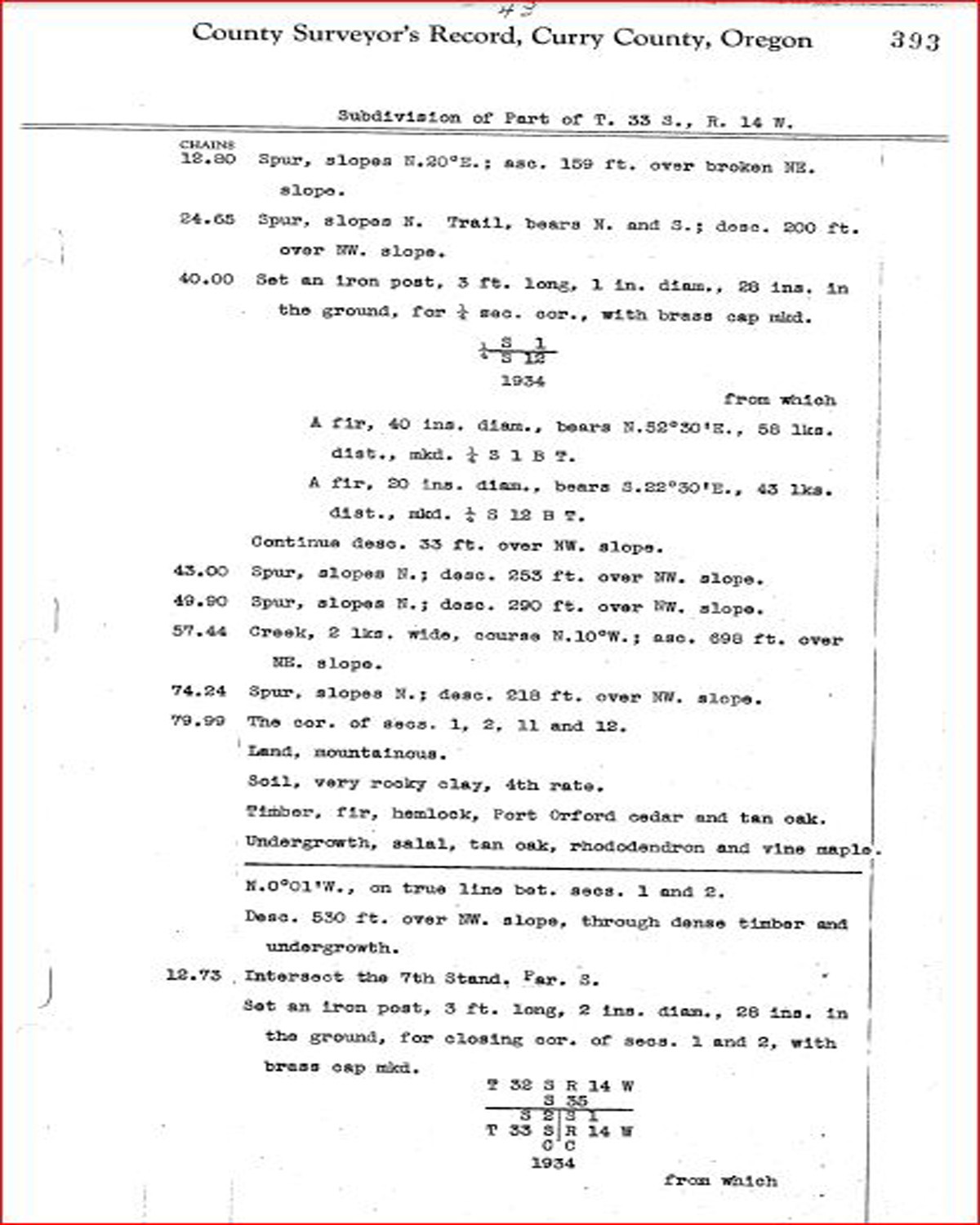
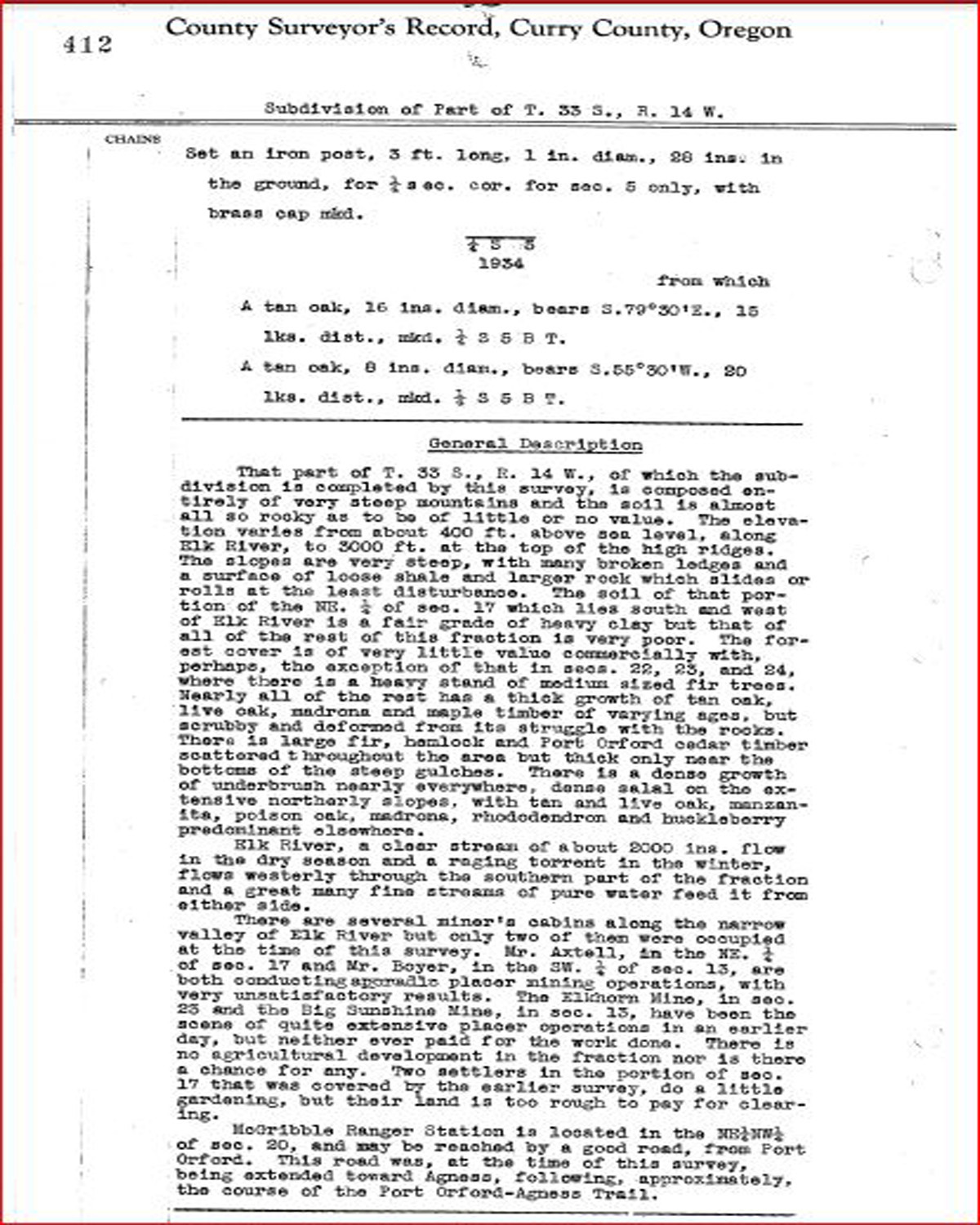
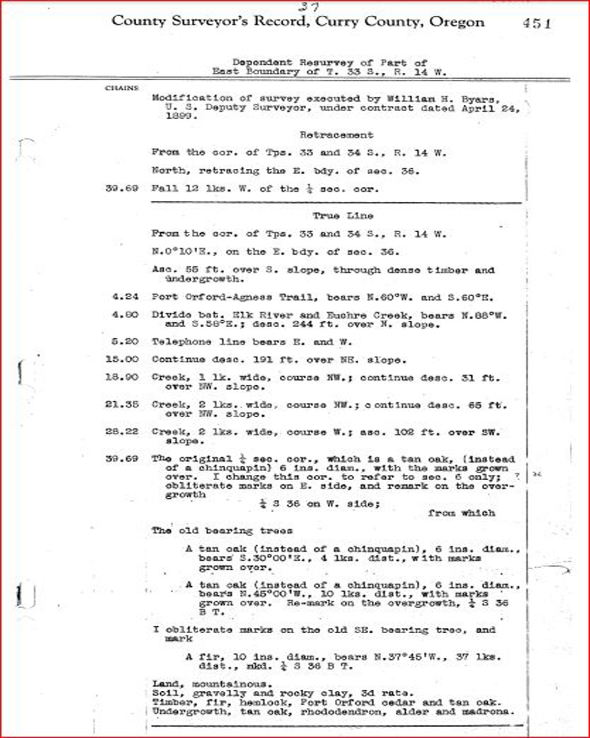
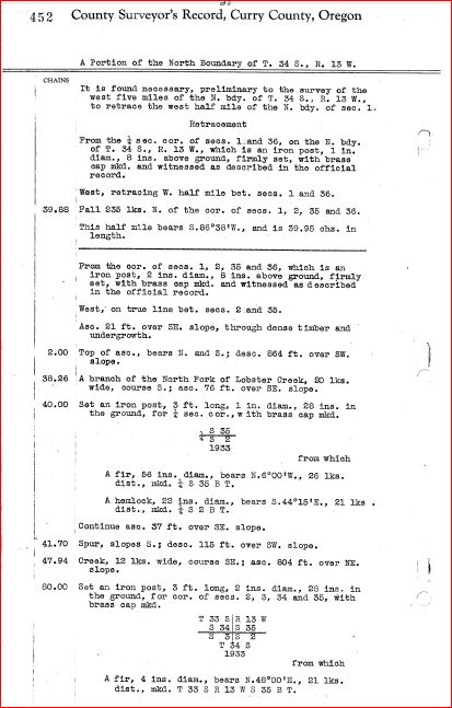
This township is entirely within the boundaries of the 2011-2012 Coquelle Trails Project. It includes China Mountain, Bald Mountain Creek and Elk River in the Port Orford Historical District. This survey was completed in 1857, 1875, 1882, 1891, 1898, 1900 and 1934 and mapped in 1900 and 1935 (Murphy & Murphy 1857; Colbrook 1874; Wright 1882; Moore 1891; Wilkes & Wilkes 1898; Byars 1899; Rigby 1928).
![]()