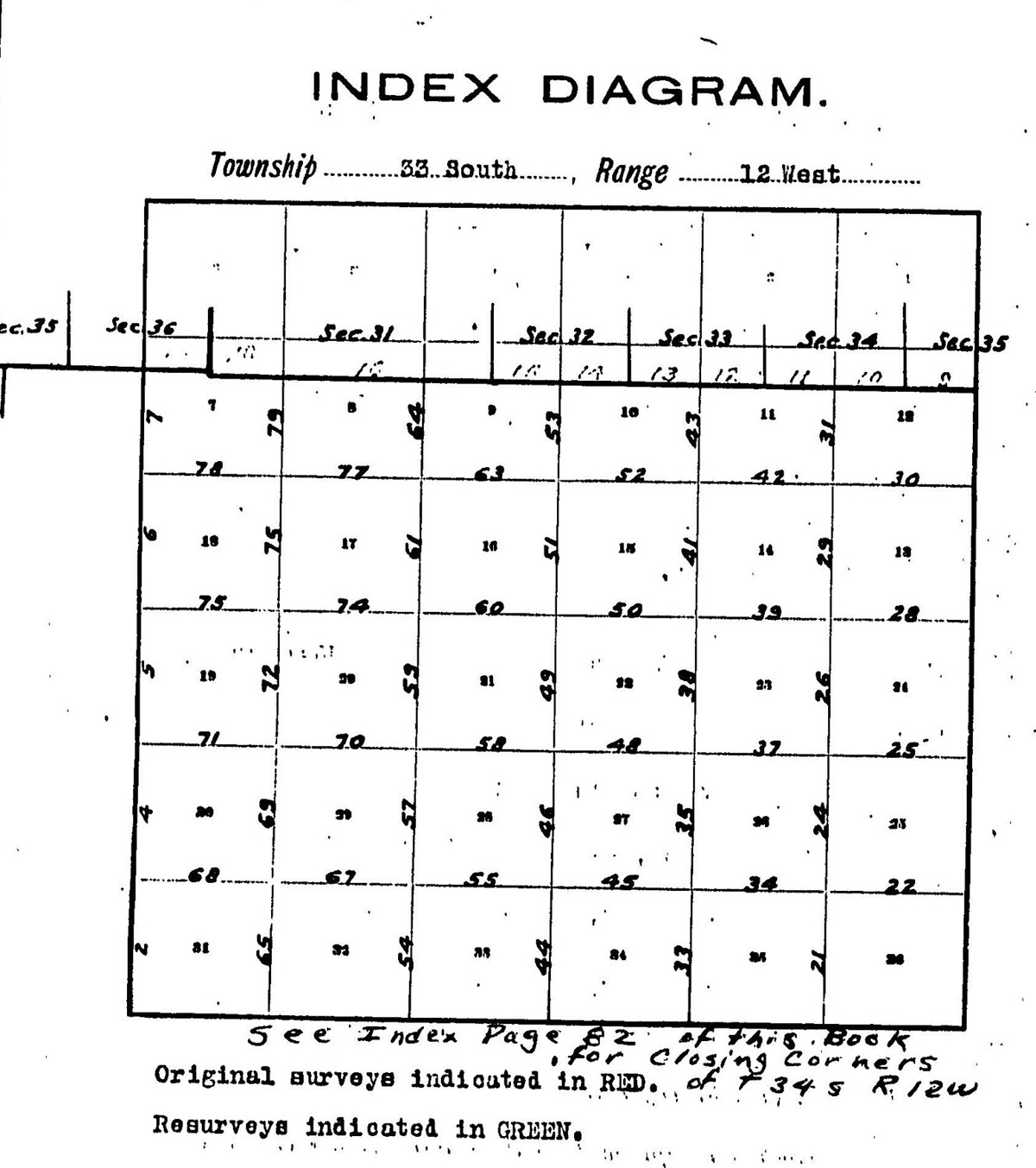
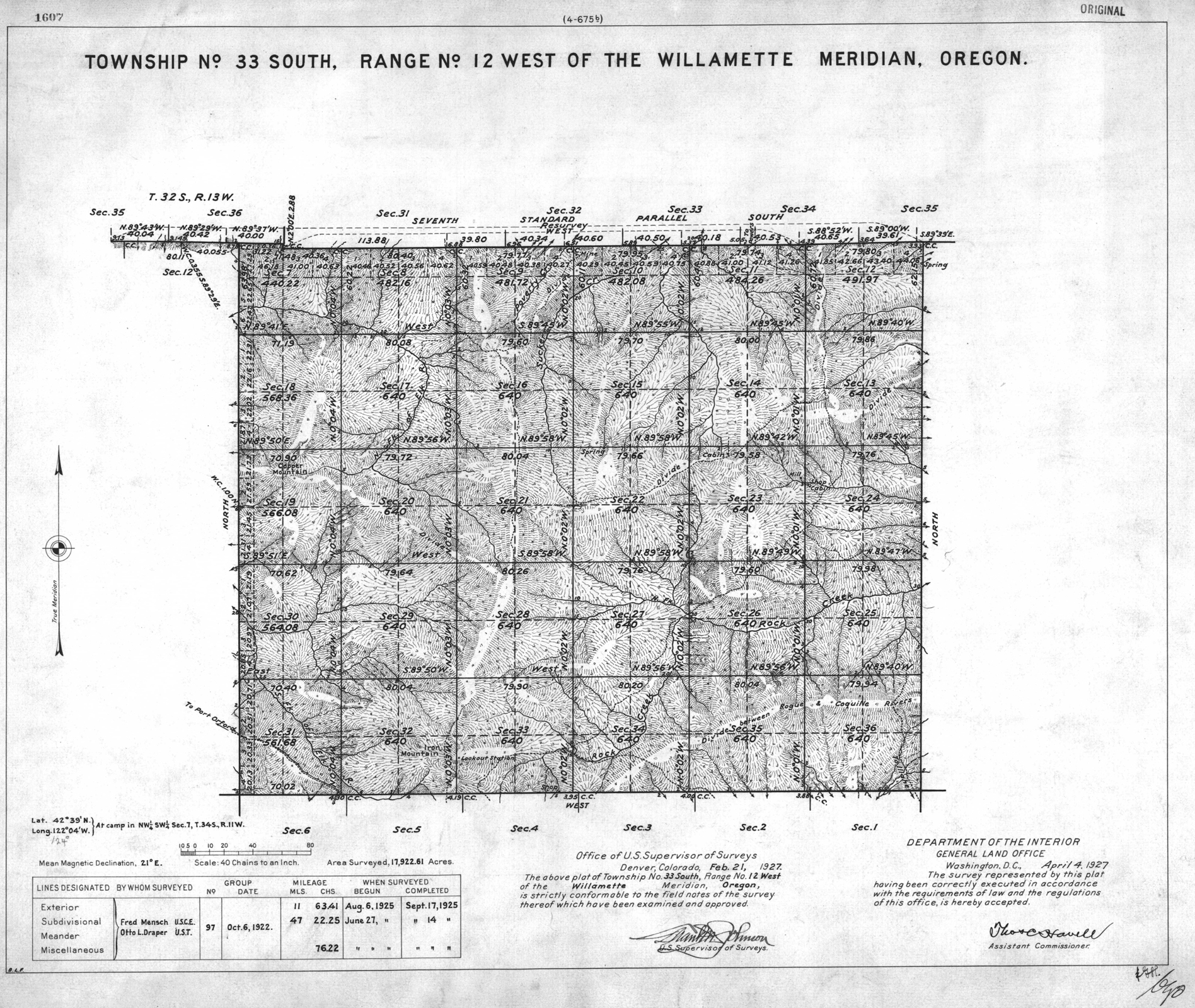
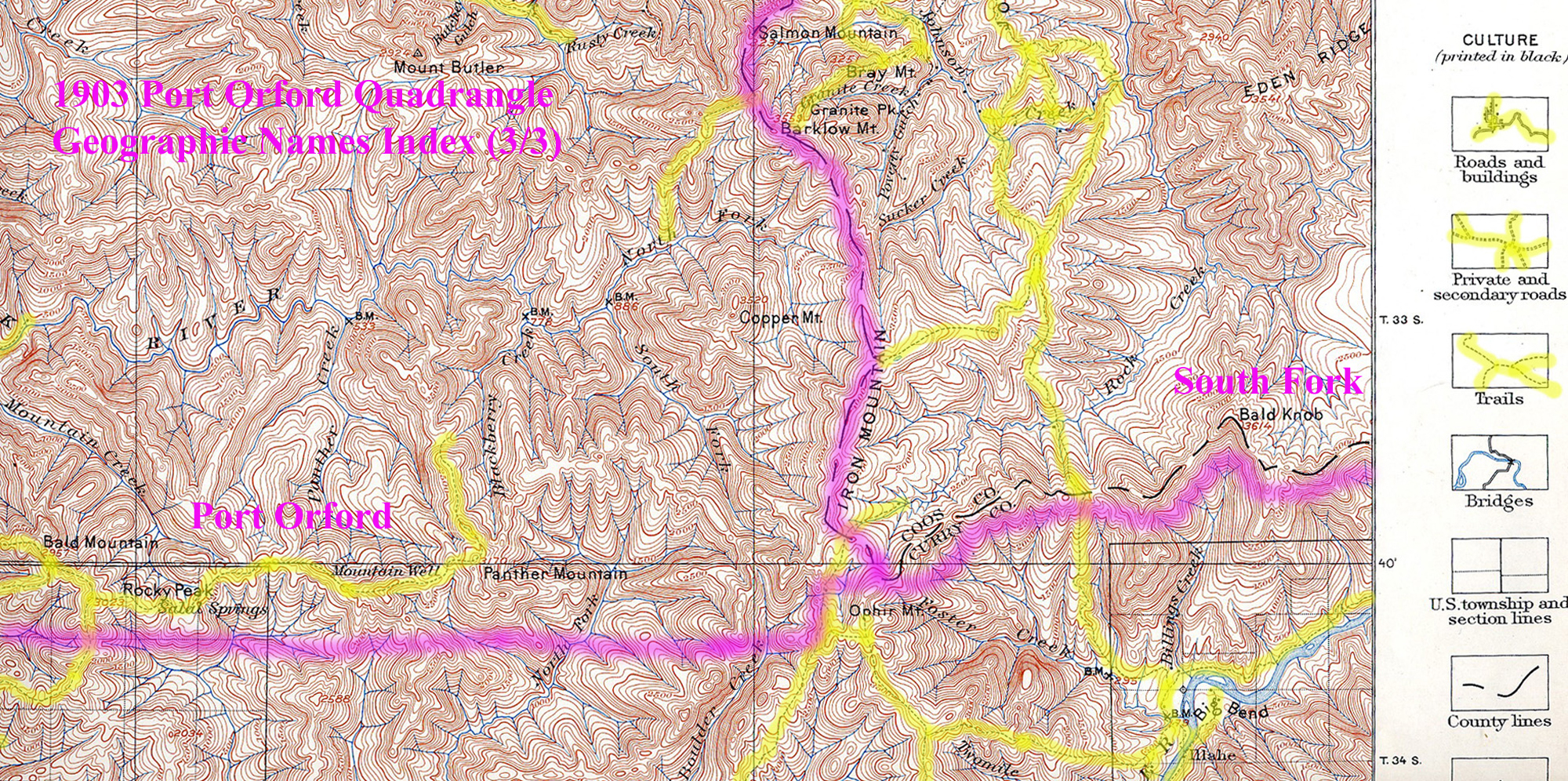
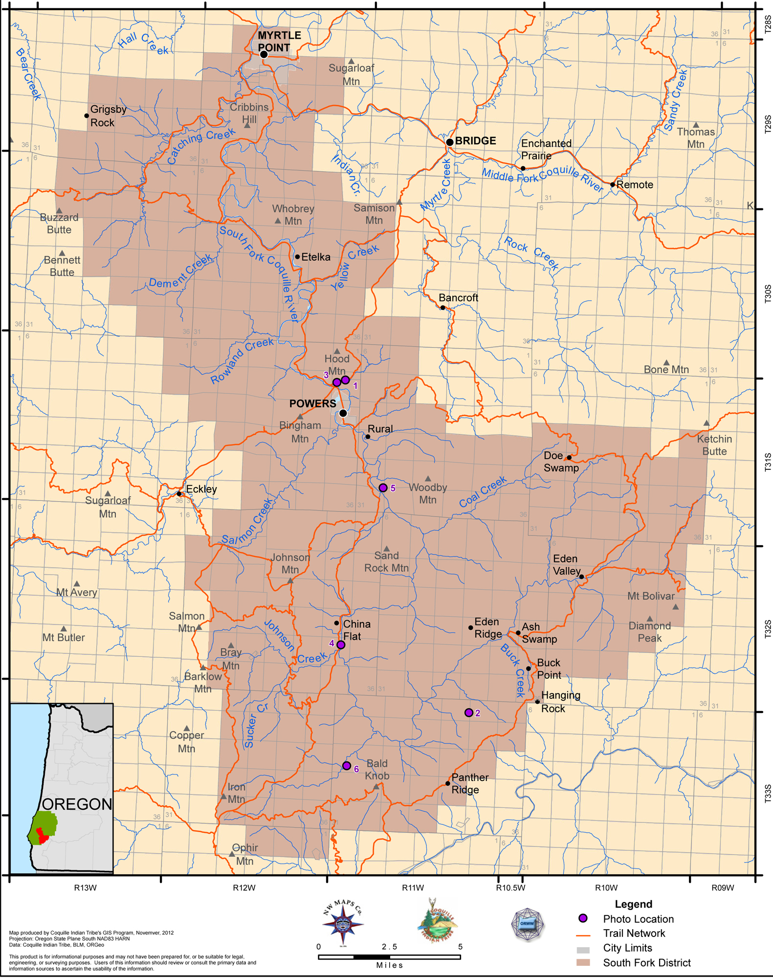
Tsp. 33 S., Rng. 12 W.
General Land Office Survey Index
 |
 |
 |
 |
1927 GLO |
1903 Annotated USGS Port Orford |
2012 South Fork District |
2012 Port Orford District |
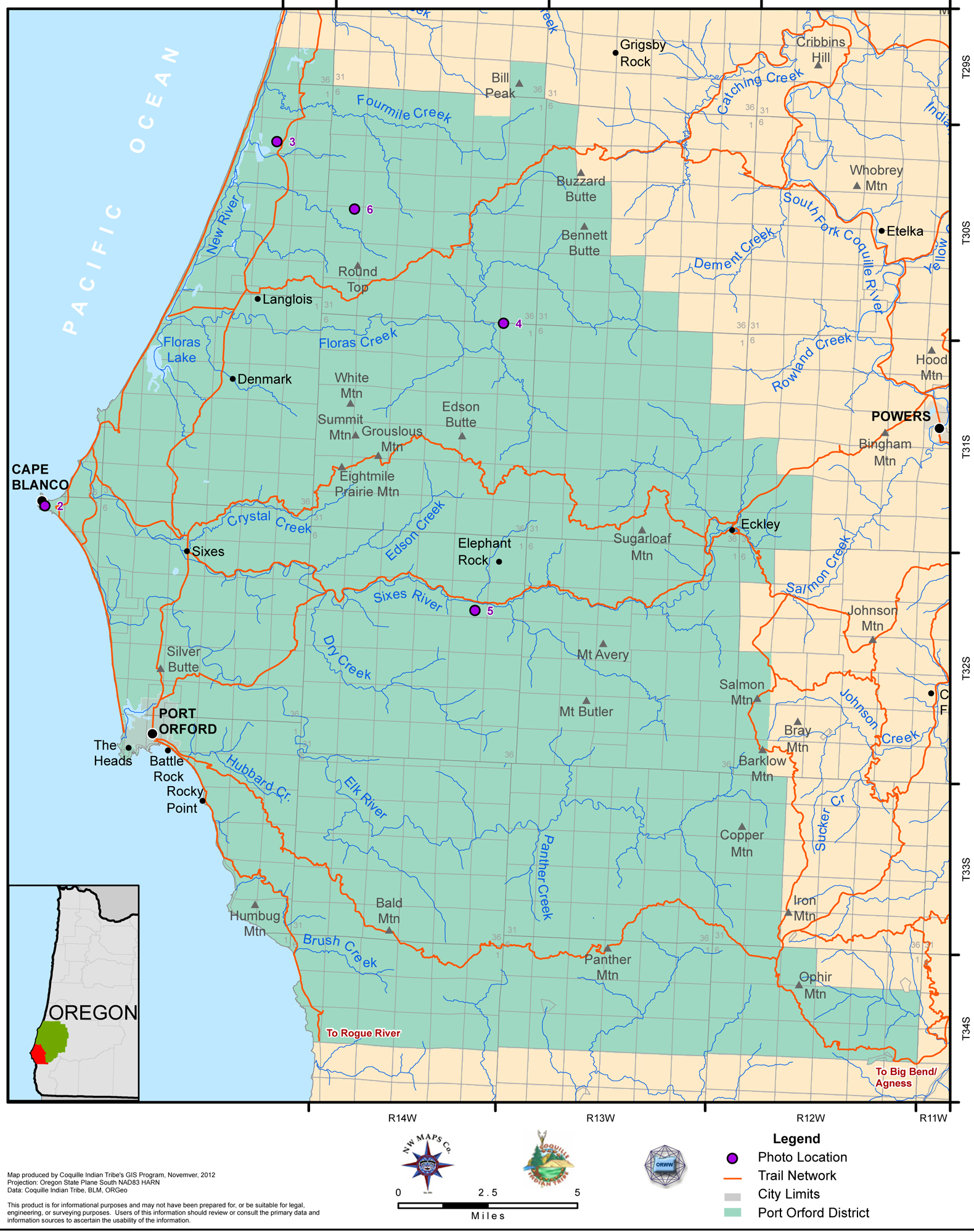
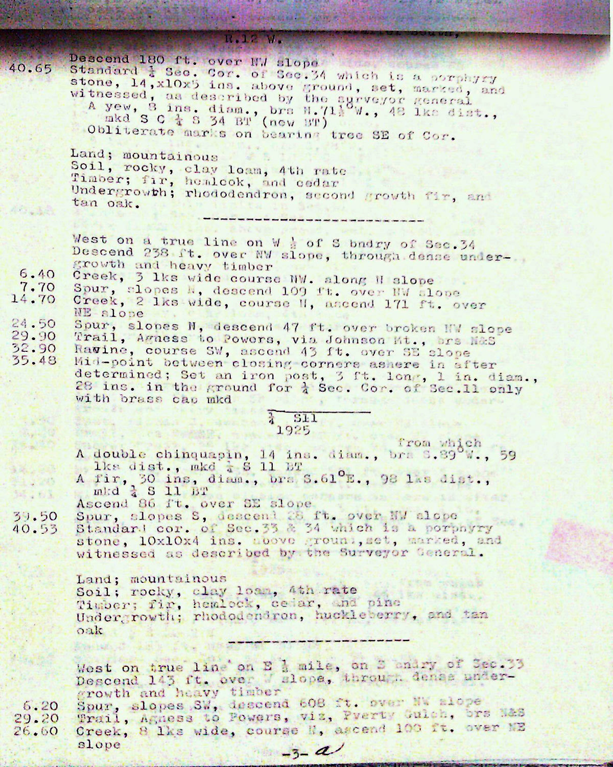
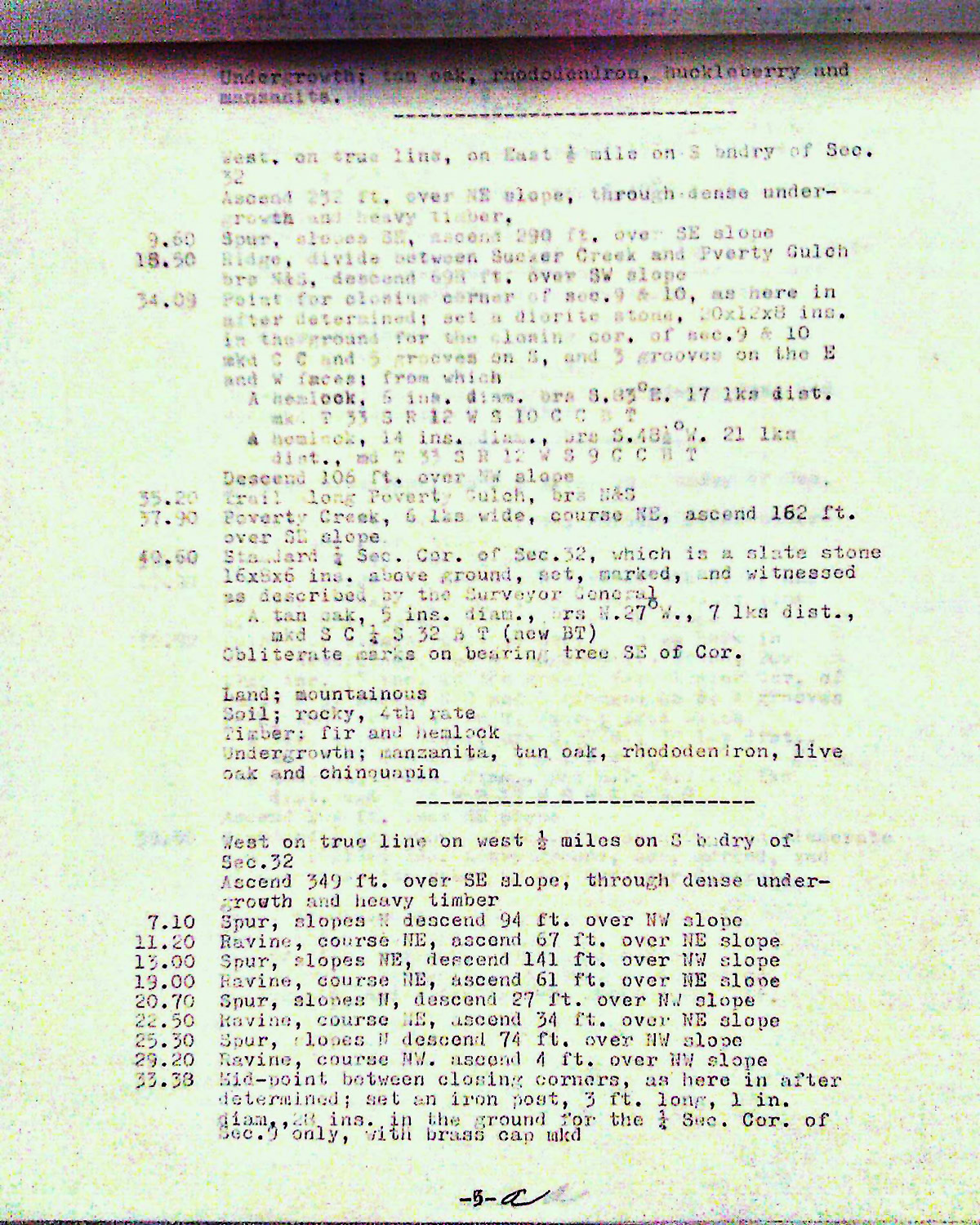
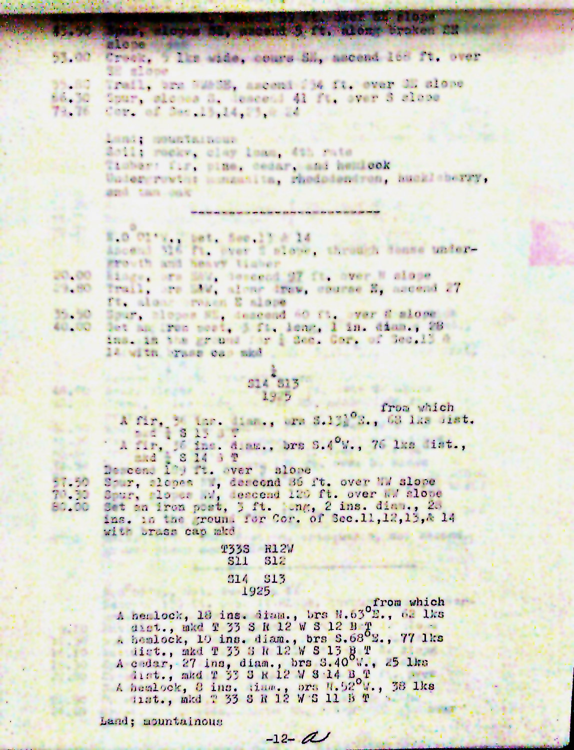
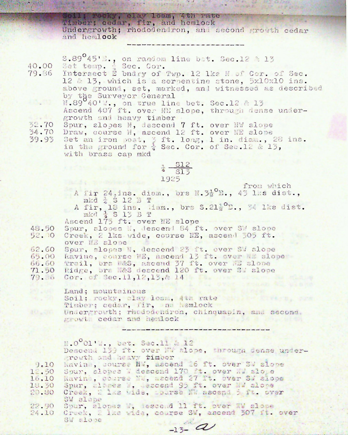
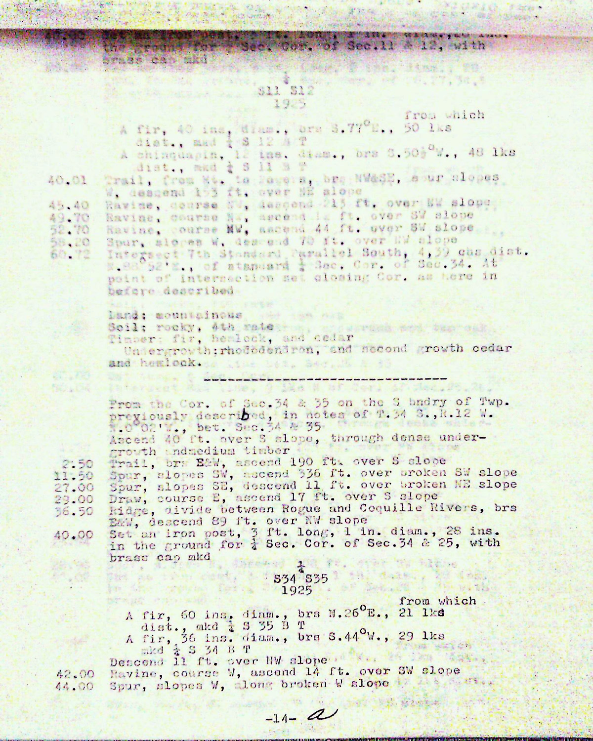
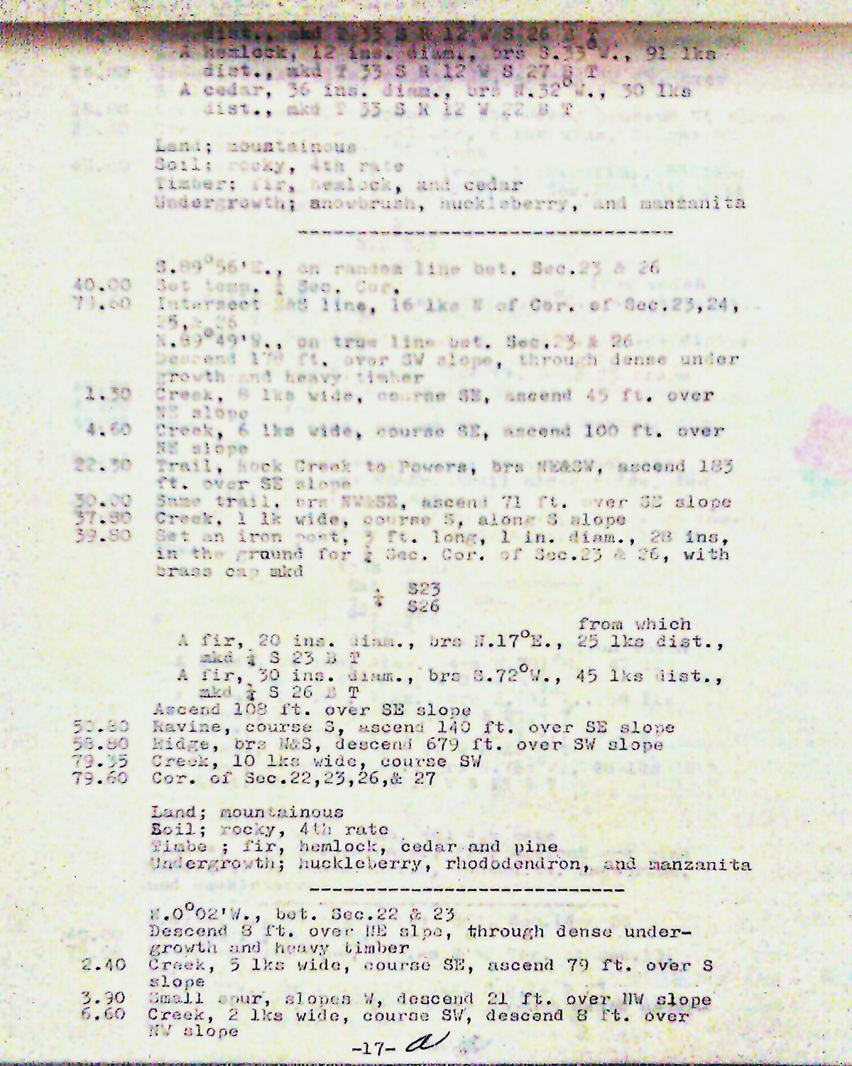
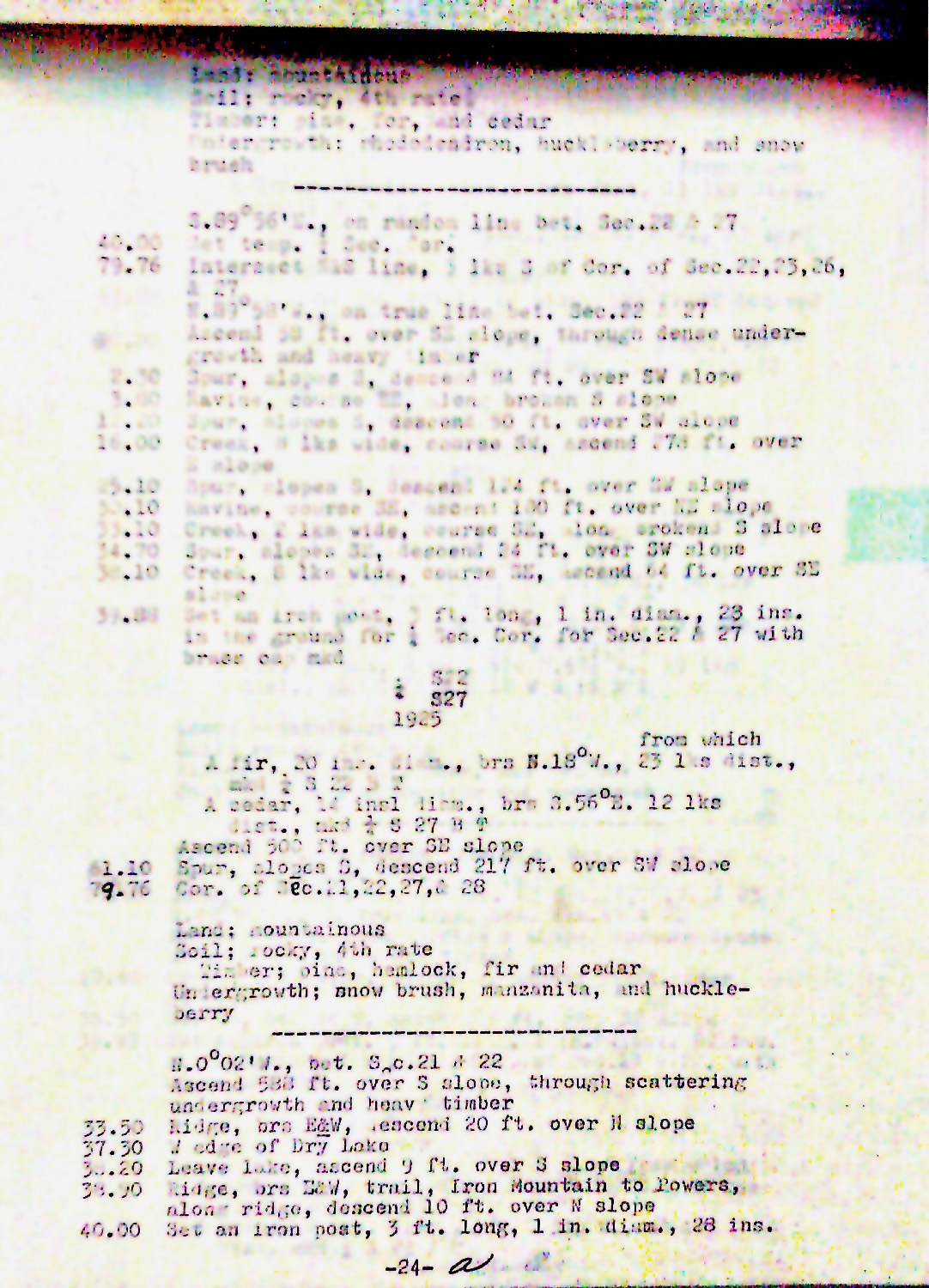
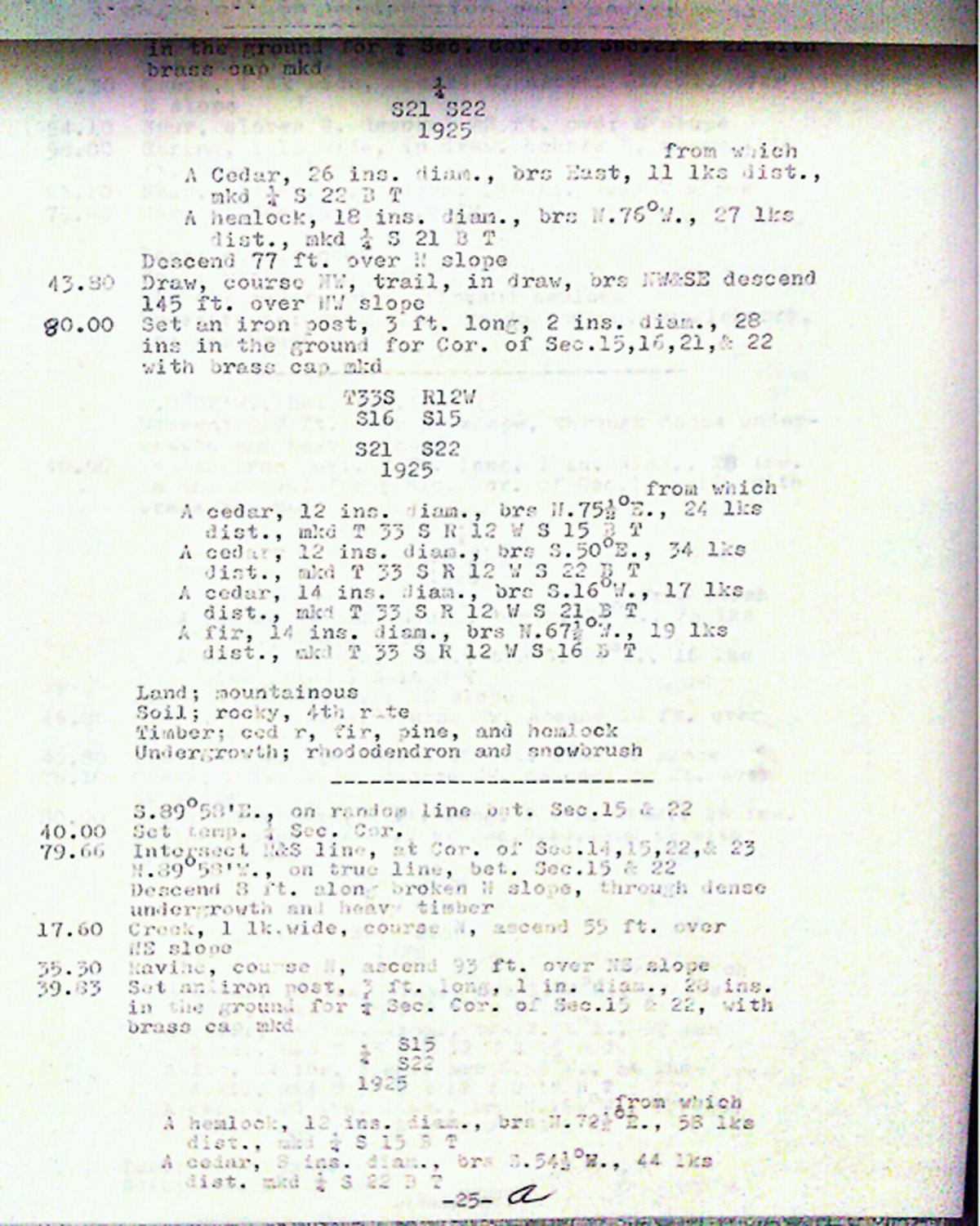
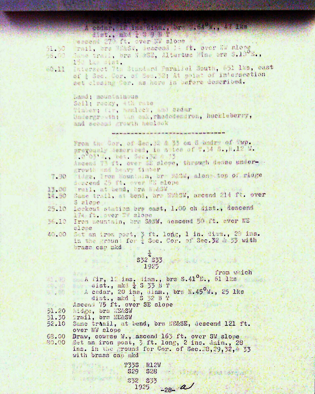
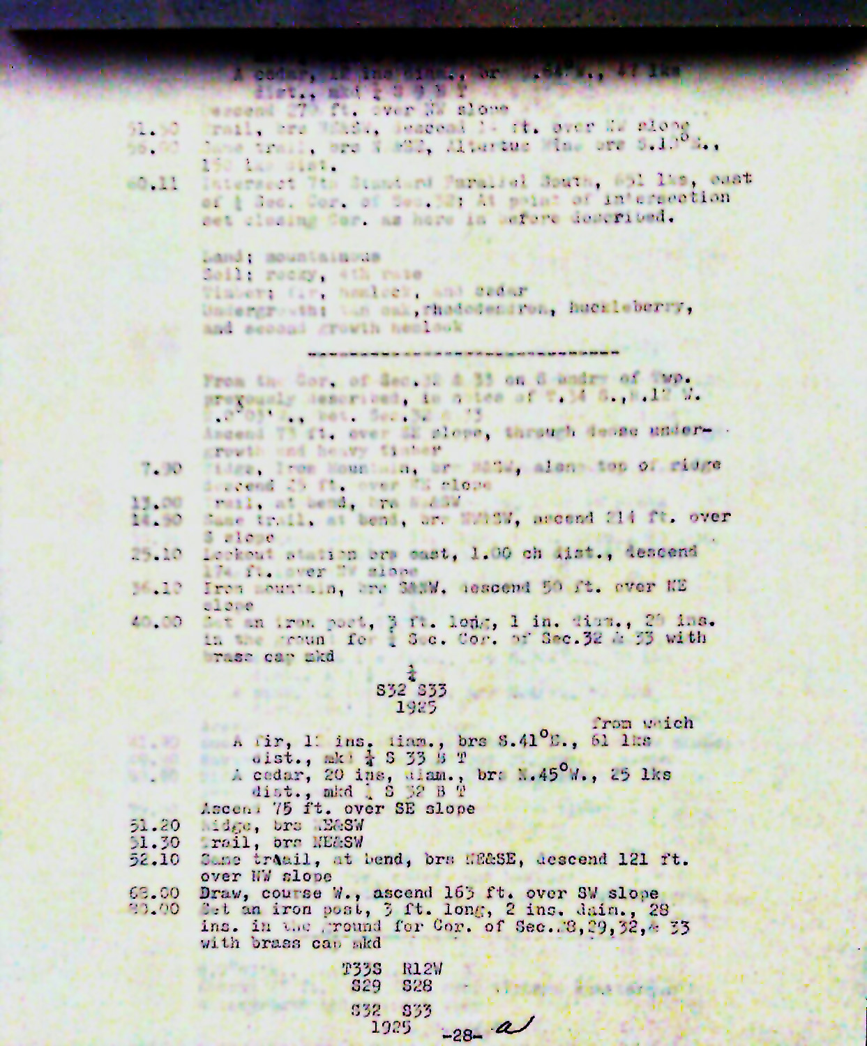
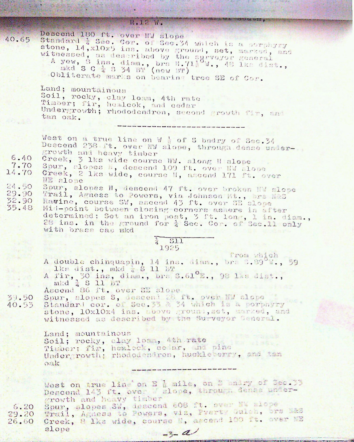
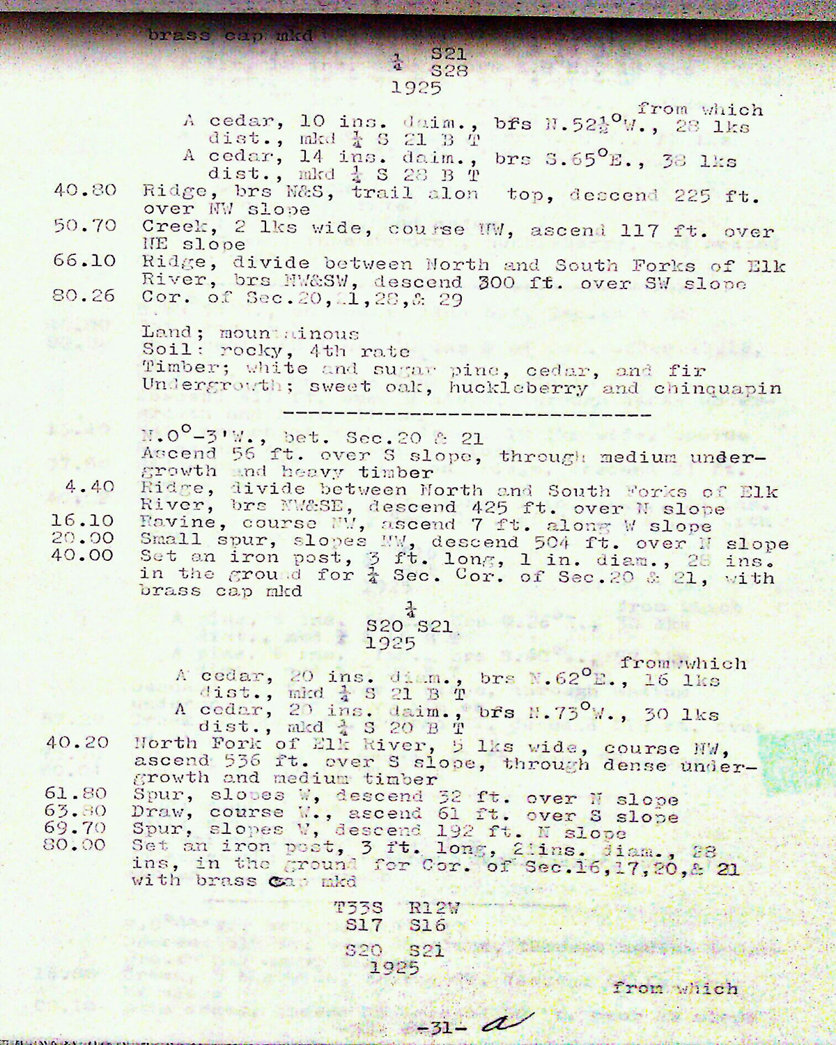
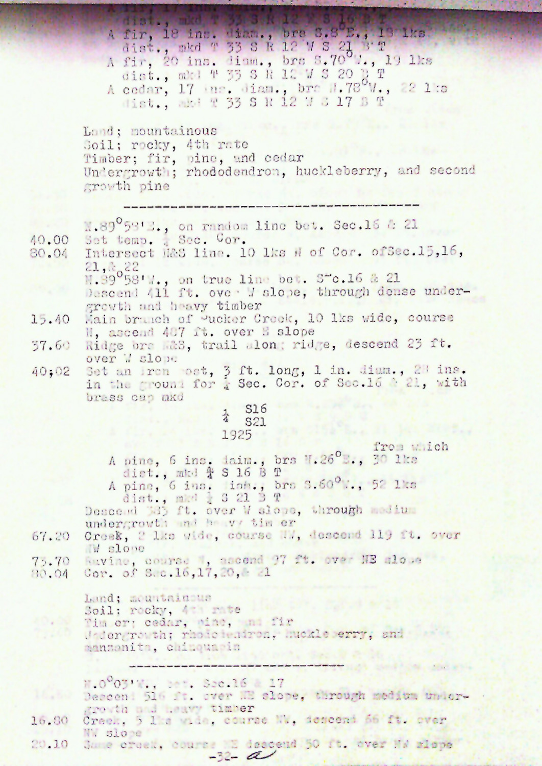
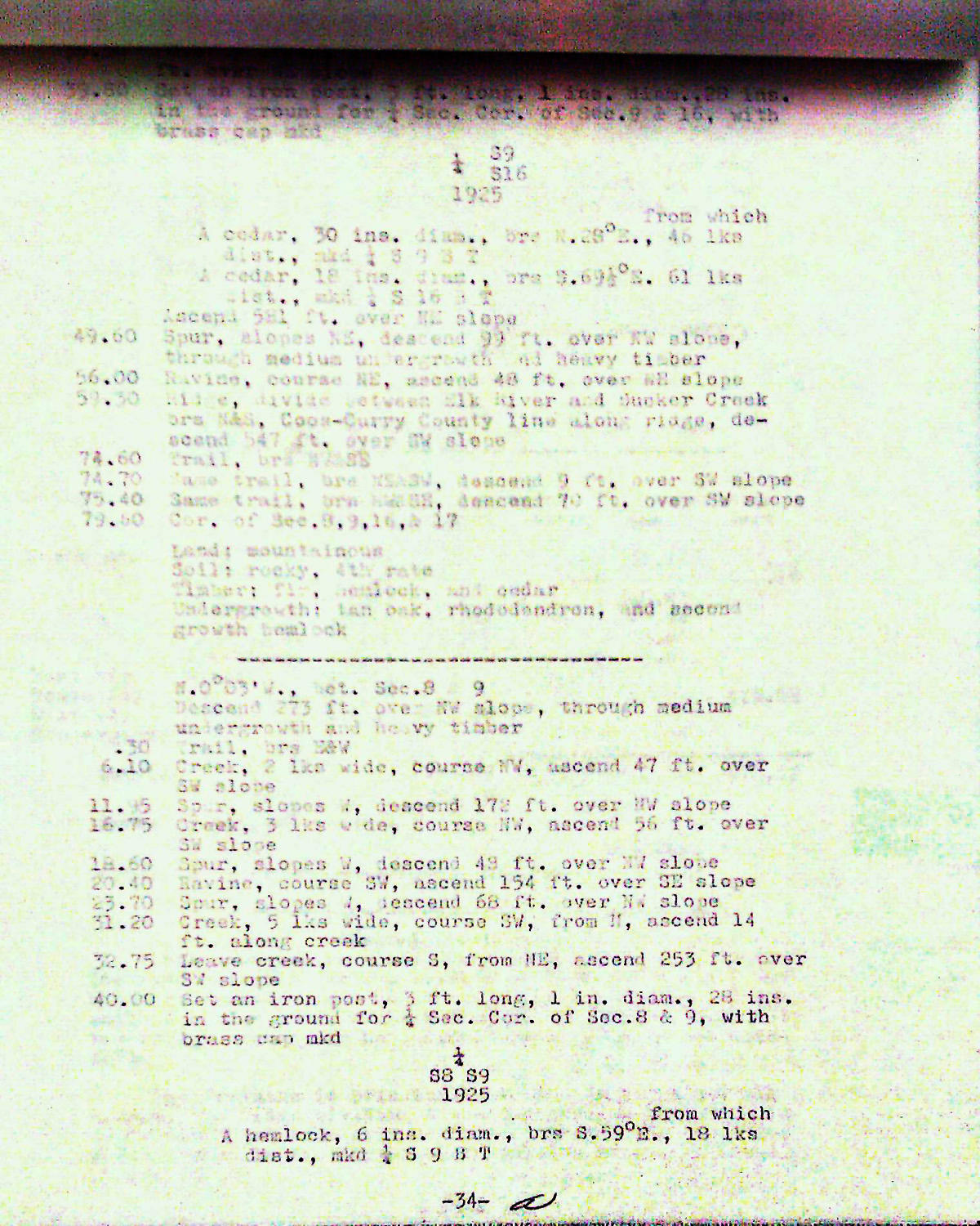
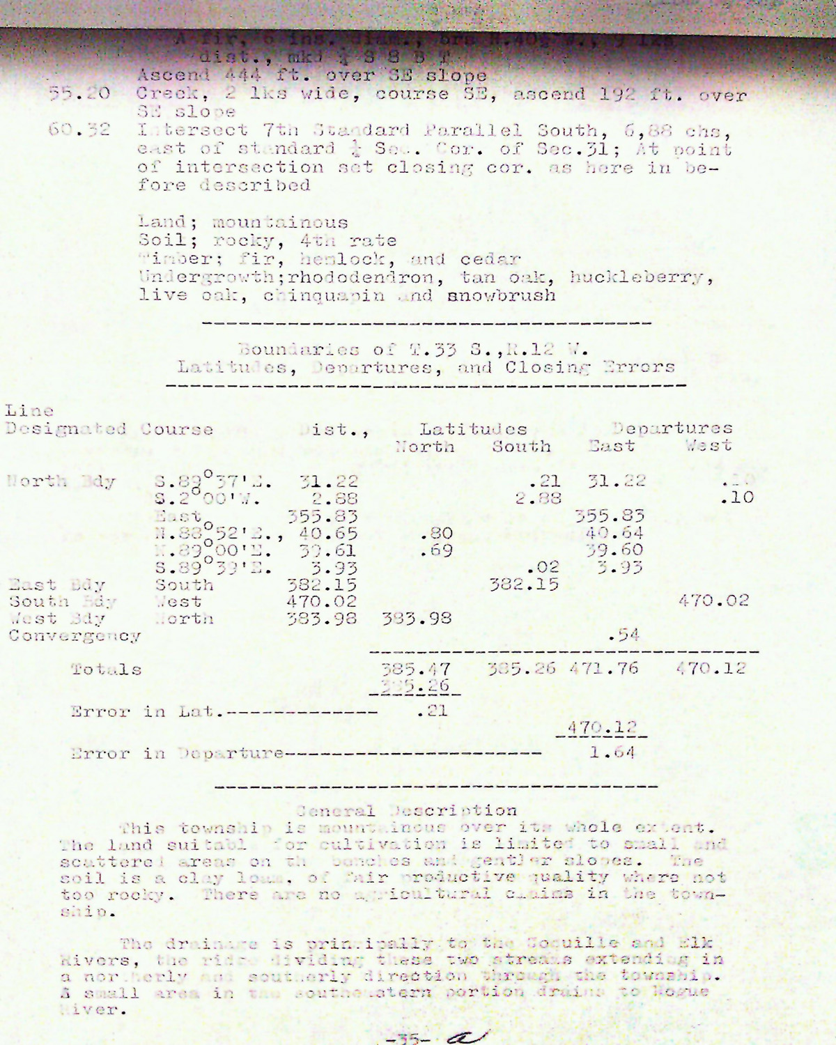
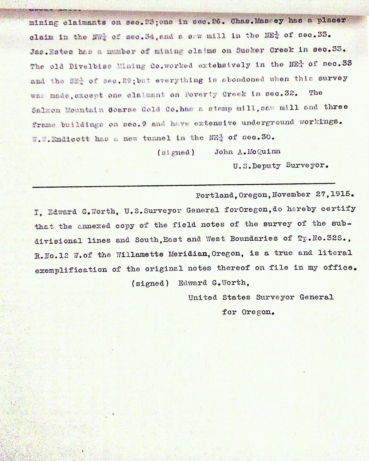
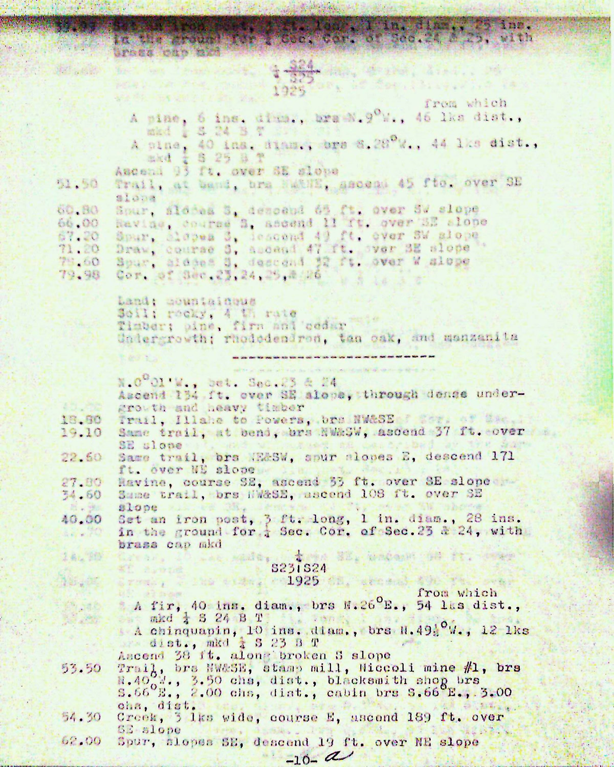
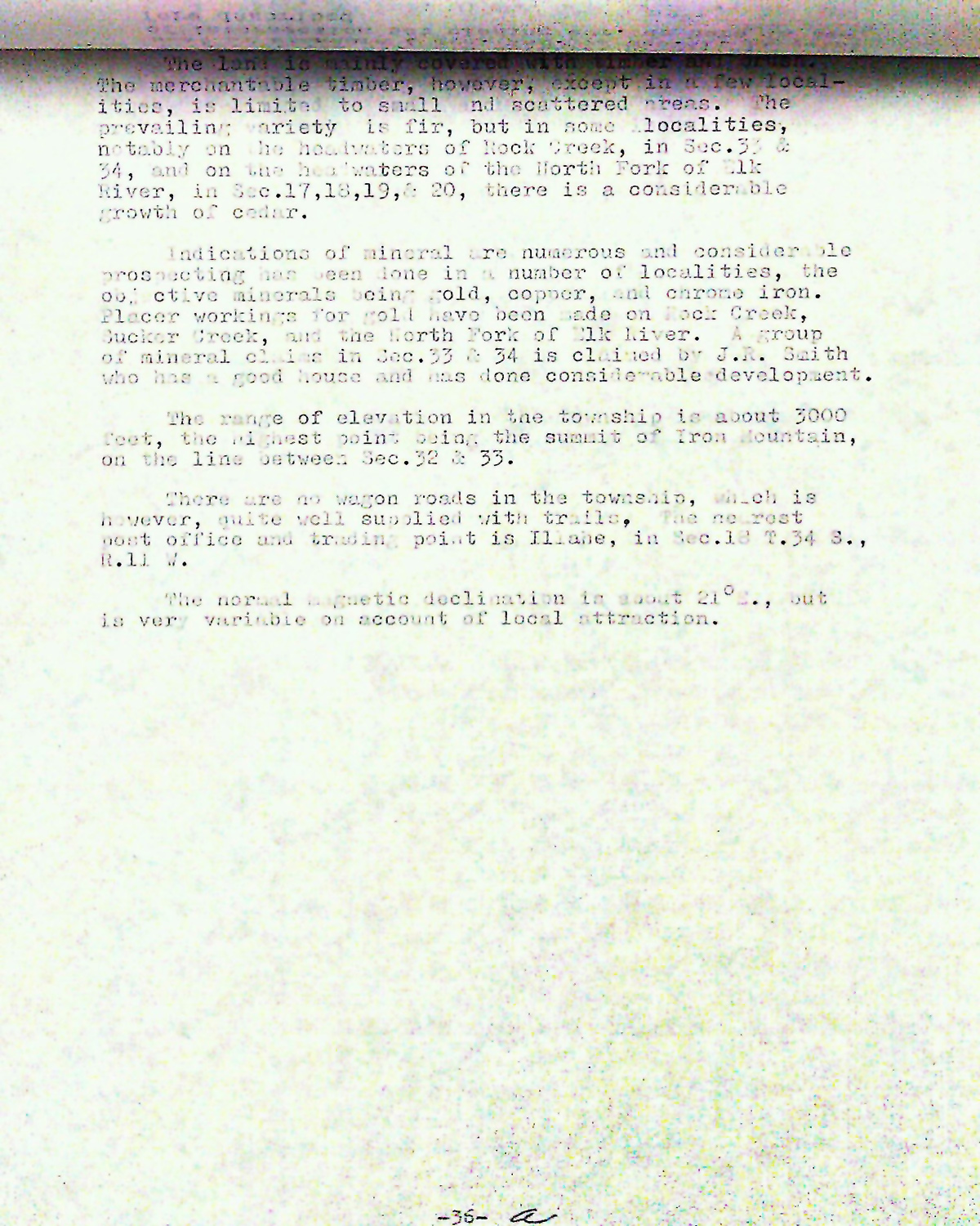
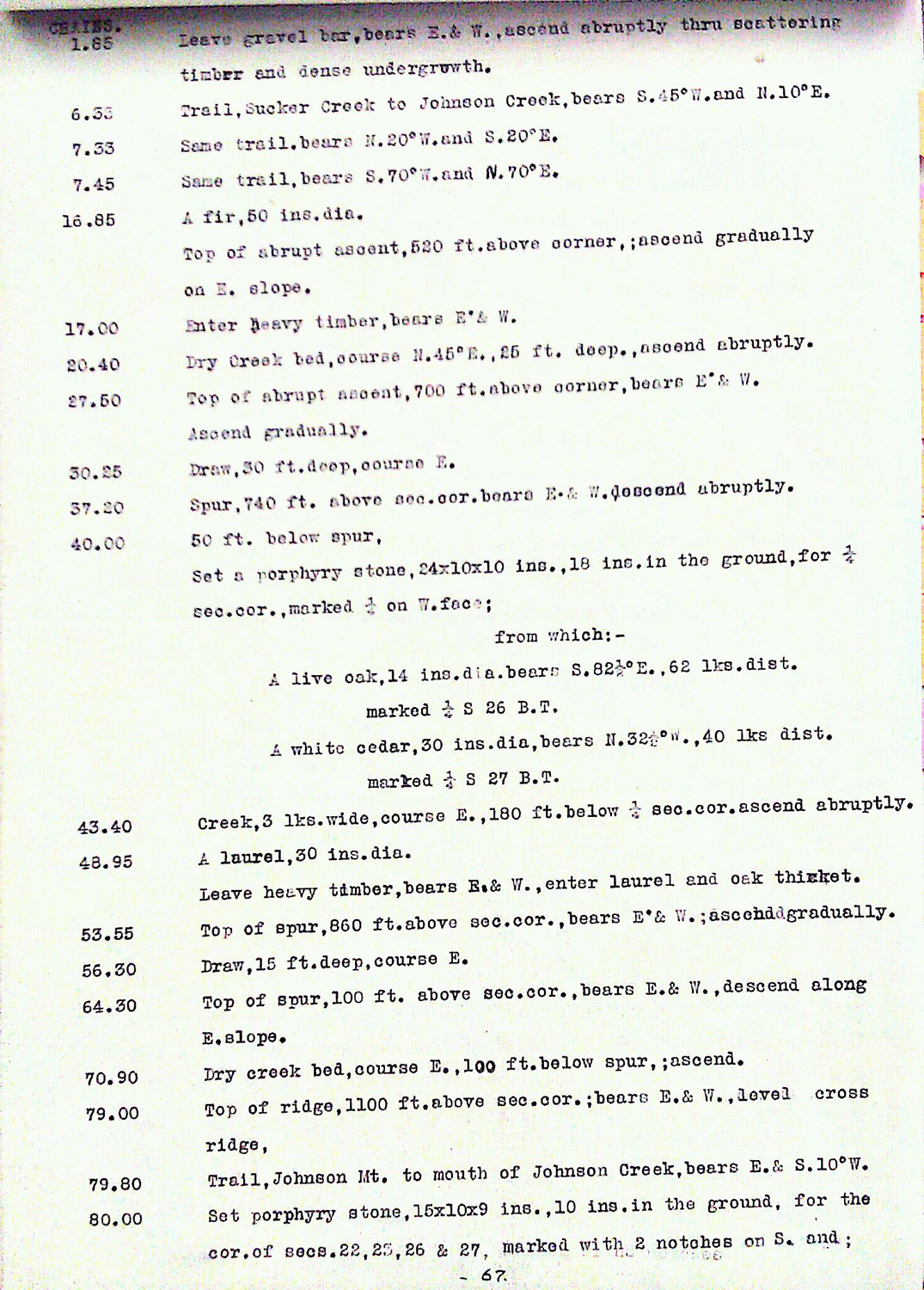
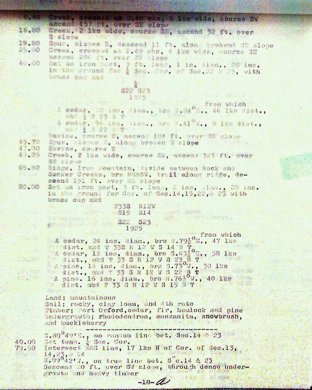
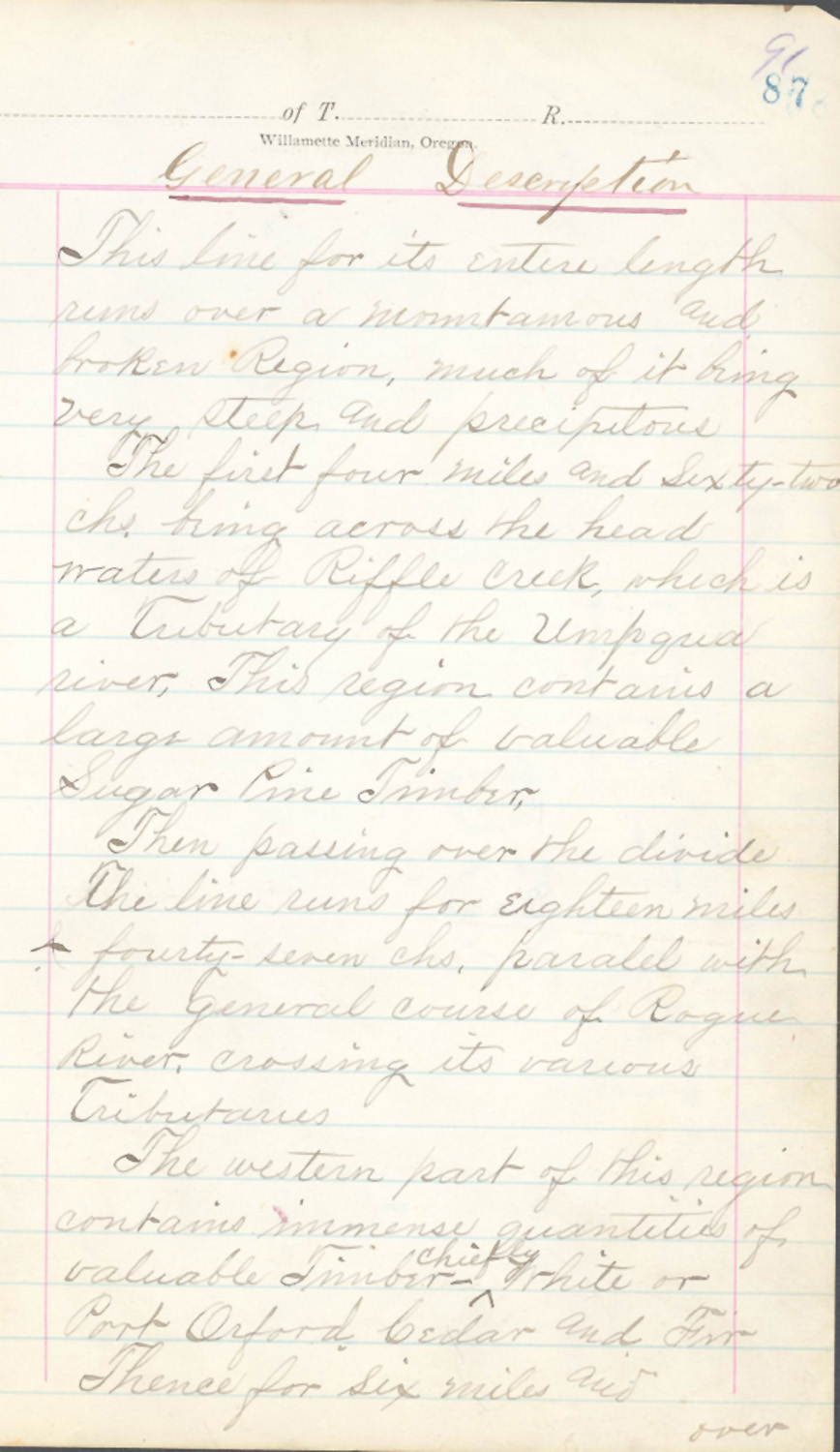
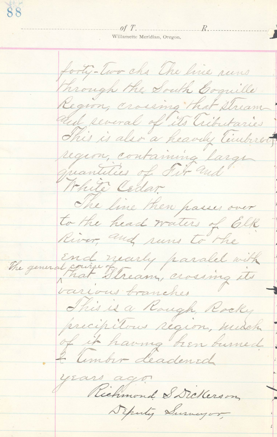
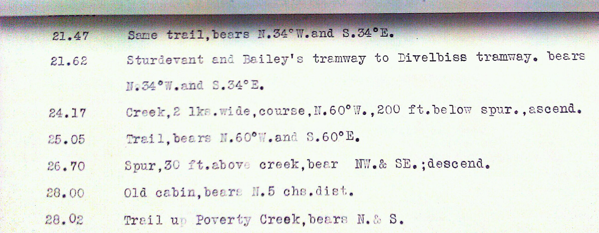
This township is entirely within the boundaries of the 2011-2012 Coquelle Trails Project. It includes Agness Pass, Rock Creek and Coquille River in the South Fork and Port Orford Historical Districts. This survey was completed in 1925 and mapped in 1927 (Mensch & Draper 1922).
![]()