 |
 |
 |
 |
 |
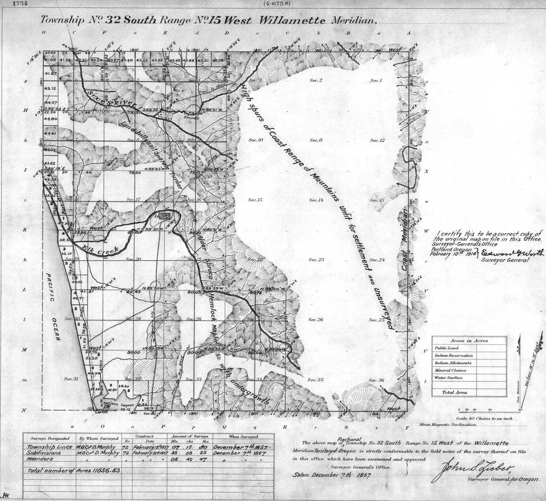
1857 GLO |
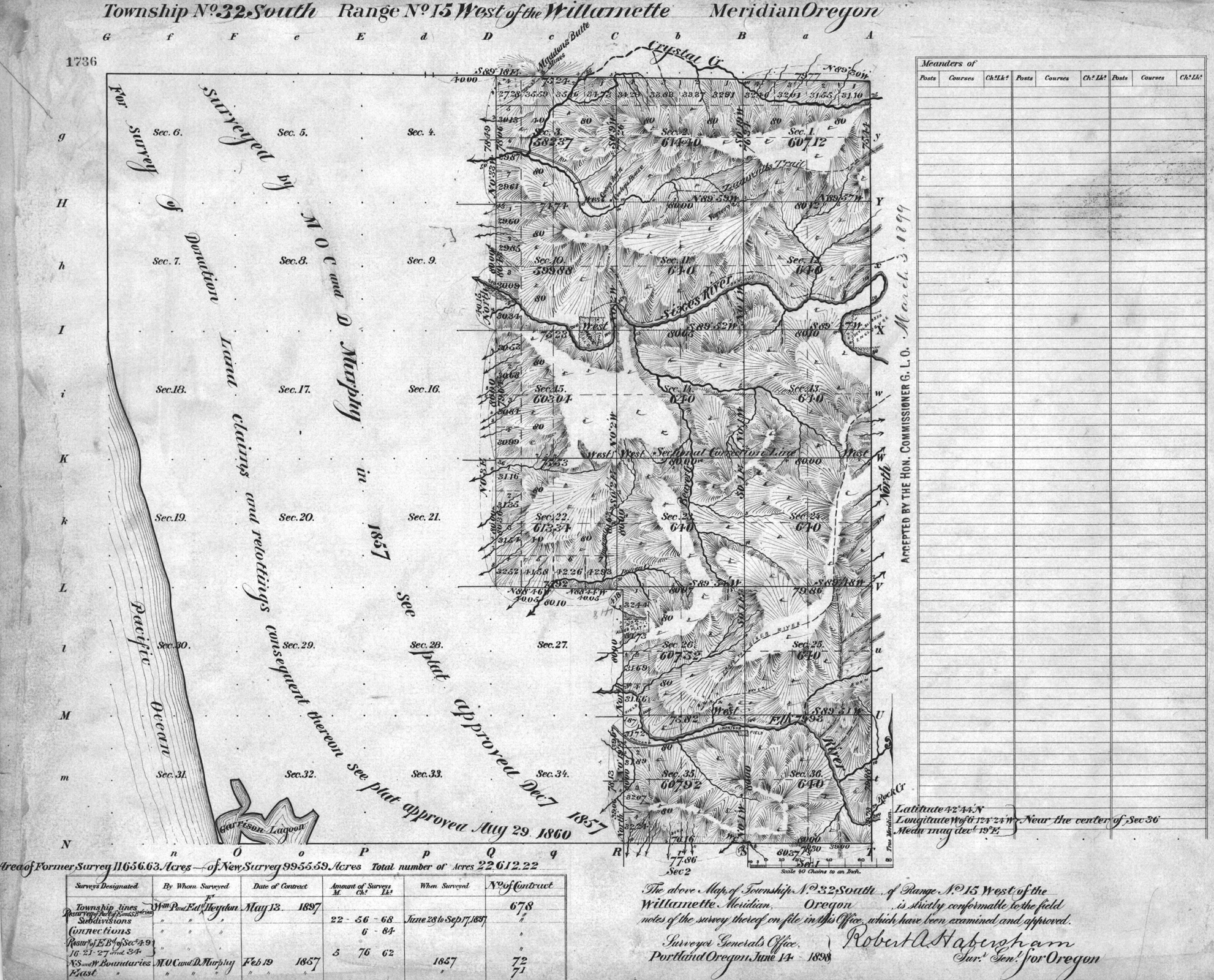
1898 GLO |
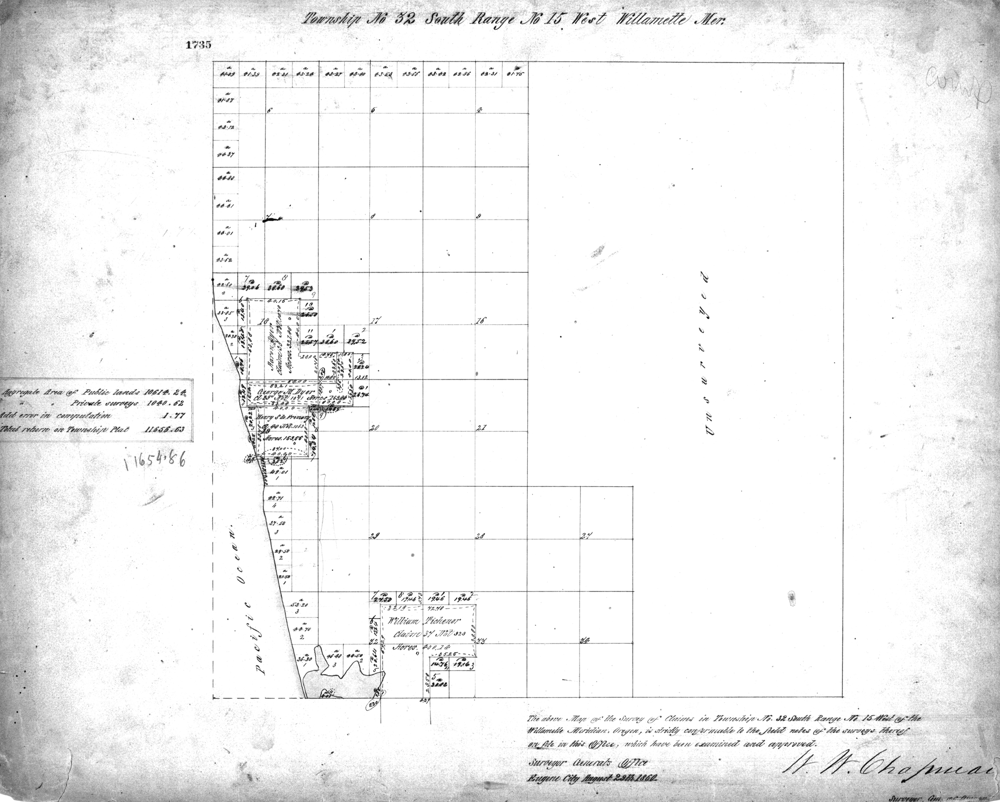
1960 DLC |
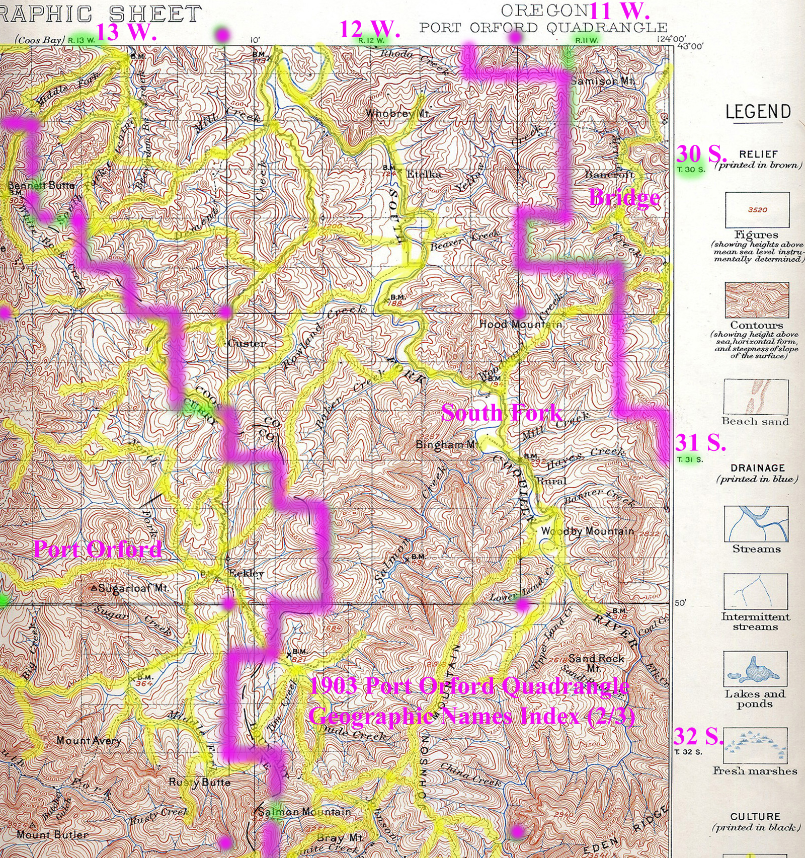
1903 Annotated USGS Port Orford |
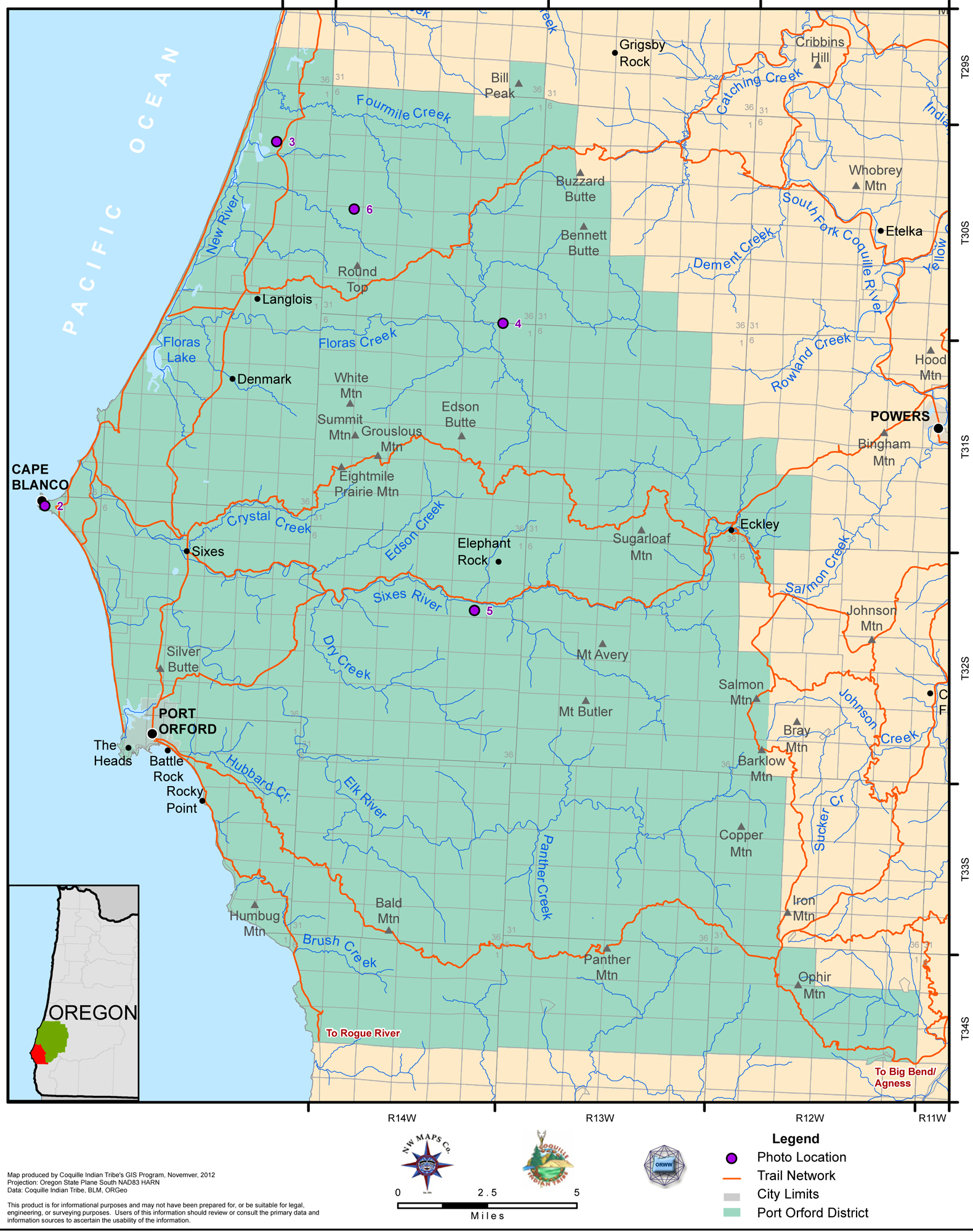
2012 Port Orford District |
Tsp. 32 S., Rng. 15 W.
NOTE: THE INDEX MAP FOR THIS TOWNSHIP IS CURRENTLY UNAVAILABLE.
General Land Office Survey Index
|
|
|
|
|
1857 GLO |
1898 GLO |
1960 DLC |
1903 Annotated USGS Port Orford |
2012 Port Orford District |
This township is entirely within the boundaries of the 2011-2012 Coquelle Trails Project. It includes Silver Butte , Edson Creek and Sixes River in the Port Orford Historical District. This survey was completed in 1857, 1860, and 1897, and mapped in 1857, 1860, and 1898 (Murphy & Murphy 1857; Heydon & Heydon 1897). Donation Land Claims were made by Shipman Crouch, Aaron Dyer, George M. Dyer, Henry S. DeFremery, and William Tichenor.
![]()