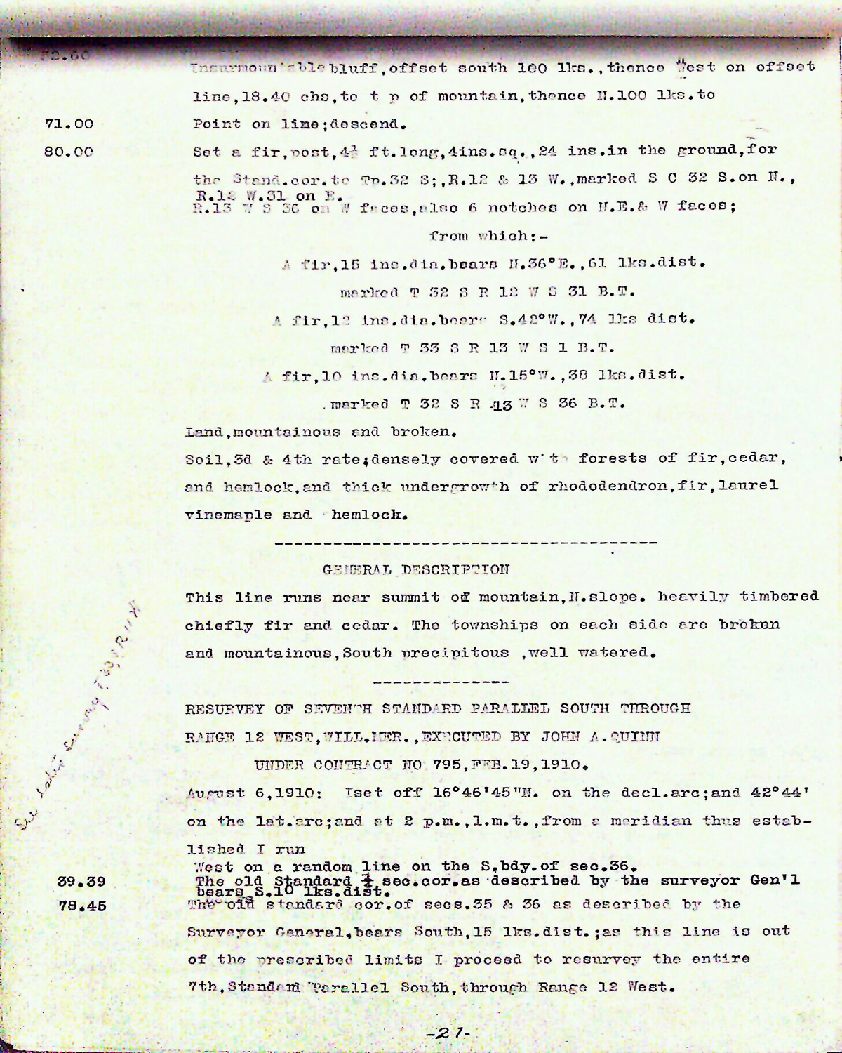
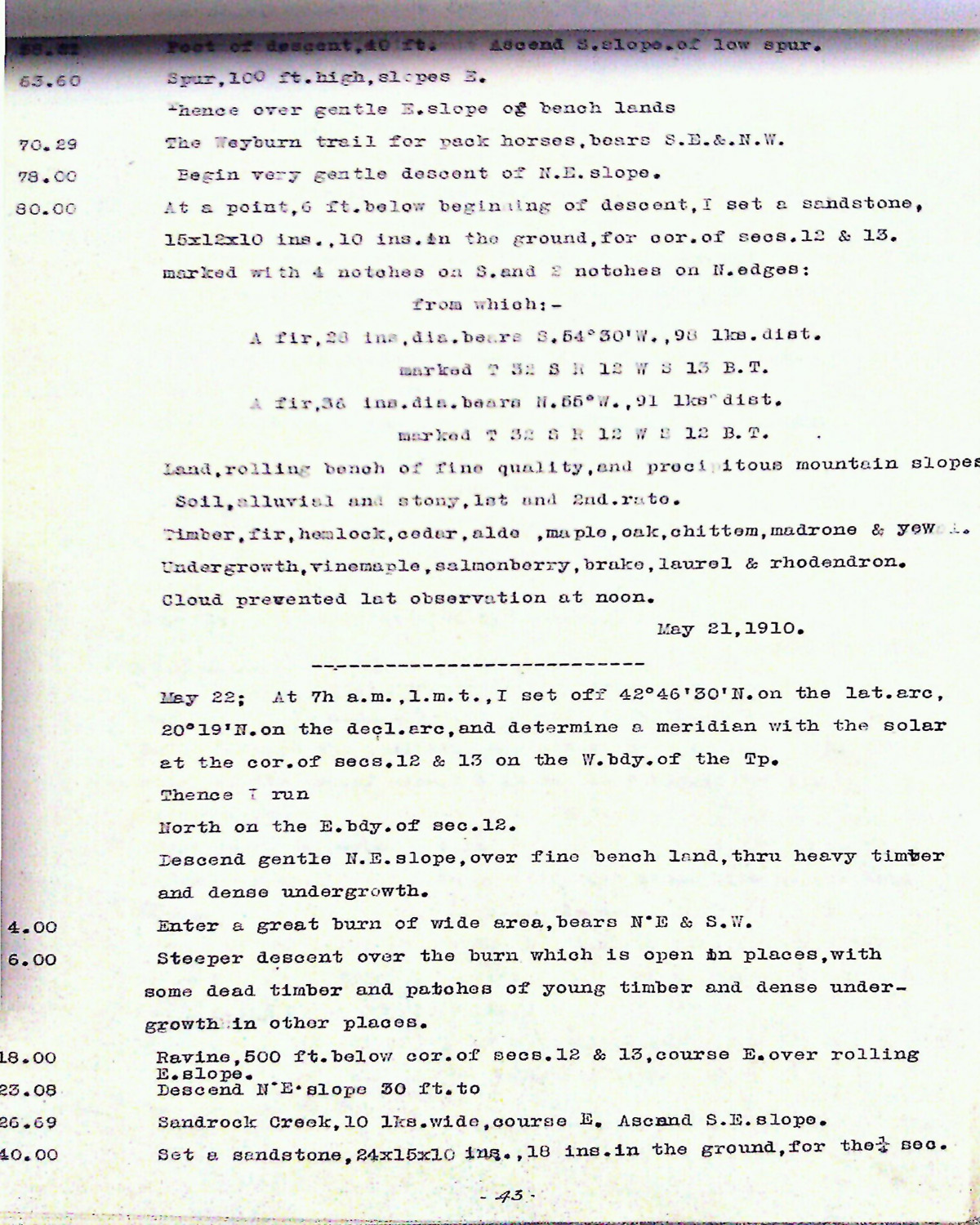
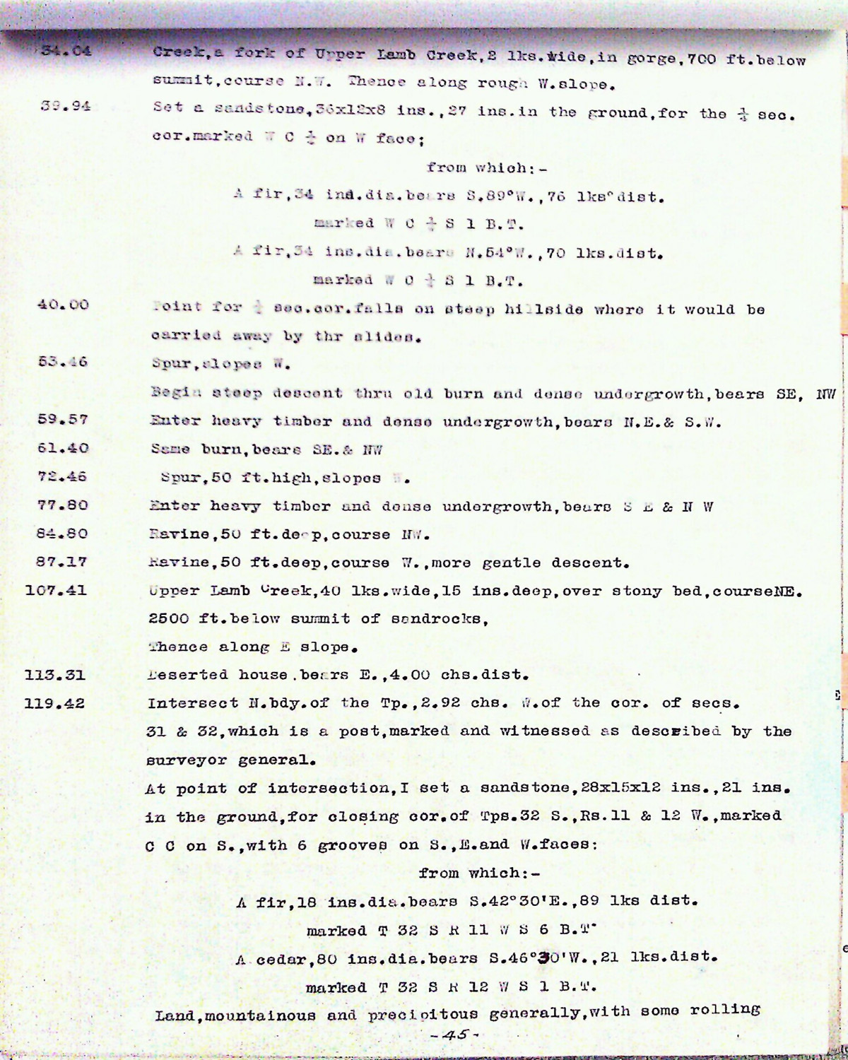
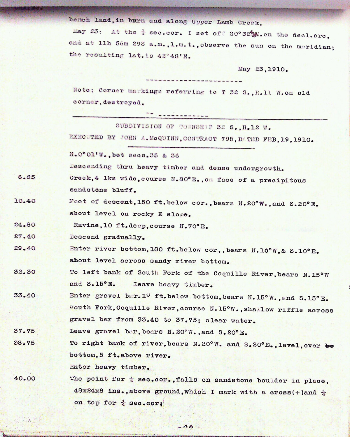
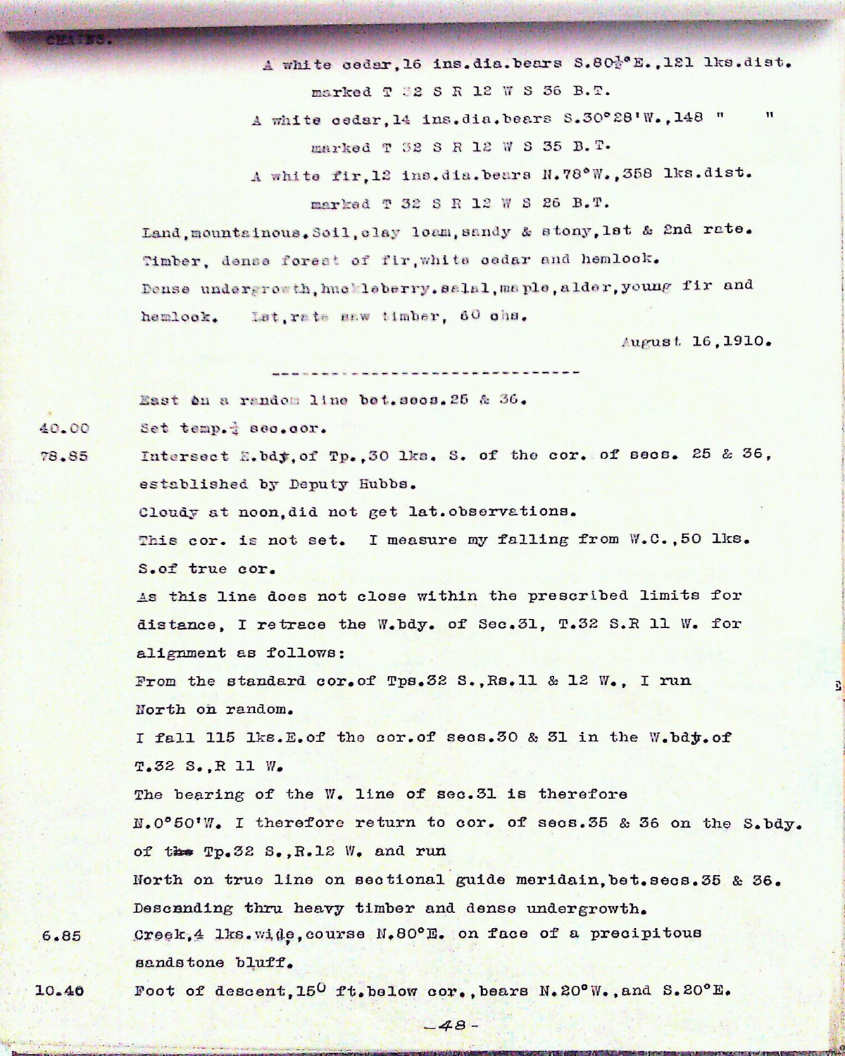
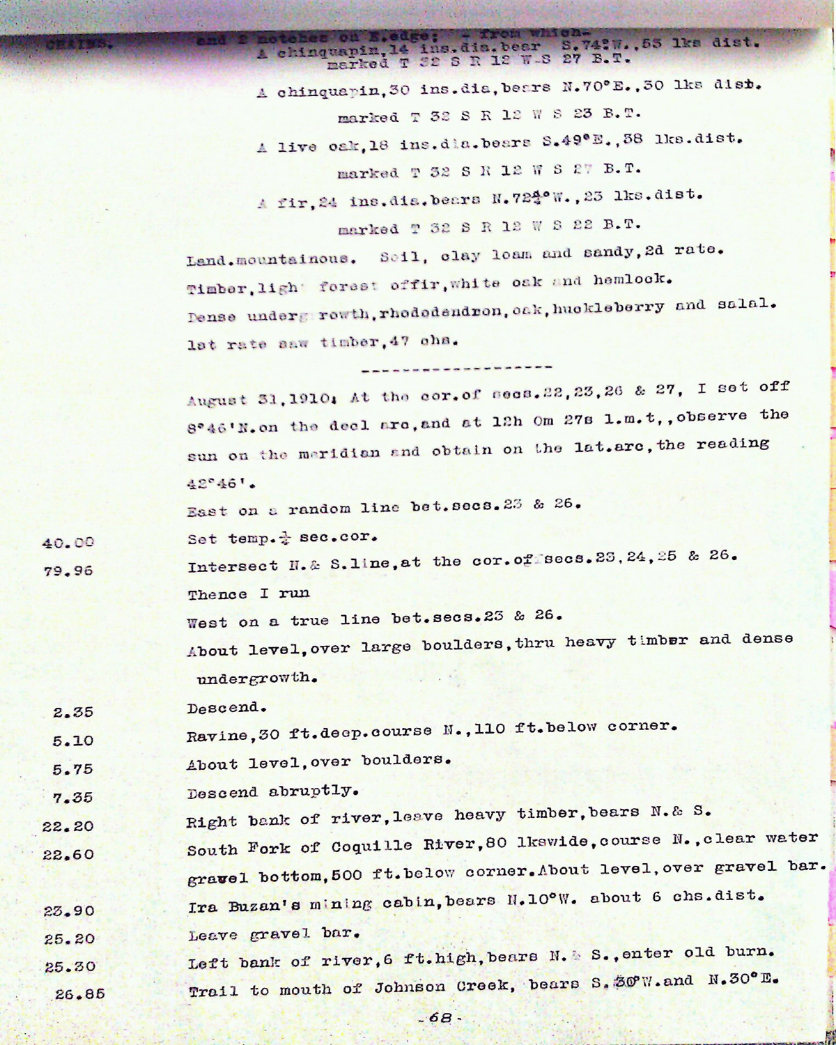
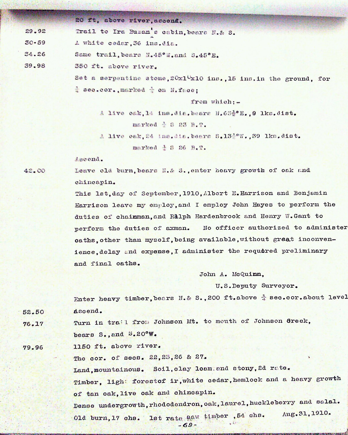
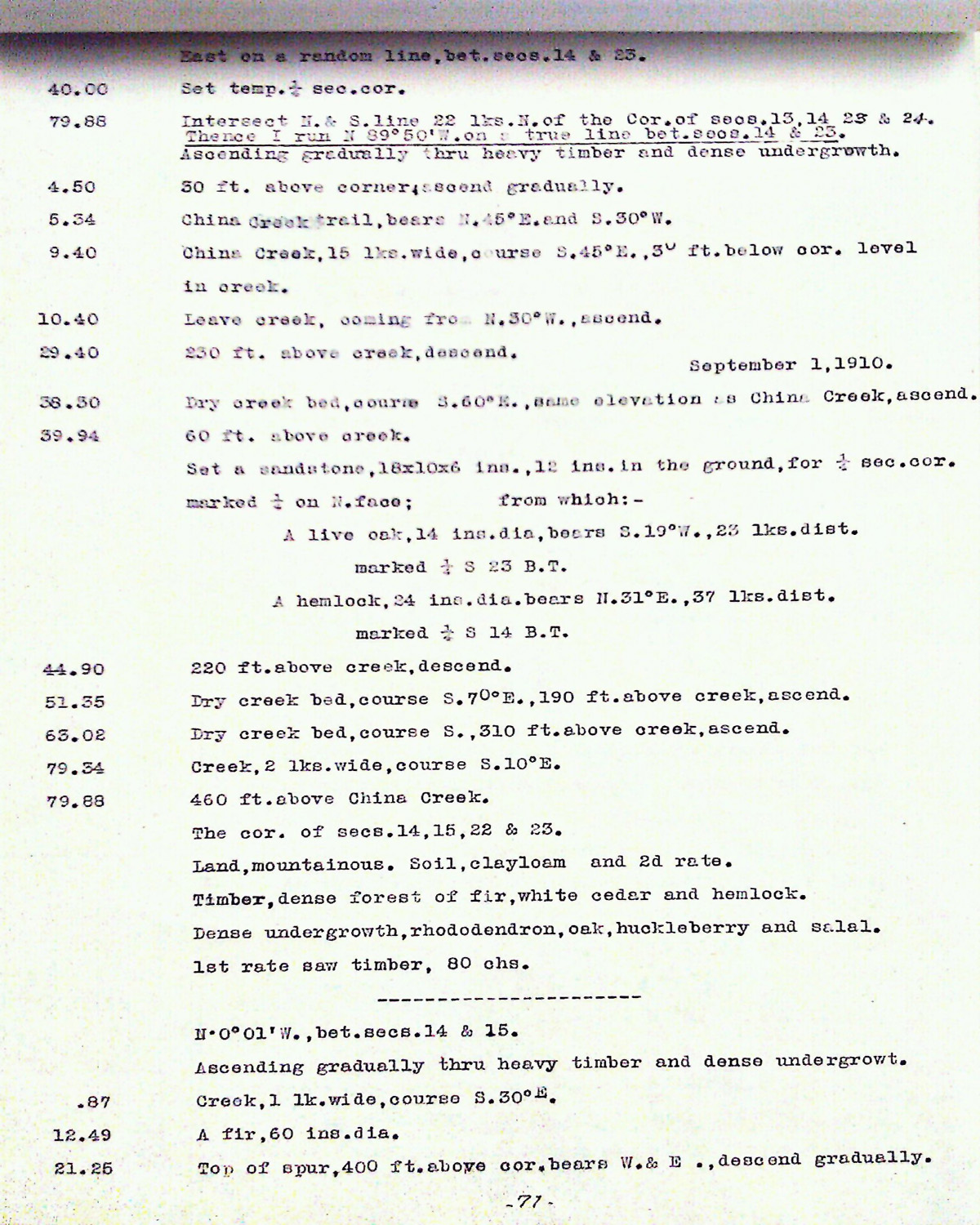
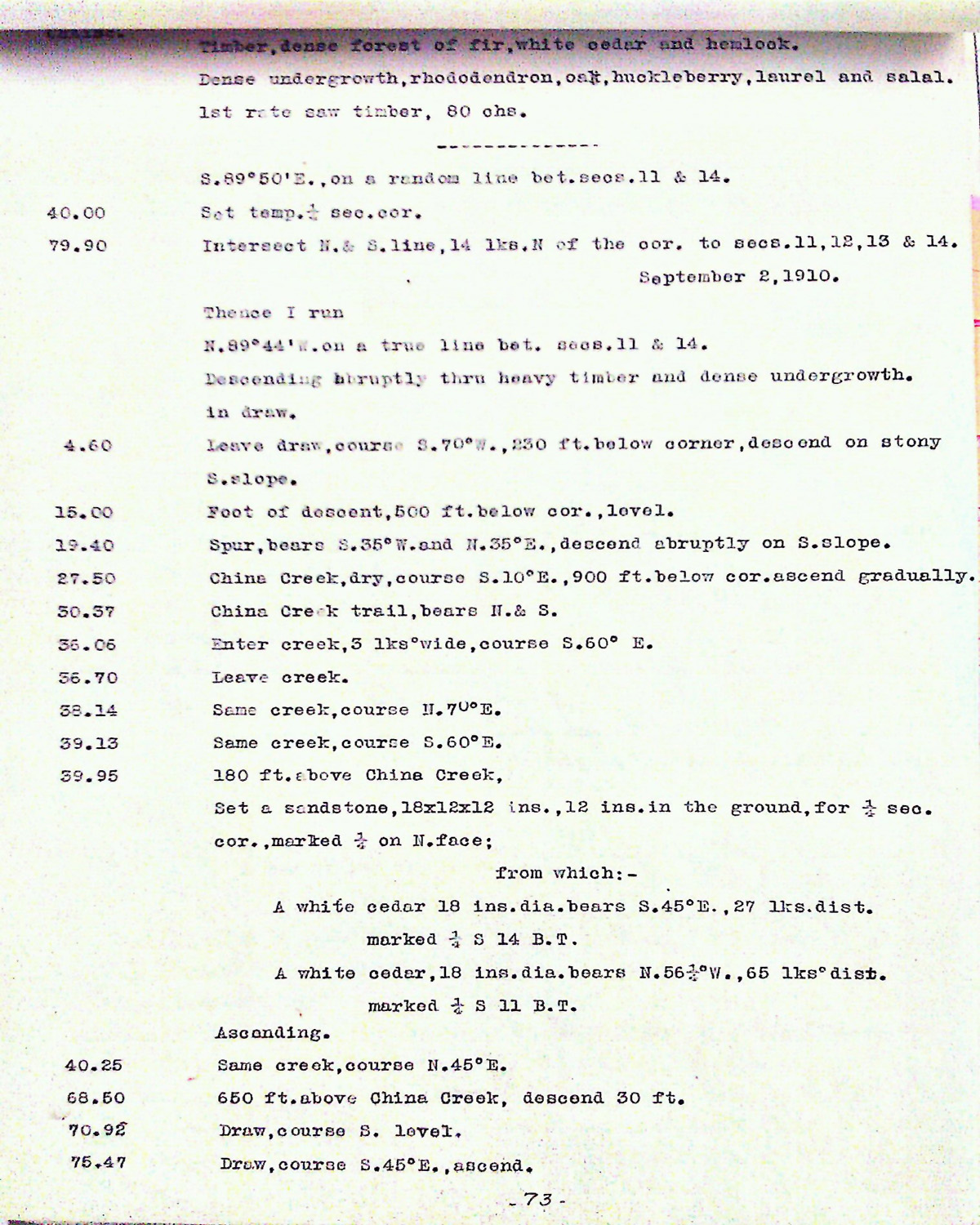
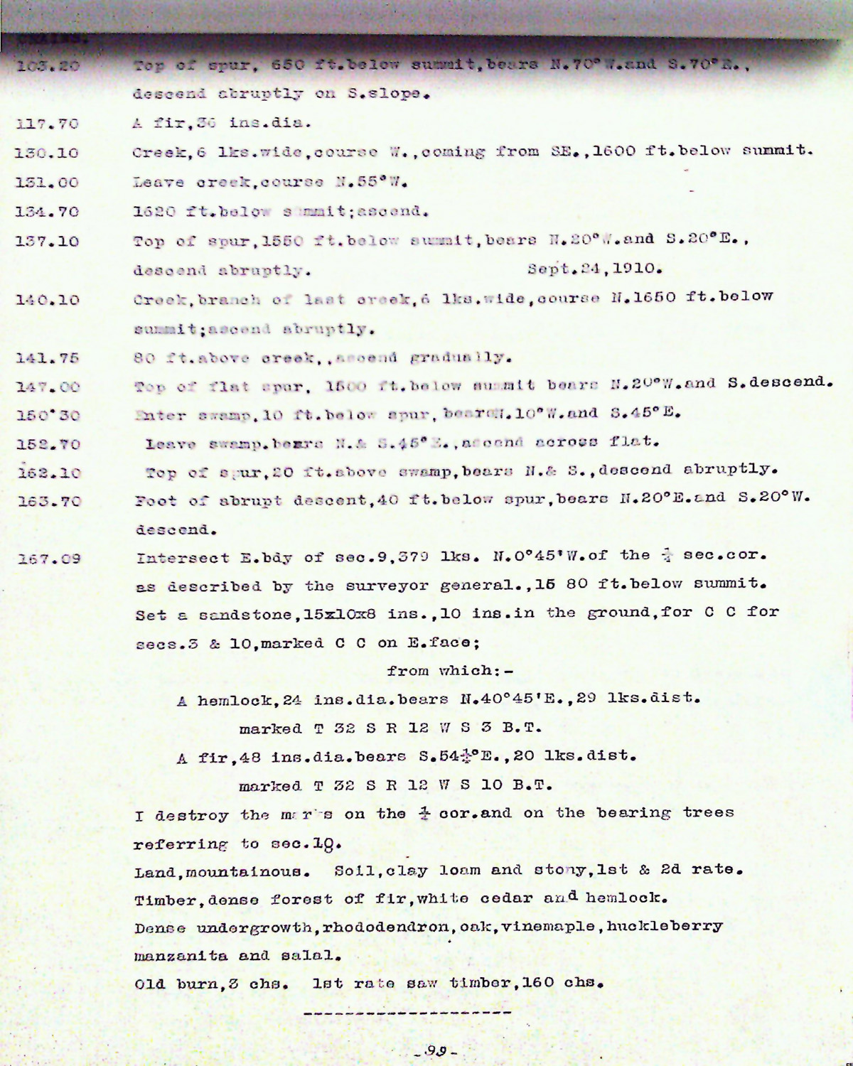
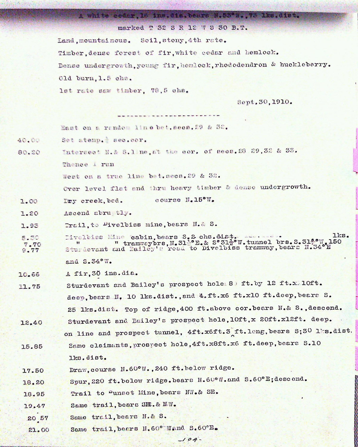
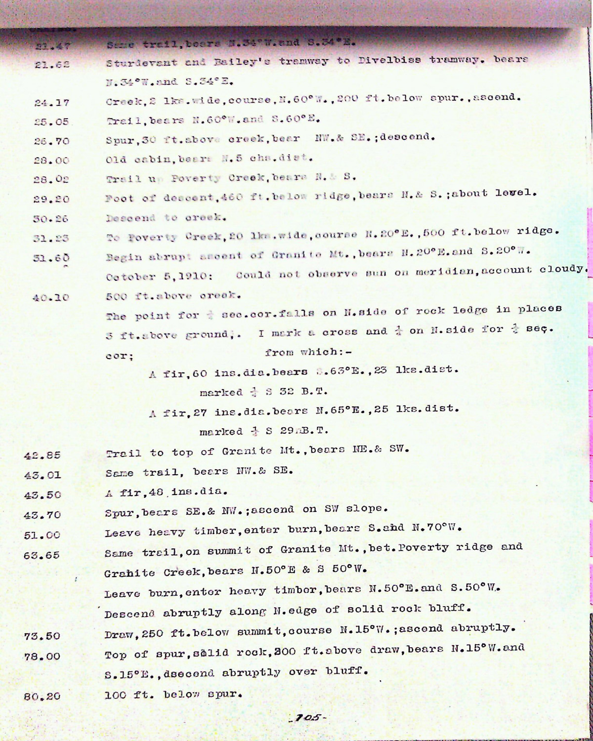
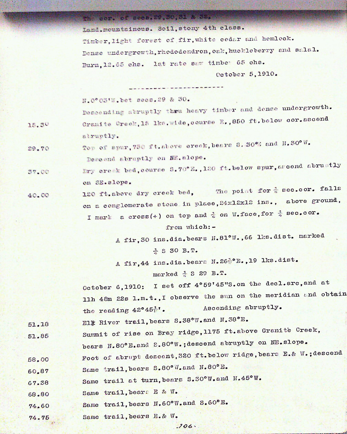
Tsp. 32 S., Rng. 12 W.
General Land Office Survey Index
 |
 |
 |
 |
 |
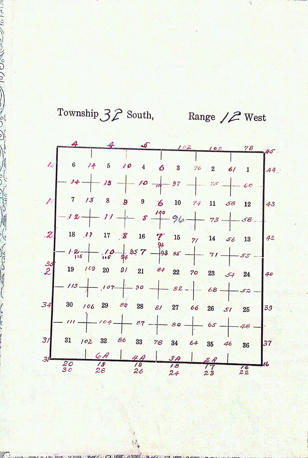
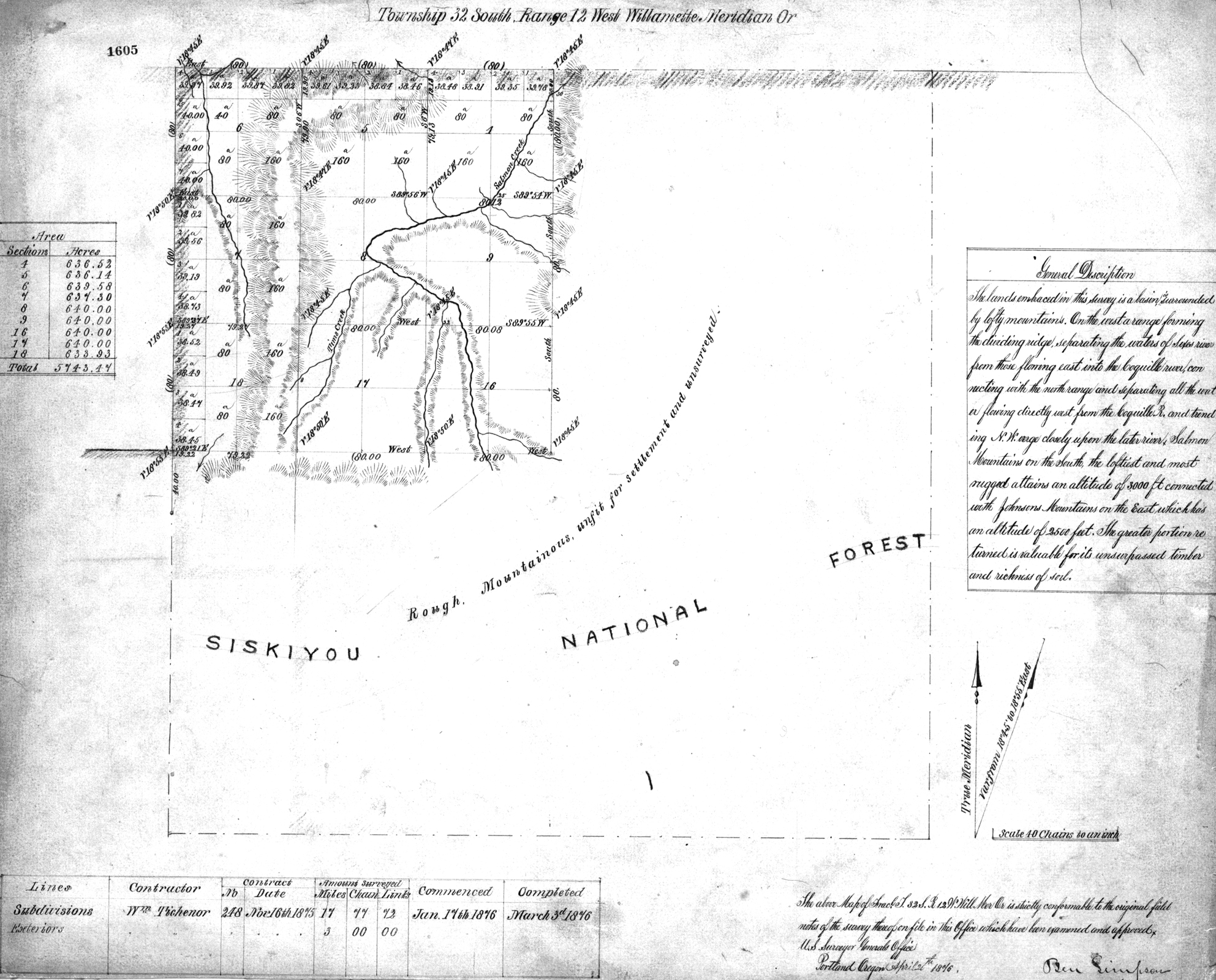
1876 GLO |
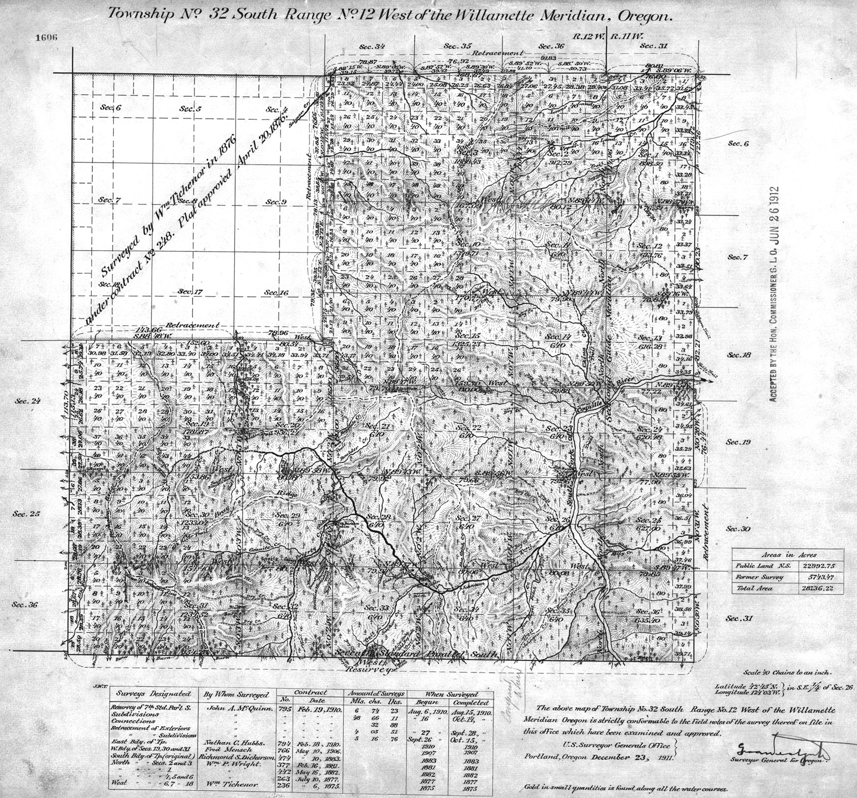
1911 GLO |
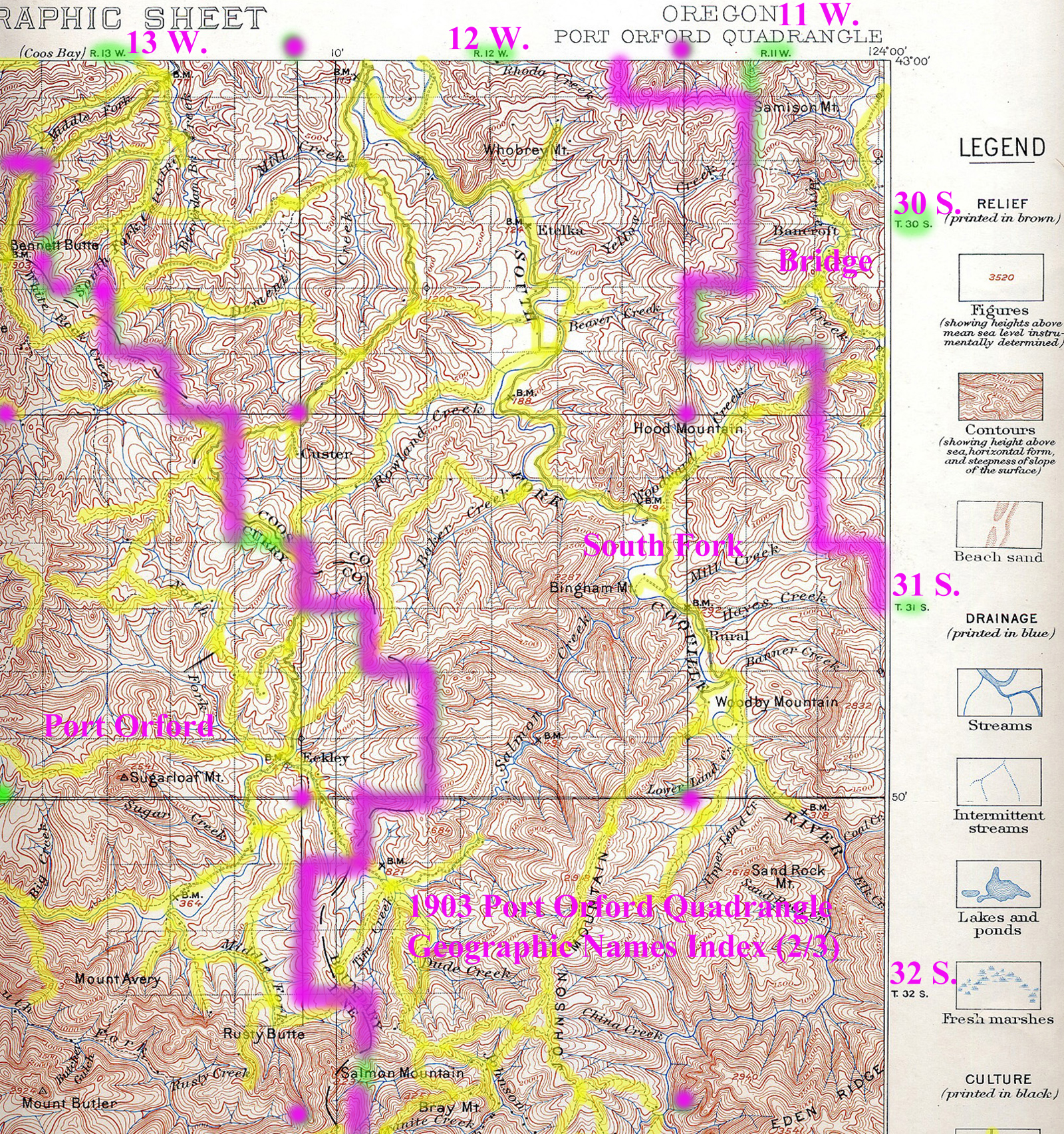
Annotated 1899 USGS Port Orford |
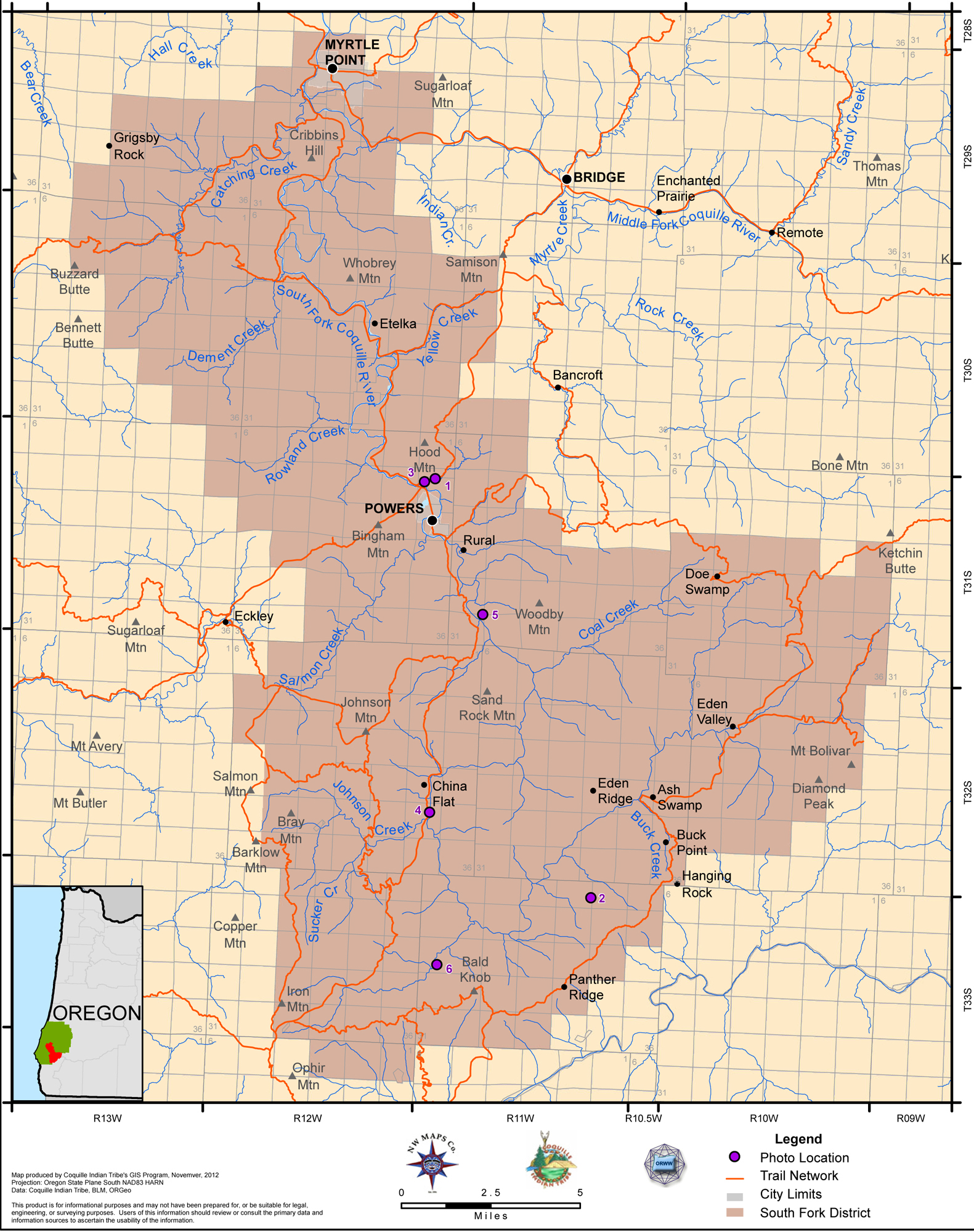
2012 South Fork District |
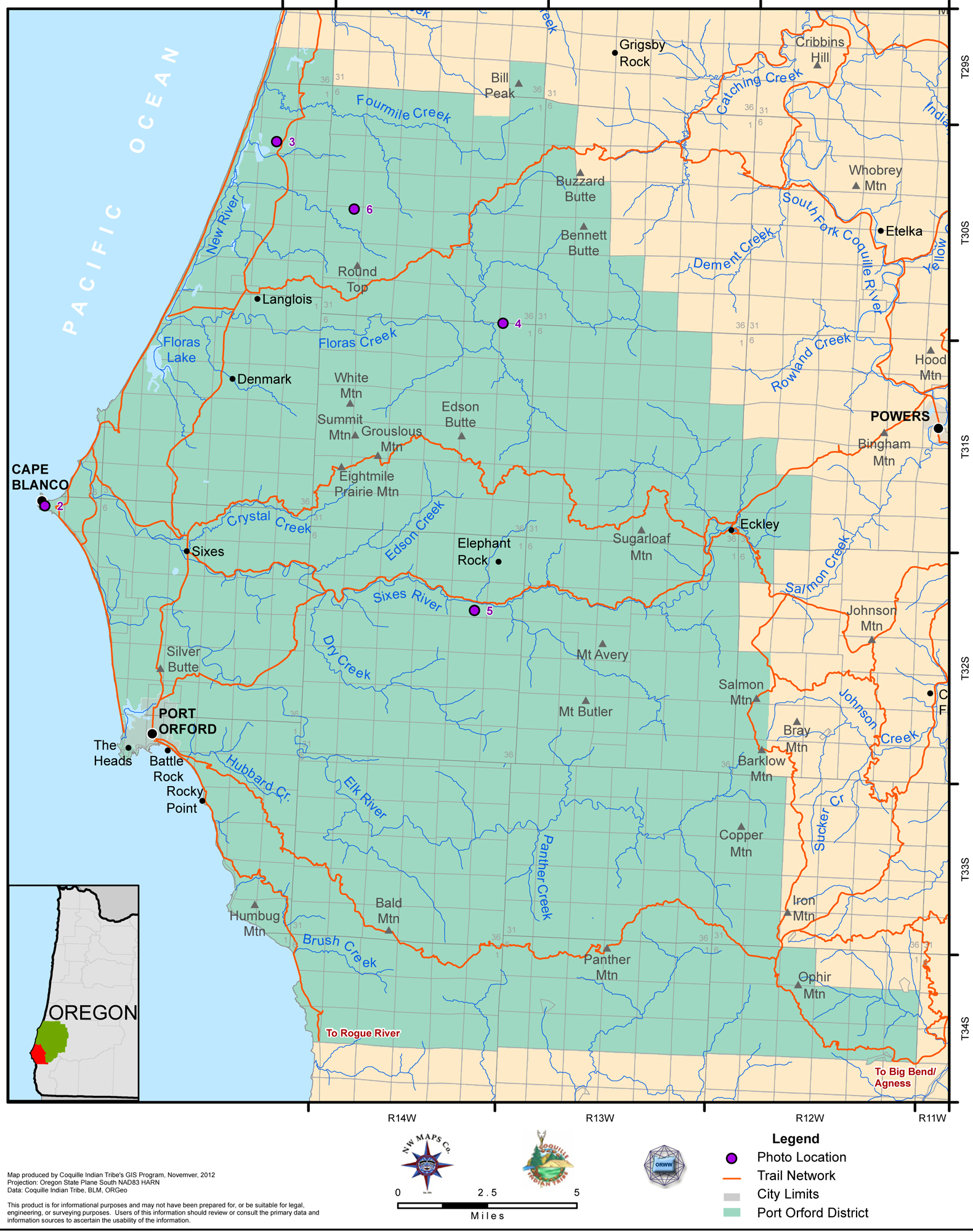
2012 Port Orford District |
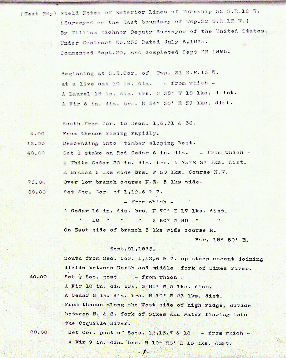
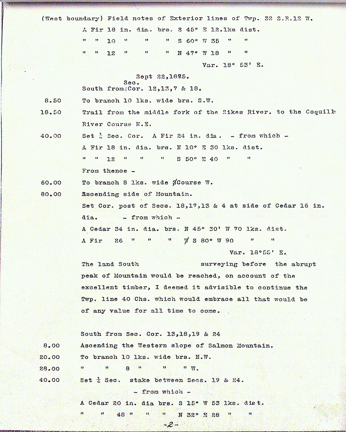
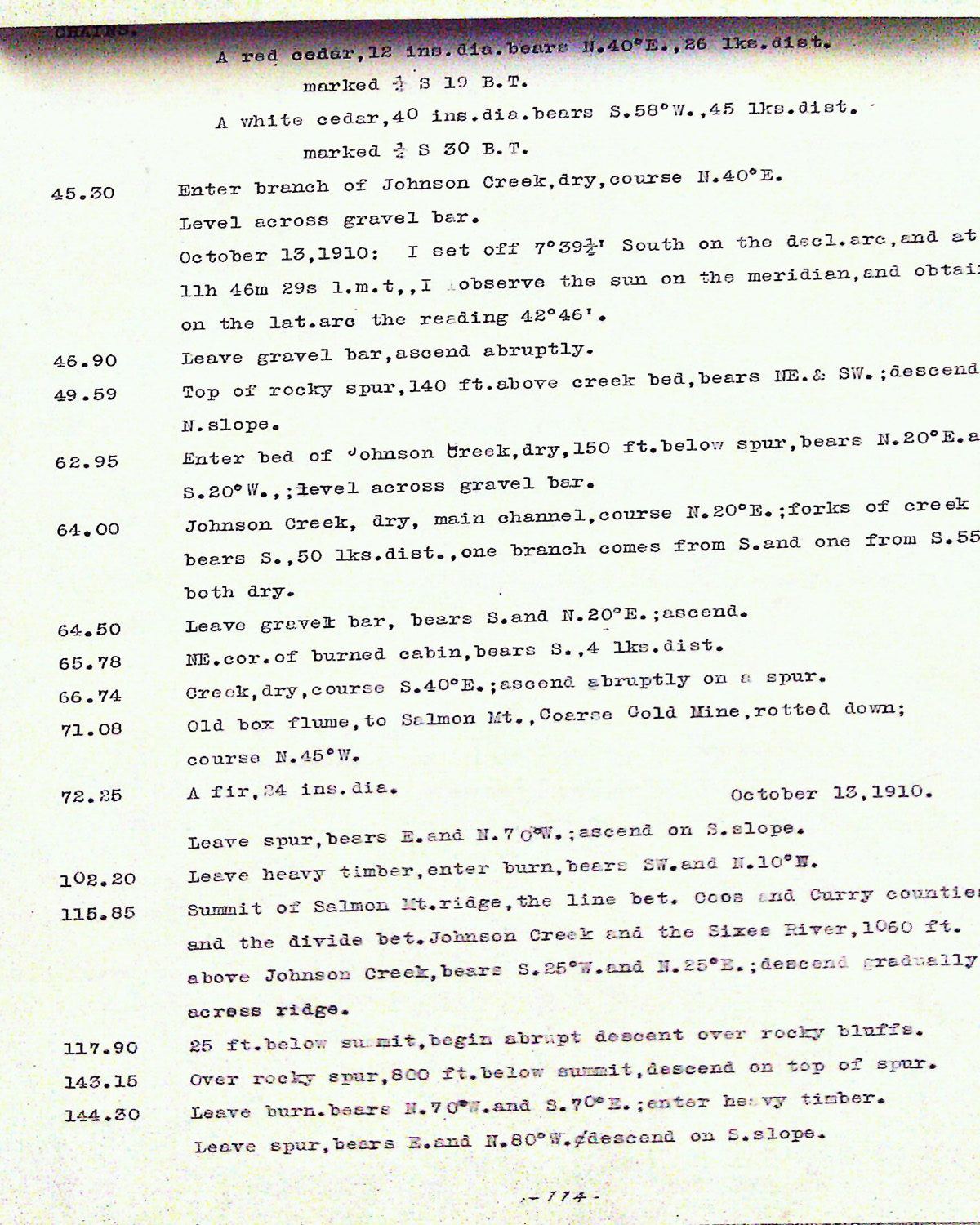
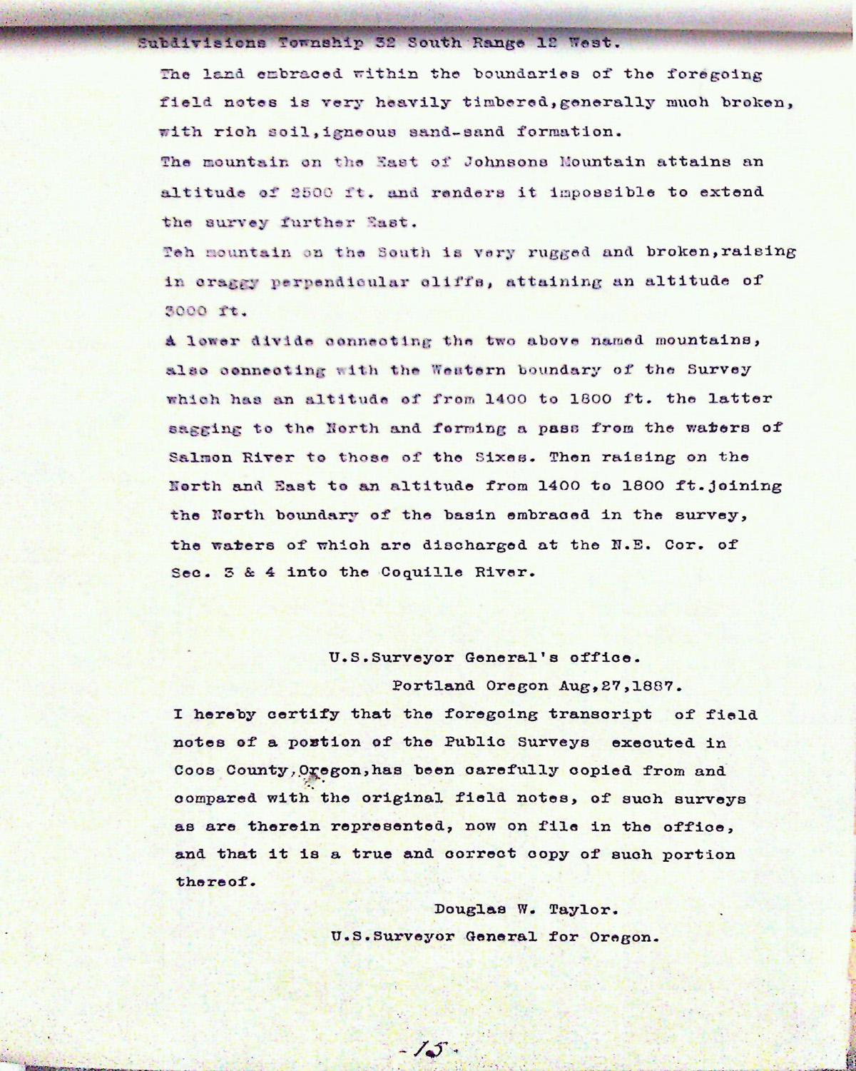
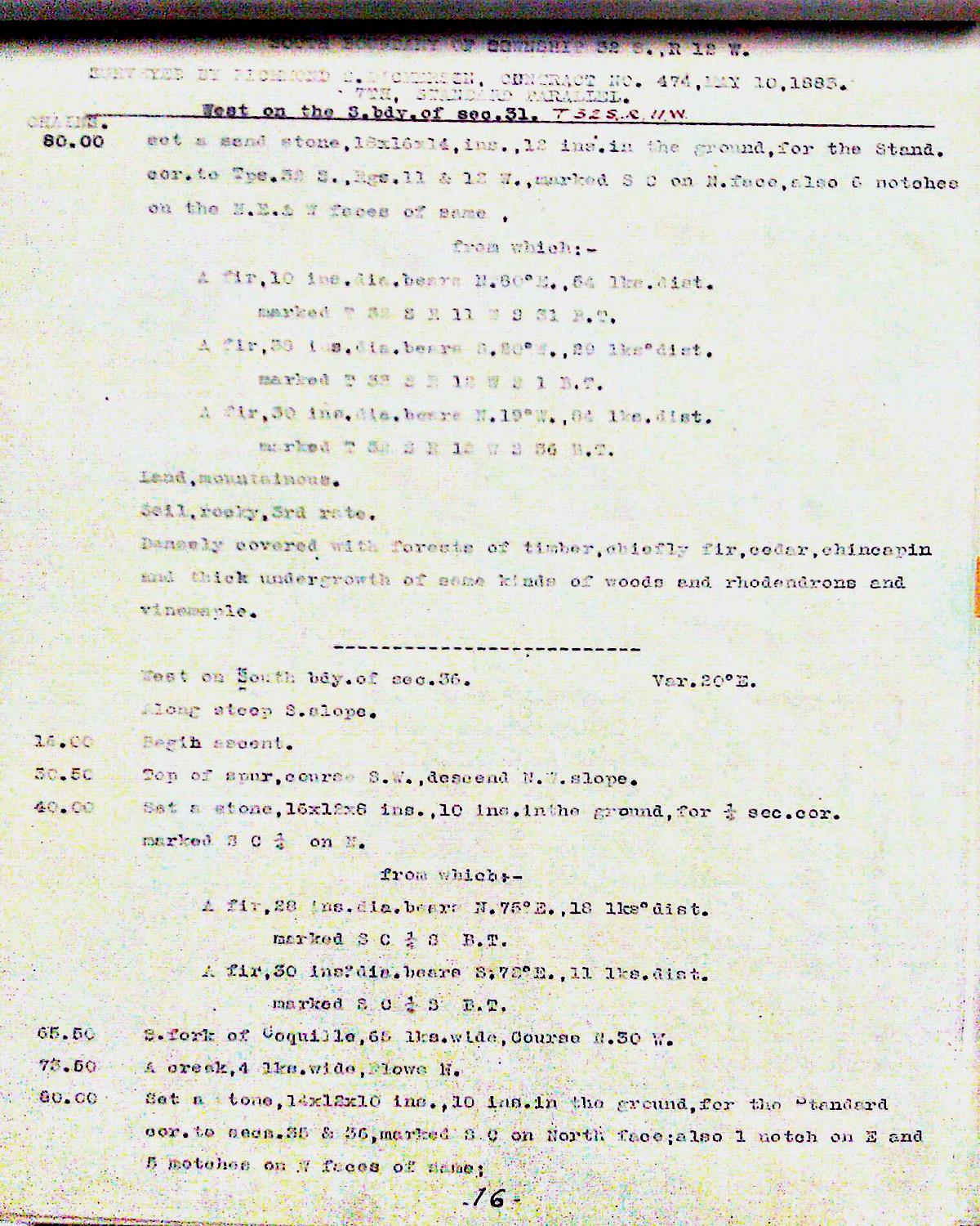
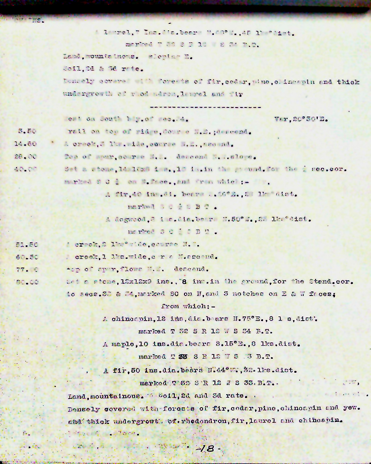
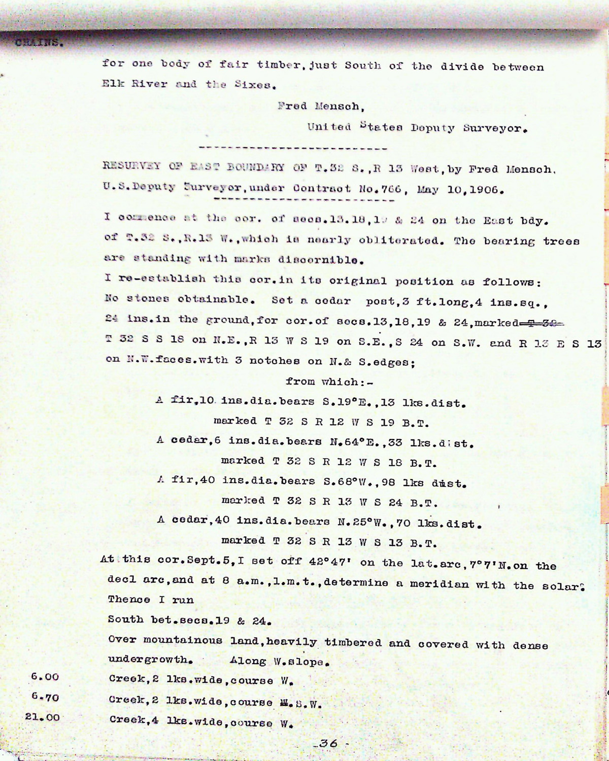
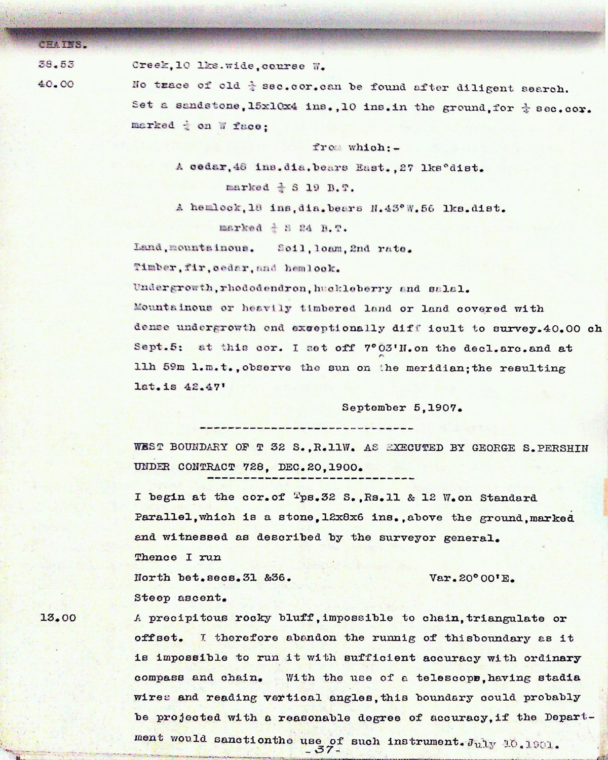
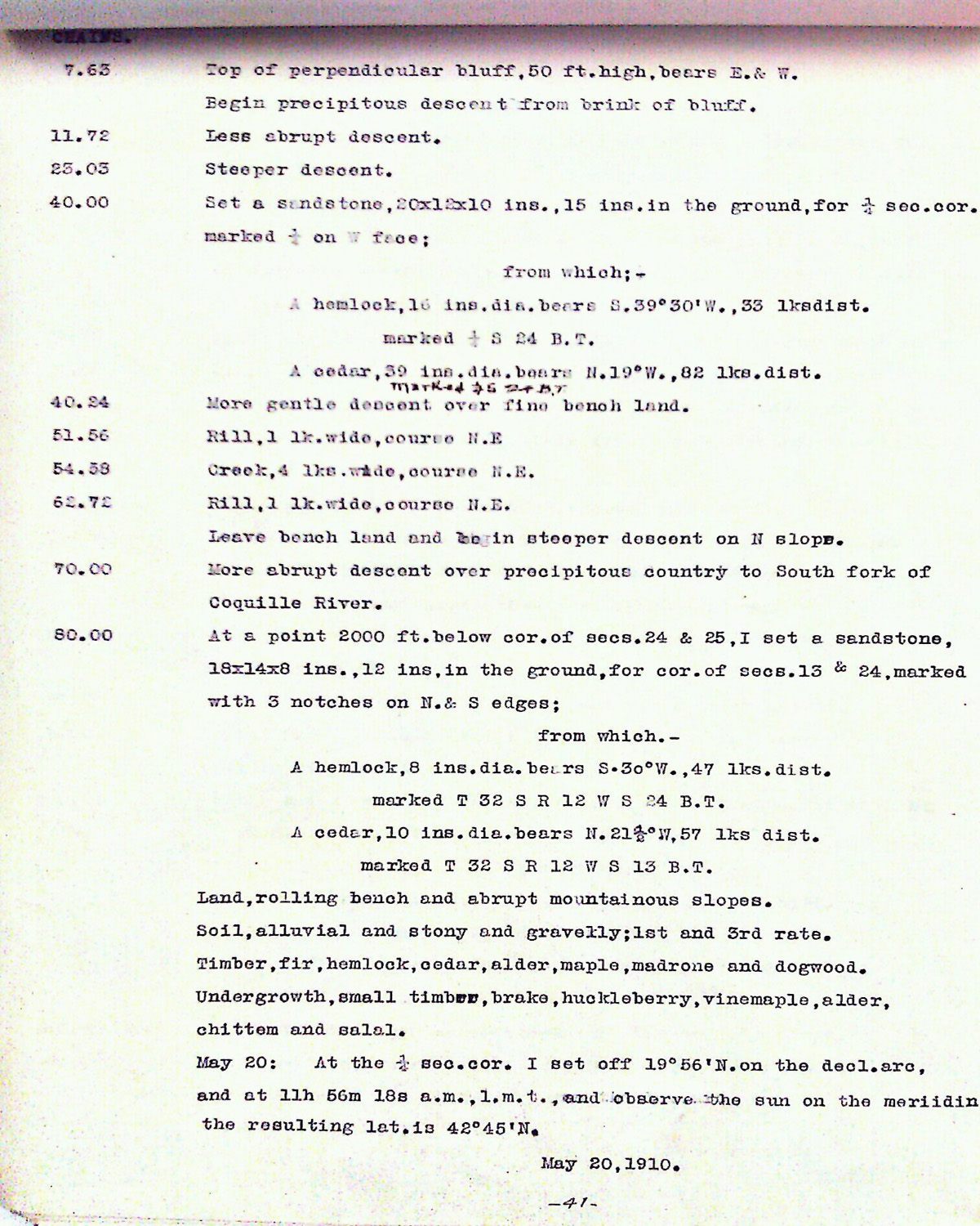
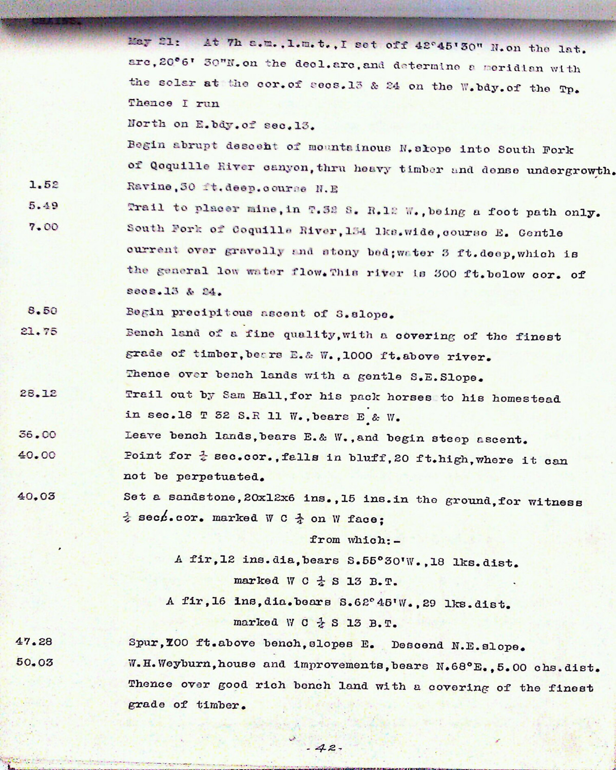
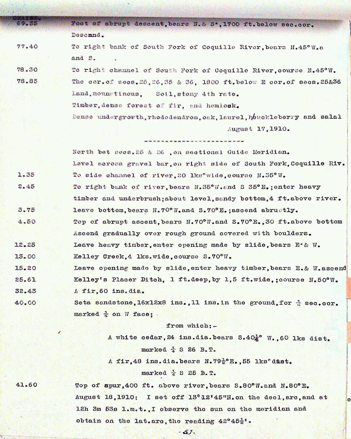
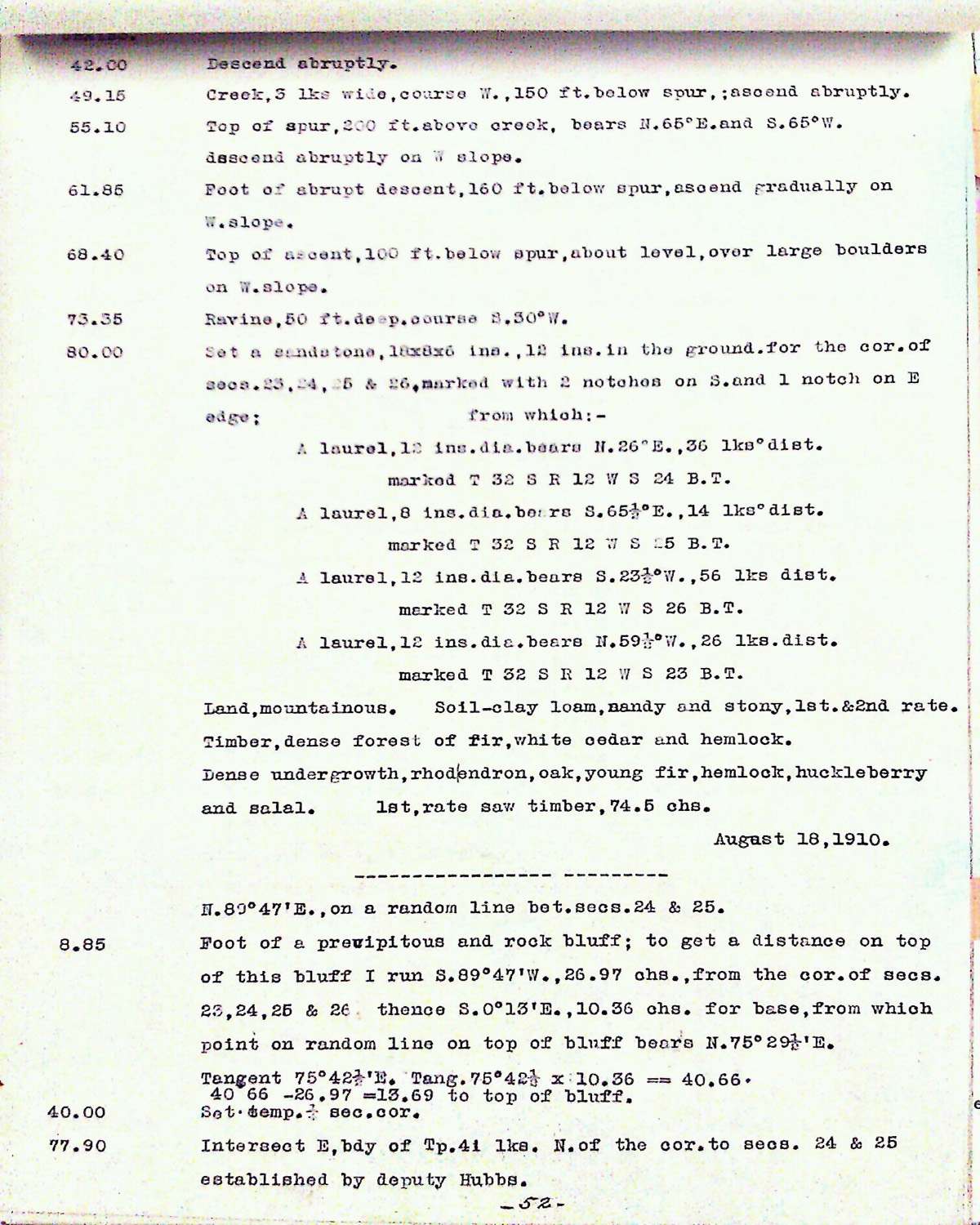
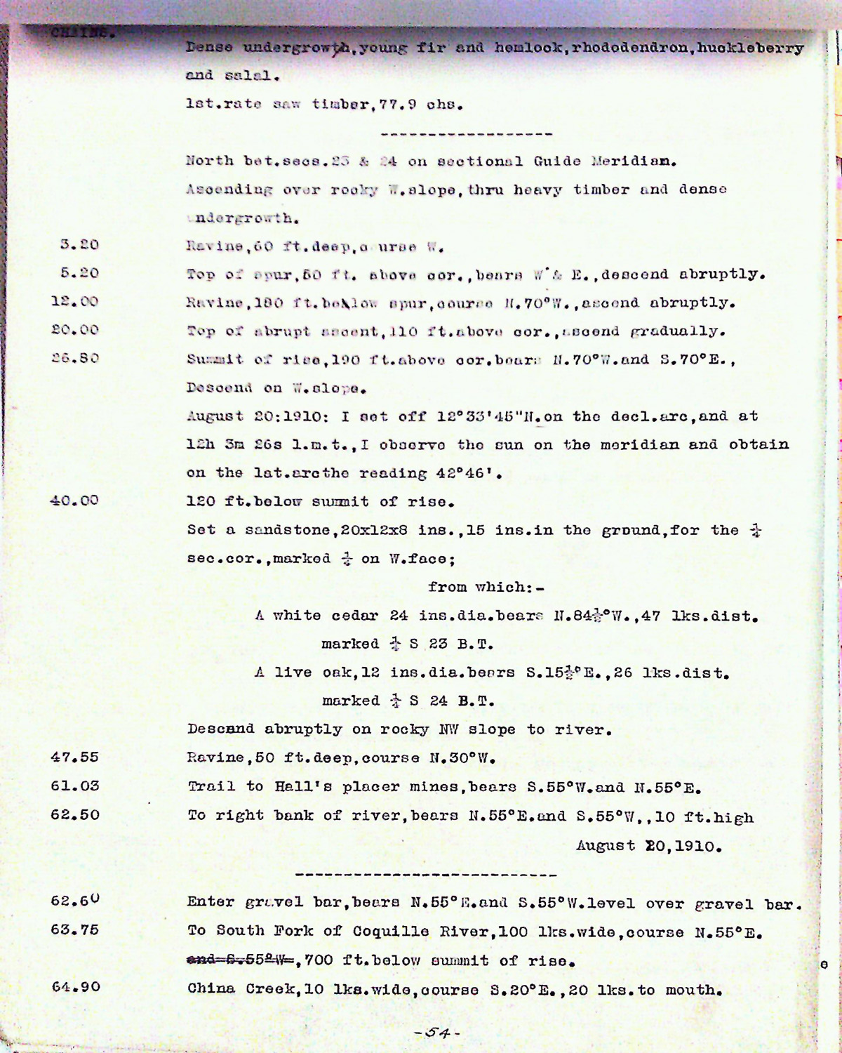
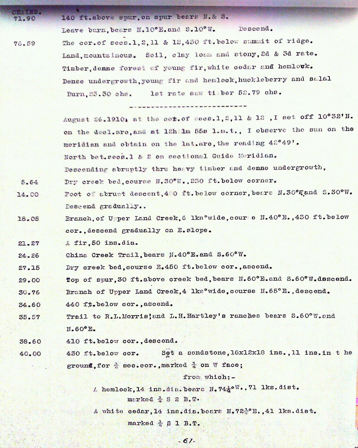
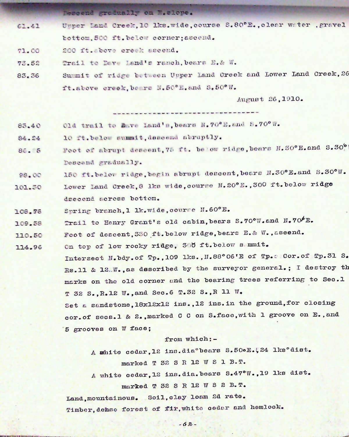
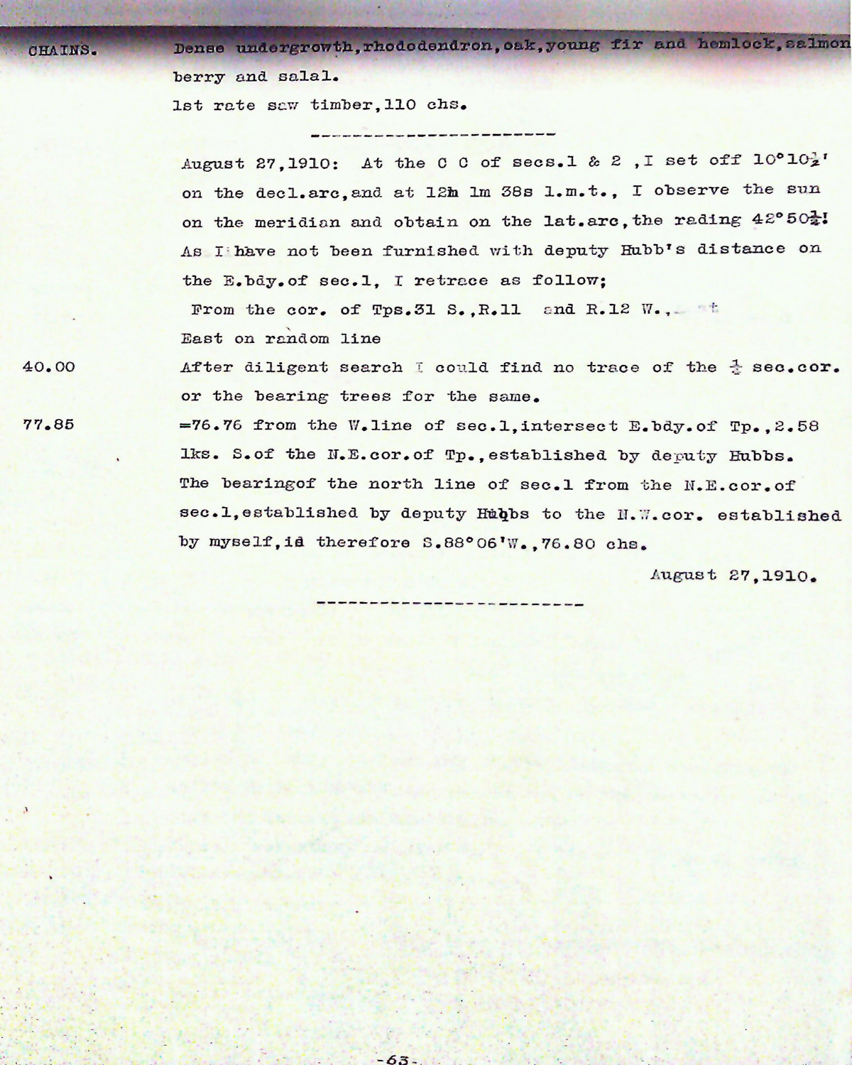
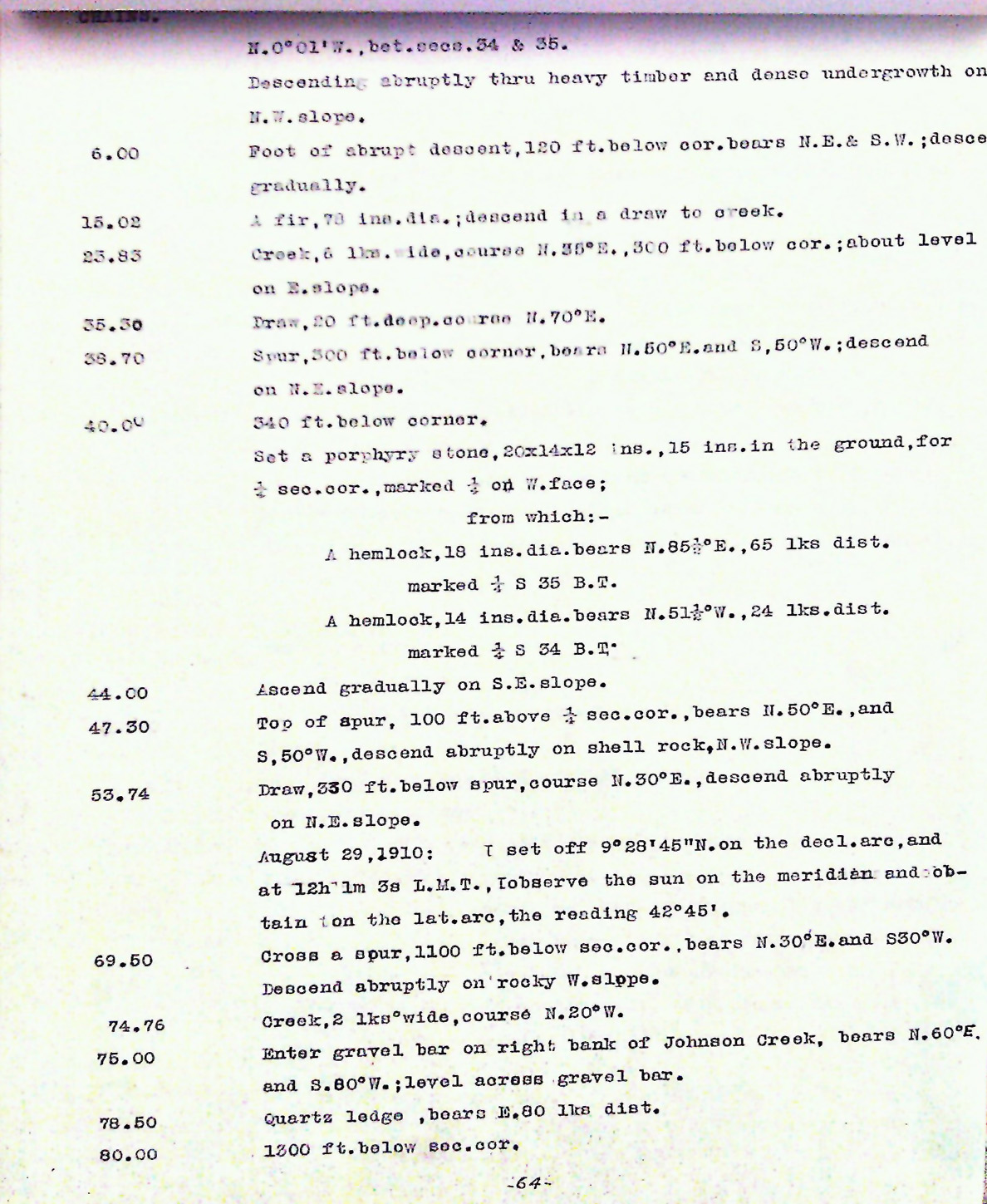
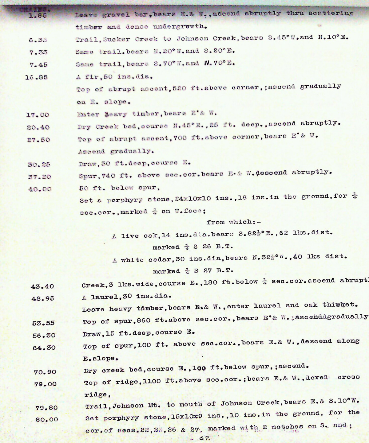
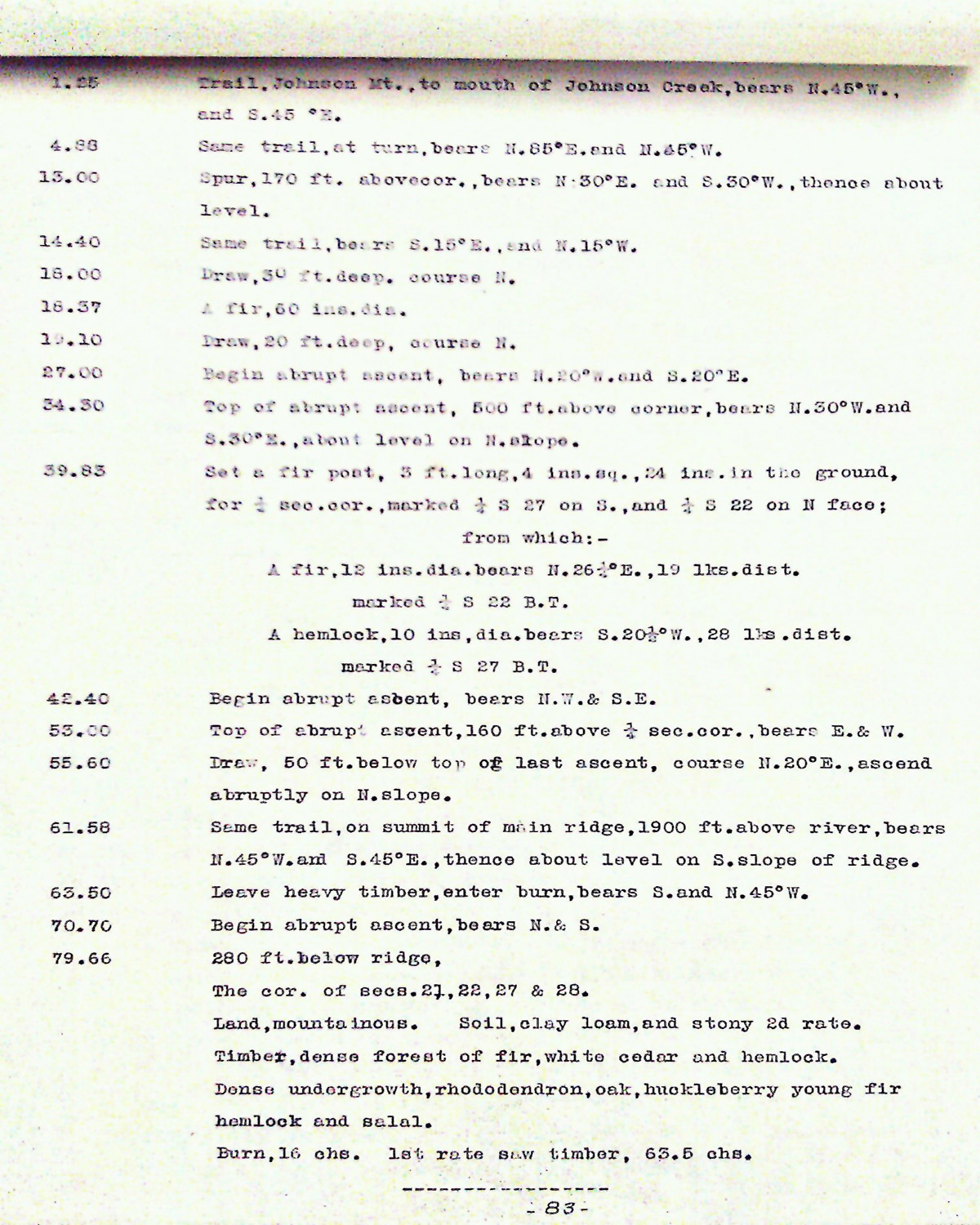
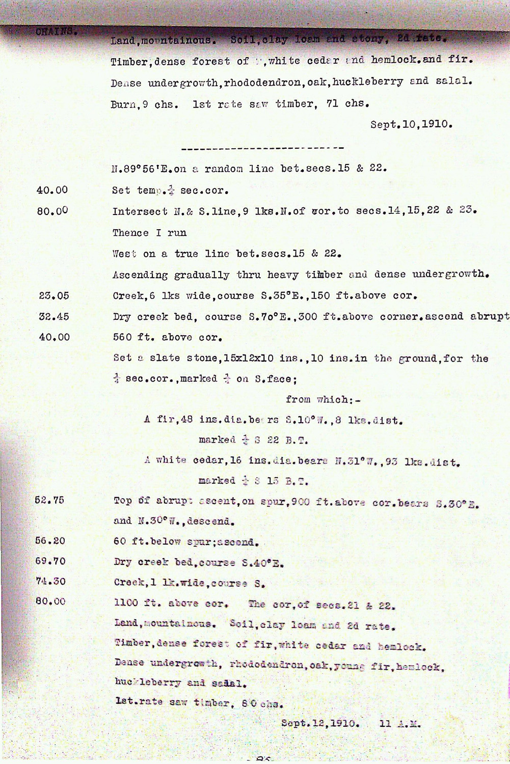
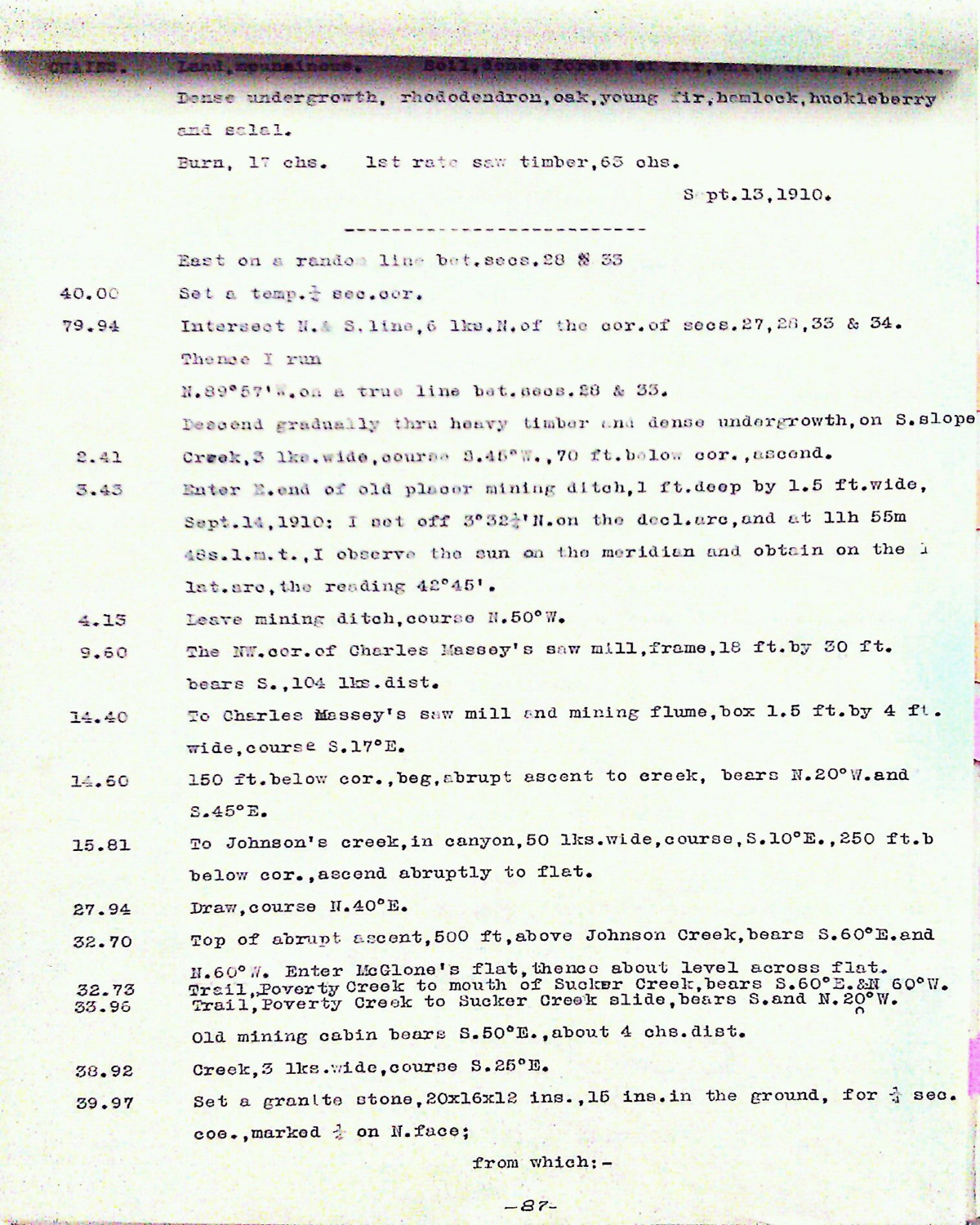
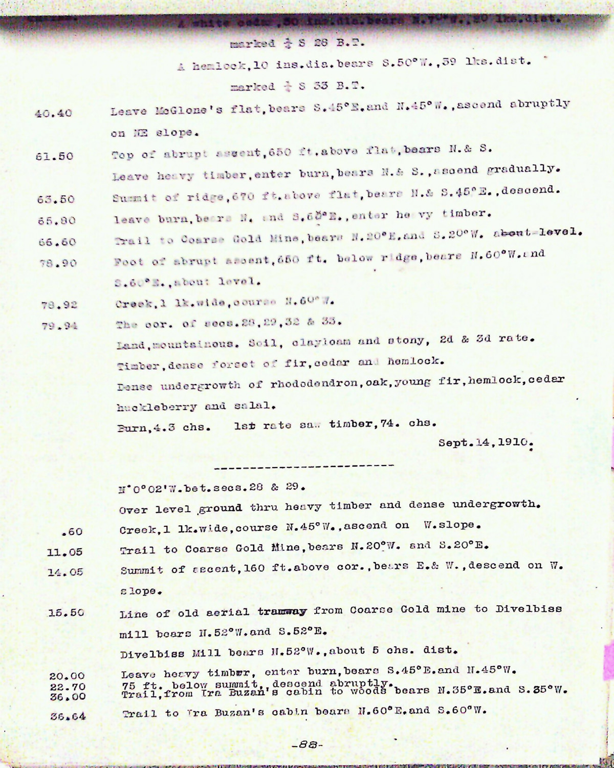
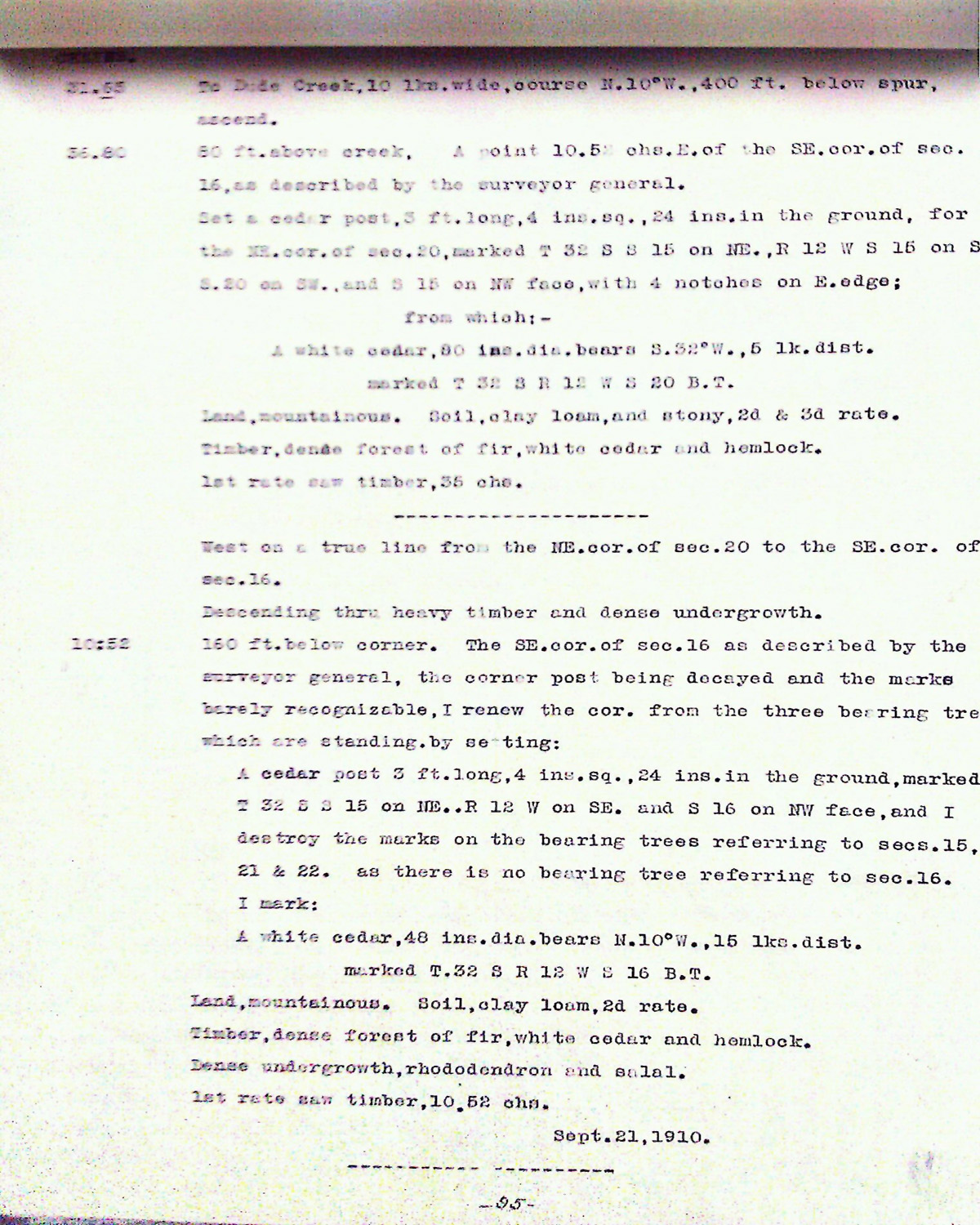
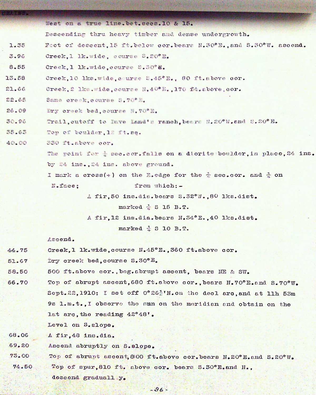
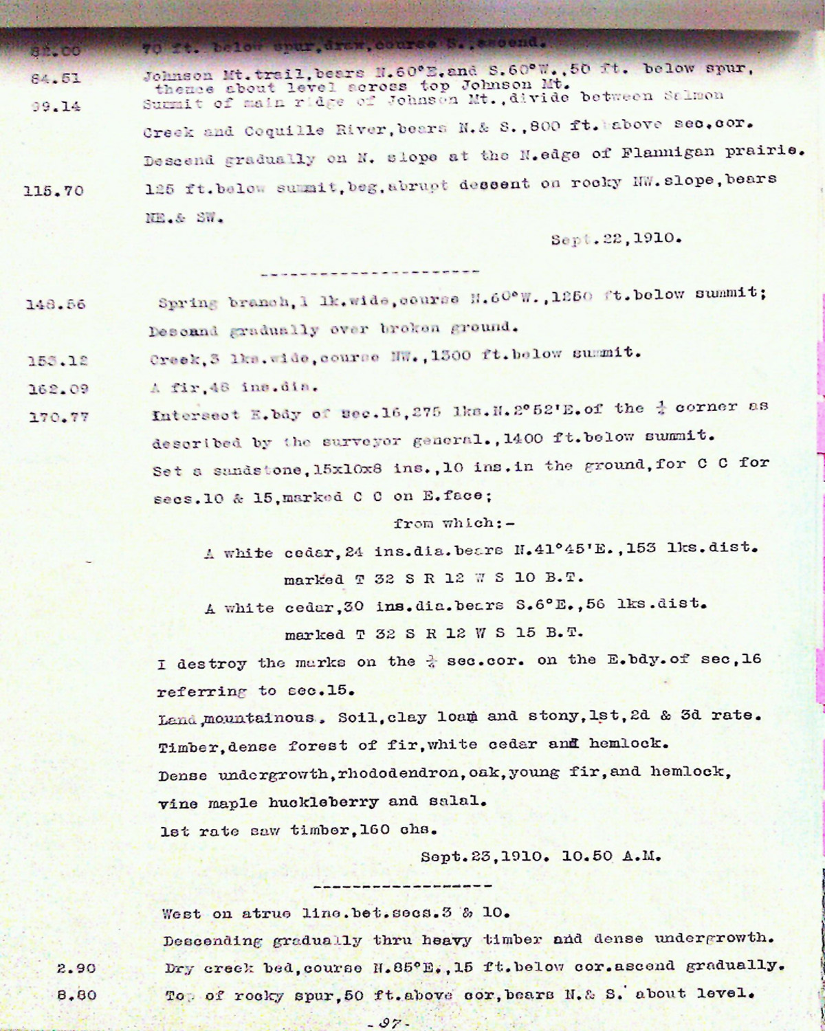
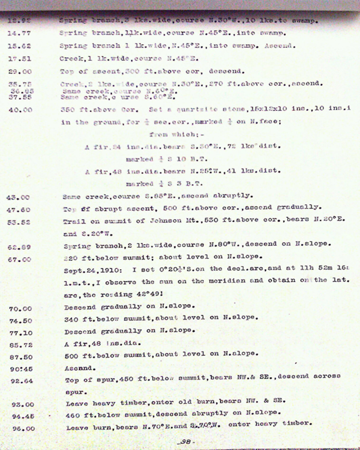
This township is entirely within the boundaries of the 2011-2012 Coquelle Trails Project. It includes Barklow Mountain, Salmon Creek and Coquille River in the South Fork and Port Orford Historical Districts. This survey was completed in 1875, 1876, 1877, 1881, 1882, 1883, 1907 and 1910, and mapped in 1876, and 1911 (Tichenor 1875b; McQuinn 1910; Hubbs 1910; Mensch 1906; Dickerson 1883; Wright 1877; Wright 1881; Wright 1882).
![]()