Tsp. 30 S., Rng. 12 W.
General Land Office Survey Index
 |
 |
 |
 |
 |
 |
1859 GLO |
1883 GLO |
1861 DLC |
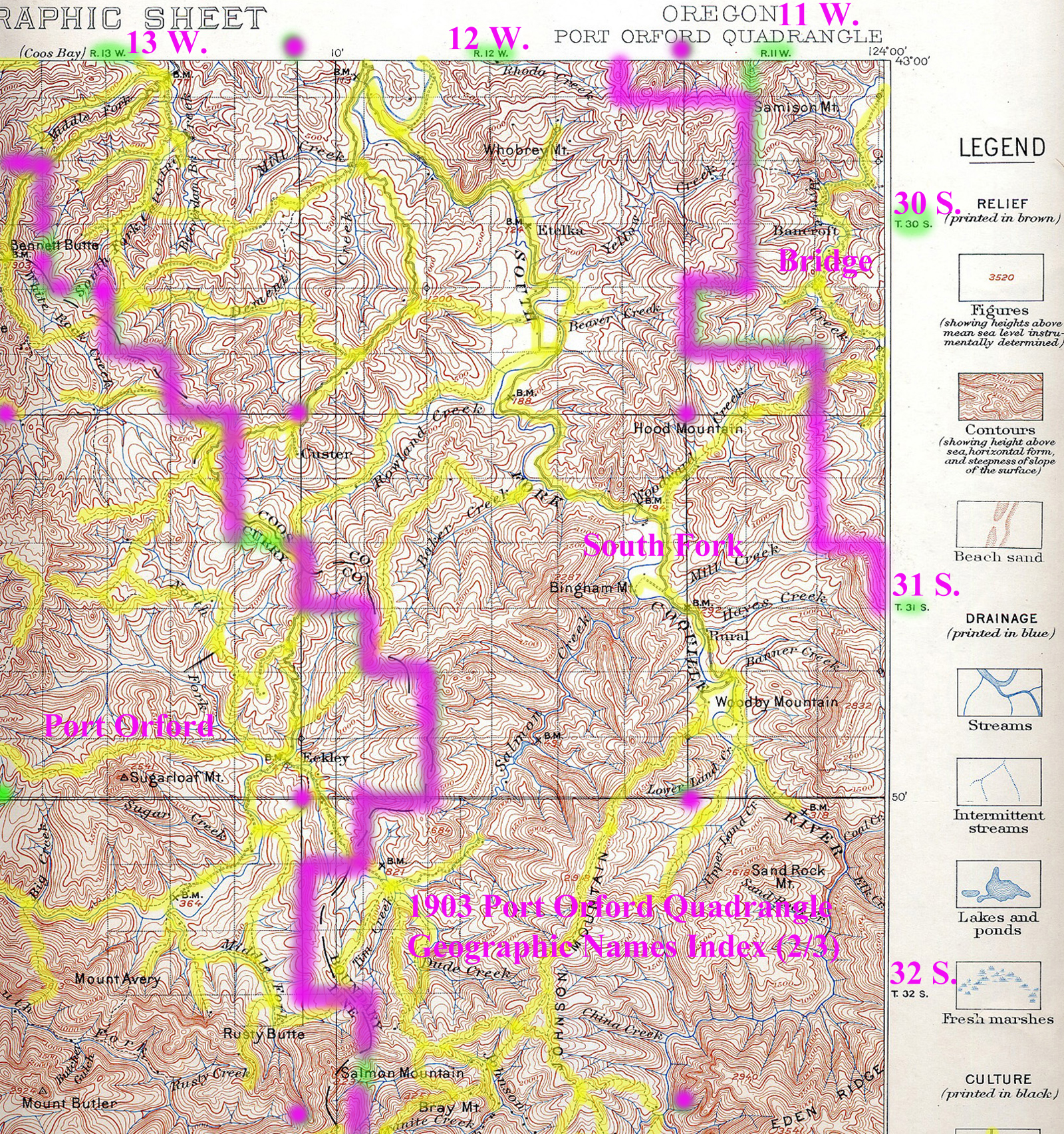
1903 Annotated USGS Port Orford |
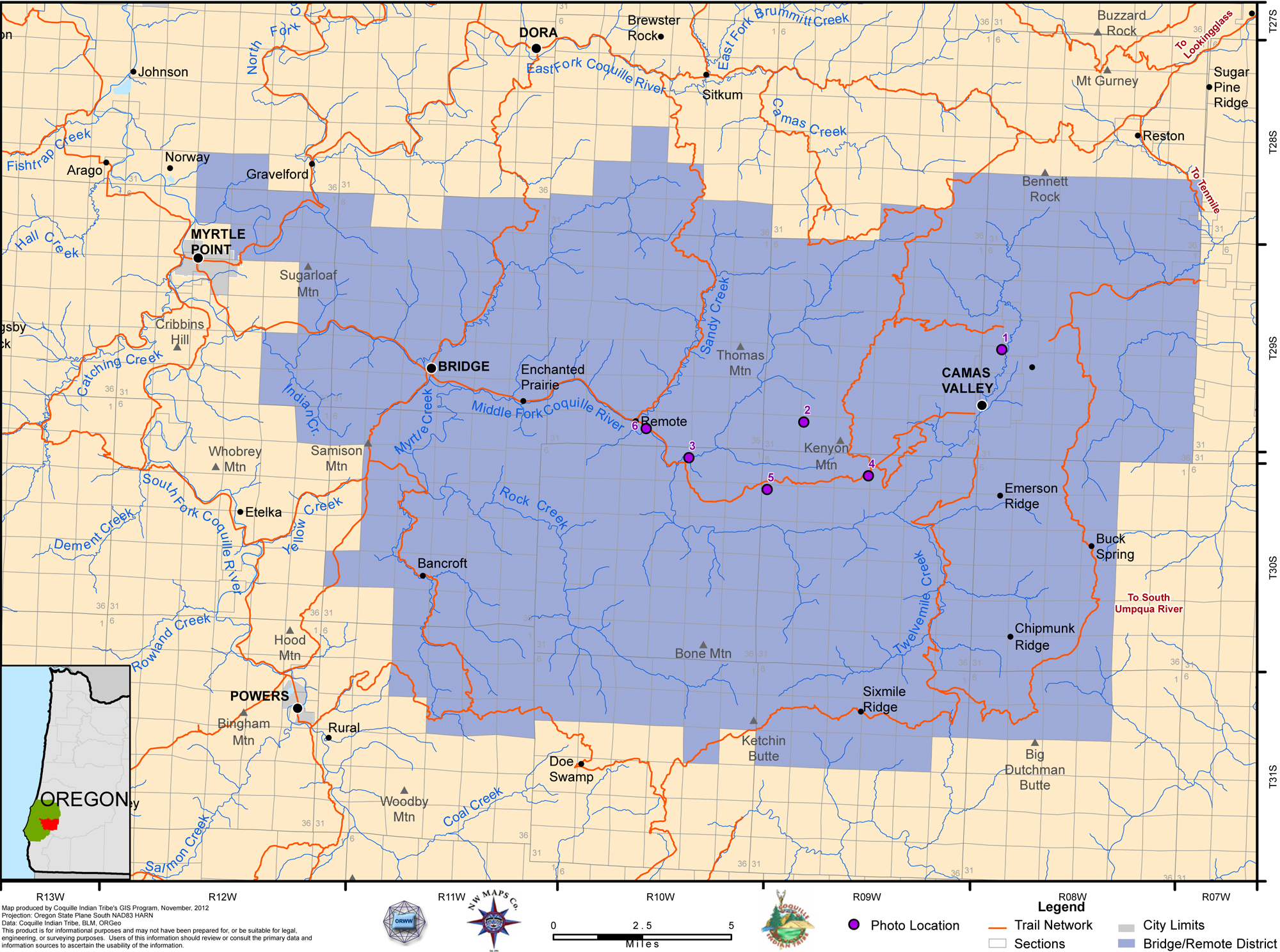
2012 Bridge-Remote District |
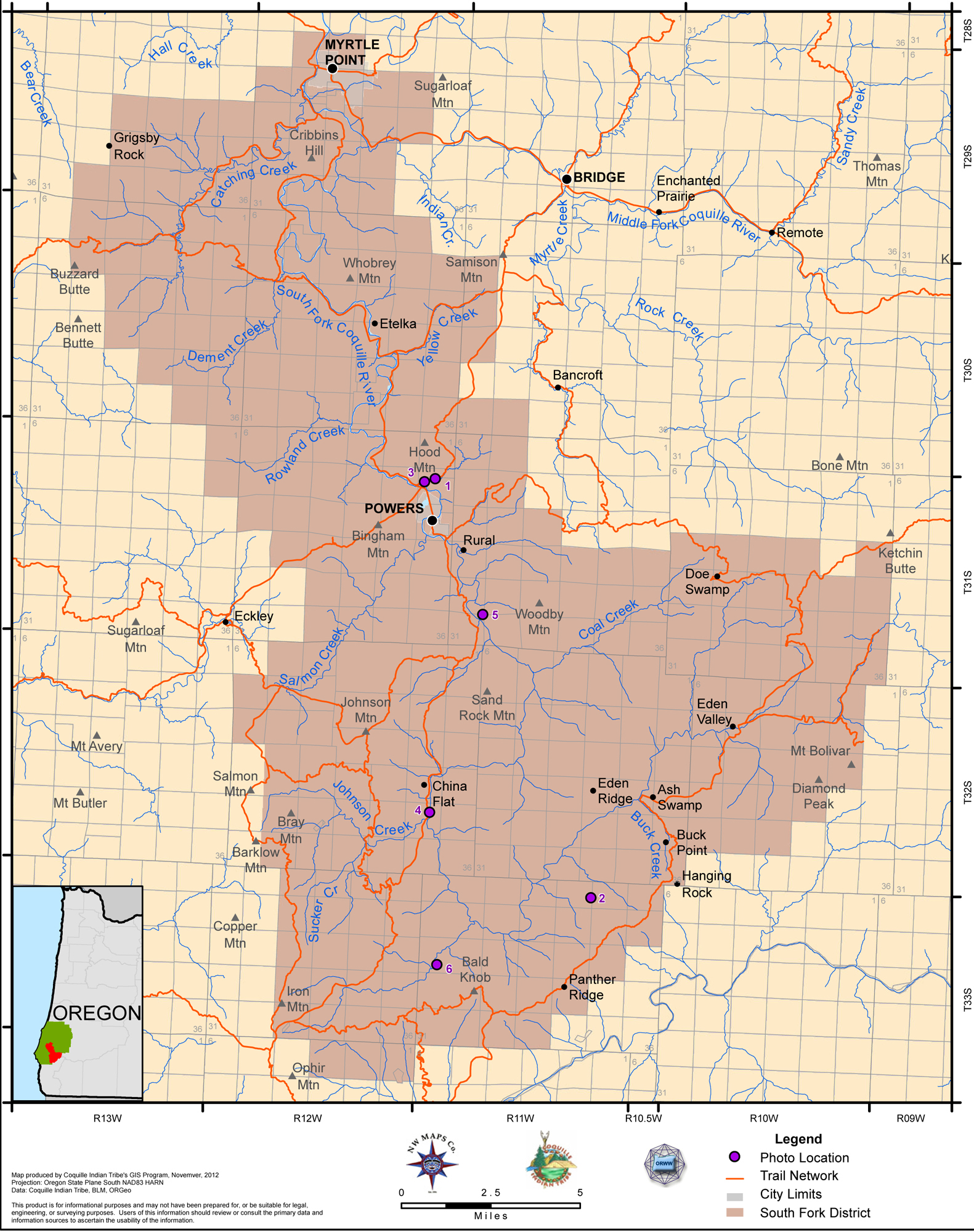
2012 South Fork District |
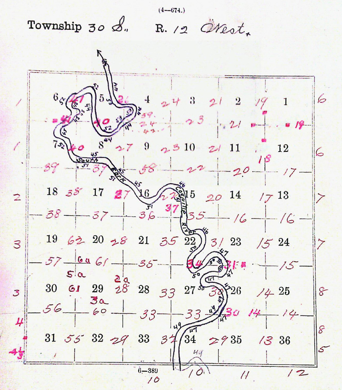
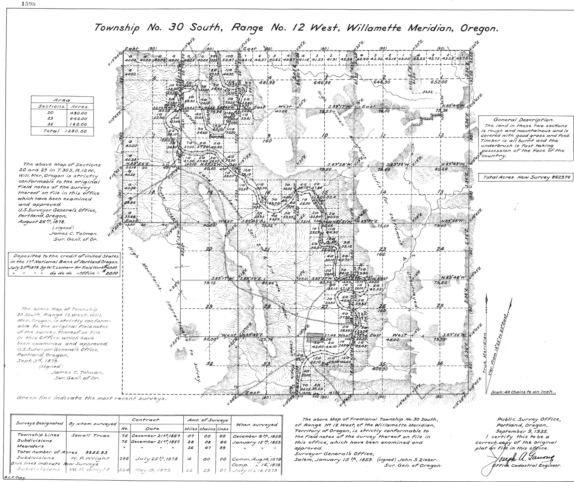
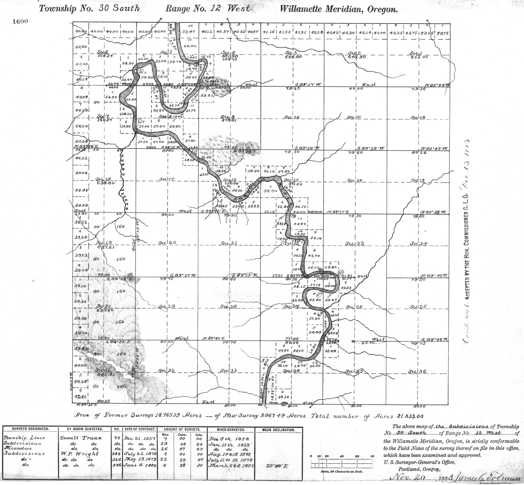
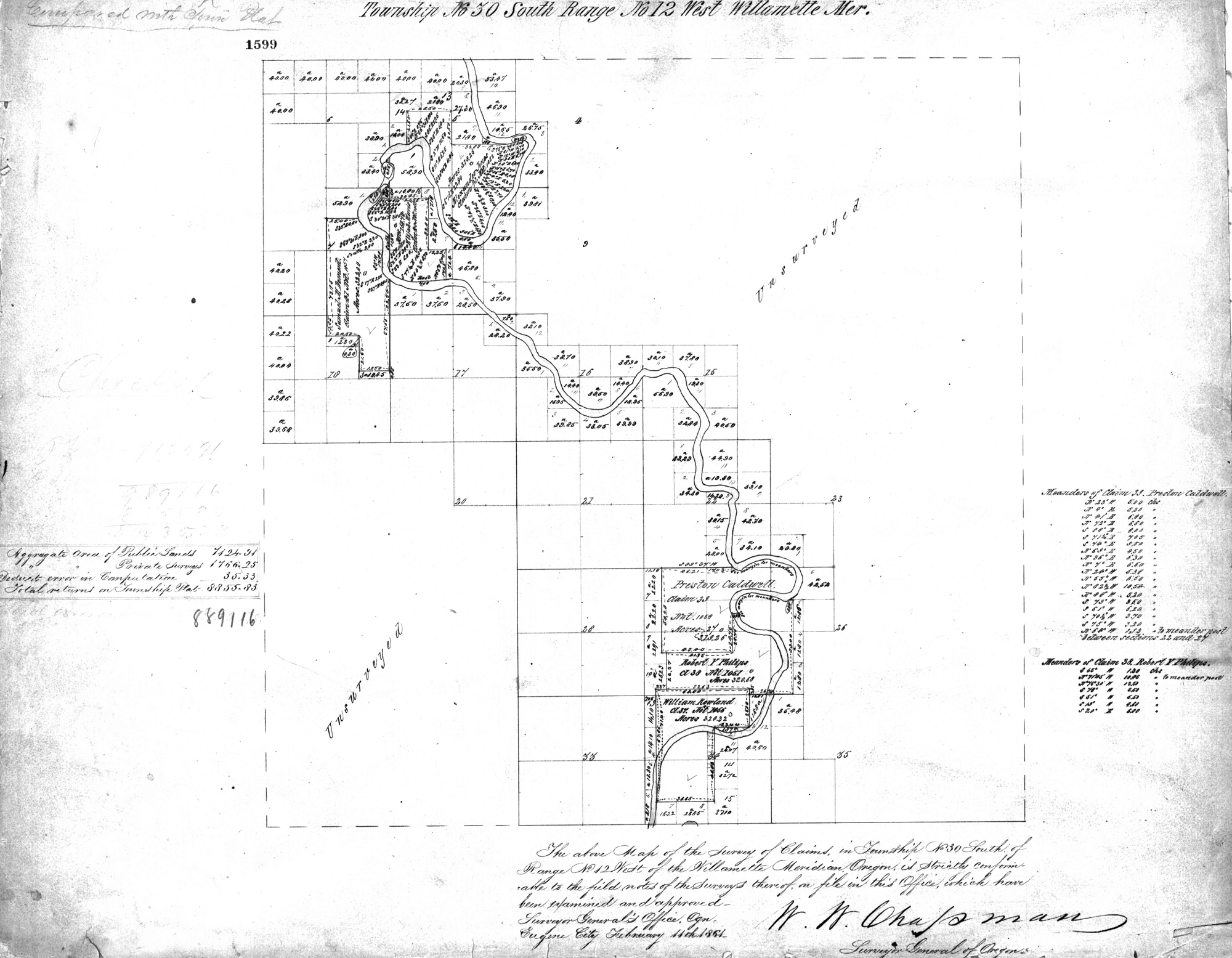
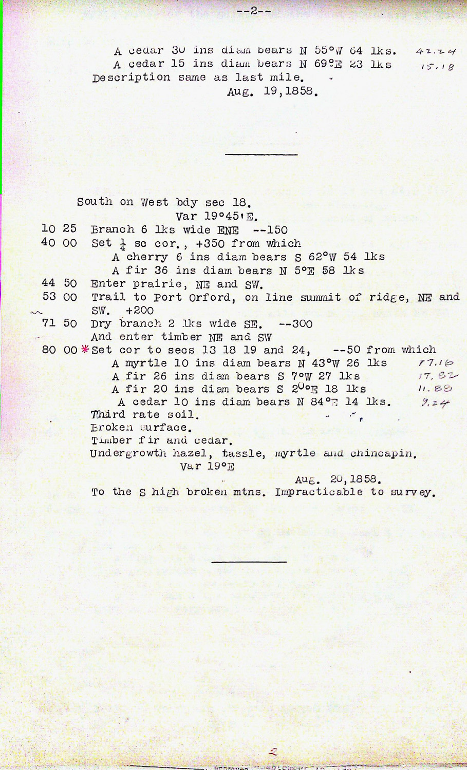
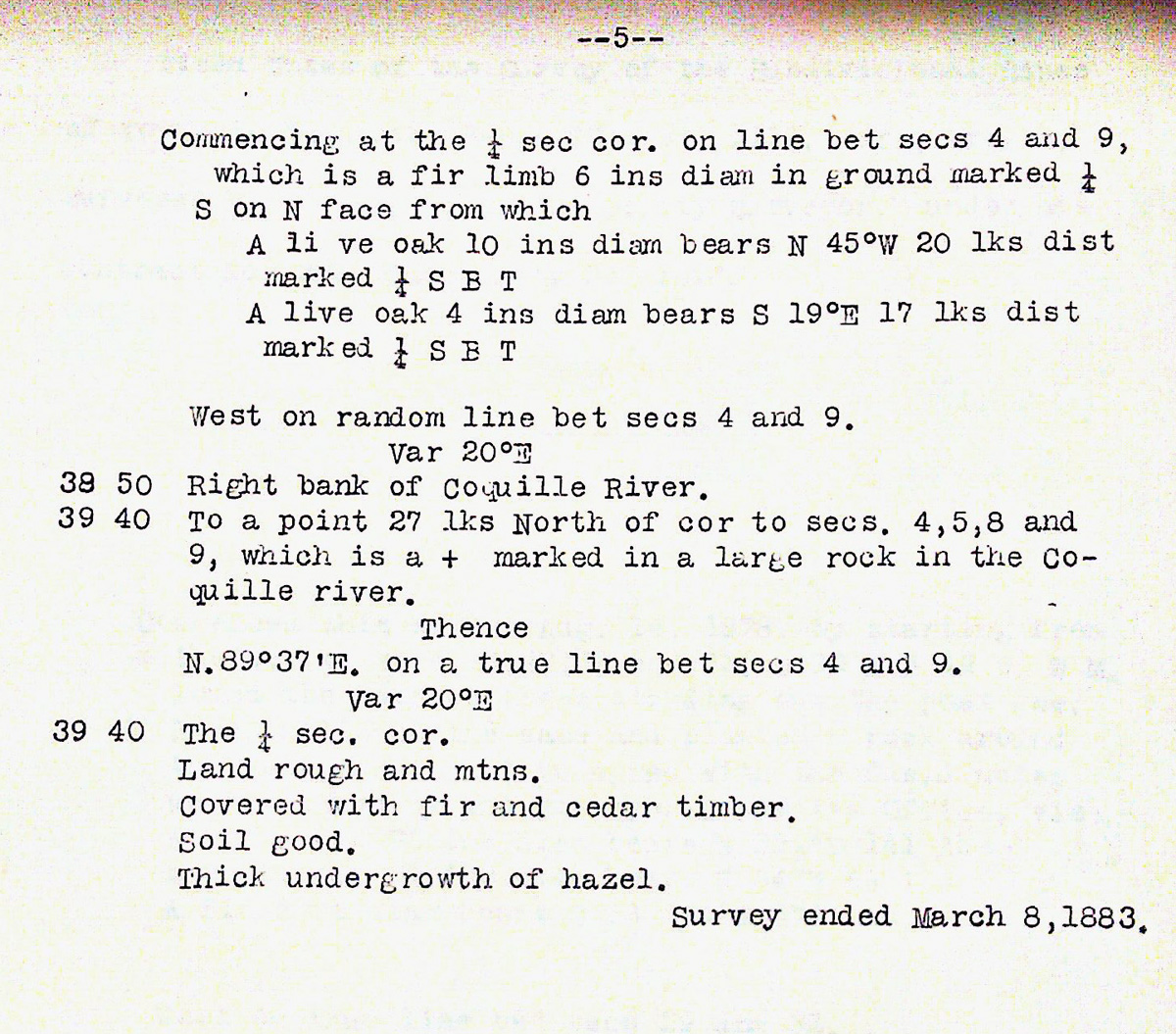
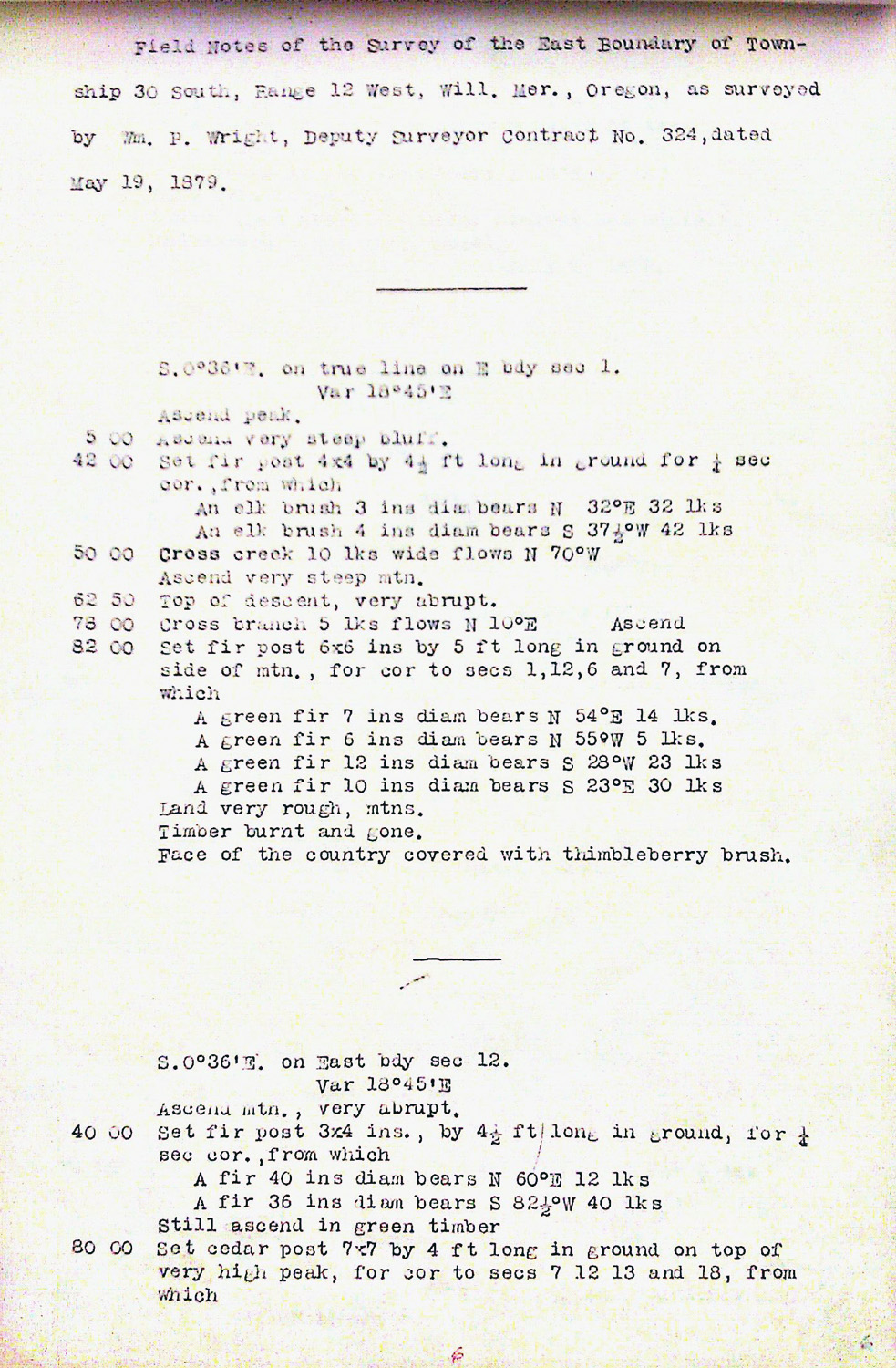
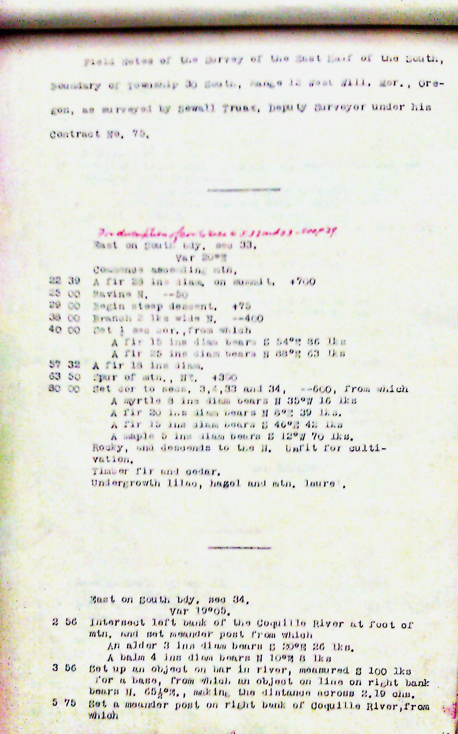
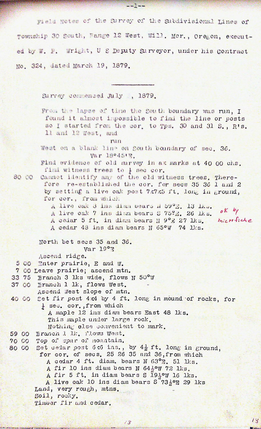
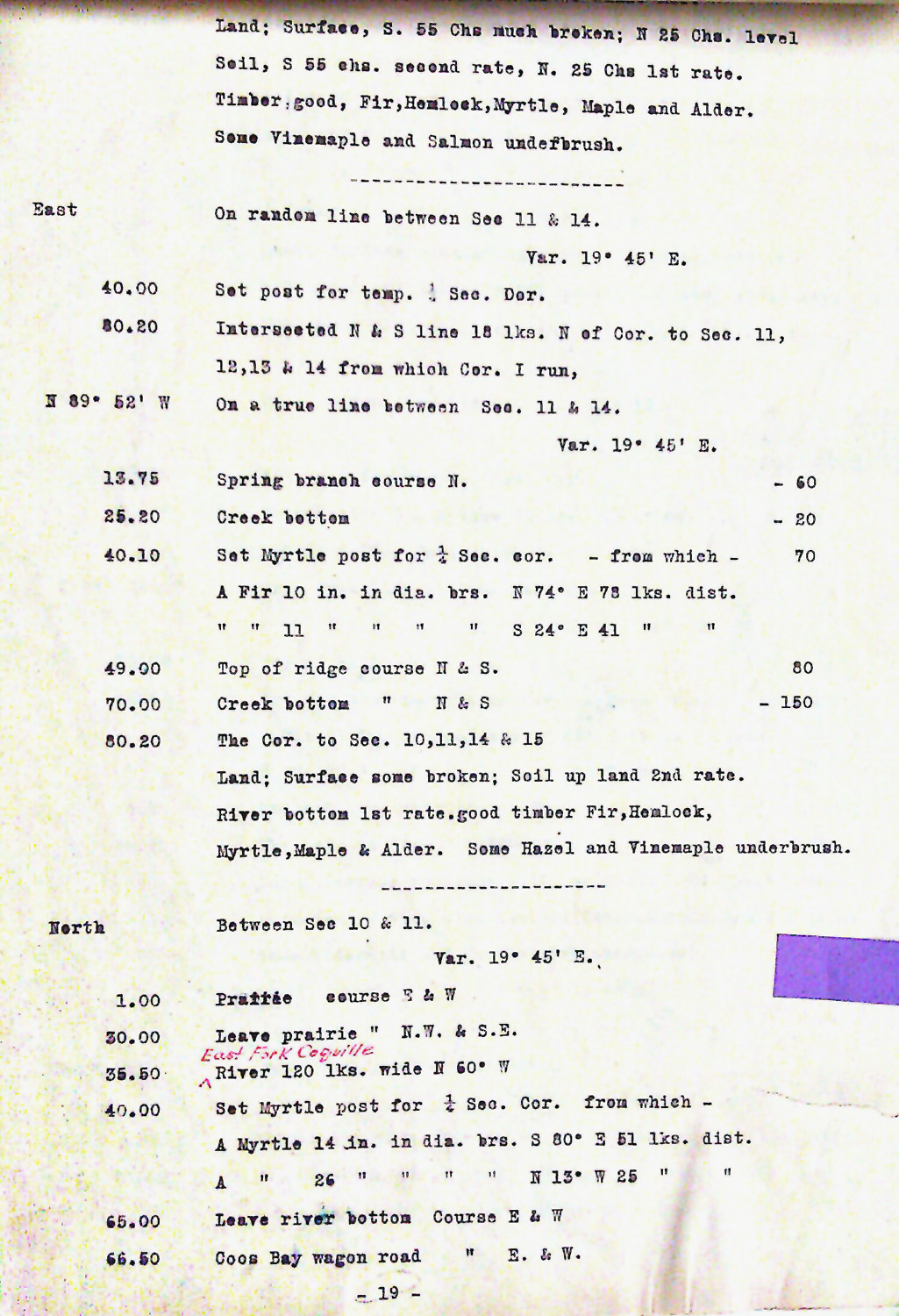
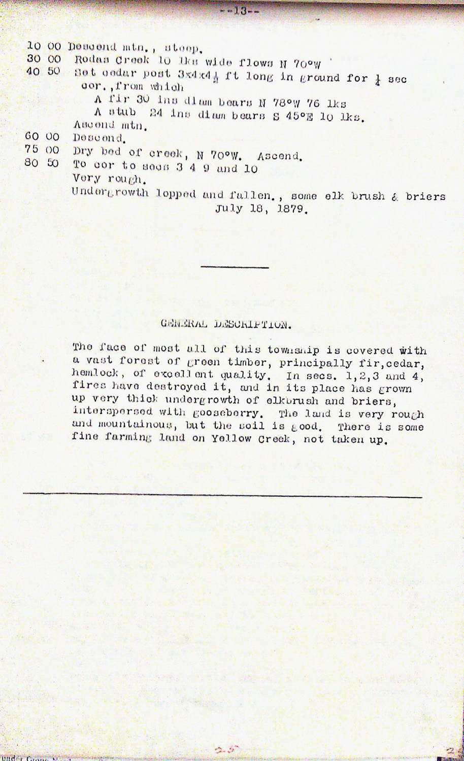
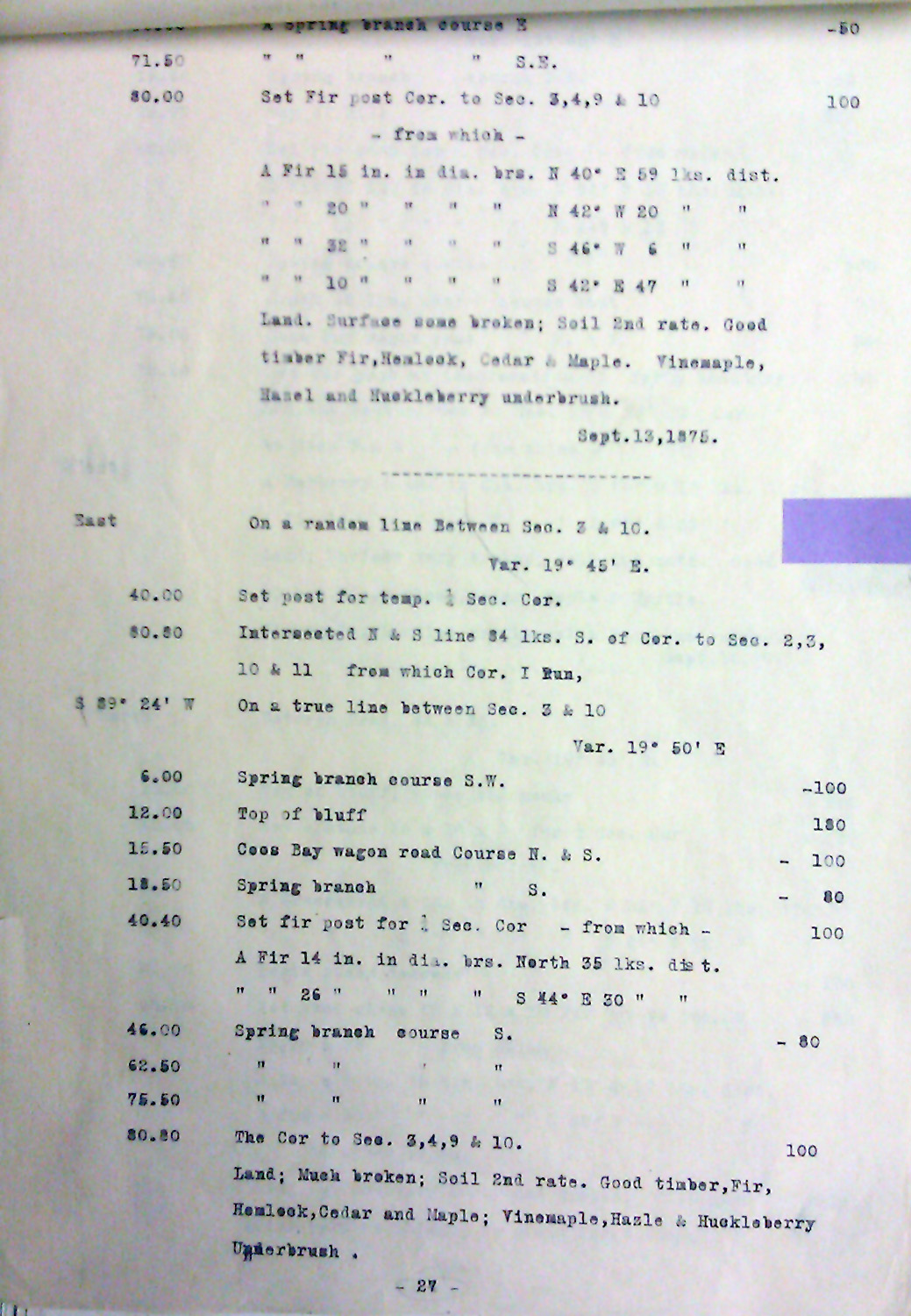
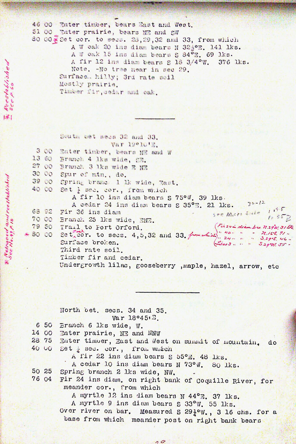
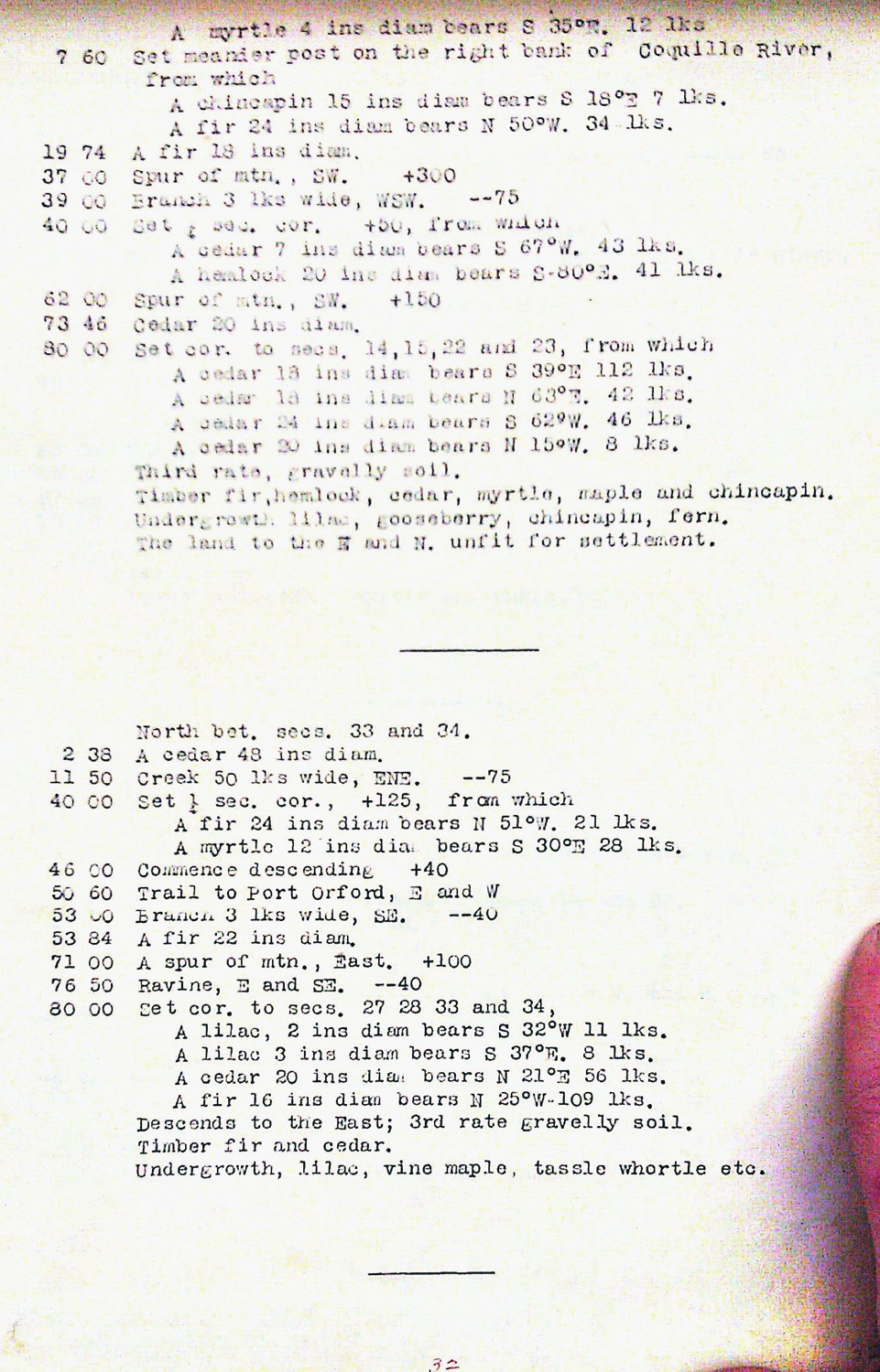
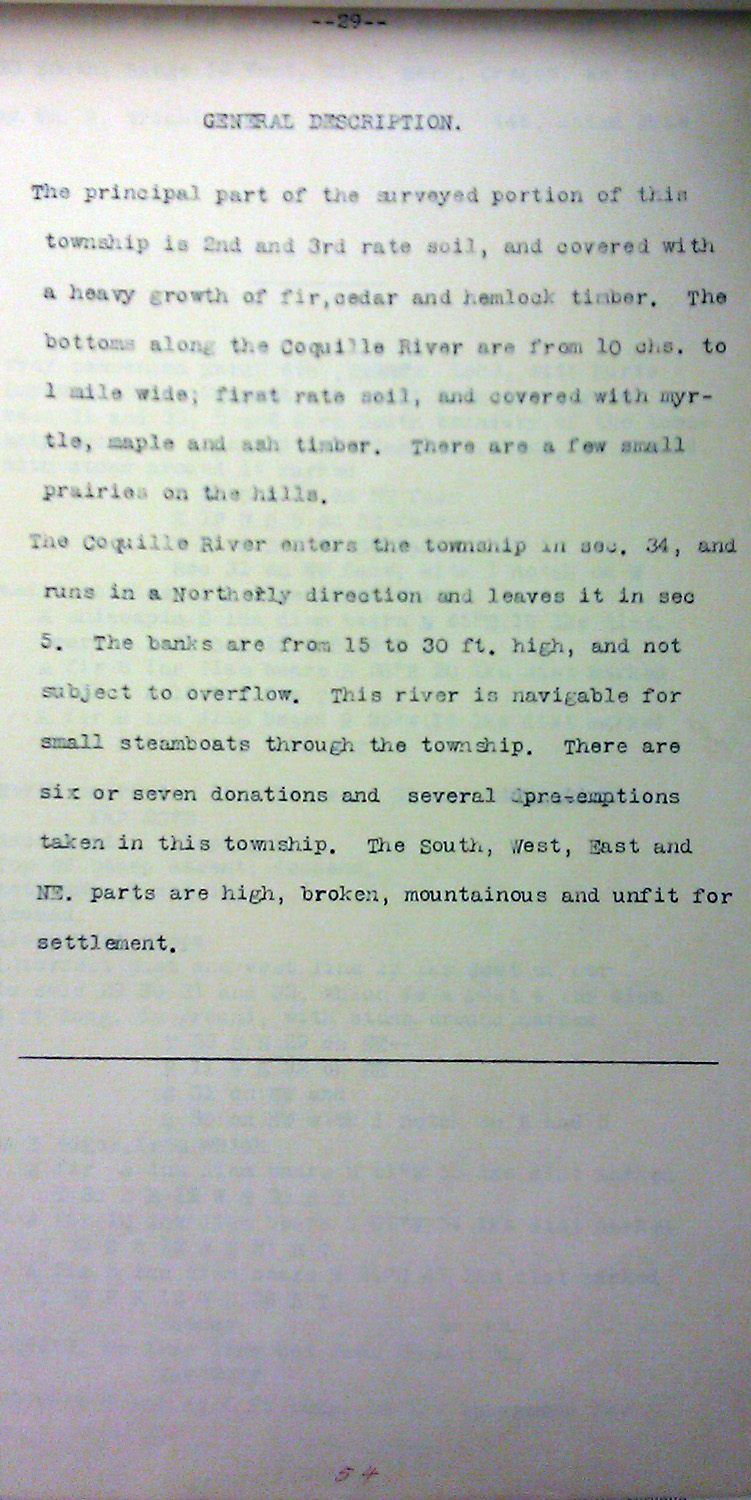
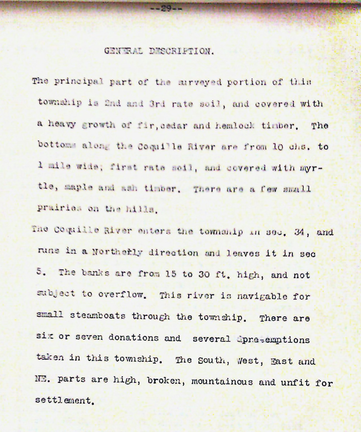
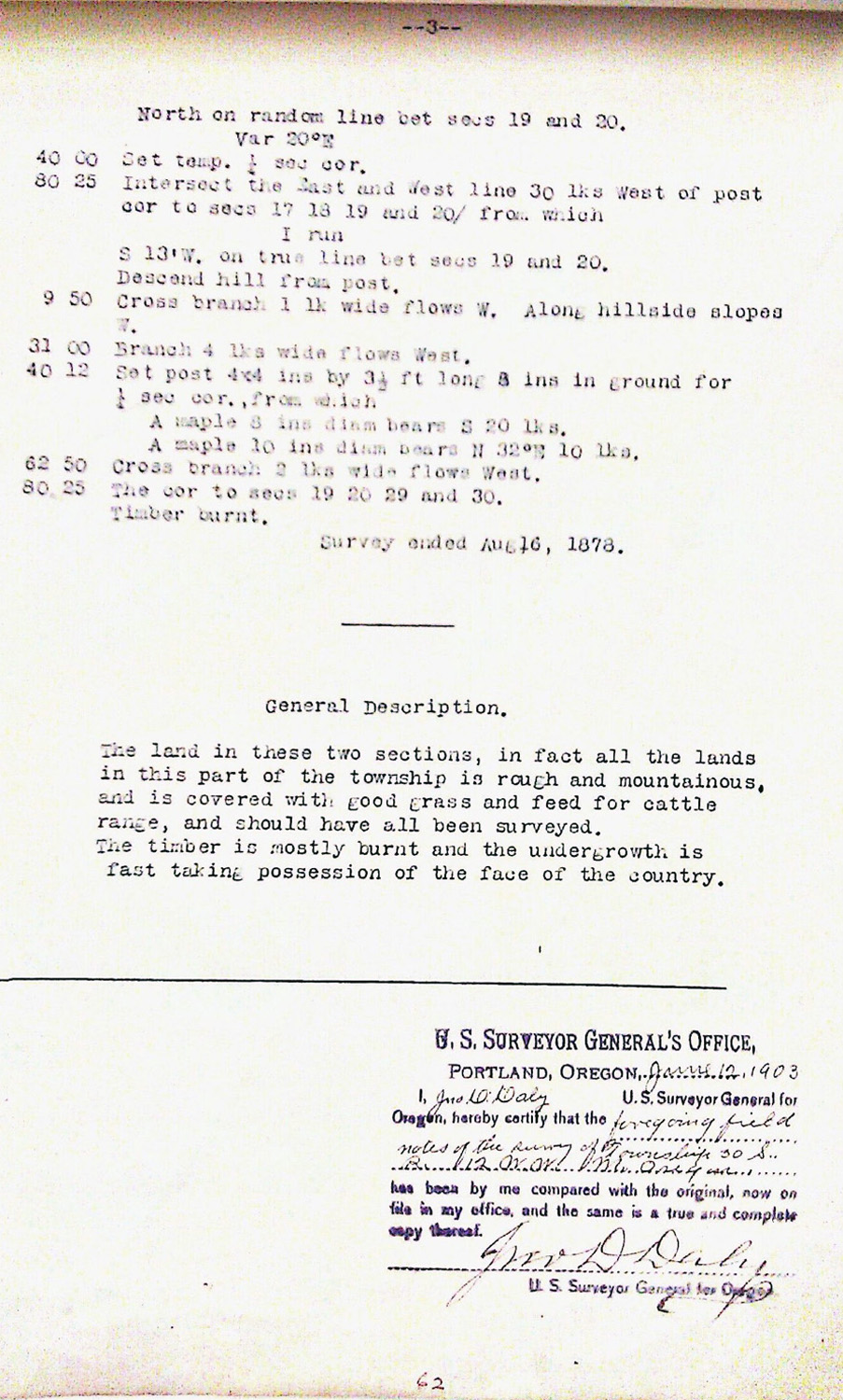
This township is entirely within the boundaries of the 2011-2012 Coquelle Trails Project. It includes Bald Hill, Dement Creek and Coquille River in the South Fork and Bridge-Remote Historical Districts. This survey was completed in 1858, 1859, 1864, 1873, 1878, 1879 and 1883, and mapped in 1859, 1864, and 1883 (Truax 1857; Meldrum 1866; Wright 1878; Wright 1879; Wright 1882b) Donation Land Claims were filed by Preston Caldwell, Samuel M. Dement, Alexander Jones, Elijah Morris, Robert Phillips, and William Rowland.
![]()