 |
 |
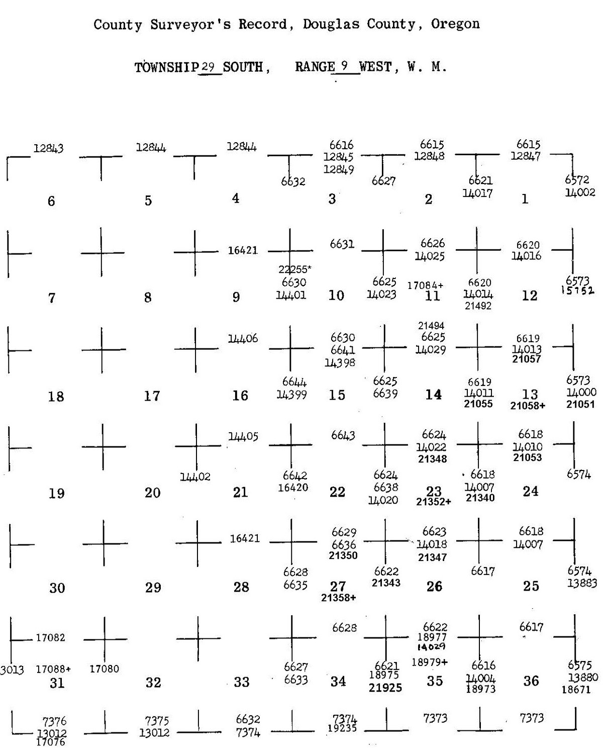
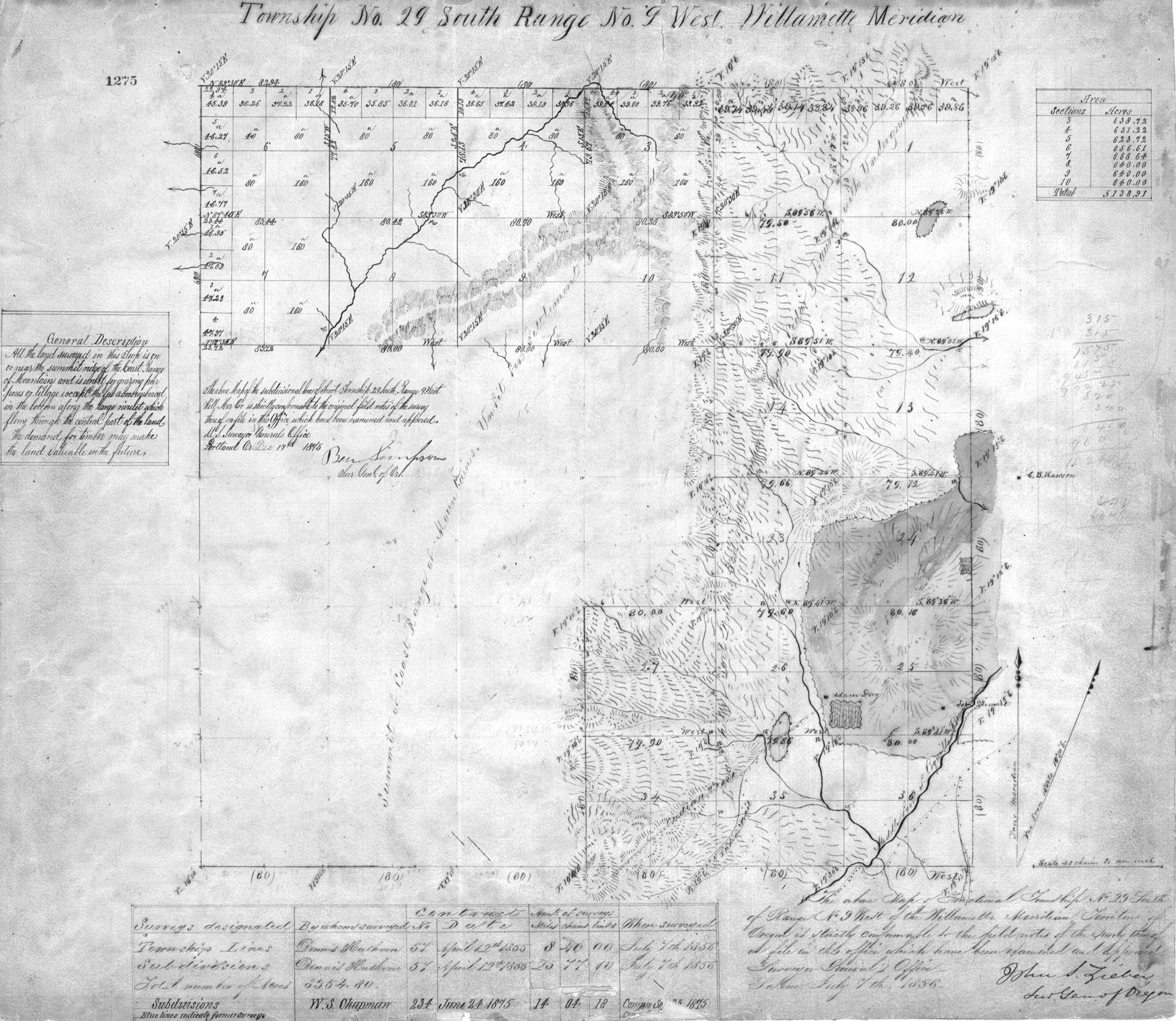
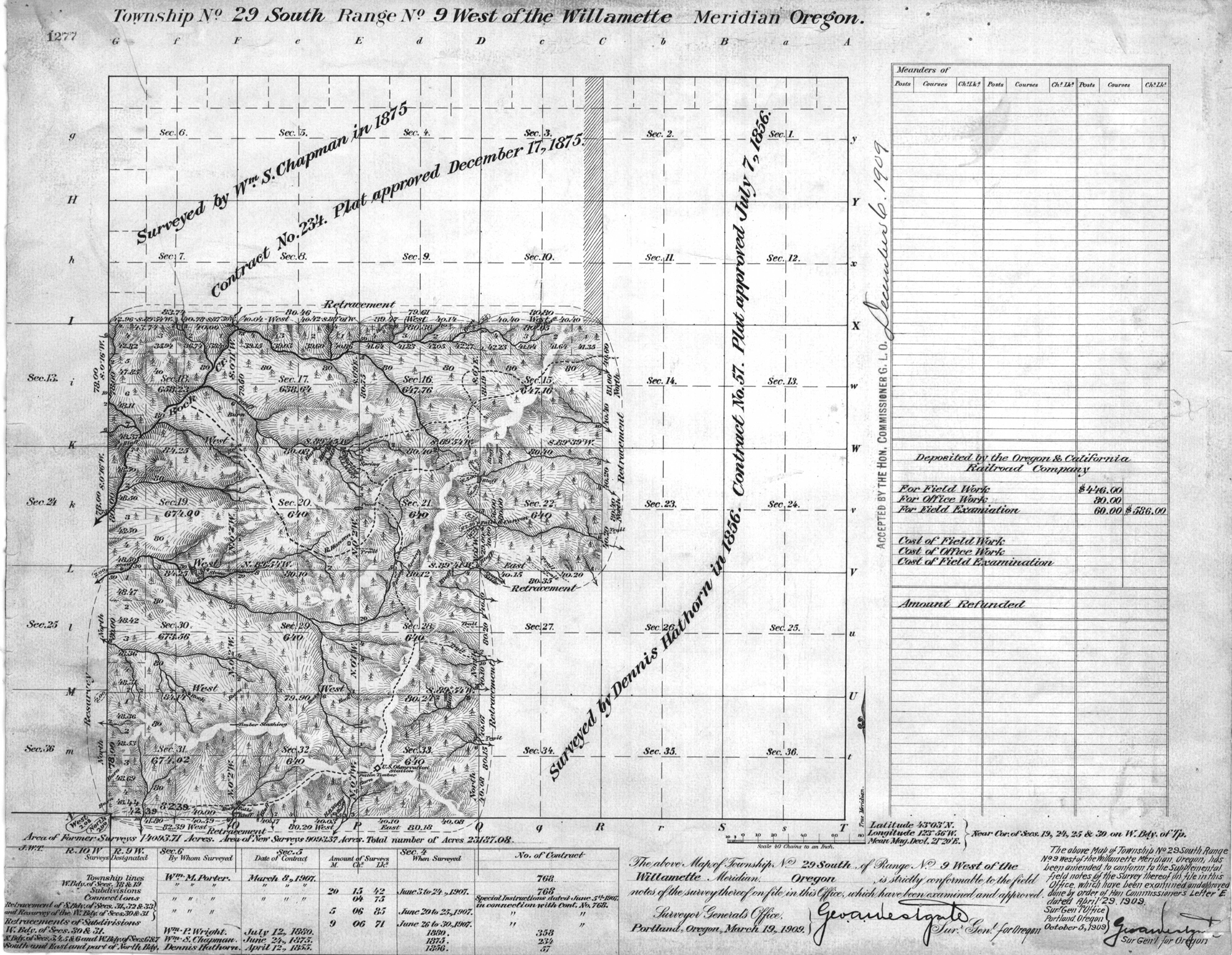
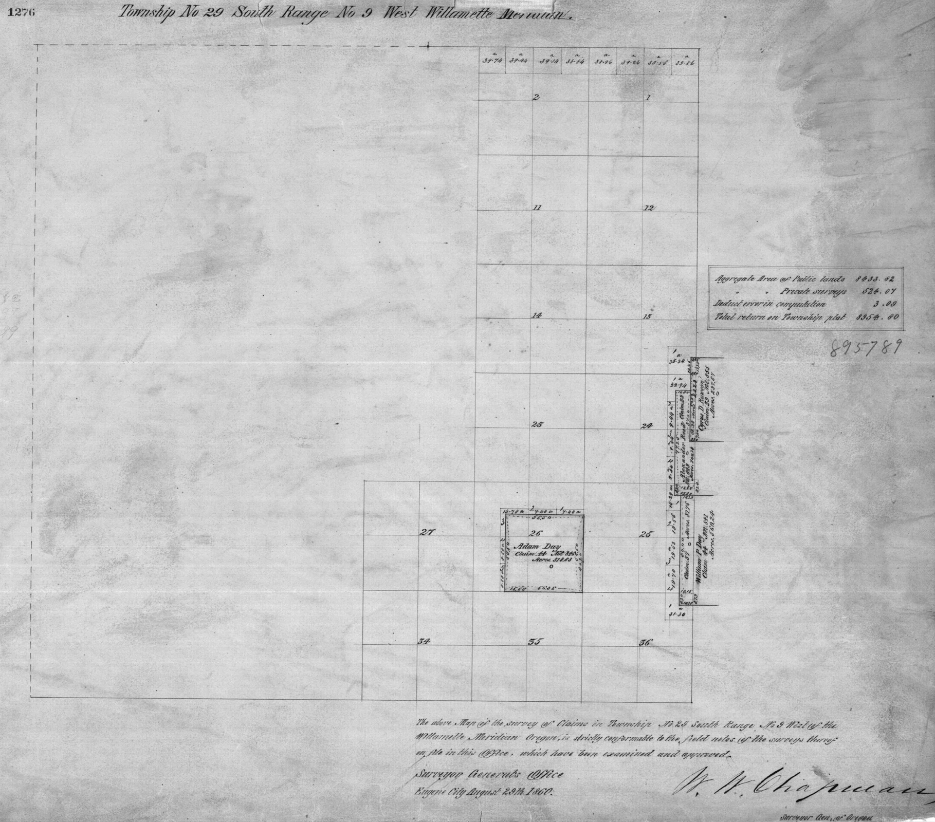
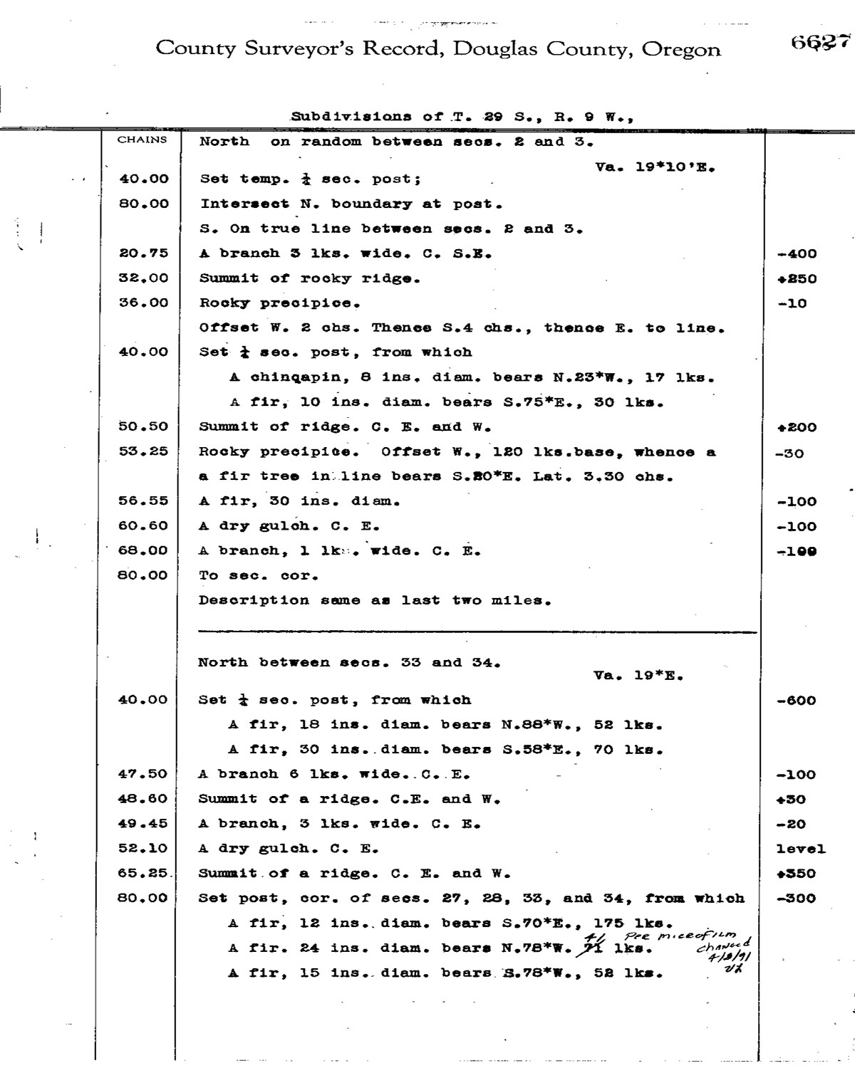
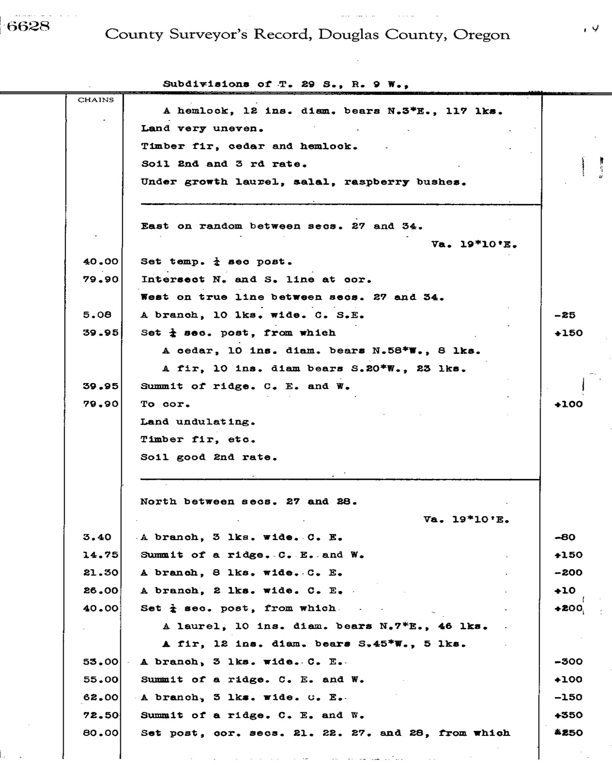
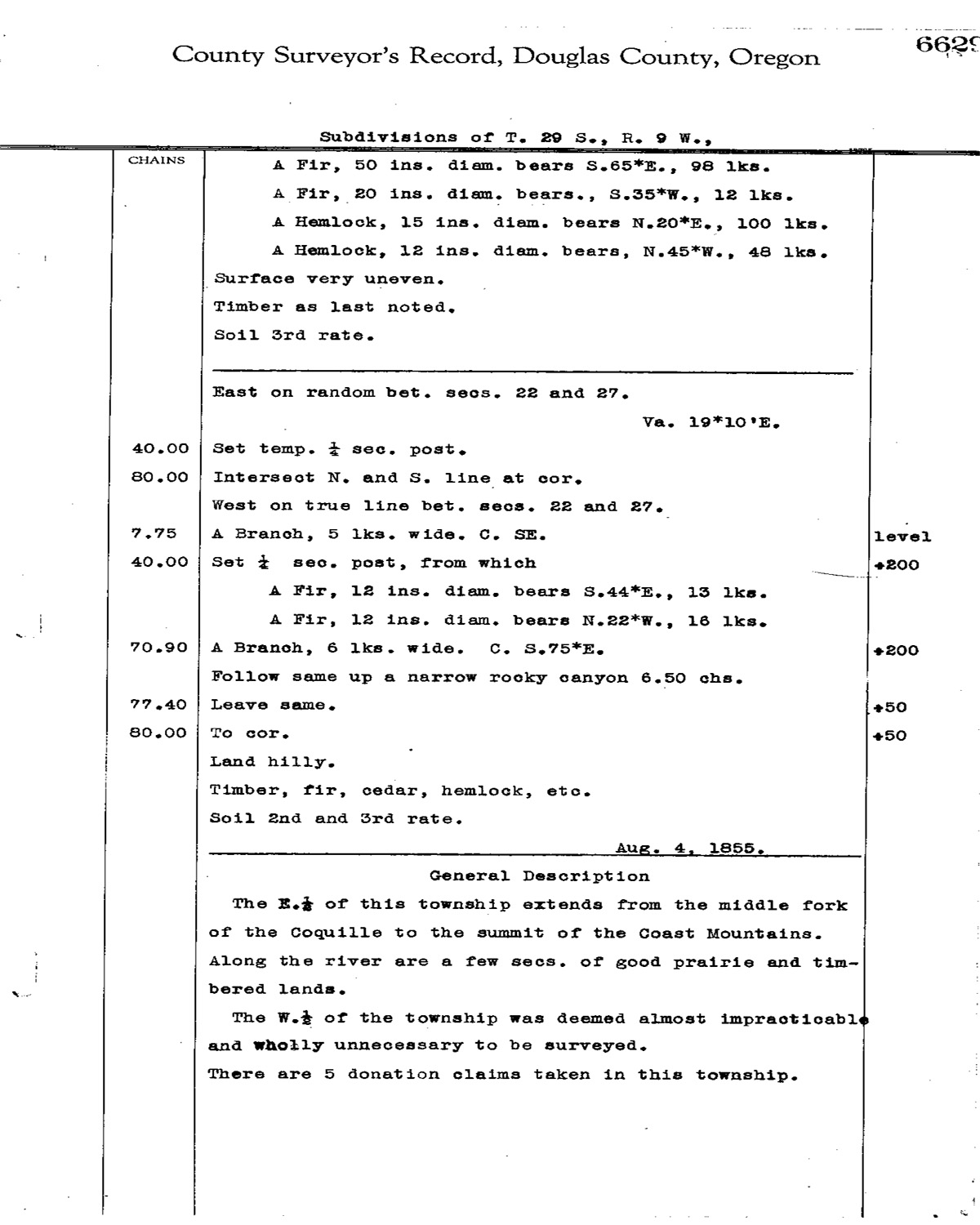
Tsp. 29 S., Rng. 09 W.
|
|
General Land Office Survey Index
 |
 |
 |
 |
 |
 |
1856 GLO |
1909 GLO |
1860 DLC |
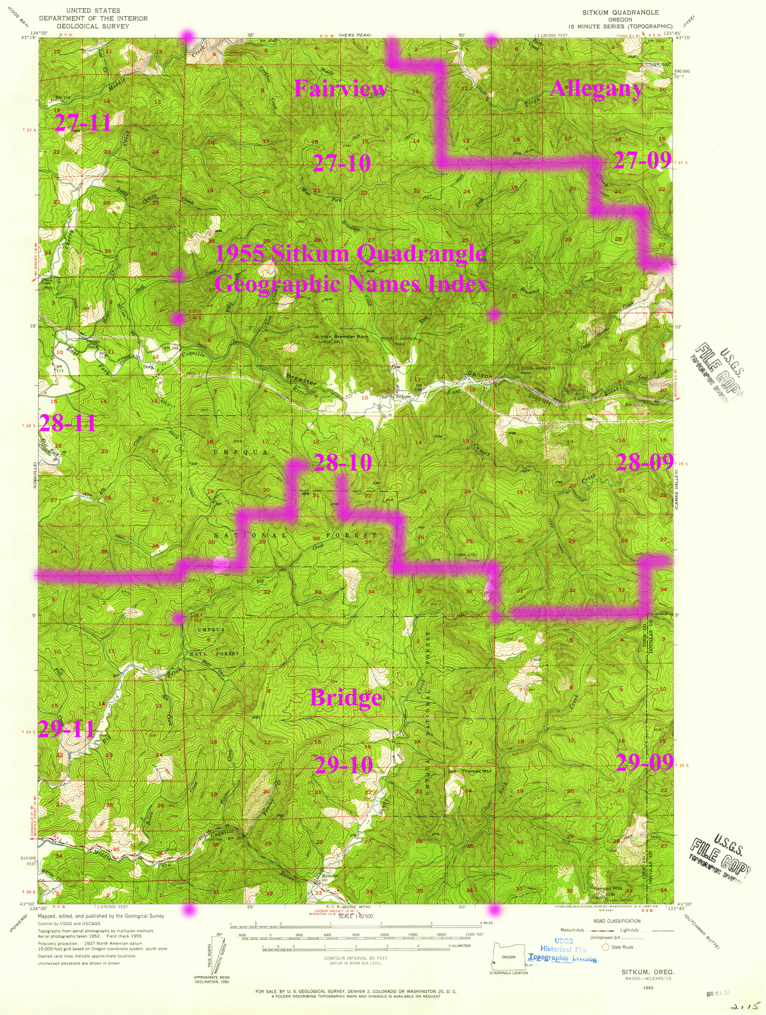
1955 Annotated USGS Sitkum |
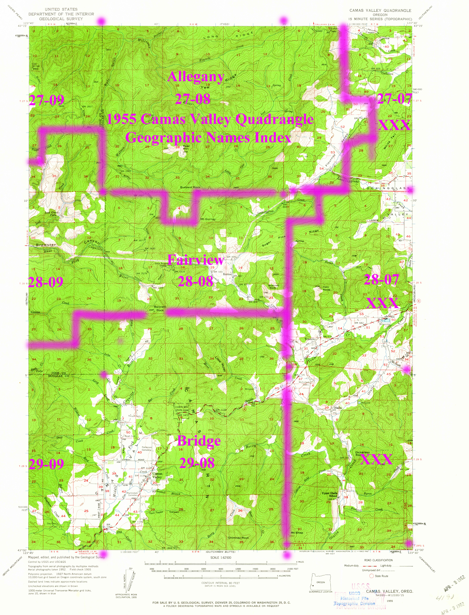
1955 Annotated USGS Camas Valley |
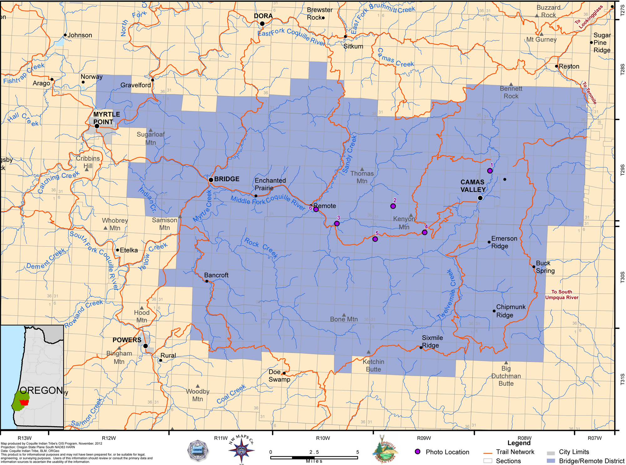
2012 Bridge-Remote District |
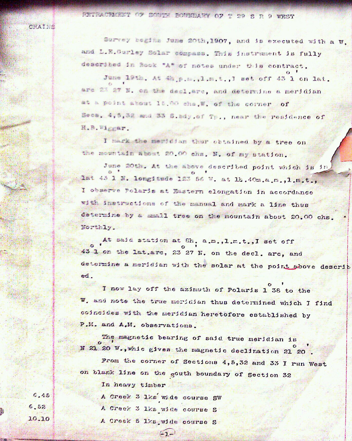
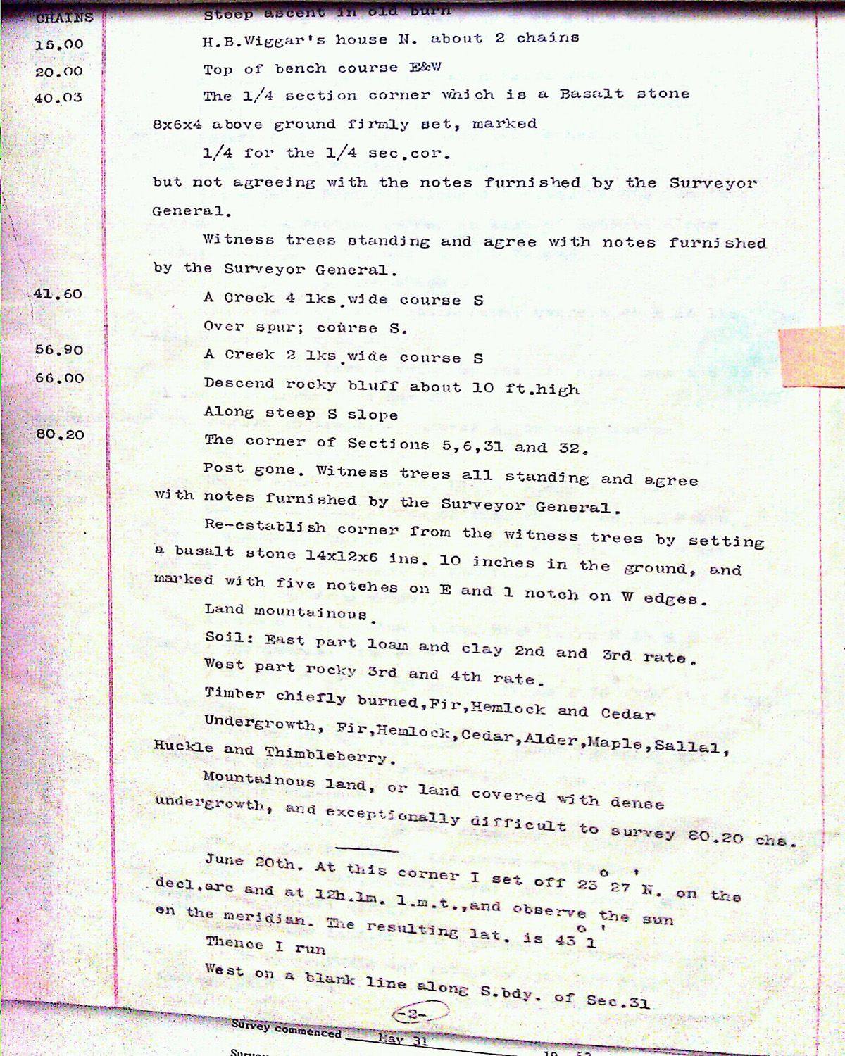
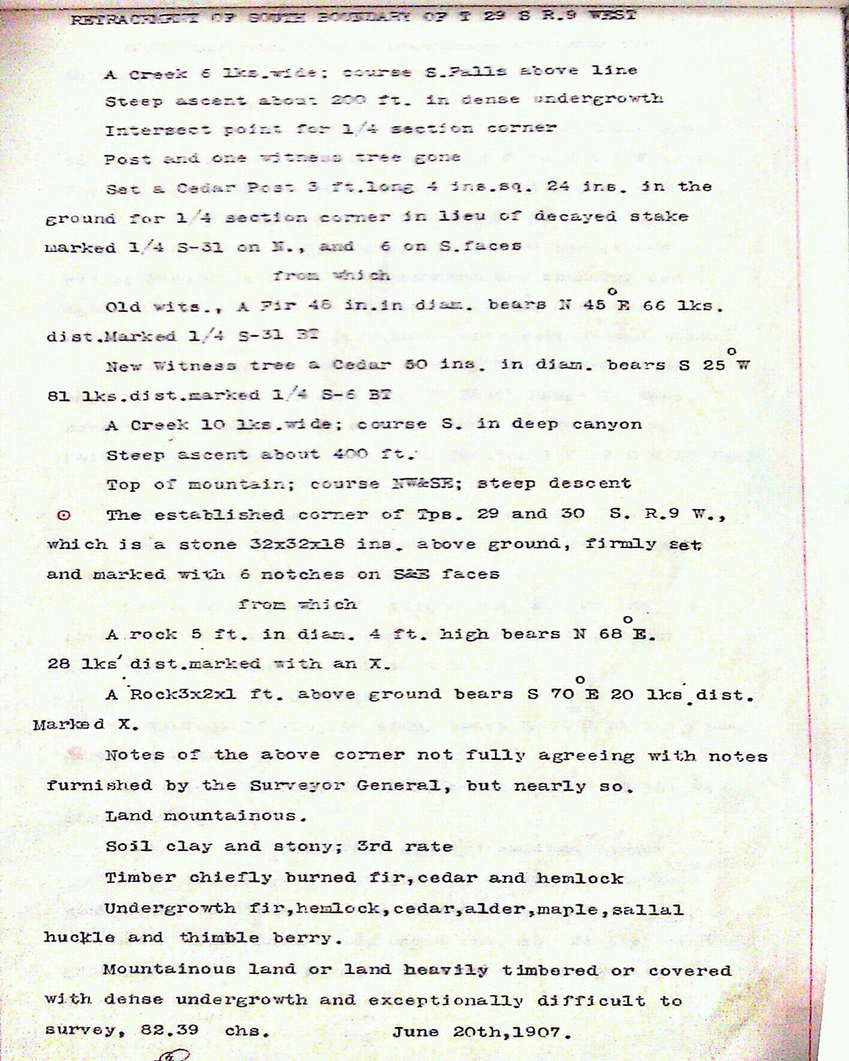
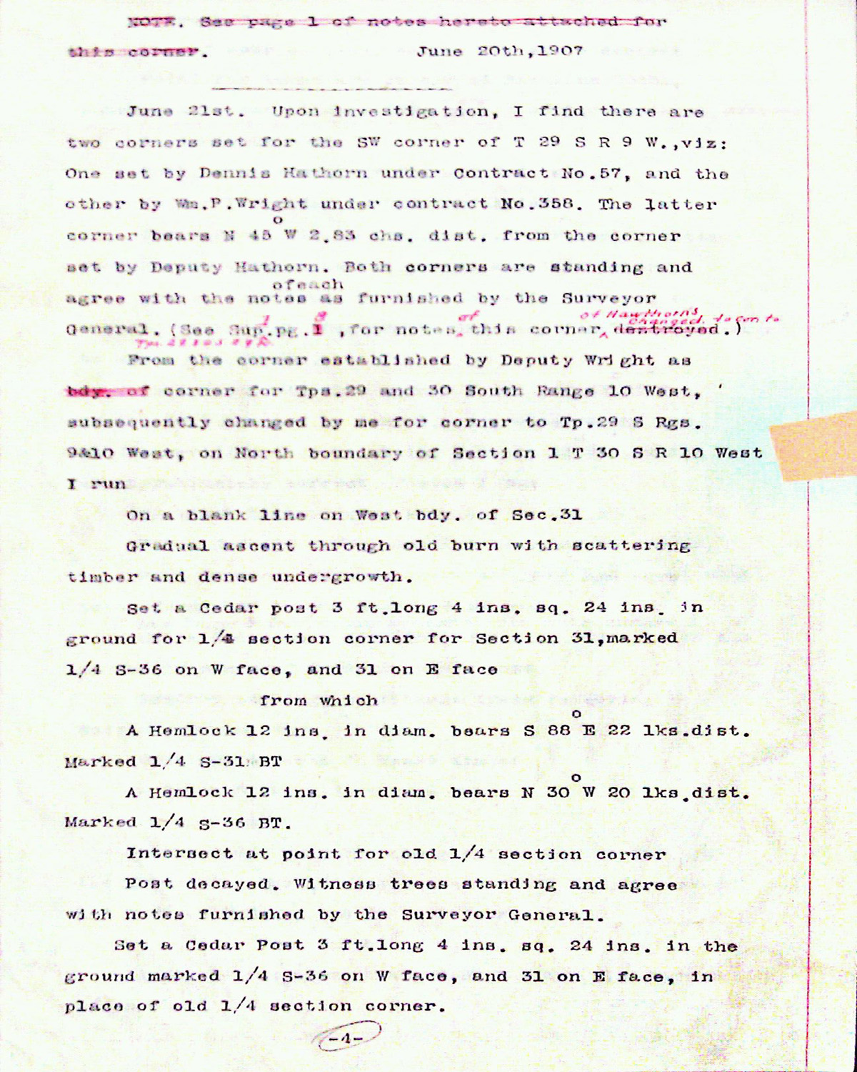
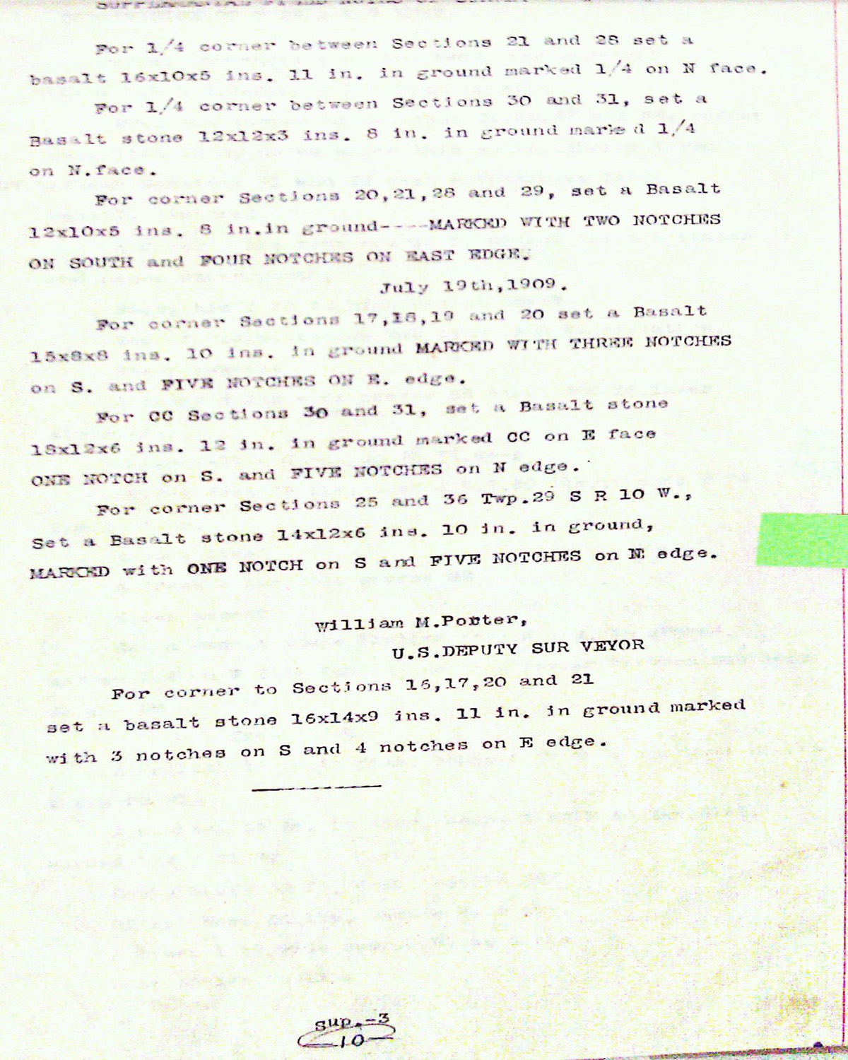
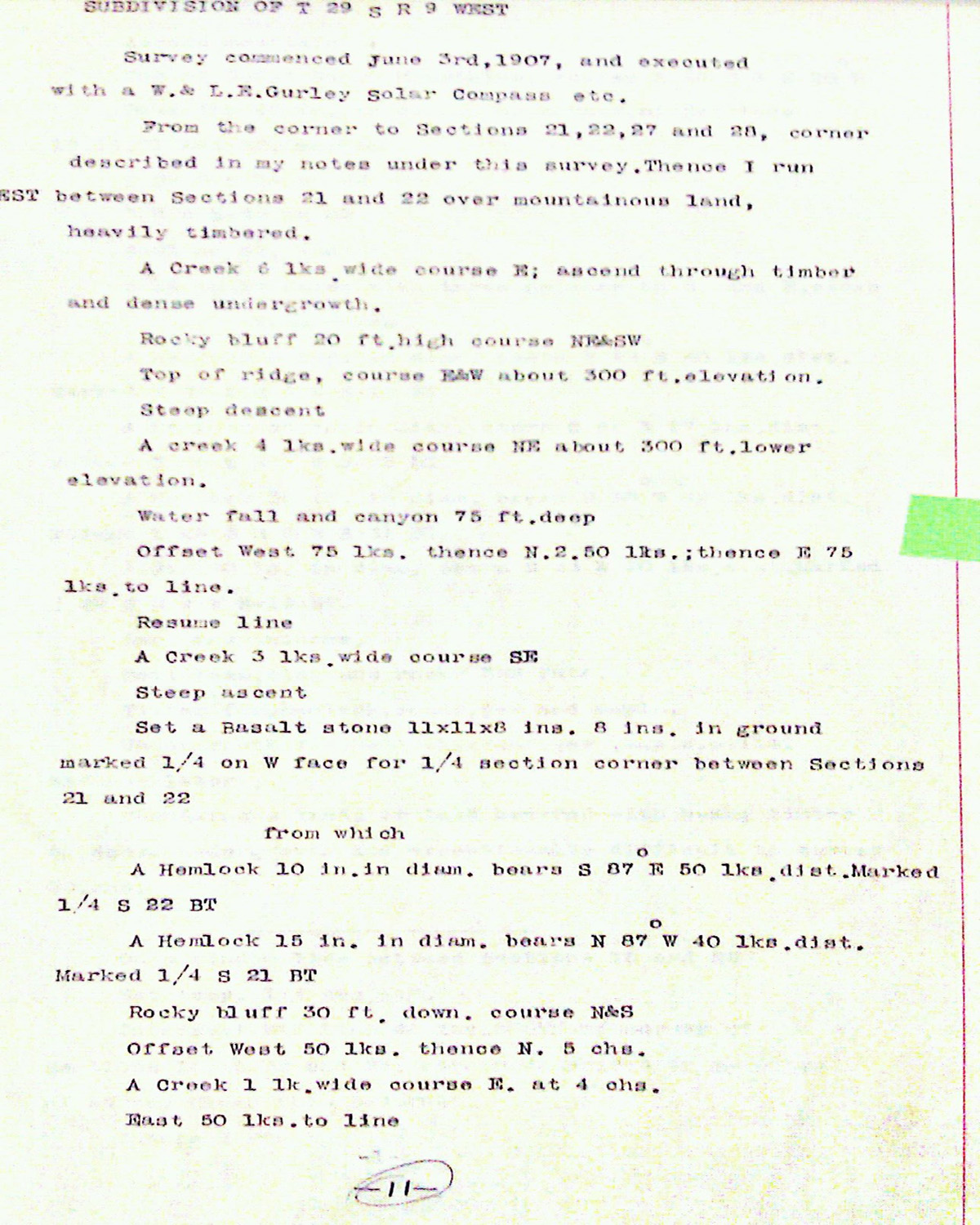
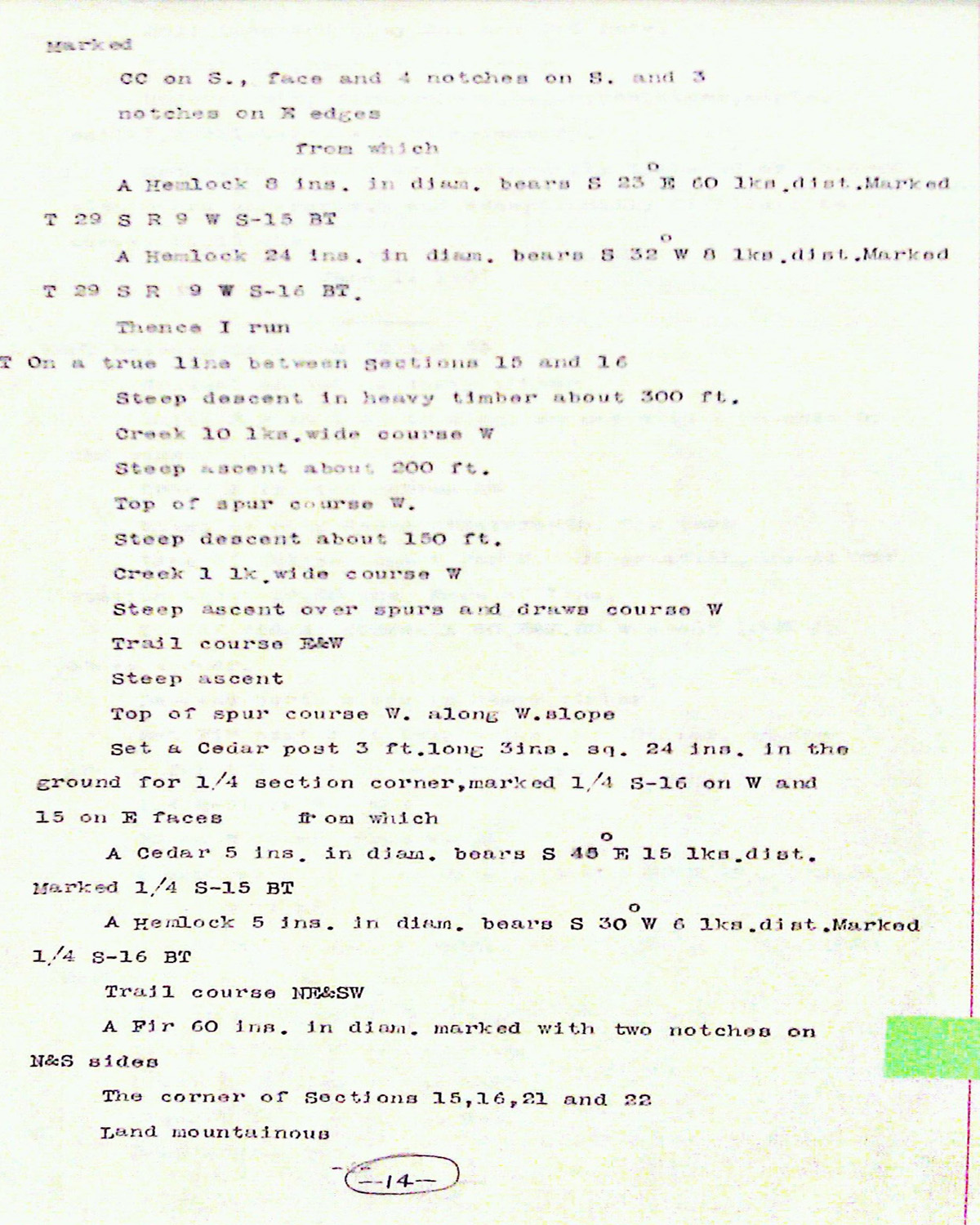
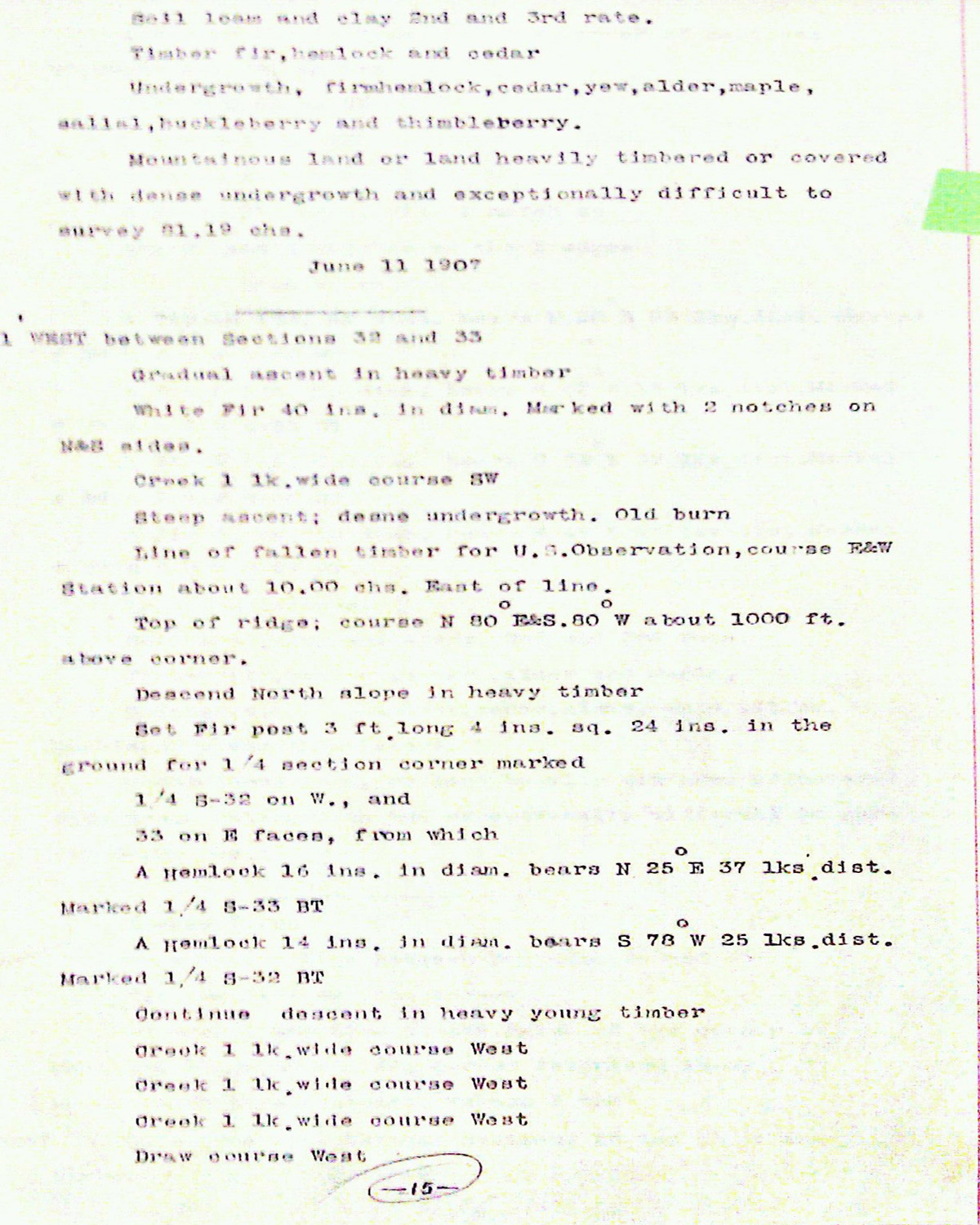
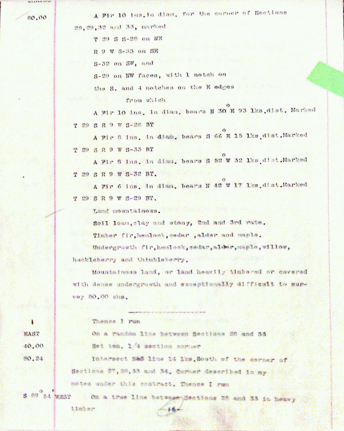
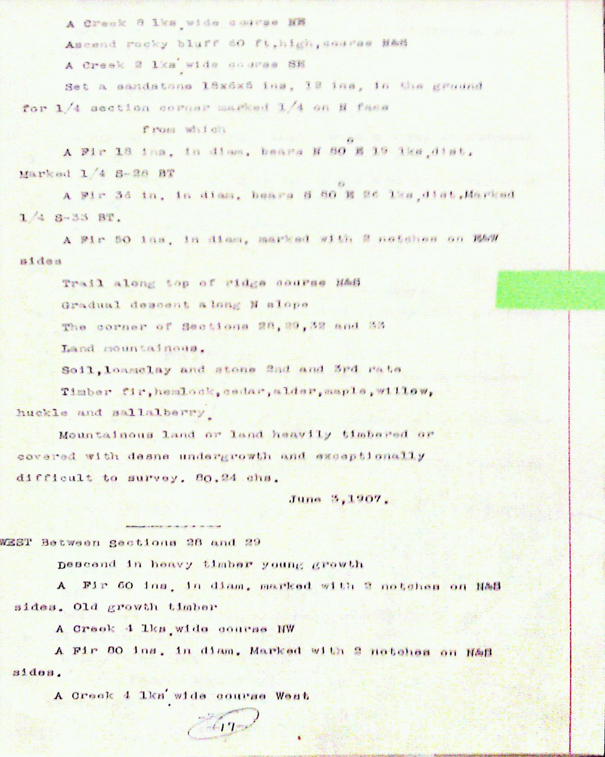
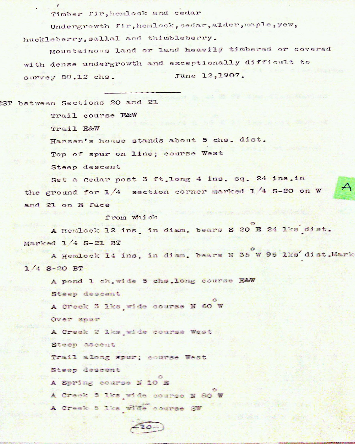
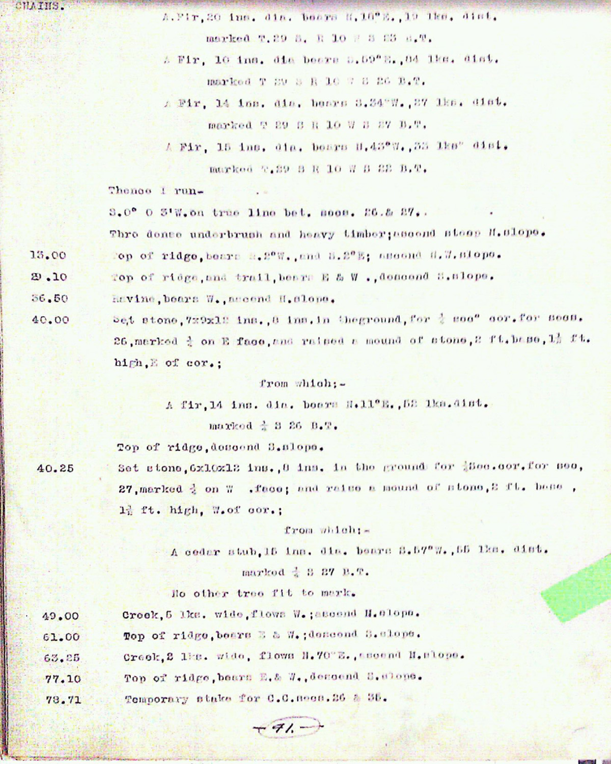
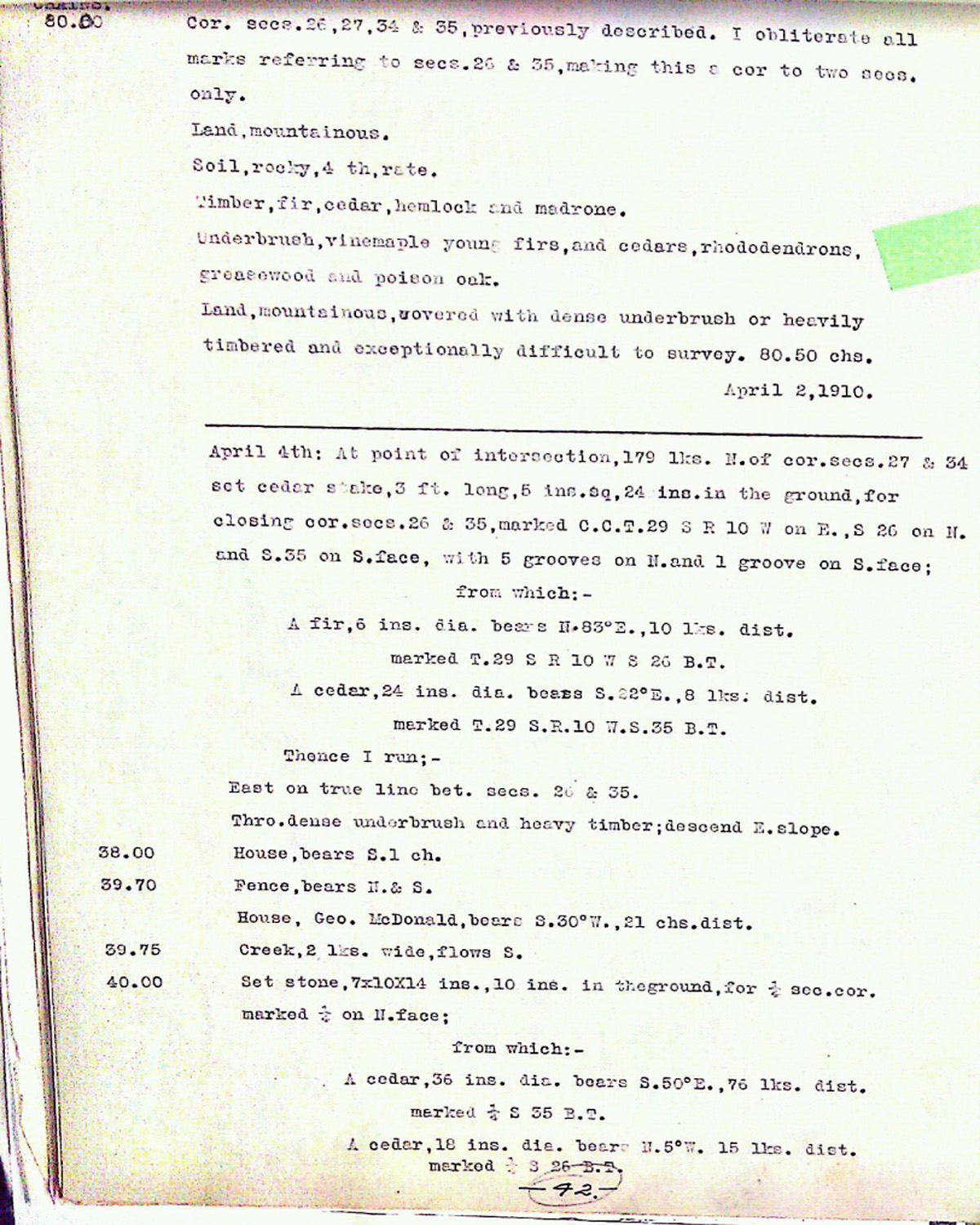
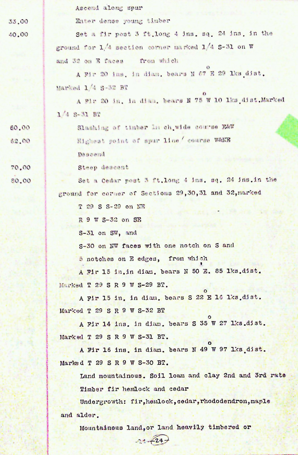
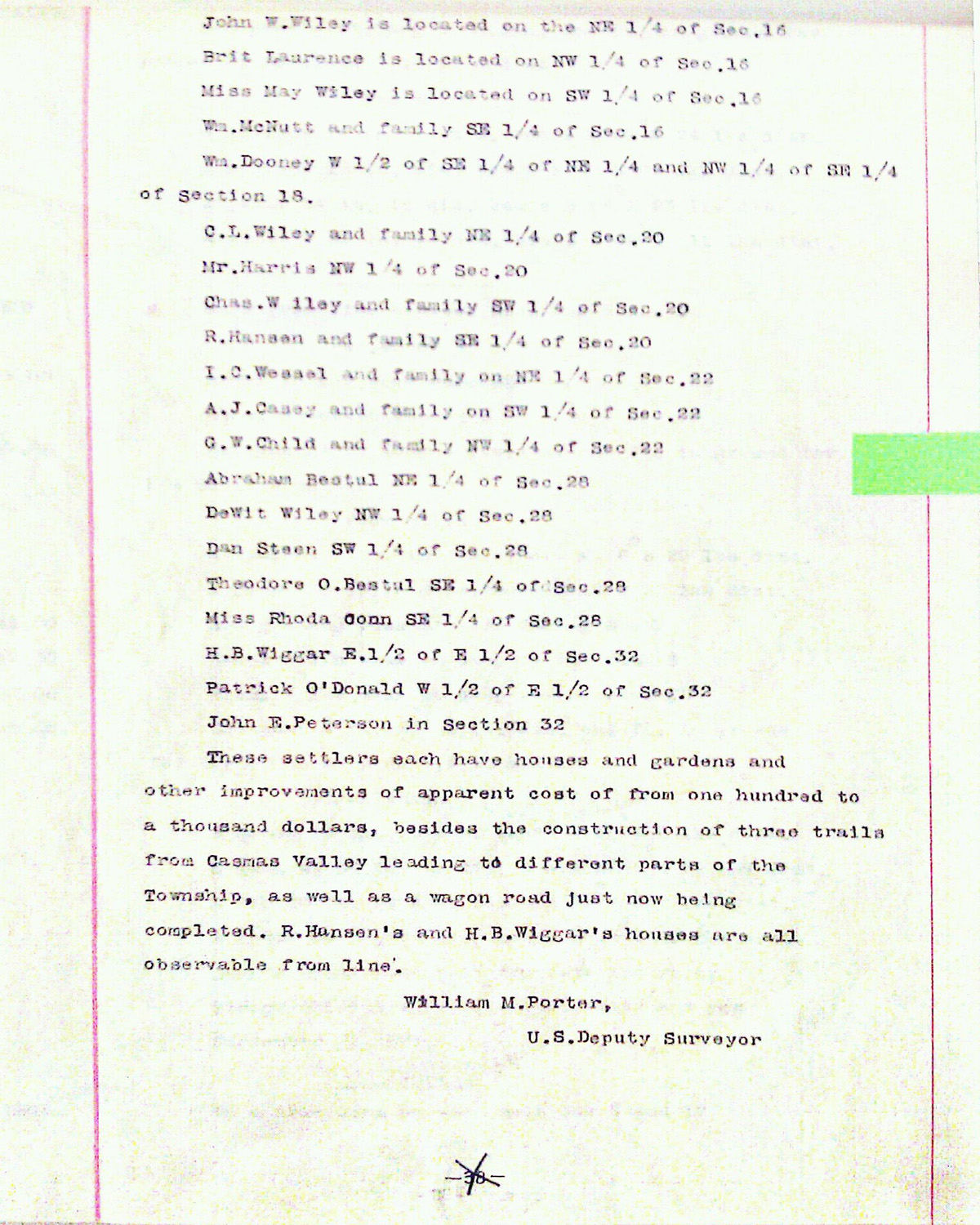
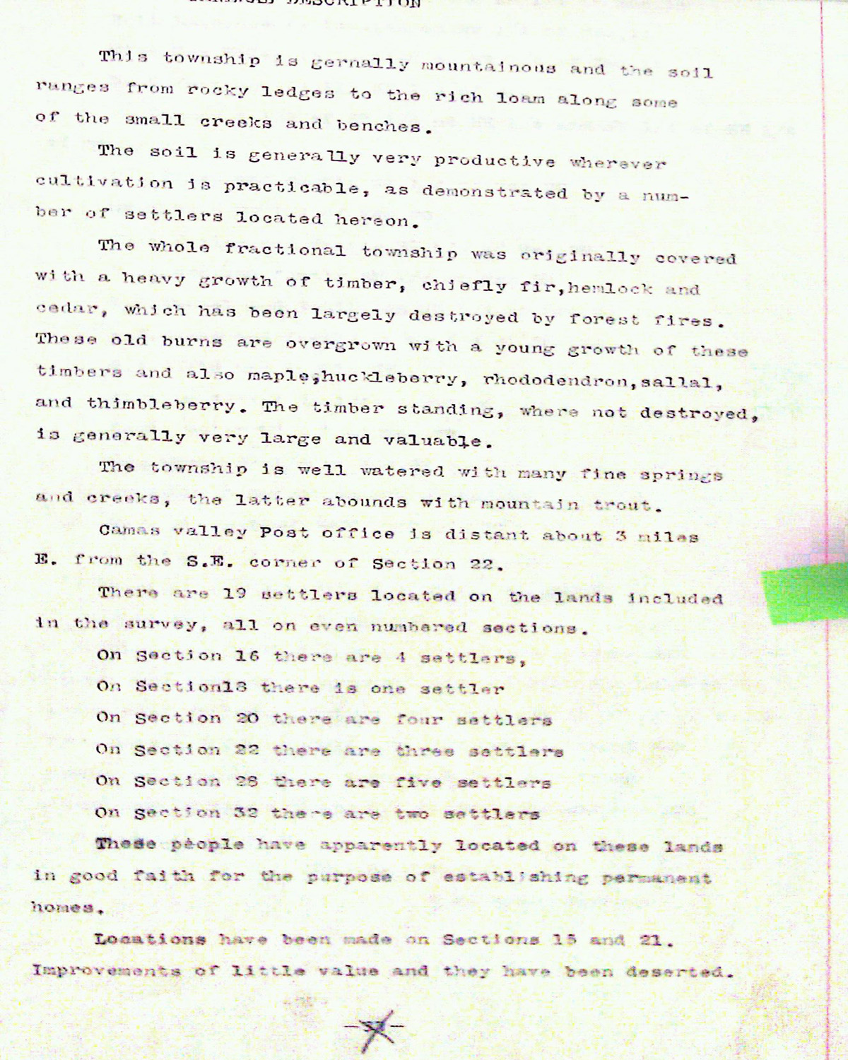
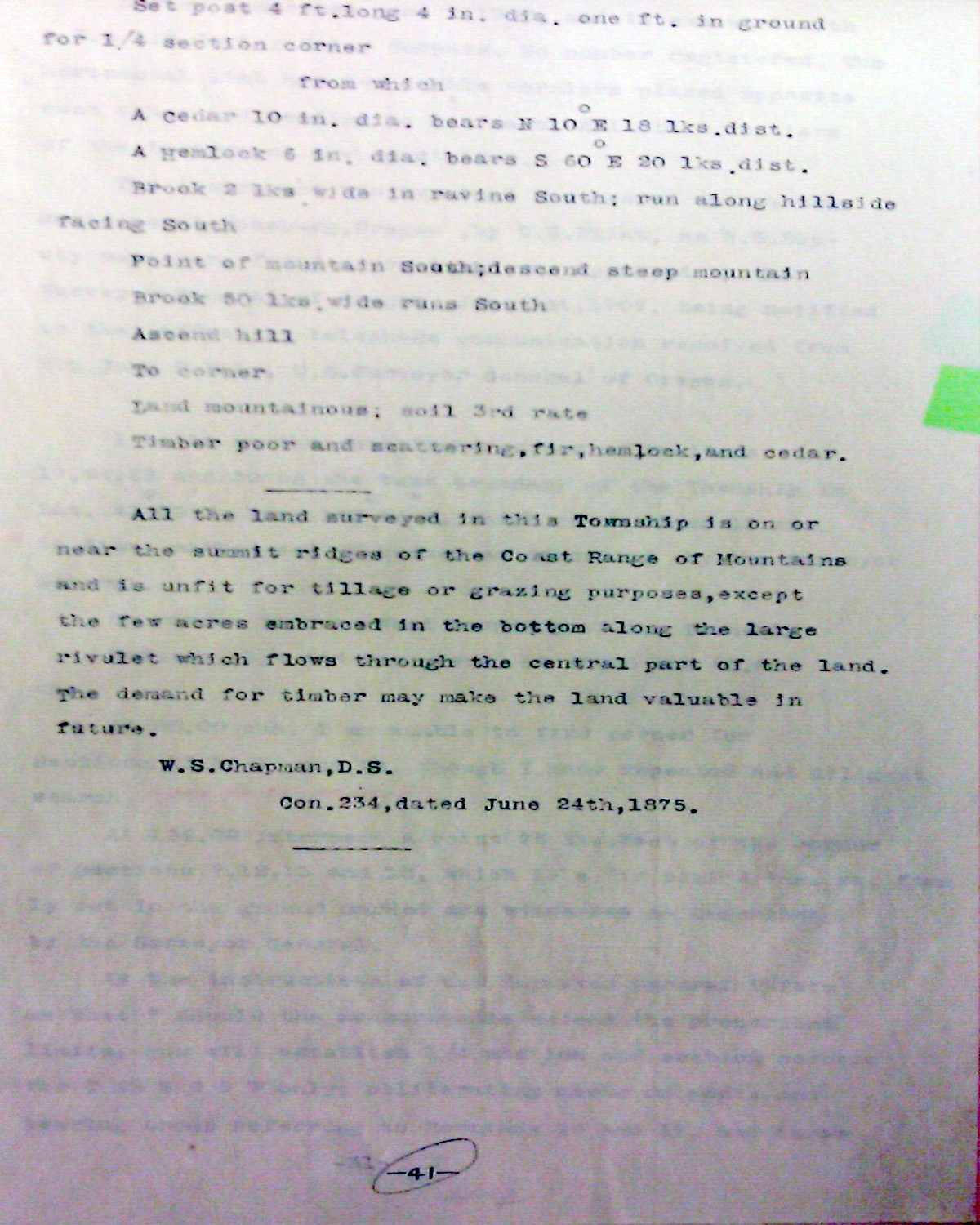
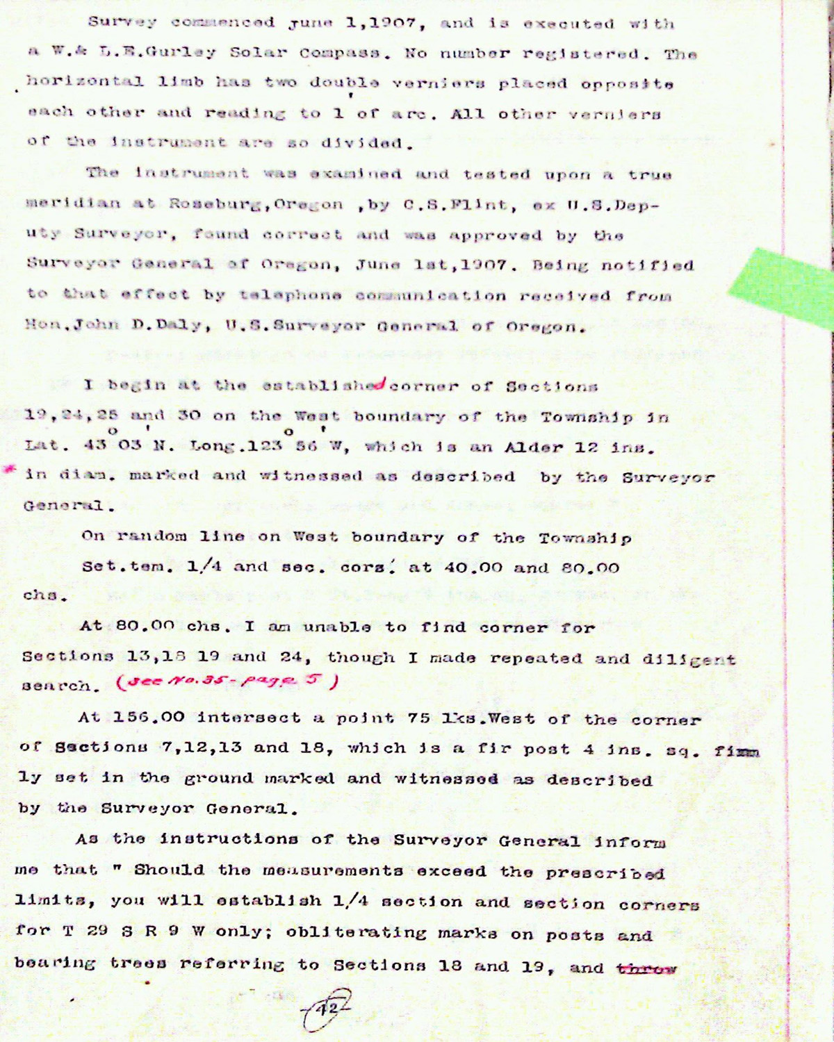
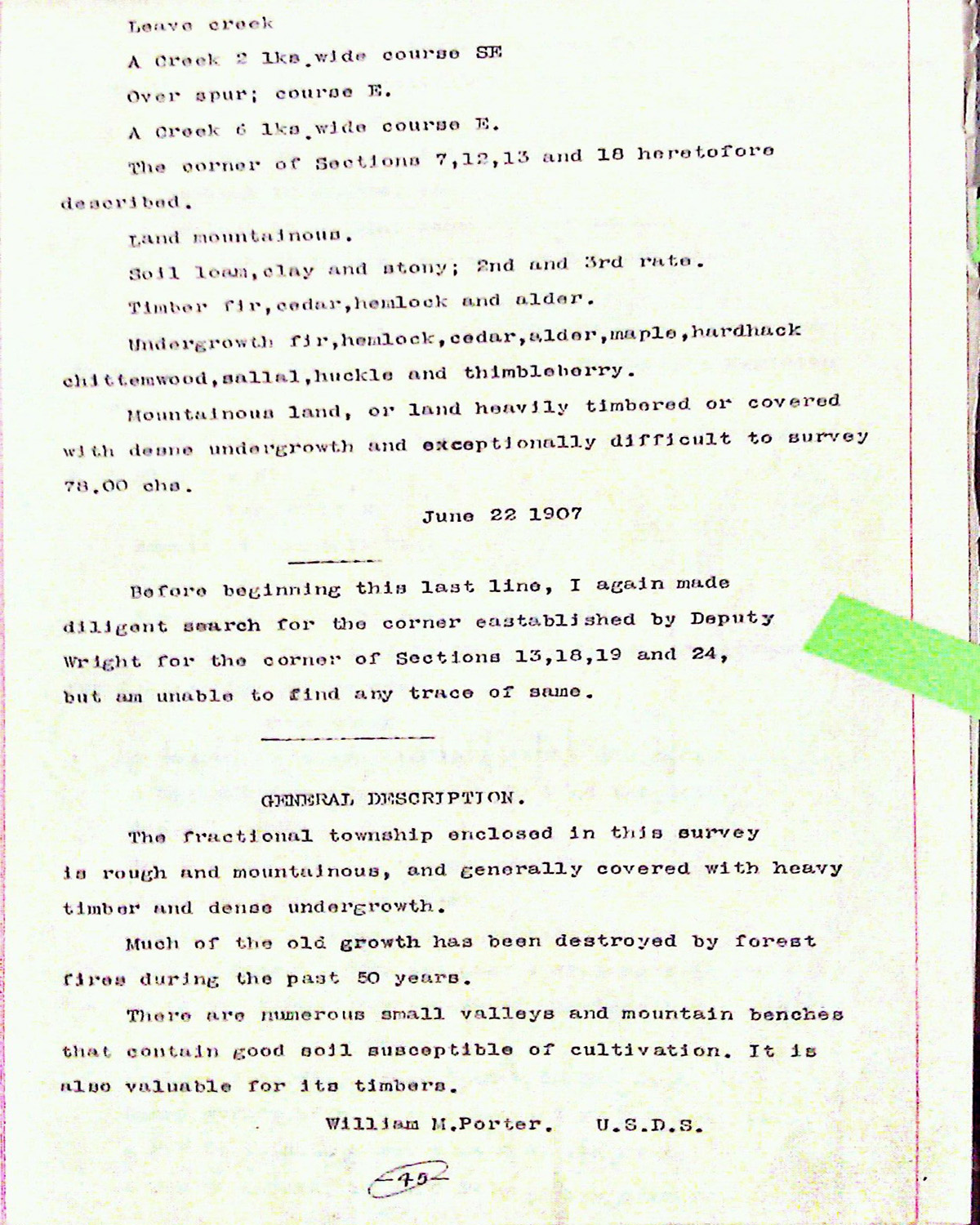
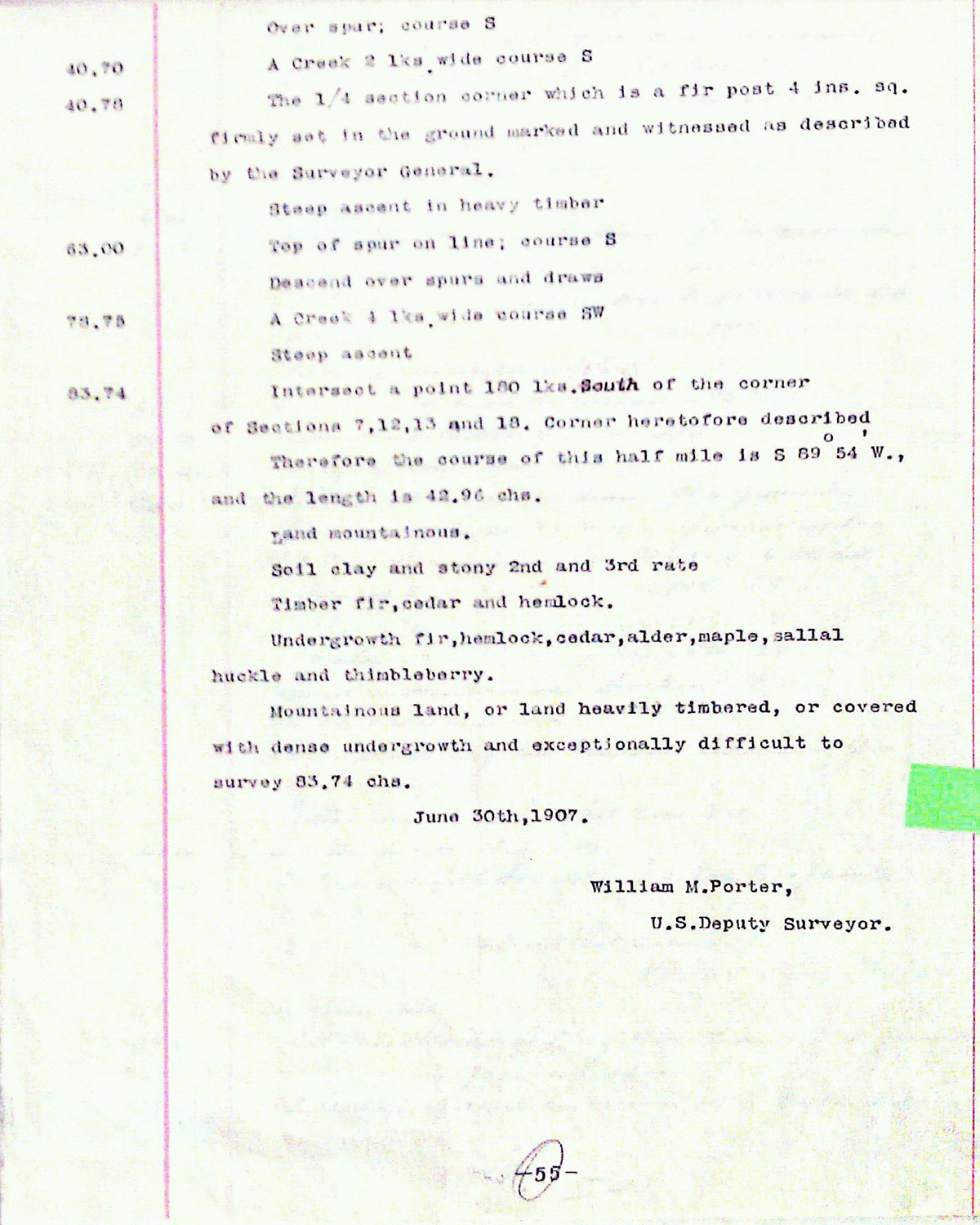
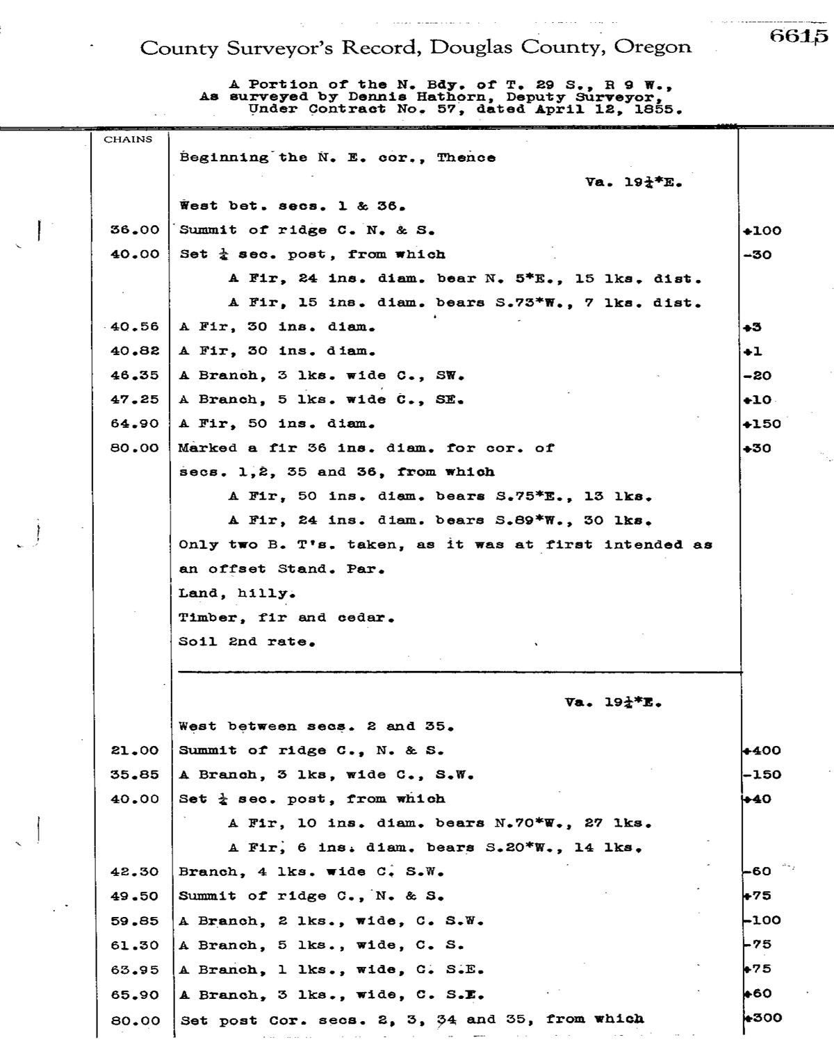
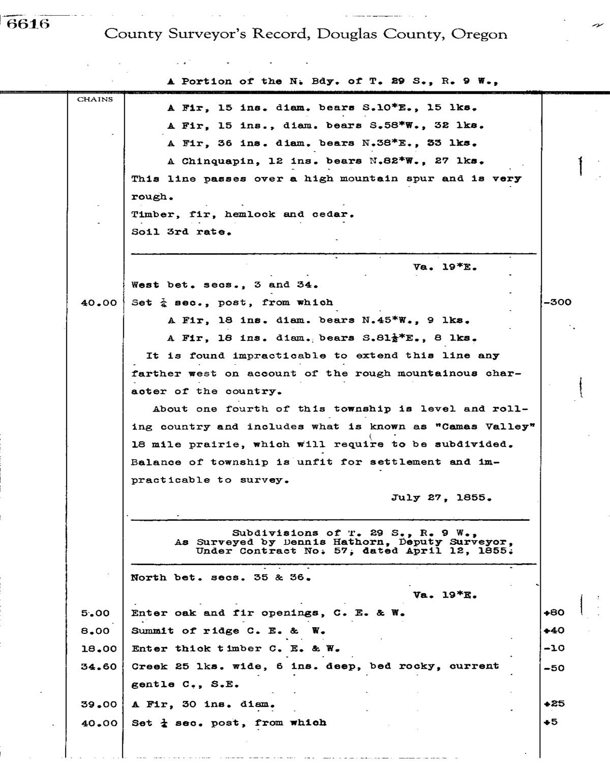
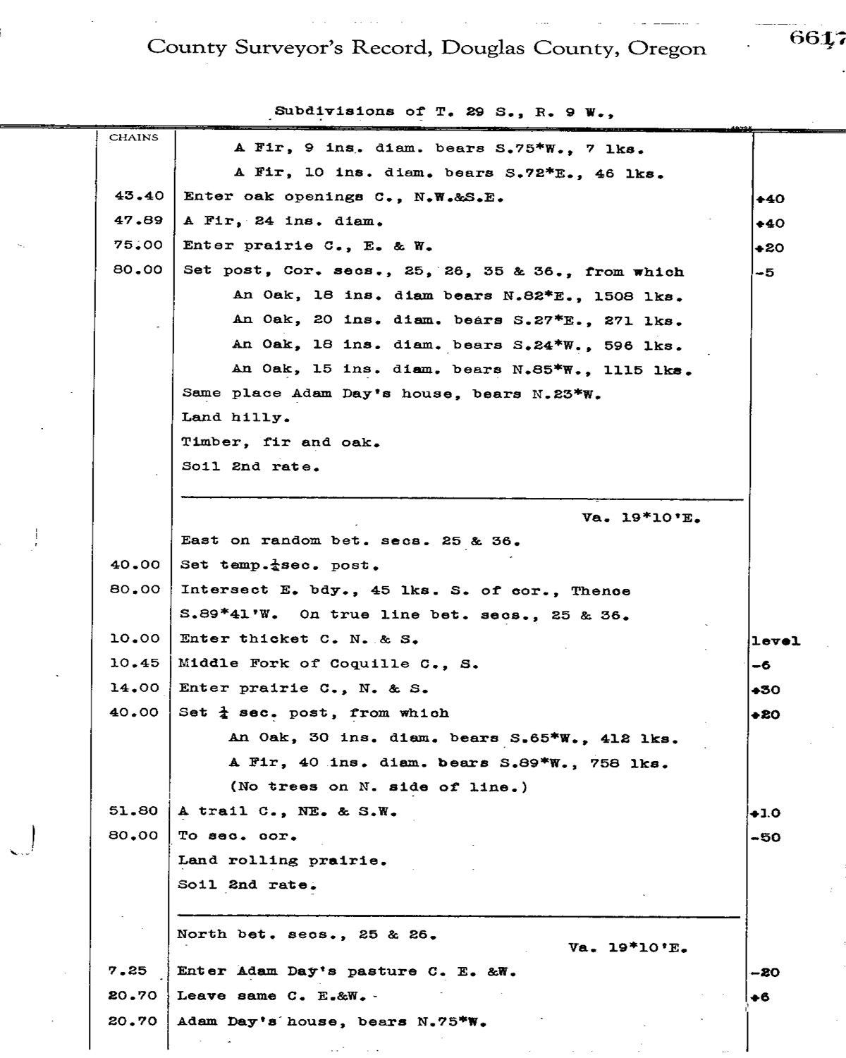
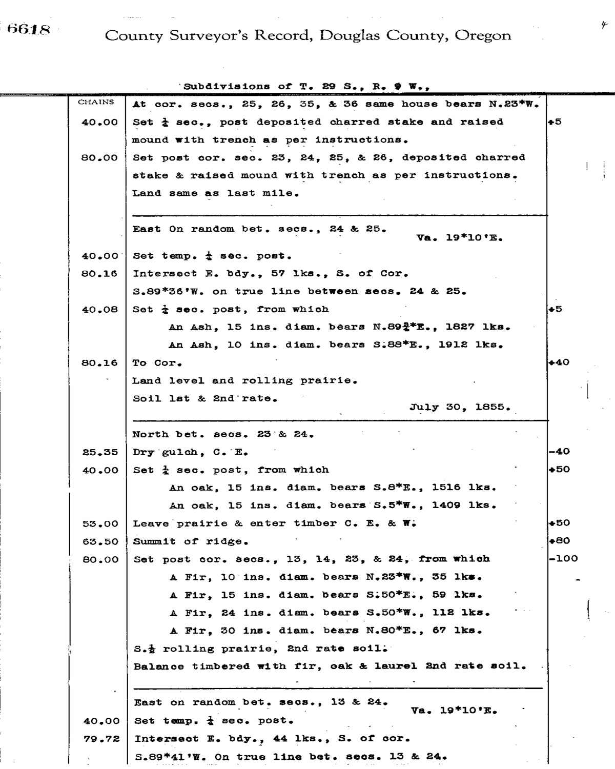
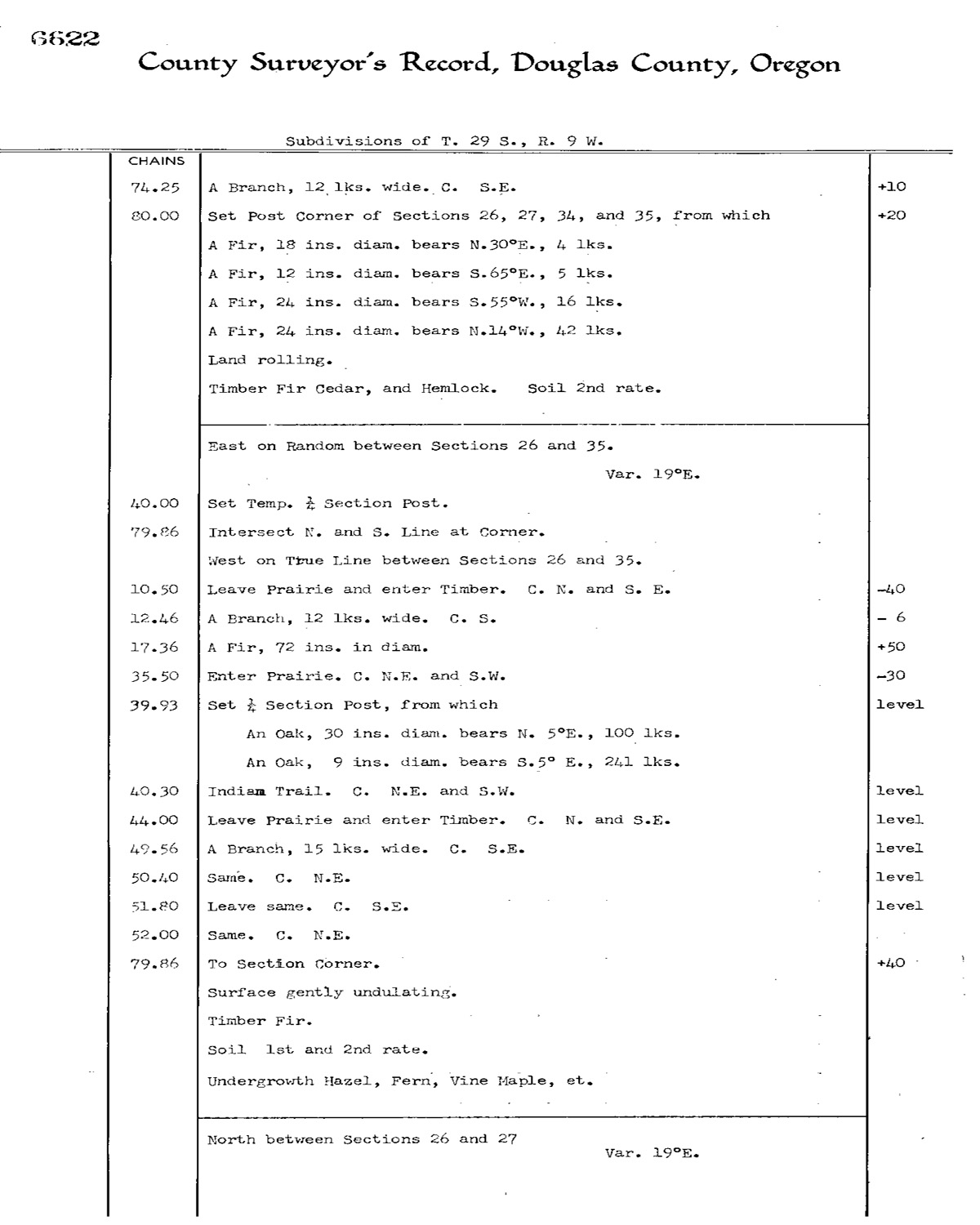
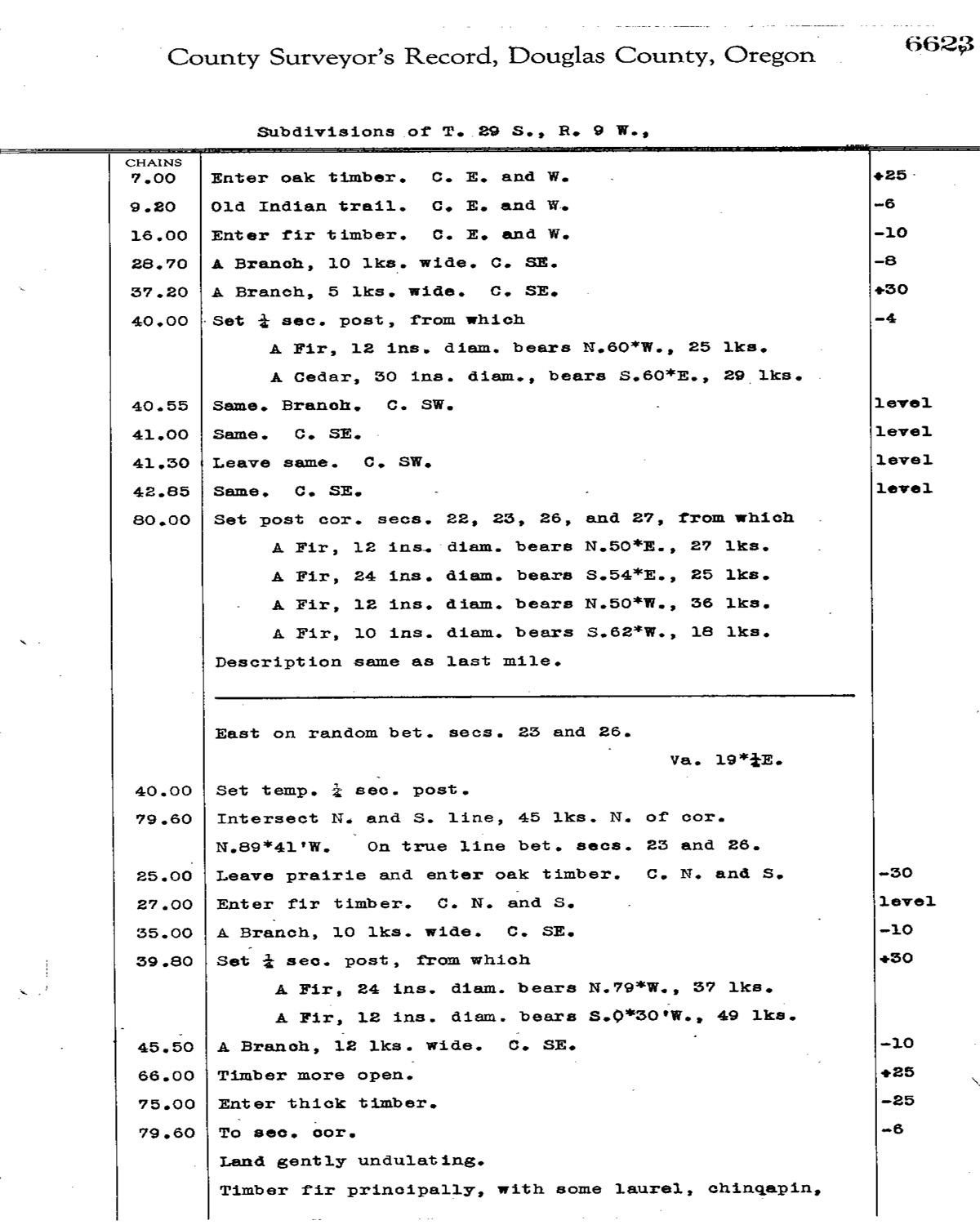
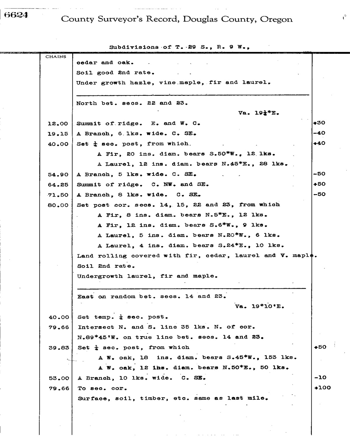
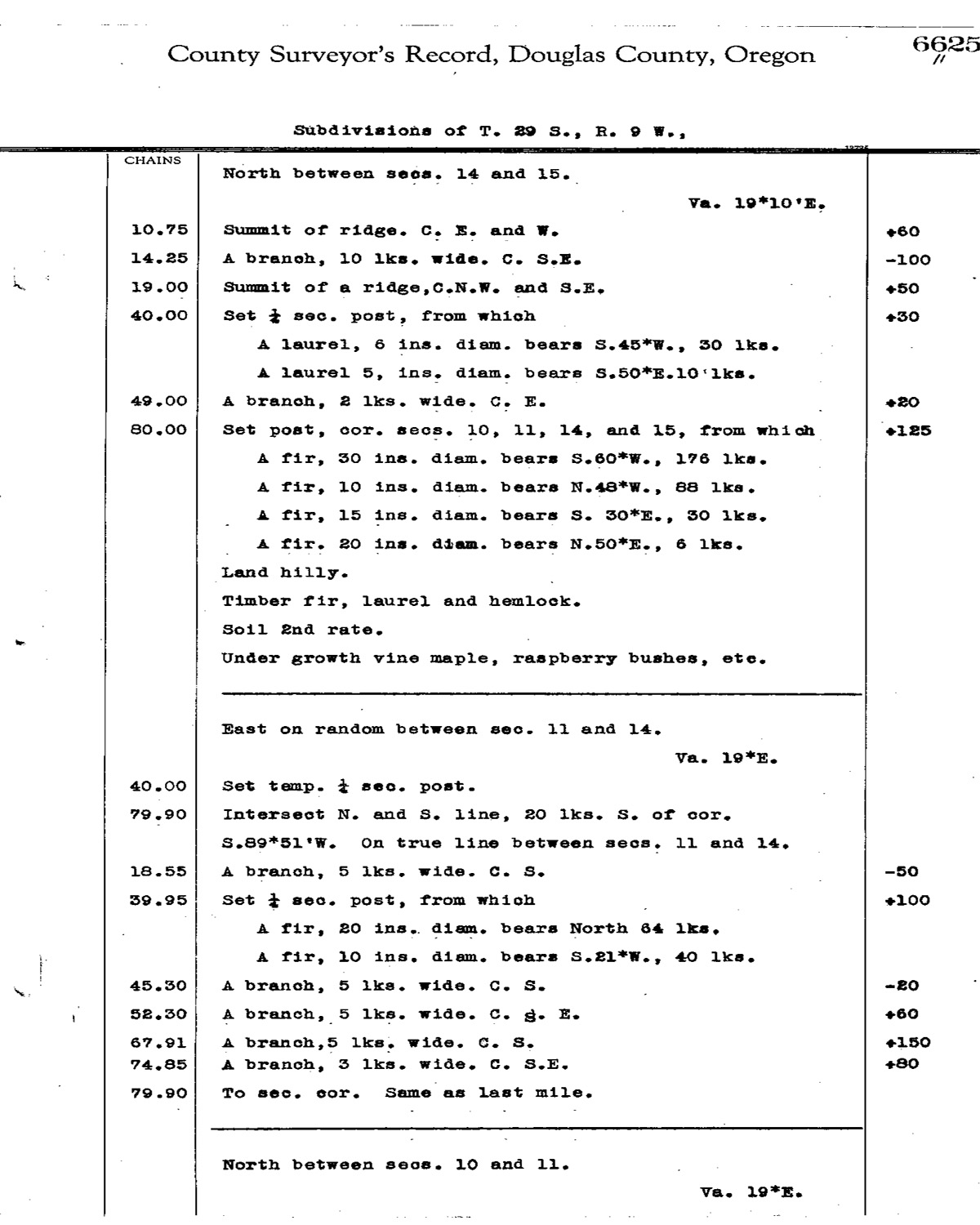
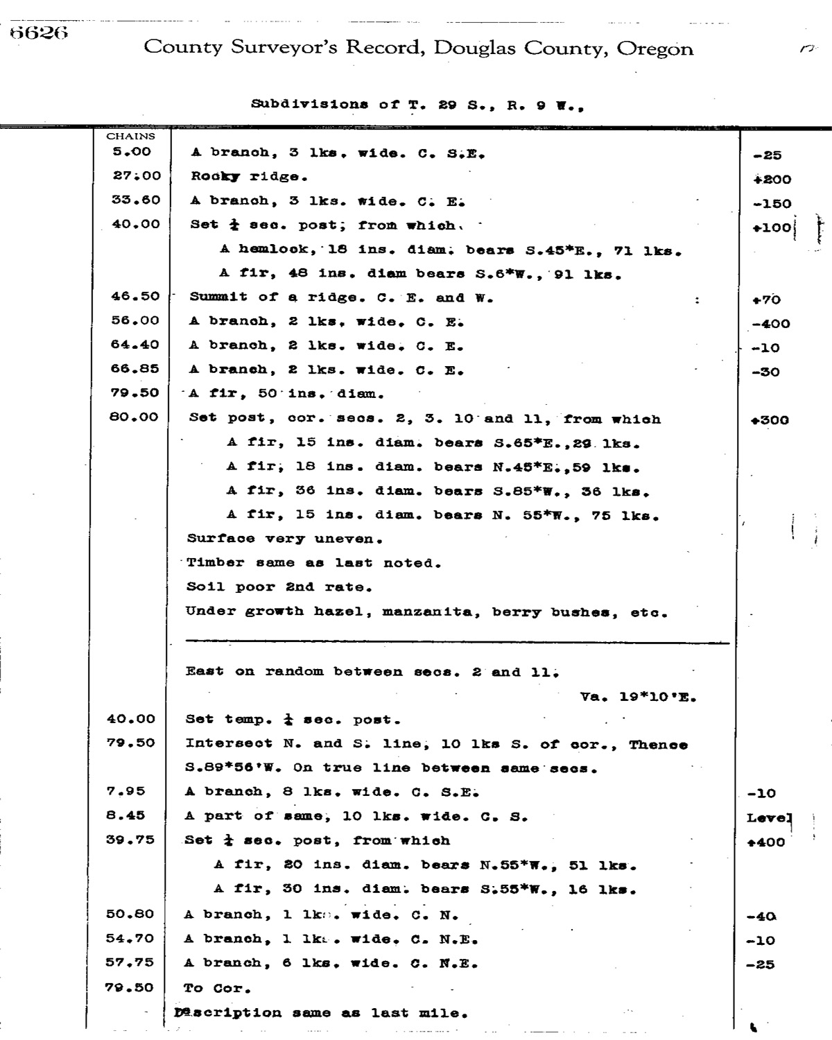
This township is entirely within the boundaries of the 2011-2012 Coquelle Trails Project. It includes Kenyon Mountain, Upper Rock Creek and Coquille River in the Bridge-Remote Historical District. This survey was completed in 1856, 1860, 1975, and 1905 and mapped in 1856, 1860 and 1909 (Hathorn 1855; Chapman 1875; Wright 1880; Porter 1907). Donation Land Claims were filed by Adam Day, William Day, Alexander Reed, and Cyrus B. Rawson.
![]()