
Tsp. 27 S., Rng. 07 W.
General Land Office Survey Index
 |
 |
 |
 |
 |
 |
1856 GLO |
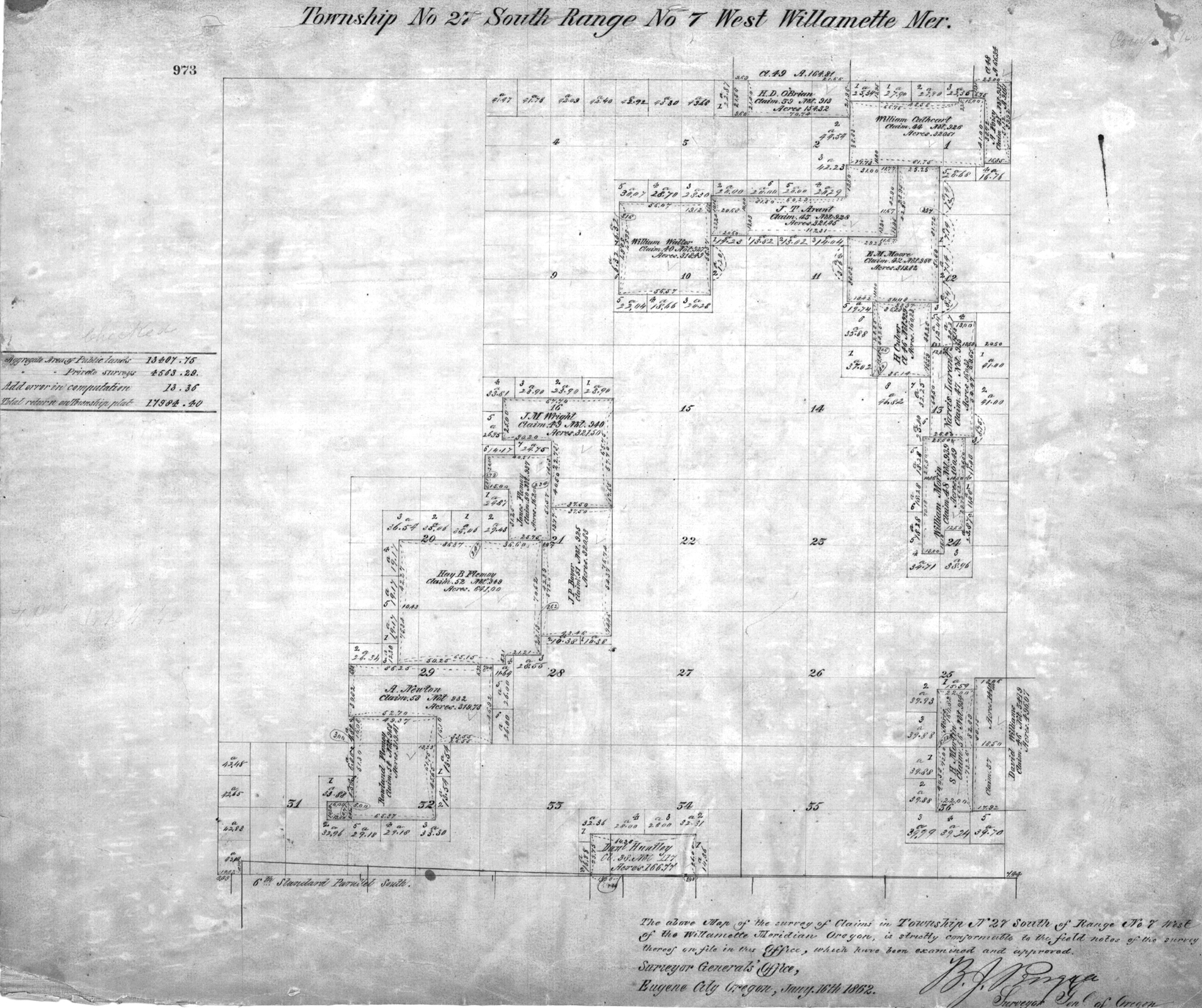
1862 DLC |
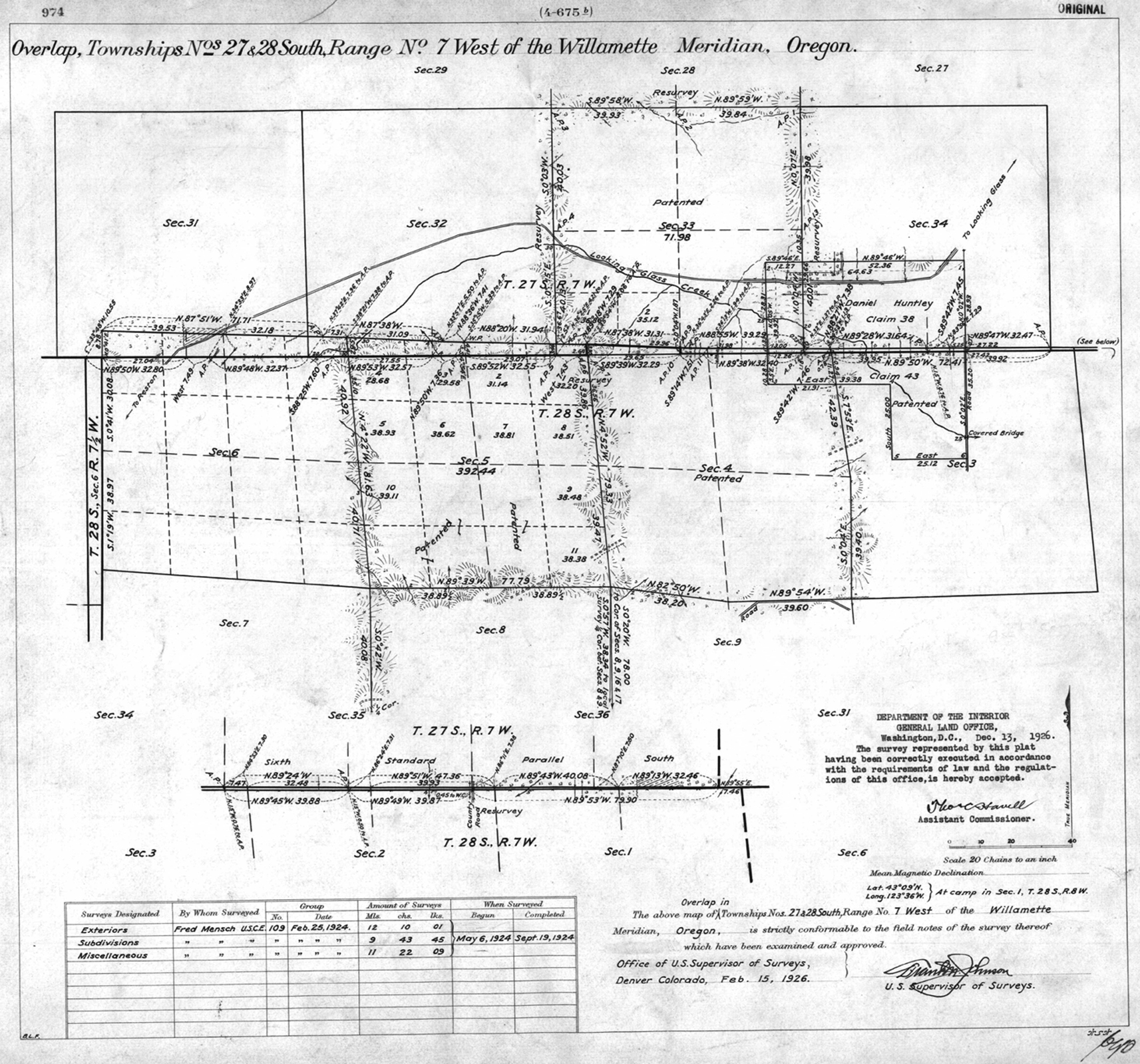
1926 DLC |
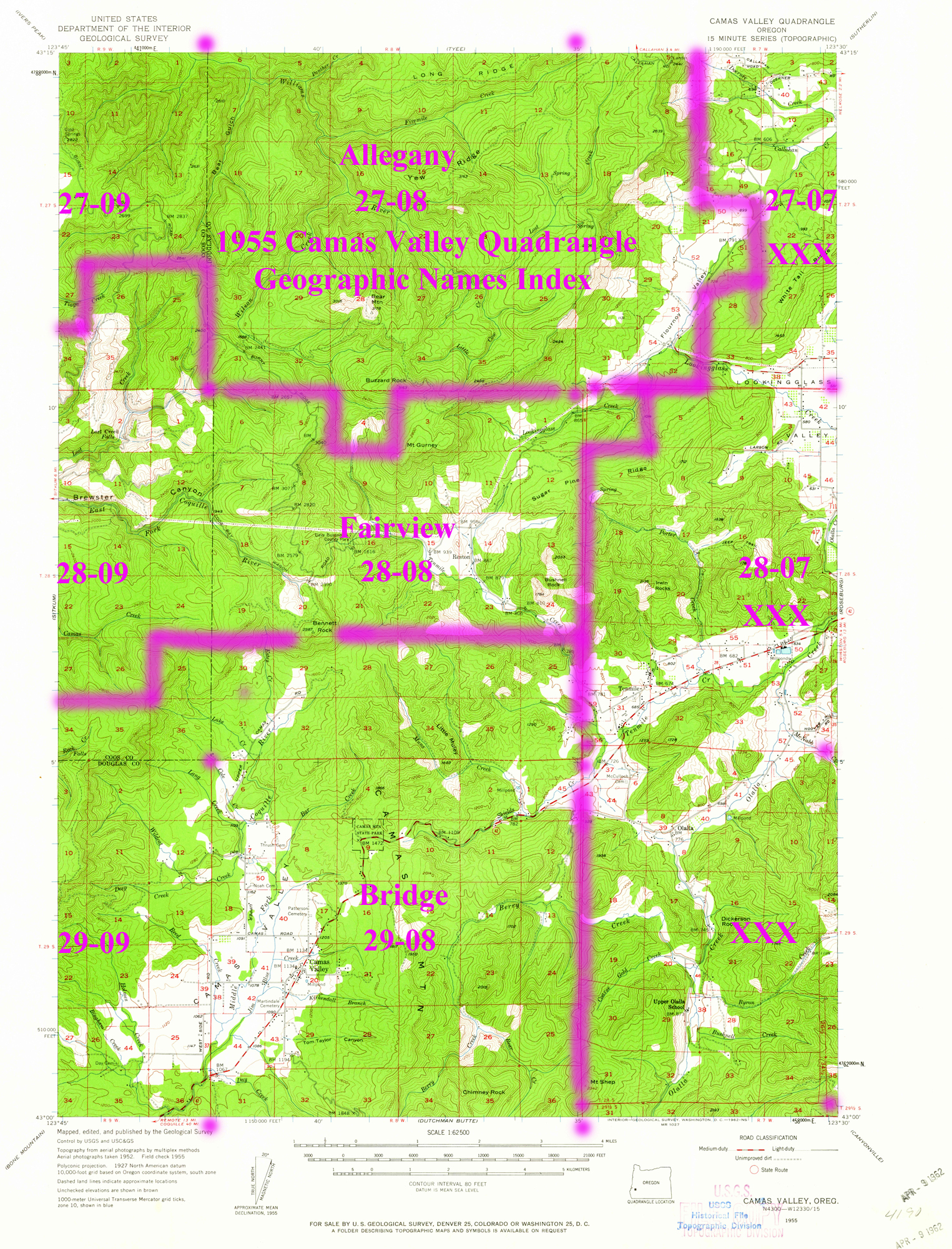
1955 Annotated USGS Camas Valley |
1955 Annotated USGS Tyee |
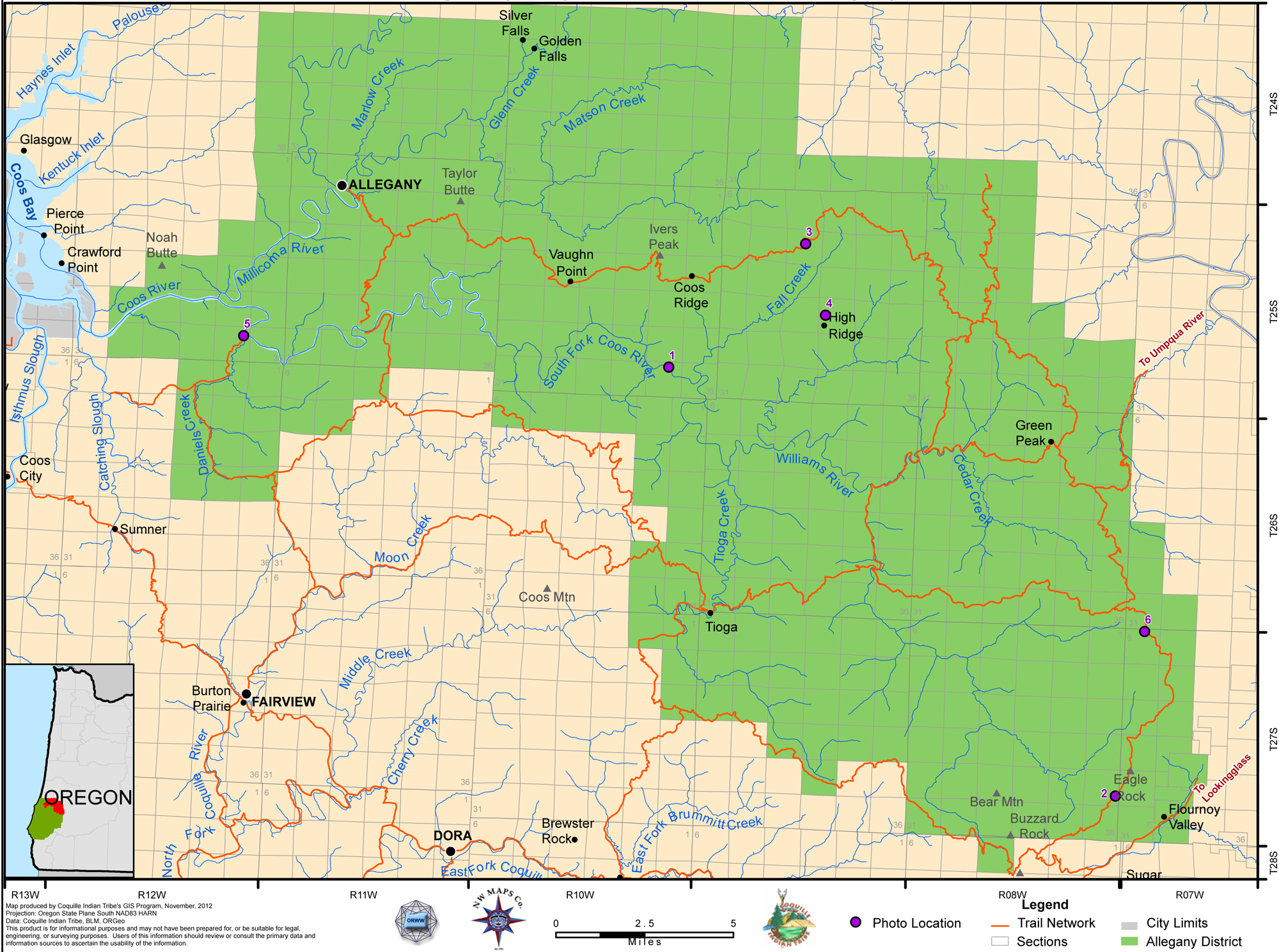
2012 Allegany District |
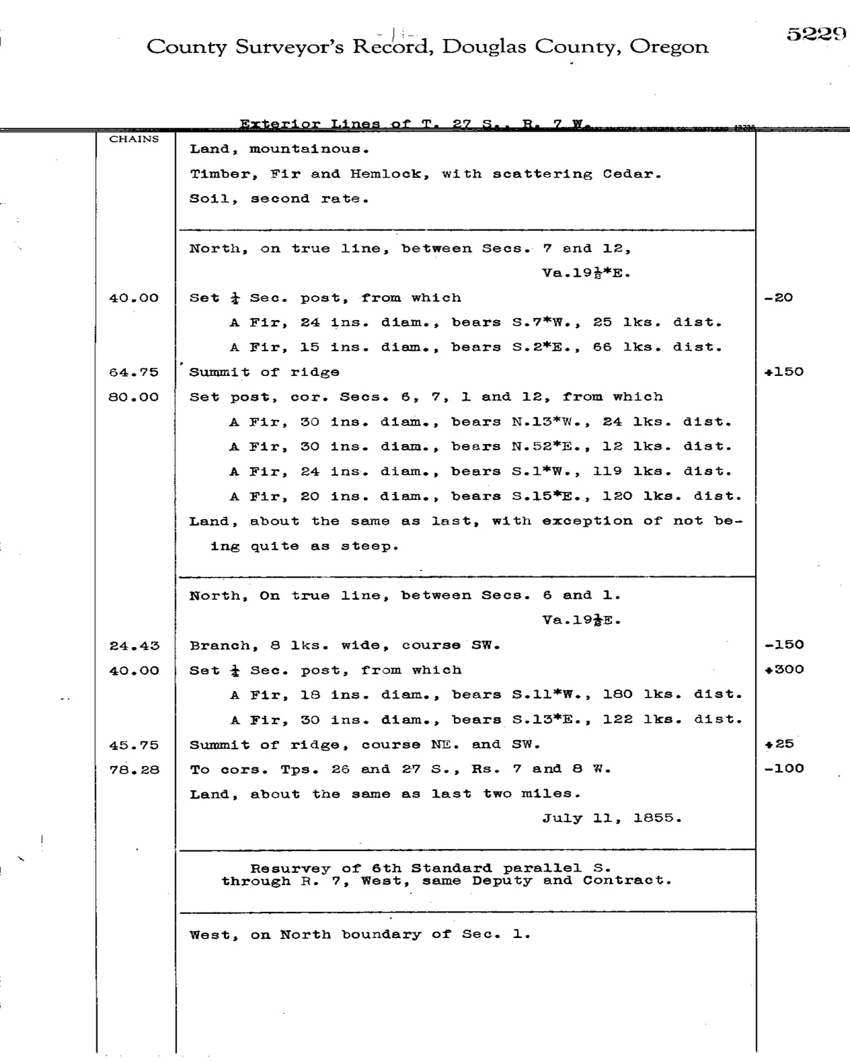
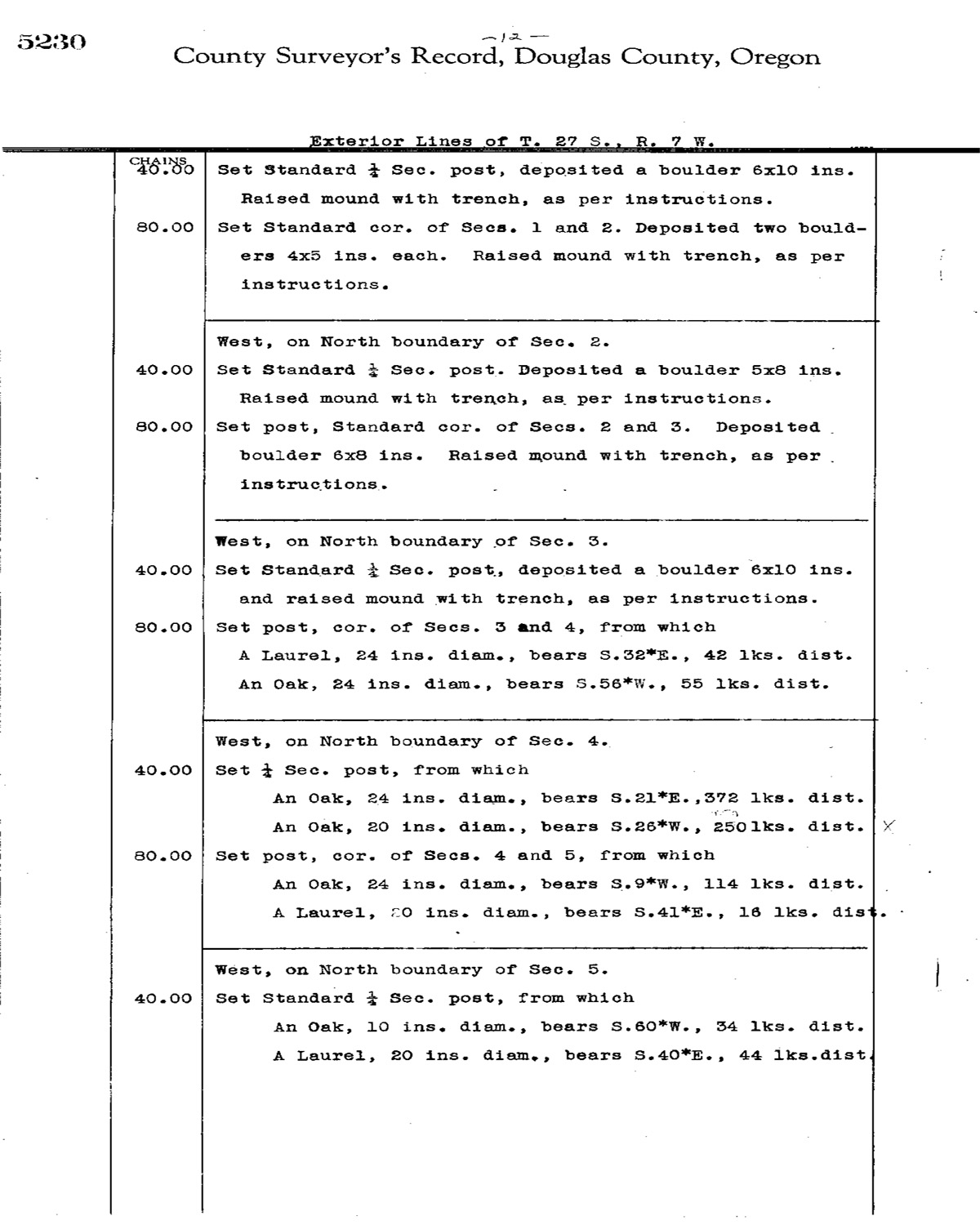
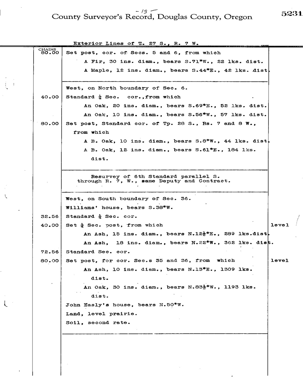
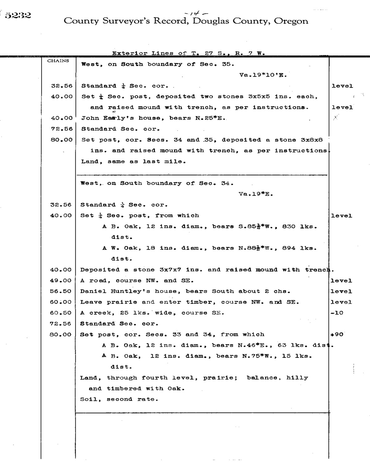
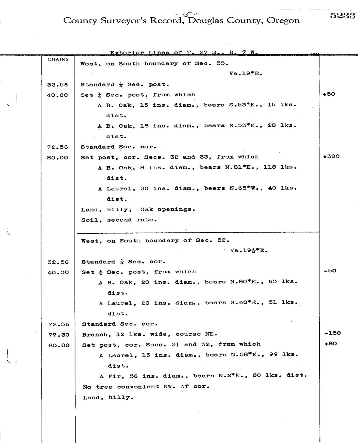
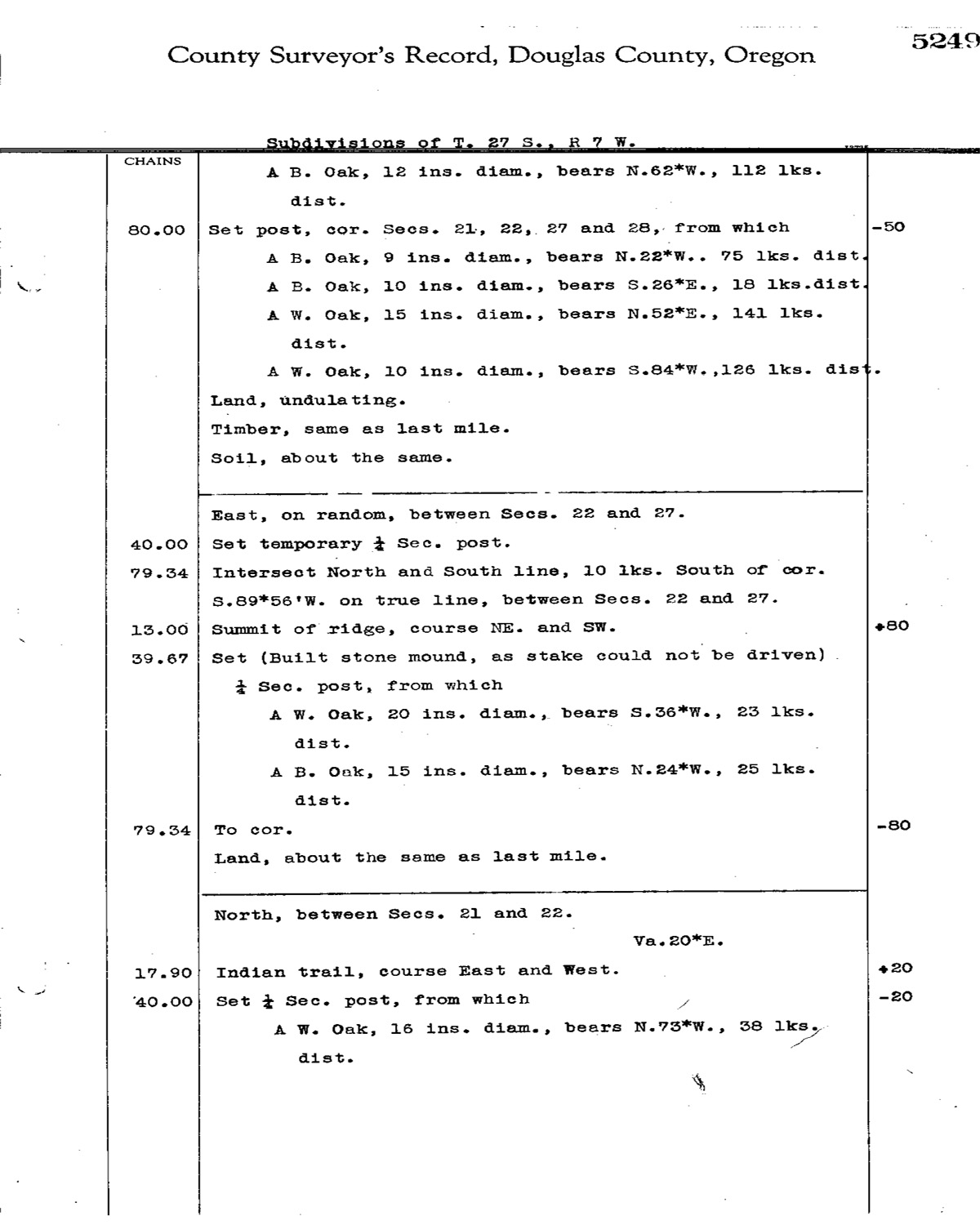
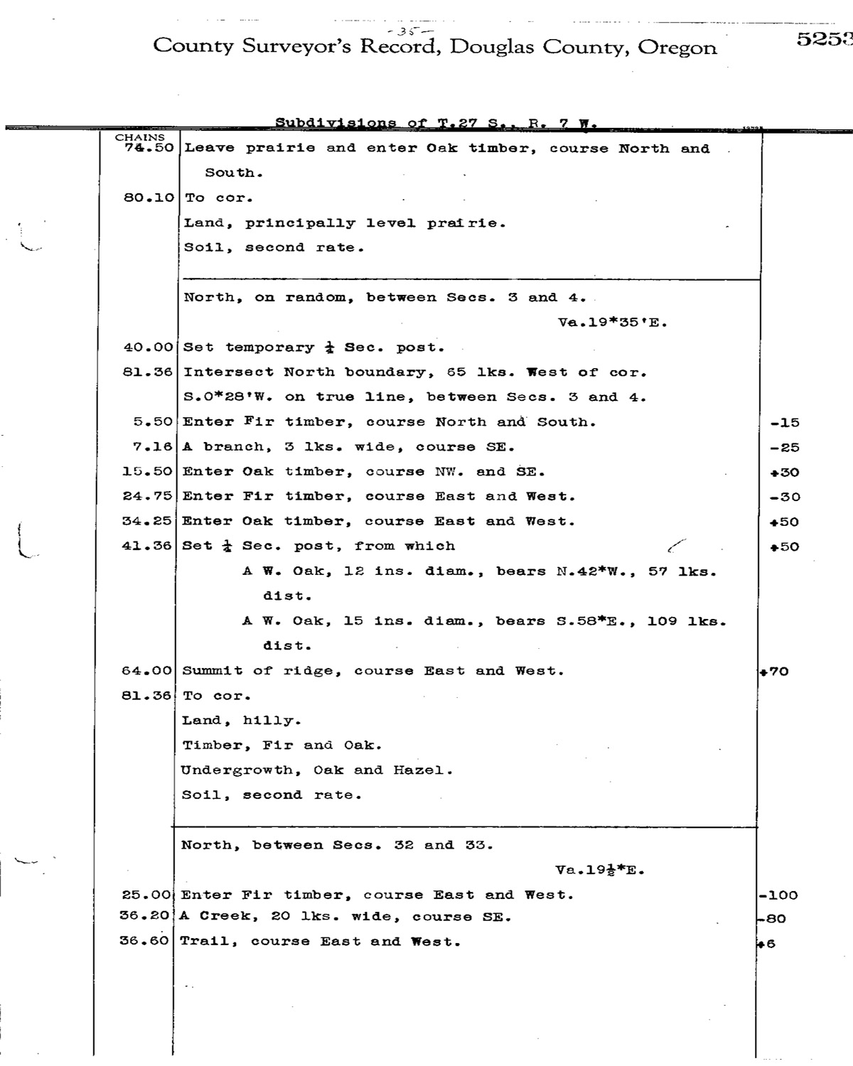
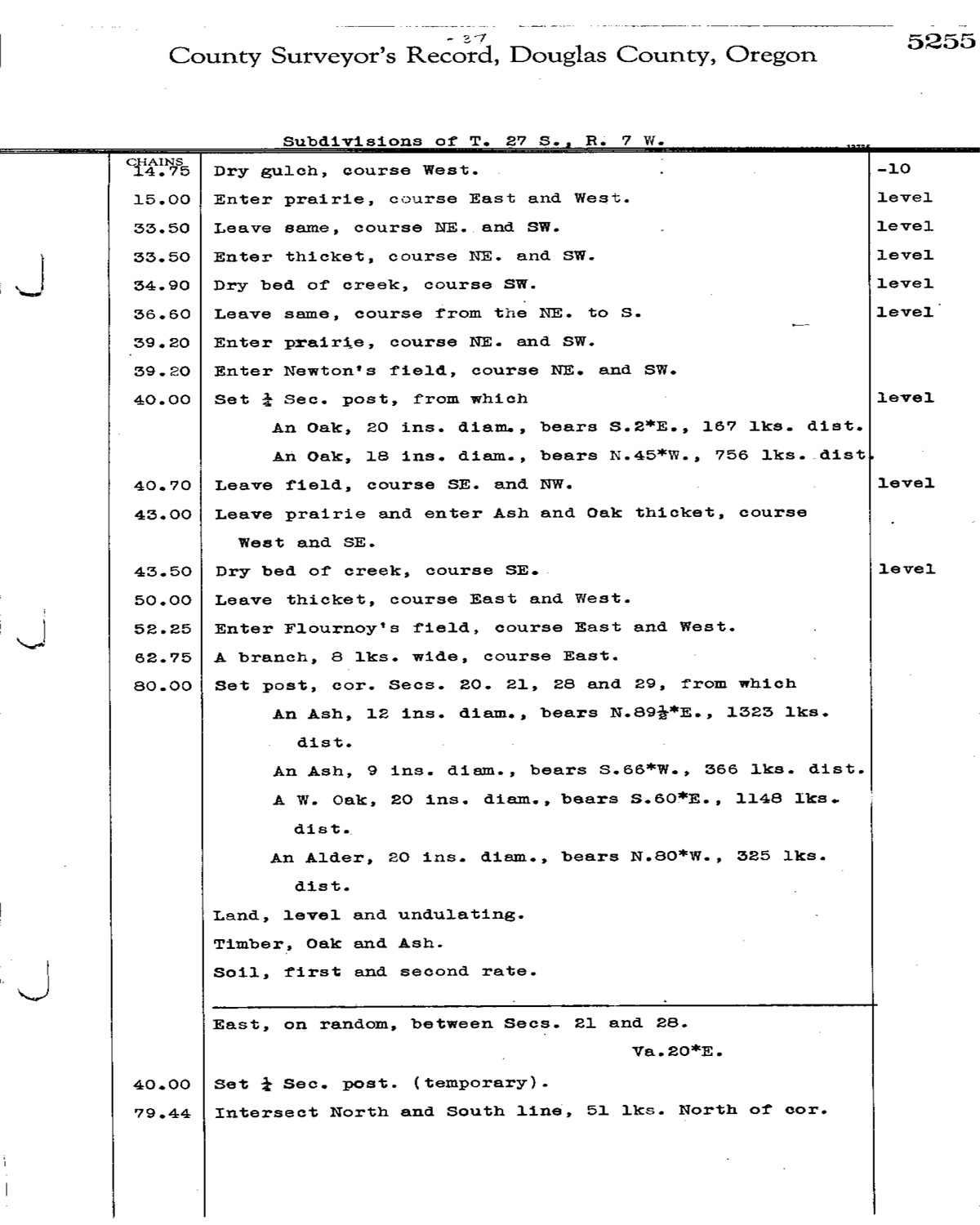
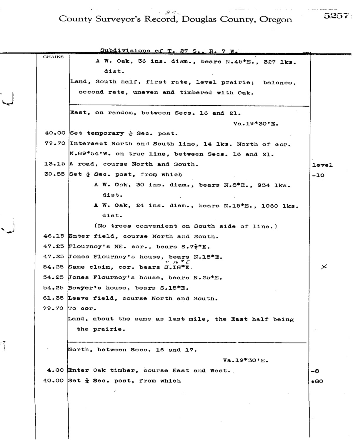
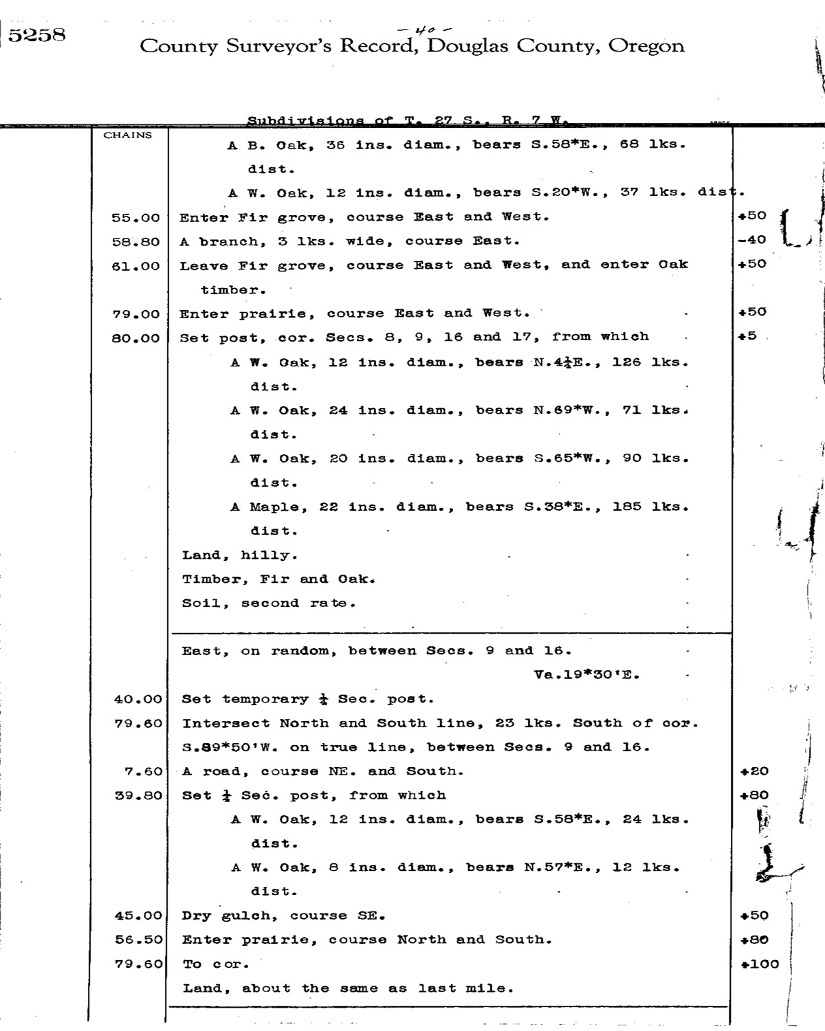
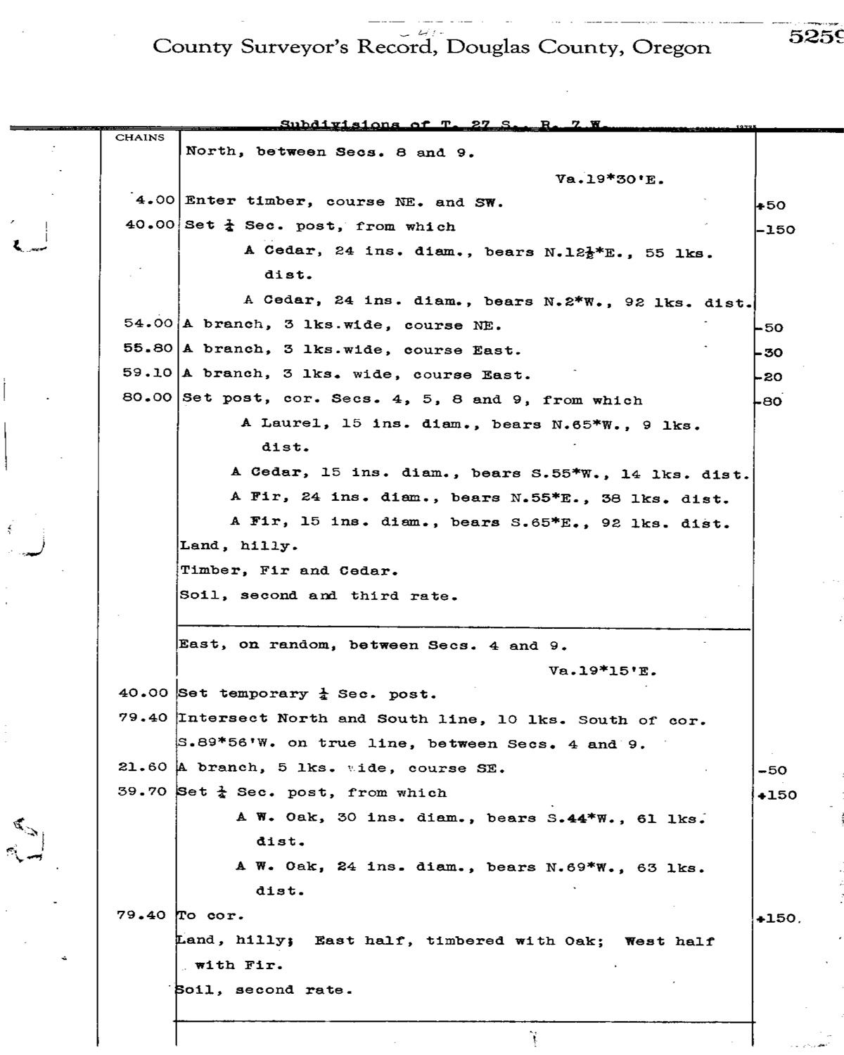
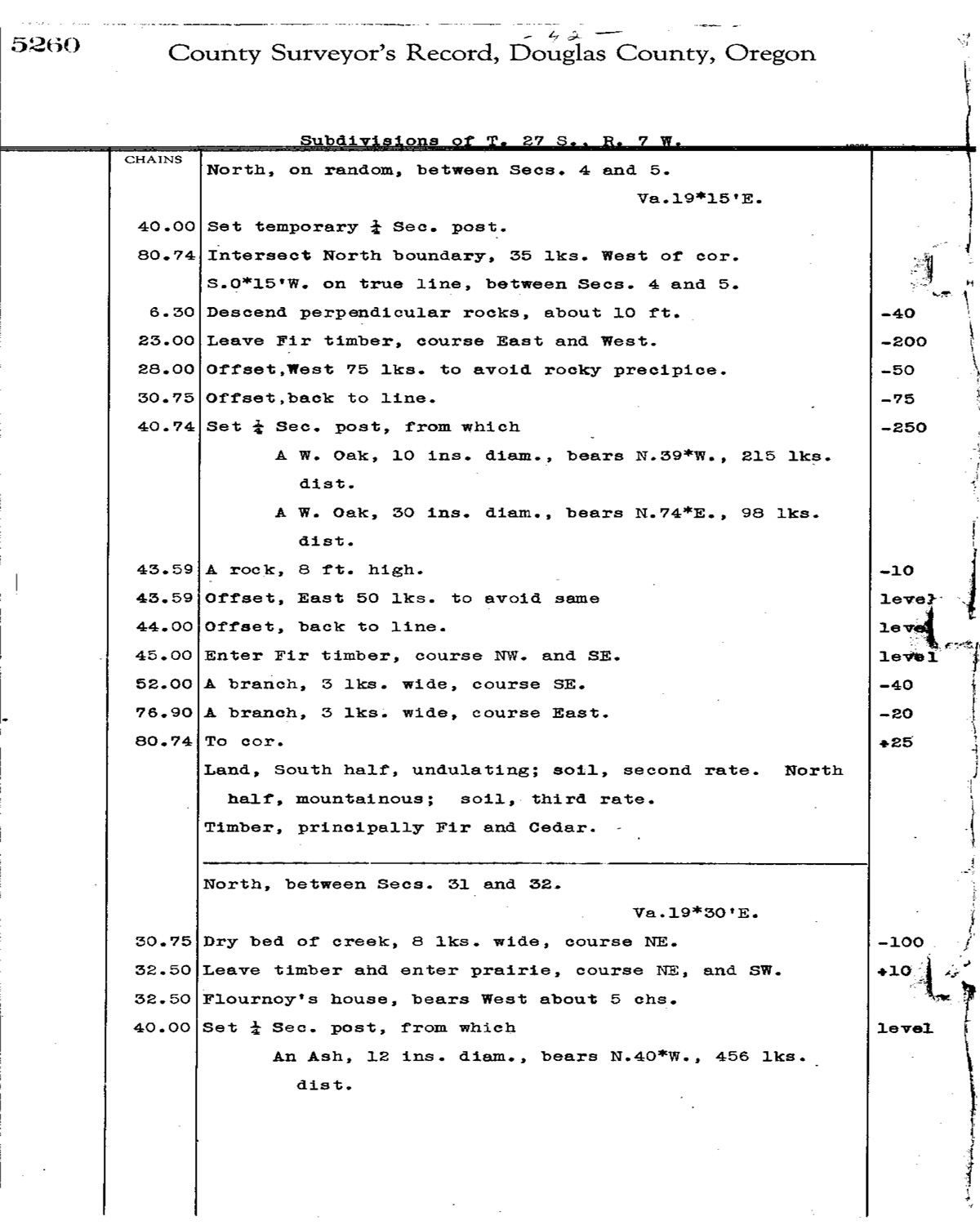
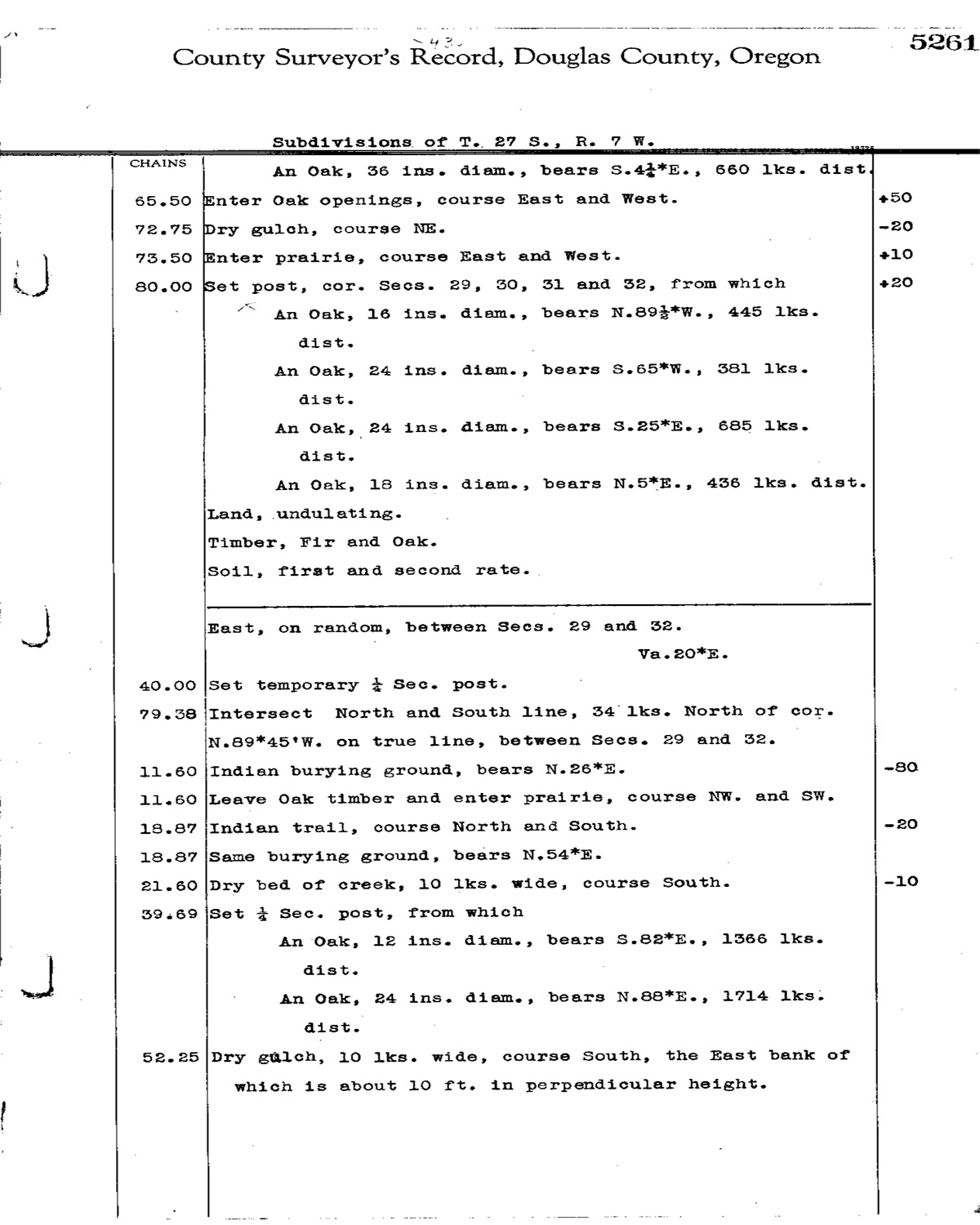
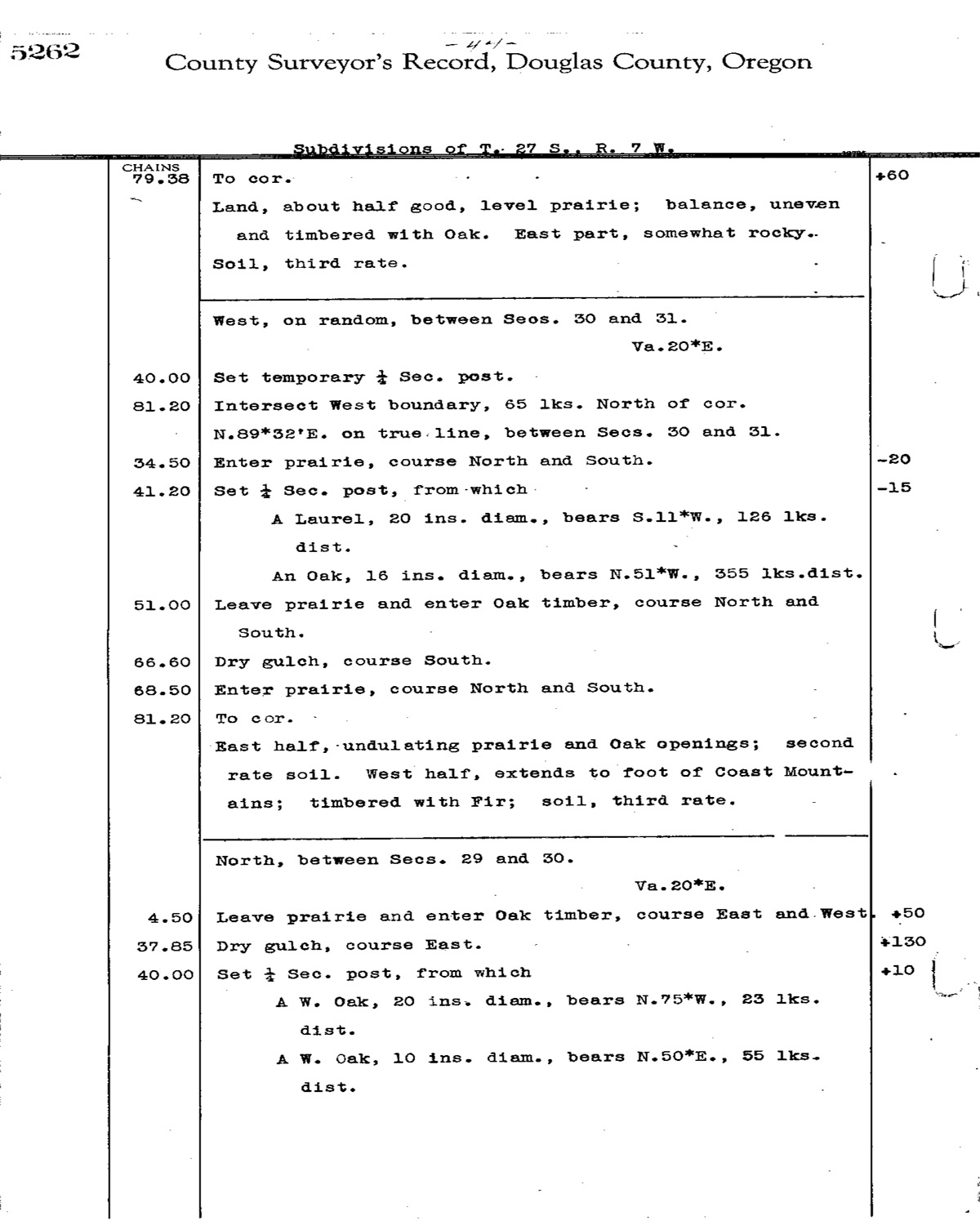
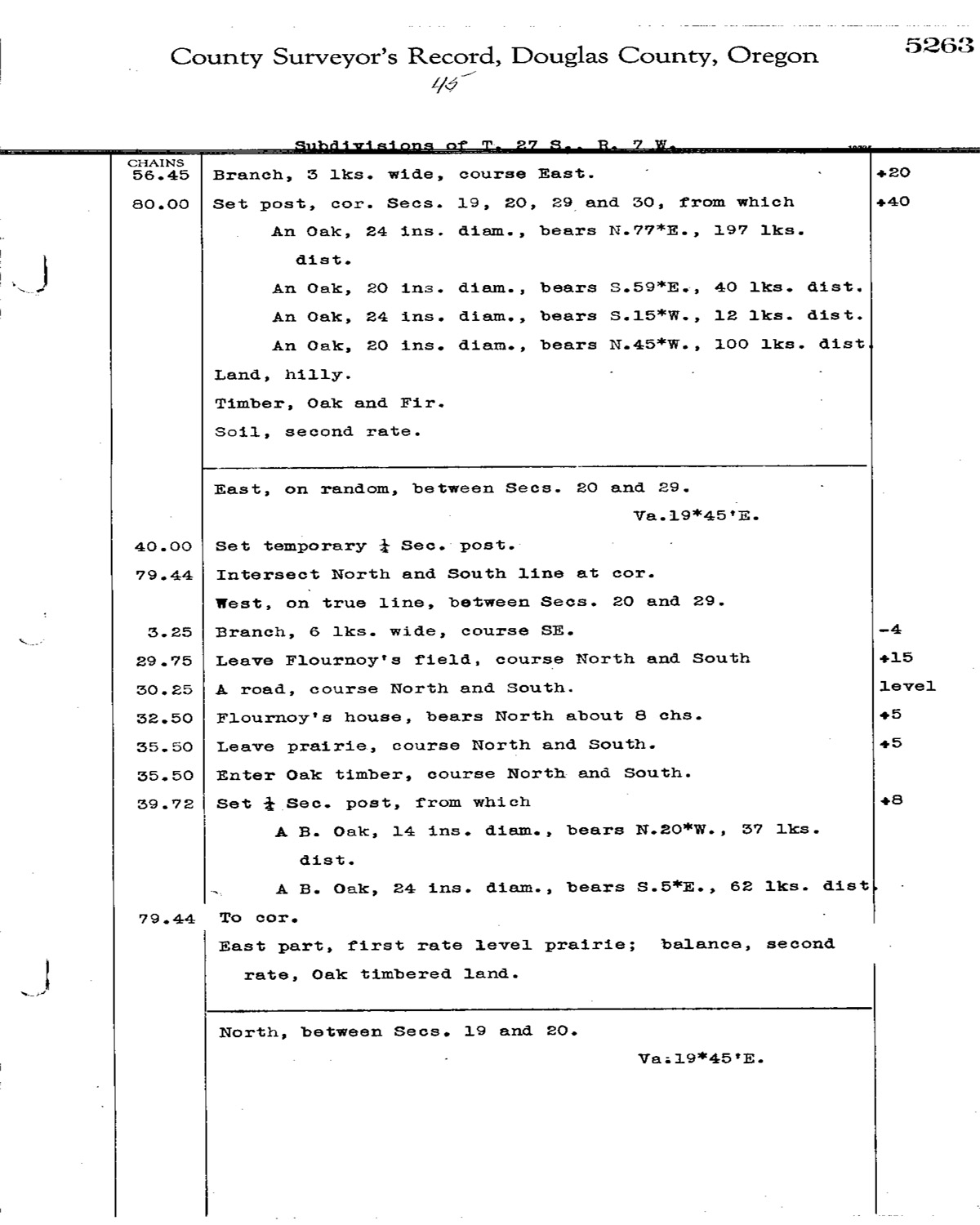
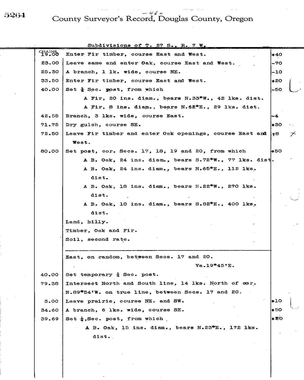
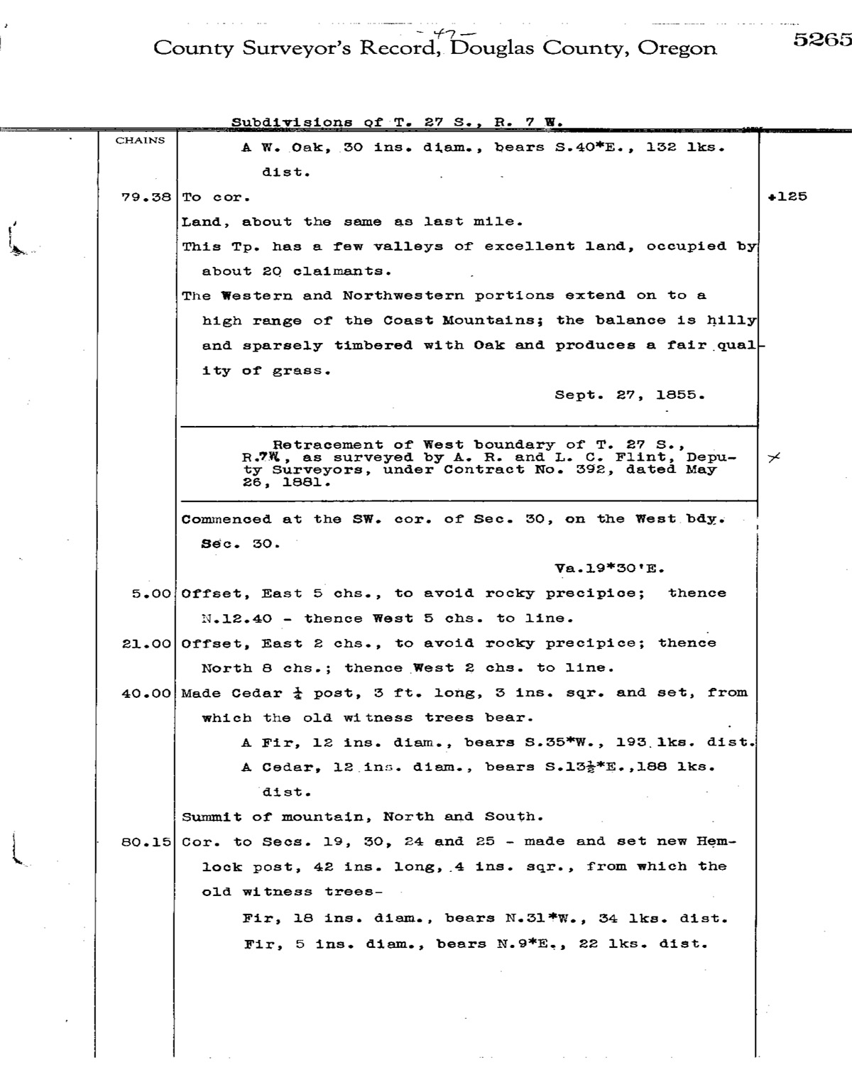
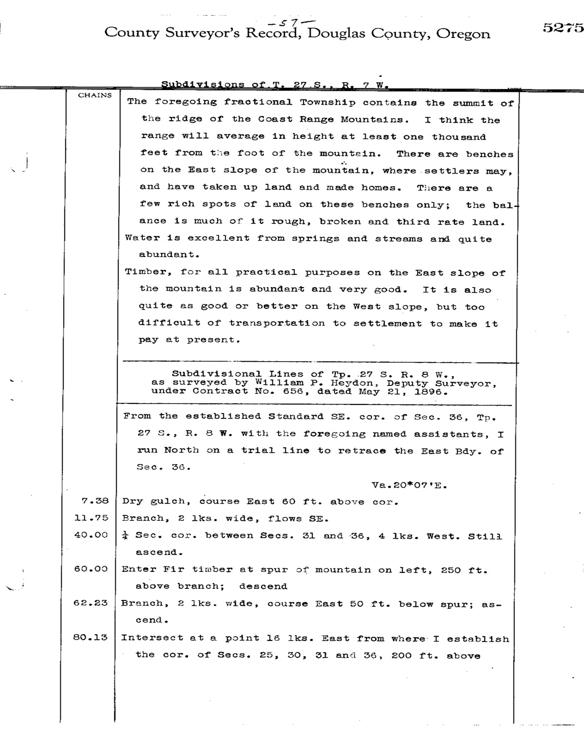
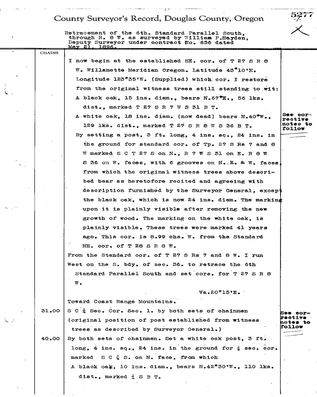
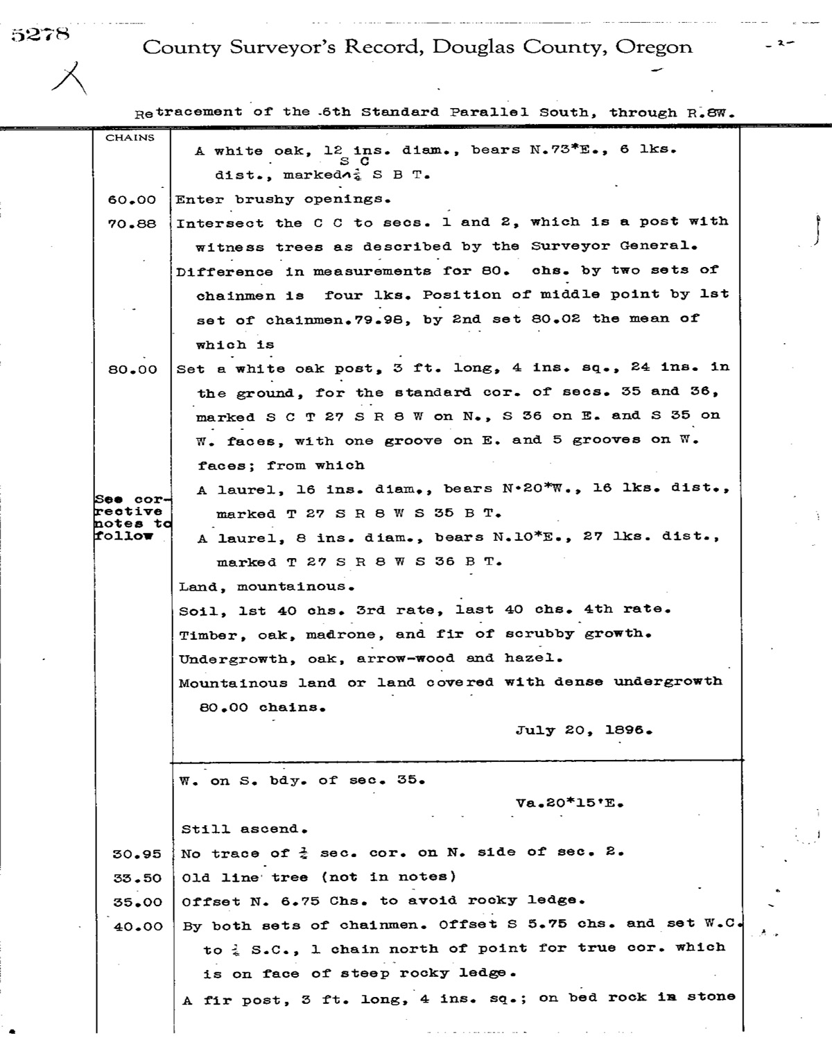
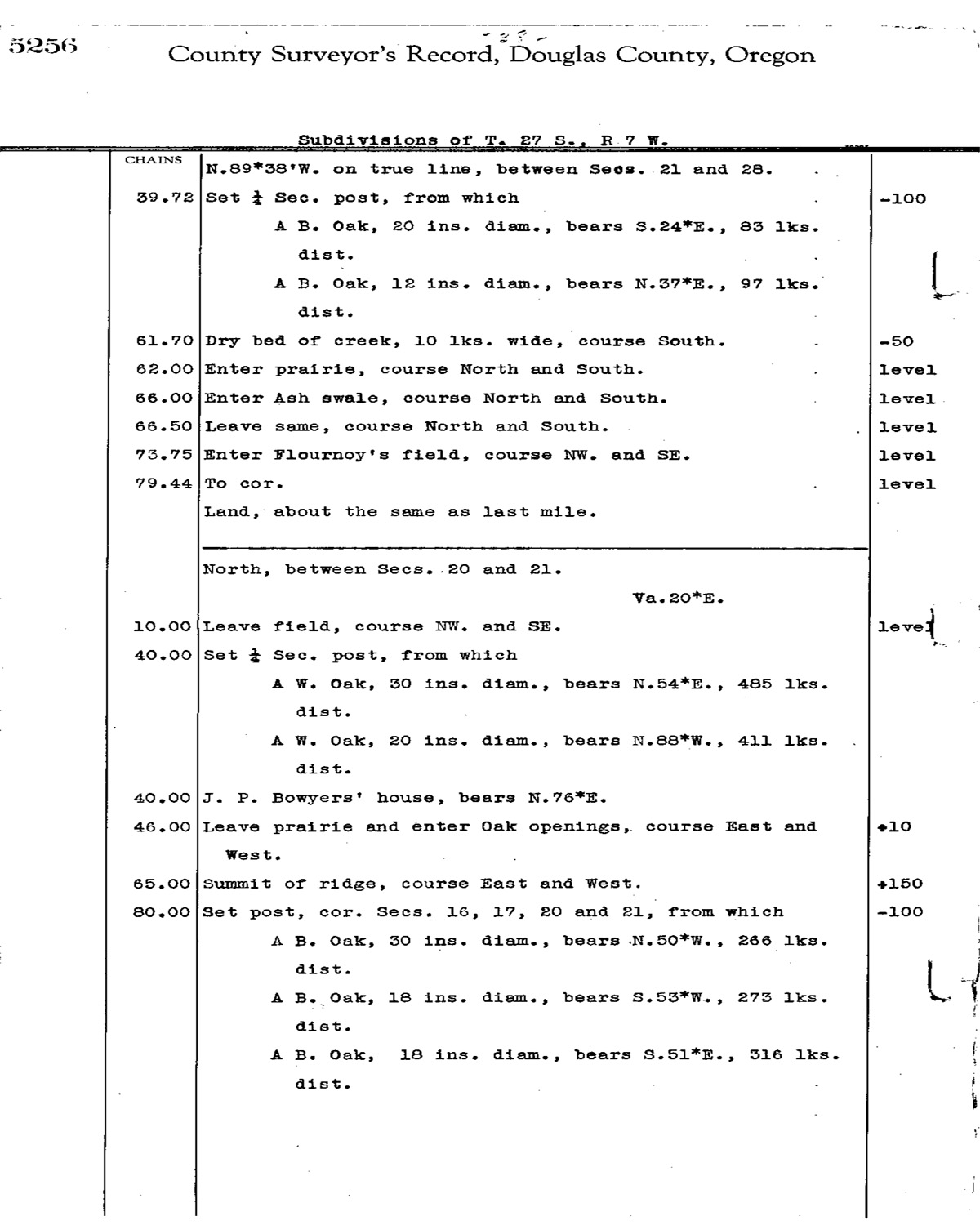
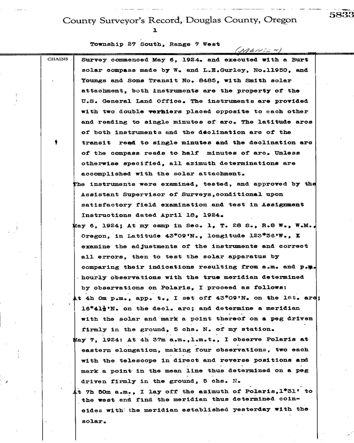
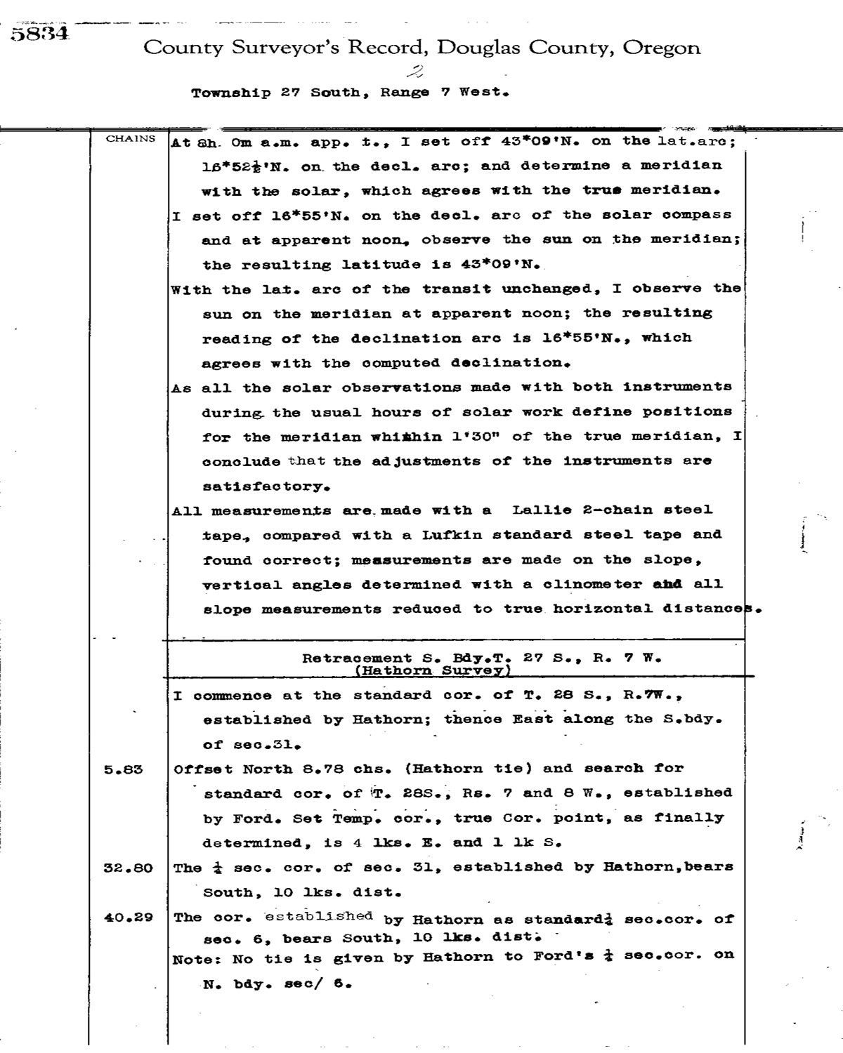
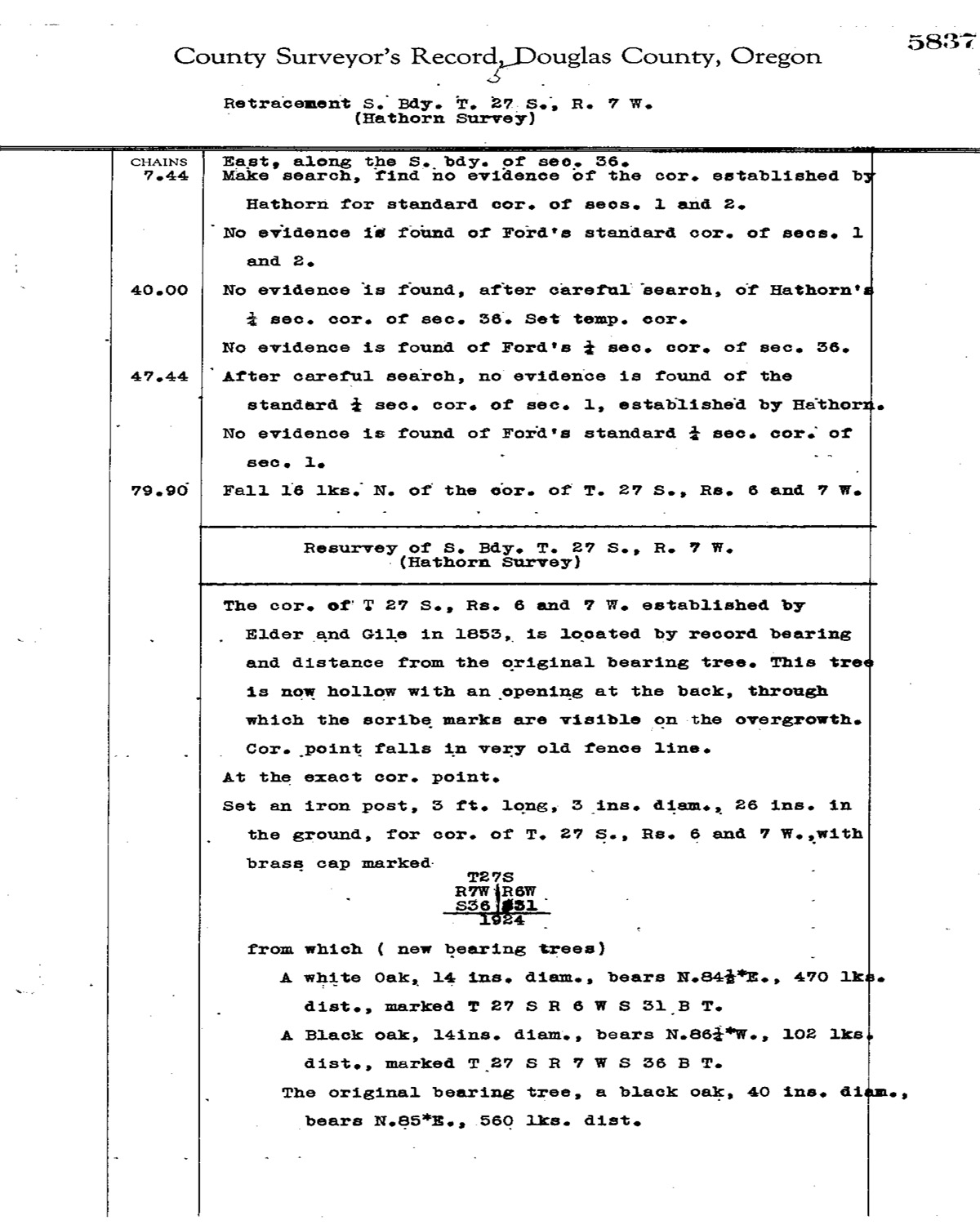
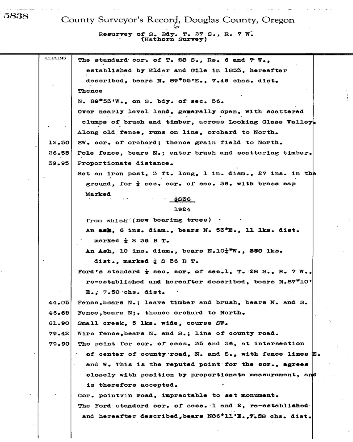
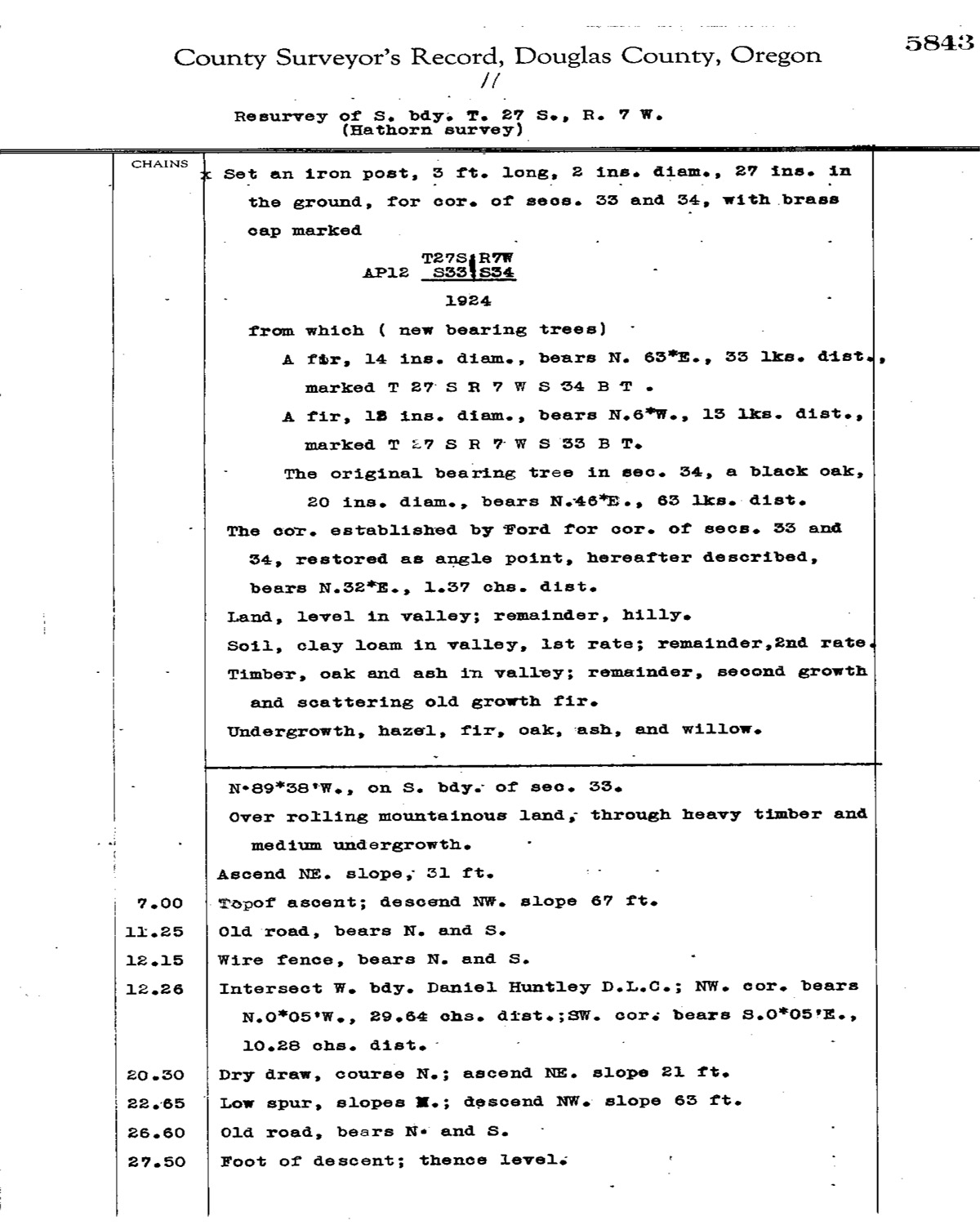
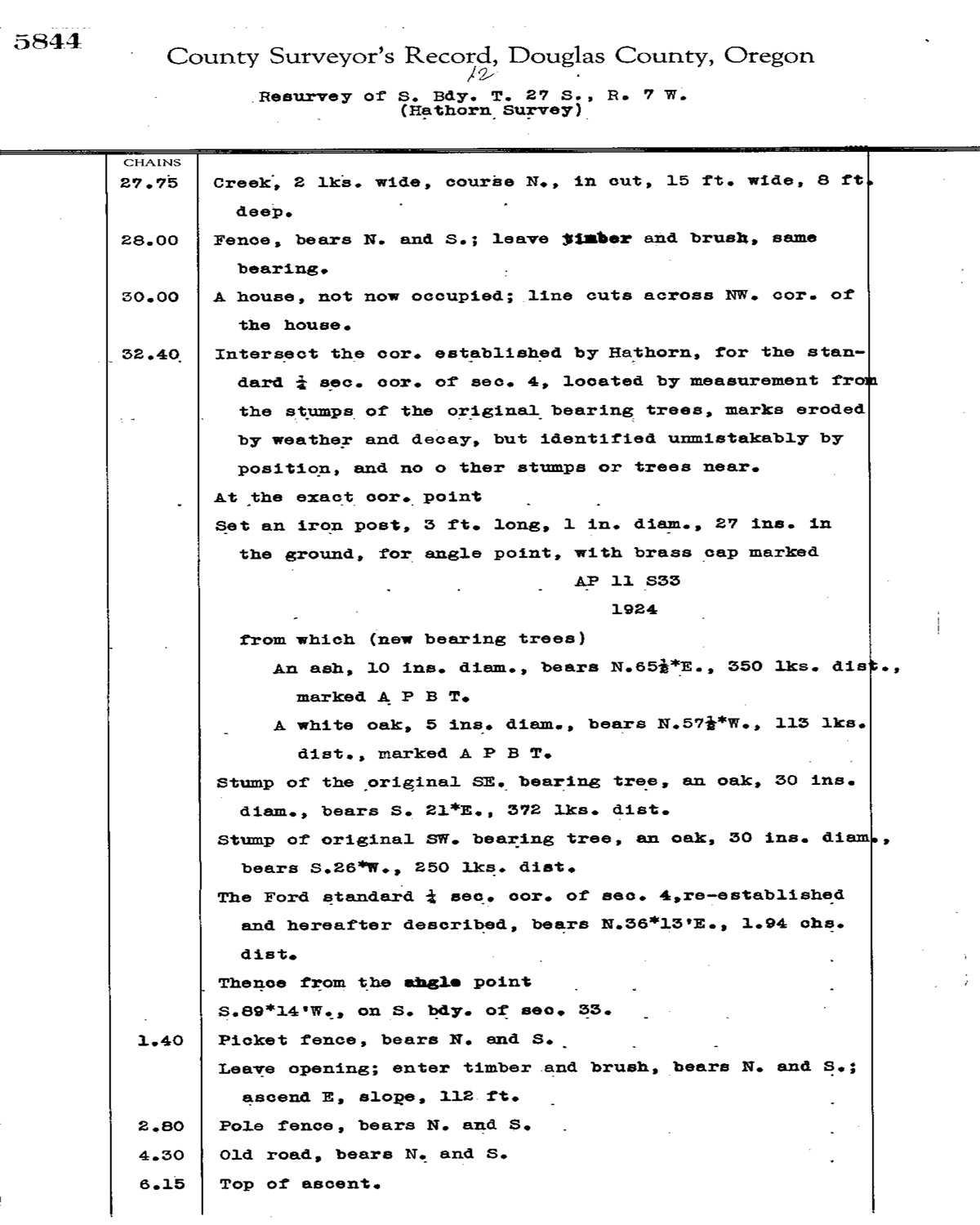
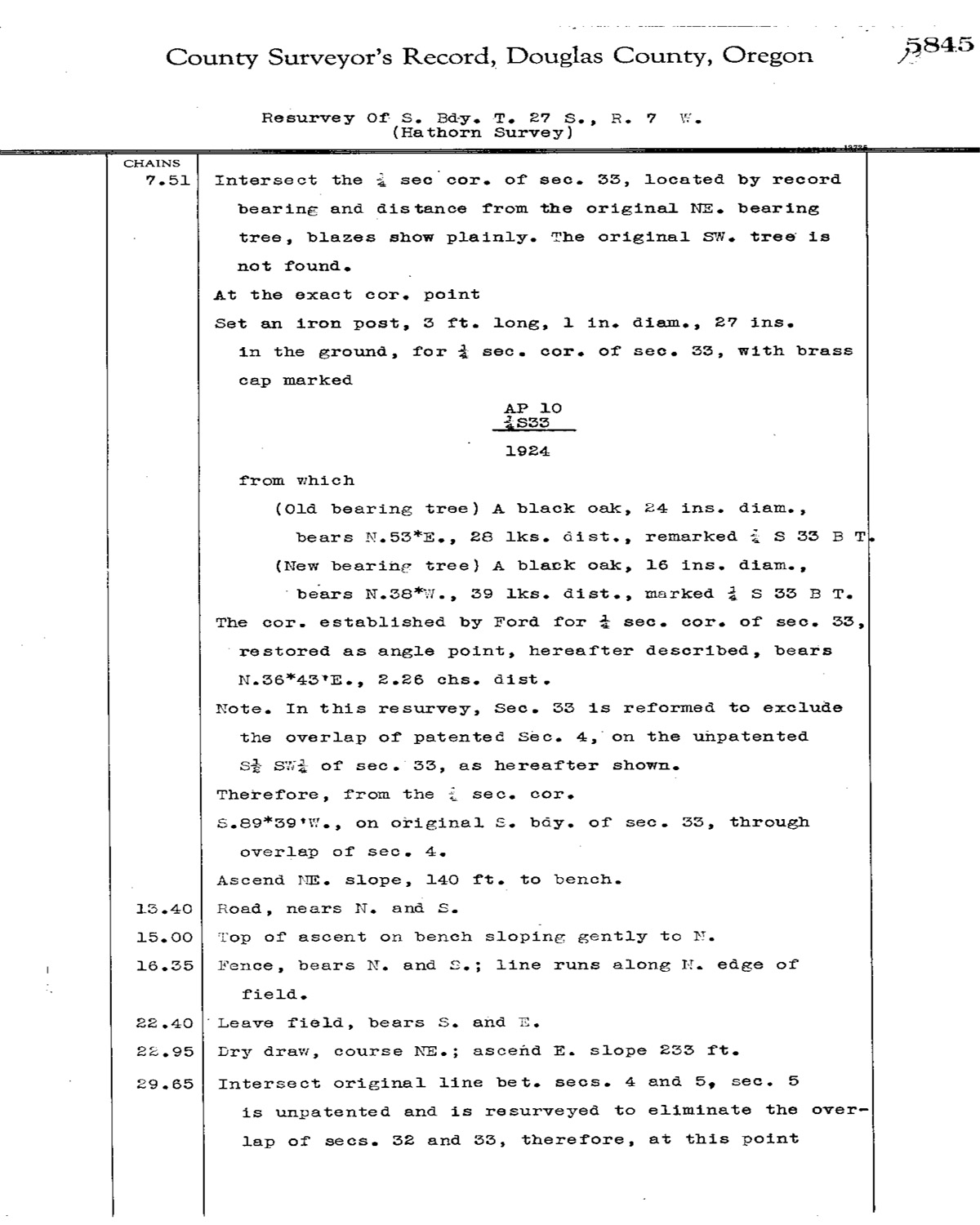
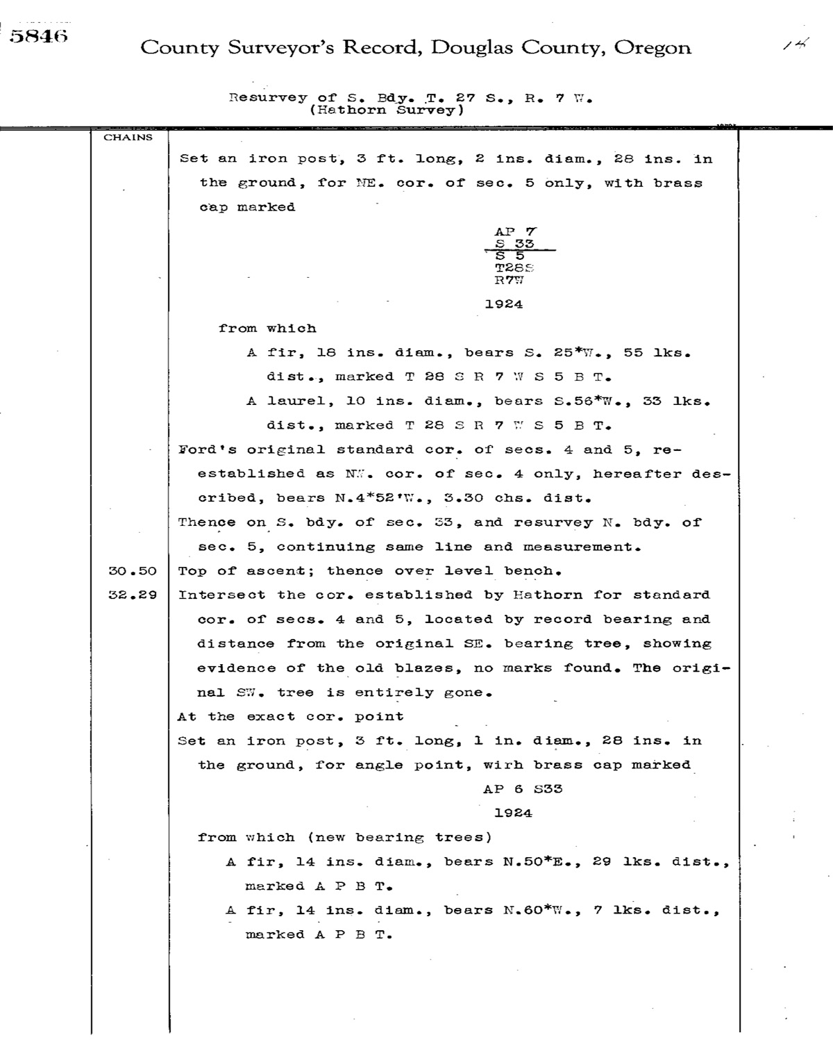
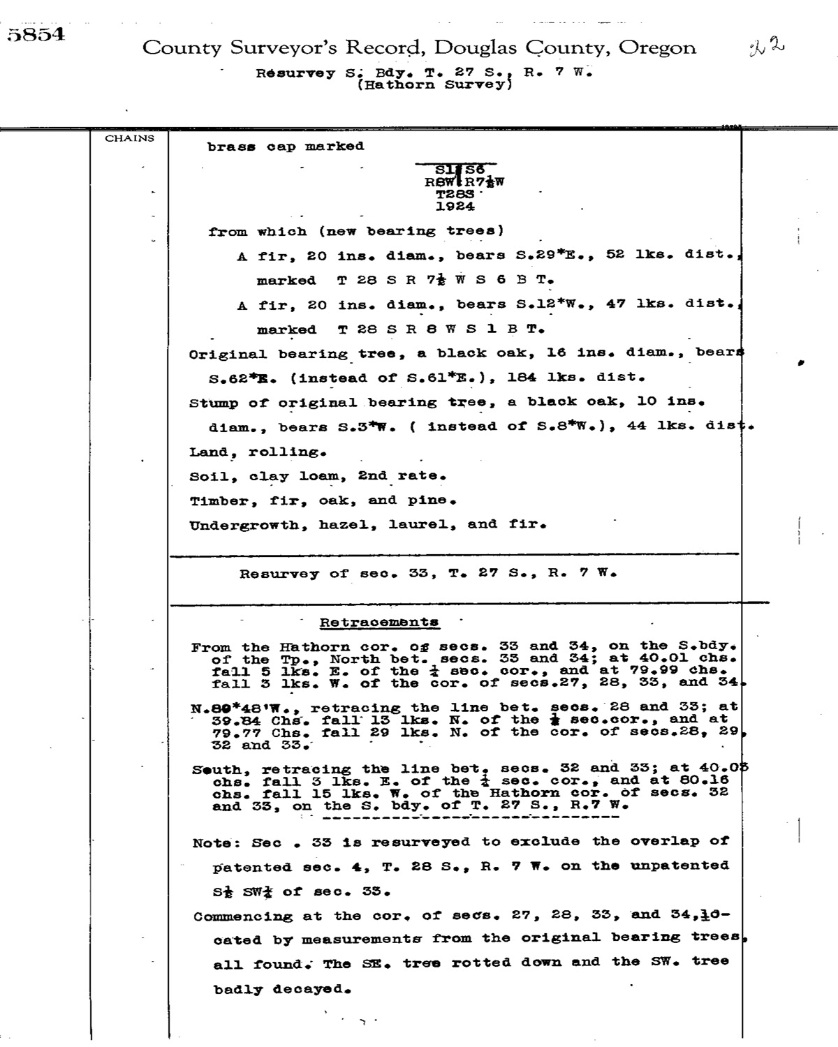
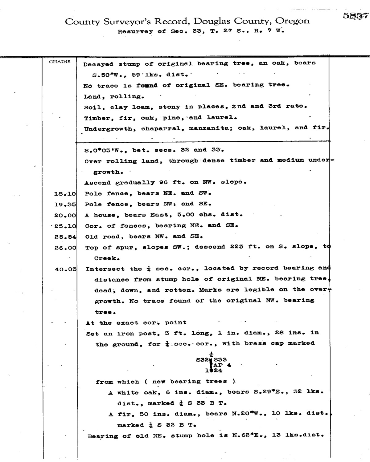
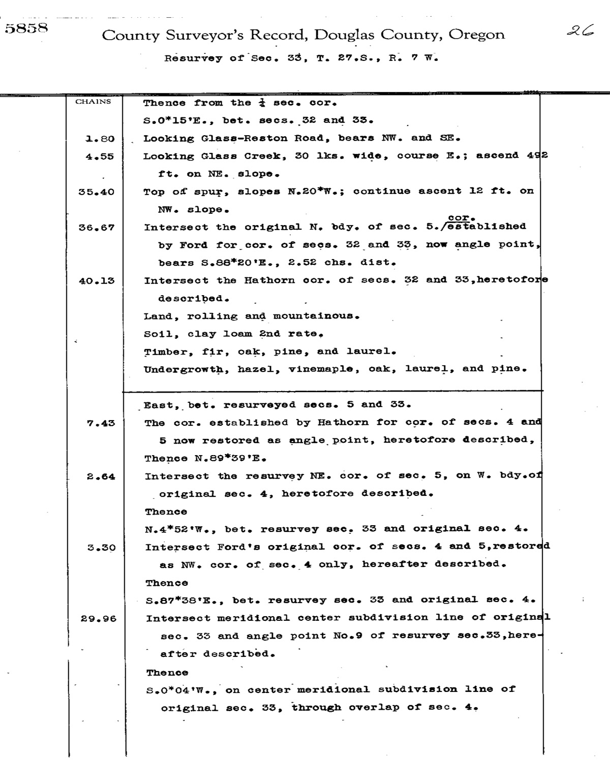
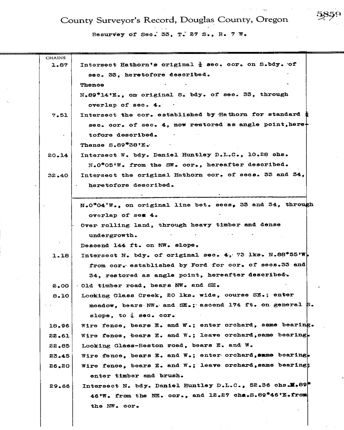
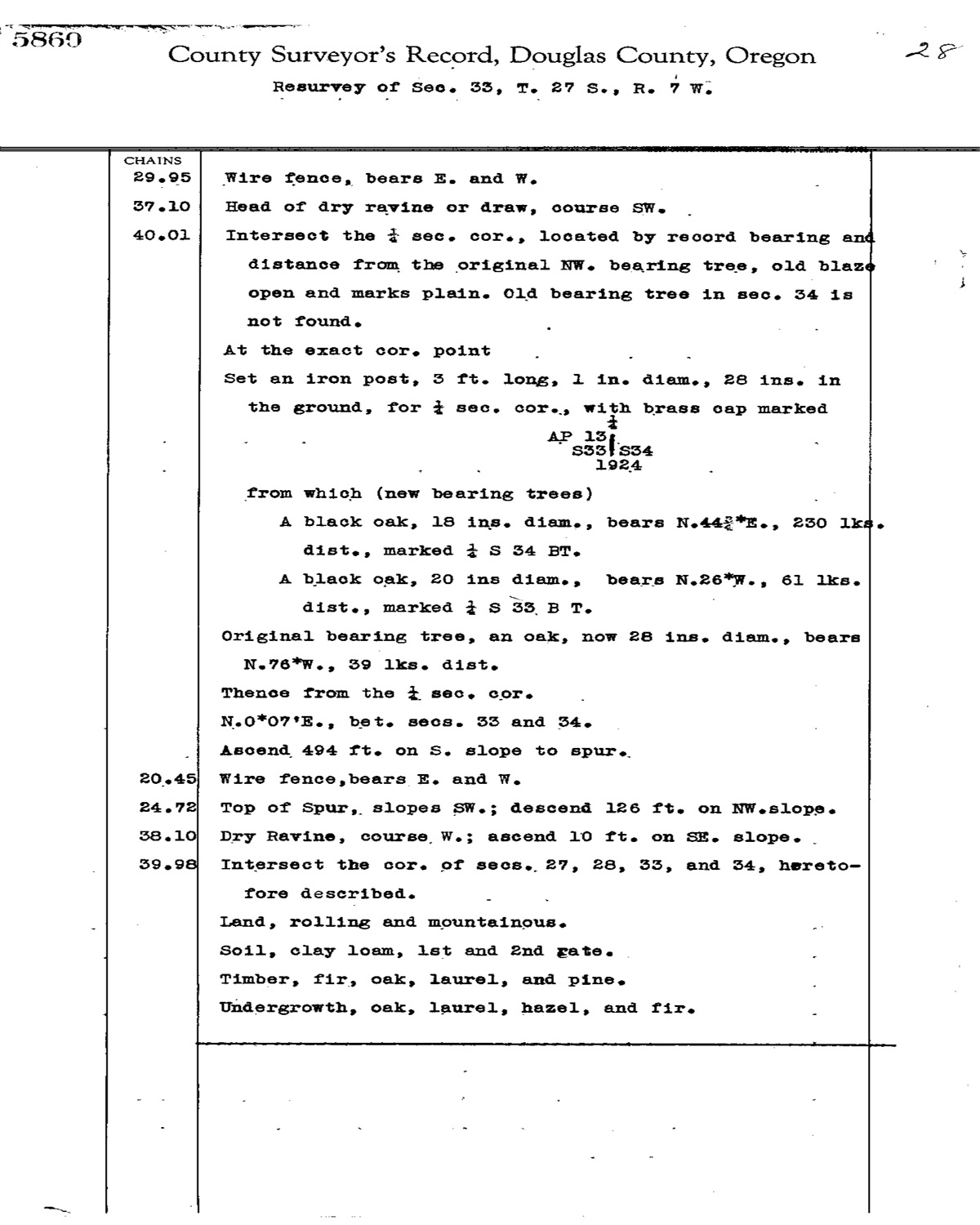
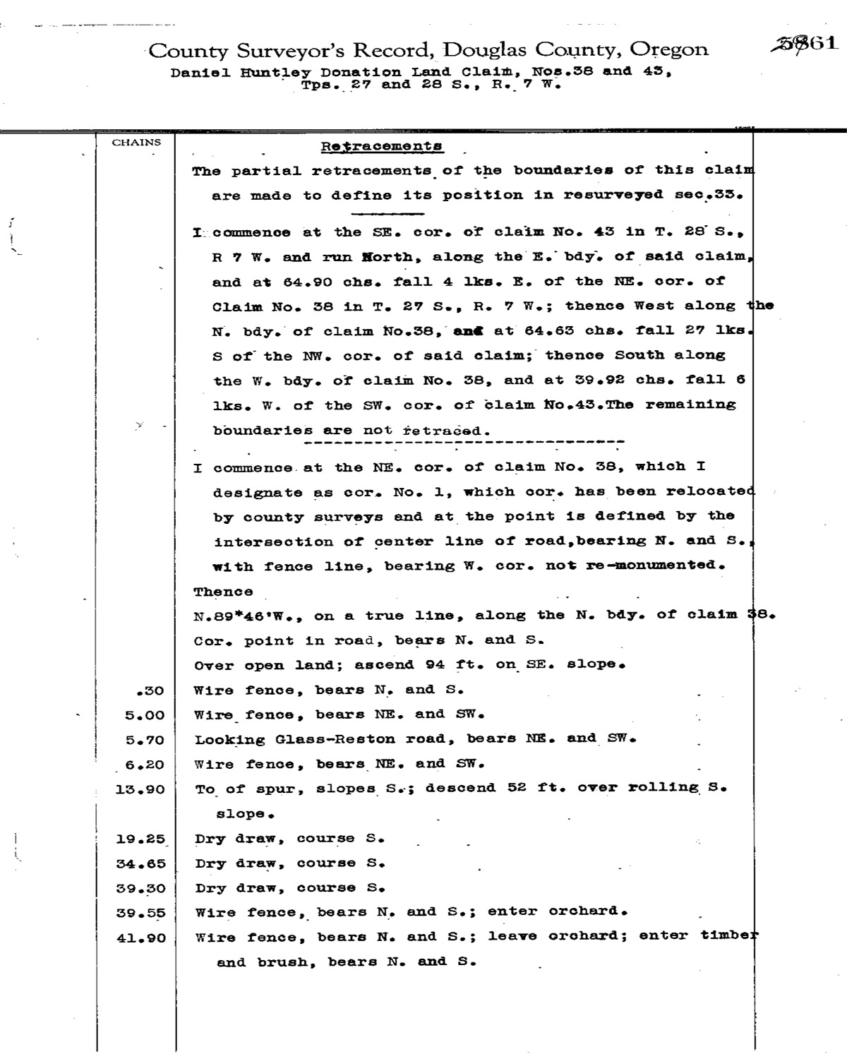
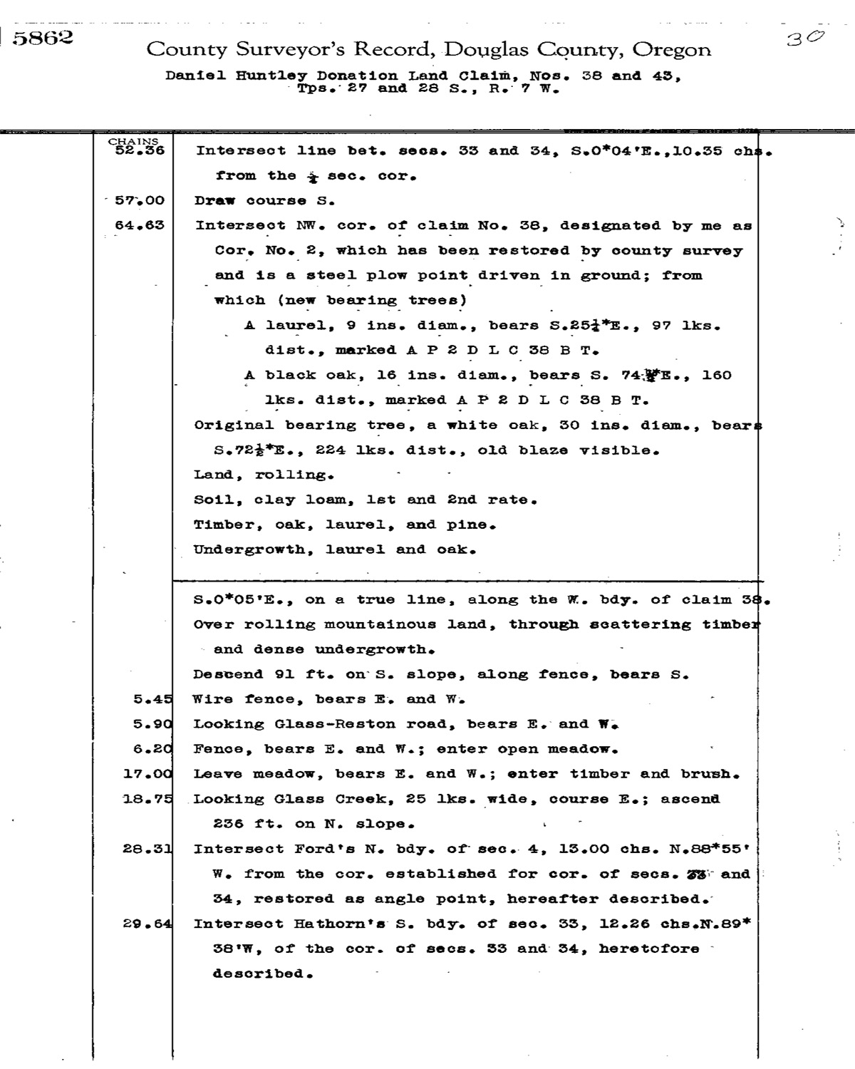
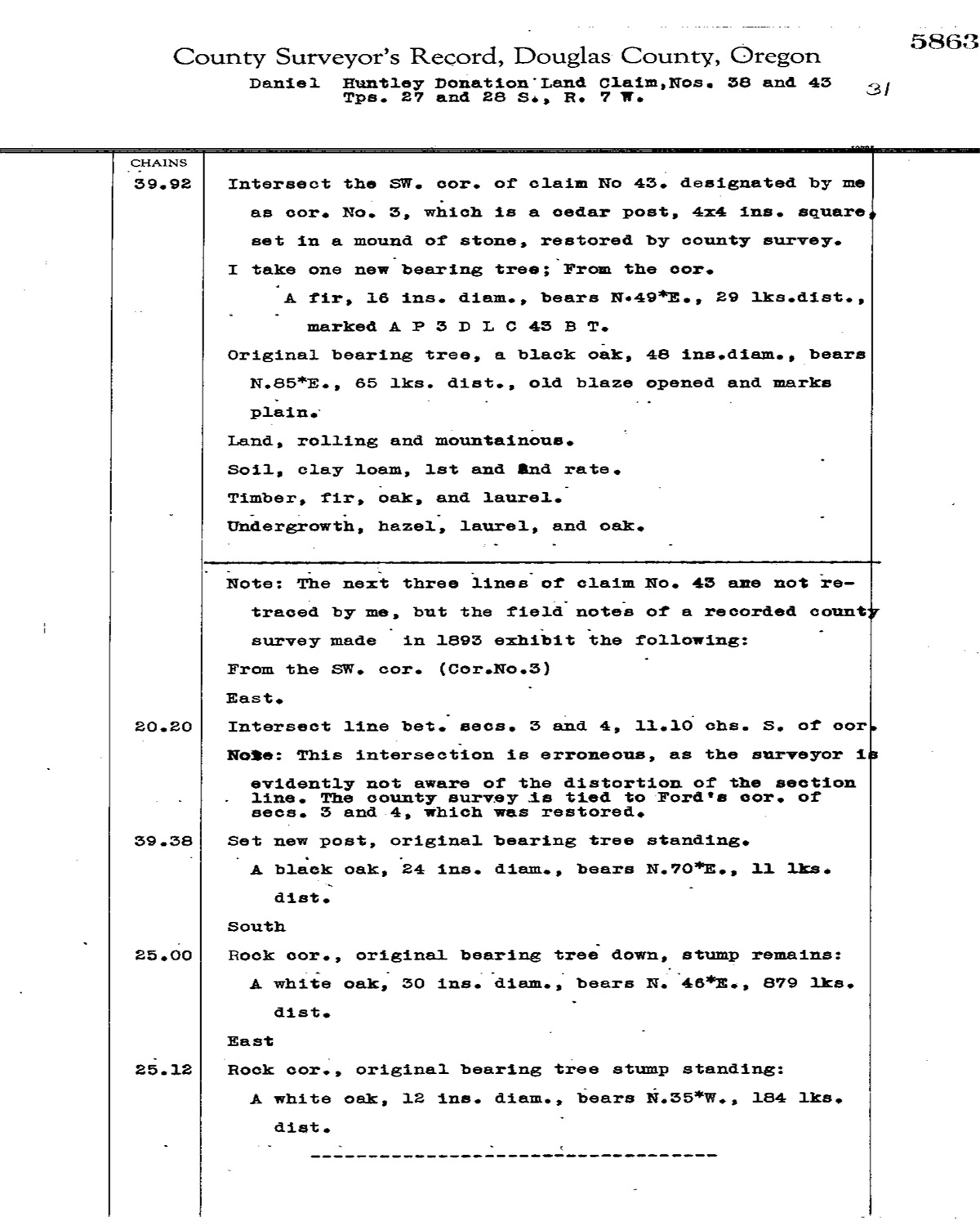
This township is entirely within the boundaries of the 2011-2012 Coquelle Trails Project. It includes Bear Ridge, Lookingglass Creek, and Williams River in the Allegany Historical District. This survey was completed in 1856, 1862, 1881, and 1926 and mapped in 1856, 1862 and 1926. (Hathorn 1855; Burnett 1857; Flint & Flint 1881; Mensch 1924). Donation Land Claims were filed by J. P. Boyer, A. Flournoy, Hay B. Flournoy, Rowland Flournoy, A. Newton, and J. M. Wright.
![]()