Tsp. 25 S., Rng. 09 W.
General Land Office Survey Index
 |
 |
 |
 |
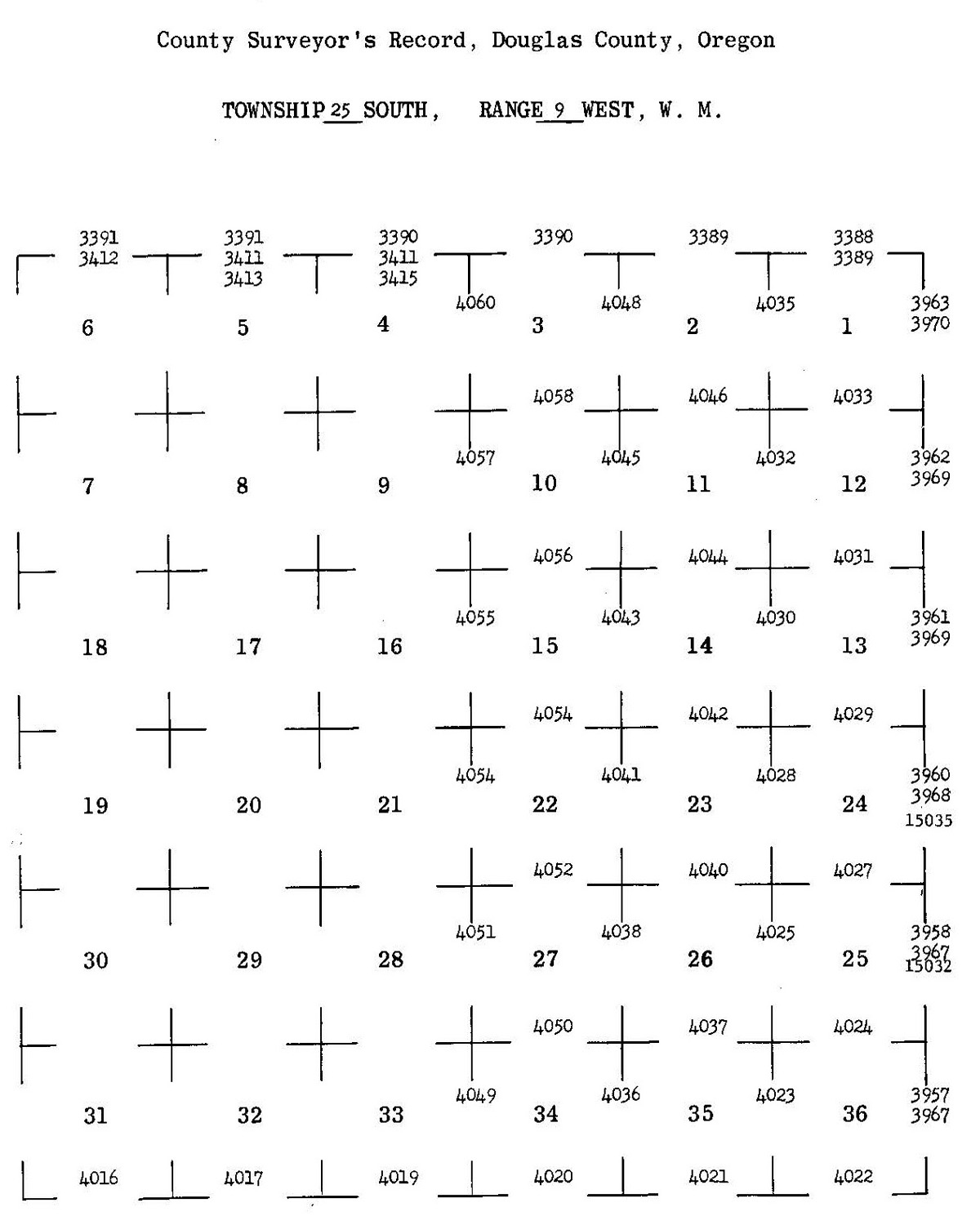
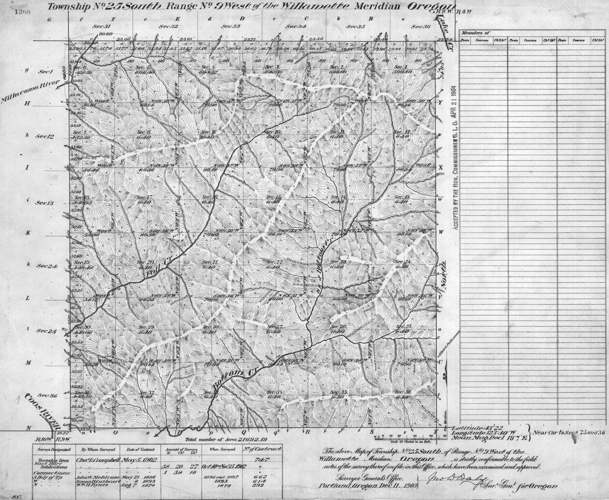
1903 GLO |
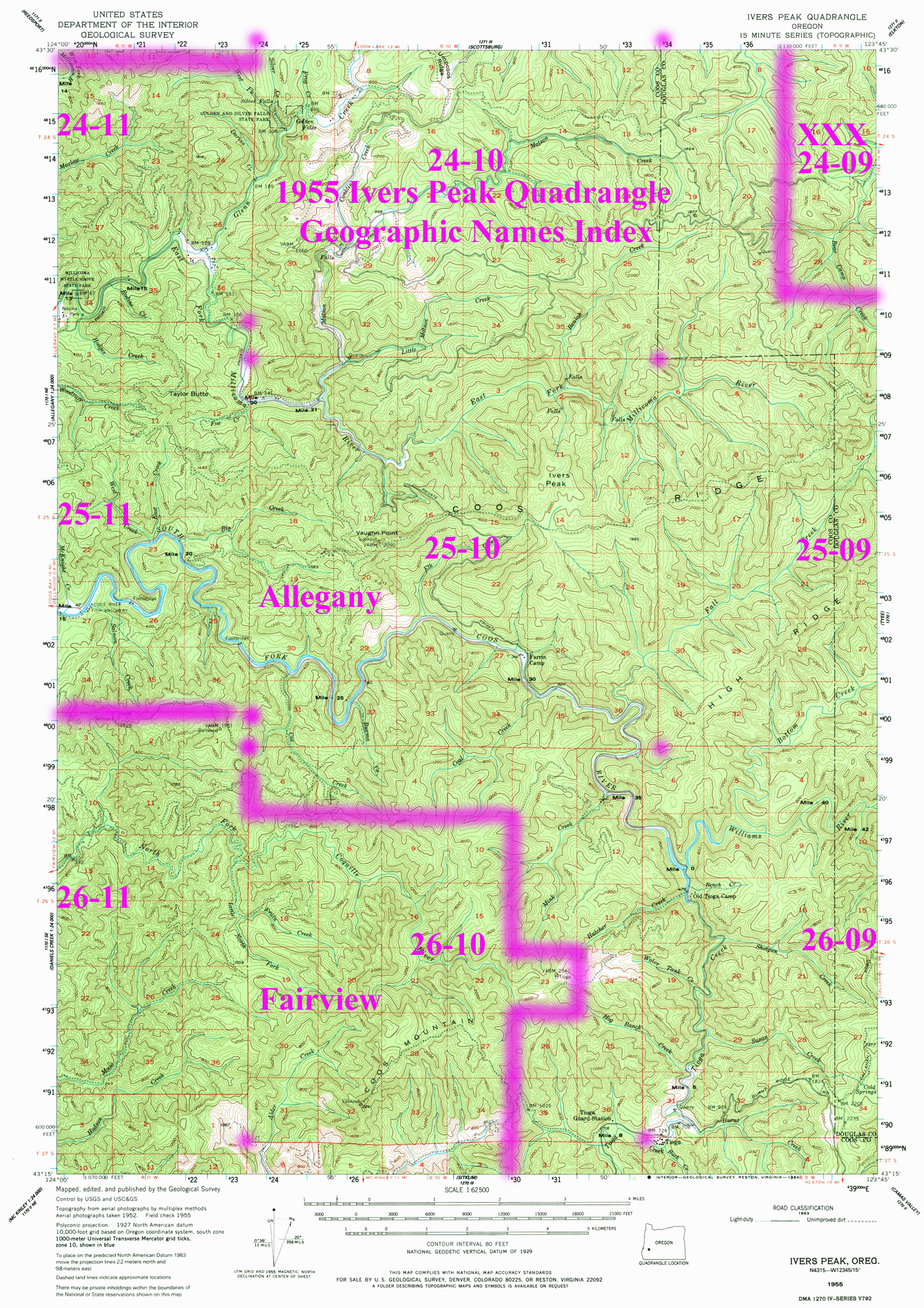
1955 Annotated USGS Ivers Peak |
1955 Annotated USGS Tyee |
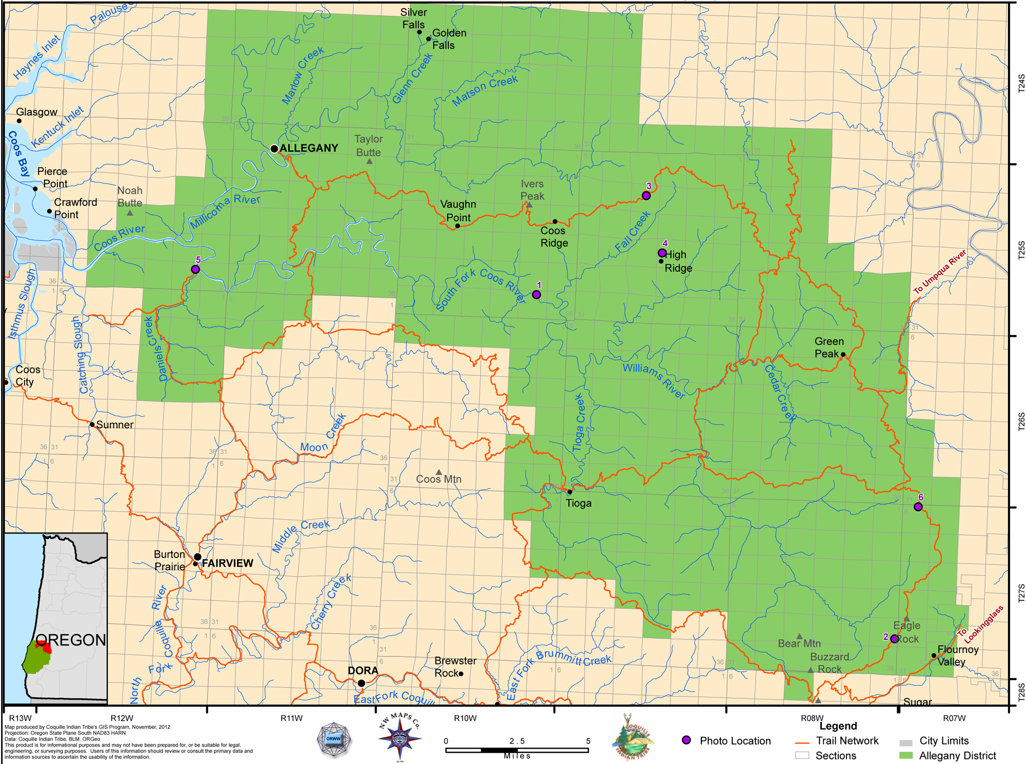
2012 Allegany District |
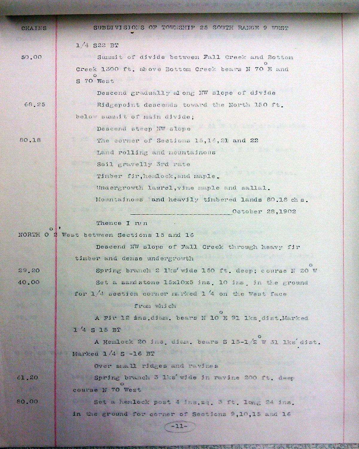
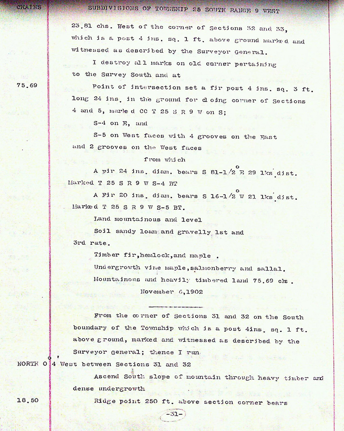
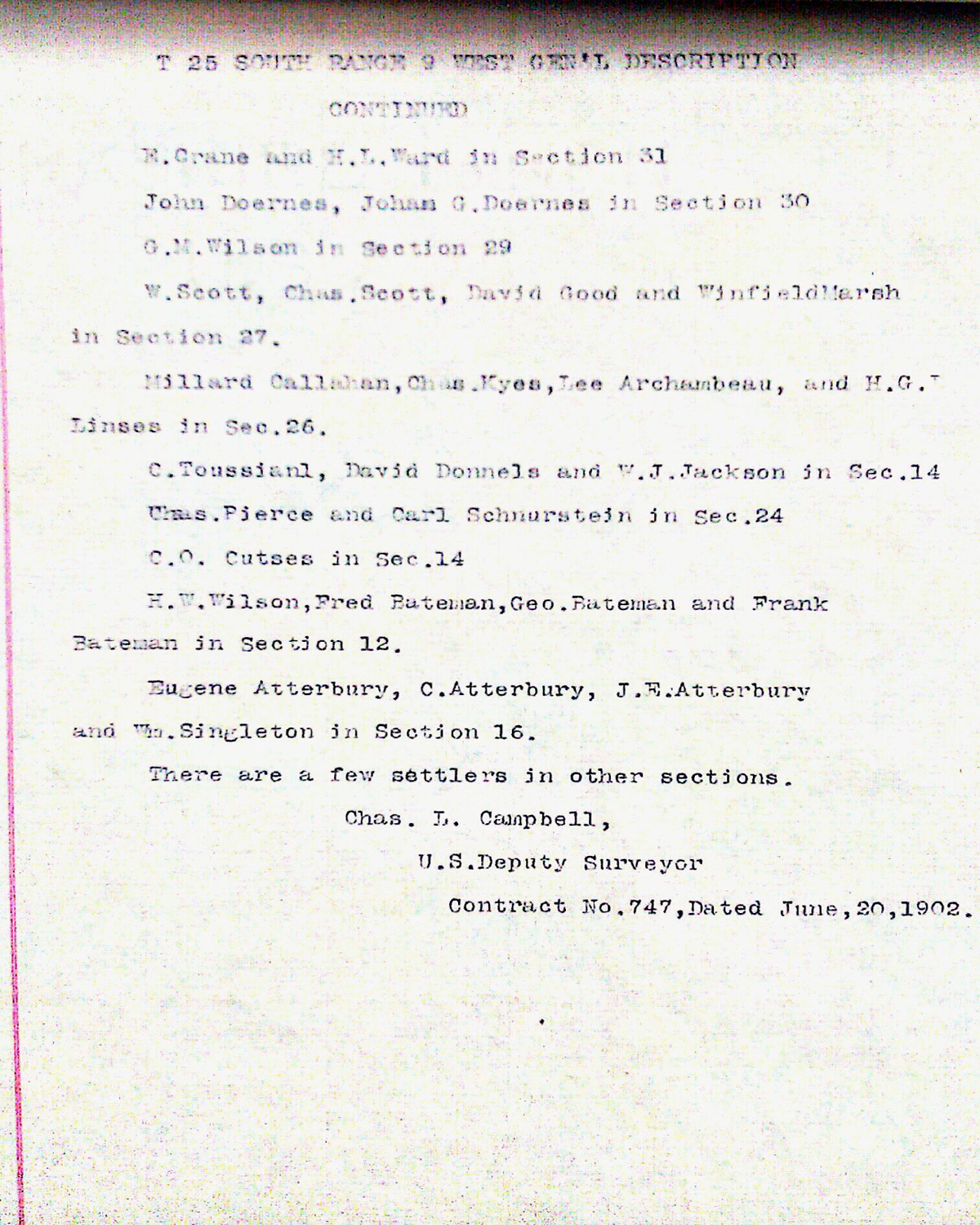
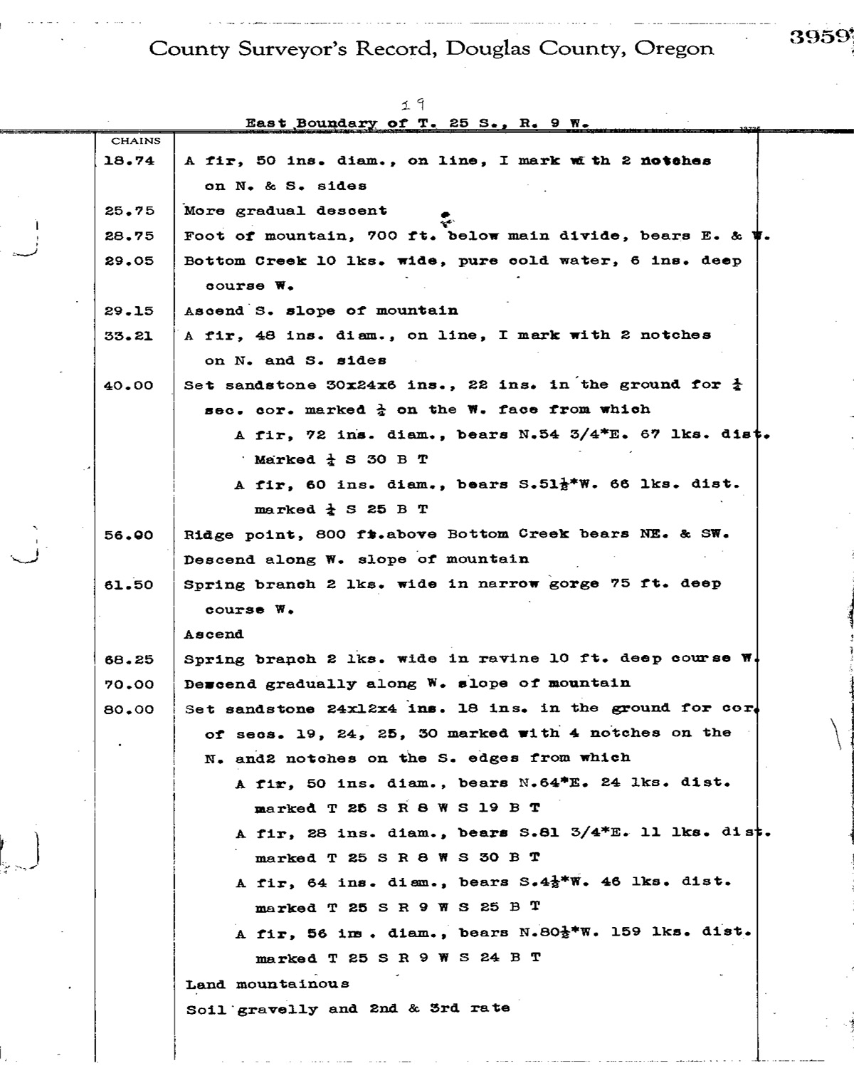
This township is entirely within the boundaries of the 2011-2012 Coquelle Trails Project. It includes Coos Ridge, Fall Creek and Coos River in the Allegany Historical District. This survey was completed in 1878, 1893, and 1897 and mapped in 1903 (Byars 1878; Cathcart 1893; Meldrum 1896; Campbell 1902).