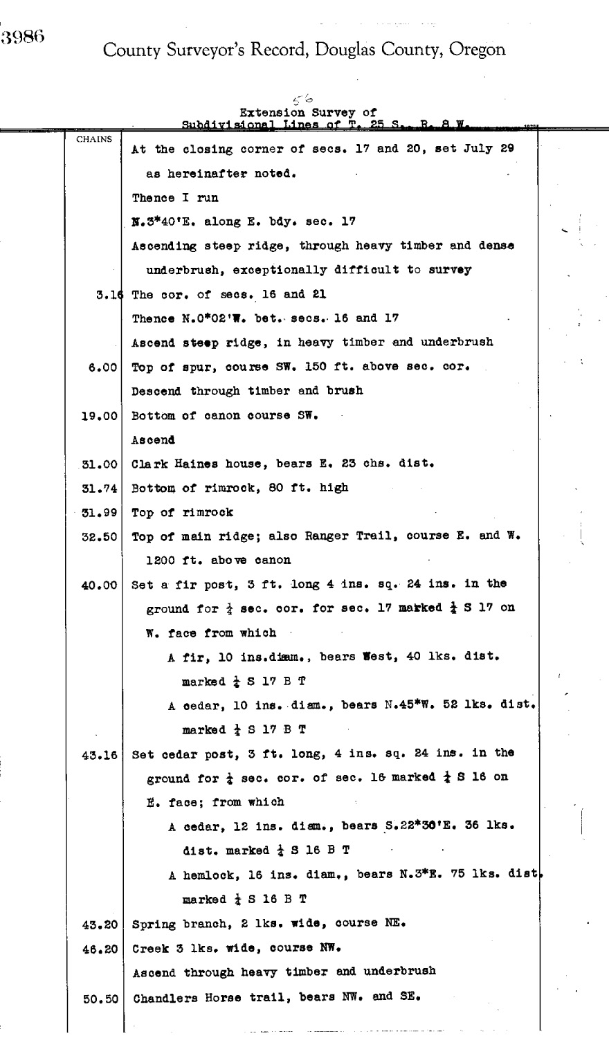
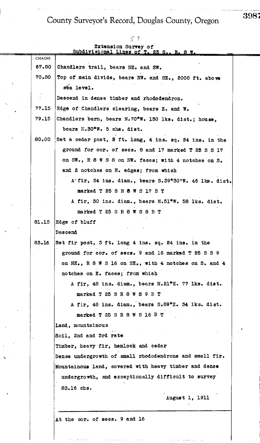
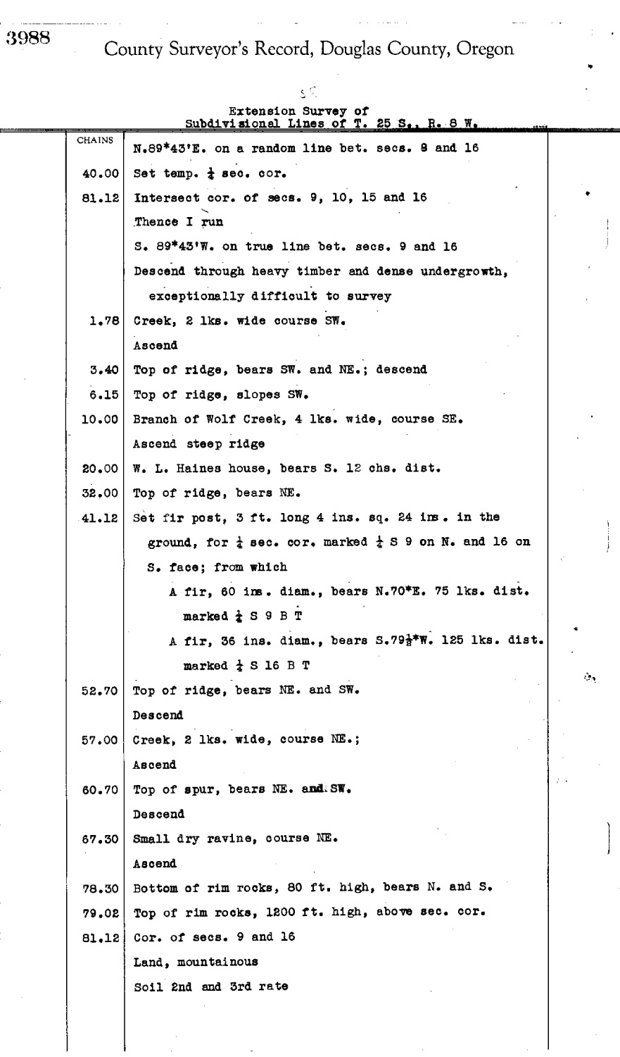
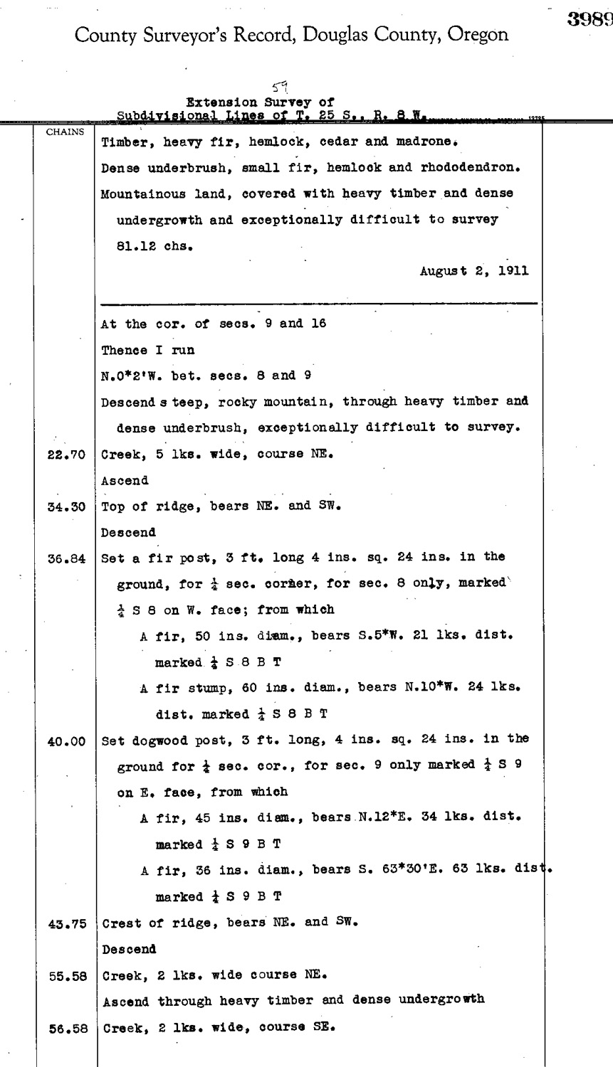
Tsp. 25 S., Rng. 08 W.
General Land Office Survey Index
 |
 |
 |
 |
 |
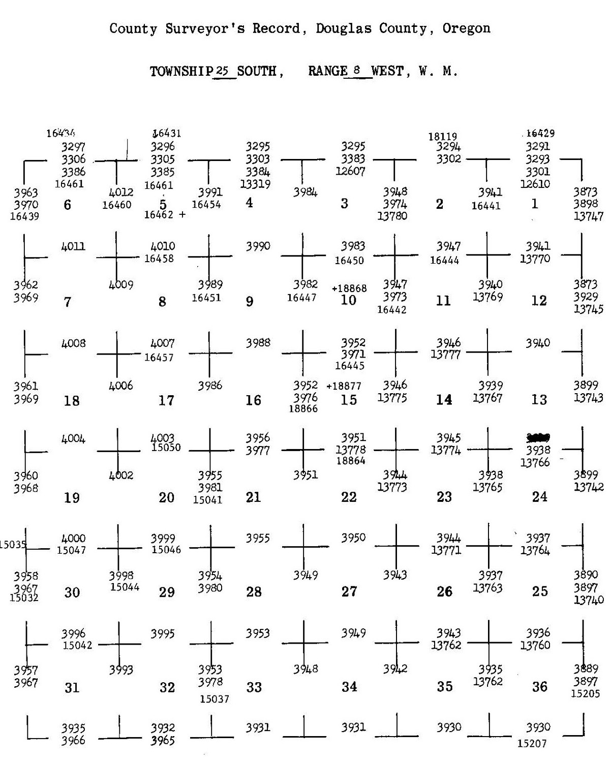
1858 GLO |
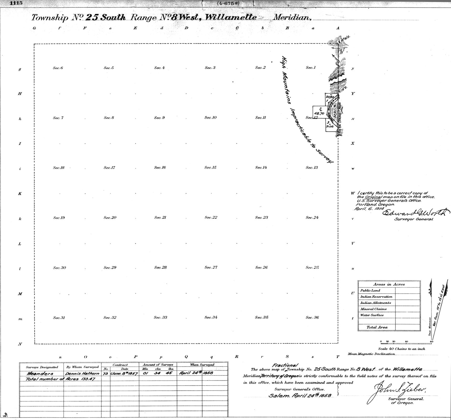
1882 GLO |
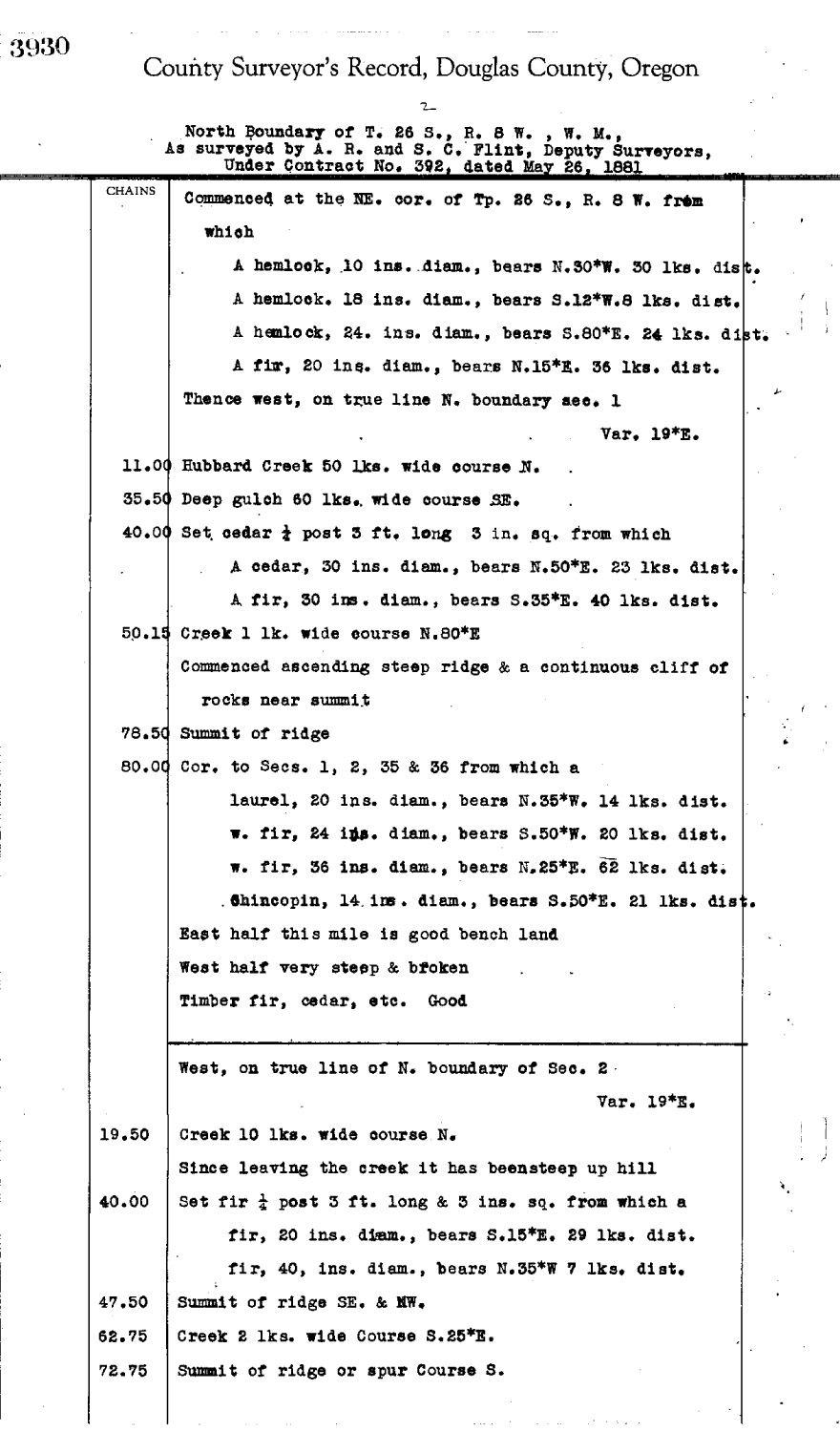
1913 GLO |
1955 Annotated Tyee |
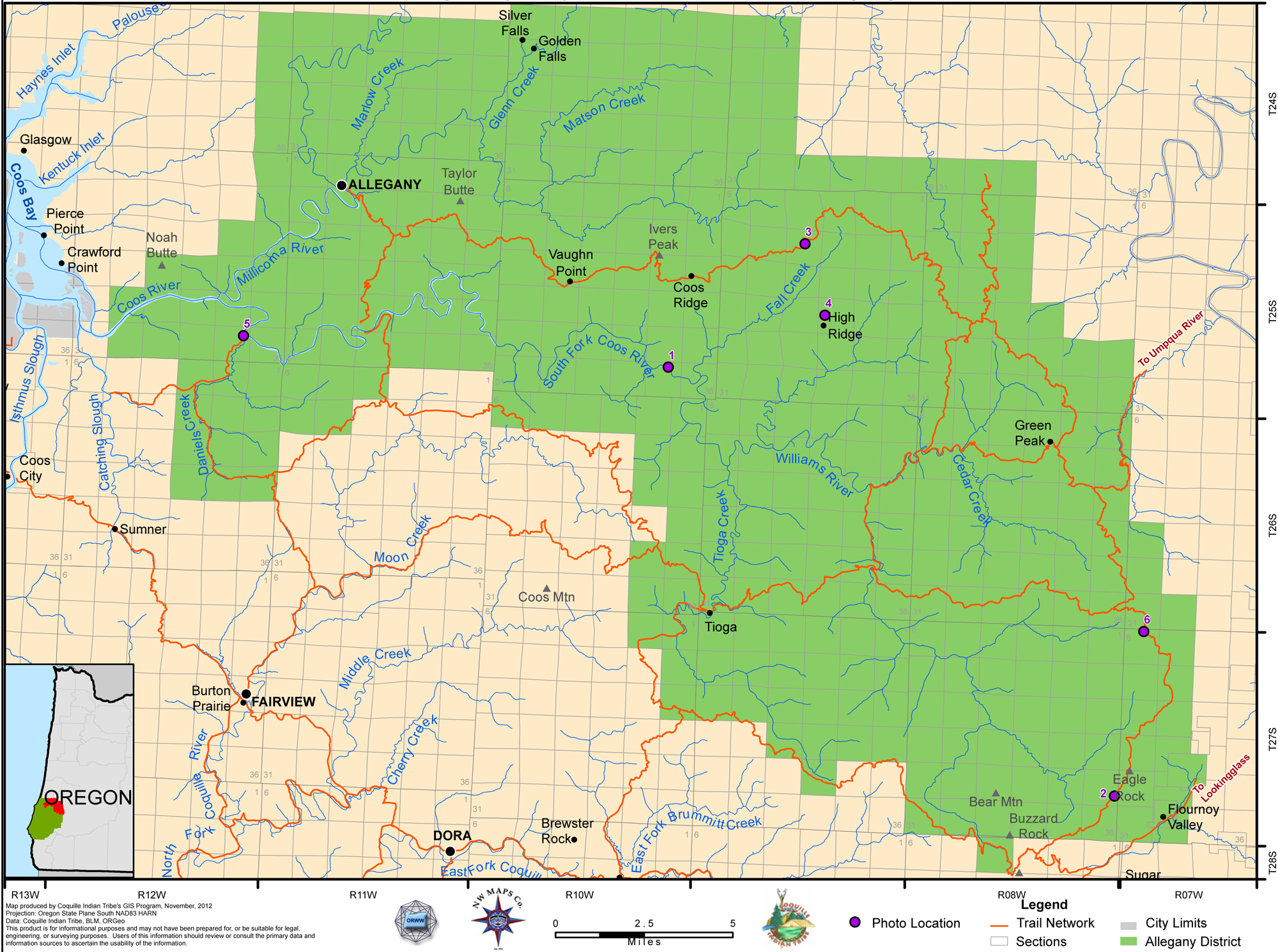
2012 Allegany District |
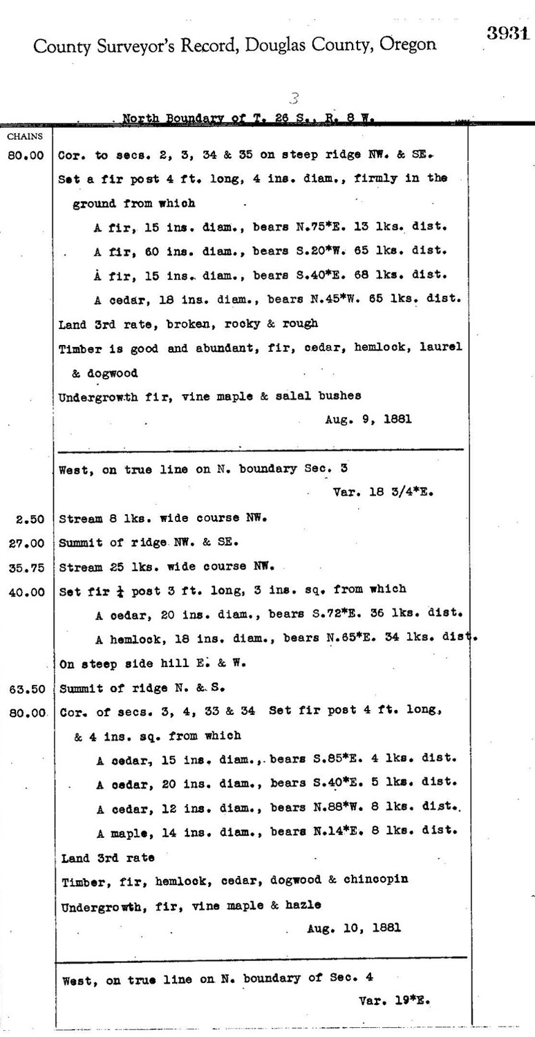
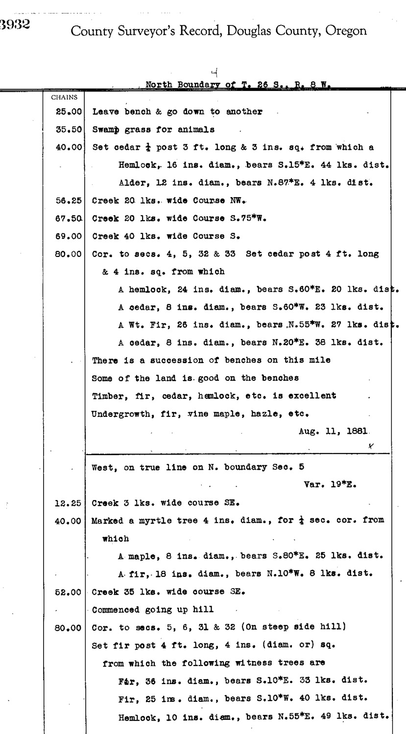
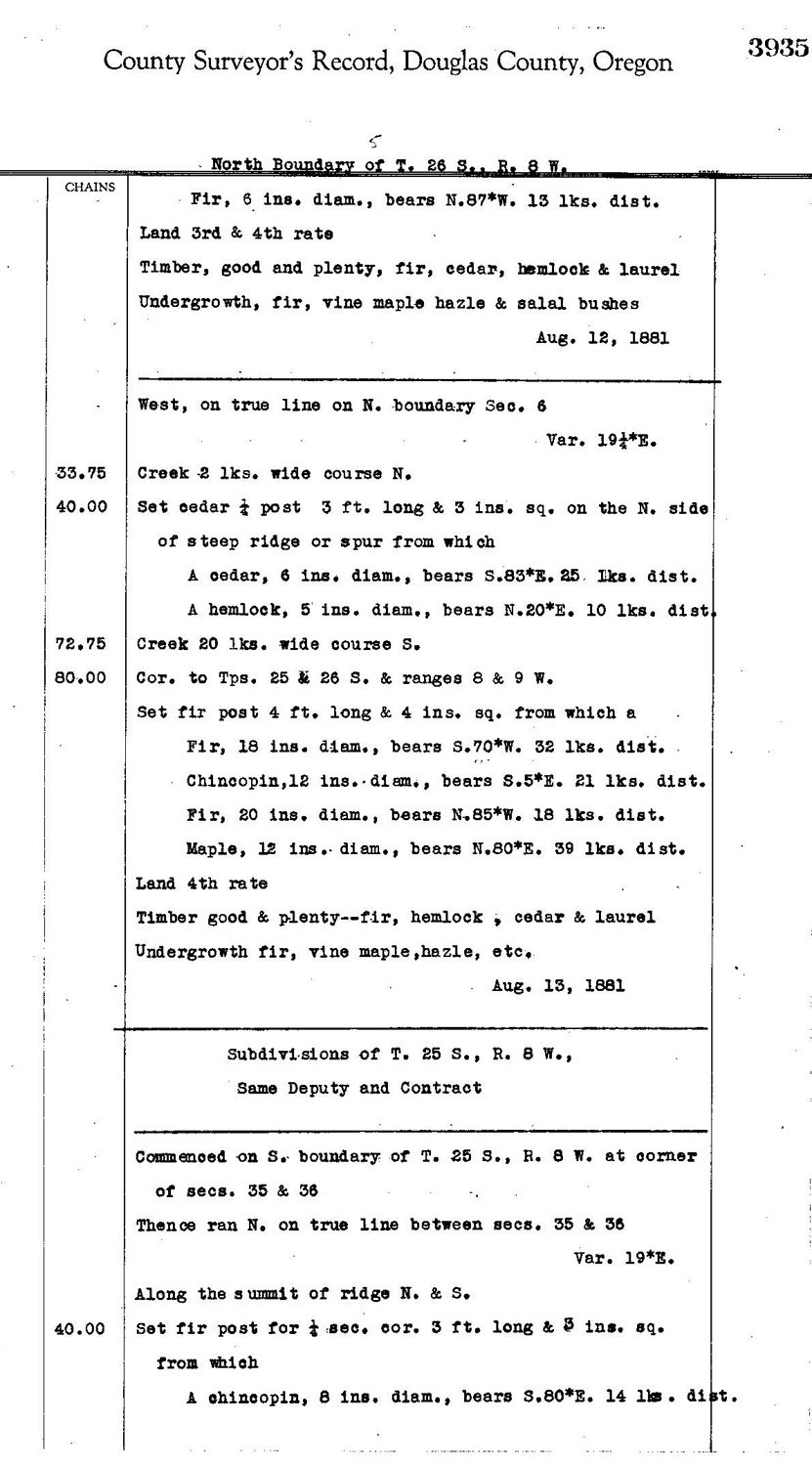
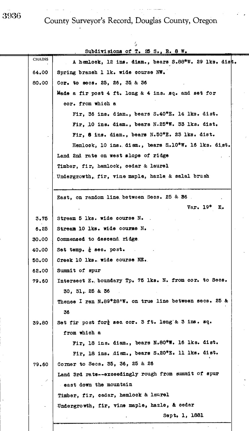
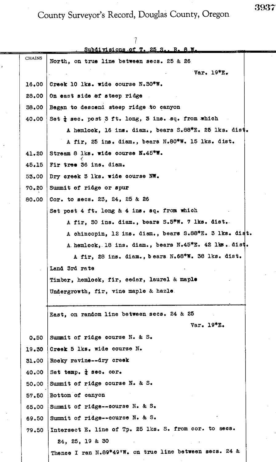
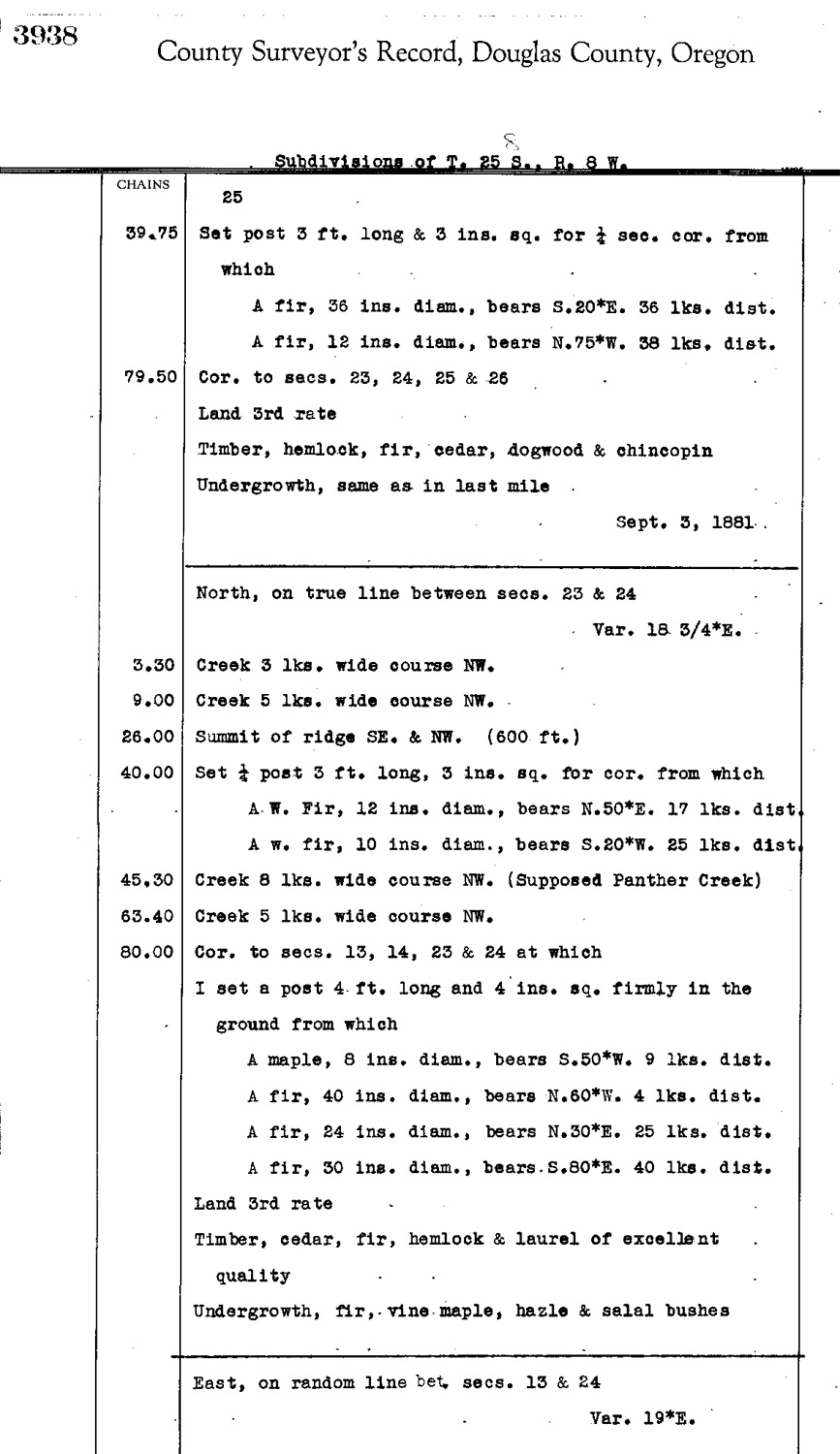
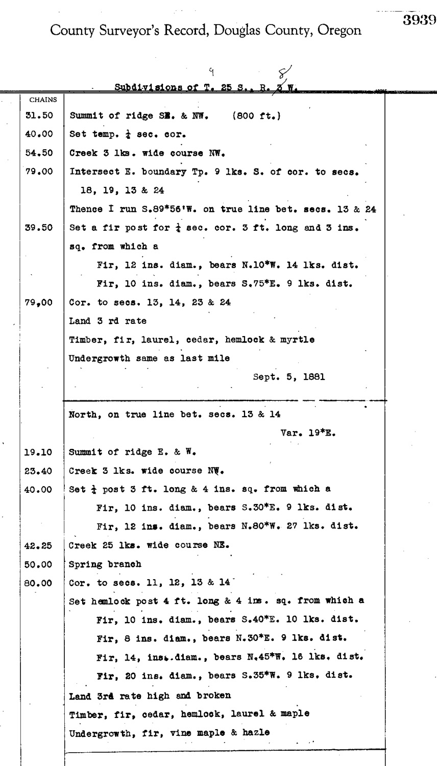
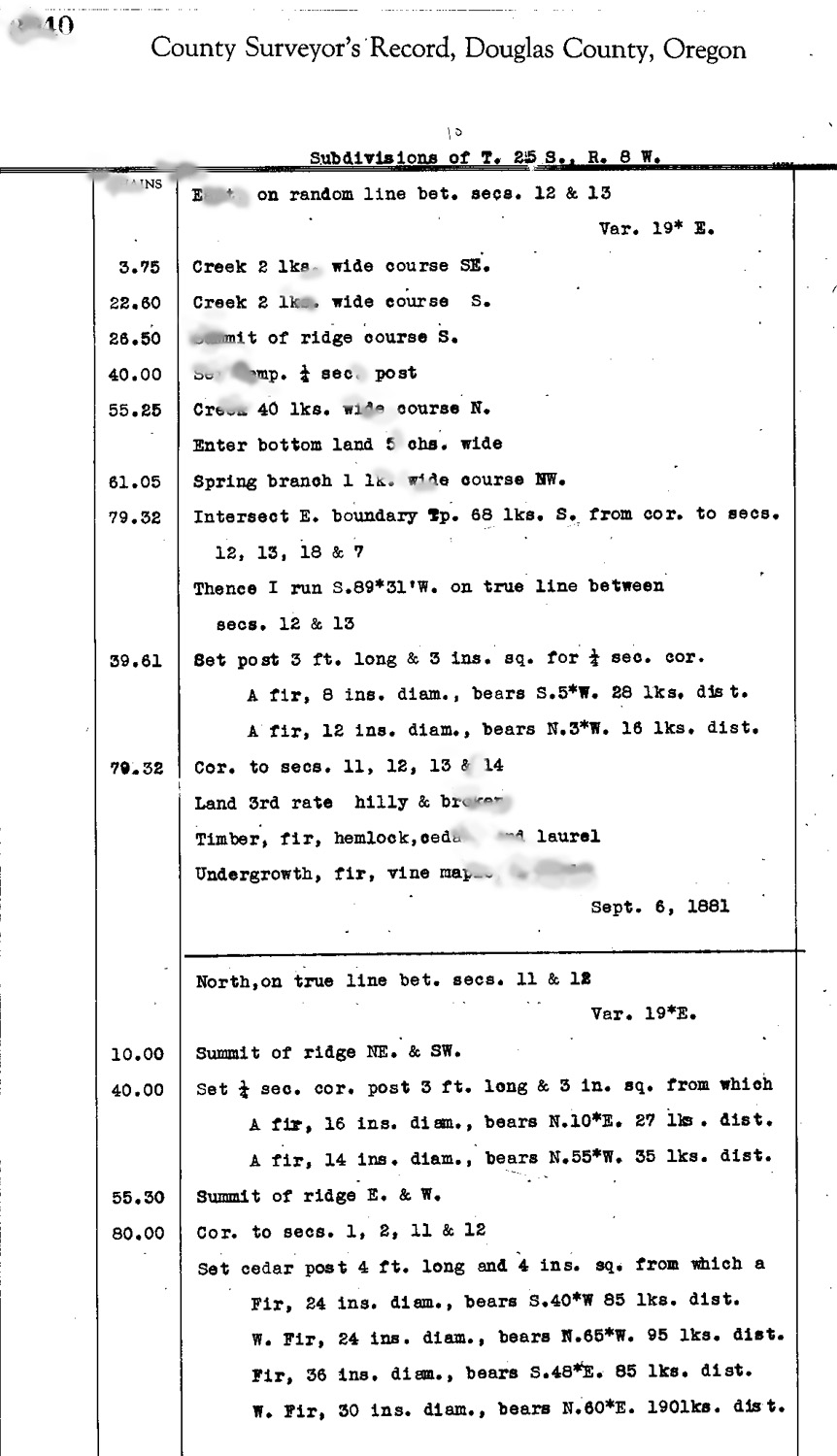
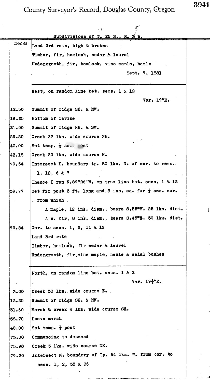
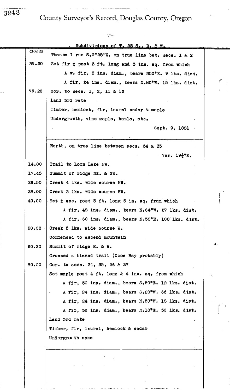
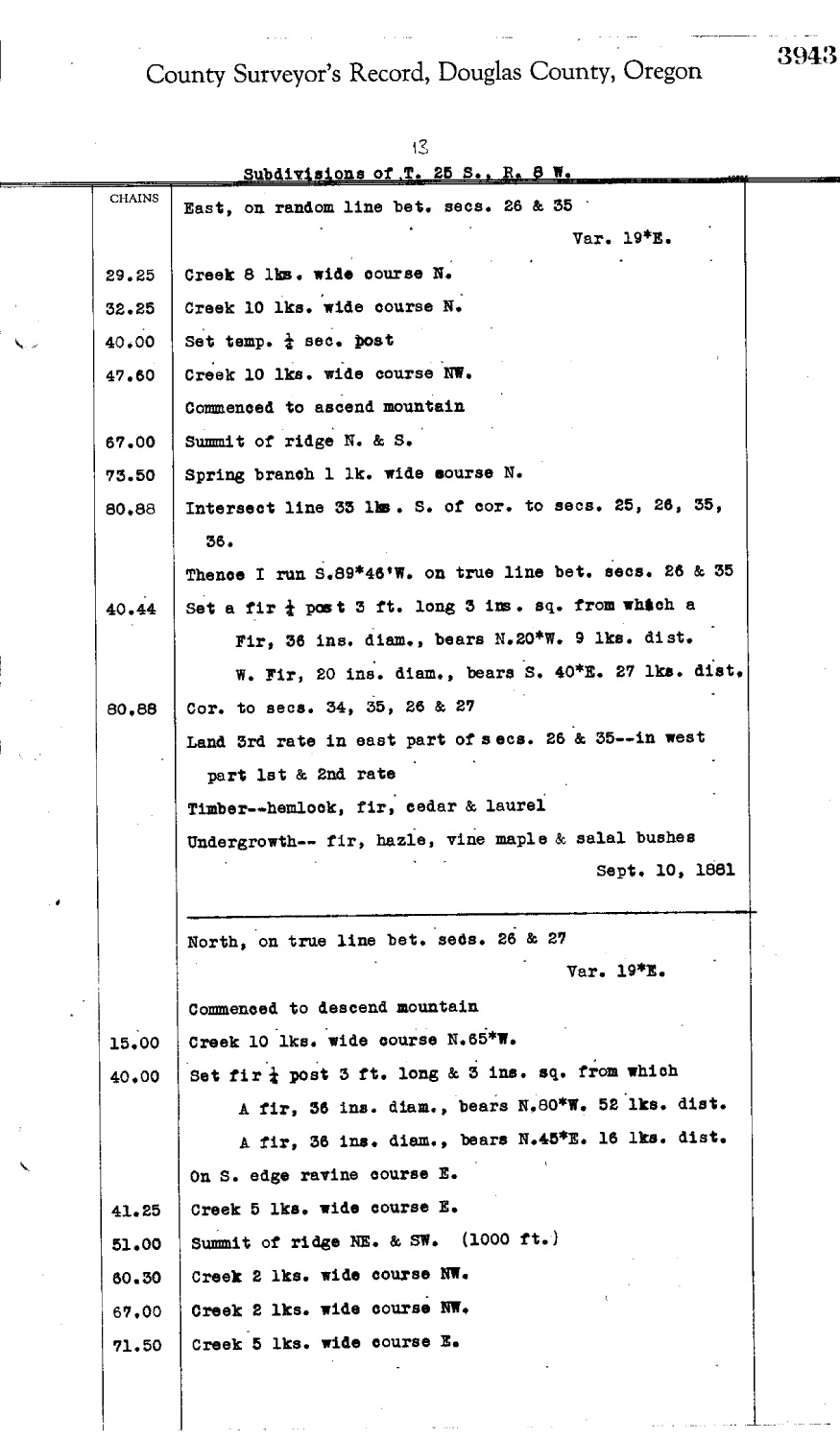
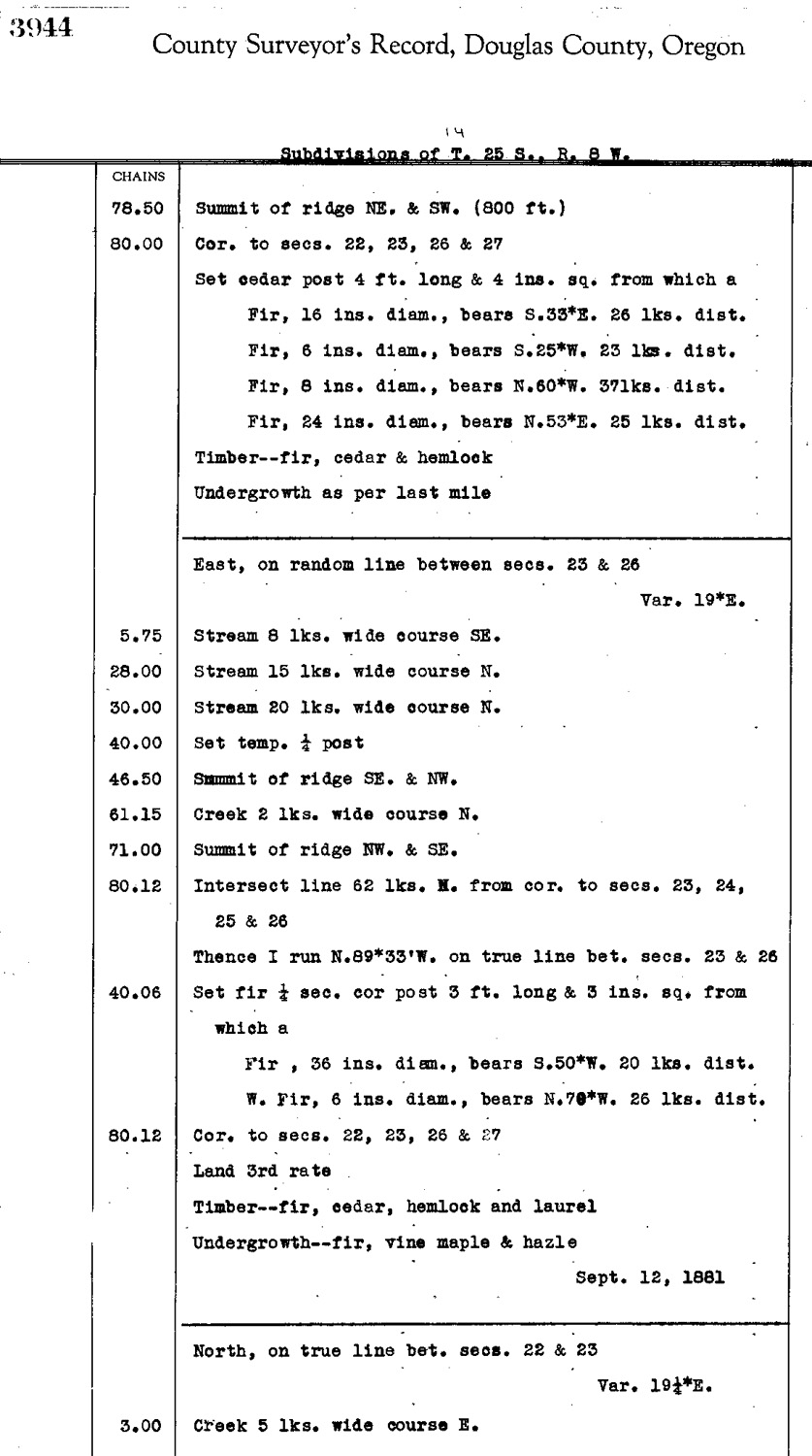
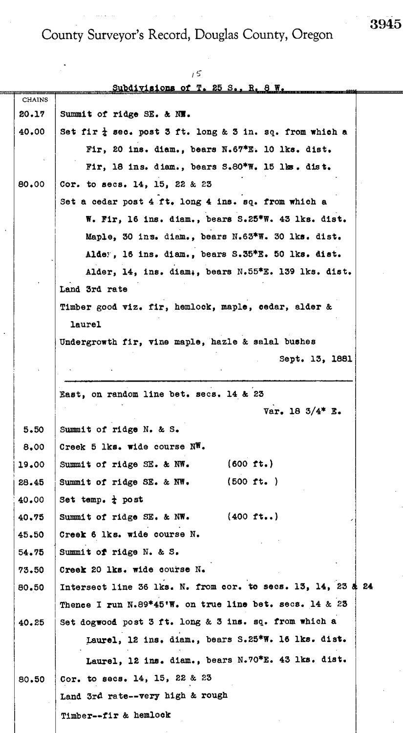
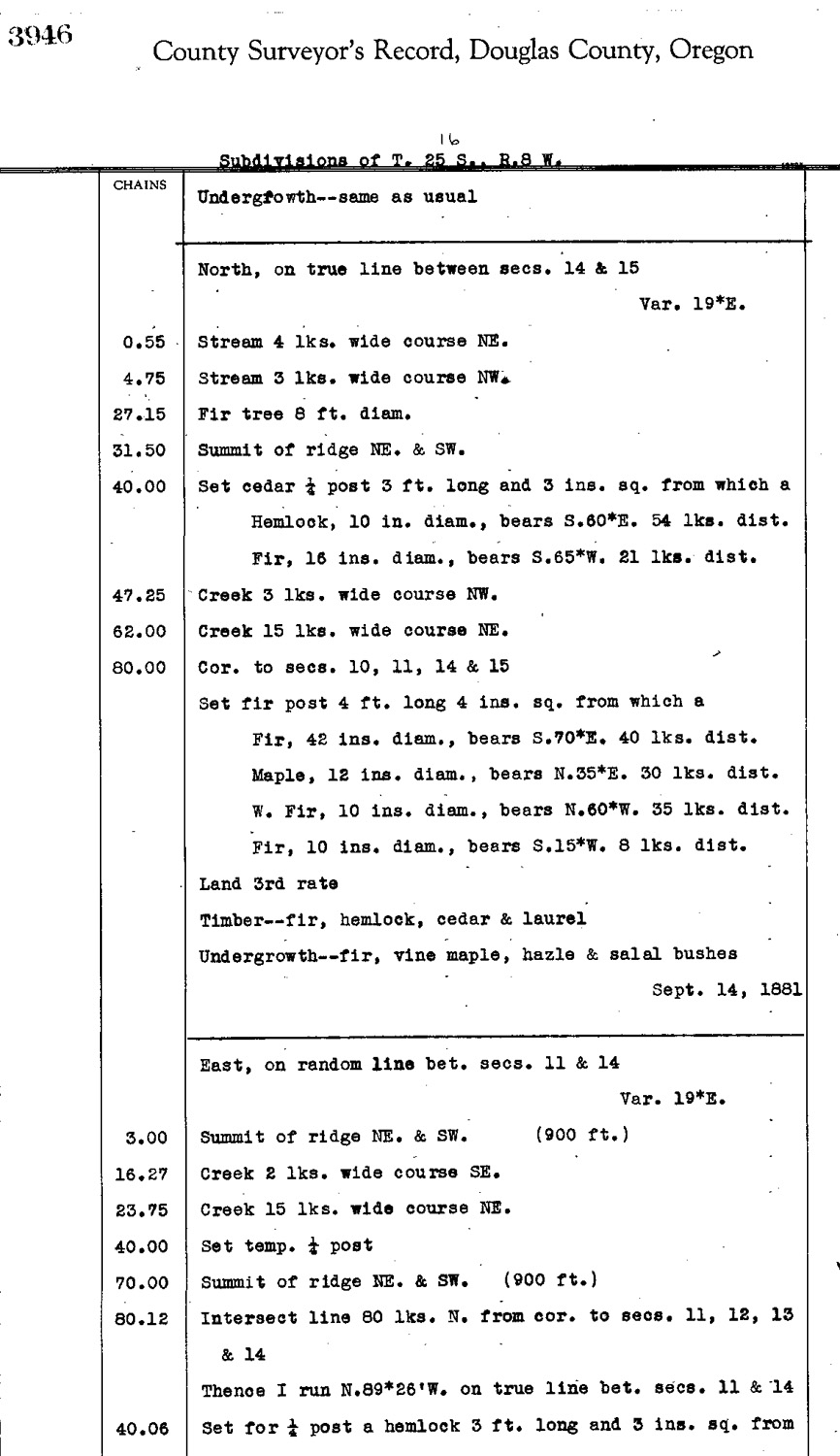
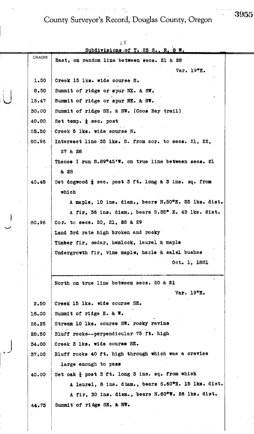
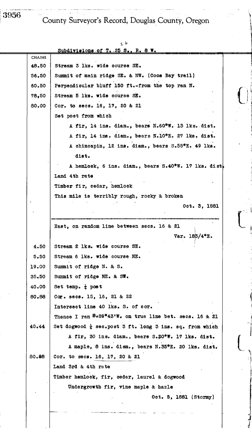
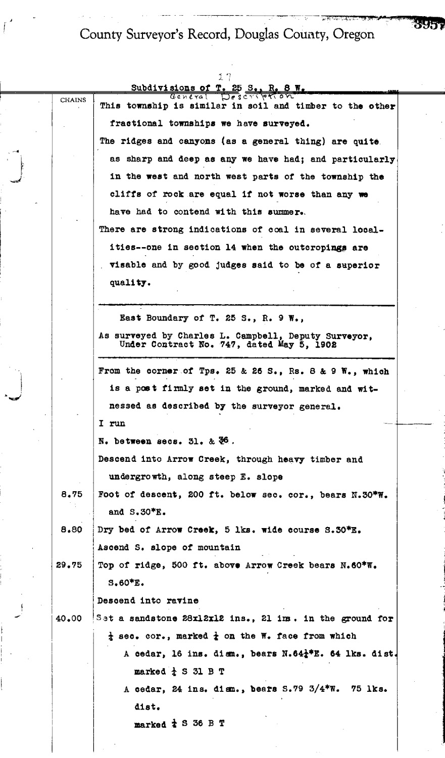
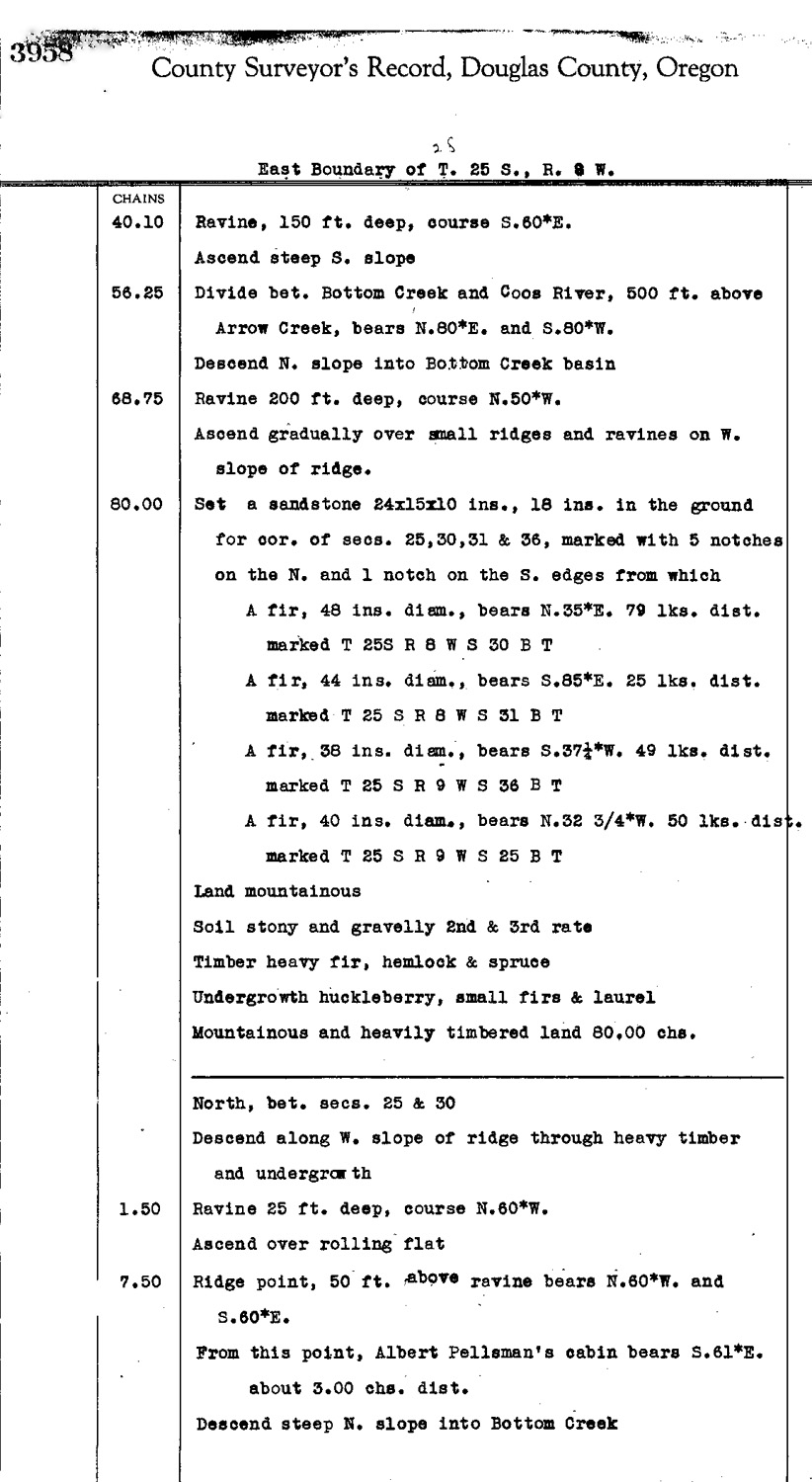
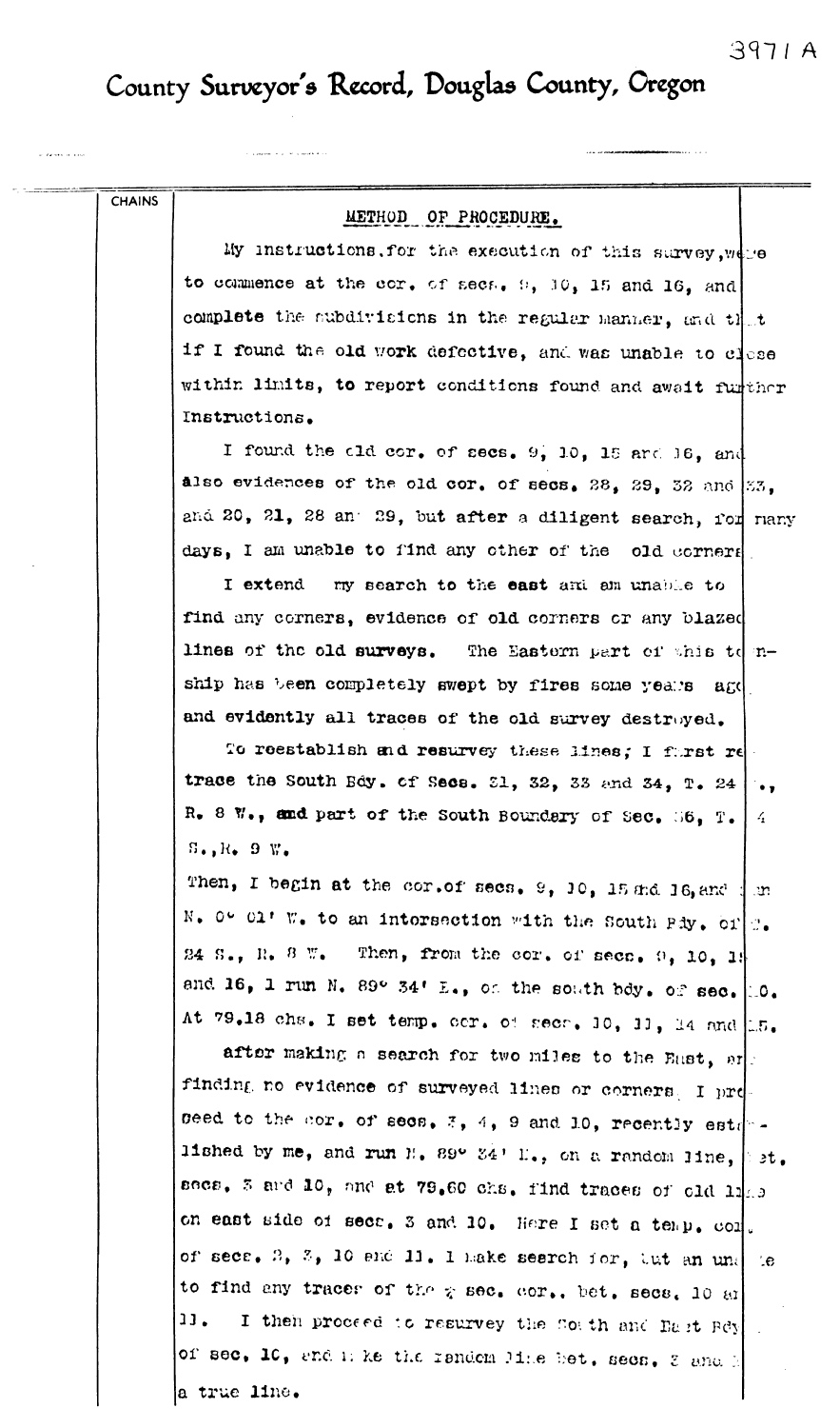
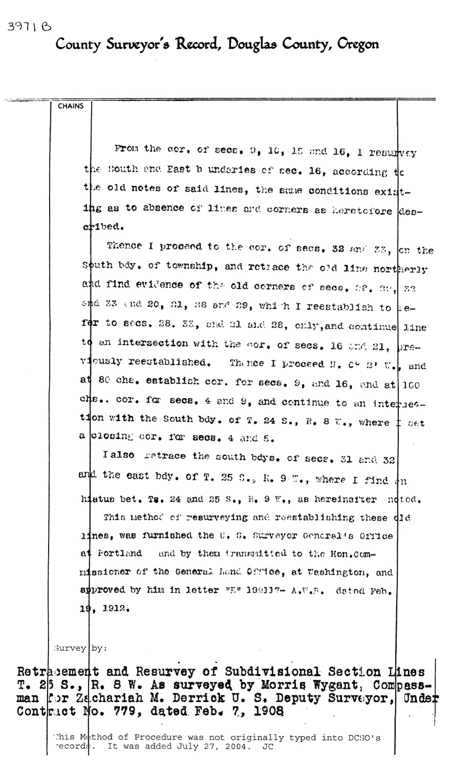
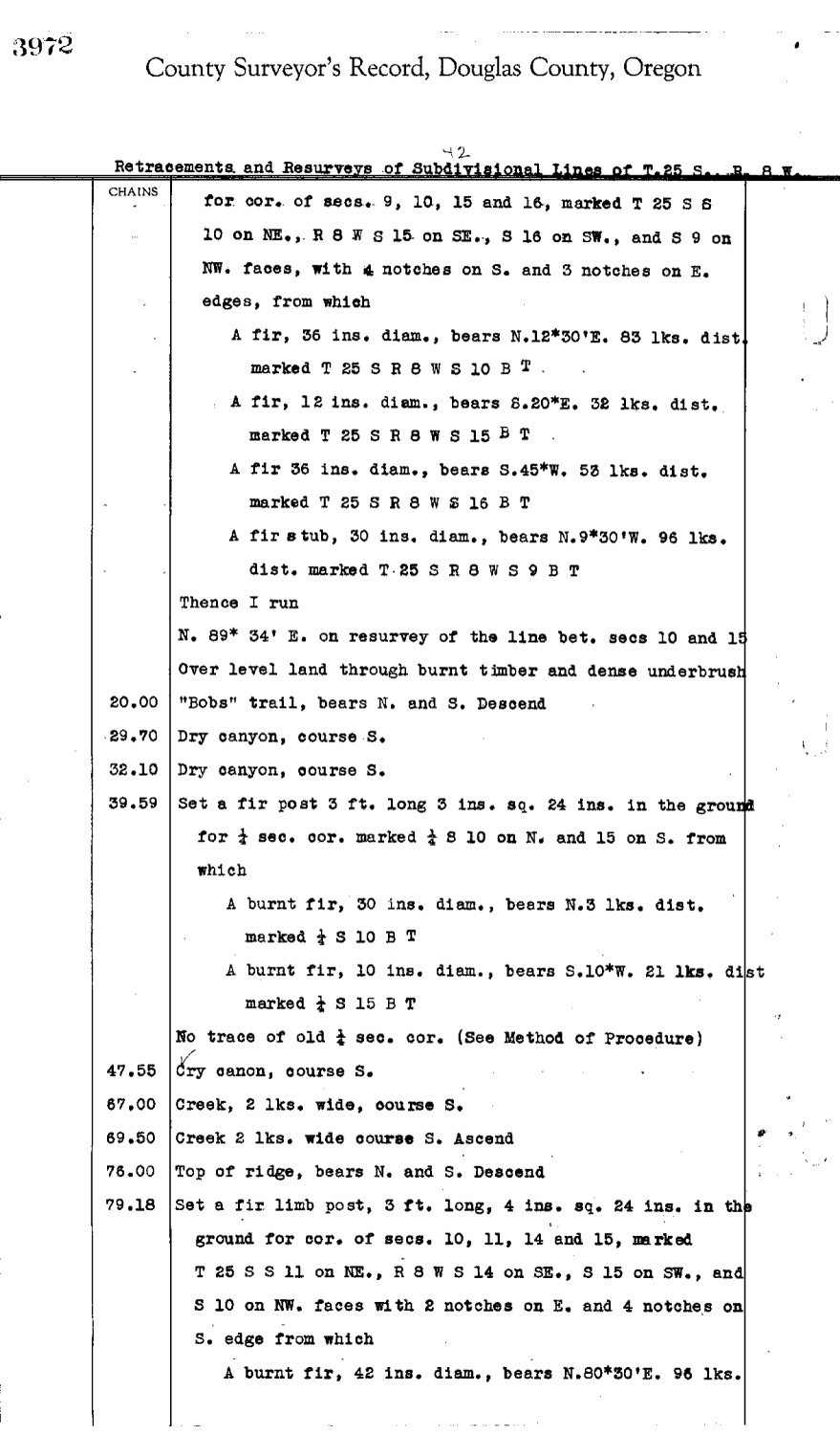
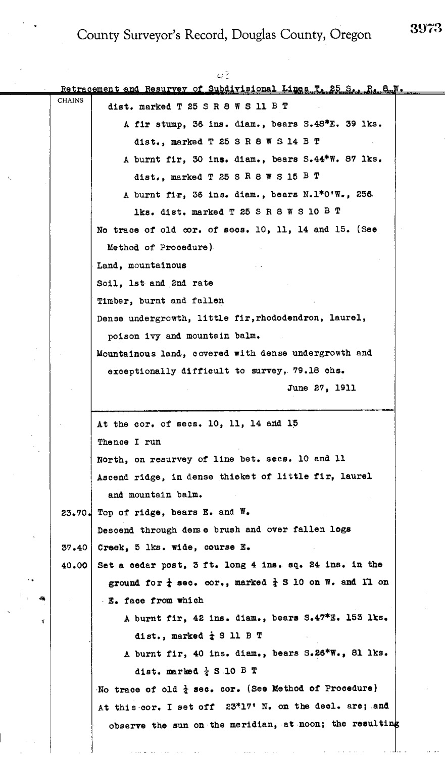
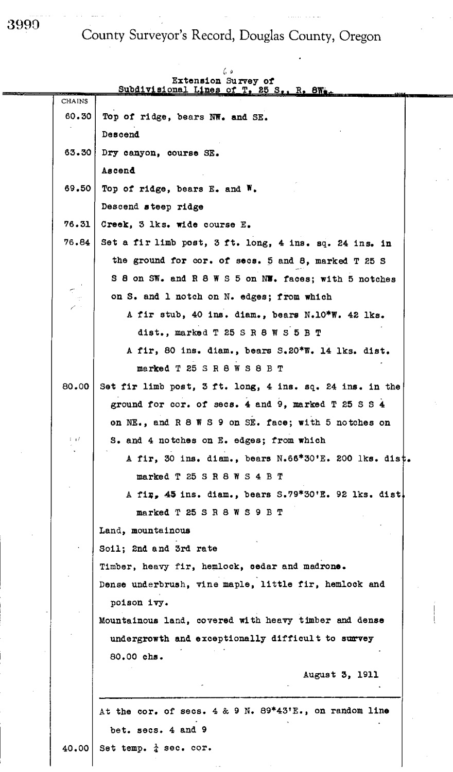
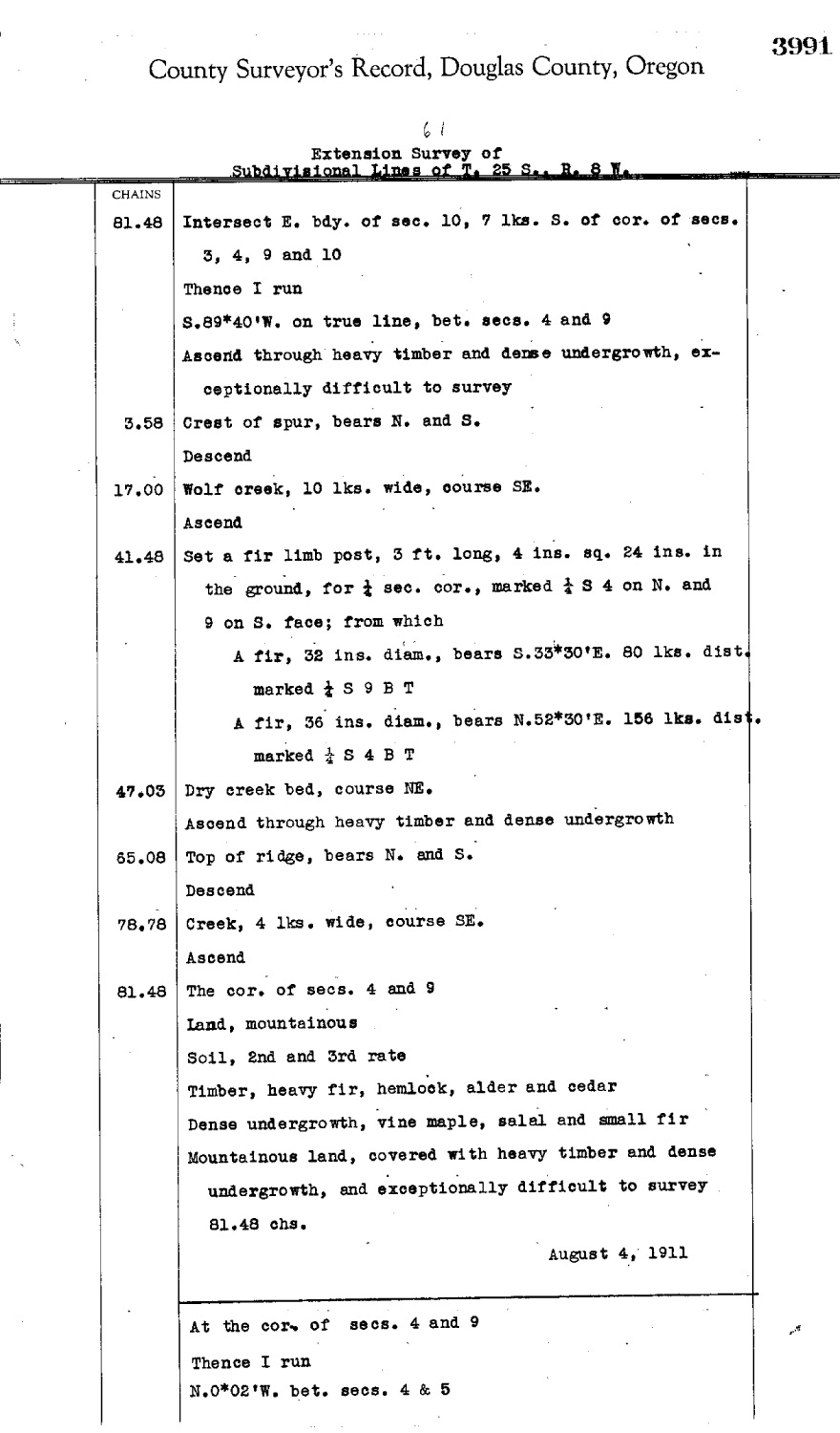
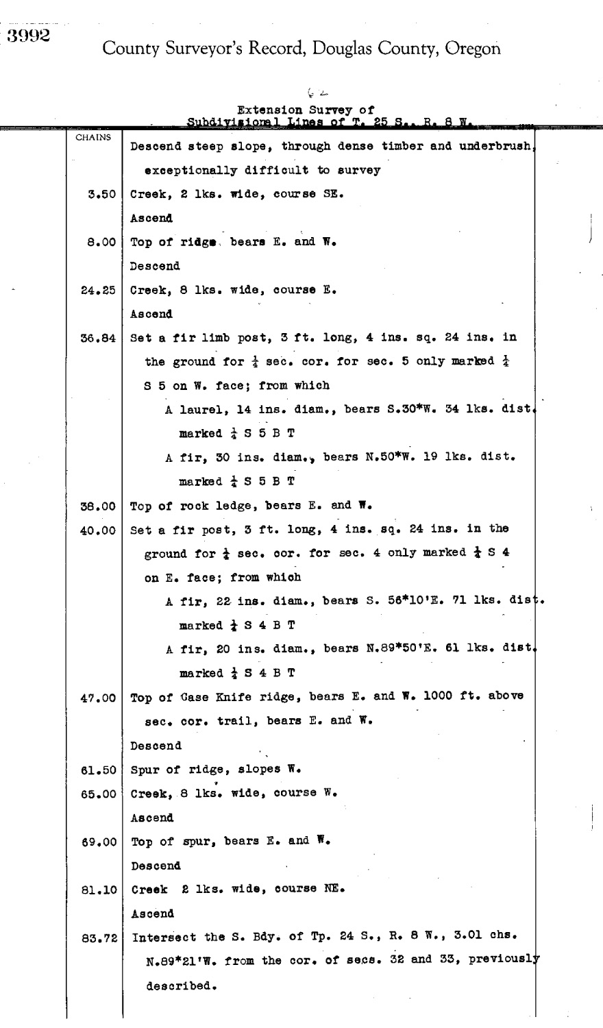
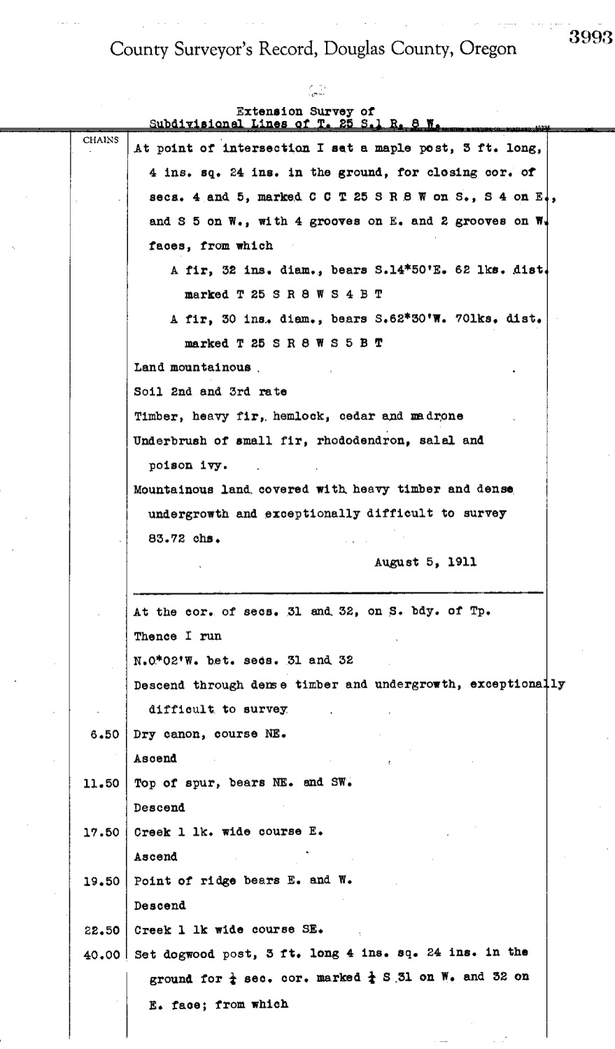
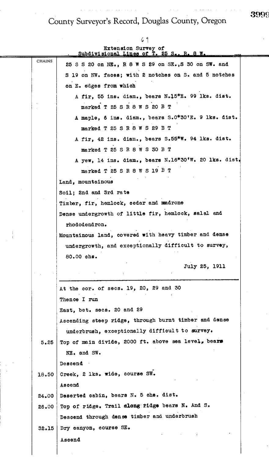
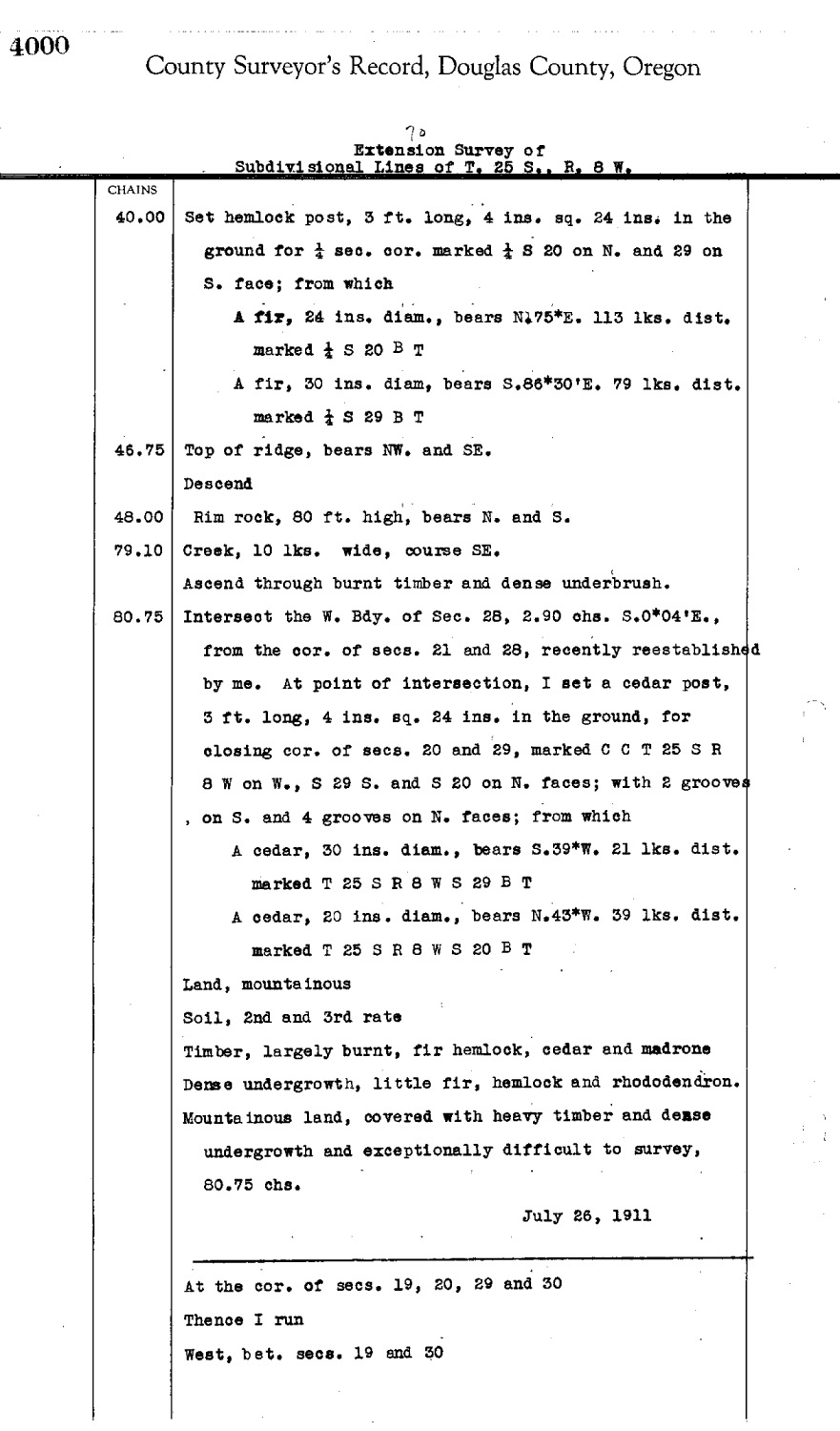
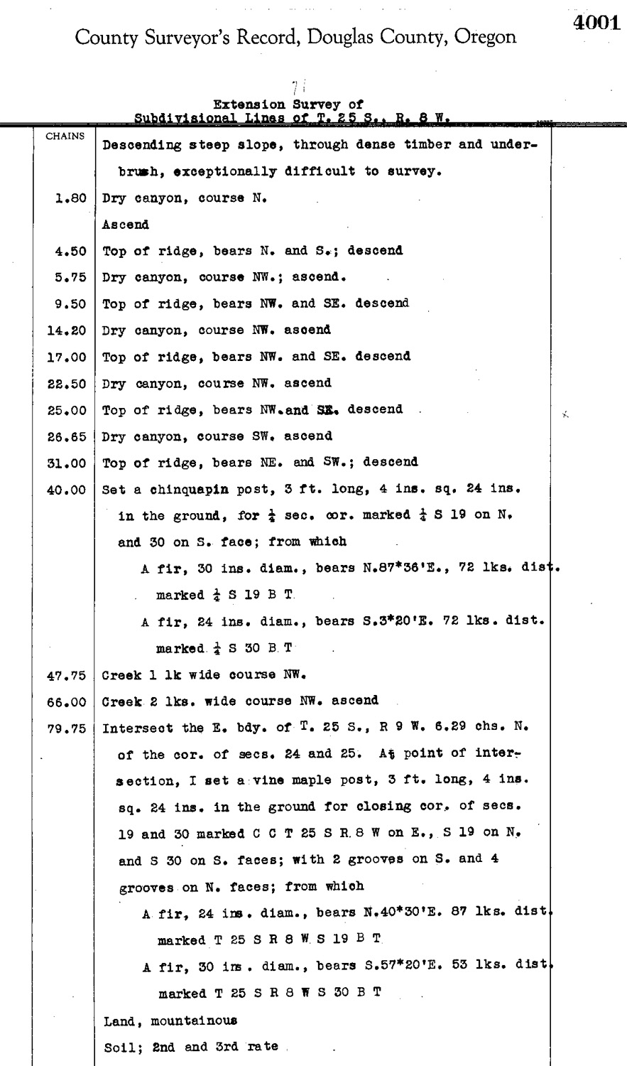
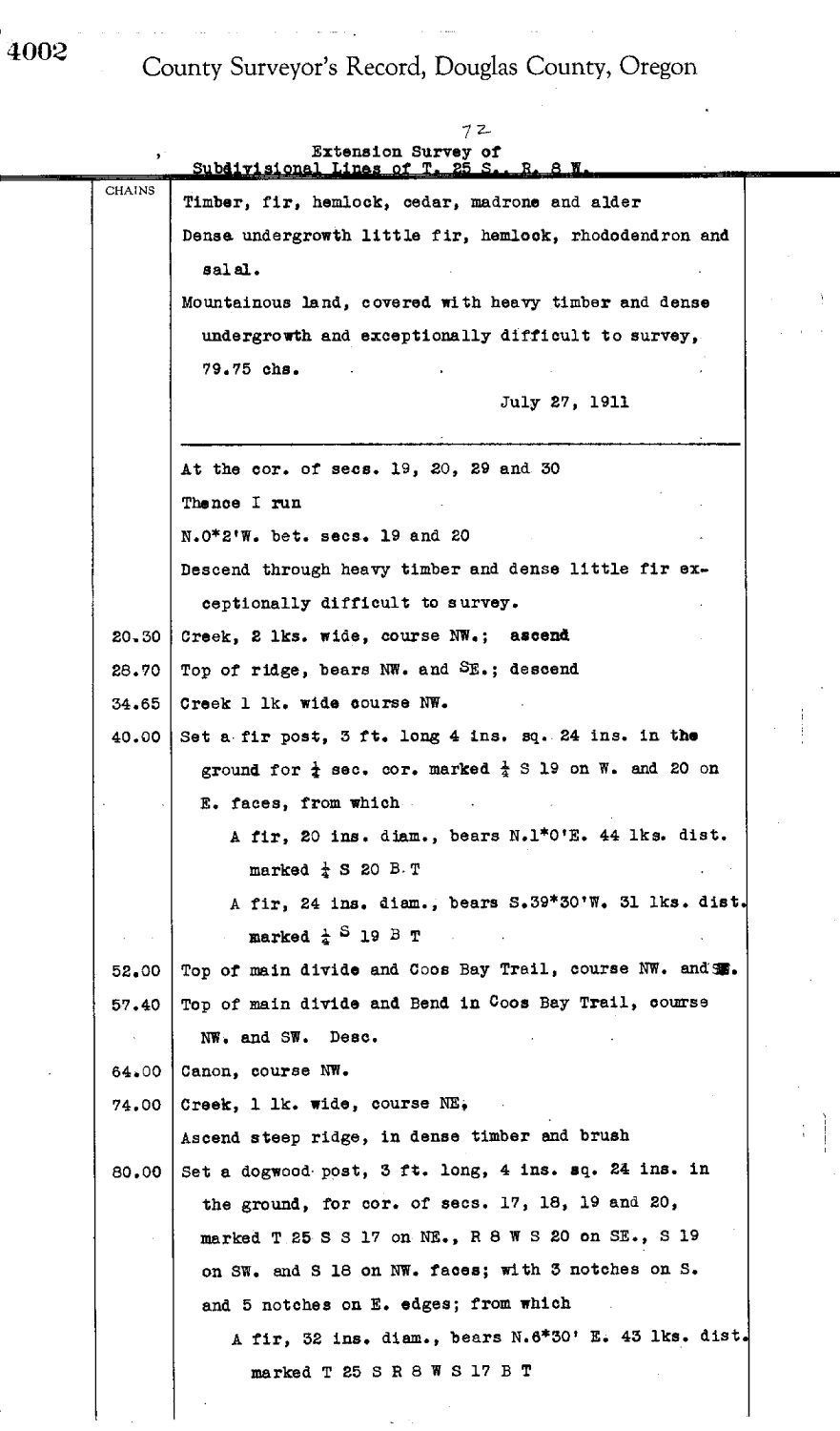
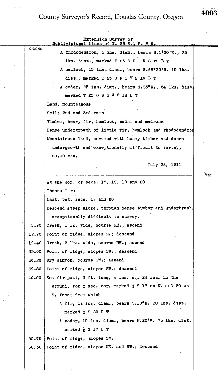
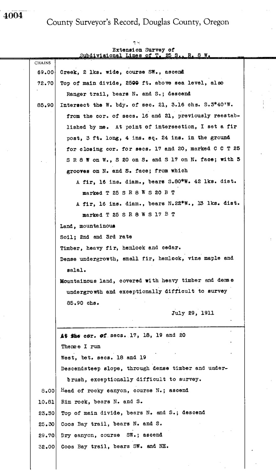
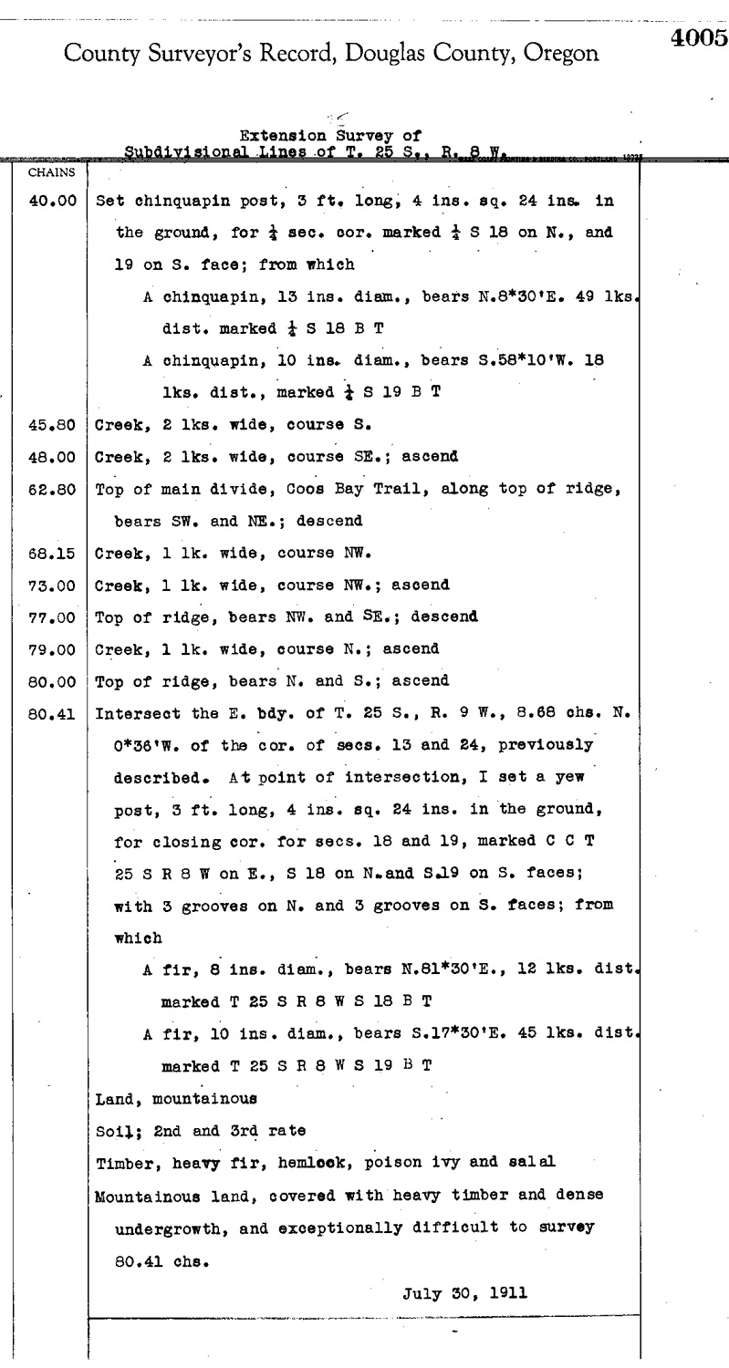
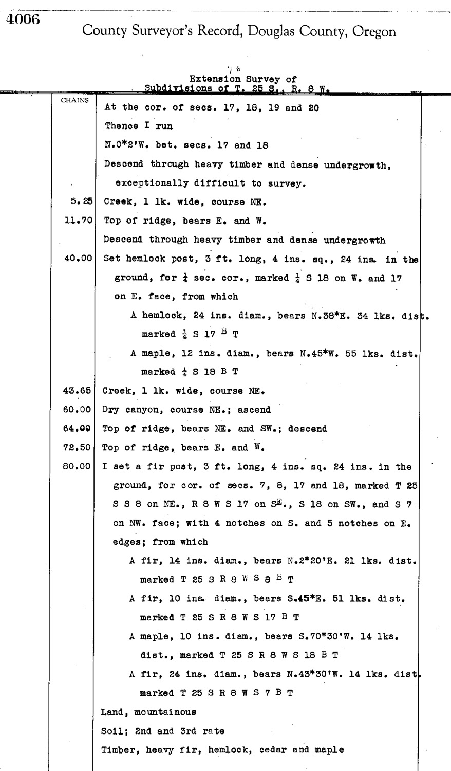
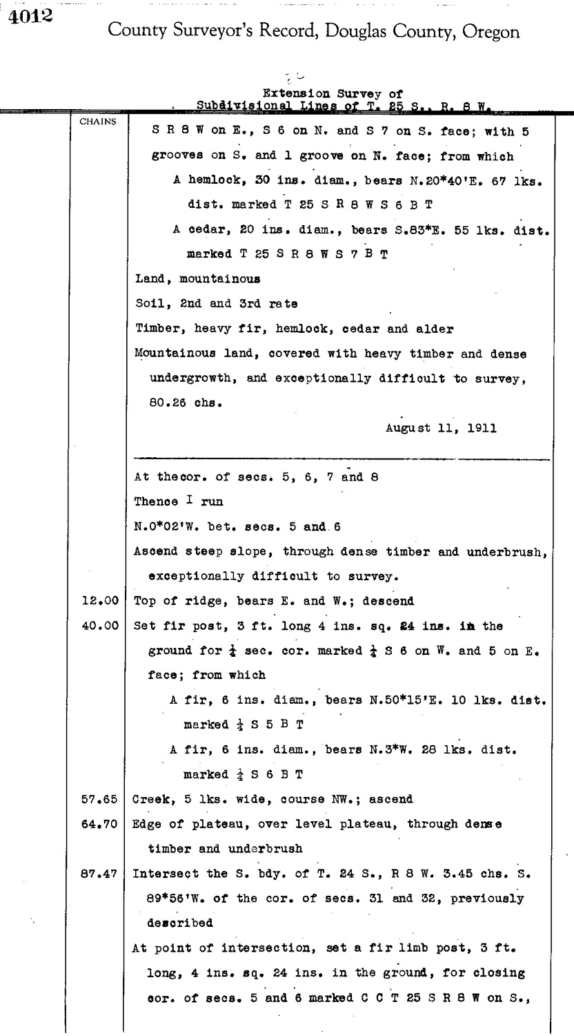
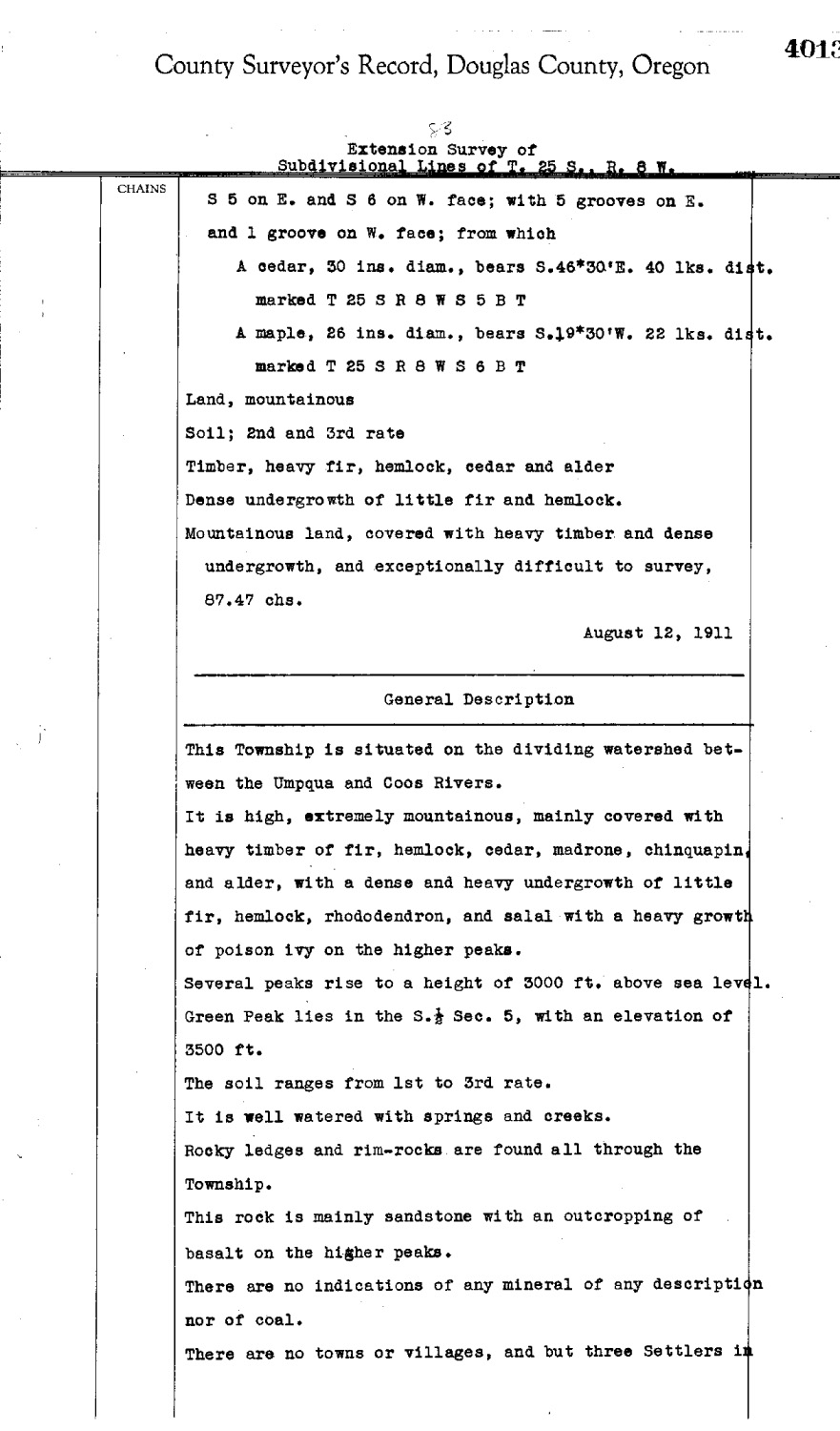
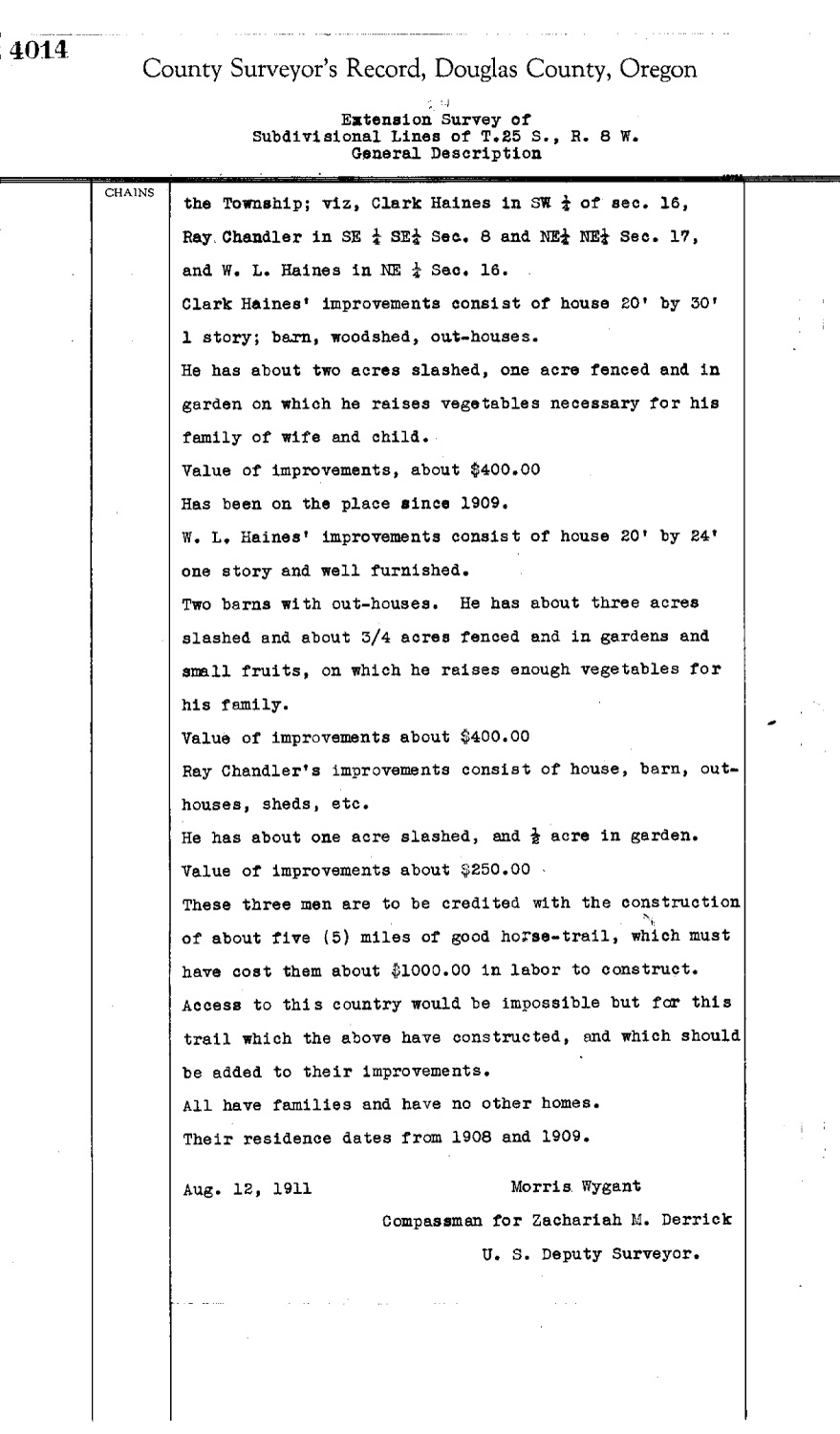
This township is entirely within the boundaries of the 2011-2012 Coquelle Trails Project. It includes Rattlesnake Ridge, Arrow Creek, and Coos River in the Allegany Historical District. This survey was completed in 1858, 1881, and 1911 and mapped in 1858, and 1882, and 1913 (Hathorn 1857; Byars 1878; Flint & Flint 1881; Campbell 1902; Wygant 1911).
![]()