B&B Complex
Forests, Wildfires, Roads, and Trails, 1850-1900
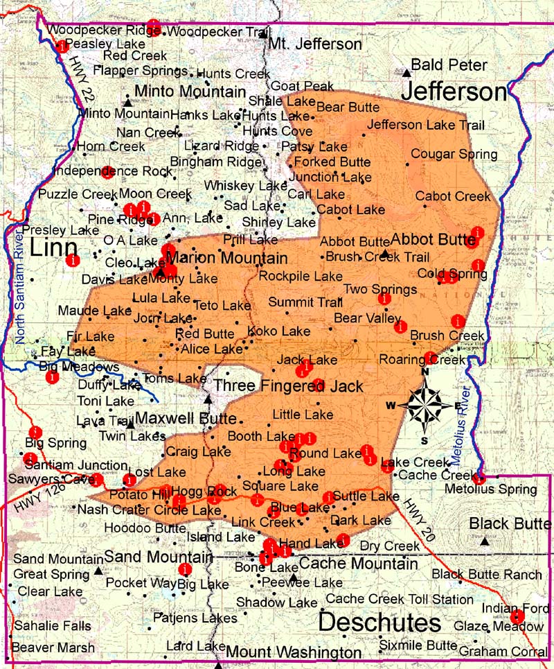
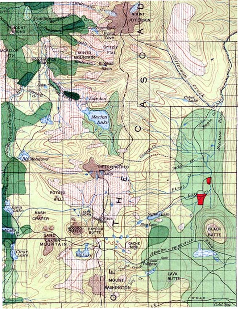
This webpage includes a scan of the fragment of Plummer's 1901 land classification map that includes the eventual site of the B&B Complex Fires of 2002-2003, and of the legend to that map. Compare details and named locations of these historical maps with the current study map.
Fragments of Plummer (1901), showing entire B&B Complex study area (Zybach and Lapham 2004).

![]()
©2004 Oregon Websites and Watersheds Project, Inc. and NW Maps Co.