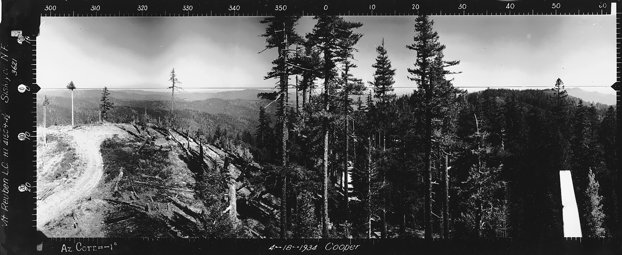
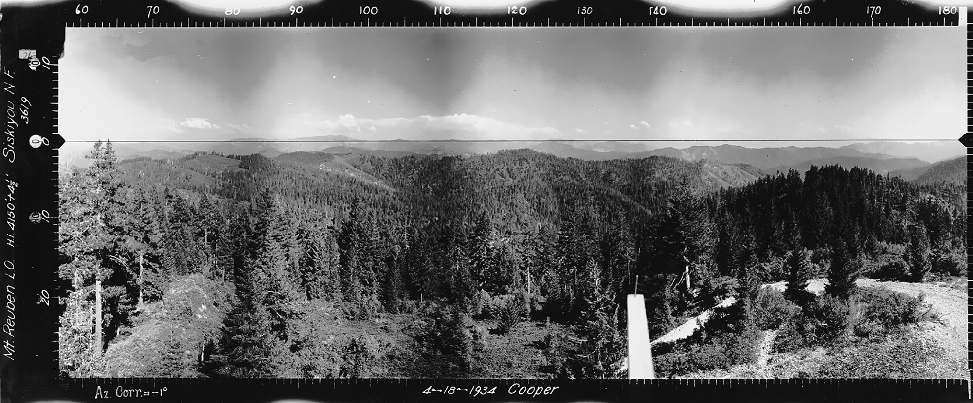
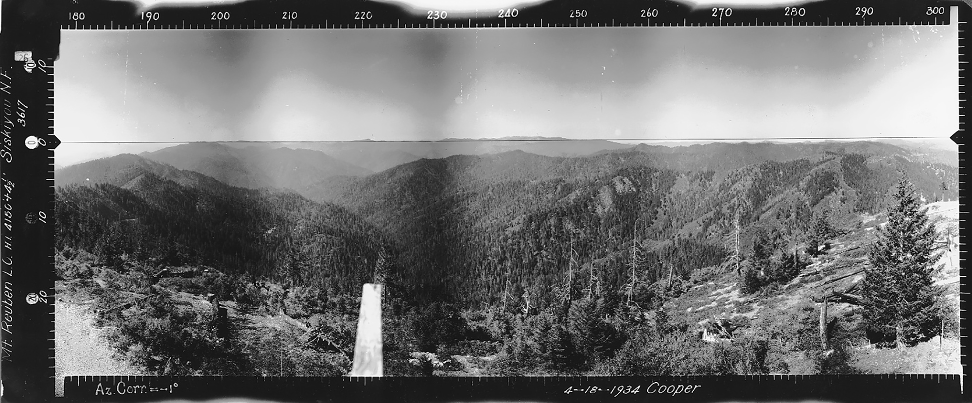
Ragsdale Butte Lookout
North View, Ragsdale Butte Lookout, Jackson County (Cooper, April 18, 1934).
This lookout was established in 1933 at Tsp. 32 S., Rng. 1 W., Sec. 14, elevation 4,803 feet; the cabin was burned by the US Forest Service in 1963. This is one of only two sets of Osbornes currently included in Jackson County because they document southern-most forest cover conditions from the northwest to the northeast in the Douglas County 2010-2011 ORWW Upper South Umpqua Headwaters precontact forest cover conditions study -- although being located within the Rogue River basin. Kemnow Online History.
2010 NW Maps Co. Index of 1933 to 1938 Osborne Panoramic Photographs: Upper South Umpqua Headwaters. Ragsdale Butte is 5 miles south of Devils Knob, nad slightly less than 9 miles southwest of Butler Butte, but is slightly below the map's boundary in Tsp. 32 S., Rng. 1 W., Sec. 14.
© 2006-2020, Oregon Websites and Watersheds Project, Inc. & NW Maps Co.
