2020 SWOCC F251 Elliott State Forest "Virtual" Roads & Trails Report
Part 4. Columbus Day Storm Salvage Logging Road Network, 1962-1970
By Regan Lavoie, Quinn Allen and Ethan Howard
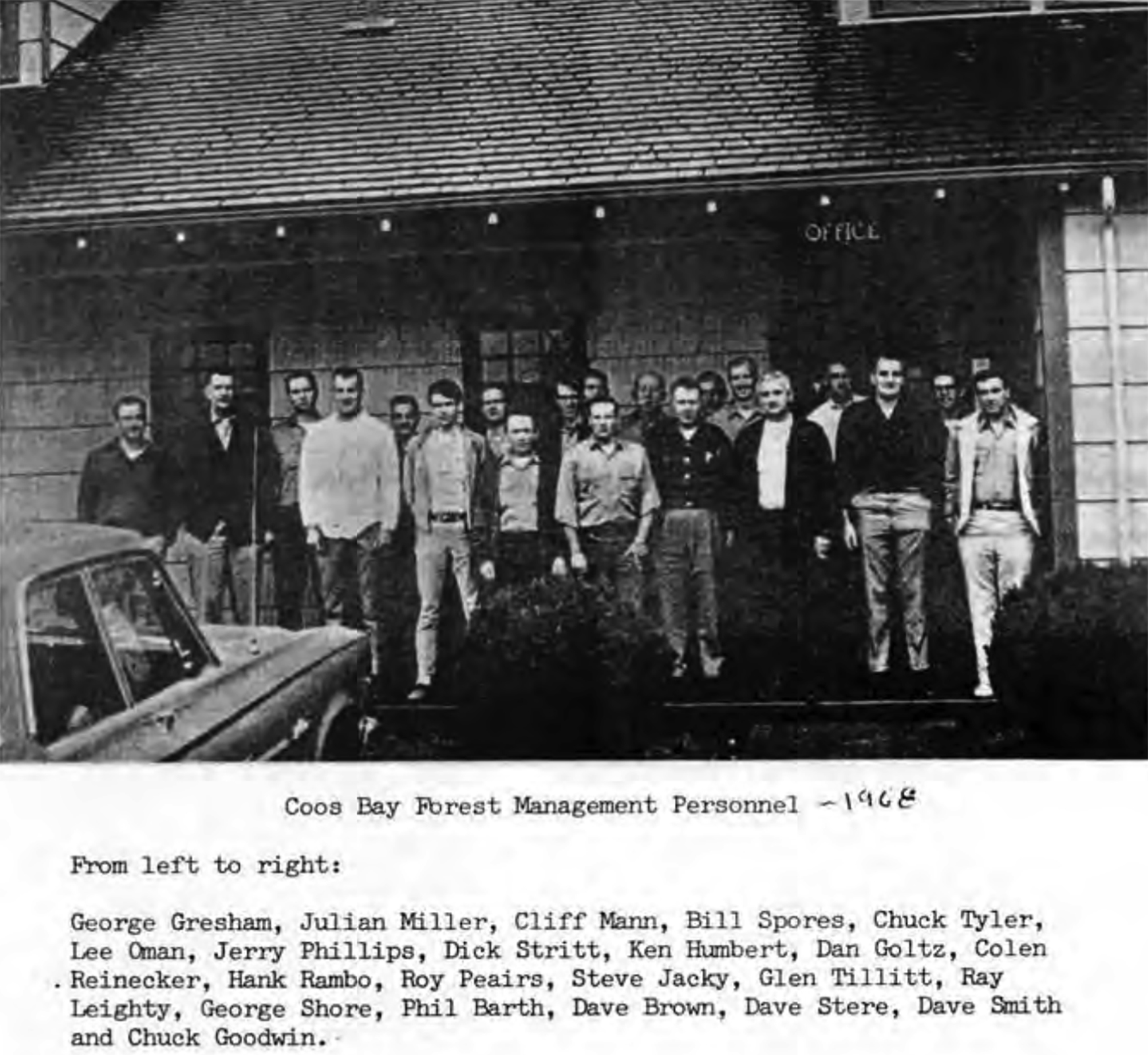
Fig. 12. Elliott State Forest Management Crew, 1968 (Phillips 1998: 290)
The Columbus Day Storm road networks construction started in 1962, which makes its roads old enough to be considered historically significant (SHPO 2013: 11-12). These roads were built in response to the most well-known storm to hit the West coast in the last 100 years. I personally have never met any local that was living here during the Columbus Day Storm who does not vividly remember it. The entire road network also lies within the Elliott State Forest, which is named after Oregon’s first state forester, Francis Elliott, making it connected to a regionally famous person.
The Columbus Day Storm road network is a series of roads added to the Elliott State Forest in response to the damage the 1962 Columbus Day Storm had caused. Most of the new roads were added in the southern half of the forest, providing access to previously inaccessible areas. Because of the rare and powerful southeast winds of the Columbus Day Storm, many trees had fallen, and the trees did not have supporting roots to help keep themselves upright from winds from that direction.
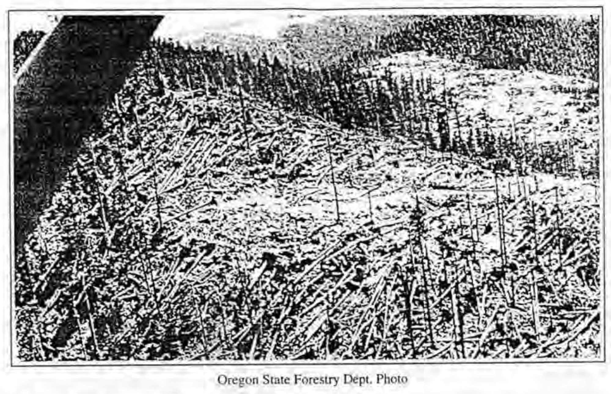
Fig. 13. ODF Elliott Columbus Day Blowdown, Oct. 1962 (Phillips 1998: 252).
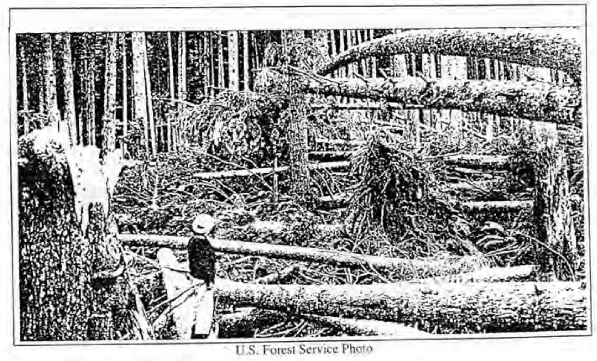
Fig. 14. USFS Columbus Day Blowdown, October 1962 (Phillips 1998: 253).
"In the 1963 Blowdown Edition of the Western Conservation Journal, W. D. Hagenstein, at that time chairman of the Timber Disaster Committee Northwest Forest Pest Action Council, writes on the subject of the Columbus Day Storm. Mr. Hagenstein estimated that some 17 billion board feet of commercial timber had been felled over an area of 30 million acres in five hours." (Phillips 1998: 253).
Most of the trees that fell were younger, meaning that there was a large amount of sapwood in the fallen trees and had the potential to rot faster than older trees would. There was also a large worry about the potential for a bark beetle infestation that would start with the fallen trees and then spread to trees that were still standing causing even more damage. This meant the downed trees needed to be salvaged quickly, and the Forest Manager in charge of this monumental task was Everett "Mike" Hunt, who had started in the position only six weeks prior to the storm (Phillips 1998: 251-254).
Before the storm there were only about eighty miles of logging roads within the Elliott Forest, but to be able to reach all the areas that needed to be salvaged they had to construct an additional two hundred miles of road. Because of the speed at which these roads needed to be constructed and with the added complication of minimal funding, the roads that ended up being built started out as very simple dirt roads with little engineering. This allowed the cost to be reduced to $10,000 per mile (Phillips 1998: 252).
Roads continued to be built in this way as more areas needed to be reached within the Elliott. 1968 marked the milestone of the completion of the all-weather transportation system and a total of $5,500,000 invested up to this point. A lot of this money went to road maintenance as well as making improvements, such as putting gravel on the previously dirt roads (Phillips 1998: 289).
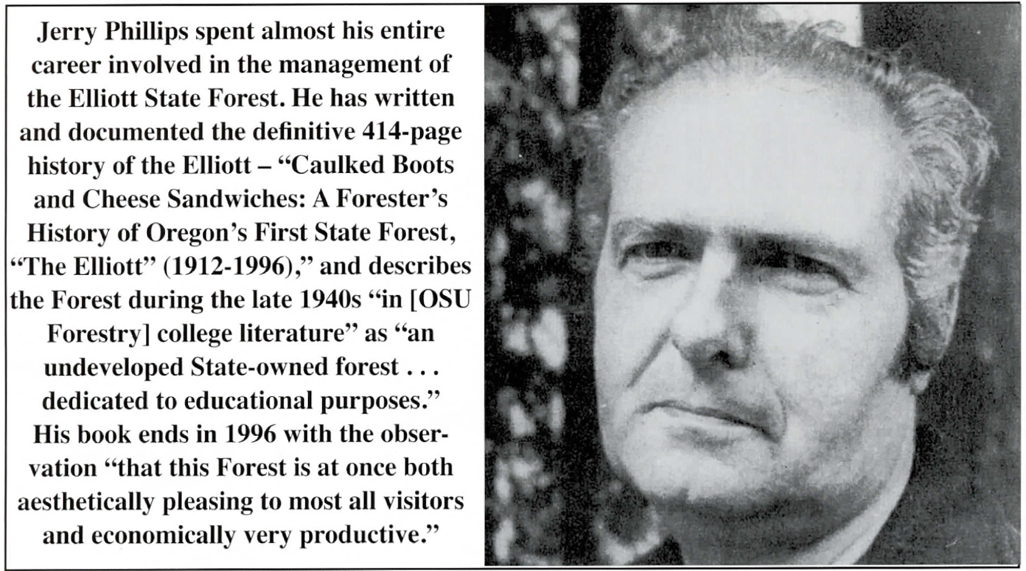
Fig. 15. Jerry Phillips, Elliott State Forest manager & historian (Zybach 2017: 13)
If the Columbus Day Storm road network had not been made out of necessity because of the storm, it's hard to say when those roads would have been constructed, or when the state would have been able to actually use the resources of the area.
Another important role these roads played was how they affected the timber market due to the collection of surplus logs after the storm. After the recovery of fallen trees, there was more timber than the local market was able to purchase and, because of this, timber started to be sold to Japan to get rid of the extra. The purchase of the excess logs dramatically increased the amount of timber that was being exported, going from exporting 146 million board feet of raw logs in 1962 pre-salvage, to 295 million in 1963, and 365 million board feet exported in 1964 (Phillips 1998: 253-254).
The amount that Japan wanted to have exported to them did not slow down after the surplus had been sold, creating a more competitive market and driving the price of timber up. The increased value of timber allowed the state to use those added profits toward schools and the construction of more roads (Phillips 1998: 253-254). While the Elliott was not the sole source of all this extra timber it did contribute a sizable amount, and that was made possible by the construction of the Columbus Day Storm network of roads.

Fig. 16. West Fork Millacoma Streamside Buffer, 1962 (Phillips 1998: 260).
Recommendations
For future recommendations I think these roads should continue to be maintained as gravel roads with the goal of keeping them in a good enough condition that they don’t require four-wheel drive to travel on. I think keeping them gravel is more cost effective and keeps the area feeling more primitive compared to paving the roads. I also think adding an interpretive sign that explained why the Columbus Day Storm road network needed to be built so quickly, as well as show how much damage the storm caused locally.
I think it would also be great to add a map on this sign similar to Map 1 that color coded the different roads, giving the general time period that they were built. To go along with that color coded map, there could be either colored markers next to the numbered road signs or a small amount of colored paint on the road marker itself to identify what historic road system the road you're currently on is a part of.
![]()
© 2021 Oregon Websites & Watersheds Project, Inc. & NW Maps Co.