2020 SWOCC F251 Elliott State Forest "Virtual" Roads & Trails Report
Part 1. The Indian Trail from Allegany to Scottsburg, and Gathering Locations Within, 1826-1900
By Quinn Allen, Evan Johnson and Kevin Ballard
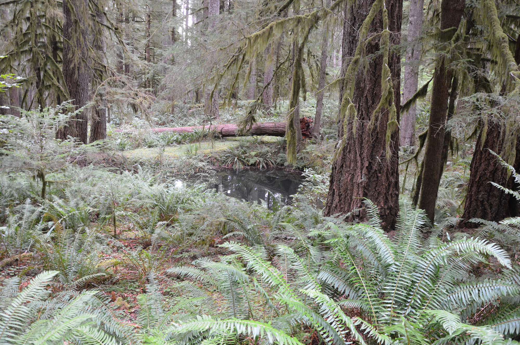
Fig. 3. Indian Trail Spring, a watering hole and camping spot for early Native American Tribes. Could the Stump be somewhere near this resting point along the trail from Allegany to Scottsburg? (Photo by Bob Zybach, October 10, 2017).
The Elliott State Forest is a large plot of land (about 93,000 acres) located between Reedsport and Coos Bay, Oregon as part of the State Land Board. This forest has an important economic, environmental, and educational contribution to Coos and Douglas counties as it is also part of the Common School Fund (Andrus, et.al 2003: 1).
In the Elliott State Forest there are over five hundred miles of roads and trails, the trails existing long before they were converted to roads from 1930 until around 1960. This introduction will focus on one particular historically traced Native American trail and gathering locations, and possible ceremonial sites of the Elliott State Forest and its inherent potential for recovering and preserving and understanding the life and history of local tribes (USDI National Register Bulletin 1995: 3-6); and is an expansion of Southwestern Oregon Community Colleges’ recreation resource management classes of 2018 and 2019 recreation plan drafts. Part of this introduction is based off of Chapter 1, “Forest, Roads, and Trails,'' (Boyd, et al. 2018: 3-6).
NOTE: These roads are mainly rough gravel, extensive, and have limited to zero signage marking roads. Visitors are advised to have a good sense of direction, bring a detailed map, and come prepared with provisions in case of emergency. This author also recommends always informing someone of the route you plan to take and give an ETA for return.
Imagine, trying to travel to a destination that had no roads or trails. How would you get there? Before 1826 there were no pack trails or automobile accessibility in the Coos and Douglas river basins. The early Native American tribes of the Quuiich (Kelawatset) and Hanis people mostly navigated the extensive waterways by canoe, or by traveling on foot, following mountain ridgelines, swaths of edible vegetation areas, and natural springs. Whether they were following elk trails, or the elk were following their trails, is up for debate.
The junctures of these tidewaters became important locations and developed into campgrounds, communities, and trade centers. This land is steeped in local history and riddled with some tall tales as well. When oral histories are passed down generation after generation things can get a little skewed. What isn’t skewed, however, are a few of the ridgeline trails, journal entries from the early settlers, and documented accounts of these trails and their purpose.
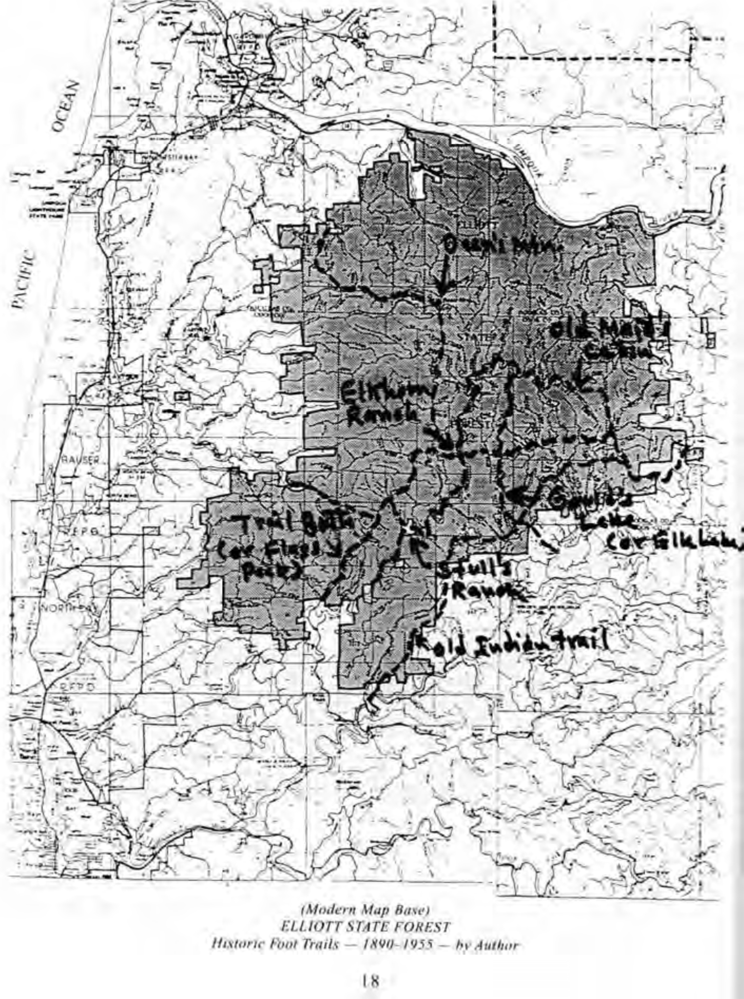
Map 2. From Jerry Philips' book "Caulked Boots and Cheese Sandwiches" (Phillips 1998: 18). This shows a few examples of how the Native people would follow the ridgelines and waterways of the early Elliot State Forest. Any of these trails hold a high probability of important archaeological resources.
“Most of the ridgeline trails of the Elliott have been turned into logging roads, and the trails that follow riparian zones change drastically according to seasonal flooding, landslides, and other weather erosion. Gathering areas like huckleberry patches, salmonberries patches, myrtle groves, springs, and waterways were connected by foot trails (there is one from Allegany to Scottsburg) and often are still used for camping” (Bob Zybach, personal communication, May 5, 2020).
It is important to preserve the memory of the land, and what it meant to the Native Americans who lived here. There is an account in Lionel Youst’s book, The Land Above the Falls, that was recorded and translated in 1942 by anthropologist John Peabody Harrington, from the last of the full-blooded Coos Indians, Lottie Evanoff, who was the daughter of Chief Daloose Jackson. In this account, Lottie details an important portion of the trail that led from Allegany to Scottsburg, and the importance of the journey that it meant to the people of the land above the falls (Youst 2003: 3-5).

Fig. 2. Indian Point ridgeline road access previously used as a trail route to Johnson Indian Allotment; example of how some Indian Trails were converted into roads (Photo by Tara Boyd, June 4, 2018).
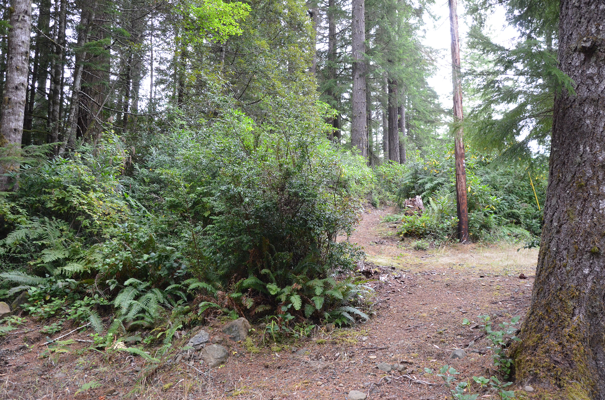
Fig. 4. Huckleberry Point, thick huckleberry patches were likely great gathering locations where Natives would harvest as much to their delight as offered (Photo by Bob Zybach, October 10, 2017).
Many Native Americans still hold a high amount of respect for the earth and its natural belongings, often holding sacred rituals, practices, and rites of passage in areas deemed spiritual, and to this day, you can find traces of these practices in areas these people lived and traveled.
In Lottie's account from her childhood, on the trail from Allegany to Scottsburg, there was a huge, hollow stump that never rotted, that was one of these exact sacred objects the Native people of the Coos revered. Leaving offerings like beads and clothing for continued health, good fortune, and safe travels, the Stump held spiritual significance. The exact location of the stump is lost; however, with clues from Lottie's account, finding it would be retrieving a lost chunk of history and artifacts of significance that may bring descendants of the Coos and visitors alike closer to understanding and connecting the past to the present (USDI National Bulletin Register 1995: 21-24).
Recommendations
These trails and gathering locations are important for understanding and preserving our history.
They originated as the backbone of the Elliott State Forest and were elemental in connecting the surrounding peoples and areas together. Spiritual connections, travel, trade, and gathering of food were all utilized along these ridgeline trails and water access points.
A possible recommendation is to start at the mouth of Marlow Creek, where the beginning of the trail to Loon Lake and Scottsburg is said to have begun, and possibly even attempt to find the famed Stump would be a great way to immerse visitors in an interpretive experience that would bring you back in time and connect visitors to the history of the land and its people. Places that could retain archaeological resources would include The Indian Trail Spring and The Marlow Creek Mound (Oregon State Historic Preservation Office 2013: 8-12).
Funding for trail clearing could possibly be provided by offering interpretive tours of the Elliott State Forest road systems and scenic viewpoints to help paint the picture of enthusiastically preserving our history, while maintaining that the Elliott continues on its path of education.
![]()
© 2021 Oregon Websites & Watersheds Project, Inc. & NW Maps Co.