Elliott State Educational Forest

MAPS

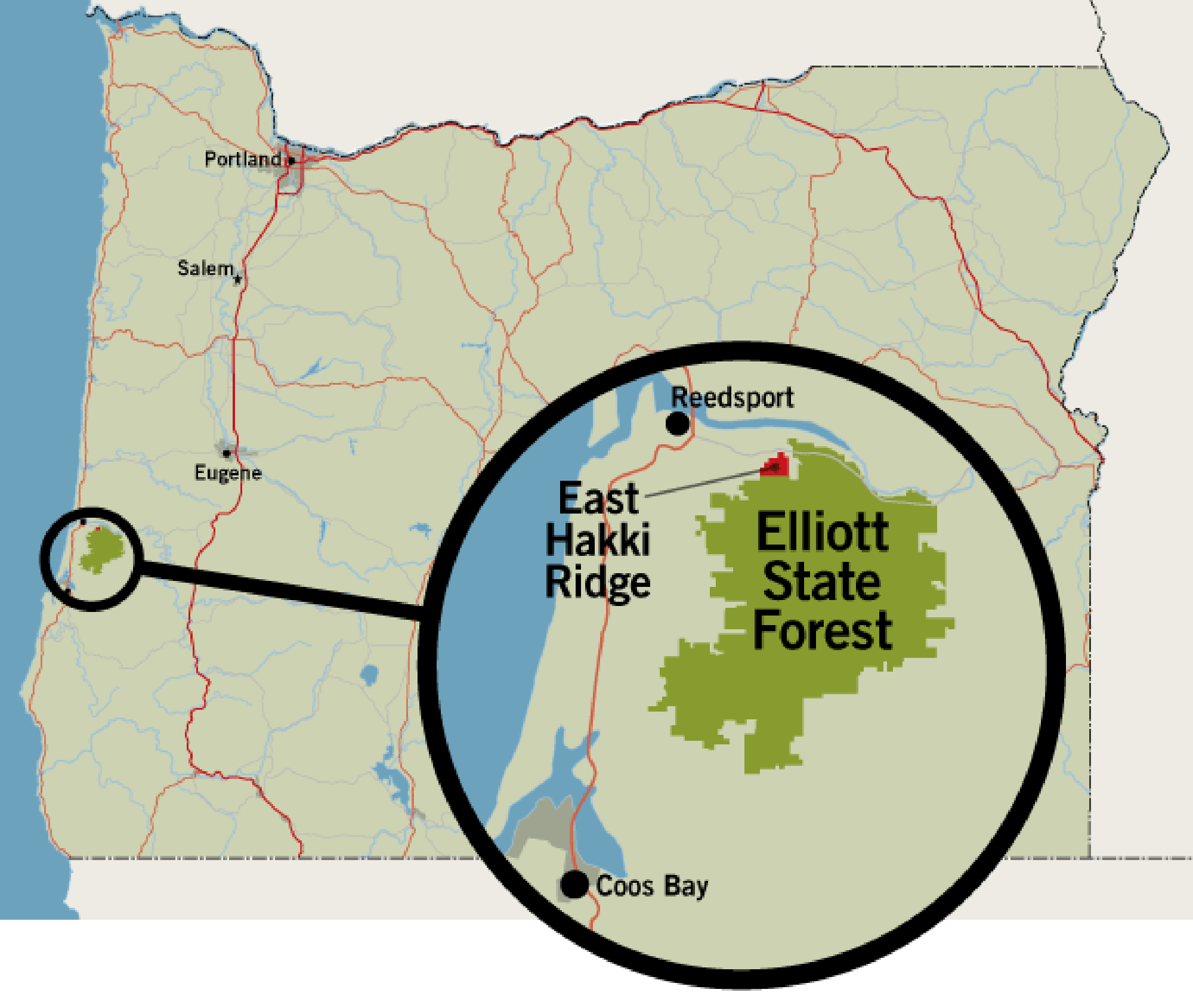
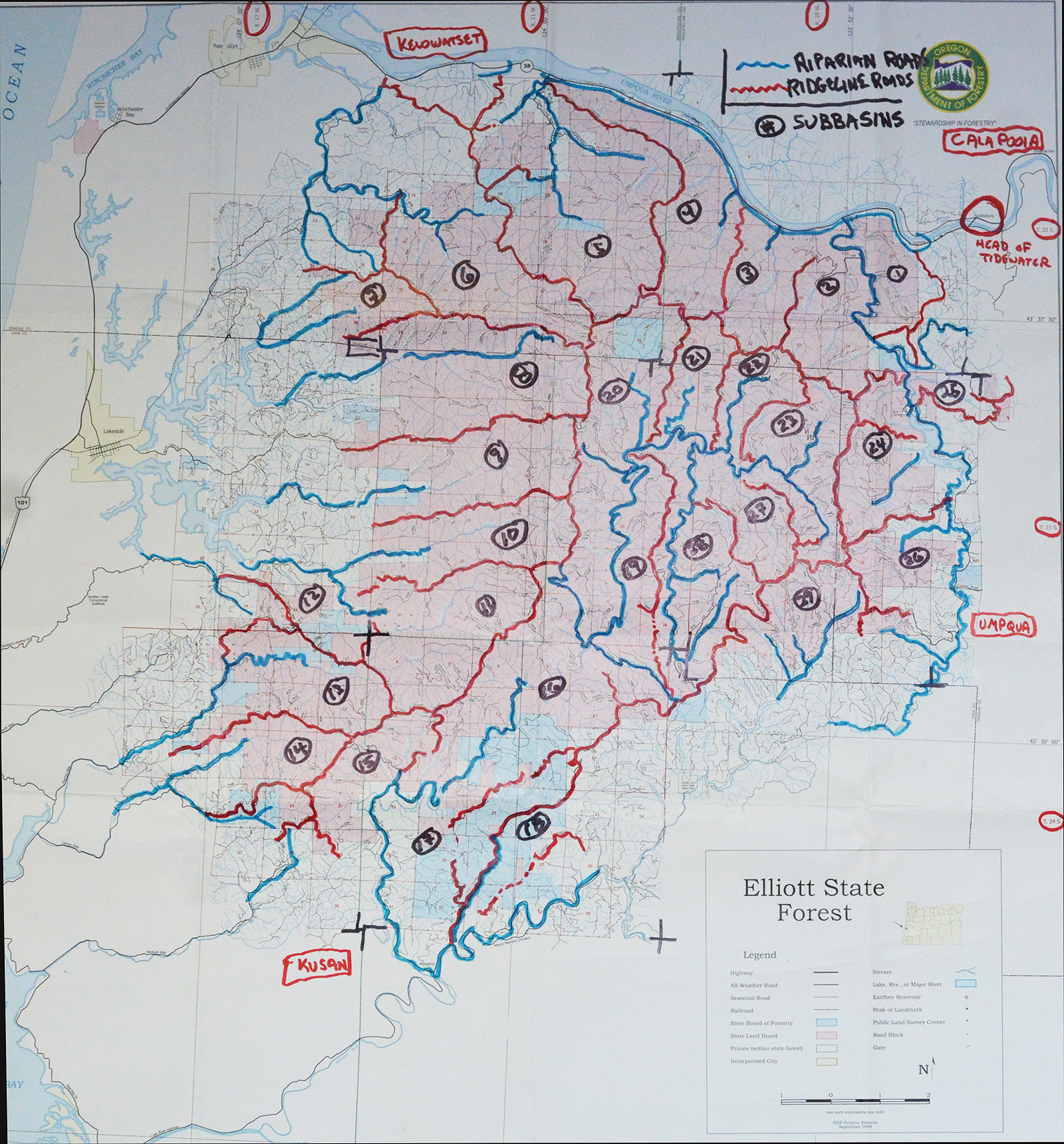
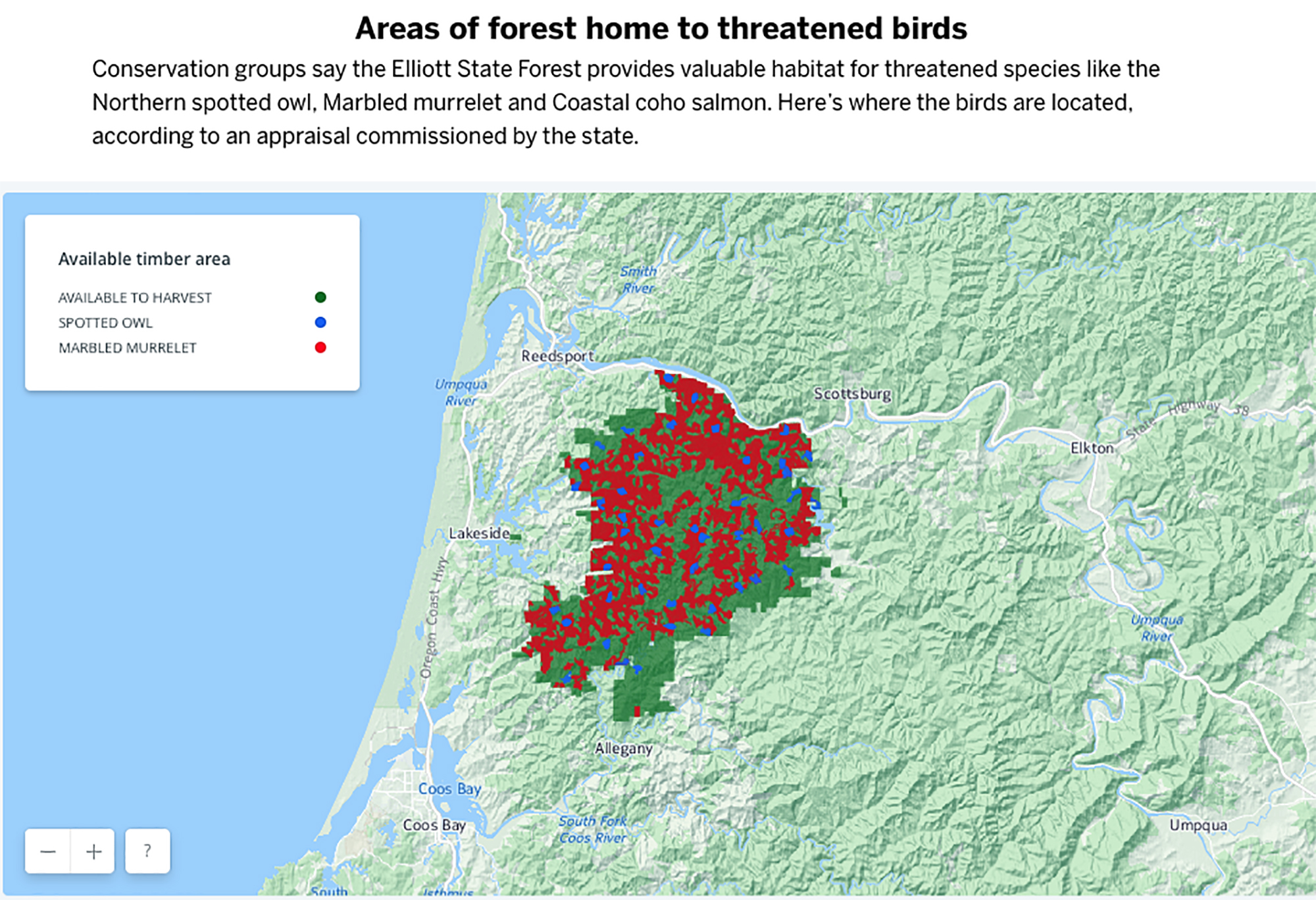
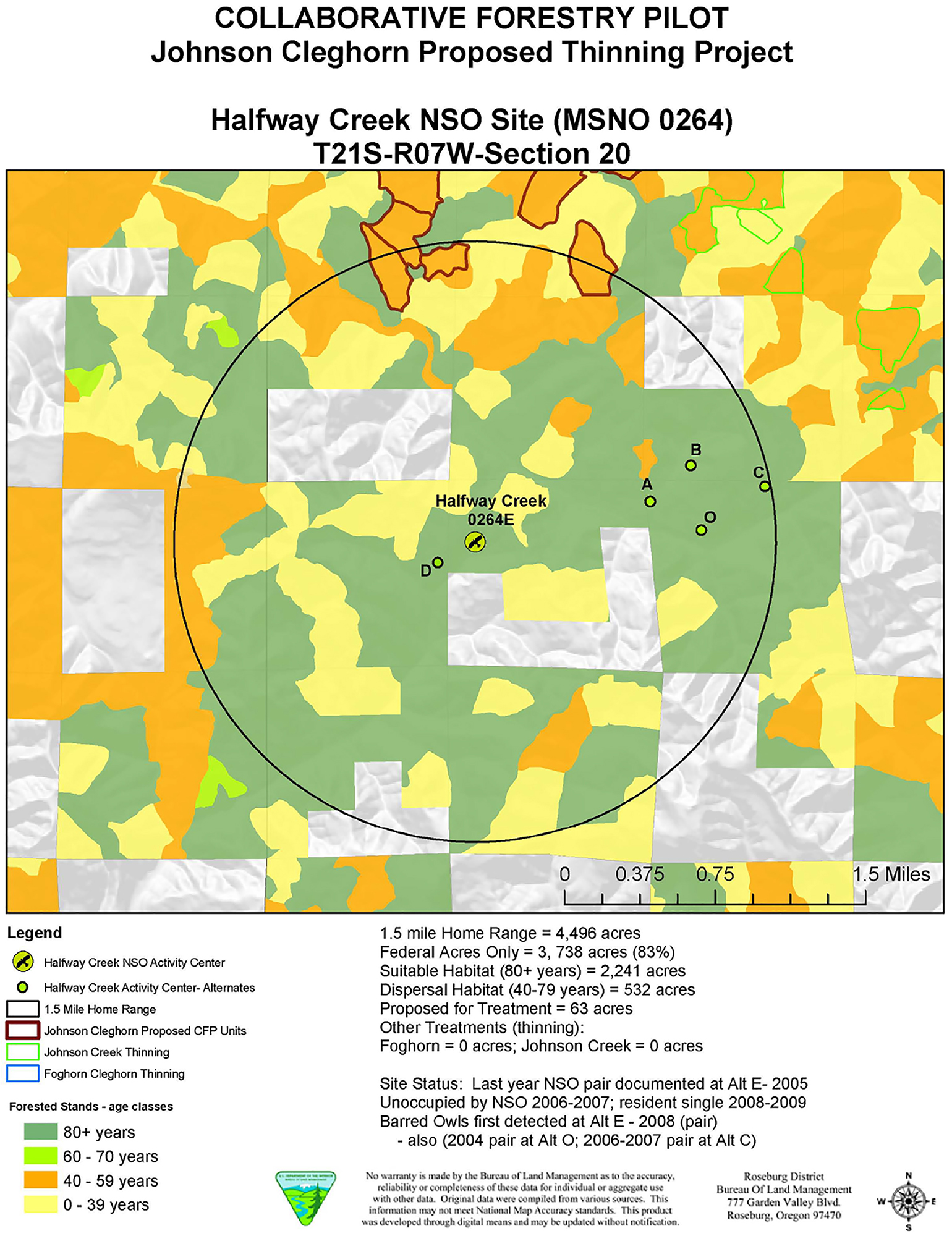
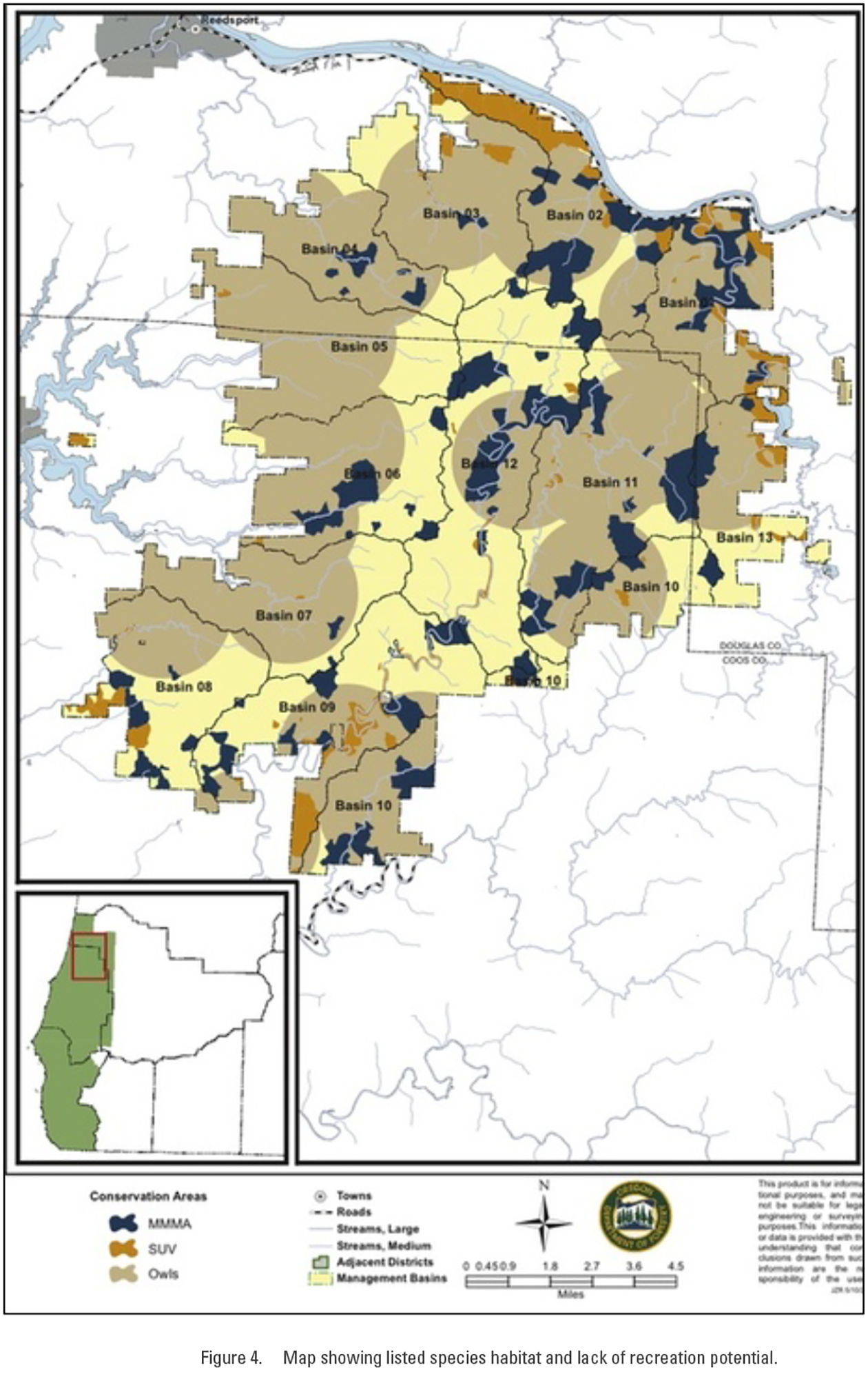
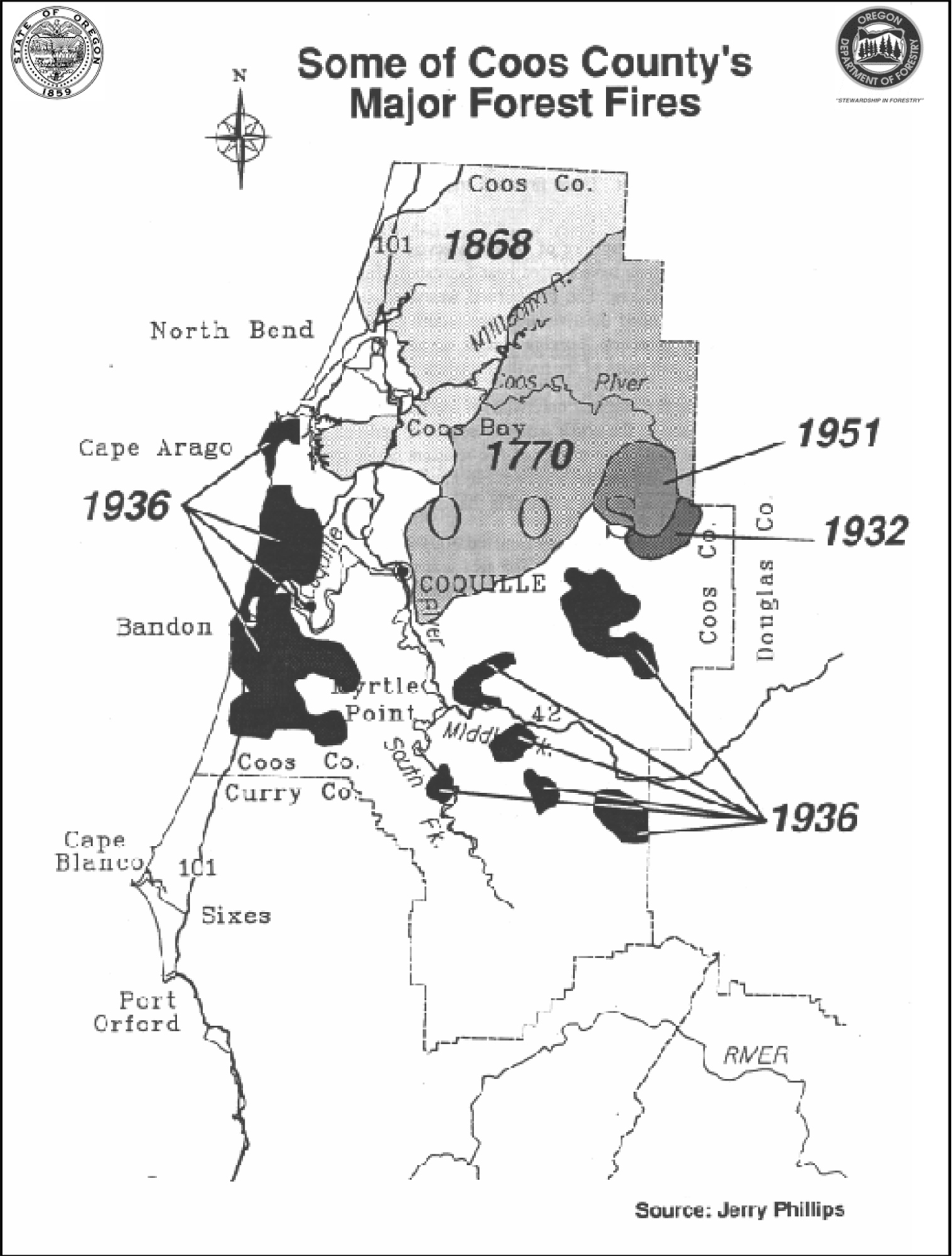
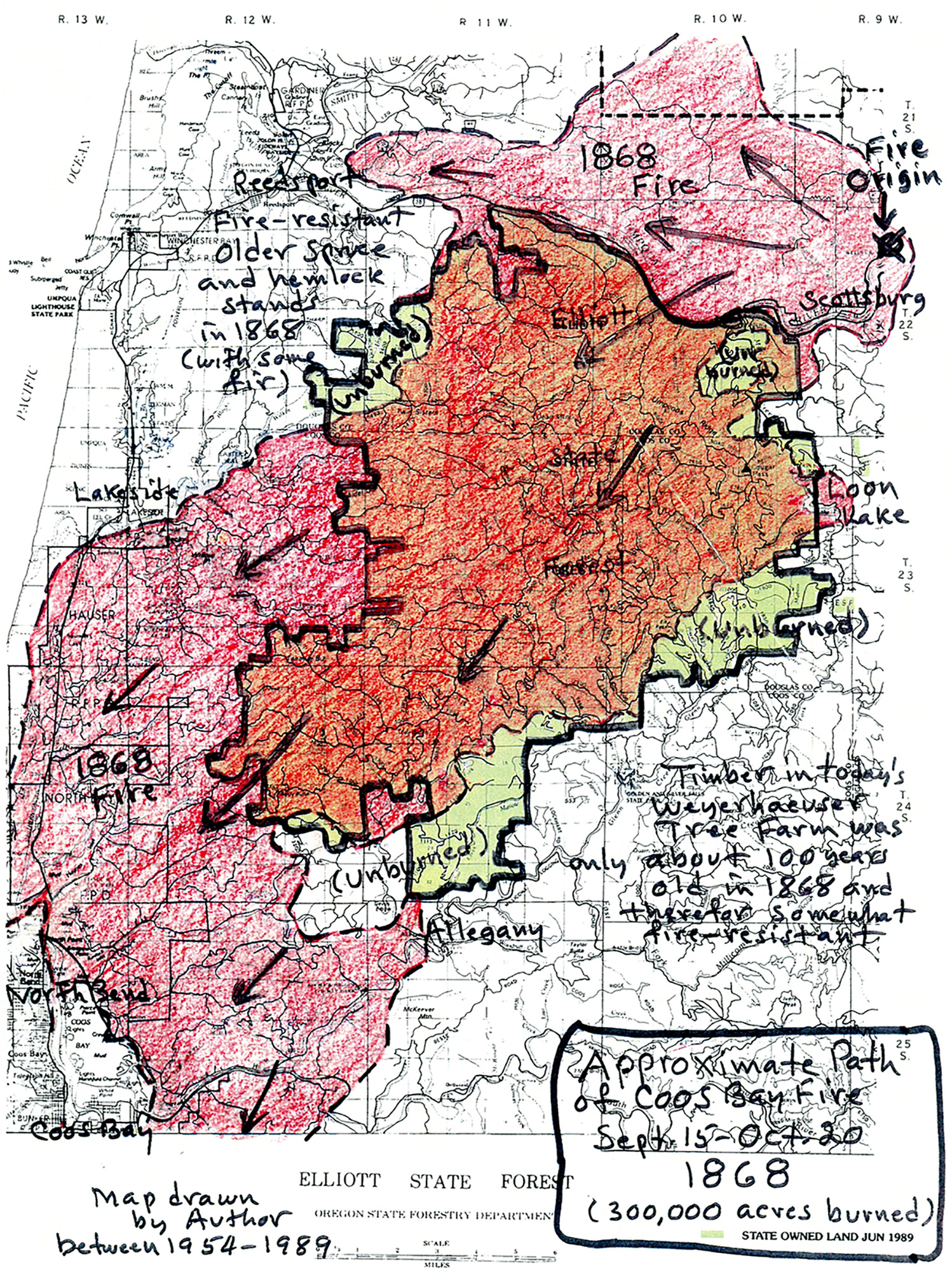
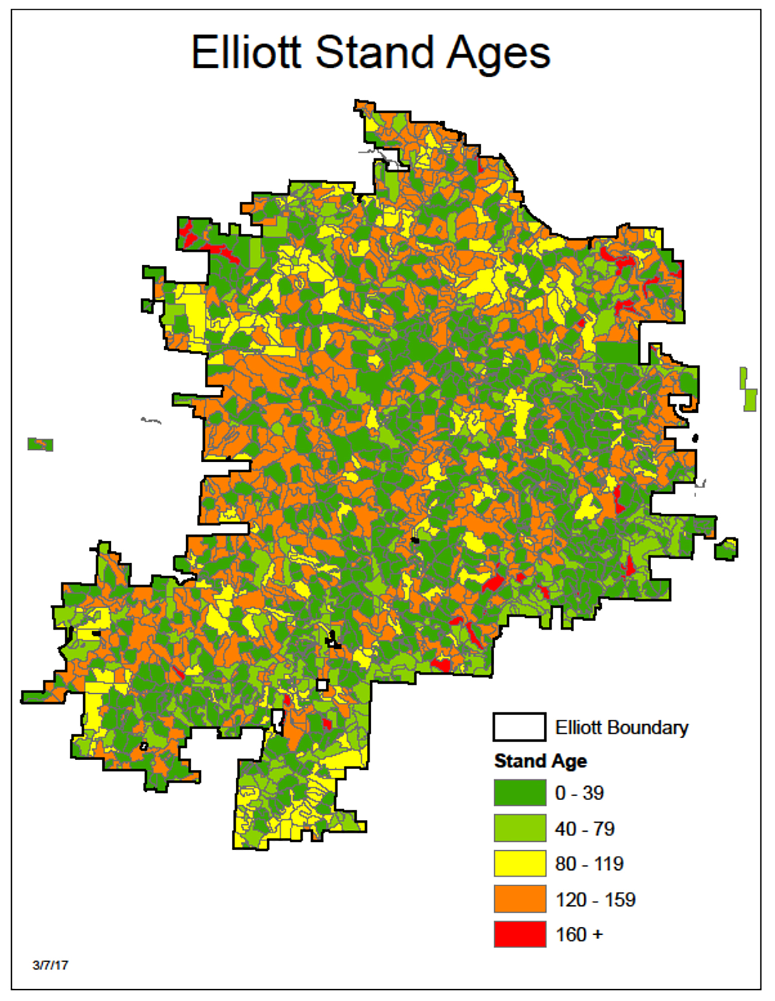
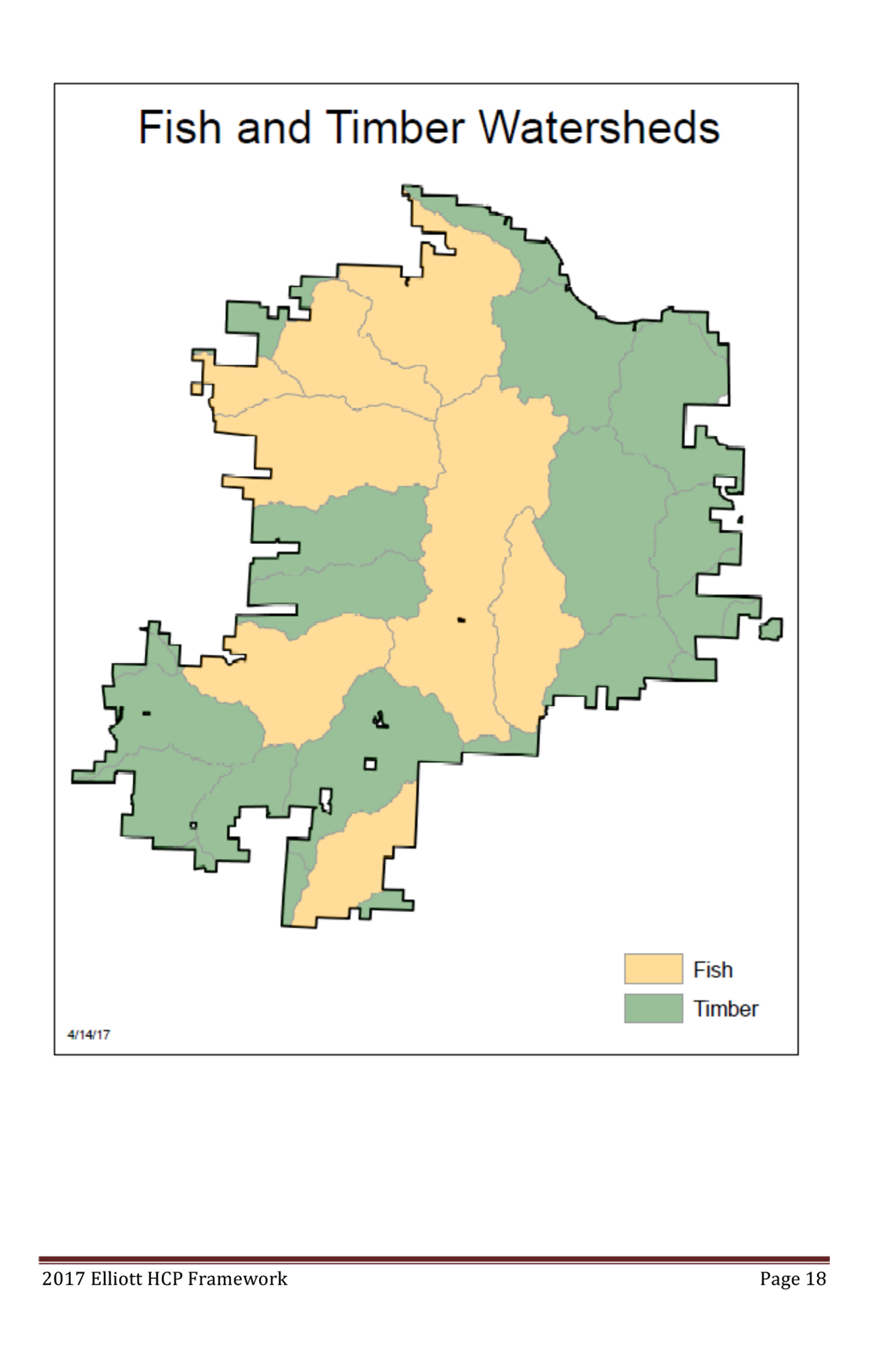
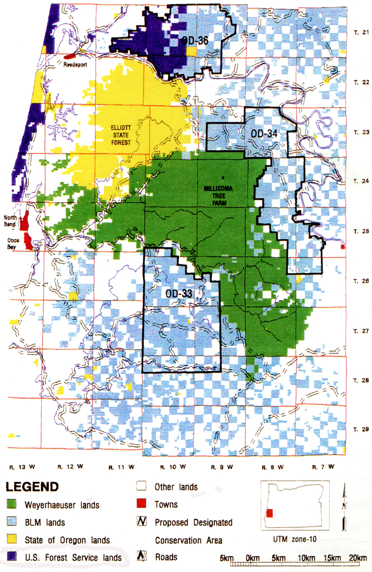
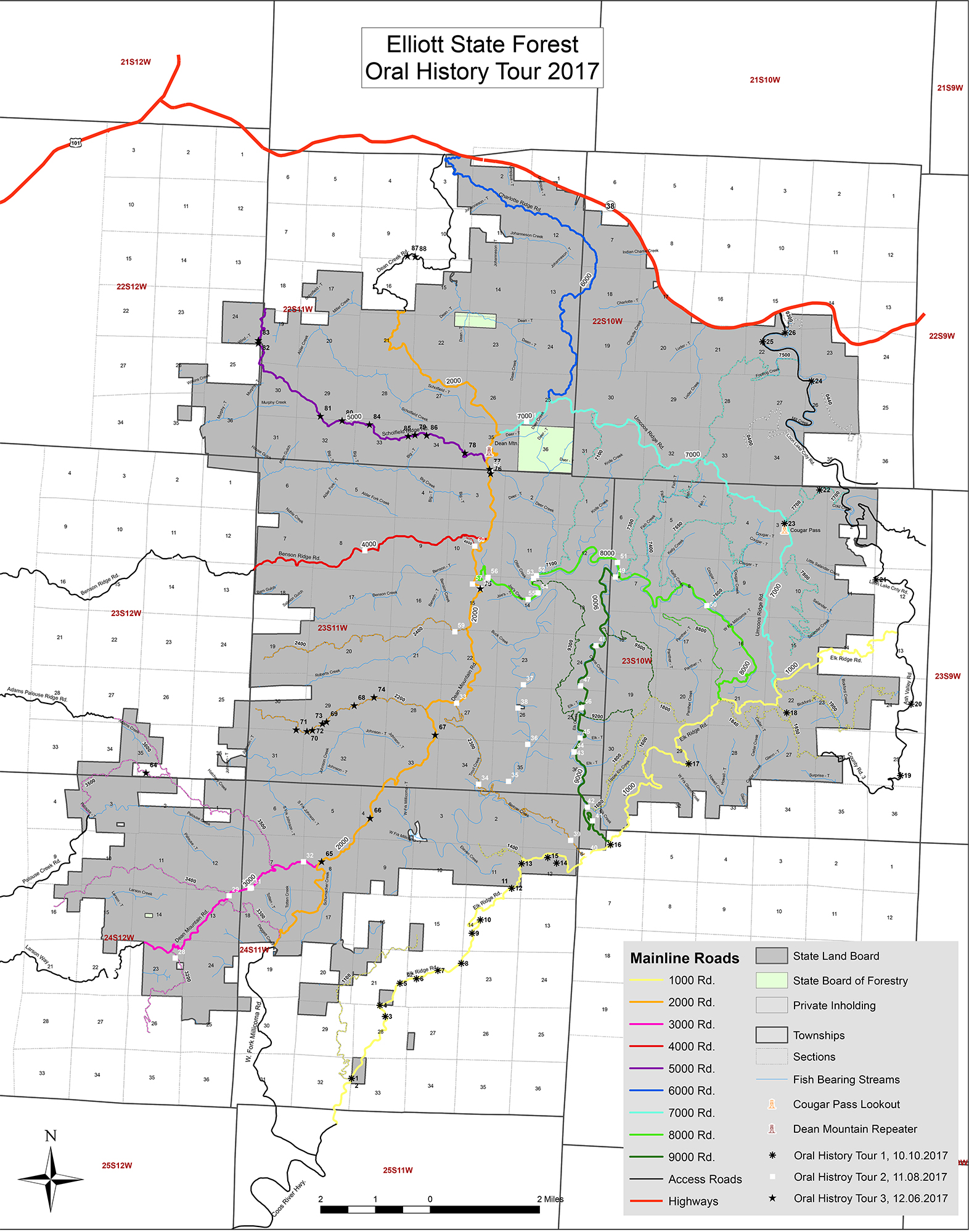
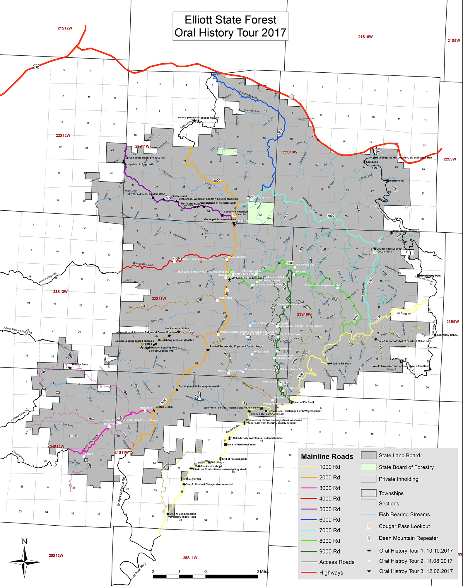
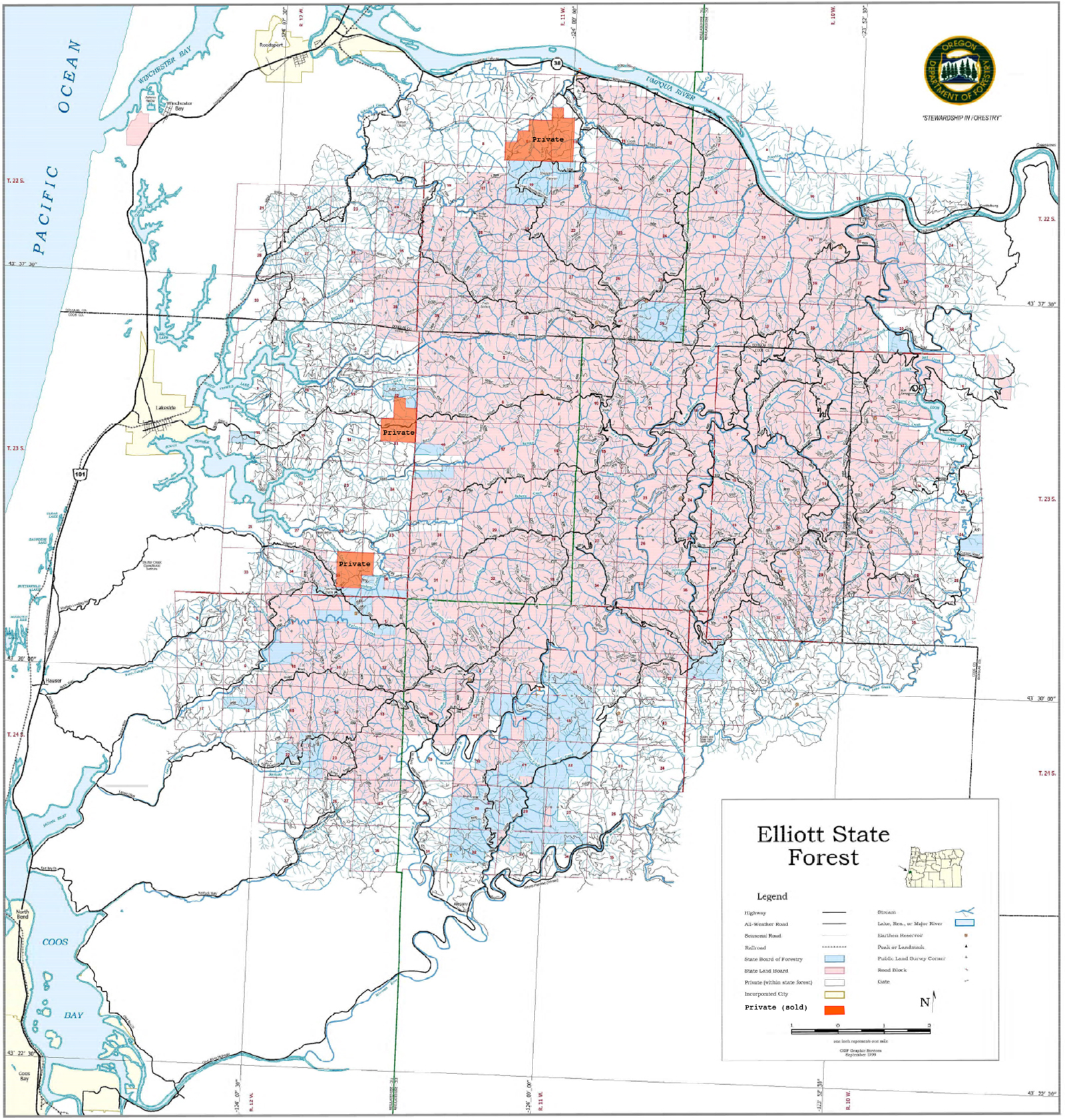
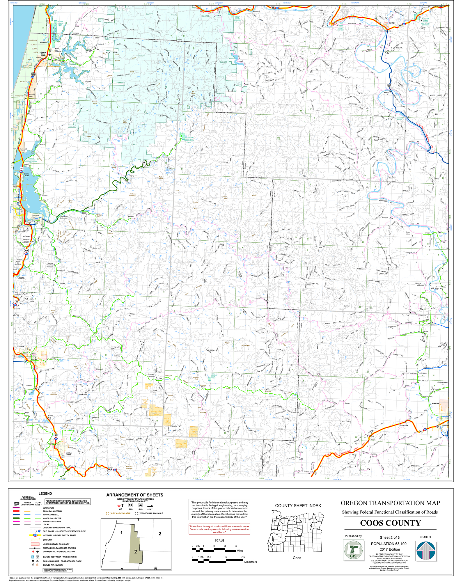
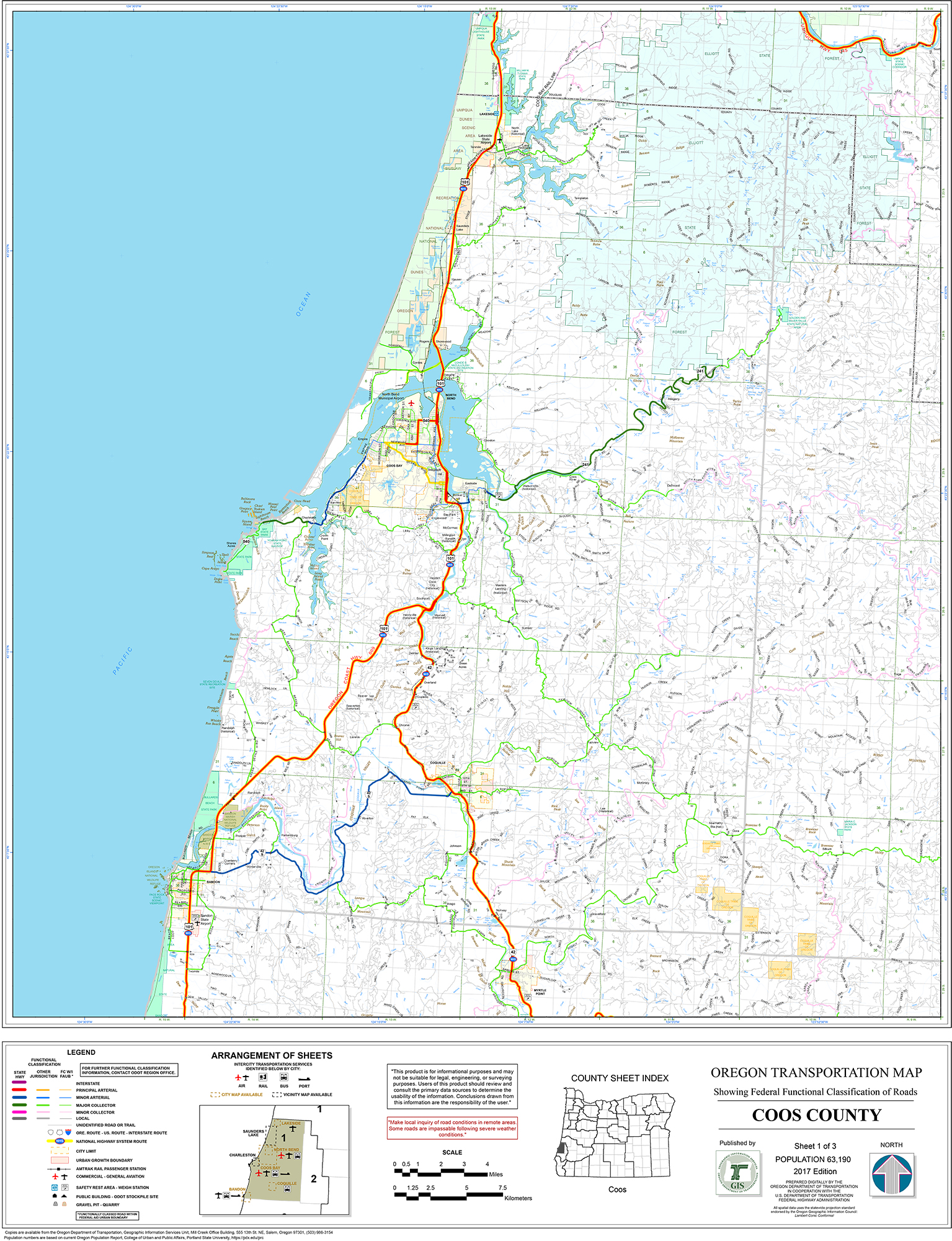
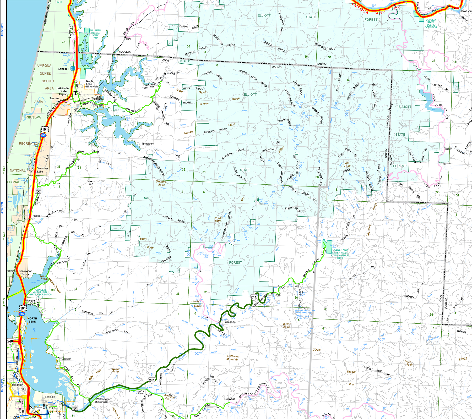
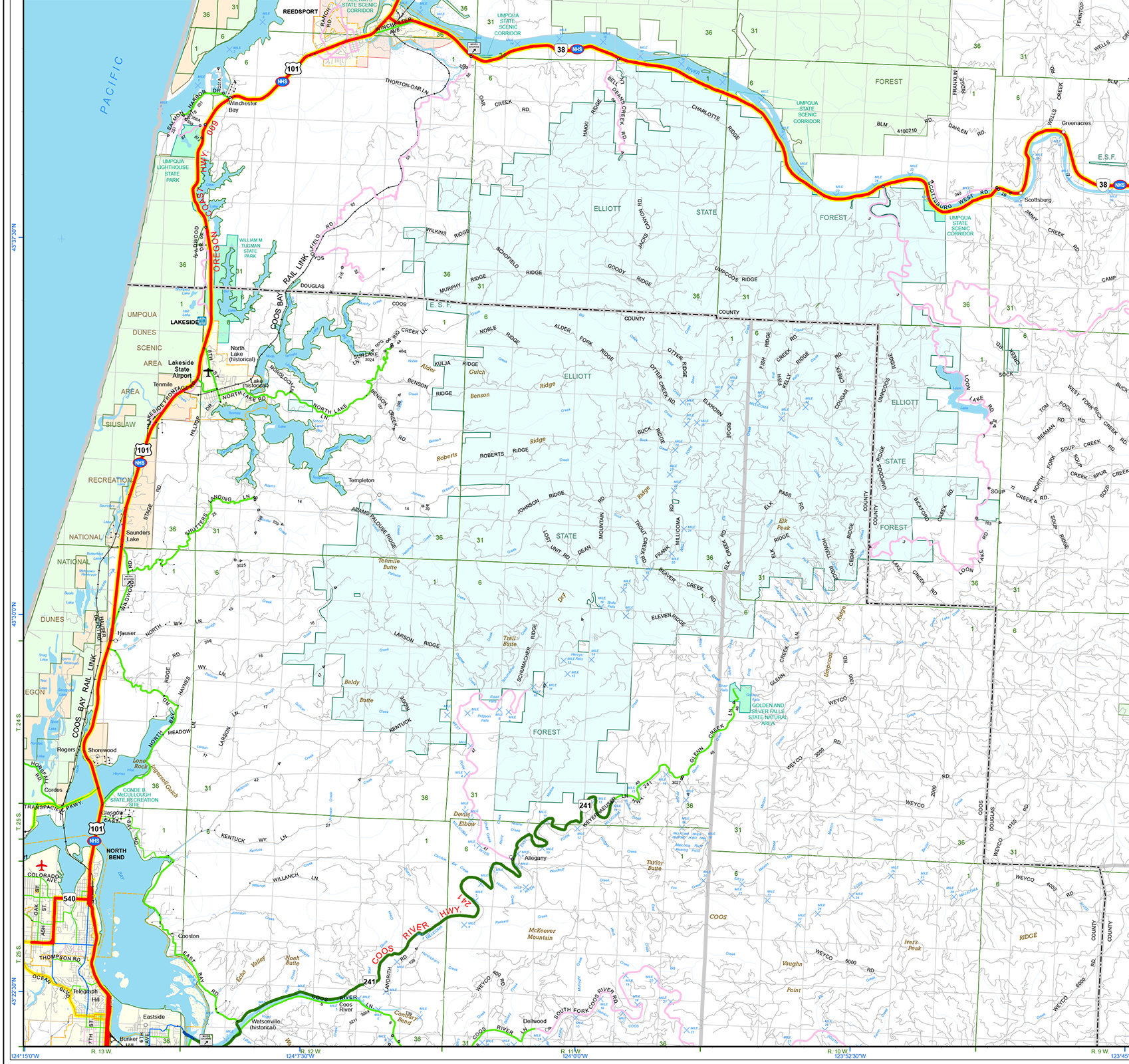
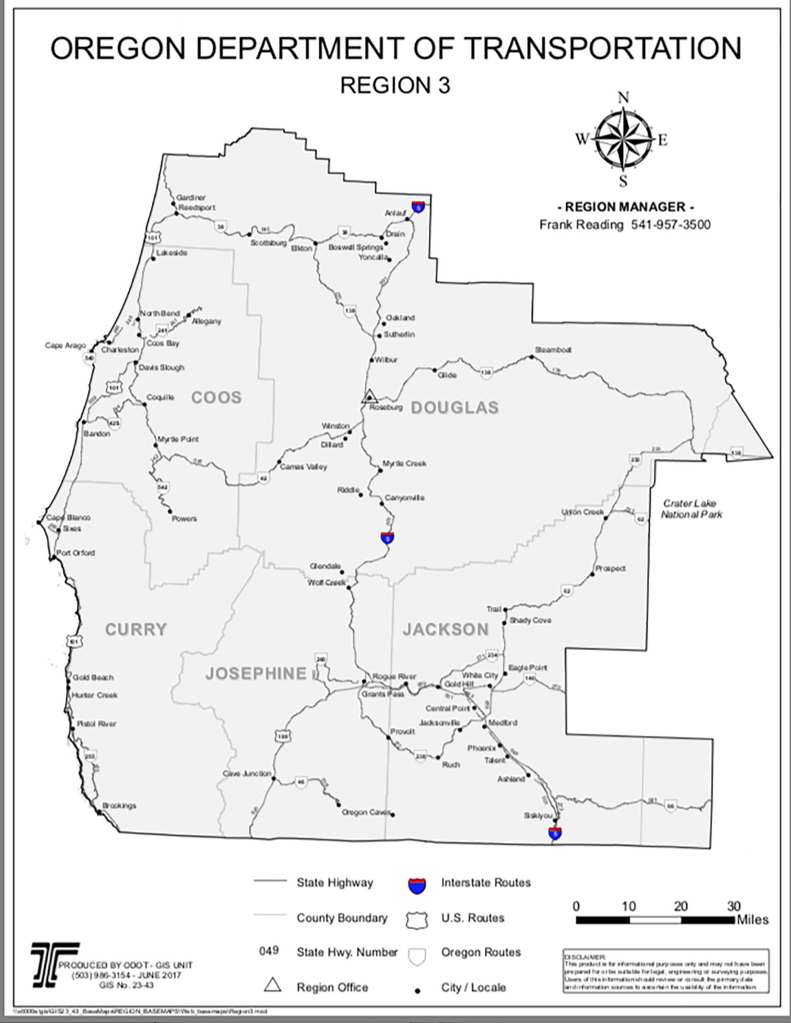
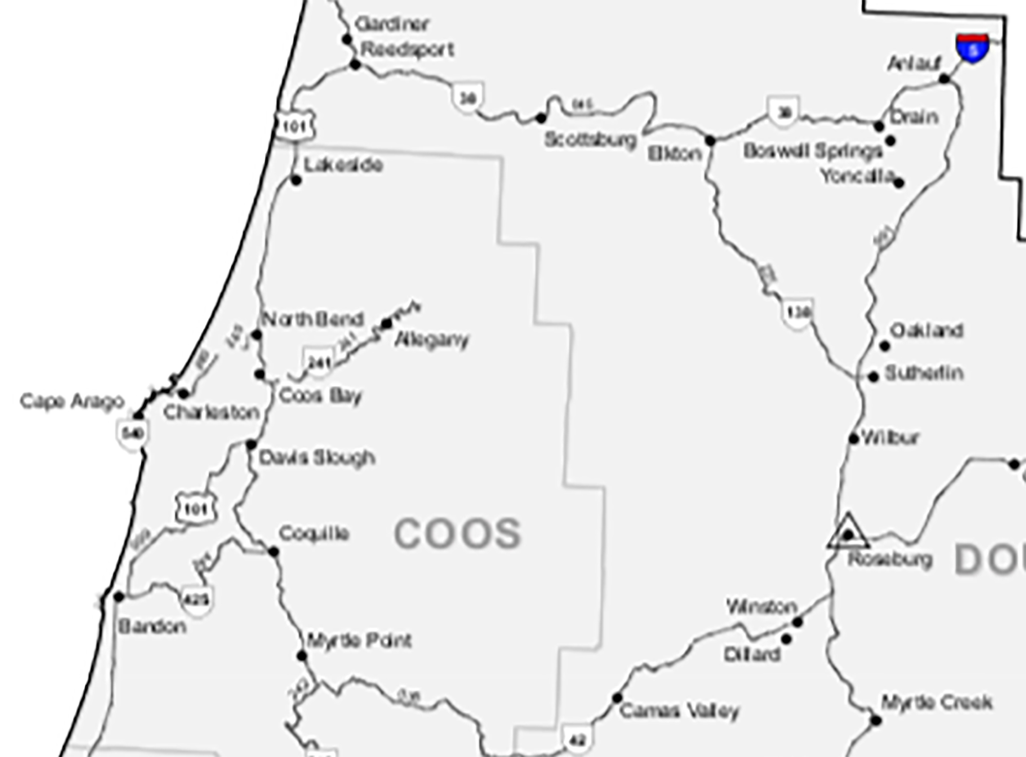
These maps are selected from the reports, magazine and news articles, government records and other documents contained in this website. They show the Elliott in reference to the State of Oregon; in relation to the other State Forests; legal boundaries; streams; topography; subbasins; fire history; early historical Oregon Indian Tribes; roads and trails; marbled murrelet, spotted owl, and coho habitat; tree ages; ownership history, and routes and locations of three Elliott Forest oral history tours conducted with Jerry Phillips during Fall 2017. Most of the maps are 200 d.p.i (dots per inch) JPEGS, sized to print on copy paper or display on a large desktop computer screen; a few are 200 d.p.i. PDF files that can be printed to full-size widths of 22- to 36-inches.

Elliott State Forest, Oregon Locational Map Oregon State Forests Map ODF Elliott Forest Subbasins Map ORWW Elliott Forest Subbasins Map ORWW Elliott Forest Native Coho Runs Map
Oregonian/OregonLive Elliott Forest Spotted Owls and Marbled Murrelets Map Oregonian/OregonLive Elliott Forest Spotted Owls and Marbled Murrelets Map w/Captions BLM Douglas County Spotted Owl Circle Map ODF "Elliott State Forest Conservation Areas" Map ODF "Listed Species Habitat & Lack of Recreation" Map
Phillips' Coos County Major Wildfires History Map Phillips' 1868 Coos Fire-Elliott Forest Map Elliott Forest Current Tree Ages Map Elliott Forest "Fish & Timber Watersheds" Map Elliott Forest & Millicoma Tree Farm Map
Smyth 1765 Millicoma Fire Map

Ross 2017-A Oral History Map/JPEG-10

Ross 2017-A Oral History Map/PDF-26 Ross 2017-B Oral History Map/JPEG-10 Ross 2017-B Oral History Map/PDF-26
Elliott Forest ca. 1930 Map/JPEG-10 Elliott Forest ca. 1930 Map/PDF-39 ODF 1999 GIS Elliott Map ODF 2015 Elliott Road Map ODOT 2017 Coos County-2/PDF-36
ODOT 2017 Coos County-2/JPEG-10 ODOT 2017 Coos County-1/JPEG-10 ODOT 2017 Coos County-1-a/JPEG-10 ODOT 2017 Douglas County-1/PDF-36 ODOT 2017 Douglas County-1/JPEG-10
   
ODOT 2017 Douglas County-1-a/JPEG-10 ODOT 2017 SW Oregon Highways ODOT 2017 Detail SW Oregon Map    


© 2017 Oregon Websites & Watersheds Project, Inc. & NW Maps Co.