
PRESS RELEASE
Coquelle Trails Project
Releases Final Report and Launches New Website
January 7, 2013
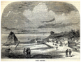
“When Alexander McLeod first entered the country of Coos and Coquille people in 1826, he had arrived in a land almost completely unknown to the outside world, inhabited by people who spoke unknown languages and kept to themselves. There were no maps, written or verbal accounts, or even known landmarks -- excepting the seacoast -- for the entire region.” |
The Coquille Indian Tribe, Inc., North Bend, Oregon, and Oregon Websites and Watersheds Project, Inc. (ORWW), Philomath, Oregon, are pleased to announce the formal completion and results of a two-year collaborative research project, “Coquelle Trails,” with the simultaneous public release of the project’s final 2-volume report and the launching of its new website: www.ORWW.org/Coquelle_Trails/References/Zybach-Ivy_2013
The finished report and “organic” website were completed by the Tribe and by ORWW in collaboration with NW Maps Co. of Cottage Grove, Oregon, and represent a significant level of commitment, cooperation and achievement by the three organizations over the past two years.
“Coquelle Trails: Early Historical Roads and Trails of Ancestral Coquille Indian Lands, 1826 - 1875” renewed a project originally started in 2006 to investigate and publish a “cultural geography” of the modern Coquille Indian Tribe: a description of the physical landscape and geographic area occupied or utilized by the Ancestors of the modern Coquille Tribe prior to -- and at the time of -- the earliest reported contacts with Europeans and Euro-Americans.
Project co-authors are Dr. Bob Zybach, ORWW Program Manager since its founding in 1996, and Don Ivy, recently retired Manager of the Coquille Tribal Historic Preservation Office – Cultural Resources Program. The report and website are a direct result of Ivy’s original vision, leadership, and project management skills, while Zybach served as principal researcher, lead author, and website designer.
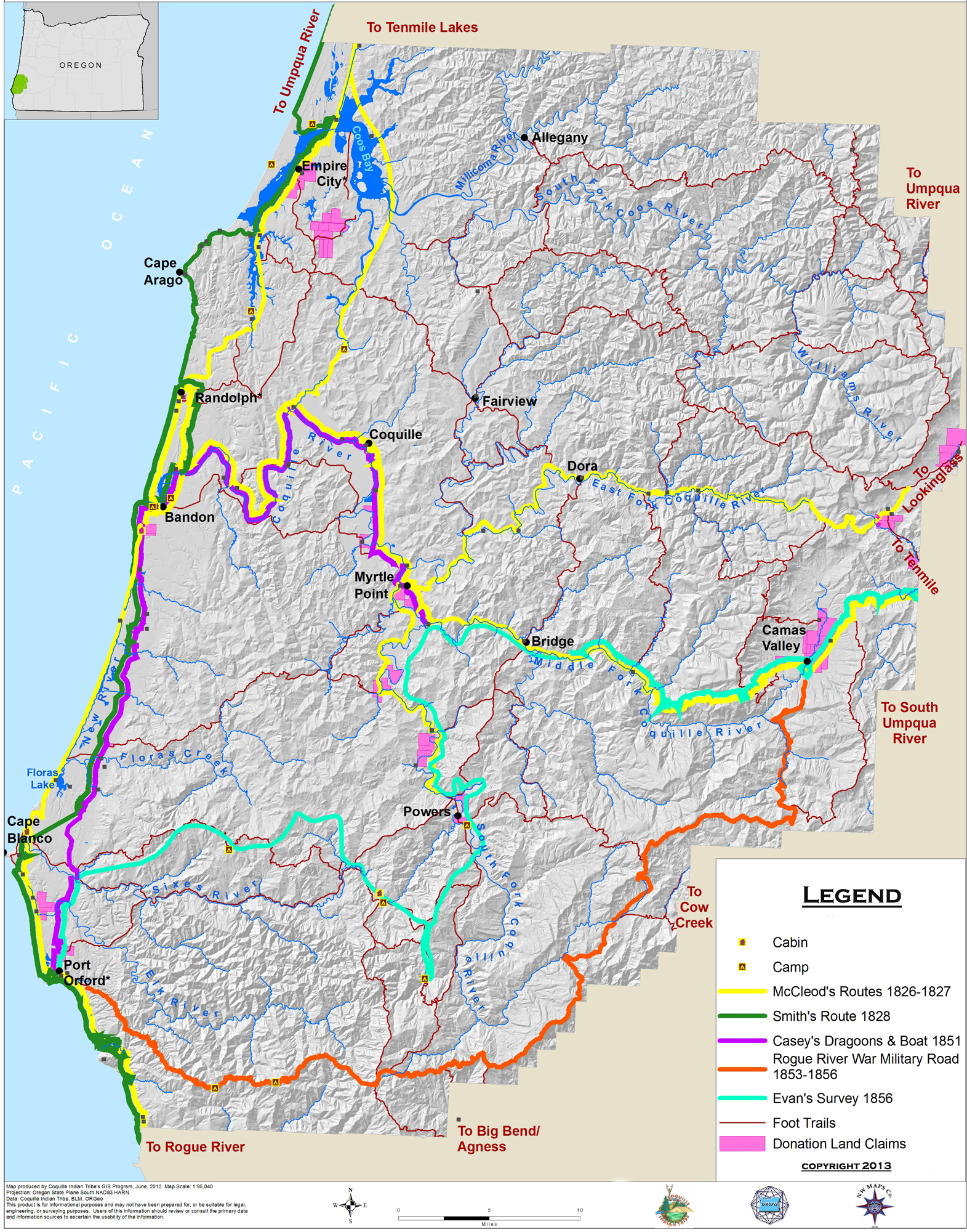
Several lasting products were developed during this project, including the report and website: numerous cross-referenced Excel database file indices, hundreds of historical maps and survey notes, highly detailed proprietary Tribal field maps, GIS layers, a number of rare documents, and the “Historic Trails, 1826 – 1856” wall map they all document or reference: www.ORWW.org/Coquelle_Trails/Maps_1826-2012/Study_Area/Map_01_Historic_Trails.jpg
Bob Zybach, NW Maps Co.: “The intended audiences for these materials are the students, teachers and scientific researchers of Oregon history, geography, and culture -- particularly those with an interest in the lives of ancestral Coquille Tribal families and communities. Each of these products is intended to be organic by design: that is, as new information becomes available they can be easily updated, corrected, amended, and/or expanded as needed.”
Wayne Giesy, ORWW: “This project fits squarely into the 16-year Mission of Oregon Websites and Watersheds Project to provide local students and teachers with information critical to the management of Oregon’s natural and cultural resources. It is a real credit to the Coquille Tribe that they have taken strong leadership and provided significant resources in developing, directing and completing this important research.”
Other key individuals making important contributions to this research and these products were Robin Harkins, GIS and cartography, Jesse Davis, field research assistant, and Nicole Norris, Cultural Resources Program Coordinator, all working under direction of the Coquille Tribe; and Crys Stephens, office research and website assistant, under direction of NW Maps Co.
CONTACTS:
Nicole Norris, Coquille Indian Tribe, Inc.
nicolenorris@coquilletribe.org
541-756-0904
Wayne Giesy, Oregon Websites and Watersheds Project, Inc.
GiesyW@ORWW.org
541-767-3087
Bob Zybach, NW Maps Co.
ZybachB@NWMapsCo.com
541-505-1298